All in a day’s work
Posted on August 3, 2018
KSFO San Francisco International
Some backstory is needed for this. On Wednesday my airplane owner partner, Mason, slammed at his SwimLabs business, asked if I could help by returning a tech consultant named Al that he’d brought down from the Bay Area. Let’s see, a fair weather day, and my professional aviation chops are needed to fly to San Francisco? Oh, twist my arm.
This provided another opportunity—I brought along Anke Boschman, the UCSD foreign exchange student from the Netherlands whom we hosted when she came in-country a few months back. She’ll be heading back to Europe soon, so this was a chance to show her a bit of the Golden State, and what U.S. general aviation looks like. And she could help keep an eye peeled for other airplanes in this state’s busy airspace.
Al was down as a tech geek, but he’s doing graduate work in paleontology, studying mass extinction events, only one of about a dozen of which is the famous dinosaur version. Anke is doing graduate research developing models in her fields of bio fluid dynamics and structural engineering, all with an eye to improving human heart valve transplants. Talk about a couple of brainiacs. While engaging them aloft, I tried not to drool while blurting high-end aviation stuff like “we try to keep the pointy end pointed over there by that whats-its.” The en route conversation was entertaining, with me occupying the bottom of the totem pole.
We were able to make the flight up and back operated visually, which provided the possibility of what is known very technically as the San Francisco Bay Tour. Right. Our landing destination, in avoidance of the bazillion dollar landing fees at SFO, was the San Carlos (KSQL) aerodrome 8 nautical miles SE of San Francisco International. The control boundaries of the two aerodromes abut, which is a key element in this adventure. When the weather allows, and SFO’s traffic levels permit, the San Francisco tower controllers are known to allow overflight through their airspace in passage to The City (as San Franciscans love to say), and then over the bay, where a turn can be effected to pass the Golden Gate Bridge, then sashay down the coastline SE-bound to return to wherever (Carlsbad Palomar airport in north county San Diego).
Another piece of the puzzle needs explanation. Very busy commercial airports like San Francisco, have designated from their centerpoint what is known as Class B (Bravo, in pilotspeak) airspace. To describe Class B airspace it is commonplace to say it is like an upside down wedding cake, with the topmost and smallest diameter part of the inverted cake resting on the center of the (SFO, in this case) airport surface and going up to 10,000′ MSL. The next layers below on what would be a real upright cake, are above in the Class B, with a floor of maybe 1,500′ and the top at 10,000′. This layer would begin a few miles out from the hub centered over the airport. The next layer farther out might begin at 3,000′ and go to 10,000′, and so on. Picture that inverted layer cake, and you’ll get the idea. All of this allows aircraft descending to the aerodrome or climbing out from it to stay in protected “B” airspace both vertically and laterally. Naturally this only works if the airliners stay within the cake material and the other folks stay out of it. Unfortunately, each successive layer isn’t completely round, but composed of all sorts of arbitrarily shaped cake pieces, with equally irregular floor altitudes. Lots of convolutions, and none of this is depicted with yellow tape lines aloft, so considerable three-dimensional awareness, a good aviation chart, and an über accurate flight management system (aircraft computerized navigational system) are essential to staying clear of the wedding cake’s innards. Guess I forgot to mention that thou shalt not enter Class B airspace without ATC’s blessing, lest one sees their airman certificate snatched from thine grubby fingers?
So how this particular event played out was during taxi out, my requesting of the ATC tower at San Carlos if they would ping SFO tower for their blessing to transit in furtherance of our lark? They came back with a transponder code, the SFO tower frequency I should expect to use, and the admonition to not get into the SE portion of the KSFO surface-based Class B 1 nm beyond the departure end of SQL’s runway 30 without first getting SFO’s authorization on said frequency. Our takeoff would be bore-sighted on SFO, and I’d have literally seconds to switch from SQL’s tower frequency and make contact on SFO’s busy frequency to receive clearance to enter their “B”. No pressure, right?
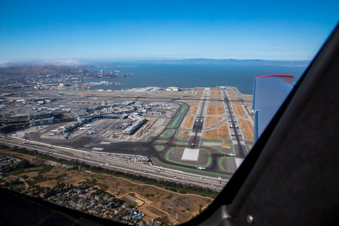
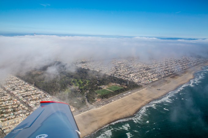
The picture above is from about 90 seconds after liftoff. Quite the view. I had just leveled at 1200 feet, westbound, and you’re looking due north at SFO’s runways 01L and 01R. These are their preferred takeoff runways for most operations, with the cross runways (28L and 28R) used for landings and heavy-weight international takeoffs. A little background to any delays you may have had in SFO flights before. The prevailing winds at SFO are out of the west, favoring runways 28, but still allowing takeoffs on the 01s. But when the surface wind from the west exceeds 14 knots, if memory serves, they go to all operations on just the runways 28. SFO then becomes a two runway airport vs. four. We pilot bums referred to it as the “Rule of Two” for delay expectations—two clouds, or two runways, expect delays. You’re now cognoscenti.

FMS flight plan
This picture shows the cockpit display of the flight management system (FMS) while underway, moments after the picture above was taken. I created the flight plan after engine start, immediately before taxiing out to the runway, based on chart study the day before that this routing would produce the desired sightseeing and stay compliant with airspace restrictions. Anyway, at this point in the air, ATC took pity on me and allowed me to climb from 1200′ MSL to 1800′ MSL to miss some gathering low marine layer stratus clouds pouring over the hills from the west. This altitude would create challenges of sticking my no longer so furry head hairs into the floor of the next layer of overhanging Class B as I exited the surface-based “B” heading away from KSFO, but I had ATC’s authorization, so there. In the right hand screen, the FMS flight plan shows that I’ve departed the SFO01 waypoint (one I created within the computer that was 240 degrees and 2 nm from the center of the airport, in keeping with the ATC admonition to stay south of the Bayshore, i.e., 101 freeway, as I passed KSFO). I’ve just made a slight right turn abeam of where Candlestick Park used to was, and am now headed towards Alcatraz island, which course will take me directly overhead the city center. Oh, yeah, SFO tower also asked if I had the jet rolling on its takeoff from runway 28L? “Good, keep that aircraft in sight.” Towerspeak for midair collisions being very bad form. If you look carefully in the inset map in that screen, you can see the SFO peninsula and a graphic depiction of this short leg of the course as a magenta line (the active leg) to the waypoint I’ve created and called SAU01, which is the SAUsolito navaid 095 degree bearing at 5 nautical miles. Lying under that fix is Alcatraz, where I’ll make a turn westbound to proceed to my next waypoint SAU02 (Sausolito/173 bearing/3 nm fix), a five nautical mile leg that will cross me right over the Golden Gate bridge, and shown in the inset map as a white course slightly south of due west in that North Up map. Then a turn to the south to fly down the west coast of the San Francisco peninsula.
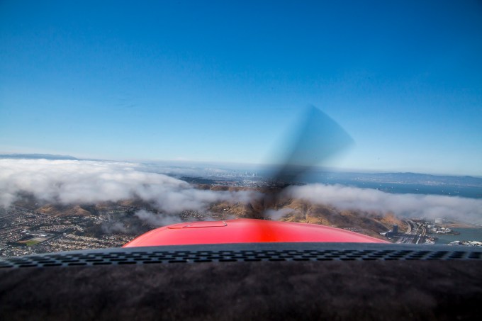
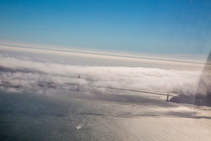
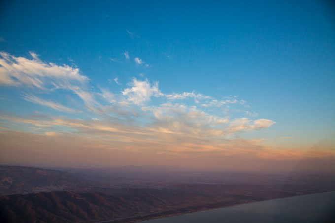
Northbound toward The City and the bay. The low clouds our operating flight rules required me to avoid by specified distances.
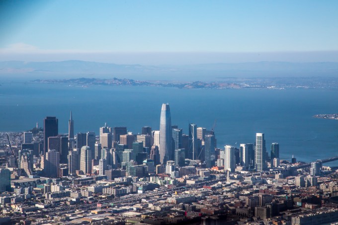
Candlestick to the right, The City at twelve o’clock
Keep your eyes on the prize
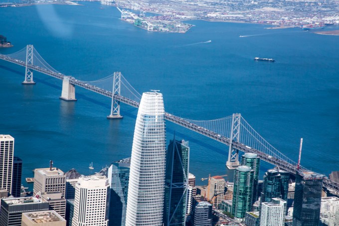
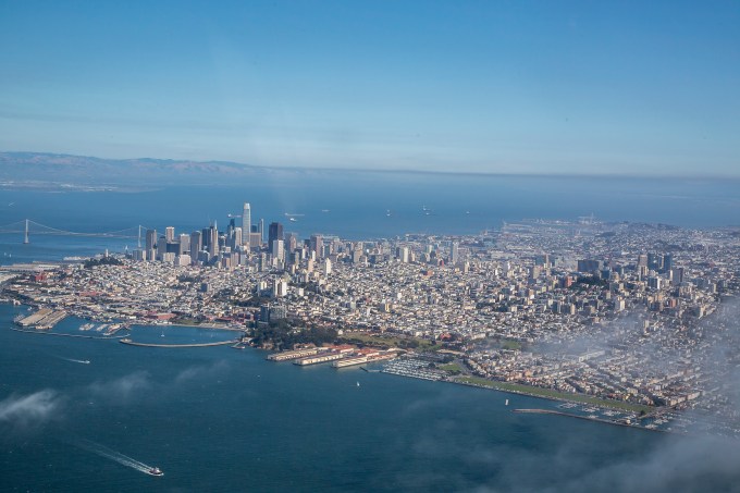
Downtown and the Bay Bridge
Federal aviation regulations also specify criteria for missing buildings and what not. A bit of a dance to comply with that and cloud separation requirements while staying out of the overhanging Class “B” and taking in the sights. No rest for the wicked.

San Francisco columnist Herb Caen’s nemesis on the left
Does this make me the Birdman of Alcatraz?

If you don’t eat your vegetables, or mind your “P’s” and Class Bravos you might end up here.
Finishing the turn towards the SAU02 waypoint t’other side of the bridge thingy.
An over my left shoulder last glance at The City.
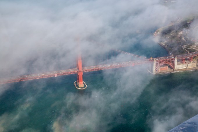
The Jewel
Well, yes, this is certainly my highlight of the bay tour.

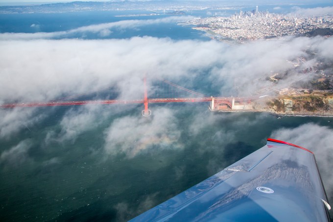
The southern abutment and the Presidio
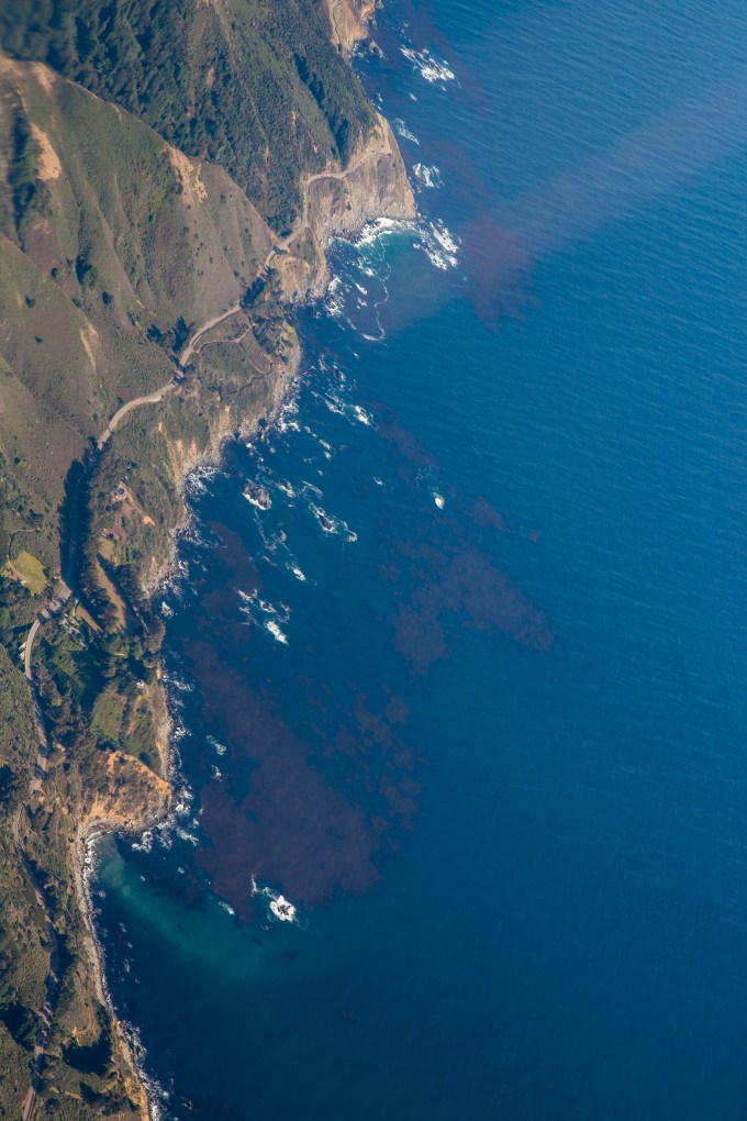
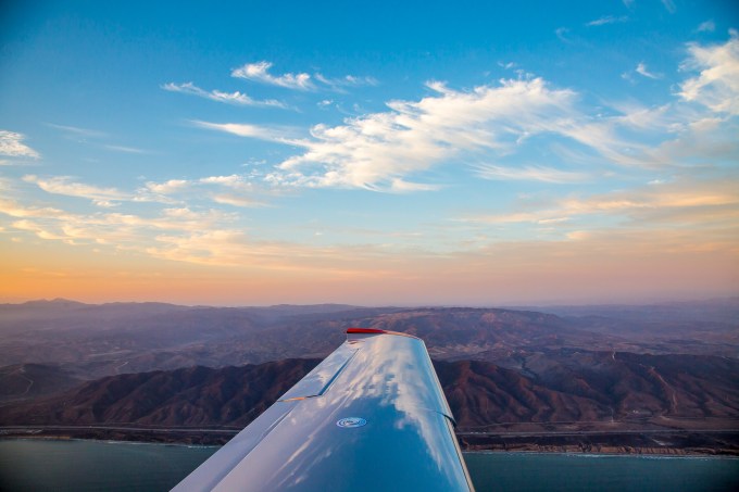
This particular shot really appeals to me. Reflections on the left wing. And check out the circular rainbow and center dark shadow spot of the light refracting around the plane and projected on the wispy clouds at the lower center of the frame.
You are at the center of the frame just below the bridge stanchion
We’re turning down the coast in the picture above, and as we roll out, there’s the western end of Golden Gate Park.
The finish line of the world’s longest moving block party—the Bay to Breakers—which I ran years back in a pink tutu. Boy did I get rave reviews in the Castro district!
Heading down the west edge of the peninsula, the shore disappeared in the marine layer, so we missed out on seeing the Mavericks surf spot and Halfmoon Bay. The Monterey bay was open, but the coastline was obscured. Monterey’s airport was in the clear, but the community was covered with clouds. Anke got a nice view of Point Lobos, and maybe she’ll share a frame or two of that. The Hunter-Ligget Military Operations Areas were cold (er, inactive in humanspeak) and the R2513 Restricted Area was cold at our 7,500′ cruising altitude. This allowed me to fly the Big Sur portion so that the shore was mostly on Anke’s sightseeing side of the plane.
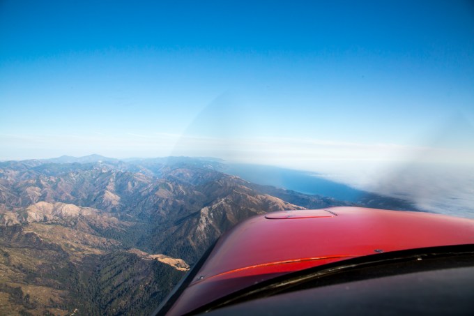
Big Sur coast
I include this image below and as comparison to the one above, to give you an idea of what a sophisticated flight management system flight deck cockpit display our plane possesses. The right screen, known as a Multi-Function Display (MFD) shows the flight plan with its waypoints and their ETAs and fuel status, a moving map with the aircraft position shown on it, and engine instruments on the left margin. This screen can be configured in all sorts of ways to provide useful information to the pilot. The left screen is known as the Primary Flight Display (PFD) which shows a computer-generated view of what you see out the windscreen when you remember to look. (See the picture above of the real world version thereof.) It also conveys the aircraft attitude in relation to pitch and roll, the airspeed, altitude, compass heading, and course guidance. And here, the PFD is also displaying what is called “Synthetic Vision,” i.e., a computer generated display of the actual terrain ahead and below from the worldwide navigational database and the very accurately known GPS position constantly updating in real time. The sort of thing that cruise missiles use to hug valleys below hilltops as they race undetected to their targets. Modern cockpits with displays like this are often referred to as “Glass Cockpits,” with the reference being to the LCD screens of the displays. Long-time pilots of conventional analog displays of 6 instruments showing some of this (called six-pack instrumentation, as well as Jurassic cockpits, or rope-start cockpits) take awhile learning how to use and interpret all the information available in the “glass” flight management system avionics. Once you learn to use them, the tendency is not to go back to old school instrumentation. Young pilots love the computer game similarities, geezers less so. The big difference is that when flying this sort of system a big part of the pilot’s operational mental band-width becomes information management. A negative by-product also tends to be a degradation of basic airmanship skills, and a tendency to get one’s situational awareness of the outside world sucked into the black hole of the avionics. Both of those are avoidable with practice and conscious effort. Years ago at United I developed a seminar introducing glass concepts to pilots transitioning from steam-gauge to glass. What I do instructionally these days is largely helping owner pilots get the most out of their aircraft, its systems and themselves.
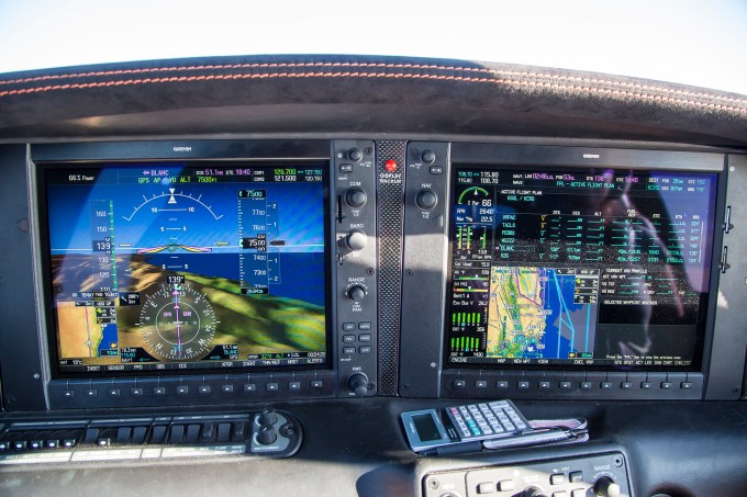
Flight displays over the Big Sur mountains.
At one point I positioned the plane to steal a glance down on Highway 1.
Okay, here’s a bit of egg-on-my face mea culpa. A few miles south of here, we came upon the Hearst Castle. As we were closing in on it, positioning the airplane so it would be on Anke’s (right) side of the cockpit, I waxed on about William Randolph Hearst’s publishing empire, the massive wealth he aggrandized, Citizen Kane, Orson Wells, “Rosebud” and even Wells’ speaking part in the War of the Worlds radio drama. I had set a course track that would put the castle nearly under the plane on the right side, planning to initiate a steep right bank to do a turn about a point on the castle below for viewing purposes. I couldn’t see it as it was under the right hand floor boards, but, Anke, looking down, allowed as how now was the time to make the turn. Hand-flying with my left hand, I rolled us into the right bank and using my right hand, fired off five quick consecutive frames with the camera held at arm’s length shooting across the cockpit and down the right wing. Splendid. Until when I downloaded the images on our return, I discovered five consecutive completely black frames. Yep, rookie mistake, having forgotten to first take off the lens cap. Obviously my mental bandwidth was still up over the Big Sur coast in an FMS black hole! Duh.
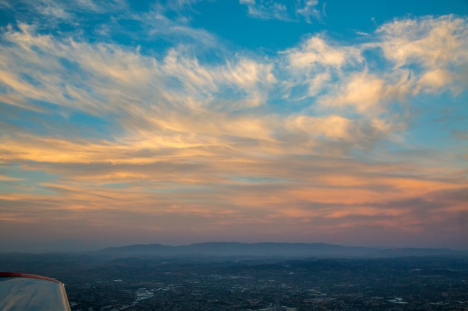
A modest while later we approached the Los Angeles basin from the general direction of Thousand Oaks. Back in the day we whimsically referred to it as “Thousand Pilots” given how many of my LAX-based brethren lived in the enclave. At this point it was getting late in the day, and colors were warming wonderfully.

The Hollywood hills from the north side.
After passing Los Angeles and Orange county it was time to begin descent for our landing at Carlsbad’s McClellan-Palomar airport where our trusty time machine is hangared. I’m proud to say that I’m old enough to have known Jerry McClellan and his son, Jayce. Jerry was a Cherokee Six owner pilot, a true gentleman and a tireless booster of Carlsbad and the value to north-coastal San Diego county of then sleepy KCRQ.
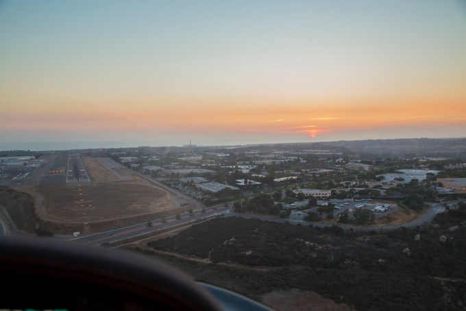
You may have heard that sunsets and sunrises find favor with me? Here’s how our business day ends as we descend and maneuver for the KCRQ traffic pattern and line up for the landing.
Yes, as a matter of fact, I DO love wing reflections.
In a word—luscious.
Credit Anke for this one, I was a little busy just then.
We rolled on takeoff from KCRQ at 14:12 local time. Two hours and a quarter to San Carlos. Maybe :30 on the ground including refueling, getting the bay tour clearance and building the FMS flight plan to stay legal with the airspace convolutions, and about two hours forty minutes on the return with the extra miles of the tour, and modest headwinds in the bargain. Touchdown exactly at the 19:48 sunset. Just the sort of mission at which general aviation excels, with some wondrous bells and whistles thrown in.
I’m a fortunate person, and I try not to forget it. T
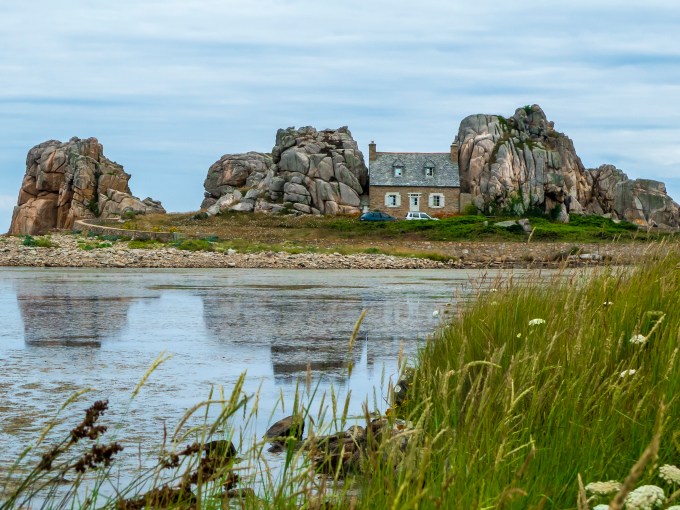
Bretagne’s Cote du Granit Rose
Posted on July 28, 2018
Jutting into the North Atlantic like a proper Gallic nose from the west of France, due south of the Cornwall/Devon peninsula of England, Bretagne or Brittany, has been under the sway of both the Gauls and the Celts over the centuries, depending on what political, ecclesiastical or marauder ascendancies were extant in either location. Now, decidedly French, one nonetheless sees both French and Bretagne languages, even linguistic remnants from Roman days.
Over just a couple of last minute days, Cathy and I pulled to fruition a self-guided inn-to-inn walking trip offered by UK-based Inntravel of the Breton north granite coast, often called the Rose Granite Coast because of the hue of much of the boulder-strewn region’s gigantic stones. The shore can be rugged, but dotted with gentle sandy beaches and reedy estuaries, while the terre barely inland, is lushly green and flower-strewn.
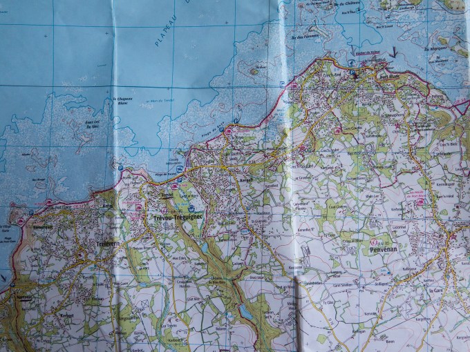

Inntravel (https://www.inntravel.co.uk/holidays/walking-holidays) arranged for the lodgings, connecting surface transportation (trains and taxis), and would gladly have provided air reservations if we’d wanted to go full fare positive space vs. using United passes. They provide detailed 1 km grid maps and textual directions. The text conveys guidance where the rubber meets the trail, with the map giving the big picture of each day’s walking, which for us, was six days of around 15-17 km each. Inntravel calls themselves the “Slow Holiday” people, as in forget frenetic-paced sightseeing. Just us traveling—no group—generally hitting the trails after breakfast at the crack of 10 AM, and we were feet up/shoes off by 3 PM. No rushing—just savoring the views, the vibe, the picnics and the occasional path-side bar or café treat and libation. We stayed in three separate lodgings, so at each there were both out and back loop walks, and off to the next inn several towns or villages over yonder jaunts. We took a day pack and a provided picnic lunch, and our luggage taxied ahead to the next lodging where it awaited us in our rooms on check in.
Our route mostly followed the GR34 pathway. Grande Randonnée, or “Big Hike” are walking trails throughout France, with the 34 covering all of coastal Brittany. In the map above you can see the GR34 depicted as a red line generally following the coast, and indeed, we were often walking along the shore, scampering about seaside boulders and even on low tide beaches. The map and text are for our day four of walking, 16.5 km estimated as a 5 hour walk. The GR trails are marked with small painted red and white horizontal lines on walls, tree trunks, power poles, and such, with the white line sometimes shown as an elbow to indicate a change of direction at that point. We mostly stayed on route, with the occasional side trip for sightseeing, bush watering, or correcting navigational errors. Ahem.

No, I do not possess a selfie-pole. The picture was taken by daughter, Torrey, using my i-Phone camera. The planets really aligned in so many ways for and on this trip. Having used Inntravel years ago for a walking trip in Normandy, Cathy gets e-mail delivered teasers, including one about this route. Having this time off between SDSU semesters, she dove into research and found seat space on United in both directions between California and Paris, and that the United arrival at Charles de Gaulle airport was timed perfectly to clear customs and catch the high speed TGV from within the terminal directly to Rennes, the capital of Brittany. We selected a delightful boutique hotel near the Centre Ville there, easily reached as the second stop on their metro accessed within the gare (train station). We found Rennes, a city of 200,000, approachably sized for strolling about and taking in the sights, ideal for jet-lag adjustment, and from which we could subsequently take the train up to the northern Breton coast to begin our GR34 sojourn. Meanwhile up in London, Torrey had a matching gap in her meeting with professors/Master’s dissertation research/beginning a job allowing her to join us. She caught the Eurostar from St. Pancras station to Lille, and then her own TGV to Rennes, arriving a few hours after us.
European street markets are favorites for local color, and delicious tidbits. Perhaps a few olives?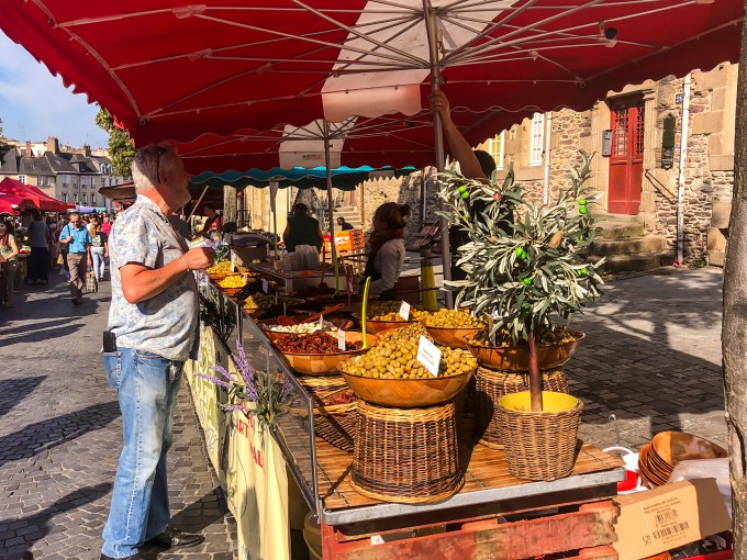
…or peppers, apricots or roses?
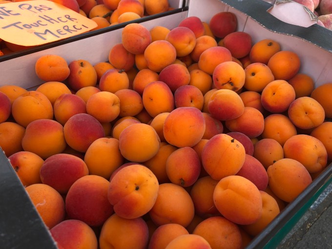

You’ll recall that I grow weak-kneed over color? Including visual local color…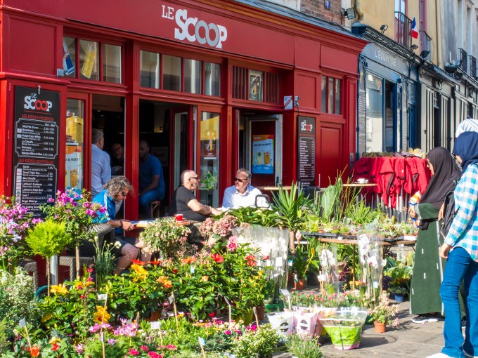
…and the aural variety. I should mention we were in Rennes during Bastille Day celebrations? Transat en ville translates roughly as deck chairs in the city. Free. Have a seat, tune in, drop out.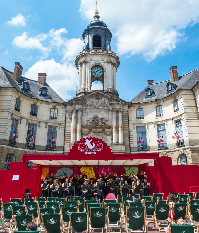
I was positively giddy over this, and both my musician dad and John Phillip Sousa are doubtless smiling still.
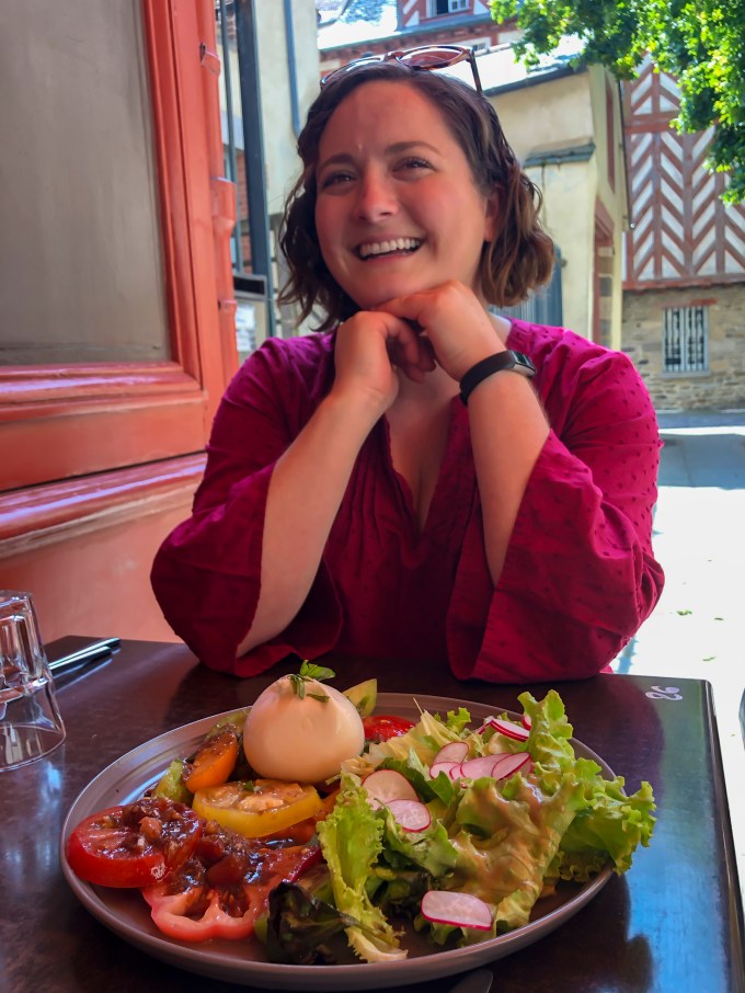
Foot tapping works up an appetite. Al fresco lunch on the town, Rennes. A beginning theme here—Brittany is a gastronome’s delight.
The next day we caught connecting trains from Rennes to Guingamp then Paimpol, where the prearranged taxi awaited to deliver us to our lodging at Manoir d’Hotes Troezel Bian in Kerbors http://www.troezelbian.com/the-manor/. Bian translates as small, which fits, considering the four guest rooms in the eighteenth century stone inn run by Tony and Armelle Sebilleau. The inn’s stone walls are about four feet thick, and as throughout Brittany, the roof is steeply pitched slate. Tony provided me a bike and directions for a 1-2 mile cruise through the rural countryside to the water’s edge whilst m’ladies settled in. Prior to dinner, we repaired to an umbrellaed outdoor table for cold libations while the dropping evening sun imbued the grounds in rich warm color.

The evening’s dinner of turkey, new potatoes and greens fresh from the garden followed in the dining room next to the stone fireplace. Wine? But of course.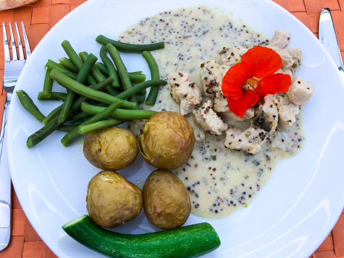
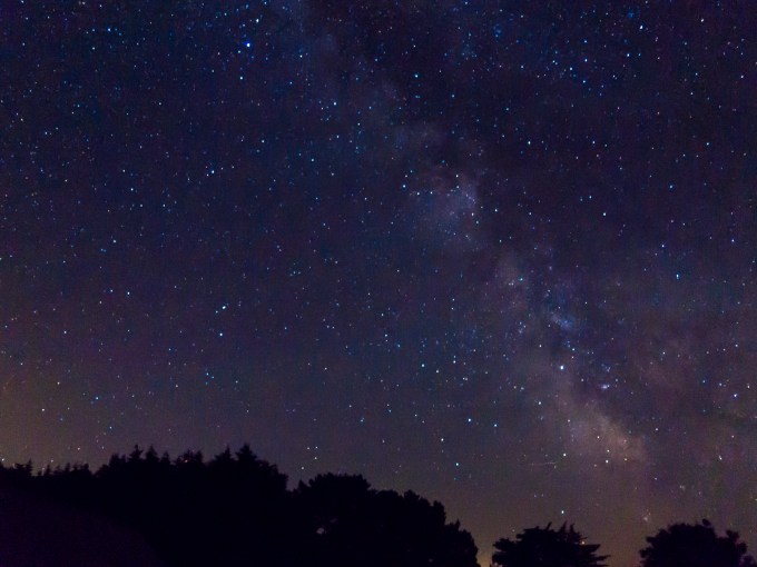
As I say, rural. No lights to disturb a long exposure view of the Milky Way. You camera technogeeks should know this was shot without tripod or remote trigger release, the hand-held camera jammed steady for 10 seconds against the frame of the wide open window in our room. The dazzling fruit of an old guy’s nocturnal potty calls.
And so began our walking journey, Tony showing us quaint St. Georges church in nearby Pleubian, en route to dropping us off on the point of land beside the Sillon de Talbert nature reserve. Another theme—the sea, its fruits, its ships, sailors, and fishermen are integral to the region.
A ship model between the candles and the stained glass, a most natural Breton depiction.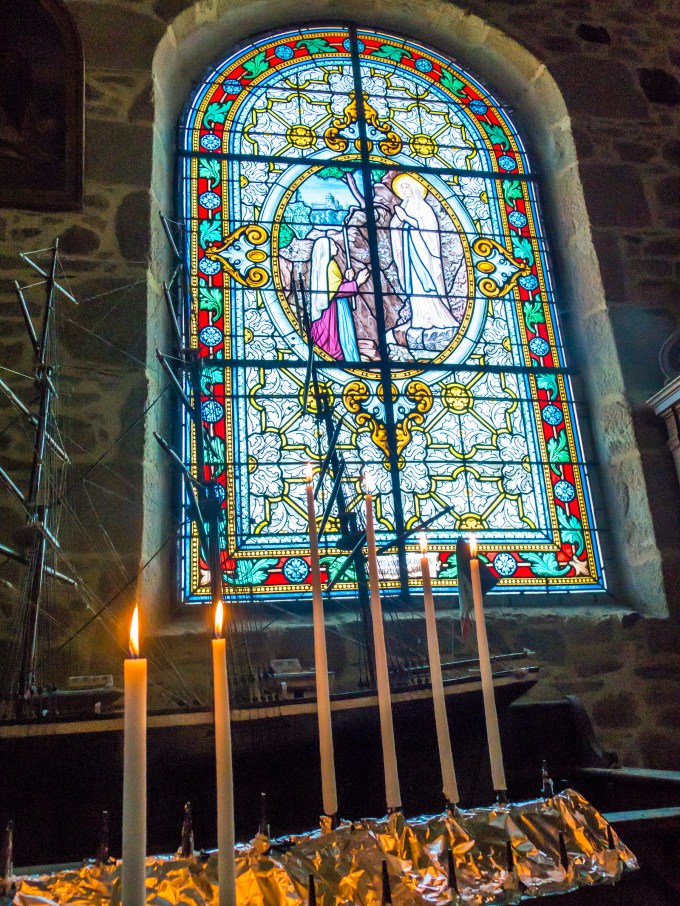
Then underway. Putting one foot before the other for the next several hours made easier by the views in all quadrants. Thrust into the North Atlantic, Brittany is known for being cold and wet, although July possesses its most temperate climate and the least rain. Our trip was bookended with hot spells before and after in both Del Mar and London, so we were ever so pleased with skies like this and temperatures overnight of the low 60s, and mid-afternoon in the low 70s (Fahrenheit) with light winds. One of our days had partial clouds with a forecast of possible rain, which did not materialize. The only precipitation was rain after midnight on our last night preceding our train journey back to Paris for the return flight home. The weather’s here, wish you were fine.
 Flowers. Flowers everywhere. Songbirds as well. Yum.
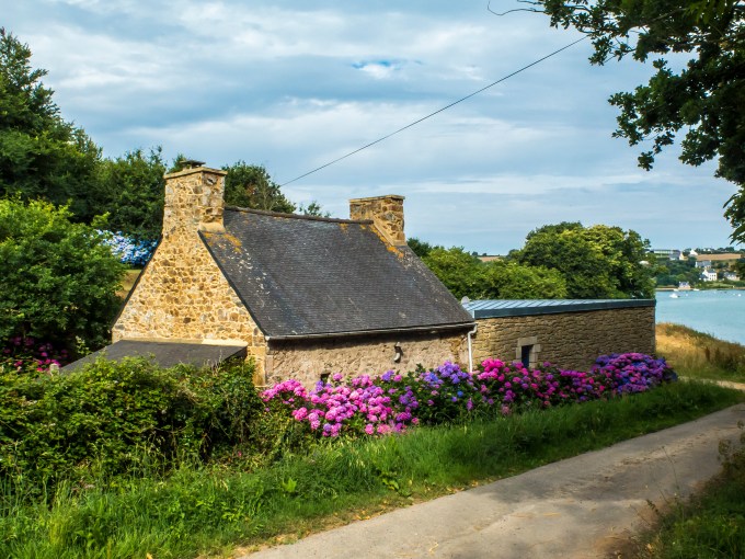


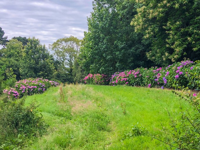 All of these are of the GR34 trail. We did occasionally see other walkers, but this accurately conveys the crowd the majority of the time.
Our second day’s walk brought us to the the Hotel Aigue Marine in Tréguier https://www.aiguemarine-hotel.com. Aigue Marine is French for Aqua Marine, stones that early Breton sailors often took with them to sea as a superstition talisman. My least favorite lodging, but only because it was, well, a hotel instead of a manor. Maybe 50 rooms and all the usual niceties like pool, workout room, sitting garden and bar and restaurant. The owners and staff were gracious and helpful, and Tréguier is a delightful small community. Okay I also have to say that the Aigue Marine’s restaurant is Michelin-starred. That’s a foodie big deal anywhere, and the food, service and presentation here were in keeping with the award.

The impressive Tréguier cathedral.
Within the interior grounds we were treated to handsome gothic architecture, and so much more. 


The covered walkway around the periphery of the garden allowed peaceful repose both temporary and eternal. The walkway treated us to a wonderful art exhibit in keeping with the region’s ecclesiastical and maritime history.

From alongside the sculpture atop the sarcophagus you can see that the linen painting on the adjoining wall is a stylish recreation of the stone pose of the church figure entombed therein.
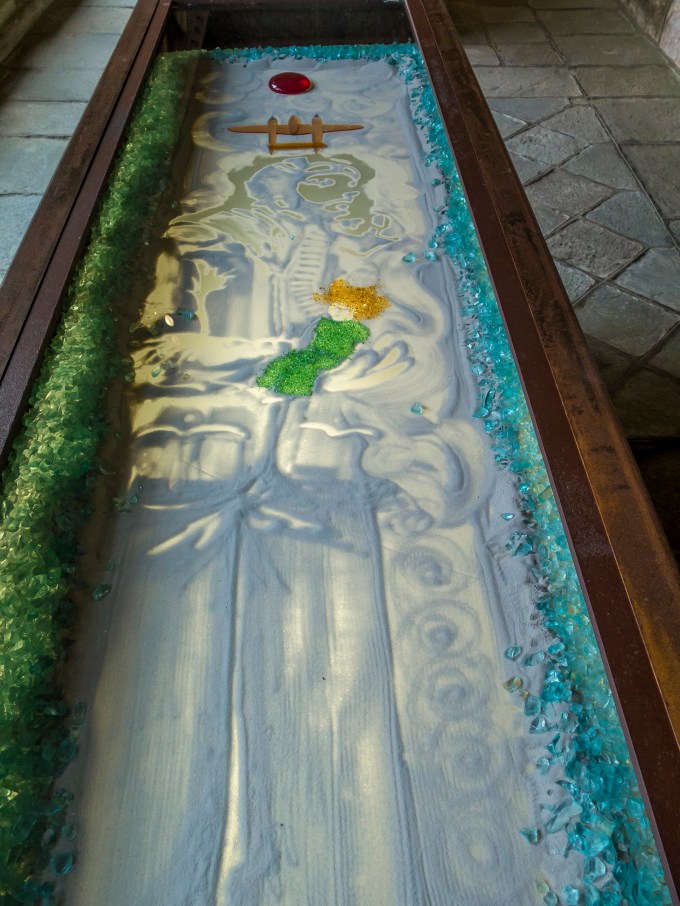
Along the same walkway several of these boxed pieces stopped me in my tracks. This first is an homage to Antoine de Saint-Exupéry, who as the author of Night Flight, Wind Sand and Stars, and The Little Prince, is probably already known to you. Saint-Exupéry was a French aristocrat, poet, journalist, pilot and philosopher, which speaks as to why he resonates with me. Themes in his writing often turned on sacrificing oneself to causes in which one believes, in some, pilot protagonists musing mystically on life. Already an established commercial pilot before WWII, flying in Africa and South America, when war broke out he joined the French Air Force. When France capitulated to German occupation, he flew for the Free French Air Force. It was on a FFAF reconnaissance flight in a Lockheed P38 Lightning sortied out of North Africa, that he was lost at sea over the Mediterranean near France’s southern coastline in July of 1944, presumably in support of the allied advance to liberate Europe following D-Day the previous month. One of his quotes is “What gives meaning to life gives meaning to death,” which is much in keeping with what little I remember of French philosophy during the last century. Personally I’d invert the thought, so perhaps some day he and I can discuss the nuances.
Anyway, look carefully at this artistic piece, wood-boxed and glass topped. Once you get in the groove you can see him standing there looking right, in his leather flying helmet, oxygen mask and hose, his forearms cradling…the little prince? Above his head is the classic plan-form of the P38. All of this is done in tiny glass pieces and carefully shaped sand, backlit from underneath.
And here’s another, representing the loss of the Titanic. This particular piece seems lifted directly from the imagery of the hull resting on the sea floor as conveyed by filmmaker and deep-sea explorer James Cameron, with the luscious colors reminiscent of his magical film Avatar. 
There were several of these boxed glass and sand art pieces, all of similar size around seven feet long and 30 inches wide. Each conveyed an homage to individuals or groups whose lives were lost in or on the sea. Others included those who died storming the Normandy beaches on D-Day, Roald Amundsen, the Norwegian polar explorer who disappeared aboard a flying boat embarked upon a rescue mission for an airship. There was one unfocused, other than paying respects to children lost in oceanic accidents. And one, referencing the January 15, 2004 capsizing and sinking of the French trawler Bugaled Breizh (Children of Brittany in the Breton language) to the southwest of Lizard Point, Cornwall, England. Scribed into the sand of the piece are the exact 49 42 34 North, 05 10 45 West latitude and longitude and the time of sinking at 12:25 Greenwich Mean Time. You can put those lat/lons into Google Earth and see the location. Did you know that you can e-search “shipwrecks on (in this case) 15 January and will get a list of all shipwrecks on that date over the centuries?
Some backstory. The creator is glass sculpture artist Jean Divry, a resident of nearby Paimpol in Bretagne, and his works conveyed at the cathedral all relate to the strong influence of man and the sea we saw in so many ways during our time there. I tried to engage the gatekeeper woman who sold the 1.5 Euro exhibit entry tickets to learn more about what we were seeing. It was a thing of painful beauty to see her try to reach out with her limited English to edify us about the artist and the art. She and I created a whole new language of facial expressions, eyebrow accents and raised shoulder and arm grammar. What a sweet woman, so intent on conveying the magic of art and shared experience.
The walk back to the hotel was typical of the sorts of small communities we meandered.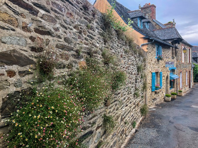
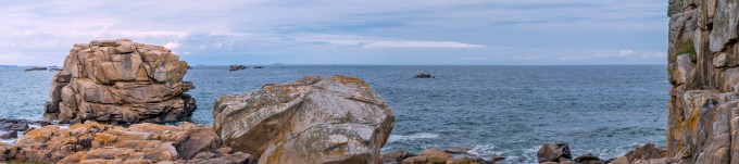
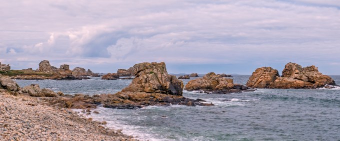
Our next day’s walk was billed as two choices—long and longer. We selected choice one. The hike began with a drop-off by taxi near Castel Meur (pictured at the very outset of this missive) at a tiny spit of land called le Goufree on the peninsular thumb of Pointe du Chateau. It takes another fold of the map to sort this one out, sorry. There were plenty of other rocky sights, heading southbound along the eastern periphery of this thumb bordering the Jaudy river.

Our choice of abbreviated hike required a pre-arranged taxi to pick us up at a tiny cafe on the equally tiny harbor at La Roche Jaune (The Yellow Rock). We arranged pickup for 3:45 at a café, suggested by our driver, which we heard him say was called “Le Café Biscuit.” I even repeated it to make sure I had it right. Talk about being a stranger in a strange land? The actual name was “Le Café Pesked,” with Biscuit, or Pesked—whatever!—referring to something about fish or the sea in Breton. What a hoot. That’s what 20,000+ hours of jet engine noise does to your hearing. Don’t know about the yellow rock, but the cafe walls are bright yellow, red, and orange. Did I mention that I go gaga over color? Yep, that’s a local lobster trap over the door, and is there anything more sensible after five hours of walking than a two-scoop bowl of glacée (ice cream) and a cold local brewski? Why it’s called a holiday.


The next morning our taxi delivered us to the starting point of the day’s hike on to our final lodging. I was wowed by the lovely quaintness of Port Blanc…
…and all of the water activities for the children on this summer morning. The scene reminded me of my own youth and even young adulthood with activities at Santa Clara Point in Mission Beach. It’s this starting point that is referenced in the textual directions at the outset of this post, both images taken while on said promenade.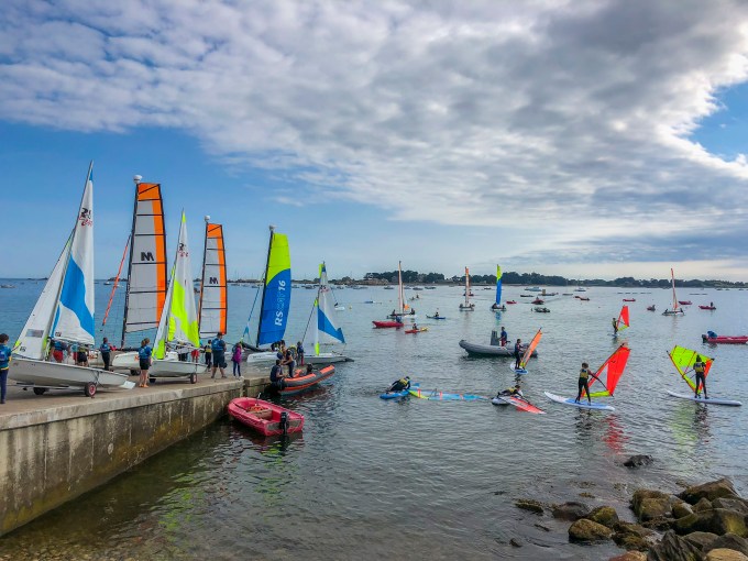
After a longish day of walking including a picnic sitting on granite next to the water, we finally arrived at the yacht harbor announcing the beginning of Perros-Guirec and our lodging at the Manoir du Sphinx http://www.lemanoirdusphinx.bzh. Funny name, right? It’s perched on a bluff directly above a rock and sand shore, with the map conveying that spot as Sphinx point. I couldn’t see the similarity, but what’s in a name? Anyway, before we left the harbor and trudged the final kilometers to the manor, at a local café we elected a Breton delicacy pick-me-up, a pomme et glacée galette (sliced baked apple and ice cream held in a buckwheat crepe) washed down by icy local beers. I was the thirstier, why do you ask?
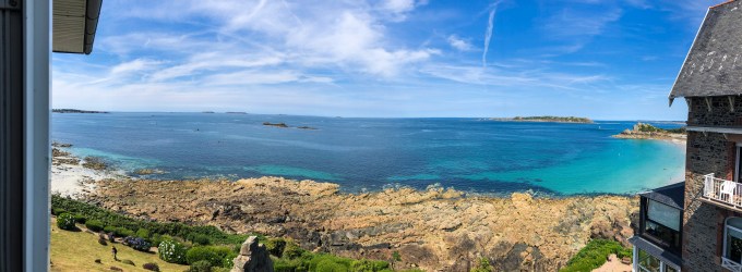
To say that the manor has a commanding view is a bit of an understatement. This is a panorama of about 150 degrees taken from the fully openable window of our room (21) which jutted out several feet from the face of the building like our own personal aerie. This was taken at low tide, and herein is another Breton worthy-mention. The biggest tidal differences correspond to full and new moons, and in Del Mar those might be as much as an 8 foot difference. This picture was taken when the moon was half full, or a period of modest tidal change, and yet with the local bathymetry, the tidal swings were in the neighborhood of 23 feet. During high tide, those rocks below were fully covered, with the water up against the greenery of the manor’s lower garden. At the far right of the frame you can just make out the curving shoreline of a gorgeous sand beach—Plage de Trestignel. Cathy and I both cavorted in the water there, albeit in short doses given the 62F water temperature. You can make out the bird sanctuary of Les Sept Iles (Seven Islands) offshore.
After getting situated and gawking at the view, it was time for dinner. Brittany is known for its seafood. I hope you came hungry. Oh yes, another Michelin-starred restaurant.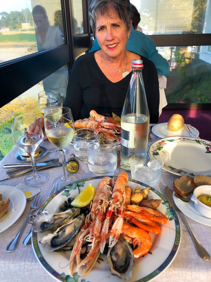
It turns out that the nighttime views from our room were equally astounding. That would be the Big Dipper (Ursa Major) in the lower left, the right lip of its pan pointing, as always, at the brightness of Polaris to the right of center near the top of the frame. Known also as the pole star, it is a delight to navigators, as it defines one’s latitude in the northern hemisphere—it’s on the horizon when at the equator, and directly overhead at the north pole. Here in north coastal Brittany at nearly 49 degrees north, it’s a tad above halfway betwixt the horizontal and vertical. You’ll notice that each of the bright stars in the frame are tiny sideways teardrops, reflecting the amount of movement by our rotating earth during the ten second exposure. More on that anon. Love those dark nighttime skies.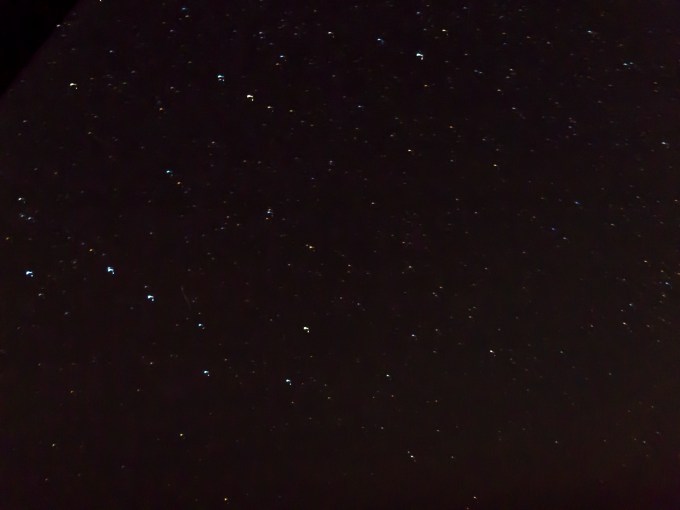
On our second of three days in Perros-Guirec we stayed and visited local sights and scenes. We strolled some ten minutes to the centre ville (city center) where we caught a local bus towards Ploumanac’h, getting off at the Chapelle Notre Dame de la Clarté, named for the patron saint of sailors. It’s prominence was supposed to have been a targeting reference for pre-D Day bombers attempting to take out a nearby German radar. Breton foggy weather blanketed the peninsula and saved the church, leaving its blessing of sailing ships and pipes intact.


Following a wooded path, and then meandering through byways, we eventually arrived at the lovely sheltered harbor of Ploumanac’h where we took sustenance before resuming our walk to return to the manor a couple of hours later. An observation on the French way—we arrived at an outdoor café here at 11:45, but were declined service because it was not yet 12:00. Waiters were ready, the tables set, it just was not midday. This wasn’t delivered with down the nose insult, more a perplexed confusion over how anyone could wish it otherwise. We continued our walk another quarter hour and spent our Euros at another restaurant adjoining a lovely plage a kilometer farther on.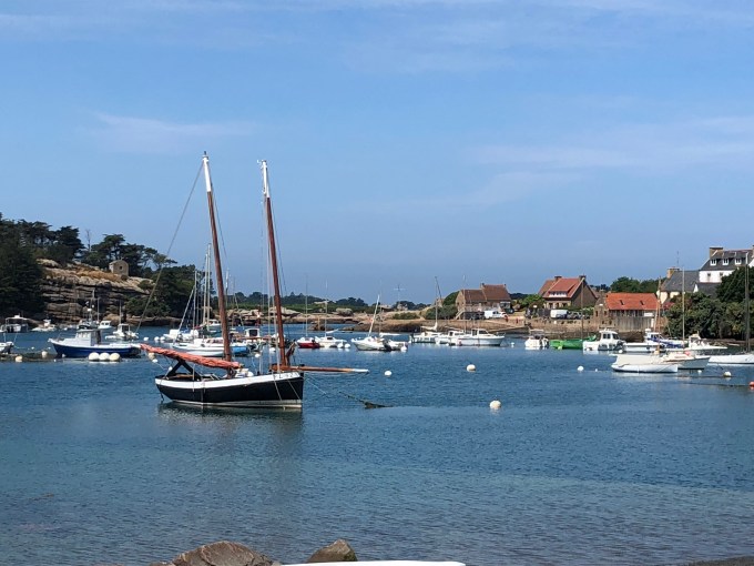
And so we come to 20 July, 2018, which began with an auspicious sunrise at “Oh-Dawn-Early” on this 33rd anniversary of our marriage.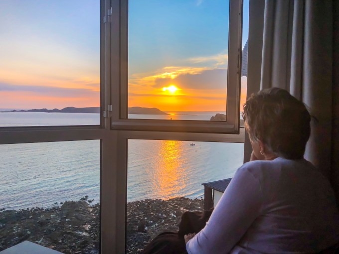
Another taxi ride to what was billed as possibly the most scenic stage of our journey, beginning on Ile Renote, actually a peninsula by means of a narrow stretch of connecting land at the island’s southwest extremity. Ol’ What’s Her Name taking in the view. 
And what a view it was.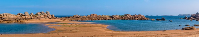
By now we are starting to get this Rose Granite thing.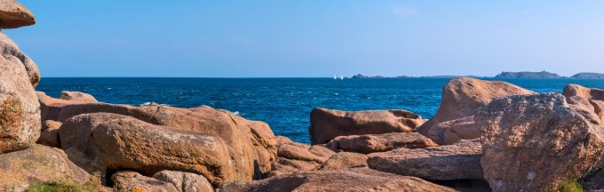
This fantasy-land stretch treated us to luscious low light and solitude. That’s the duck under and twist through trail here.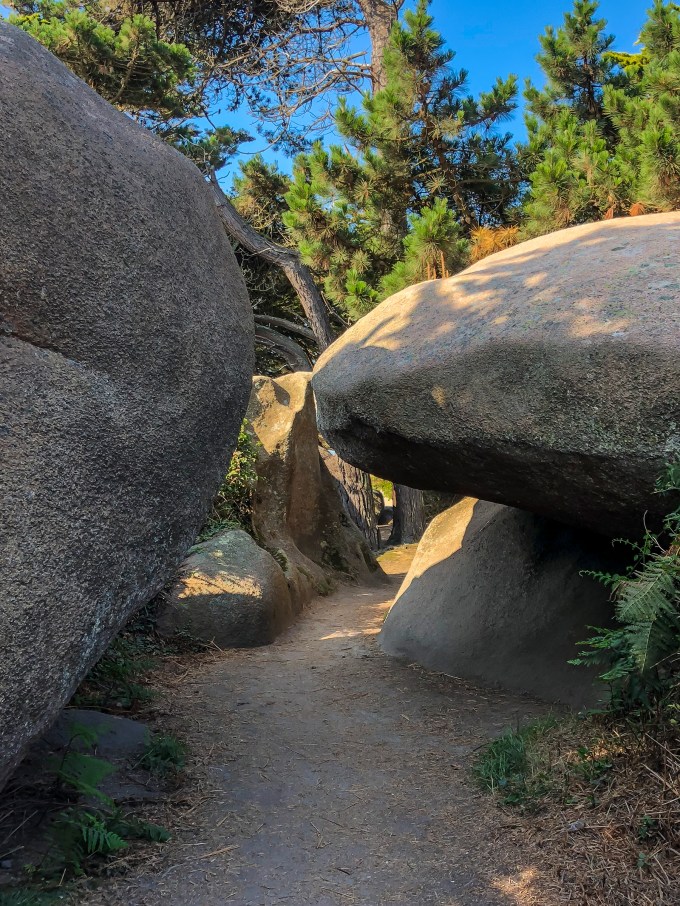
There were gargantuan apparitions like this leaping bear, its left wing shot through.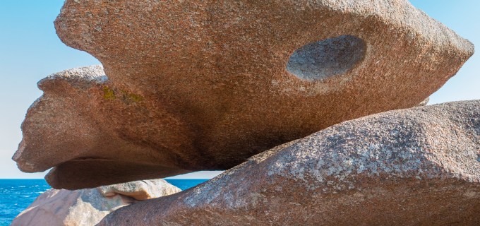
And tranquil spots to feel the air, absorb the vibe, and perhaps take a water break? Double entendre.
You can’t overstate the raw beauty of the region. This particular stretch drew modest crowds, which is to say we actually saw other walkers. To give us space, we took our picnic lunch ensconced on boulders we had to scramble to, gazing toward this maritime navigational light.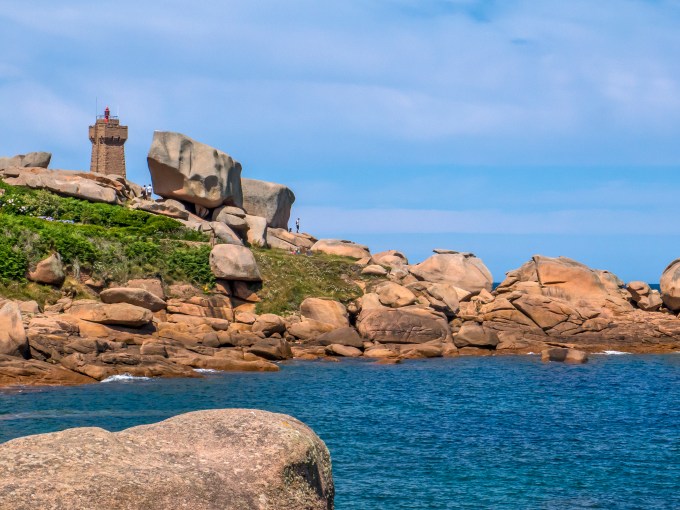
Ceaseless wildflowers.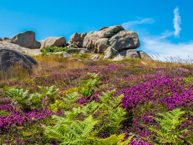
GR34 ambling on the right.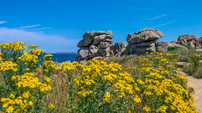
We returned to the manor, and went for a swim at Plage de Trestrignel, then dressed and repaired to the lounge for champagne and on to the restaurant for our anniversary dinner. Our three course meal began with a gazpacho appetizer accompanied by a glass of Sauterne. That grin is because she’s unwrapping a velvet-bagged lovely silver and glass bauble I slyly acquired days before at an artisan’s studio next to Tréguier cathedral. 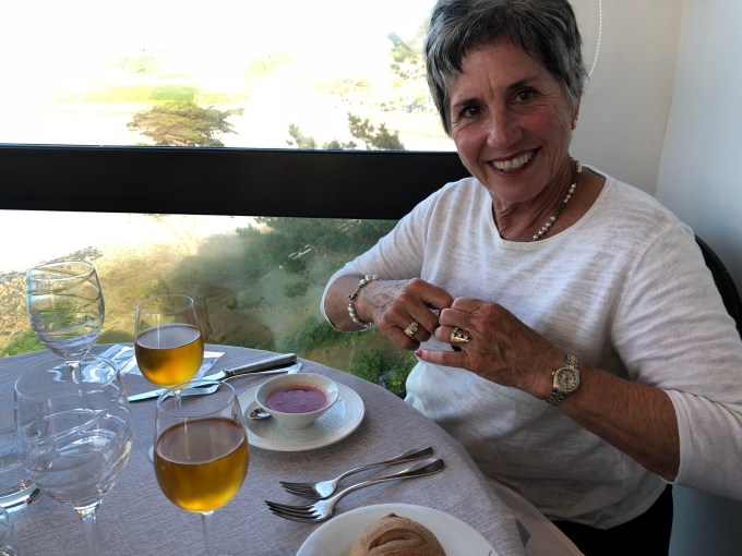
Atlantic cod, Breton style. No newspaper. A bottle of red the sommelier recommended if we were keen on red in spite of fish. We were. An inspired choice.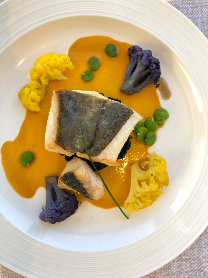
For the sweet tooth. Citron something or other.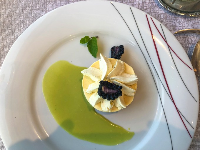
Observations on the Breton dining experience. Breakfasts were of the continental variety, with plenty of cheese, meat, cereals, rolls and buttery croissants adequate for the day’s walking. Our prepared picnic lunches were not what you’d think of as picnic lunches. Salads, yes. Potato salad, no. Dinners were set your watch by it, begun at 19:30. And people arrived pretty much on time, creating a single—not staggered—seating for supper. This translates to modestly slammed servers forcing a leisurely dining time. Method to their madness? The Breton way, a byproduct of which was that we were usually finished by 9:45 PM, about :25 before sunset. At the Sphinx we invariably took ourselves out to “our” sunset viewing bench in the garden below chambre 21.
Nice light for 10 PM. Have I mentioned the flowers?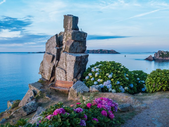
Bench view to the west. Three separate shots to convey a point.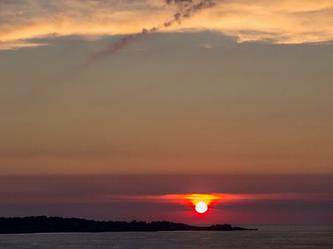

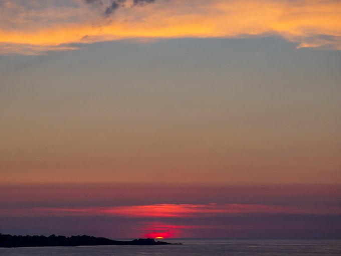
You’ll recall the minute sideways teardrops of stars in the Big Dipper time exposure? These three sunset frames convey the same in their own way—look carefully how the setting sun shifts appreciably right during the sixty seconds duration from the first to the last frame. This big blue marble in space revolves at a rapid pace, like life itself. Our time in Bretagne was a slow travel antidote to the daily rush. No news of presidential taunt tweets, just time spent renewing love for a good woman and enjoying rose-colored stones and sunsets.
Au Revoir, T
An Early Spring in the UK
Posted on April 5, 2018
Spring Break for Cathy at SDSU. Torrey at Middlesex University, didn’t really have an official break, but had a week without going-to-class requirements, just projects to keep moving toward fruition in her Master’s studies in Digital Marketing. Sufficient planetary alignment to jump across the pond for a rendezvous in England. We arrived the day after the vernal equinox, equally early enough and late enough for England to show both climate and seasonal faces—the first hints of buds, in spite of residual snow on the ground from the previous week’s white blanketing.

St. Paul’s Cathedral
Principal reasons for me to go were to see and visit with Torrey, who is living in London’s Islington borough at this point nearly half way through her studies, to recon her local digs and meet her university chums, with a side dish of all three of us exploring the southwest English peninsula of Devon and Cornwall.
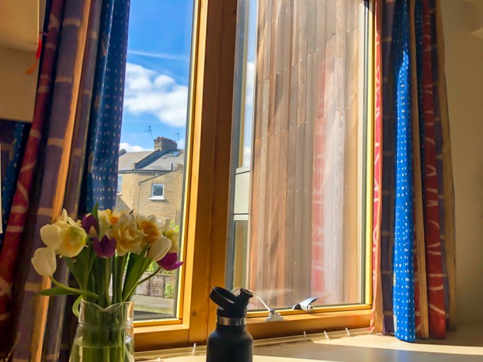
The view from Torrey’s flat
Her flat is in a secure apartment complex dedicated to foreign exchange students, a studio apartment showing her inimitable style in personalizing her living space. The neighborhood is oh so British, with tea rooms and pubs, and all the usual residential amenities.
Our first three days were dedicated to London cruising and jet-lag adjustment. We renewed our skills negotiating both the Underground and London’s ubiquitous double-decker busses. Torrey, the resourceful young adult, arranged for two sim cards for our mobile phones so that we could call and text in the UK, and turned us onto the Citymapper app for our phones that enables knowing and using every sort of public transport, including bus route numbers and tube maps with schedules to the nearest :01. Essential stuff in a realm divorced from harnessing oneself to the automobile.
Torrey and three of her four favorite classmates joined us for dinner at the trendy COPPA Club just off central London’s bustling New Oxford Street, and a short walk from our Thistle Hotel near the Holborn Underground station, a stone’s throw from the British Museum.
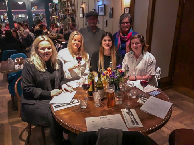
We three and three classmates
From left to right, front row: Emilia and Alessandra—both from Norway—Judith, from Spain by way of England, and Torrey. Back row, the geezer, himself, and ol’ What’s Her Name. Unavailable this particular evening was Trang, from Viet Nam. I’m conveying this to share just how diverse and cosmopolitan London and Torrey’s university are. Of course some would say that this diversity is the seed bed of Brexit, but I’ll leave that for others to sort out.

Queen Anne at the entrance to St. Paul’s
St. Paul’s dome in the first image, above, is the iconic view I remembered from past visits to London, but lo and behold, there’s actually a front entrance to the cathedral, overseen by the statue of Queen Anne. The church has been here, rebuilt several times, for over 1400 years.
We departed, southbound, walking across the Thames on the Millennium Footbridge, a steel suspension bridge dedicated by Queen Elizabeth on my birthday in 2000. I failed to receive a special invitation to attend the ceremonies. But the bridge is easy on the eye with great views from it, and of it.
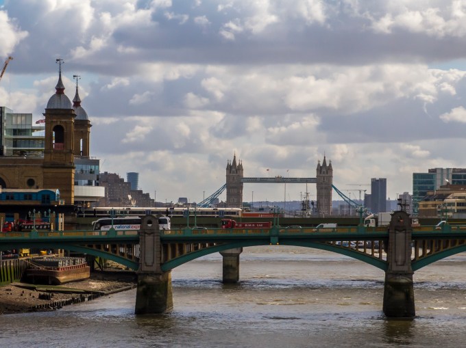
London Bridge and Tower Bridge, seen from the Millennium Bridge
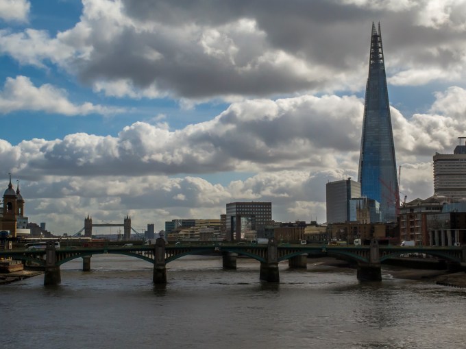
London Bridge, the Tower Bridge and the Shard
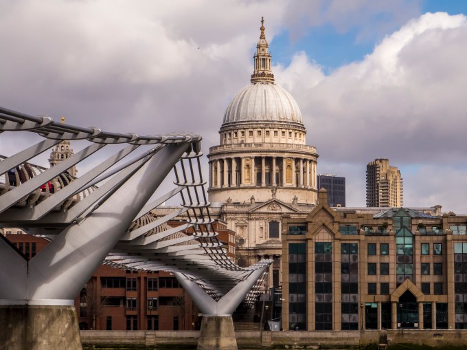
The graceful lines of Millennium Bridge directing the eye to St. Paul’s iconic dome
Exiting the bridge on the south bank places you in one of London’s many art districts—directly in front of the Tate Modern art gallery, and a very short stroll to Shakespeare’s Old Globe. Continuing the stroll eastward, we soon came to our intended destination of Borough Market—a foodie’s nirvana, and sadly, the site of a terrorist attack last year, which had begun overhead on London Bridge.


Teeming with locals and tourists, Borough Market delights the eye in colors and shapes, the nose in fragrances of every imaginable food from a world of cultural appetites, and the palate as you sit in tables amongst the food stalls letting your dietary imagination run boundless. Everything is freshly caught or picked and arrayed kaleidoscopically in sensory overload. Cheese from England and Switzerland, fresh fruit from the countryside, or just flown in from distant climes, freshly grilled duck confit on a bed of greens, partaken with chilled Prosecco. Decadence, defined.
Following lunch at Borough Market we used the tube to get to the V & A, the Victoria and Albert Museum, south of Hyde Park and Kensington Gardens. That would be Queen Victoria and Prince Consort Albert. The Victoria whose name establishes Victorian England’s inclusive descriptor for place and time in the nineteenth century. Like our Smithsonian, England’s major museums are free, although for certain exhibits there may be a fee. Such was the case with a newly opened exhibit on Ocean Liners and their place in the 19th and early 20th centuries as both mode of intercontinental travel, and definers of chic elegance for those with means, not to mention proud examples of national technological and style prowess for sea-faring countries’ governments and businesses.

Cunard Lines advertisement
The exhibit showcases liner paraphernalia from the time when ocean crossing was the stuff of curving staircases to grand salons, intentionally designed to showcase the beautiful people in elegant attire descending to the evening’s revelry. An exhibit of hull riveting, and over the top gowns, custom travel cases, engineering marvels like gyro stabilizers and hydrodynamic hulls, deck chairs, a bit of Titanic flotsam and so on. A quite fascinating flashback to a time before torn jean short shorts became today’s de rigueur attire for a certain segment of cattle car airline travelers. All of this, nourishing to me, whose dad had his own music combo performing on numerous ocean liners to alluring distant ports of call during the time between the world wars. His still lovely accordion and its well-scuffed travel case plastered with destination travel stickers are prized mementos here at Chez Close. Well, for heaven’s sake, as long as I’m walking down a stream-of-consciousness memory lane, you should know that the first airplane ride I had as a young whipper-snapper was in an old fabric-covered Piper taildragger owned and flown by the gent who had been my dad’s trumpeter in that world-hopping combo. He flew down from Corona Del Mar, used an unpaved strip somewhere around the eastern edge of Mission Bay, and took me up for a local flight. Art, airplanes? The apple fallen not far from the tree. I thank the V&A for this, shall we say, flight of fancy?
London, the melting pot, sadly has had more than its share of recent terrorist attacks. The second evening of our visit was the one year remembrance of last March’s auto and stabbing attack on Westminster Bridge, commemorated by this lit attestation on Westminster’s government buildings. Londoners, are decidedly shoulder to shoulder in their verrrry British undeterred stiff upper lip carrying-on. These are the people who survived the Blitz, after all.
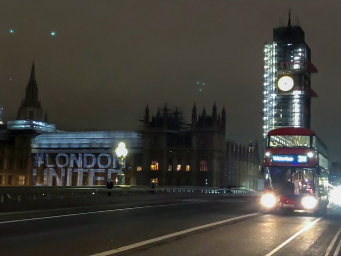
London United, Westminster Abbey, and Big Ben undergoing restoration.
Our plan was to explore another part of England not previously visited, and settled on the southwest peninsula of Devon and Cornwall, which we reached by train from Paddington Station, with a change at Exeter, and arrival at Barnstaple.

Reflecting on Devonshire
We picked up our rental stick shift Ford Focus there, and proceeded to our home away, a three bedroom residence in Ilfracombe, a small city on the northern Devon shoreline. Ilfracombe, pronounced Ilfra-coom, where combe is a bay not coincident to an emptying river, is quaint and walkable small. This northern shore of the southwest peninsula is approximately 25 miles south, across the Bridgewater Bay extension of the Atlantic, from the southern coast of Wales, which is visible across the water. There are quaint shops, pubs, even a Michelin-starred restaurant. We shopped for groceries and took breakfast in our place, but dined out for lunch and dinner.

Ilfracombe from our Air BnB living room
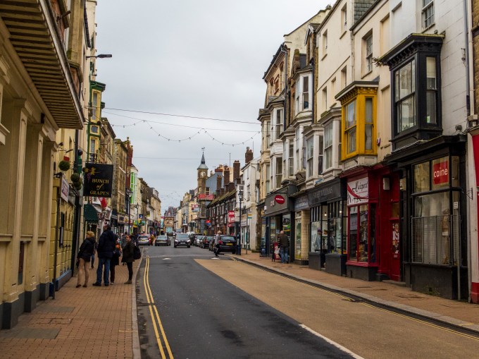
Window menu perusing in Central Ilfracombe
Each day we headed out with only vague ideas about what we wished to do, so long as it allowed absorbing the local vibe and getting some fresh air and exercise on the countless walking and hiking paths. For pilots, aviating there is half the fun, but driving in Devon was stressful, punctuated by decidedly scary moments. I was okay with the manual shift, but the typical roads were quite literally 1 car wide, with occasional bow-outs such as you can see on the left, below, to enable two vehicles to pass in opposite directions. The problem is that hedgerows are universal, higher than the auto height, which with constantly twisting rural roads means that you don’t seen another vehicle coming until you are nose to nose. The natural response for a gringo is to dodge right, which is precisely the wrong thing to do in England, then there’s the necessary instinctive downshifting, and my neural pathways and muscle memory were all for my right hand to shift, not the left. To say that there was vehicular tension is a touch of understatement. We survived and didn’t wreck the vehicle, but good fortune had much to do with that.
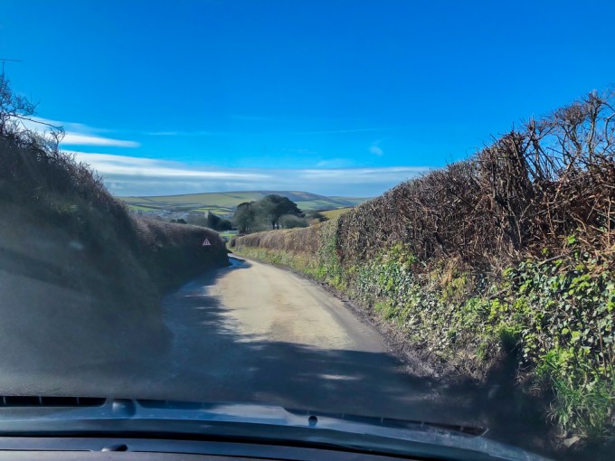
Hedgerow road view
Our destinations varied from tiny hamlets to just trailheads around Ilfracombe and Exmoor Forest, the trails through forests and up and down coastal headlands.

Water-powered funicular from Lynmouth, above, to Lynton , below:


Clouds and sun, dry, or intermittent rain showers, calm or windy, temperatures in the upper forties to low fifties…all in the same day. There was snow on the north sides of the hedgerows, residual from the prior week. In a word—”seasonal”—for late March.
Villages with hundreds, if not thousands of years of history. A trailhead just past this bubbling brook.
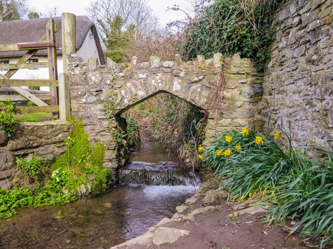
Along the trail…

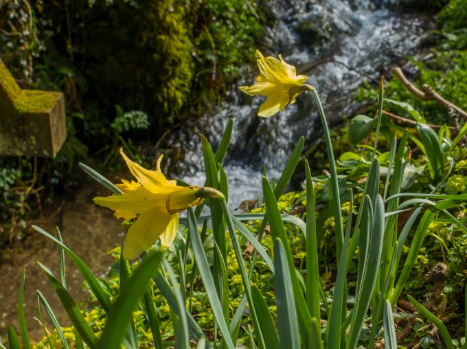
…and trailside views, Spring breaking through

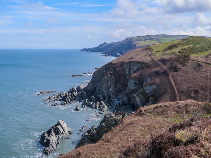
Tidepools along a coastal pathway. The Welsh coast on the horizon.
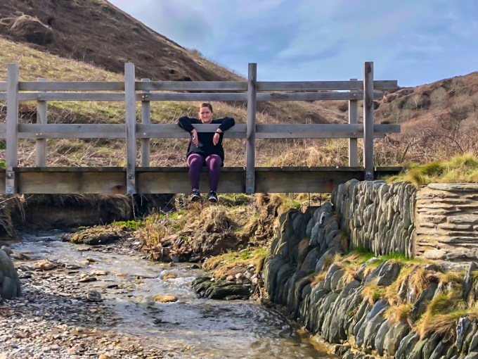
Taking a moment to recharge while savoring the view
Trails that drop down to the sea, climb back up the hills above
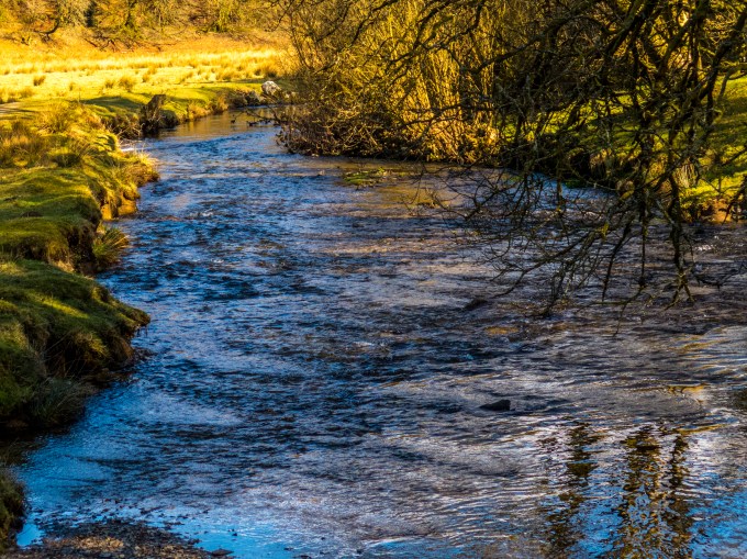
Sylvan reflections
Buffeted by winds, cool temperatures perfect for hiking, and muscles mumbling “enough already,” the trails would return us to our starting point in or near small country villages.

“Downtown” Georgeham, trailhead of the Putsborough beach hike and home to the King’s Arms village pub.
Hike behind us, we routinely settled into a bit of mid-afternoon lunch R&R in a local public house, a pub not owned by a beverage company, and thus able to surf all varieties and labels of adult libations. Many such establishments had been doing business as far back as the 1200s. Each facility has its own vibe and eclectic decorations, a crackling fire, yummy hearty fare from the kitchen and pints of local draft craft beers, wines and spirits. Indulge yourself, you just earned it.
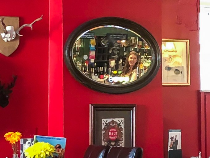
Reflecting on the King’s Arms serving wench
On this particular day we had hiked somewhere between six and eight miles before repairing to the King’s Arms for lunch, “rehydration,” and revelry. The friendly woman serving us mentioned a trail accessed from just out the door leading to Putsborough beach, a local favorite surfing beach. Lest we settle into an afternoon food coma we departed for another hike of 4 miles or so, with the expansive sand beach our turn around point. There was a young people’s surf school just about to paddle out into the ill-formed waves and 45F water temperature. I didn’t notice anyone trunking it! Looking at a map, it’s hard to imagine how that north shore of the Devon/Cornwall coast could have much in the way of waves, but it is an active surf locale, with surf shops, schools and clubs much as we see here in SoCal. Who knew?
The neighborhood pub is a staple of English life. Nowadays it is smoke-free, thank goodness, but it continues its long tradition as a central meeting place for locals and passersby. I think Cathy has hit upon a viable explanation of pubs’ prominence—the homes often have modestly sized living rooms, such that having your mates over for a visit can be problematic. So why not meet at the pub just a short walk away? They are rendezvous sites and sights for the whole spectrum of the community—kids, parents, grandparents, singles, the well-heeled and the reprobates. Think Cheers Bar with a touch of “wi-fi available” modernity’s nose under the tent flap of a centuries’ year old established-there history.
Speaking of which, after a strong wind-buffeted hike on another cliff trail above rock-crashing surf near Croyde to Baggy Point, as we ensconced ourselves with a ploughman’s lunch and a pint of Ureka IPA next to warm sun streaming in a window of The Thatch, Torrey received a text message school assignment on obscure patent issues. Throughly Modern Milly, she completed her research and finished her assignment on her mobile phone while enjoying lunch and the vibe. Multi-tasking, anyone?
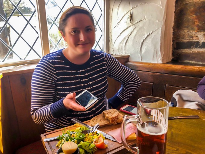
Millie, hard at work.

Ilfracombe moon
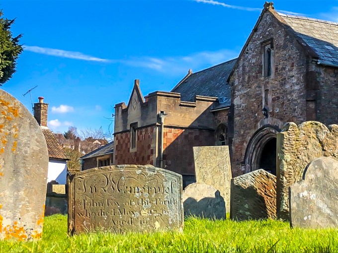
On our last night in Devon, we walked into town, me tired enough to wonder why I wasn’t driving, but concluding the fresh air was much better than negotiating the left side of those twisty tiny streets. On our walk back from a lovely small café the gauzy cloud cover overhead spread the curtains just enough for this Holy Week view of ancient stones and ancient moon.
The next day we drove to Barnstaple and caught the train back to London. Dinner that evening at the Museum Pub around the corner from our hotel, and across the street from the British Museum. Morning tube ride via the Picadilly line and two seats on a United 787 to home and Sawyer. Yes, he was wiggly glad to see us, and thanks to Nitza for dog-sitting while we were away.
Cheers, T
A Glorious Morning
Posted on December 7, 2017
From my vantage point God has made me a quirky sort, and as per the proverbial expression that He clearly has a sense of humor, must find whimsical pleasure in the sort of things that float my boat. This morning my pump was primed when I ambled upstairs, sleepy-headed, and gazed out at the Pacific, with the 3/4 moon high in the western firmament and that before-sunrise sky and sea color that you local early risers know we can experience on clear dawns this time of year. A bluish sky high up, turning to a wonderful pinkish magenta farther down, all of which is reflected in the glassy early sea surface. My dad, a painter, used to remark about the bizarre color pigments he needed to capture the light of various scenes delivered from his palette to the canvas. Nowadays, I very much can say “Amen” to that. This morning I called Cathy’s attention to the color in a “quick, hurry, come look” exhortation in keeping with the little kid within me. Then our canine Sancho Panza chum Sawyer drug himself off our bed downstairs and came up to enquire if it wasn’t time for him to take me for my morning walk?
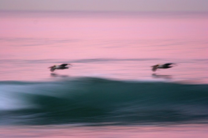
Finishing up our stroll on the cliff trail, wandering back, I was relishing the beauty of pristinely formed waves, the tops of which looked like they’d been cleaved with a straight edge and Exacto blade, feathering spindrift blowing off the pitching lips in the offshore wind, tiny barrels of aquamarine as glistening punctuation marks to swells having come across the sea from thousands of miles away. And there on the reef break where we often surf, a lone pelican afloat, sitting in the water right where the usual surfer lineup spot is. This morning’s small two-foot size had not tempted any humans out, but there Señor Pelican was, probably digesting a just-swallowed fish caught from their typical near vertical plunge into the water. Materializing from the west a one-wave larger “set” A-frame peak rose up. I thought surely it would pitch over and pummel him. But no—he waited, and at the last second as the pitching swell went critical, he launched, a single push of his webbed feet and effortless extension of his wings, and he was airborne, deep in the peak and gliding effortlessly along the the updraft being forced up the wave face by physics. Ridge soaring in the oceanic way so marvelously accomplished by the lowly pelican, a creature only a mother could love on the ground, and a thing of forever beauty in the air. Surfers and glider pilots of the world, eat your hearts out. This guy clearly planned and pulled off his no-stroke takeoff, no doubt hooting with stoke at the pure fun of it.
Now, isn’t this a wonderful way to start your day? Forget the shopping malls, and the workaday challenges. This is where the glory is. And I bet my maker is upstairs, twinkle in his eye at having made me to see and share this sort of thing. Lucky us.
Shalom, Tom
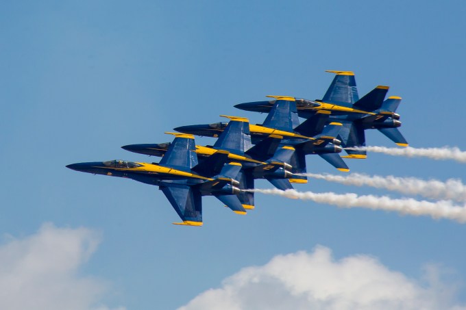
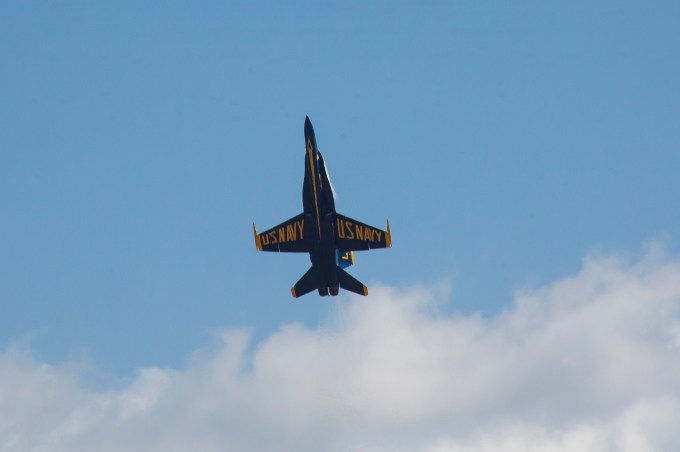
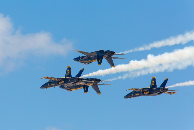
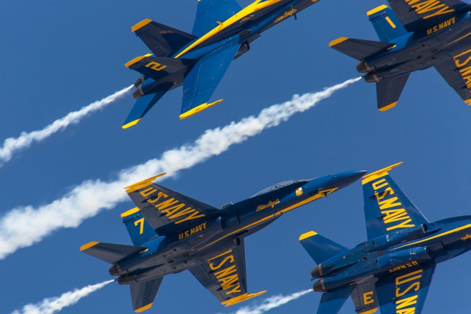
Miramar MCAS Airshow
Posted on September 24, 2017

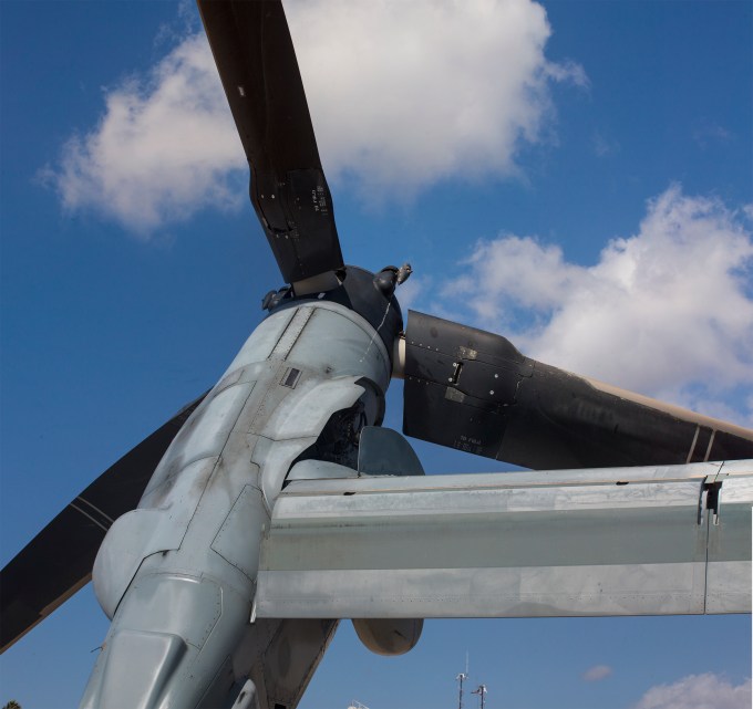
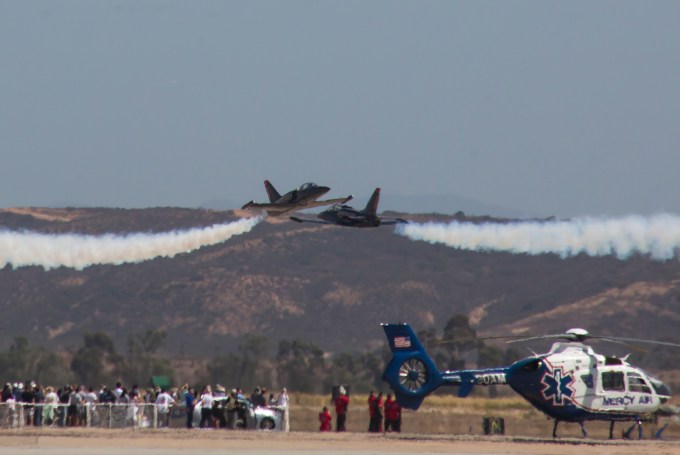
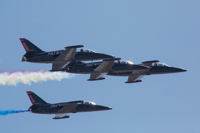
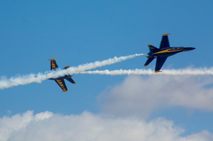
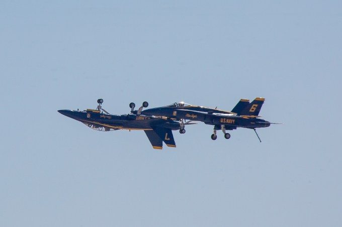
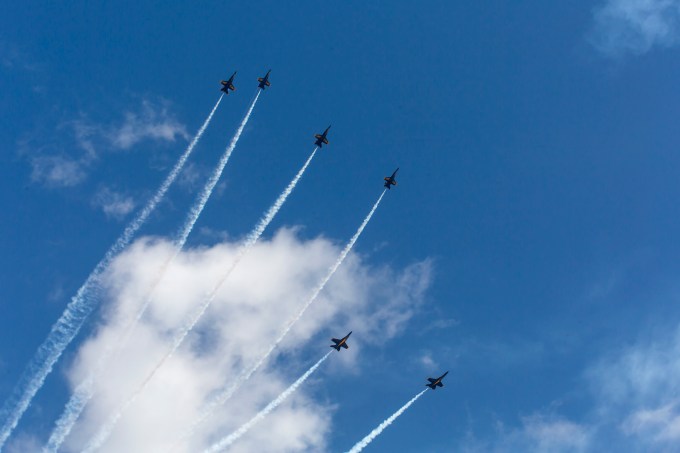
Very little to say here. Images mostly in the order taken. The Patriots team and the Blue Angels. A few shots of the Bone (B-1 supersonic bomber) a fixture of North Korean tension news stories, and one of the tilt-rotor Osprey.


August 21, 2017 Solar Total Eclipse
Posted on August 31, 2017
When I consider your heavens, the work of your fingers, the moon and the stars which you have ordained, what is mankind that you are mindful of him? Psalm 8

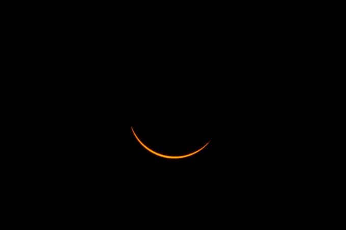
C2 Totality
As you surely know, the U.S. enjoyed a cosmic (dare I say, near biblical) event last week— the first total eclipse of the sun to cross the entire country in 98 years. Perhaps some baseline tidbits? A solar eclipse occurs when the moon’s orbit brings it in alignment between earth and the sun. Our moon’s diameter is 400 times smaller than the sun’s, but coincidentally, the moon is 400 times closer to earth than the sun. The moon’s orbit is modestly elliptical, so some alignments of the moon between us and the sun do not fully eclipse the solar disc, producing a so-called annular eclipse. But for this August event, the moon was at just the right distance from earth to produce a precisely complete beach umbrella shadow total eclipse beginning off the west coast of Oregon and arcing southeast to exit South Carolina into the Atlantic, in a path roughly 60 miles wide.
Astronomers speak of total eclipses in four stages, labeled C1, C2, C3, and C4, referring to the very beginning of the eclipse (the time at which the orbit of the moon’s leading edge begins to cut in front of the outside periphery of the solar disc), the beginning of totality, the end of totality, and the end of the lunar periphery in front of the solar edge. Our viewing location was atop a bluff above a radio-control model aircraft airfield to the north of Redmond, Oregon, carefully chosen to produce an adequate duration of totality, an absence of teeming throngs (just the four of us), and providing relatively quick egress from there to our Cirrus, awaiting us on the ramp at the Redmond aerodrome, KRDM, for transport back home. Cathy had classes to teach the next morning.
It’s amazing what you can find on the internet and the sort of apps that can be added to a mobile device these days. In pre-eclipse recon, I discerned that my chosen camera site would have C1 at 09:06:24 with the sun at an azimuth of 103 degrees (ESE) at an elevation of 29 degrees above the horizon, and so on. See my hand-scribbled crib sheet below, which I frequently extracted from my shorts’ pocket as reference during the morning’s passage. The vagaries of mobile phone latitude/longitude position determination during a dry-run rehearsal were such that, in fact, we got a bit more totality than expected, but otherwise pretty much on the mark.

My crib sheet makes reference to a new moon moonrise at 05:05, followed by official morning twilight at 05:44 and sunrise at 06:16. This was all too glorious to pass up, so I arose at 03:30, with host Neil H kindly driving me to our viewing site so as to be setup and capturing Time-Lapse of this beginning of the day. The new moon was such a sliver that, with cirrus clouds to the east, it escaped being noticed at all, but the rest of the dawn was lovely, as I hope the linked video below will convey. My Cathy came along with Neil’s wife Kathy S (meine frau’s college dorm chum) a tad after sunup, and before C1.
All these celestial machinations are a demand for my peabrain. Okay, the phases of the moon are the result of the terrestrial shadow on the lunar surface with earth coming between the sun and the moon. A solar eclipse is when the moon comes between the sun and the earth, the moon throwing its shadow racing across the earth. But on this day, the moon rose first, even if we couldn’t see it in its newness. The sun followed, over an hour later. Then with the sun climbing left to right in the southeast sky, the moon’s shadow began taking cookie monster bites out of the sun, with the chewing starting at the upper right…

…and moving to the lower left across the sun. I guess that means that the speed of terrestrial rotation about it’s axis was faster than the speed at which the moon was rotating around us? But it makes steam exit my ears just thinking about it. Anyway, it was just wonderful being ill-informed and wide-eyed observers.
Not to mention, selfie photographer subjects.


So, it’s the moon, betwixt the sun and earth that blocks the sun to produce the eclipse, casting its lunar shadow across the earth’s surface in the process. C1 corresponds to the beginning of the penumbral shadow moving across the terrestrial surface, the diffuse shadow ahead of the full umbral shadow which races across the earth like a tsunami, first overriding then receding at C2 and C3 respectively. Those not in totality’s path also take in the penumbral shadow to the side, and it ceases everywhere at any location’s C4 time.
Midway between C1 and C2 the glow of the grasses and sagebrush began to dim while the cameras captured their T-L, and successive still imagery. That’s a very clear sky, but already dimming.

And mere moments before C2, the sky began suddenly darkening in earnest, with the umbral shadow racing towards us readily observable. That would be hostess, Kathy, below, taking in the moment. This twilight was of a different look and feel than vanilla dawn and evening twilight. The hues, which seemed to emanate from some gossamer veil of light grays and violets cast over us didn’t correspond to the pinks, oranges and reds of the myriad sunups and sundowns I regularly enjoy.
At the same instant as above, just before C2, the last moments of solar view before totality.
There’s more shadow things to mention. I had heard that two things are possibly perceivable. One is “Baily’s Beads” named after Francis Baily, who, in 1836 posited an explanation of lunar surface peripheral light at C2, and the other is referred to less elegantly as “snakes,” myriad twisting, writhing vaguely linear shadows on the earth’s surface in the split moments as totality comes on. Both are caused by the same thing—the lunar surface is not a uniformly smooth circumference, but one composed of mountains, craters, valleys and such. At just the moment of totality the sun’s light is not instantly and totally eclipsed, but manages a moment or two of wriggling past the low spots while being blocked prematurely by the higher terrain. Baily’s Beads are a dancing of light at the moon’s edge as perceived from earth. From observing it with the 12X magnification of the telephoto, I saw all sorts of spectral color variations in apparent prismatic effect, light beams bending around the lunar topography and coming through earth’s atmosphere in some angular warpage. Breathtakingly beautiful.
With a little inference, one can imagine how this might make darting snake-like shadows momentarily appear on our earth’s surface. But I’d like to share a personal vignette that you fellow terrestrials may have experienced, especially those who do first light dog walks and surf checks along the bluff in my Del Mar haunts. When the sun is up but not yet over the hill of Del Mar, the surf near the shore is cast in shadow by the cliff. As the sun rises farther, there are a few seconds when there is direct light on the white foam, brilliantly lit, simultaneously with penumbral shadows from higher trees and such up the hill. This softened, shadowed light quite literally dances aglow in fervent gay abandon in an absolutely magical way around the churning whitewater. It is momentarily fleeting, pretty much an earthly version of what a keen observer on the lunar surface would see at the edged interface of umbras and penumbras on the moon if it had an atmosphere to diffuse shadow. Pick the next sunny morning here and transport yourself into this unique earthly experience of the physics of beads and snakes.
There’s yet another eclipse experience about which many have already heard—the “diamond ring.” I don’t know if it ever occurs at the beginning moments of C2, like Baily’s Beads. I did not perceive that, anyway. But as C3 came on, the sun breaking forth at the lunar periphery, we were treated to a spectacular 1000 karat version perfectly in keeping with Richard Strauss’ Also Spracht Zarathustra fanfare.

Go ahead, indulge yourself, and turn up the volume:
So here’s the deal. All of this seems so precise and technical, because it is. The sort of information one would use to carry the proper gear, to the proper location, set up in the proper manner to assure a no-sweat, slam dunk oh-so-informed turn-key eclipse experience. True as that may be, no amount of preparation as to the technical details prepared the four of us viewers for the emotional experience. Not on a par with walking on the moon looking back at our earthly blue marble home, but a whole lot more than taking in a fine sunset or a full moon rising above the coastal mountains in the east. It haunts me still, and I am already thinking of the next opportunity, perhaps Chile in July 2019, and for sure, Fredricksburg Texas on April 8, 2024.
May I present a multimedia version of our morning on August 21, last? Don’t forget to observe the dark sunspots on the sun and the red solar flares at the one o’clock and four o’clock positions.
“Mein Jesu! Was Vor Seelenweh” by Johann Sebastian Bach. Stokowski transcription for symphony orchestra.
I thank Victor V for keying up Psalm 8 for me, and Russ H for doing the same with this quote from Blaise Pascal:
“In faith there is enough light for those who want to believe, and enough shadows to blind those who don’t.”
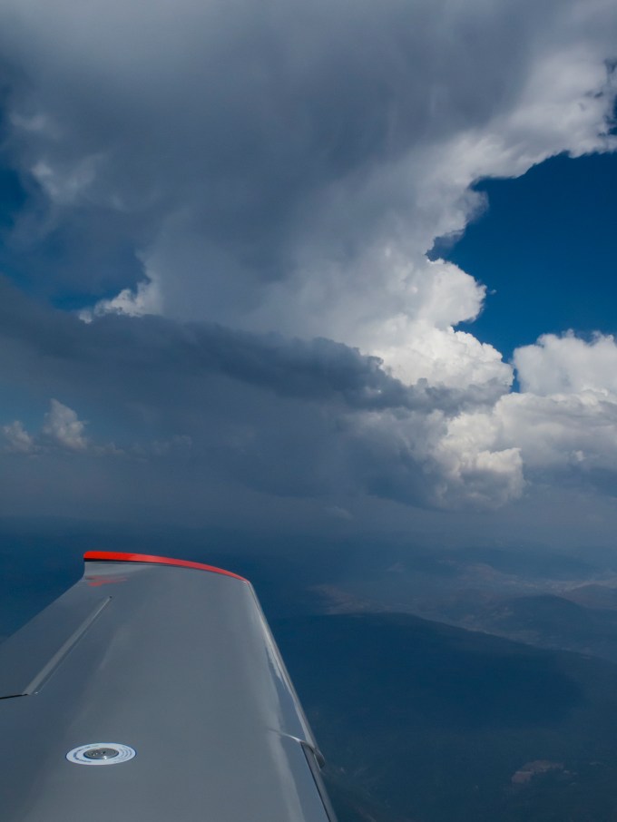
Headed home along the western edge of the Sierra Madre range.
Home in time to take in the end of the day from the front deck.

As ever, Tom
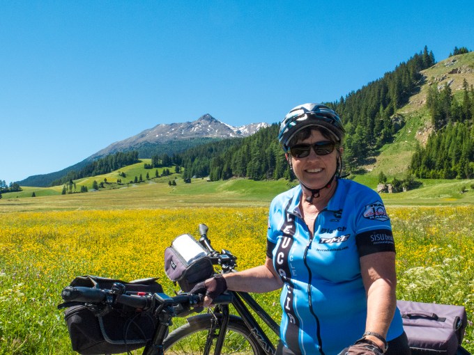
Biking the Italian Dolomites
Posted on June 23, 2017
The beginning of Summer and the end of Cathy’s Spring semester. What to do? How about a biking vacation in the Italian Dolomites, part of the Südtirol, or southern tyrollean mountain region which includes parts of Switzerland, Germany, Austria and Italy? Intriguingly, while the biking was in Italy, the tyrol its largely a German language region, so we didn’t really start interfacing in Italian until our fifth lodging. Each of the small towns where we stayed have both German and Italian names, and the routine language spoken in cafes, trains, and street corners was German.
United initiated new non-stop service from San Francisco to Munich about a week before our trip, an as yet undiscovered flight routing sparing us the usual “are we going to get on?” space available travel nail-biting. There’s a train station right in the MUC terminal, where we acquired our tickets through to Innsbruck, Austria, and boarded a train for there within minutes of our on-time arrival. We used Innsbruck (which means, loosely, the place where the bridge crosses the Inn river) as our jet-lag adjustment location, and it’s a worthy mountain-surrounded city destination in its own right.


The Inn river, and a pedestrian platz, above
The “Golden Roof,” seen from the City Tower

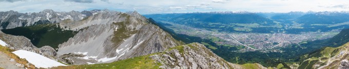
We lodged at the Schwarzer Adler in the “Old Town” just a short walk from Innsbruck’s fine Tyrollean museum and several strolling platzes, and an equally short walk to the gondola ride up into the mountains for hiking on the west side of the city.

A shaded trail leading to a mountain hut for food and drink, before proceeding above the tree line for spectacular vistas.
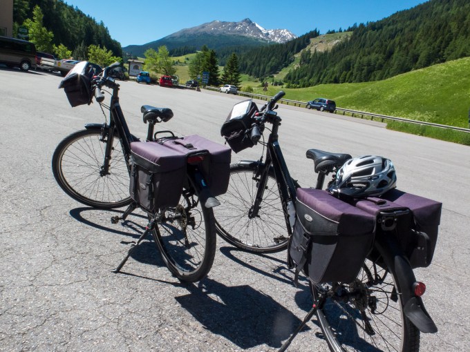
There’s more than one way to get about and take in the sights.

After two nights in Innsbruck we boarded a train for a four hour journey including two train changes to tiny Silandro (aka Schlanders) Italy where we would begin the biking phase of our trip, set up by the Pure Adventures outfitter we used two years ago in the Czech Republic. Self-guided, using their rental bikes, detailed maps and written directions, with stays in very nice lodges and hotels, breakfast included, and luggage transfer provided, while we rode from town to town, generally between 50 and 60 km each day.

The view out the train window while nearing the Austrian/Italian border.

The Schlanders Bahnhof, or Silandro Stazione, if you prefer. As small and delightful as the town. One track, or gleis or binario.
We stayed two nights here, at the Hotel Golden Rose, beginning riding the next day, driven up to the Resia Pass at the border with Austria, for a 60 km downhill back to Schlanders. The route generally followed the Adige river, which means more downhill than up, but nonetheless plenty of “up” in each day’s rolling.
The scenery on Day One was none too shabby.

Small towns through which we passed usually had their own take on fountains with potable water for refilling the bike water bottles. It was in the upper 80s to mid 90s each day, so we were constantly needing to top off the H2O. We stopped at tiny Canal (20 structures?) for water, then an off-the-charts lunch of fresh salad and vegetables, and the most delicate gorgonzola white sauce and broiled chicken pasta, partaken in the shade of overhanging grapevines. Well in the running for best meal ever.


Our breakfasts throughout were continental, with an enormous variety of delectables—eggs, cereals, muesli, fruit, cheese, meats, yogurt, fresh and grilled vegetables, every sort of kickstart sweets, breads, rolls, juice, sparkling water, coffee, and even Proseco. We waddled our way to the bikes and never needed to dine again until mid-afternoon, though timing the hunger and sustenance was required, as cafes closed from 2-6 PM.
Each afternoon I tried to capture a feel for what we experienced with that day’s journey, free-associating on my i-Pad, and will paste it whole, here:
Reflections on 11 June: Resia pass to Silandro.
Sounds–Eagles’ “Hotel California” from the speakers in the diesel 6-speed stick Ford Transit Van. Songbirds. Babbling streams crossed, and shushing Adige river alongside, wind swirls as we head downhill into a headwind.
Sights–Tyrolean crags, whitewater, maps/textual directions/bike paths & signage, tall church spires, walled castles, wildflowers, and pollinator collisions–okay, that’s feel, not sight. Mea culpa.
Tastes–pasta with a delicate Gorgonzola white sauce at Canal. Five stars.
June 12: Silandro to Merano.
Cycling through countless km of apple orchards, the trees pruned to near vertical stalks in close-quarter rows. Apples, this early in the season, small green and reddish nubbins. Birdsong incessantly delighting, and joyously saluting the fine sunny day. Widely scattered small undeveloped cumulus, per Camelot meteorological statute, confined solely to the ridge lines either side of the descending valley.
Leapfrogging a family of four–two small children on their own bikes. We’d pass them, only to have the favor returned when we stopped for another Canon moment. Must have happened a half dozen times.
We beat our bags to the City Hotel, a complication for Cathy, who, used to our Czech trip, with bags awaiting, failed to stash walk-around attire in her panniers. For once I had the edge. Not to be repeated going forward.
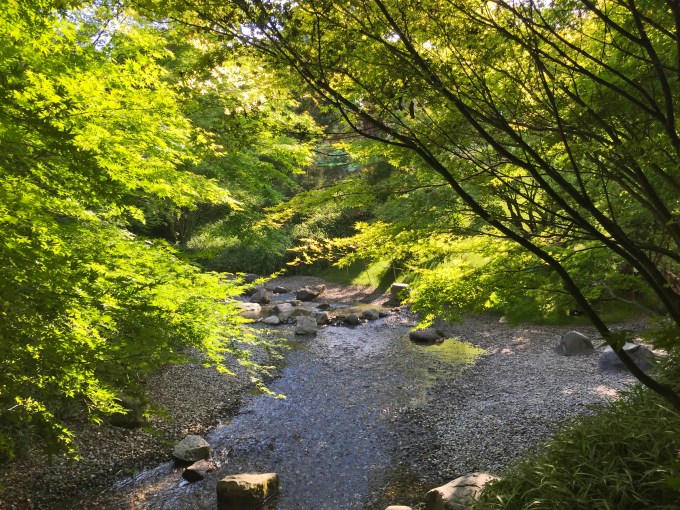
Castle Trauttmansdorff gardens. Wow! By city bus, no less. At about 95 F. One portion of the extensive gardens featured its own river and waterfalls, a stretch slowing over pebbles along a sandy bank (where are the darting trout?) trees laced overhead, all of it a blessed relief from the late afternoon swelter. And, oh, those breezes coming up the slope at 18:30 with wasser kalt mit gas, were a godsend.
June 13: Merano to Caldaro.
It took some navigational work leaving Merano, where the directions were based on a lodge well out of town. A local map from the hotel, and a bit of intuition, and we were able to join the route after several km. The riding has been on mostly well-marked designated bike paths, with great smooth pavement, absent the broken glass of US roads. Biking is a way of life here with a diversity of riders from toddlers to oldsters, male, female, clubs, cruisers, you name it. Flip flops to SIDI and spandex. Some slower than us even in our dotage and 45 pound clunkers, but many young Italian and German men with high tech rides, wheels singing on their missions from God.
June 14: Caldaro to Trento
Our lodging in Caldaro was a small boutique hotel, Das Haus am Hang, situated well up a killer hill for heavy bikes at the very end of the riding day. But a worthy place with a commanding view of the lake and valley down yonder, a fine restaurant with al fresco dining, livened by a refreshing breeze. There’s a pool, and lounge chairs scattered under the overhead vines of this working winery.
Two problems, however. At bedtime the breeze quit, as did the AC! And the morning’s departure directions were not from Haus am Hang, but from a “you-can’t-get-there-from-here” starting point–down yonder. Eventually we found our way to down yonder, and a local, seeing our bewildered furrowed brows, took us under his wing with a half German/half English “follow me” to get us onto our route. Good to his word, in spite of a rat in the maze circumbobulation, it worked out sportingly. With another 10 km added to the day’s required kilometerage, of course. Do I sense a trend here?
A bit more about our riding days. Four or so hours including physiological and photo respites, steaming at just less than 20 km/hour. The trip follows the Adige river generally downhill but with a fair share of up amongst the down-rolling. Our riding has, without exception been into a headwind, so pedaling downhill, too. There’s a benefit to this, though–the headwind cooled us somewhat. Scattered along the route there are fountains and dedicated water sites, all with potable, often quite cold artesian water. Given the heat and exercise, I never could consume enough wasser or acqua. Invariably thirsty. Numerous bici bars and small cafes, where we’d stop for a full liter of wasser mit gas (carbonated mineral water, a staple of the region), refill the bike bottles, empty what little we could, given the extant sweat elimination process, swing a leg over the top tube and saddle up, the sitzbones and quads reminding us of their vote in the discussion.
June 15 & 16: Trento to and in Riva Del Garda
Leaving Trento was even more complicated than arriving. Our lodging was in town, but the directions were from a pension outside of town on the other side thereof. This resulted in an additional 10km to negotiate without explicit guidance, using a hotel-provided city map, and naturally a day 10 km longer than advertised. Ah, but what fun starting the journey through the Piazza Del Duomo, this morning, turned into a bustling farmer’s market, spilling into the first blocks of Giuseppe Verde Strasse. Yes, let’s laugh together at the incongruity of Italy’s iconic opera librettist having his street name in German. And while we’re indulging our funny bone, how about taking an enormous imaginative and temporal leap to join me in mirthfully transposing Cathy and I and our bikes as Audrey Hepburn and Gregory Peck slicing through the throngs on our Vespas, now an appropriate half century after our Roman Holiday! Okay, you had to be there, but memories are made of this stuff.
Not until well out of town did I realize I’d left my water bottle at the hotel. Nothing for it but to pull from the pannier the small bottle retained from our flight to Munich. This occasioned a delightful refill opportunity at a fountain in the center of a flower-bedecked traffic circle in a one horse town beside the Adige. Then there was the textual directions’ river crossing denied us with the bridge being closed. Backtrack to the preceding waypoint, and sure enough, dayglow chartreuse signs (in Italian, natch) pointing to the necessary detour to carry on towards Riva.
There were clues, if one was alert to more than their road-weary derrière and tired quads–let’s see, we have to exit the Adige valley at right angles and proceed to a pass, so as to drop into the mountain-locked Lago Garda, the largest lake in Italy. Does the term “climb” ring any bells? Earned, the right to make the roaring descent from San Giovanni Pass, an exhilarating punctuation mark, prelude to eine grosse bier und pizza, lakeside, just before the 14:00 cafes-closed bewitching hour. Consumed as emphatically deserved-certain as the divine right of kings.
Riva Del Garda is right out of central casting as your quaint waterside Italian town. We stumbled on a wonderful cafe up an oxcart-wide cobblestone passageway in keeping with a place a couple thousand years’ established. The following day We endured the obligatory tourist boat ride down lake, the high point of which may have been the sailboat regatta on the return.
June 17 – 19: Verona.
Verona is an ancient place. We reconnected with our Italian UCSD exchange student “son” of 9 years’ past beneath the Porta Borsari, which dates to the BC era. Marco squired us to favorite sites and sights, not to mention tastes and personal vignettes. The coliseum, here, predates Rome’s, and now is celebrating its 95th season as venue of al fresco summer opera–unfortunately beginning next week. Then there’s this evening’s sold out Tony Bennett concert in the Teatro Romano. Double “Rats!”
We’ve explored very vecchio (old) streets, churches, towers, and hills, collapsing, footsore into shaded trattorias, red and white checkered tablecloths supporting leant-on elbows and glasses of chilled Soave vino bianca. And if spirits sag, how better to rally to the next adventure than with a double gelato from that tiny dispensary of taste extravaganza Marco told us of on the corner of Via Cappelletta? Then right on cue, having just licked fingers clean of cicolatta drool, while strolling in afternoon shade on Pietra Vecchia, what should we encounter but an open garage? Within, a man and his ten (?) year-old son diligently conjuring the machinations they have set in motion on a hand-made wooden Foucault pendulum using a weighted pendulum with attached stylus to render colorful circles and ovals in never-ending arcs scribed on paper. Dad waves us in, and in conversant English we learn a bit about one another. No, he’s not an Engineer, but a forest ranger, who like me, delights in the tactile pleasure of wooden things, like his scribing device, and the hand-crafted wooden-frame kayak hanging from the ceiling. His wide-eyed son is clearly enjoying this unexpected drop-in event nearly as much as he exudes love and pride in his father. I share that in the U.S. this Sunday happens to be Father’s Day, and ask of dad if he’s familiar with the English term “serendipity?” The tongue twister is beyond his vocabulary, but he clearly grasps my definition and the none-too-subtle example our ice cream-engendered chance visit represents thereof. We part, four happy humans, none of us knowing the others’ names.
And tomorrow we secure train transport back to Munich for our Tuesday flight return to day-to-day reality, serendipitous and planned adventures drifting into memory lore.
Drink break on the way to Schlanders, and then the arrival thereto.


The biking was always on dedicated and well-signed bike paths, which combined with our maps and textual directions mean only modest navigational challenge, but when challenged it was always in the getting to and from the lodging within the community at each destination.

Flower bedecked covered bridges. The sign reads “You are pedaling in the areas dedicated to the cultivation of marzipan.” Except at this point we are pedaling amongst vineyards. Ah, Italy.


En route navigation mostly amounted to how many kilometers to the next bench under a shade tree for a butt-break and a little back stretching. Which is to say that there was plenty of time to look around and enjoy the view.
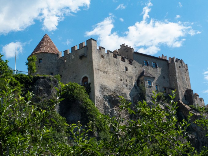
Castles abound, why do you ask?


But don’t forget to take in the small scenes close at hand.

And, as ever, smell the flowers and refill the water bottle.


We arrived in Merano, pretty bushed and beaten down by the late afternoon heat. But Cathy wanted to find a way by bus to the gardens at Trauttmansdorf Castle in the hills outside of town. I went along to get along on this, only to discover that she had nailed it as a worthy venue. The gardens cover several square km, and are lushly beautiful. There were shady mini forests, vast numbers of blooming flowers and a cafe with a lovely fresh breeze overlooking the valley from the shaded al fresco watering hole.


The view of Caldaro from Haus am Hang.

Haus am Hang lounging, mit grosse bier after plunging into the pool.

I’ve mentioned bici bars and alongside the path cafes as R&R oases. The local riders routinely would consume a beer or two at these locations.


Cathy and I just tried to keep going and save the adult beverages for the end of the riding day, as in this interlude of beer, wine, bread, cheese, olives, and scenery at Scrigno del Duomo on the Piazza del Duomo in Trento. And yes, that is a new apple from one of the orchards through which we rode. A personal smile-inducing talisman. The duomo (dome) itself is off my right shoulder.

The Italians are such friendly sorts, never mind the crumb-dusted beak.

This afternoon, there was a community event in the piazza, urging people to rally against cyber bullying, with locals casually taking in the event and enjoying Neptune’s fountain.


The next morning the piazza was a thriving farmer’s market with food, flowers, and hand made goods, the square chock full of people doing the day’s shopping. We had to walk the bikes through and onto Giuseppe Verde Strasse.

Our final biking destination was Riva del Garda at the north shore of Lago Garda. There was that climb out of the Adige river valley, and then the roaring downhill to the lake.

This northern end of Italy’s largest lake has regular afternoon winds to delight wind sailors and kite sailors, as well as those engaged in sailboat regattas which we enjoyed when taking a ferry ride down the lake on our second of two days there.
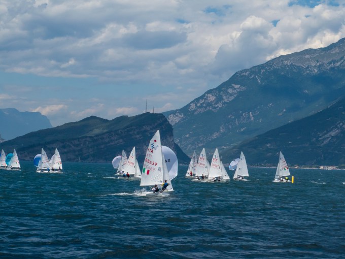
The view from the harbor quay next to our lodging at Hotel Sole.

The quay is a gathering place from early morning to late at night.

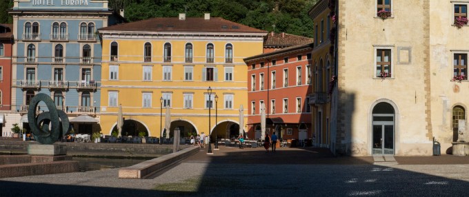


And, of course, like all of Italy, the Garda area is a rich environment for a color and texture hungry photographer.


Riva has plenty of trendy stores, and cafes with tablecloth al fresco dining on narrow cobblestone streets of a dimension and carefree abandon in keeping with having been laid out a couple of millennia ago when transportation was by oxcart. On one evening we dined between two delightful Bavarian families, and learned that we were there at the end of a two week school holiday in southern Germany, thus accounting for the large number of German-speaking tourists in a highway accessible vacation mecca.


Having concluded the bicycling, we were driven to Verona, an ancient Italian city notarized by William Shakespeare, even though Romeo and Juliette never existed except in his fertile mind. The Veronese nonetheless have capitalized on the lovers’ tragedy by establishing a home for both, Giulietta’s being just off Via Capello, close enough sounding to Capulet, and finishing the nod to tourism by adding a balcony that did not exist on the house when it was chosen in 1932. Marketing 101.

An important motivation for our visiting Verona before returning to Munich, apart from never having visited the lovely oh-so-Italian city, was the chance to reconnect with our Italian “son.” Marco Tebaldi hails from there and was hosted by us as an incoming UCSD exchange student nine years ago. We’ve had wonderful host relationships over the years and have daughters from Spain and Taiwan, and other sons from France and Mexico. Marco was in town during our time there, having returned from his most recent work posting in Melbourne, Australia. We got a chance to be squired about with a local’s eye, and his boundless enthusiasm and bonhomie, and then meet and take dinner with his real parents.
Marco chose to meet us, just steps away from our Palazzo Victoria lodging at the Porta Borsari, a gate entrance to the old city dating from before the time of Christ.
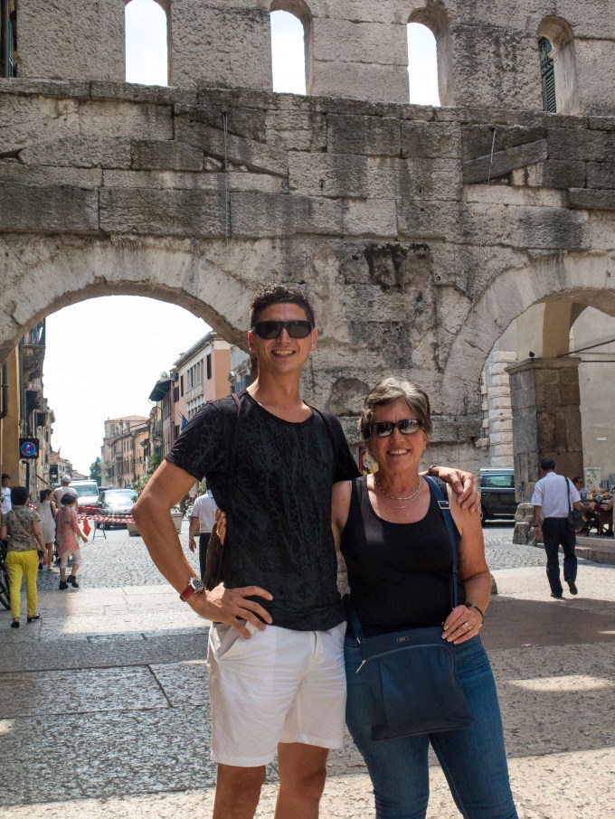

The old city is a labyrinth of twisting pathways, and something fascinating and colorful awaits around every bend or corner.
The view from the Clock Tower.
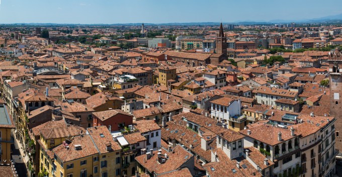
The Clock Tower itself.

Dynamic Duo just below the tower.
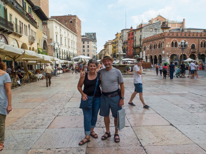
Striding on the Ponte Pietra (stone bridge) crossing the Adige at the Castelvecchio (old castle).
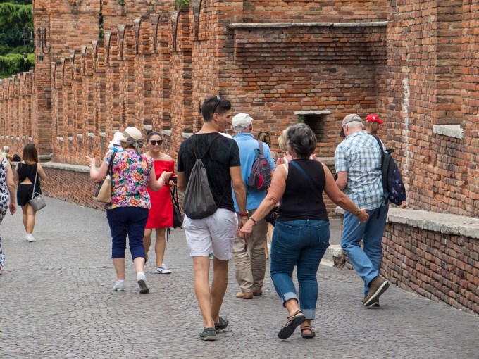
The bridge is both a wonderful viewpoint, as well as worthy view subject.
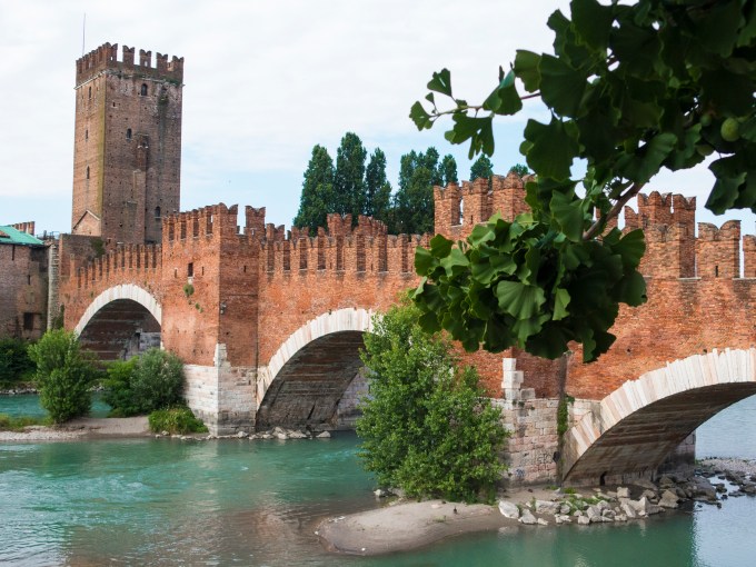

Ponte Vittoria as seen from the Ponte Pietra.

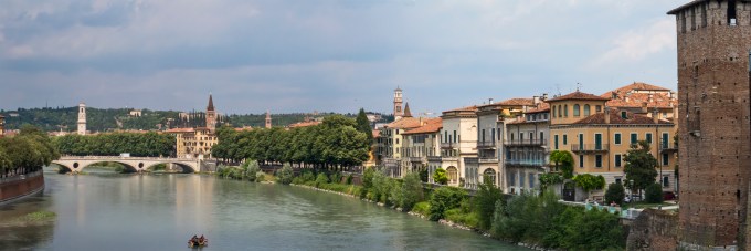
Last of the twilight.
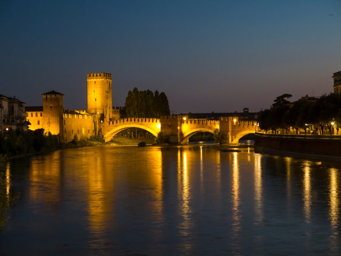
I’ve mentioned Verona’s multi-millennial age. It has a coliseum, which predates the one in Rome, with whatever Caesar it was at the time, getting the idea for Rome’s version when seeing Verona’s on a visit. Dating from the first century it is more lately the venue of summer opera presentations, unfortunately beginning the week after we left.
A little set decoration outside the coliseum’s walls, awaiting installation within.
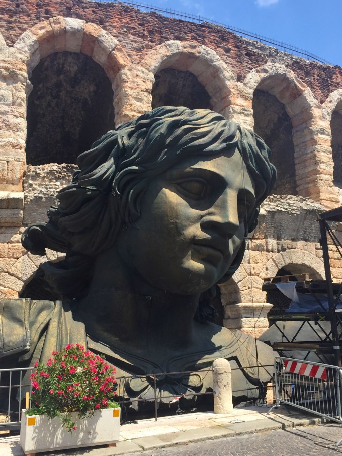
Speaking of ancient, Dante Alighieri hailed from Verona. I think one of his circles of hell might well include our country’s present governance circus. That’s him, striking a pensive pose.


Wherever one strolls, there are sights to delight.


It was just around the corner after the picture above, that we had the serendipitous encounter with the man and his son in their garage with their handmade pendulum and kayak. And just before this next serendipitous hello appearing on cue as we strolled by, and fully in keeping with the neighborhood colors.

Well, trips end, as does this missive. But first a glimpse from our sleeping berths on the return flight. Somewhere northwest of Hudson Bay.

Ciao, Tomaso
A new moon sets, a new home rises
Posted on May 29, 2017

Memorial Day weekend, and a staple of Solana Beach Presbyterian Church is the annual Come Build Hope mission over that Friday to Sunday to build homes and plant seeds of hope for deserving families in northern Baja California. This year, a return visit for Cathy, Torrey and I, perhaps the best ever.
As a once Army grunt, I liken Come Build Hope to a military campaign, with all the strategic vision and copious logistics planning. And similarly, many things go off well, but not without a few glitches and a touch of drama here and there.
Hundreds of us rendezvous at the church campus and are transported by high-end comfortable buses to a pre-staged campsite a short distance from the shoreline near Rosarito Beach. Not just SBPC, but other churches sponsor worker bees, and all of it is coordinated with Amor Ministries, based in Mexico. Amor bulldozes a relatively level site in coastal grasses, maybe 250 yards square, and when we arrive near sundown, the tents are set up, as are the portapotties, kitchen, food serving area, modest solar showers, and a couple of sinks to wash hands and brush teeth with potable water. We travel with our individual work team group, and the site is set up with a designated module for each group encircling a campfire pit, and folding chairs to take in the warmth and camaraderie during evenings and early mornings. The Amor staff has a quiet generator to provide for the kitchen, but for everything else, it is strictly campfires and headlamps. You know, there’s something to be said for the forced quietude of non-electrification.
One of those aforementioned glitches occurred during the Friday arrival, with the group that flies in from Colorado for CBH. They got picked up on time at Lindbergh field, but their bus driver got lost navigating the warrens of Tijuana, and arrived around 2130 military time, long after the gorgeous moonset and chilling time after dinner for the rest of us. Amor kept dinner for them and their arrival was greeted by cheers from one and all.

But it’s early to bed and early to rise. I’m not sure about the healthy, wealthy and wise part of the old saying, but early the next morning we’d get a fire started to take off the chill and nurture the team’s coming together.


There’s always a flurry of activity getting the day started, a teeming mass of humanity as we fill our lunch bags with the sandwiches we make for ourselves, along with chips, granola bars, and fruit and a water bottle. This is followed by breakfast of eggs and sausage, french toast, potatoes, cereal and milk, fruit, coffee, hot cocoa or juice. There are meetings for team leaders in preparation for the day’s labors.
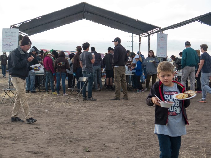


As you can see, Come Build Hope attracts workers of all ages and stripes. Some are not persons buoyed by faith, merely wanting to do their part as citizens of the world. There are Scouts that come as a troop. Old and young, and old that are made young, as well as young that are made mature just by the experience. It’s genuinely lofty stuff. But there’s also the stuff of families and friends having spontaneous fun.

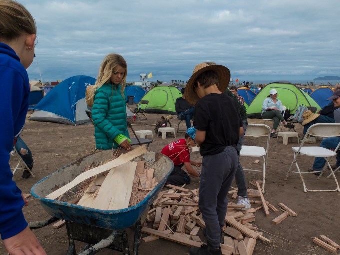
The windup finished, the ball’s on its way.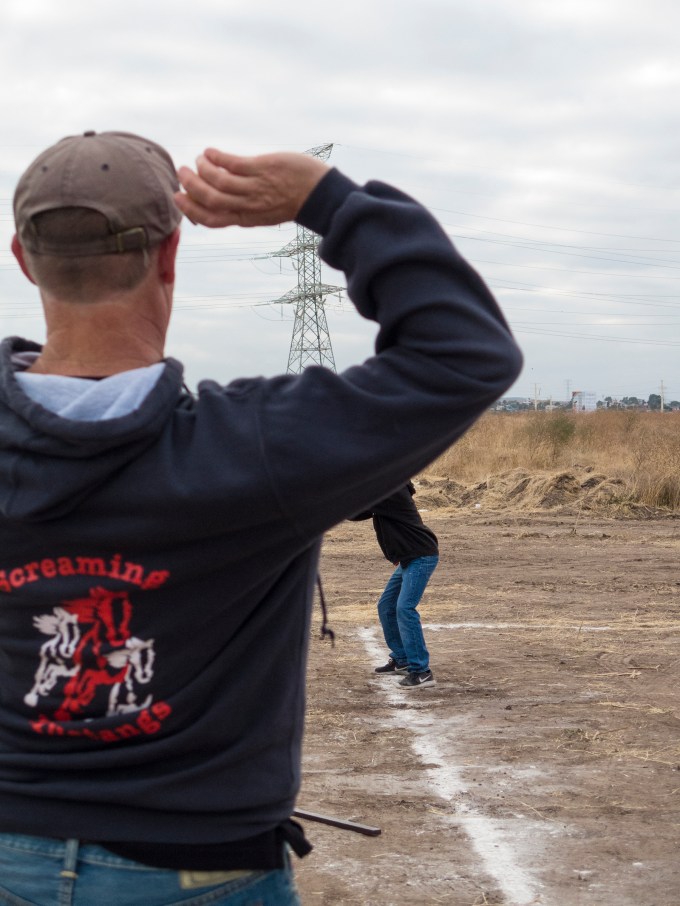
A solid hit with a spare scrap of wood…
We load up the water and Gatorade, and board the buses for an 0800 departure to the various job sites.


Two teams per bus, each headed to separate sites near one another. We called ourselves the Dirty Dozen, and by the end of the day, the term fit like the proverbial glove. That’s a small team of unprofessional builders to build a house from the ground up in two days, but most of us had been on previous Hopes, and under the excellent guidance and cajoling of team leaders Sandi and John (aka Juanito) we pulled together. Not a slacker amongst us, and the mutual support of other self-igniters carried the day. Okay, days.


This is a human endeavor, and the humanity of it all is everywhere. Our driver, Rosaria had Danna Paola written on her inside mirror with a picture of a young girl. I asked if this was the name of her daughter? No, the name of her deceased young sister.
Glitches and drama visited us on Saturday morning. After dropping off the other work crew we proceeded to our site, only to learn that there had been a reassignment to a new family. The problem was that no one knew the site address nor the name of the family. Torrey and I were the Spanish speakers in our group, and we enquired of those we encountered in the neighborhood, with little success. Eventually phone contact was made with Amor and we were able to navigate to our young family of three— Natalia and two year-old José, then after work, Cesar.
The task is to build from the ground up. Amor prepares the site by pouring the slab with tiedown straps in place. On site await the lumber, nails, tarpaper, roofing materials, bailing wire, chicken wire, cement and sand, sand strainer, windows (two per house) and front door, plus a box with some (but never enough) tools. For safety, and because there isn’t electricity at the site, all labor is manual without powered tools. We returnees tend to bring our own work pouches, with tapes, squares, saws and hammers. And hats and sunscreen.
Team leader Sandi spoke to the dignity of doing God’s work, and in the spirit of “praise the lord and pass the ammunition,” job forman John, gave us a brief overview of the tasks at hand and the division of labor before lighting a fire under us, one and all.

And, then, begins the day’s work.
There were sub teams assigned to framing the two straight walls, the three raked walls and the two subcomponents of the roof. An early challenge was that—surprise, surprise—the foundation was neither flat or rectangularly plumb. John’s internal compass worked out ways to resolve this conundrum in spite of the difficulties it presents to making walls and roof come together agreeably and having doors and windows that function.
Before long, the first wall rose up off the pad where we had framed it, followed soon after with additional walls.


And while some of us began installing the roof framing and sheeting


Others set about crafting the door jambs and hinging up the front door.
There were a few snack and hydration breaks during the day, plus emptying our brown bags—opportunities to catch our breath, stretch out complaining body parts, and savor the sea breeze and the splendid view.

Natalia and Cesar, and abuelo, straining the rocks out of the sand to be used for the next day’s stuccoing, while José (Pepe) supervises.

We finished around 1800, by which time the framing was finished and the bailing wire was wrapped and tightened to about C-sharp, beginning the process of creating a taught and stable abode.

Saturday evening’s al fresco dining by firelight was as wonderful as Friday’s, not withstanding the stiff bodies. Do you sense that I rather like the campfire aspect of Hope?
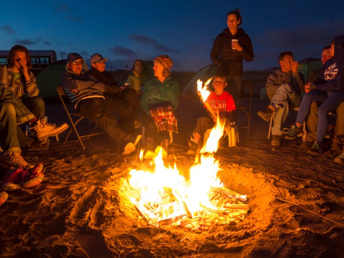
Sunday morning began with John (aka Juanito) buoying us with the fruits of our labors.
And there was much to do, with everyone doing their part. Two years old and oh so cute.


The overhead work required first putting in bird-proofing blocks along the top of the walls, then squaring and nailing the plywood, followed by stapling on tarpaper, and lastly securing the rolled roofing composite.
Then in an afternoon race with the clock, the tarpaper, which had been stapled in place in the morning, was covered with chicken wire, forming a base foundation to which the stucco adheres. Roofing nails are applied to underlying studs and fire blocks, then with a technique of manually levering with PVC pipe, the wire is stretched tautly over the nails followed by cutting out the doors and windows.
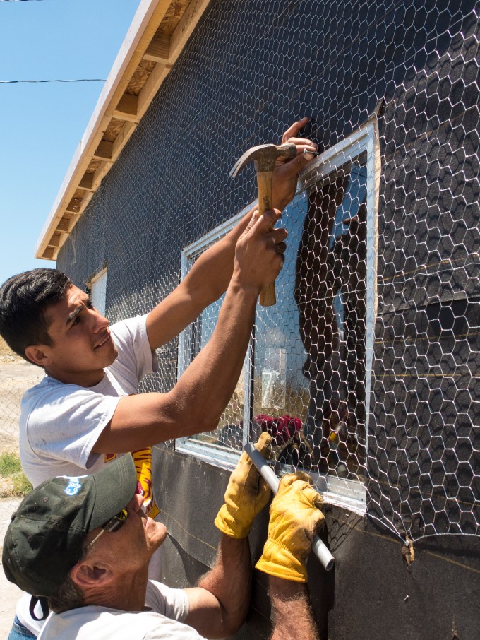

Close on the heels of this, cement and sand in prescribed ratios are mixed with water to create the first coat of stucco, which is then troweled over the walls from bottom to top. This stage is an all-hands project, it being necessary for the stucco to be the right consistency, applied before it starts drying up, and getting it done in one step—no stopping partway through. All this while racing the clock to finish before the day does.
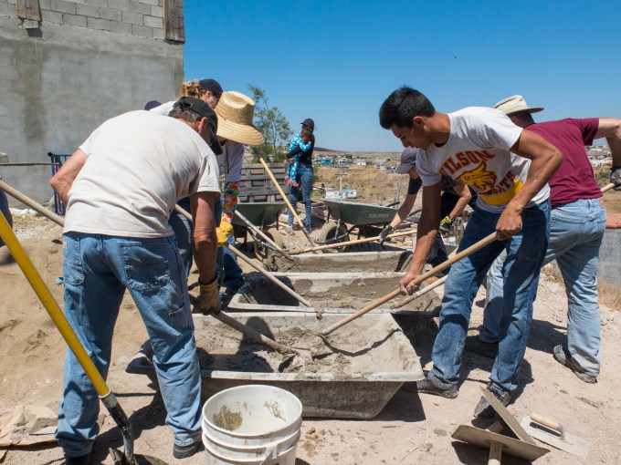
Finally what the entire experience is designed for—presenting the homeowners the keys to their front door, a few mementos of our time together including a framed group photo and bible inscribed by all of us. Even Scrooge would choke up at the beauty to be savored in the moment. Cesar and Natalia, suffused with pride and joy, a curtain sewn by ladies from the church drifting on the afternoon breeze, as she haltingly reads our words of blessing.

After giving our stucco time to dry, Amor Ministries comes back and applies the second, finish coat of stucco, removes the internal braces, and (hopefully) adds insulation and interior wall coverings.
Giving esperanza y amor (hope and love) to a new family, honoring them and the spirit of giving, as we honor those who gave their full measure in service to our country that we might have the peace and freedom to share our blessings with others in this way.
This year we built 14 homes, which brings the total to over 20,000 built under the auspices of Amor Ministries. On Saturday evening, the head of Amor shared a satisfying backstory about Mexican governmental red-tape being cleared out of the way by the mayor of Tecate—who grew up in an Amor home and carries with her the appreciation of what giving can accomplish.
Sureste al México
Posted on February 27, 2017

Barra Navidad Air Force
February. Winter. Cirrus magic carpet. Escape. México.
Last fall the Cirrus Owners and Pilots Association announced plans for this season’s group flight getaway to Alamos, Sonora, and Bajía de Navidad, near Manzanillo, Colima, Mexico. I jumped on the opportunity, paired up with a time that Cathy, the resident SDSU professor, had free from academia. It turned out to be a large and congenial group of forty-five attendees in twenty-two Cirri, flying in from California, Arizona, New Mexico, Texas, Minnesota, North Carolina and Pennsylvania.
Come launch day on Sunday the 19th, a winter cold front was pummeling not only SoCal, but all of northwestern Mexico. Egads, doth we really have to file and fly under Instrument Flight Rules? The aviating began with a climb-out through low clouds and rain before breaking out on top over the San Diego county mountains heading first toward Mexicali, then southeast by airways paralleling the eastern shore of the Sea of Cortez, en route to Ciudad Obregon as our Airport of Entry to clear customs and immigration. At MMCN we purchased our multi-entrance permit to fly our U.S. registered aircraft in Mexican airspace. Not to mention refuel and decaffeinate before a short second leg to our first destination of Alamos, an old colonial era silver mining town where we ensconced ourselves in the gushingly beautiful Hacienda de los Santos. http://haciendadelossantos.com/wp/
The views of the delights within the high periphery walls of the Hacienda immediately abutting our San Bernardo suite. I should mention the mesquite log fires set for us in our bedroom’s fireplace to warm the nighttime slumbers. Daytime temperatures in the mid seventies, nights in the low sixties. Yum.
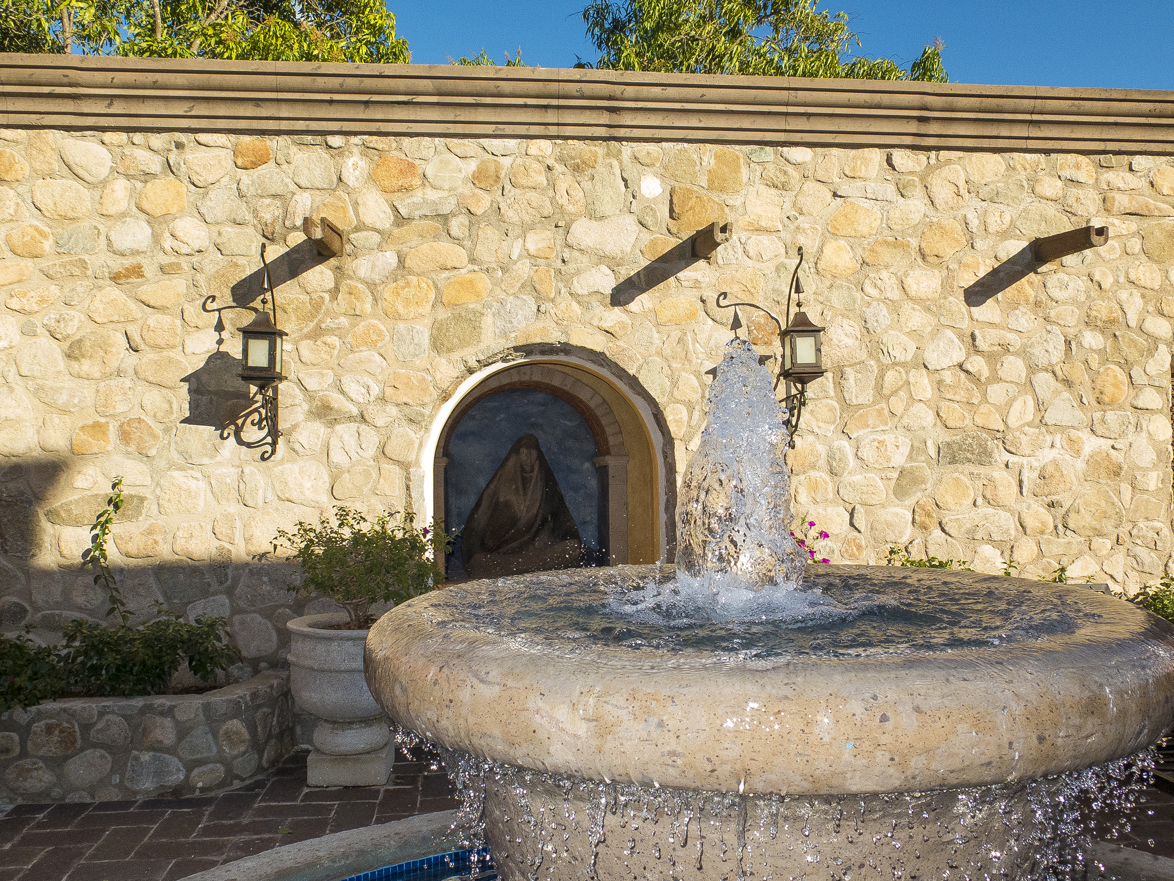
For pilots, getting there is part of the fun, of course, and the leg to MMCN required sitting up and paying attention. Prior to effecting the hand-off to Mexican air traffic control, Los Angeles Center enquired of our desired cruise altitude, and I selected 11,000′ . This seemed a nice balance between what I anticipated as cloud tops and freezing levels, and not having to trundle on with oxygen cannulas. That worked out to have been a nearly prescient choice, but not without deviations left and right of centerline to avoid the ice-laden higher cumuliform tops.
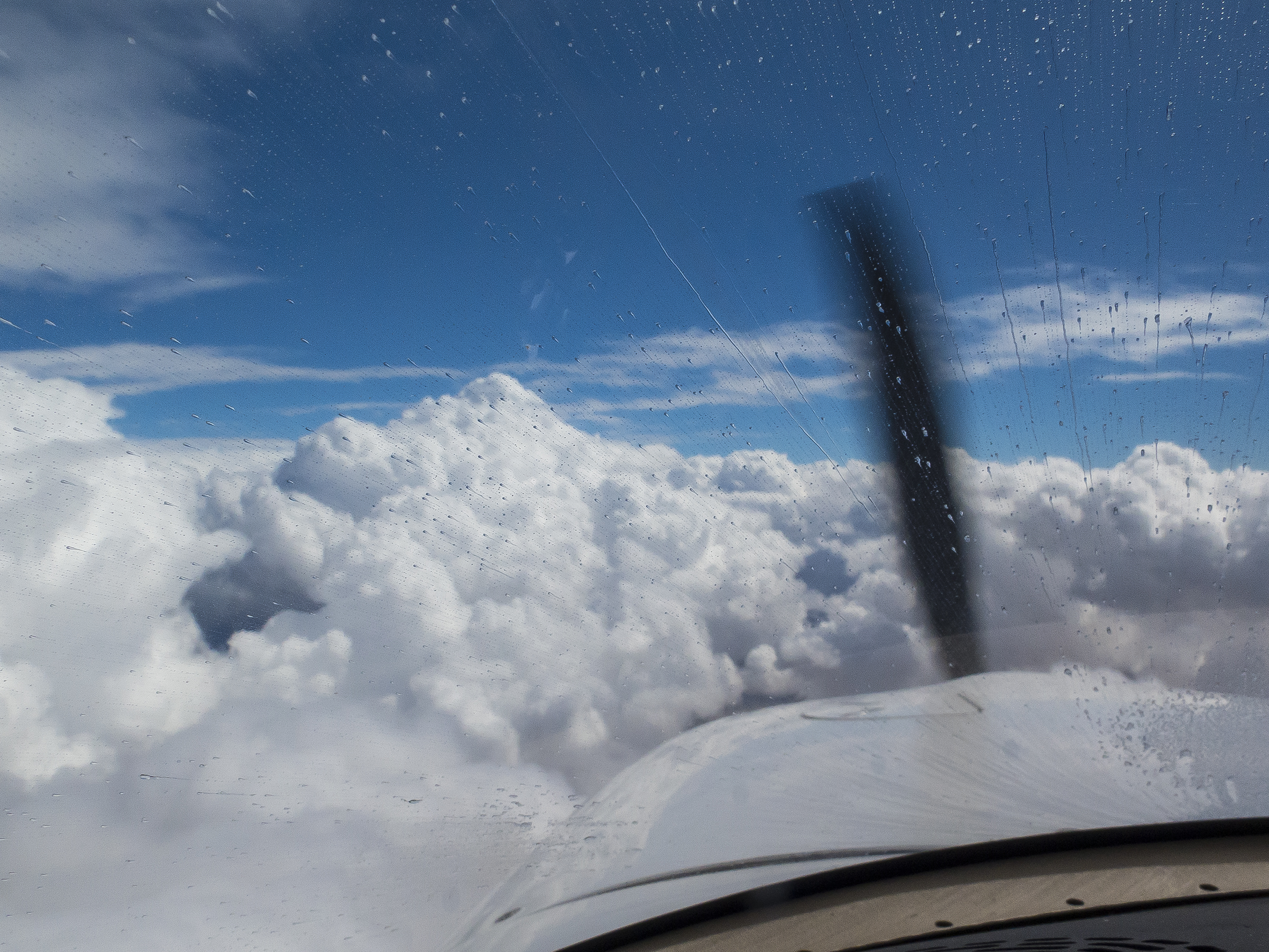
That’s TKS anti-ice fluid streaming back along the windshield, above, for our occasionally unavoidable forays into cloud tops. The higher tops were above 13,000′, and all of them were ice-laden, with many being modest thunderstorms. At least our sashays left and right of course centerline averaged being on course!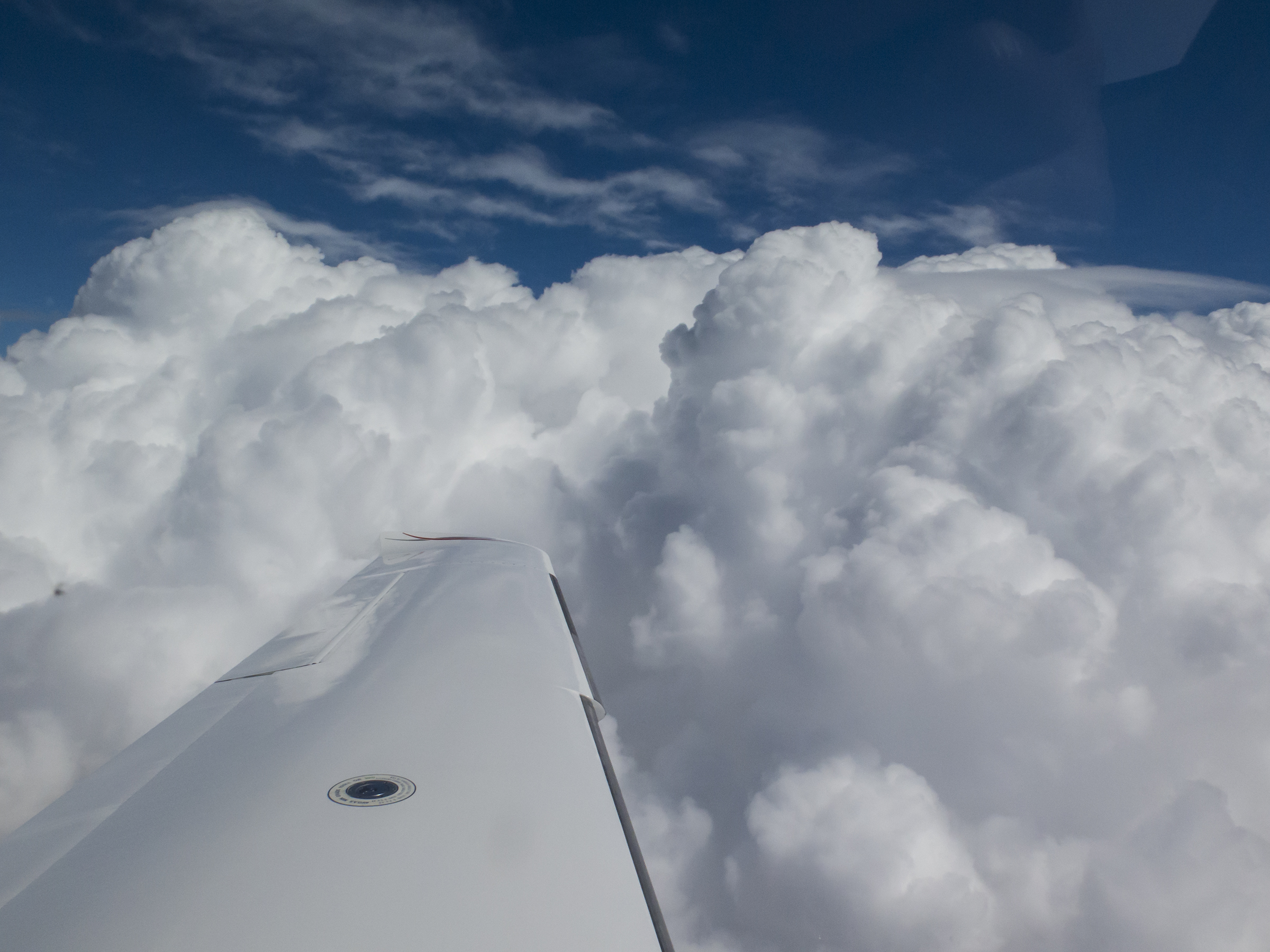
The worst of the weather was between Hermosillo and Ciudad Obregon, with the VOR DME 2 Runway 13 instrument approach a necessity. Then we had to proceed under Visual Flight Rules at a lowish 3,000′ MSL betwixt cumulonimbus bases above us and cumulogranitus tops below us, with partial success in dodging rain shafts to our landing at the MM45 (Alamos) strip’s runway 13.
Solid rain from a buildup washing the windscreen on an extended base leg leading to a straight-in final approach to Alamos.

We mostly dodged the worst cell between Obregon and Alamos, then headed down a river valley for a straight-in visual approach, lifting our skirts just above the rooftop of a house atop the knoll immediately off the approach end of runway 13, and clearing to the transient ramp, guided into our spot by a marshaller. Thomas Daniel, a Pole by birth, and longtime US resident, put this trip together for COPA, and he really outdid himself coordinating for mass arrivals and departures with the aerodrome Commandantes, immigration and customs, fuelers, surface transport. and luxurious accommodations at both stay-over destinations. Kudos, Thomas.

Newsflash—I’m a devotee of the visual, and this time of year in these latitudes of Mexico, the sun enriches the already eye-popping colors and textures of México, a land of warm and vibrant people. As I like to say, it’s a target-rich environment for all the senses sybaritic, and a relief to the soul in this contentious social and political time. Given the incessant tweets and shoot-from-the-hip emanations from Washington, it’s fair to wonder as to how Mexicans greet Gringos these days. I’m happy to report that our southern neighbor remains the land of “Bienvenidos,” of warm smiles, twinkling eyes and hearty, sometimes shy, salutations. Individual Mexicans know that not all of America is as dysfunctional and pugnacious as is D.C. Beltway chic. Our time was universally of a humanity in keeping with the warmth and beauty of the tropical milieu.
Following the passing storm of our Sunday arrival, even the cobblestone puddles and windblown corners of elevated sidewalks graced us with color. Reason, as ever, to keep the peepers peeping.

How did we spend our time? Abandoned to overindulgence, of course. The Hacienda has it’s own tequila bar with something like 500 different types to ensure a proper wasting away in Margaritaville, if not savoring fine sipping Reposado or Añejo. The group wasted no time signing up for Tequila 101, a graduate level afternoon slurpfest—everyone eschewing written exams by auditing the class.

The town of Alamos, population somewhere around 13,000, exudes the quiet small community vibe, where teenagers hang out on foot or bicycle in and around the town square zocalo, the community social heart, and always fronting the church, or iglesia. Families pass by on their daily meanderings, and seniors hold court, siting on tree-shaded benches.

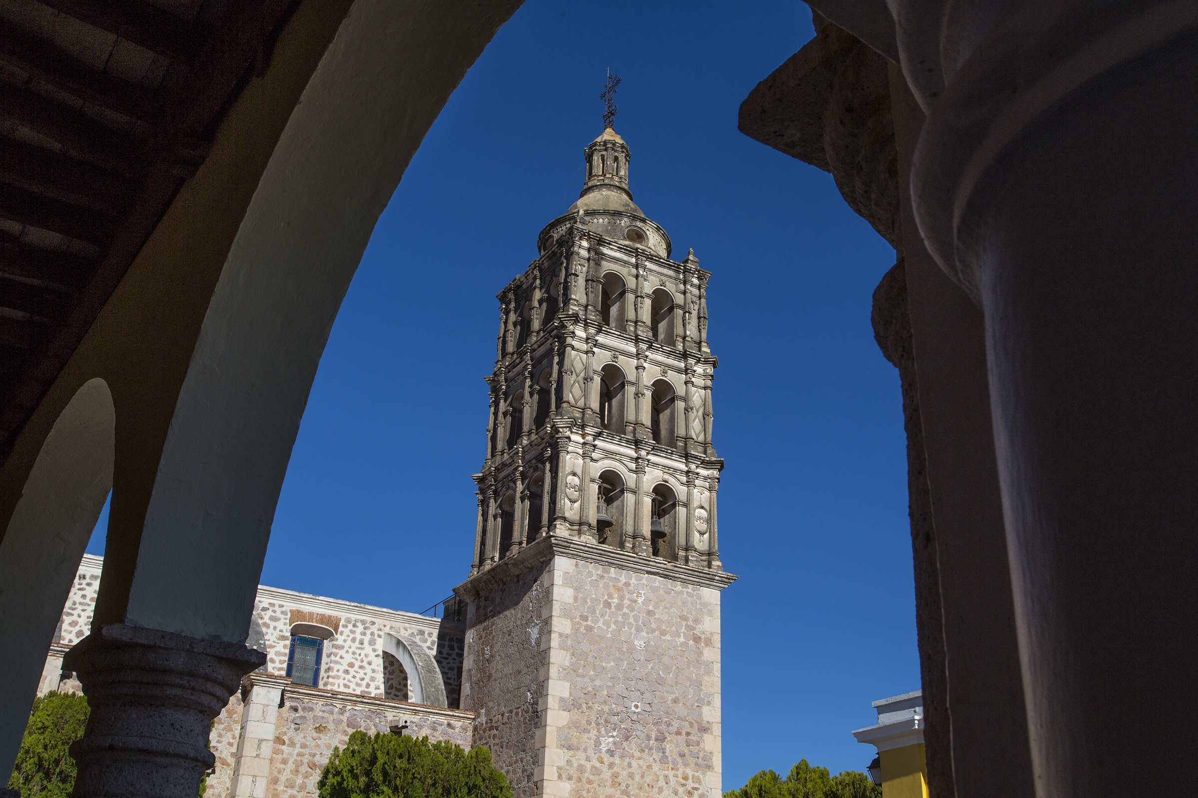
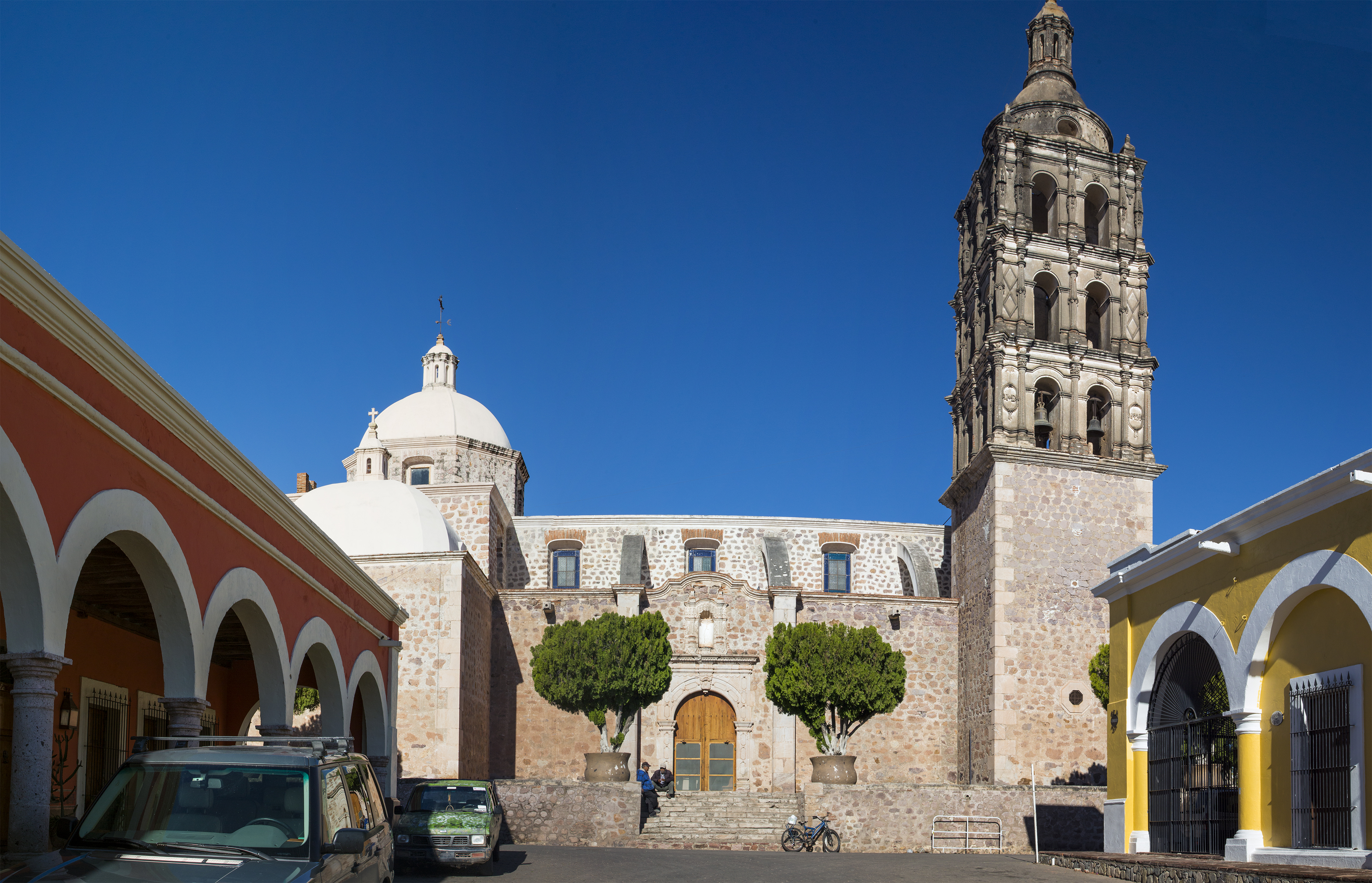
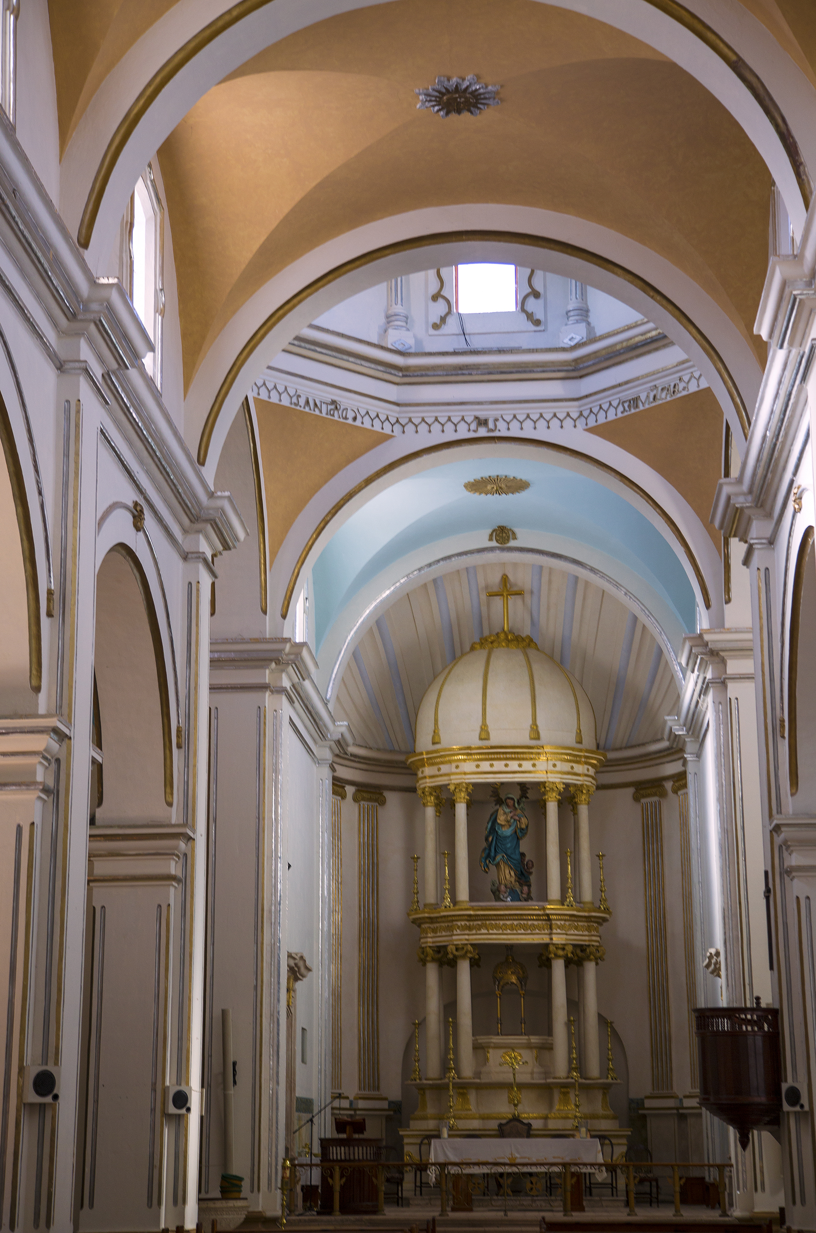
Along the back wall of the iglesia, a typically colorful Sonoran mix of cactus and bougainvillea.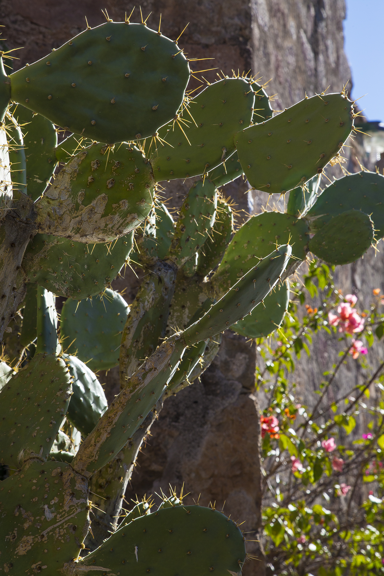
A local farmer’s haul of naranjas which seem somehow a more vibrant orange than we see this side of the border.
A glimpse in the town hall where citizens quietly await an afternoon activity.
For our second day antidote to epicurean overload we set out to explore an outlying area not encountered in years past, seeking trails up the tall mountain on the west side of town. Hacienda staff gave us some street-wise guidance, and then put us in touch with an eco-lodge operator who added trailhead input, and off we went. We got to the edge of town okay, but it took two salients to actually find the trail beginning near Parque Colorado. And, herein some backstories of just why following one’s nose can be such a splendid endeavor.
Just another arch leading to residential grounds, except this one belongs to a Massachusetts Henry Cabot Lodge family scion. Old wealth, well used.
Passing onwards and up the trail, the really interesting stuff presented itself.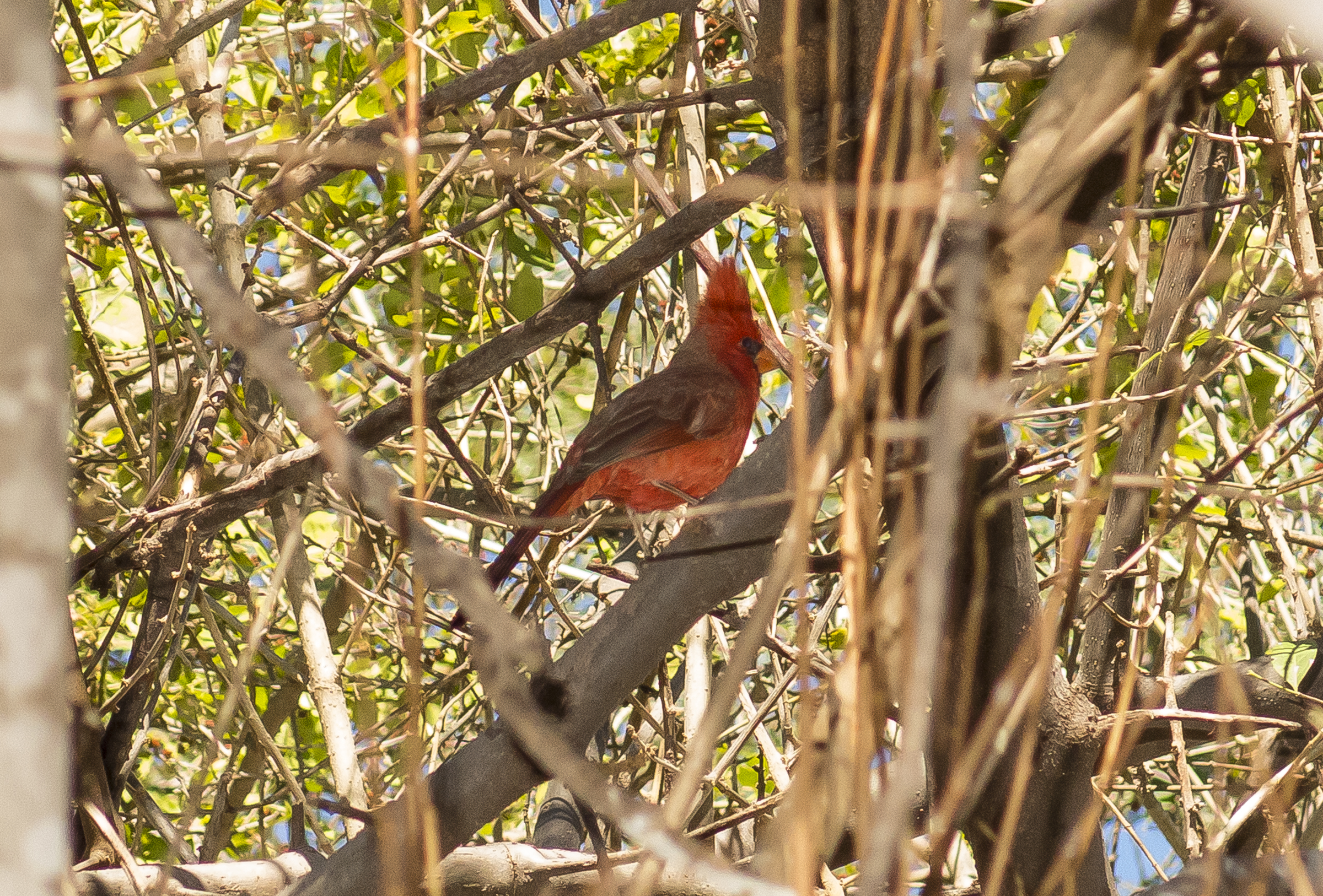
This is leaf-cutter ant territory. Such industriousness—and a power to weight distribution of which The Incredible Hulk can only dream.

Speaking of which, emerging into our consciousness as if from a dream, we came upon a vision of Sancho Panza astride his faithful donkey, Dapple. Coming closer and into focus, a buenos tardes discussion revealed the wizened (there’s a pun, here) gentleman to be Ramón, astride Gaspár. Yes, he assured us, gentle twinkle in his eyes—the very same Gaspár of biblical three wisemen fame. I’ll wager he’s never heard of Donald Trump, nor bereft thereof.
Okay, truth will out. The above picture’s focus is neither the result of tequila, or of daydreams, but of the camera not resetting itself from Macro mode after the picture of the leaf-cutter. But hey, this is what unencumbered vacation is all about, right? To the errant walker, the spoils.
Back down the mountain, in what turned out to be a five mile hike, we followed our exploratory instincts and stumbled upon this delightful tiny cafe hidden behind yet another Alamos arched door set in a thick tiled adobe wall. Teresita’s was all it advertised on its doorway—a bakery and bistro celebrating its sixth anniversary. Everyone but us was local Mexican or expatriate. Cathy chose delightful soft corn tortilla carne tacos and I savored a truly awesome Monte Cristo with homemade dipping preserves as counterpoint to its tangy cheese and spicy mustard interior held in place by egg-battered French toast bread. Artisanal Mexican cerveza to wash down the trail dust, while savoring homemade cheesecakes, floured cakes, cookies and pastries. Boy, howdy.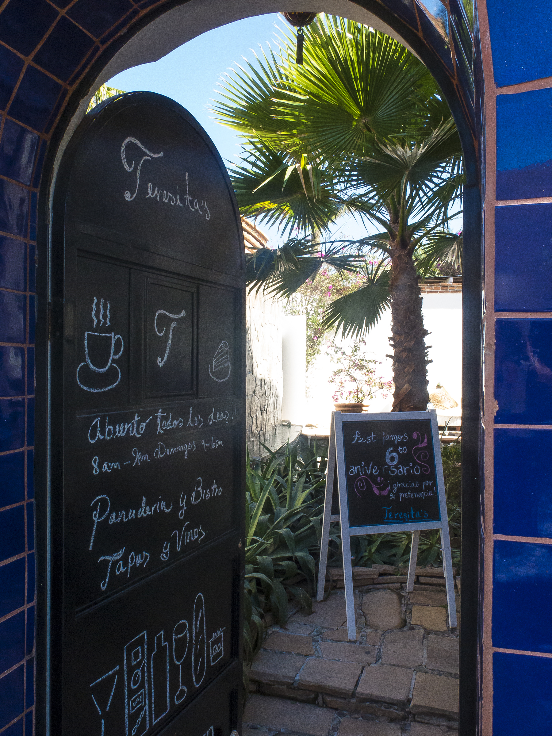
The view within—hand crafted native rock wall, washed from above by a gently sibilant waterfall. Bougainvillea and achingly blue sky.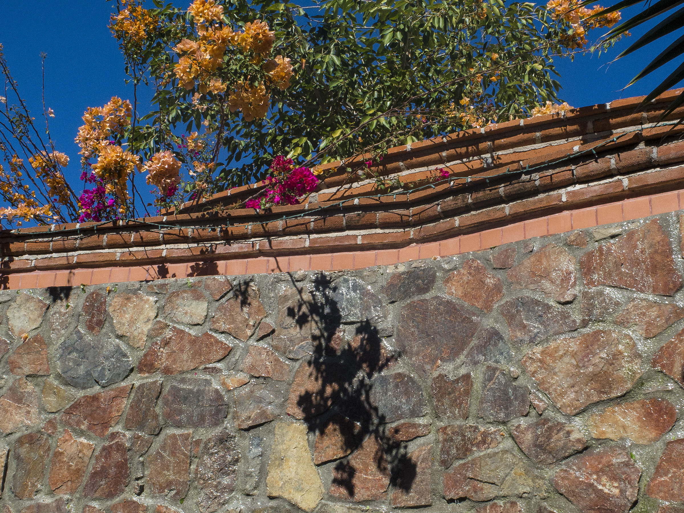
Ahhh, Mexico. End of the day after a dunk in the pool alongside San Bernardo, and before the evening’s gustatory excess.
Leaving Alamos on the way to Manzanillo (ICAO identifier MMZO), we elected to revisit the Barrancas del Cobre, (Copper Canyon) quite nearby in the Mexican state of Chihuahua. Carved over the millennia by six separate rivers that combined, drain into the El Fuerte, which empties into the Sea of Cortez near Los Mochis. And this being no problema Mexico, we underflew the canyon.
Dropping over the rim into the canyon near Divisadero, and turning south. Snow on the rim off to the right.
The cockpit Primary Flight Display “Synthetic Vision” view of the canyon while descending into the main channel. That warning is the electronic Ground Proximity Warning System chastisement that we are below ground level. Well, duh. It’s driven by a worldwide database, probably originally satellite-derived, and corresponds remarkably closely to the actual view out the window. The system knowing our location, direction and altitude from onboard WAAS GPS. Scheiss Heiss. Hopefully you aren’t offended by German pilot expressions. I used the autopilot here so that I could wield the camera. 
A left rim bank shot before arcing back to the right to stay above the El Fuerte in the center of the canyon. 
And then onwards, overflying Culiacán, Mazatlán and Puerto Vallarta en route to MMZO. Lots of mountainous terrain along the way, and we got a moderate turbulence arse-kicking on the last segment southeast of Puerto Vallarta. Tight seatbelts a must, and reduced airspeed to soften the bumps.
Short final approach to runway 10, wind 150 degrees at 9 knots. 
I can report that we never saw Manzanillo, which is the other side of the hills at twelve o’clock in the frame. Our destination was one of those absurdly over-the-top Mexican Xanadus behind us in the small Bahia de Navidad (Christmas Bay), so named by the Spanish explorer who arrived there to shelter his ship on a Christmas Day. Our lodging was yet another suite, of pretty nearly the square footage of our Del Mar digs, and overlooking the yacht harbor, strewn with vessels of J.P. Morgan’s admonition “if you have to ask, you can’t afford it” ilk. If these belong to pensioners, they still have theirs!
Which is segue into a side discussion of some of the attendees, an interesting cross-section of the owner demographic. One other flight instructor chum with his lady friend, the granddaughter of a former assassinated El Salvadoran dictator. Her verbiage. Or the British developer of a Cirrus desktop flight simulator. The Indian computer PhD husband and wife team from the Silicon Valley. A farmer from Minnesota. An RV sales owner and sometimes flight training client of mine with his devil may care wife. The husband/wife team who’s retailing business turned out to be adult paraphernalia—dinner conversation turning on the benefits of the dual-motored vibrator. It gives new meaning to the common pilot preference of twins over singles. I’m not making this up. The money manager from Pennsylvania, a true gentleman of multiple years’ association from instructing at the Cirrus proficiency event in Williamsport, and his sweet as honey Mexican-born wife. In keeping with the last sentence in the paragraph above, the eighteen-wheeler owner/operator who matriculated into the Teamsters, and then ended up successfully litigating the union as a self-educated expert, on behalf of fellow retirees, regaining 80% of the value of their pensions, which had been dumped by Teamster shenanigans. He still has both of his knees, by the way, and is a stellar hero in my firmament of those who do the right thing.
After settling in at the Grand Isla Navidad Resort http://www.islanavidad.com.mx/site/US/index.php we took one of the 24-7 water taxis across the oceanic inlet to a typically Mexican low key “poor cousin next door to big cheese extravagance” pueblo—Barra Navidad (Christmas Sandbar) and wandered the village seeking meaning and enlightenment.
Well, at least enlightenment. Right echelon formation in late afternoon sun. Have I mentioned that Mexico is unafraid of color? Barra resonated easily with me, a smaller-dimensioned version of the Mission Beach of my youth—a sandspit jutting between the Pacific on the west, and the bay (bahia) on the east. Comfy.
The hotel staff member who golf-carted us to the water taxi, we being too tired to walk it, suggested Simona’s as a worthy alfresco dinner café. Excellent advice worthy of two evenings’ dinners. I chose seared ultra rare fresh-caught tuna the first evening, and Veal Scallopini the next. Simona is a German expat of seventeen years’ Sandbar experience. First a margarita rocas con sal, then an agreeable Chilean wine while taking in the sunset over our cena. 
I am Crusoe. I shall call you “Friday.”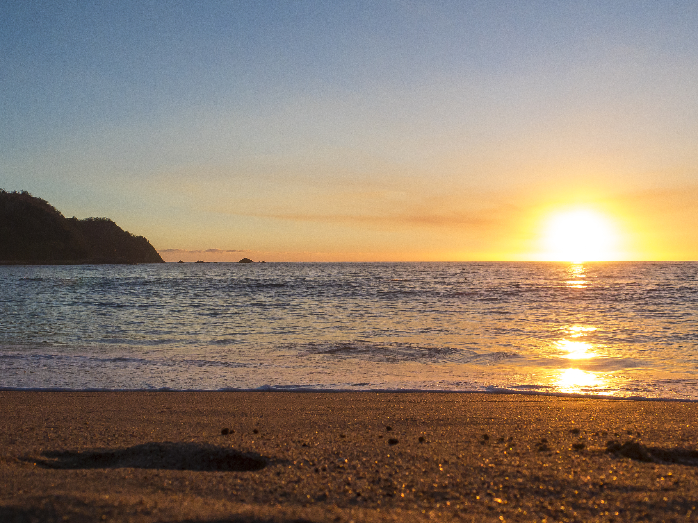
Barra Navidad street scene. Shades of my youth when we jacked up VW’s to drop the engine for a driveway overhaul. These guys are on a union contract—one worker underneath the well-loved pickup, one to hand him the appropriately-sized wrench, and two to kibbutz from their courtside seats.
After departing this maintenance event, and before partaking of our last evening’s dinner at Simona’s, we had another road less-travelled experience, coming upon a small community park between Barra’s two main streets. Cathy eyed two young gals of early twenty-something age, setting up a cookie stand. In my best, only partially stumbling loquacious Spanish, we discovered one was the new entrepreneurial head mistress of her own Xocolate panaderia (bakery) and she was proud to offer some freshly baked cookies. Seizing upon the opportunity to have some snacks on the next day’s long return flight to El Norte, we secured a bag of nut-filled cookies. Learning of our intention to consume them on our flight home, she insisted that we take another bag—of butter cookies—tambien. For the price of one bag. Eat your heart out Donald Trump.
An auspicious early commencement to our headed home day. The view across the bahía. It’s always about the light. Always.
Ol’ What’s Her Name trying to figure out the name of this pueblo or that rio. That’s when she wasn’t reading her book on the world’s refugee crisis, or playing electronic Sudoku or Solitaire. The mountainous air between Manzanillo and Puerto Vallarta, where we’d had such a drubbing three days before, now sublimely somnolent.
It helps to engage one’s sense of humor or at least still the passions when in unfamiliar travel circumstances, it not life more generally. We had to dodge a modest immigration incident bullet as we passed through MMCN as our chosen AOE international departure station. When you process through México’s immigration on arrival, they issue a paper visa and place it in your passport. That visa paper is surrendered to them on departure. Cathy’s passport had her visa, but mine had gone walkabout AWOL from my passport, which had been snugged into a pocket of my pilot’s kneeboard (a holder of charts and other pilot necessities, usually strapped around your thigh for easy and secure access in flight). This produced real terror in the customs inspector, who had been the very gentleman who had welcomed us at MMCN at the beginning of the week. He remembered us both just fine, but was distraught because the process involves not only securing the paper, but entering data from it into the governmental computer system. After much handwringing and head scratching I remembered that I had taken out of my passport, where I usually keep it, my immunization record, which I had placed in my Baja Bush Pilots “Airports of Mexico” booklet sitting on the back seat of the Cirrus. I hurried out and found the visa hidden in the yellow record. I’m not sure if the officer or I was the more relieved—it was smiles all around, for sure.
And as icing on our departure cake, the computer link of the Obregon Oficina de Combustibles (Fuel Office) was down, and everyone purchasing fuel had to pay cash. Fortunately having occasionally experienced this elsewhere in Mexico on past trips we had held in reserve enough cash to fill ‘er up. No, this is not a subterfuge for corruption, it is just “the computer is down” that it appears to be. In fact, without exception, over the years, every time we’ve had anything to do with Mexican officialdom at the aerodrome interface, everyone has been completely professional, courteous, and welcomingly helpful. A bona fide treat.
Before signing off, perhaps you may find interest in a few technicalities? We flew on three days of our week’s getaway, covering 2284 nautical miles. An even 16 block to block hours in my pilot logbook, but 15.2 hours takeoff to touchdown, for an average economy power groundspeed of 150 knots. 213.1 gallons of avgas, for a fuel consumption of 13.3 gallons per hour. Altitudes ranged from around 1,000′ above ground level, to 11,500′ MSL. Some actual instrument flying on Day One, a little icing, a lot of deviating that day, and one non-precision VOR approach with a non-radar airways transition in actual instrument meteorological conditions, IMC, in pilotspeak.
Safely back home with a plethora of happy memories in the can. And unrelenting rain again today, as I write. Oh, for the warmth and blue skies of tropical Mexico. Next year, once more with feeling.
Hasta Luego, Tomás
Peak Color
Posted on October 11, 2016
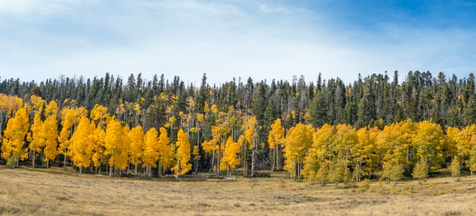
Over those many decades of commercial flying I developed a strong affinity for the stark beauty of the Four Corners region. Over the PA I’d point out that it was the only place in the U.S. where four states come together at right angles—Arizona, Utah, Colorado and Minnesota. Mind you this was back in the day when people actually looked out of the windows, passengers and pilots alike. Ahem. ‘Tis a region with appropriately modest population and infrastructure to minimize distraction from the beauty and solitude.
As SoCal Del Martians we are used to seasonal changes, but not on the order of many locales, so come autumn, Cathy and I frequently heed the siren call of deciduous extravaganza. In the mountainous regions of southern Utah, one gets to double dip with the flora as punctuation for the colors of the earth itself. Yum.
Catalina had set up her SDSU schedule with an eye to having the time off and we settled on a VRBO home in Brian Head, a quiet ski resort in the Dixie National Forest at an elevation over 10,000’ and a short drive out of Cedar City, where the Cirrus took us in 2:02.


Zion to starboard. Short final approach to Cedar City runway 20.
The otherwise sleepy aerodrome, these days is actually busy with extensive helicopter training for flight students at Southern Utah University. The folks at Sphere One Aviation had a silver Nissan rental ready for us—in fairly nice condition considering its 166,000 miles on the odometer! Well, anyway it ran well and like The Little Engine that Could, managed to get us to all of our trailheads and national monuments and parks.
Neither of us had ever visited Cedar Breaks National Monument, just a stone’s throw from our Brian Head lodging, so now was our opportunity, and it did not disappoint.

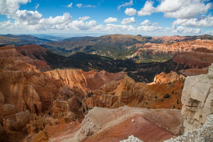
The only downside for some, might be that unlike Bryce Canyon National Park, all the hiking at Cedar Breaks is along trails atop the canyon rim. But at over 10,500′ there was enough gasping along the rim’s undulations to not add more by dropping into and then back out of the canyon itself. Not to mention, the topside view left us gawking as well as gasping.
While the second time-lapse was running, I read in the monument materials that the Spectra Point trail led to an outcrop with multiple Bristlecone pines. Oh, my. Bristlecones are the oldest living things on earth, up to 5,000 years old, although Cedar Breaks’ versions have matriculated through a mere 2,000 seasons. Lord knows in this election season it sure helps to think in terms of a longer perspective. 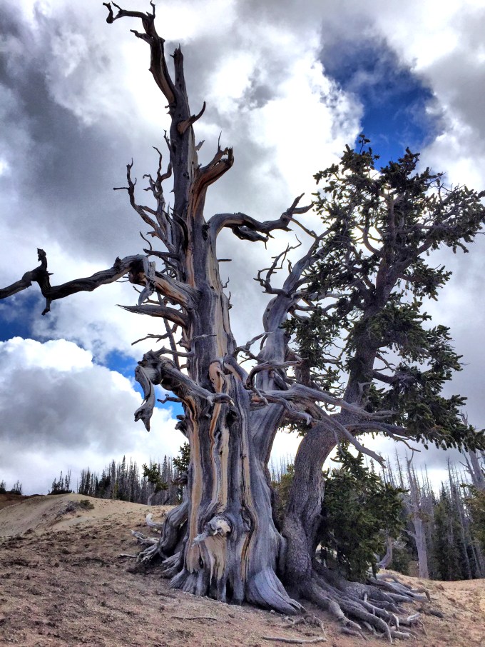
Ancient One
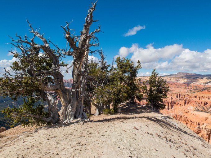 Can you imagine the stories to be told from this vantage point the past two millennia?

Bristlecone pines have a somewhat intriguing life plan. Some of the older portions of the tree twist to take best advantage of the location, and eventually die off, leaving the newer parts to continue being sustained by the roots. These are hearty plants that take root in poor quality virgin soil that would not support other trees, and with a dense resinous wood resistant to insects. They survive with very little water, not to mention carrying on at high elevations that would be above the tree line for many species. In a word, durable.

Plus they are wondrously gnarly. Given the advancing arthritis in my limbs, I feel a particular affinity with this specimen, so reminiscent of Tolkien’s Treebeard. I’m sure he is gesturing to make sure I appreciate the beautiful contrast between the red rock and the golden Aspens over yonder. Probably smiling internally at the colorful pranks of those youthful lowlander whippersnappers with their flashy colors.
On our second day, we ventured forth to Bryce Canyon, about an hour’s drive east of our lodging.
I thoroughly enjoy making beach drip castles with the grandchildren. Besides their redolence with my own youth, they always remind me of the sandstone filigree of Bryce. Bryce, like Zion, has shuttles about every twelve minutes that take riders to and from the various viewpoints and trailheads. A great way to get about and minimize traffic jams.
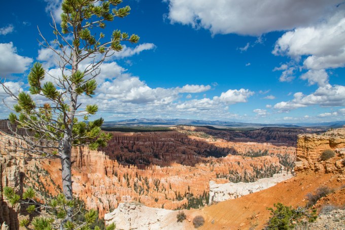

Following our day at Bryce, we considered driving 1:20 or so the next day to Zion National Park. We decided, instead, to stay near Brian Head and hike in the Dixie National Forest. Zion is superb, but worth multiple days in its own right, and the roundtrip drive time was off-putting. Ol’ What’s Her Name did a bit of online research, and came up with a couple of days’ worth of exploratory hiking from two trailheads on the Virgin River Rim Trail, meandering up and down either side of 10,000′. This entire region is part of the northeast-bound rising terrain of the Grand Staircase, forming among other things, a watershed that includes the Virgin River. Excuse my tangentialism, but here’s a glimpse of the Virgin River flowing through Zion from a previous year’s visit.
 Virgin Inversion, Zion National Park
Cathy’s excellent research really hit the target for beauty, exercise and perfect crowds—we saw three other hikers on the first day, and zero on the next. 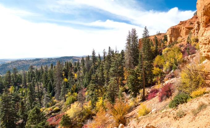 Descending terrain along the Cascade Falls trail exuding the early October autumnal colors
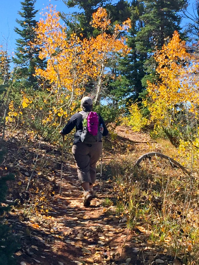 Climbing the Virgin River Rim Trail southeast-bound from the trailhead at US Forest Service road #054. Weather conditions were primo throughout our stay, but layering was absolutely essential, with early morning temperatures in the low thirties, warming up to the middle forties, and strong gusting winds waxing and waning throughout the days. With the exertion of hiking at these elevations it felt cool, but not cold—so long as you kept moving and didn’t dally in shaded areas with the full force of the wind on you. Cathy complained about cold fingers, but didn’t let that deter her. Rounding a bend in the trail, or easing along the edge of red rock drop-offs, we were constantly reinforced for our exertions.
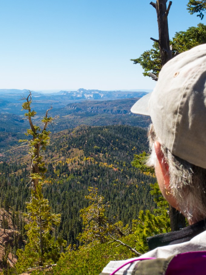 Gazing at the back side of Zion National Park from the trail.
Well, as mentioned at the outset, we came for the fall colors. Veni, Vidi, Vici. You Latin experts will have to change that to the first person plural, past tense—We came, We saw and We conquered the opportunity to drink deeply from the splendor of it all.
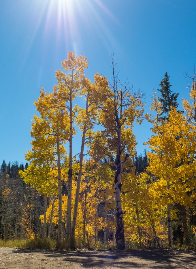


And, yes, that’s the trail along the forest floor just to the right of the tall Aspen in the center of the frame, above. I’m sure you’ve noticed the title to this missive is a silly double entendre, on hitting the season at maximum coloration, but also the mountain peaks in the region in which we traveled. Trees’ peak color is very short-lived. The image below of this particular strand of trees was taken as we drove on that unpaved #054 USFS road proceeding to the trailhead in the morning. By that same afternoon returning to our lodging, the leaves were already noticeably more orange and rapidly blowing from the branches.

Consider another example—the strand of Aspens, below, is the same as that shown in the very first image in this post, but seen twenty-four hours later. Gold, turning to rust.
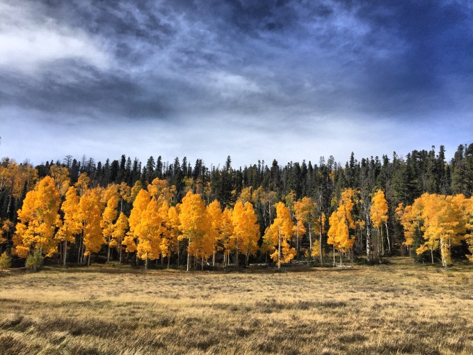
Following our second days’ trail hiking I returned to another vantage point at Cedar Breaks with hopes of a viable sunset time-lapse sequence, the cirrus clouds you see in the image above, glowing in iridescent glory. However nature had other ideas. The clouds disappeared entirely, leaving an entirely clear sky—lovely by day but lacking in the pizazz of clouds lighting off in prismatic excess at and after sundown.
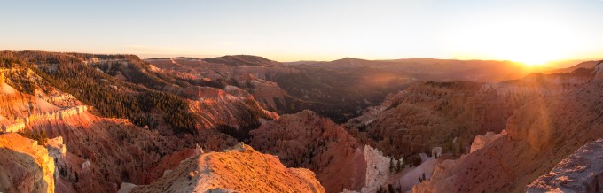
Still, the rich low light giving way to dim pastels has its own appeal.
My intention was to follow up that T-L with another of the Milky Way arcing above the southern through southwestern horizon, with a nice new moon setting in the bargain. Great idea, until the reality of an upper 20s temperature and about 25 knots of wind racing up from the canyon floor and over the rim directly into my face took hold. This would have required nearly three hours to film, and my teeth-chattering got the best of me after about twenty minutes. So just a few still frames lifted from those from the beginning of the abortive T-L. Dang, but I wish I’d had warmer clothes and maybe a bottle of Laphroag as anti-freeze. No guts, no glory this time.
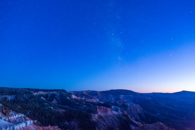

 That’s Venus, setting in tandem just below the moon, which while a sliver in real time, appears here as a globe, given the speed of movement over the fifteen seconds of the time-exposure. These frames all come from a time over a half hour after it became dark. Isn’t our galaxy just gorgeous, and can you see, as I do, how it forms a ghostly lion’s visage staring back at us, two glowing eyes above the snout, an umbral mane defusing into the night sky? The horizon glow is probably a mix of residual twilight augmented by Lost Wages’ luminescent excess, not visible with the naked eye, but fully apparent in a fifteen second exposure, taken every twenty seconds at ISO 2500. That fifteen second exposure is what necessitates 3 hours—three frames a minute for 180 minutes is 540 frames, and at 24 frames per second you end up freezing to death for 22.5 seconds of T-L video. Brrrrrr.
I’d like to finish up by dedicating this missive to two chums—T.J. Steer, a United pilot colleague from yesteryear with whom I had a guys’ Cirrus trip to the Four Corners, and Wes Mudge, with whom I’ve had a couple of trips in this region. Great guys and great memories. Being in this region has had me thinking of both of them rather a lot. T.J. has flown west, very sad to say. Wes is still happily amongst us, glad to say.

Recent Comments