th2ombre
It's ALWAYS about the light
There and back again—a bicoastal Cirrus road trip
Posted on June 28, 2014

Mecca for pilots
My wife, Cathy, has an affliction—when she’s free from her SDSU professorial duties, as with the recently completed Spring semester —she’s compelled to tempt me to travel somewhere, anywhere, but especially to regions she has not previously explored. Translated—”Let’s take the Cirrus and fly to the east coast to visit Aunt Tilda, and see some of our country I haven’t yet explored.” What? At one level, this is music to a pilot’s ears. Yet, while I’ve flown more transcontinental crossings than I can count, a bicoastal endeavor in a small plane means being down in the atmospheric levels where experience reminds me that weather actually has some teeth. The most effective methodology is careful advance planning, flexibility and a willingness to adapt—change the route, change the altitude, change the destination, and/or change what day to go or stay put. Words to live by.
We blocked out a couple of weeks and conjured up a route that would take us to the hill country of south/central Texas, the Smoky Mountains of western North Carolina, the Outer Banks abutting our county’s other ocean, a visit with Matilda in Williamsburg, VA, and back, by unknown route to unknown locales.
The trip affirmed the wonderful nature of our populace across the land, certainly in the heartland, and as pilots know, at airports small and large, where Fixed Base Operator (FBO) personnel are friendly can-do spark plugs of help and courtesy. The trip affirmed the vastness of our country, and the incredible diversity of topography, flora and fauna, and the magnificent beauty of it all. If one word sums it up—variety.
Statistics form only a framework to describe our travels. We covered 4481 nautical miles (sorry, I’m a pilot—that’s 5153 statue miles for you terrestrials) in 28.5 flying hours, for an average groundspeed of 157 knots (181 mph), takeoff to touchdown. We operated throughout at economy power settings resulting in a fuel usage of 12.9 gallons per hour. And yes, my credit card was starting to glow by the time we returned home.
We departed our San Diego Montgomery Field home aerodrome under Instrument Flight Rules (IFR) due to a low marine cloud layer. East of the coastal mountains, now beyond the clouds, I cancelled our ATC IFR clearance to proceed under Visual Flight Rules (VFR), following our own noses to our first fuel stop and potty break at Santa Teresa, NM’s Doña Ana County airport, some 20 miles west of El Paso Texas. I can’t resist musing on this ability to fly by one’s own routes and inclinations as being nearly unique to our country, a reflection, I think, of the independence mindset and self-reliance of our forebears. Pilots in other countries marvel at our freedom of flight, and flock here to embrace it. Still, one has to sit up and pay attention, for instance, avoiding the 15,000′ cable securing a US Customs and Border Protection Aerostat balloon, surveilling the nearby border with Mexico. Your tax dollars at work.

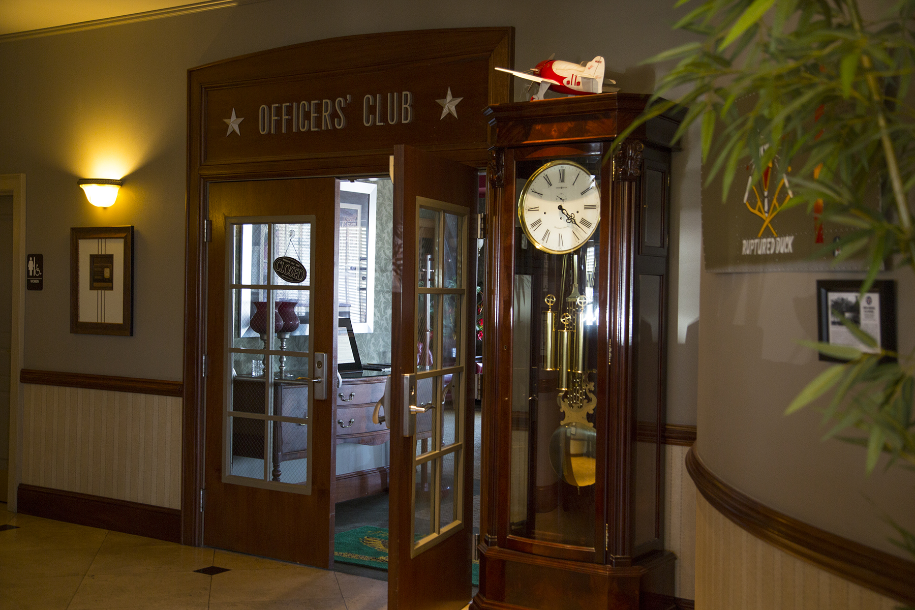
A half hour after landing, we were on our way over El Paso and on to our first destination of the trip at Fredricksburg, TX. Going with the flexibility flow of small plane travel across the multiple weather patterns of great distances in a day, we routinely traveled without advanced reservations for accommodations or rental cars. This mostly worked out, but did require a little ingenuity and patience which added to the sense of adventure in our travels. Where to stay in the Fredricksburg area? Well, how about here? We’ve just landed, and taxied in to the ramp, and have a pretty decent clue before our just-stopped prop.

The hotel was just delightful, with comfortable rooms, and friendly staff. No reservation? No problem. No rental car? Here’s the keys to my car, just out the door, and there’s a really terrific restaurant, just a mile or so down the road. The FBO arranged for a car the following morning, but that first night, being a Tuesday when the adjoining WWII diner was closed, it was hotel receptionist Peggy’s no-worries offer that provided transportation to two hungry travelers. Dorothy, to Toto, I don’t think we’re in Del Mar any more. So you’ve maybe noticed that the hotel is actually a redone Hangar? At this stage we had not yet learned about Fredricksburg’s Admiral Chester Nimitz history, but it began to dawn on us that this community reveres its WWII past, and finds ways to capitalize on it, including right here at the Hangar Hotel. The lobby is delightfully art deco, replete with 1940s era music and period suitcases and decor.

Thirsty? The bar is right this way.
This is in the heart of the Texas hill country, west of Austin and north of San Antonio. Hills in Texas? Something to learn for the both of us. Fredricksburg is a city of some 27,000 inhabitants, sporting multiple fine art galleries, many fine dining establishments, and the absolutely superb National Museum of the Pacific War. What? It turns out that Chester Nimitz, Fleet Admiral, appointed Commander in Chief of the entire WWII Pacific Fleet just after Pearl Harbor, hails from Fredricksburg. The museum is chock full of interactive exhibits conveying the geopolitics and history of the vast sweep of the war from Japan’s early feudal Samurai past through Pearl Harbor and on to the unconditional surrender aboard the USS Missouri in Tokyo bay.
You alert readers will have no doubt noted that Fredricksburg is a rather Germanic name—no accident, as early 19th century settlers in the region were German immigrants grown tired of working some nobleman’s land. From this ethnic history a couple of noteworthy mentionables. A few miles north of Fredricksburg was the Army post of Fort Mason, there to protect the settlers from Apache raids. The fort produced several famous soldiers, among them, generals Robert E Lee and George H Thomas, both southerners. Lee could not abide taking up Civil War arms against his fellow Virginians and so refused the offered command of all Union Forces, casting his fate to the winds leading to the Appomattox courthouse. Thomas served with distinction among the Union forces, and so was disowned by his family, who burned all his possessions and letters. In a more prosaic and current vein, aficionados of craft brewing can sample fine beers in the local micro-breweries, and at their leisure, take an open, still-being-consumed pint with them as they leave the establishment to wander about town, because the good German forefathers thought to include such freedoms in the city charter. How would I know? And, oh yes, this is also the Texas wine region, and I can assure you we discovered our share and yours of fine varietals.
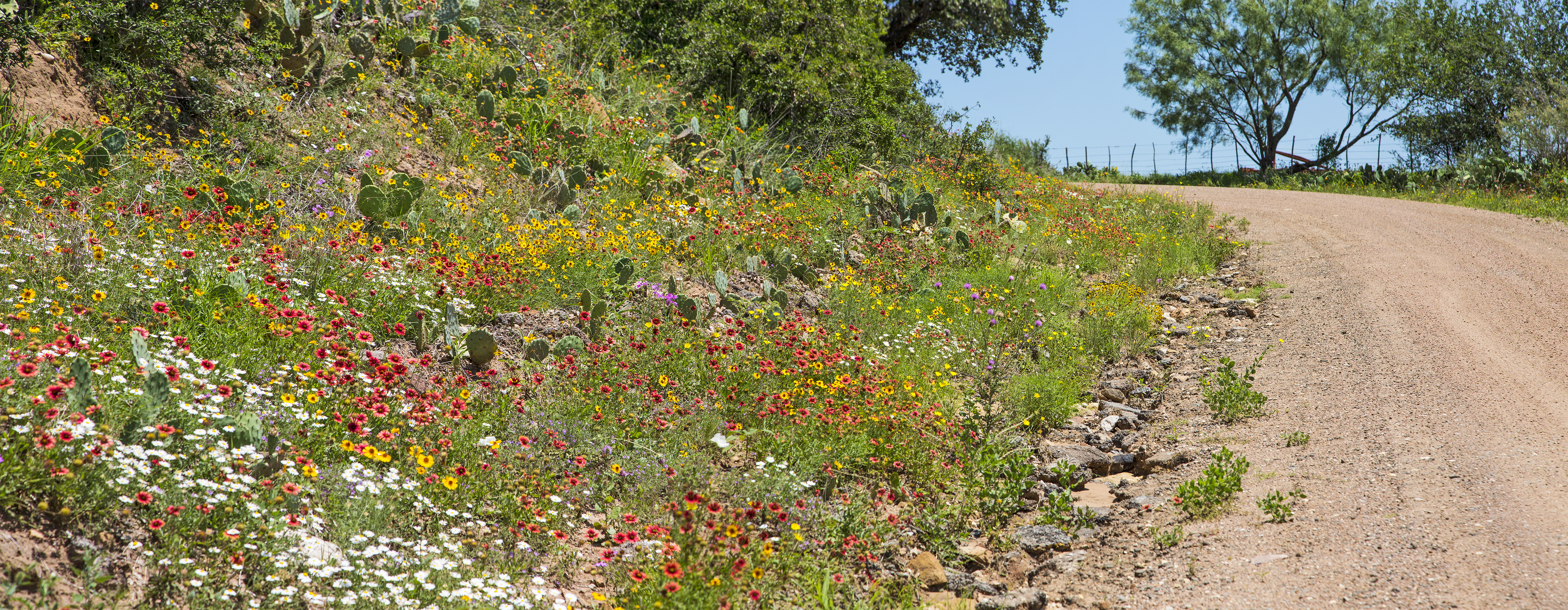
The last thing I expected to see in central Texas in June was wildflowers. The highways and byways surprised me at every turn.

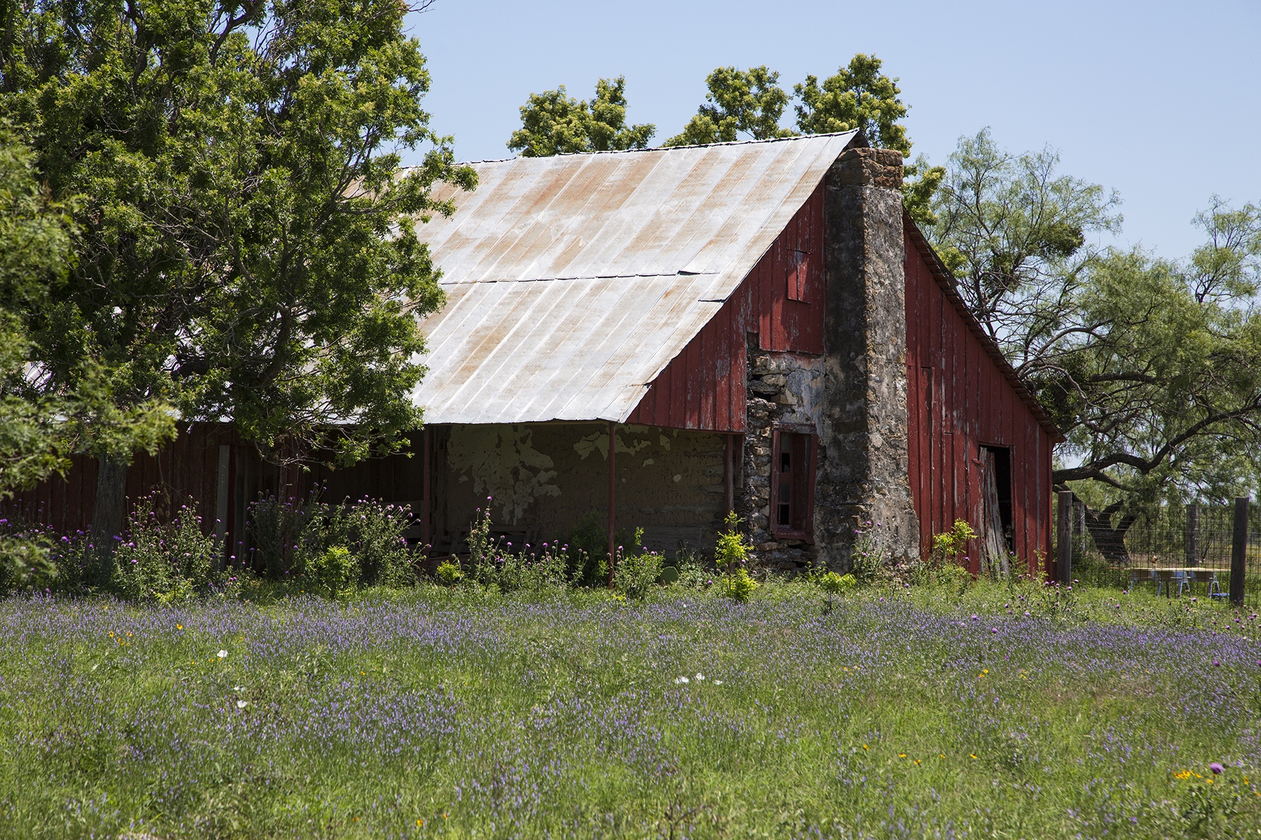
And then, this being rural Texas, there were sights like these, as well.

It’s that German welcome that brings a smile.
On one evening in the area we headed out to an old train tunnel located near Luckenbach Texas, a one horse spot in the road made famous by the Waylon Jennings song of the same name.
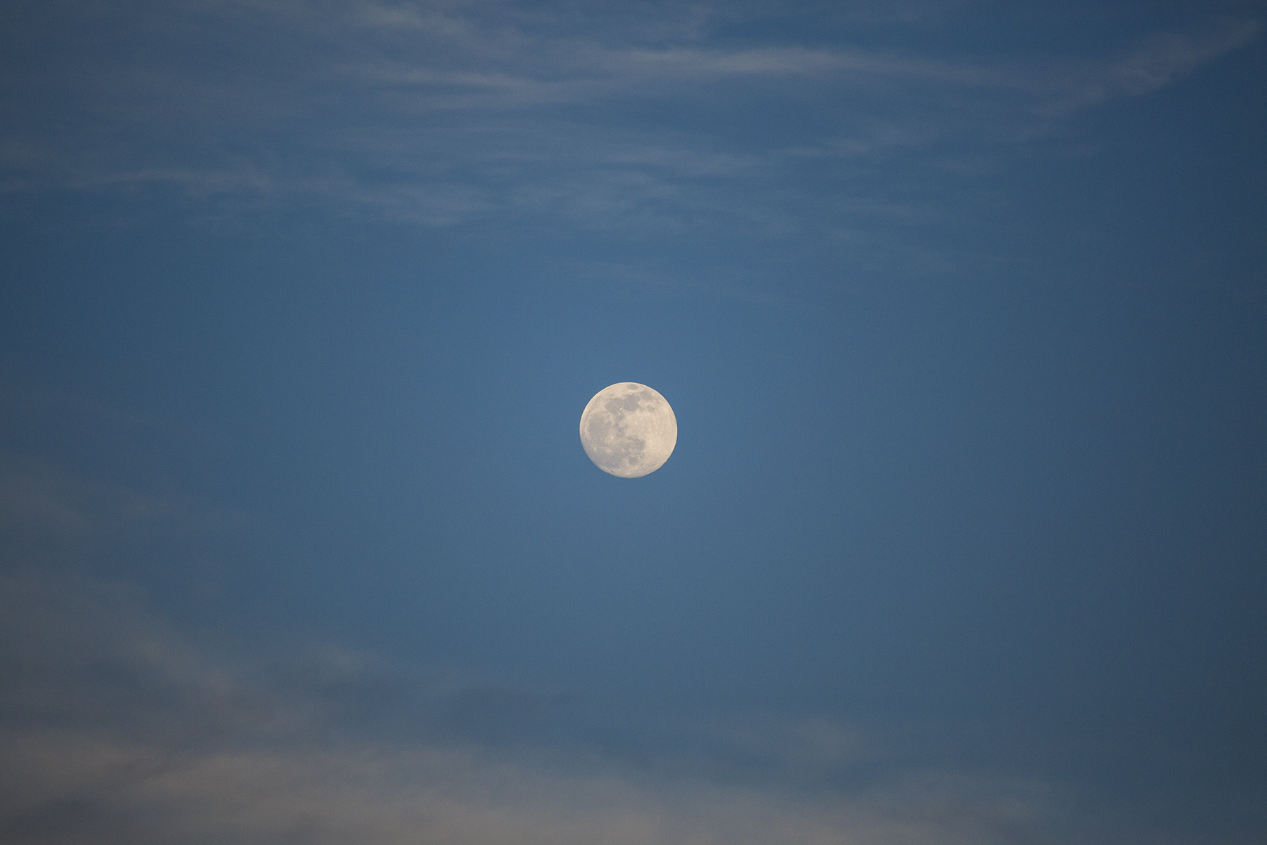
The tunnel boasts a nightly bat exodus of millions of migratory Mexican bats. They rose to the occasion, if you will, but did so late enough that the dim twilight was insufficient for photography. Instead I had to content myself with the only full moon rising on a Friday the 13th for the next century.
After a couple of days exploring Fredricksburg and the environs, we relocated to the Rose Hill Manor in nearby Stonewall, staying in a wonderful bungalow, separated a hundred yards from the main house of the B & B. Cathy knows how to pick our lodgings.

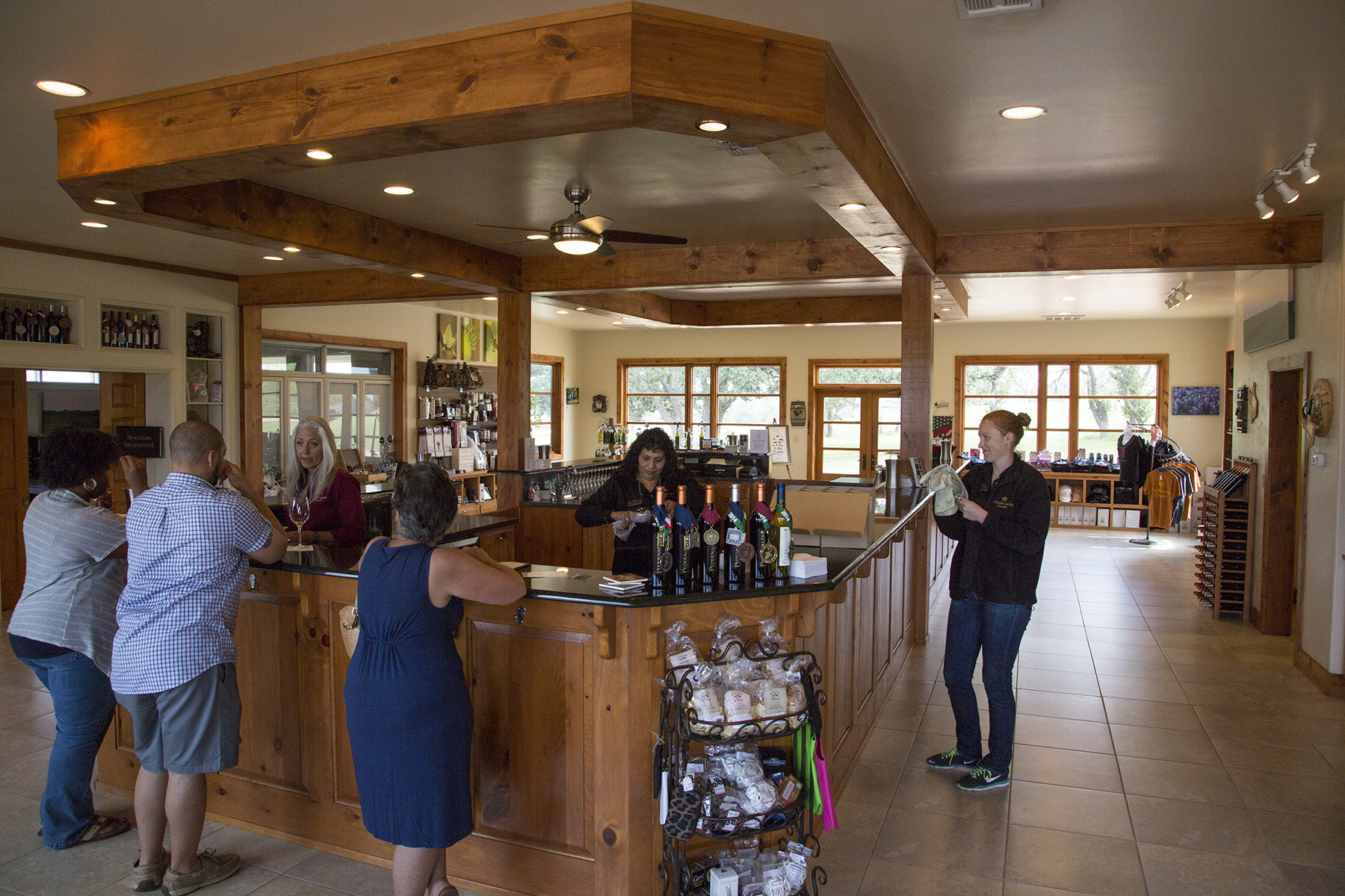
And a short walk in the opposite direction via raised wooden boardwalk through the vineyard is the Pedernales Cellars winery. Oh, must I?
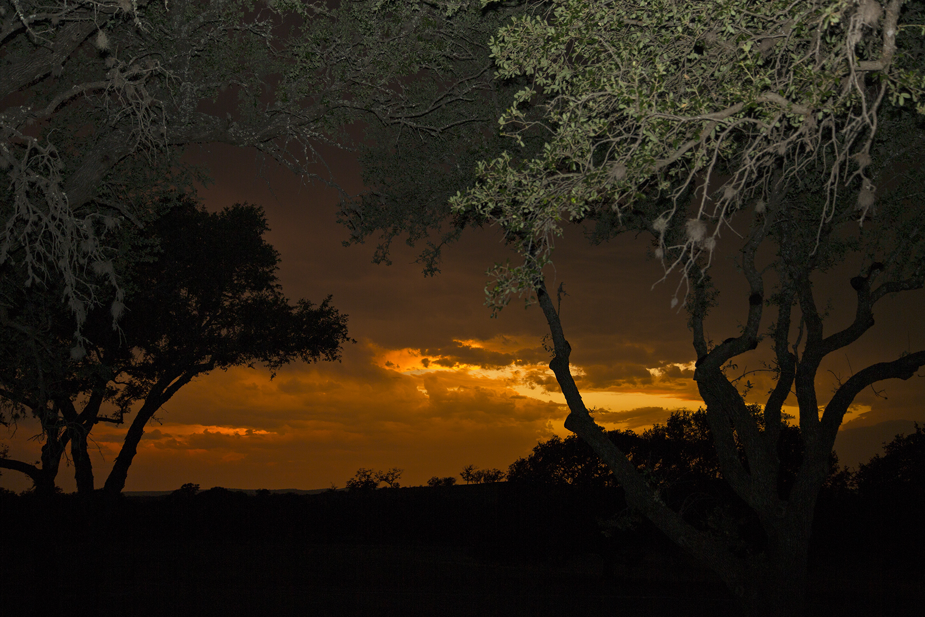
You’re probably aware that I am routinely taken with sunsets, and so, looking west between dinner and desert, this caught my eye.
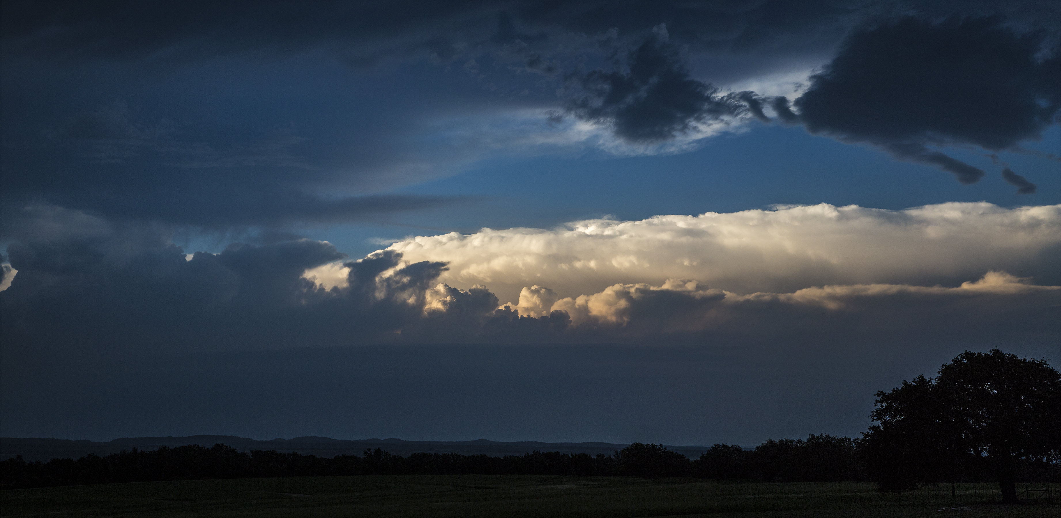
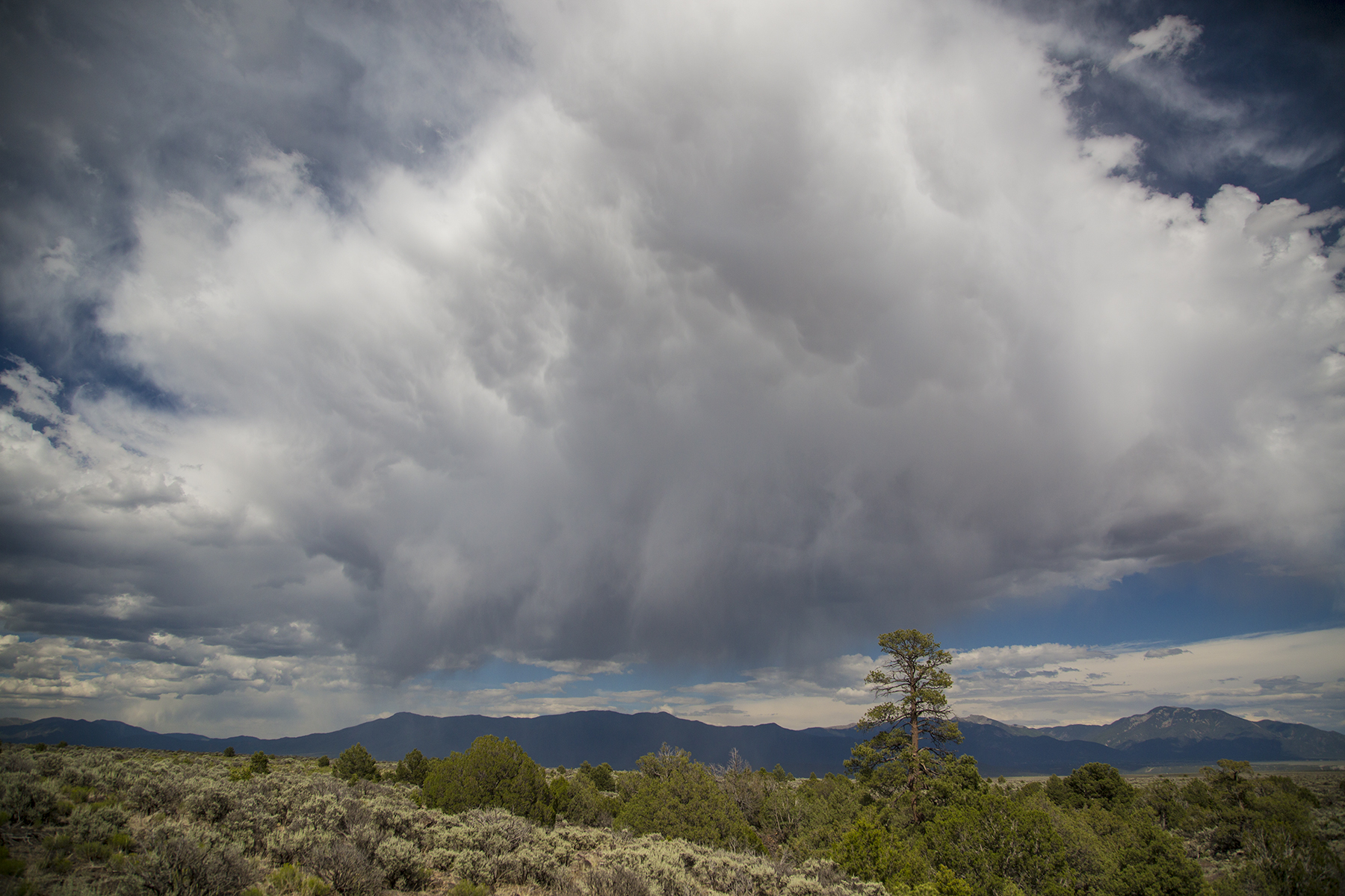
Now it is worth mentioning that I am not unawares that Texas is the southern tether of the region known somewhat euphemistically as our country’s Tornado Alley, and not without good reason. See, looking the other direction from the sunset, this was brewing up. Pilots, this is a clue. Tonight is not a good night to go flying.
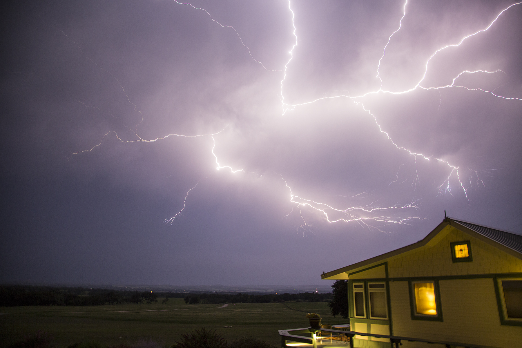
And, then thunderstorms being what they are, all hell broke loose for a full-on light show, pealing cannonades of thunder, and rain like a cow pissing on a flat rock. Texas thunderstorm bragging rights. Remedial meteorology for you aviators, this is what is referred to in METARs remarks as LTG IC CC. That would be Lightning In Cloud and Cloud to Cloud. There was also the LTG CG variety, i.e., Lightning, Cloud to Ground. The locals were very appreciative of the precipitation.
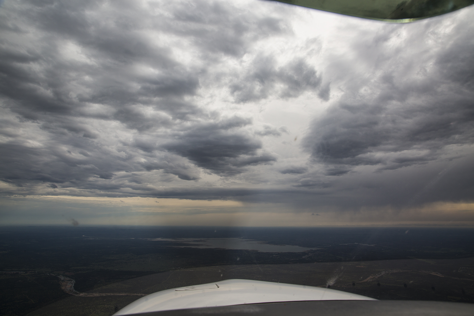
A portent of things to come? Well, yes, as it turns out. Summertime is convection time in the atmosphere. Usually it helps to fly early and quit early, but that is not invariably the case. Flexibility, as mentioned. On our last night in Fredricksburg we returned to the Hangar Hotel so as to facilitate our next day’s early launch, on a northeast track past Shreveport, LA, and on to Greenville, Mississippi for fuel and limb stretching, then continuing on for a second leg past Tupelo, Huntsville, Alabama, past Chattanooga, Tennessee (the identifier of the radio navigational aid for which is Choo Choo!) and into the Macon County strip located in a Smoky Mountains valley in western North Carolina. Checking the professionally-prepared pilot forecast just before turning out the light, it showed nothing but scattered clouds and benign flying for the next day, including the Texas hill country.

Whoops, that doesn’t look like benign scattered clouds, above. Revisiting the weather product sites on line, I discovered that the several counties of the Texas hill country sat dead center below a hastily issued Convective SIGMET. SIGMET is weatherspeak for Significant Meteorology, i.e., dangerous conditions for all types of aircraft including the heavy iron I used to fly. We repaired to the next-door Airport Diner, with decor redolent of my youth, and waited out the storm and its rain, moving southeast at 35 knots. Looking at the radar returns on my i-Pad, I guessed correctly that it would be a couple of hours before we could hope to get airborne.

This, too, shall pass. And it did.

The storm track was moving southeast, and we headed north by northeast, keeping a wary eye on the the VIRGA hanging out of the clouds to our right. Surprisingly smooth. In fact, almost all of our flying for the entire vacation was in remarkably smooth air, even in these and other conditions suggestive of hammering us with a severe washboard ride. I like smooth, thank you.
As we moved farther northeast, the weather began to clear, and we came upon Ol’ Muddy just before letting down into Greenville. There’s a nuance in this image, below, which I rather like. In about the five o’clock position of the frame is the top of my flight plan flight log clipped to my knee pad (a mini pilot desk strapped to my thigh) and reflected in the left door window. We got to be good Samaritans helping ATC with a call on a CTAF (Common Traffic Advisory Frequency) for a small rural airstrip, enquiring of anyone on the frequency if an errant Cessna had landed safely. ATC could no longer raise him on the previously used frequency, and was unable to communicate on the strip’s CTAF, so asked us to intervene from the beneficial range of our lofty height. No one ever answered—not the pilot in question, nor anyone who might have been operating at the strip, monitoring the CTAF, and aware of the Cessna’s safe landing.

After a quick pitt stop, we continued on the day’s second and final leg, sashaying around bubbling towering cumulus….

…and eventually started our descent for a quasi straight-in landing on Macon County’s runway 7—that light colored earth in the left center of the frame. Quasi straight-in, because of several mountain peaks betwixt us and the runway. Adjust as needed. Let me call your attention to the lush deciduous foliage wherever one looks. Oh yes, it turned out later that this do-si-do of dodging elevated terrain while maneuvering for landing and takeoff was to become yet another operational theme during our travels. Stay tuned.

My Cirrus training colleagues Trip and Sheri Taylor have this wonderful mountain aerie outside Highlands, NC, a community reminiscent of Carmel by the Sea, but lodged amidst thickly forested mountains. They picked us up at 1A5, the aerodrome identifier for the Macon County airstrip, and off we went to toast the fín del dia from their front deck. Sherri, herself a pilot, is the Energizer Bunny that keeps the Cirrus Owners and Pilots Association’s Cirrus Pilots Proficiency Program recurrent training program functioning smoothly and efficiently. Trip is a gifted pilot, a natural instructor and all-around affable gentleman with a rapier adeptness with the King’s English. And a wonderful and kind friend. Cathy and I have long wanted to visit this, for us, unexplored part of our country, and staying at their place as base of operations made the recon ever so simple and comfortable. Craft beers and vintage wines didn’t hurt, of course.

Views from this deck, conveying some of its multiple moods.


And maybe this hints at why they are called the Smoky Mountains. These low-laying clouds gathering in the valleys are fog on the ground, of course, and why it is routine to be unable to depart by plane from the likes of 1A5 until mid morning when the sun burns off the vapors.

You’ve doubtless discerned the thickness of the foliage when looking into the distance. How about up close? Well, here’s a glimpse of the gravel road leading to their place.

A few looks at the sylvan beauty of this verdant pastoral place. I should mention that our hiking about the hills and dales was accomplished with the good fortune of just getting back to the rental car before the afternoon skies opened up with the day’s sturm und drang lightning, thunder, and downpour. Recurring theme.


While casting one’s gaze at the near distance, it is good to remember the near ground, as well.

Okay, so you can see that these petals stick out at quirky angles, which is my segue into something only those of you who know and tolerate us can appreciate—our goofy, lovable house jester whippet buddy, Sawyer. Segue? Check out the similarity of ears and petals. So there. It might take a thousand words to do this one picture justice. The modern world has FaceTime between two i-Pads. Sawyer, with maybe a modicum of assistance from dog and house-sitting Torrey, called us at Trip’s and Sherri’s mountain aerie. I couldn’t help myself, and, as you can see in the small inclusion screen, pulled out my camera to capture this image of him looking at me. This is a photo of him on my i-Pad screen, and me, as I appeared to him, on Torrey’s i-Pad screen back in Del Mar. This was a wonderful moment, becoming terribly bitter sweet when I called out his name, and Torrey, turned her i-Pad to follow him racing around the house to find us. Wow, but that is devotion. What a bitchen chum is he.

Being time to move on, we elected to embrace an addition to our itinerary that Trip had suggested, and drop in on Billy Mitchell field (KHSE as ICAO identifier) at Cape Hatteras on the Outer Banks before continuing on to First Flight (KFFA) aerodrome at Kitty Hawk, and eventually to Williamsburg, VA (KJGG) to visit Aunt Tilda. Billy Mitchell was a WWI aviator convinced of the importance of air power going forward. Between the world wars, he adamantly harangued the establishment on this vision, to his personal downfall—he was reduced in rank from Brigadier General to Colonel, and court-marshalled for insubordination, before resigning from the military. He died in 1936. The outbreak of WWII proved our country as being woefully underprepared for the importance of aviation in all theaters of the war, and elevated his vision to its rightful place. Establishments hate muckrakers who are right. The twin-engine B25 bomber is named the Mitchell after him. On April 18, 1942, only four months after the Day of Infamy humiliation of our military at Pearl Harbor by the naval air forces of Imperial Japan, Colonel Jimmy Doolittle led a desperate raid of sixteen (U.S. Army) Mitchell bombers from the deck of the U.S.S. Hornet to bomb Tokyo and other targets on Honshu. These were land-based aircraft, stripped of armaments to save weight so they could operate from an aircraft carrier and takeoff without catapult assistance. The raid had to commence at maximum range from Japan because Japanese recon aircraft had spotted the Hornet task force. Doolittle and the Mitchells launched anyway, all assuming that it was a mission from which they would not return. They raced in low, dropped their ordnance and flew on to fuel starvation crash landings and whole crew bailouts in China and Siberia. Most survived. The raid was a gut punch at the Japanese hubris of invincibility, and resulted in whole portions of the Japanese war machine being called back to defend the home islands, effectively stopping the relentless Japanese advance from the Dutch East Indies southward, and saving New Guinea and Australia from the ignominy that befell the Philippines and Singapore. Aviation, with Billy Mitchell’s name on it, delivering on his vision. Anyway, there are two Mitchell fields in the U.S.—General Mitchell International in Milwaukee, WI, into which I have flown countless times with United, being one. Now I got to add the second field to my logbook.
Short final approach to Billy Mitchell field’s runway 25. I like the runway number symbolism as compared to the B25 bomber. Yes! Cathy and I tried to discern and follow a trail from the strip over the sand dunes, so as to stick our toes in the Atlantic, but were bedeviled by cactus and stickers lurking beneath the sand, so chose to return empty-footed.

Less than an hour later we were once again airborne headed for a truly wondrous pilot’s bucket list destination a mere quarter of an hour up the Outer Banks.

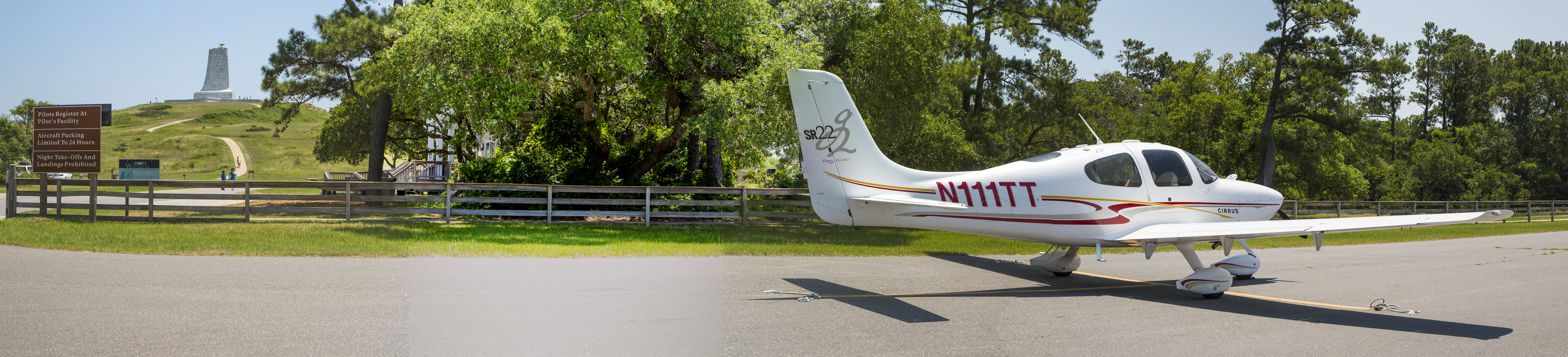
I am maneuvering for landing at Kitty Hawk, NC, the runway to the left in the image, and the memorial to Orville and Wilbur Wright atop Kill Devil Hill on the right.
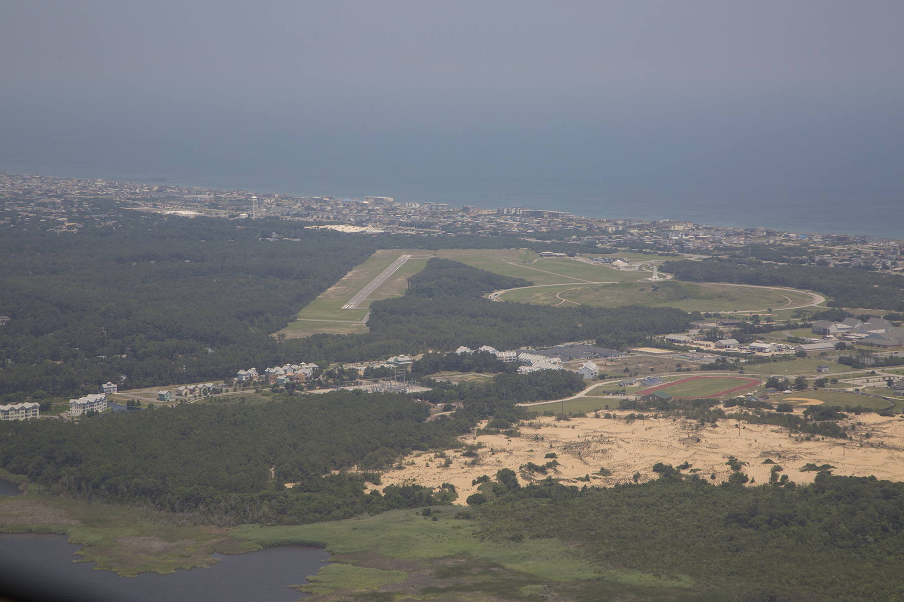
The auto parking lot had many cars, but the aircraft parking apron contained only N111TT when we shut down. Just twenty yards from the tail is the sign that provided the vantage point for the image that begins this blog missive, juxtaposing the Centennial sign and the Kill Devil Hill monument.

This monument to the Wright brothers, atop Kill Devil Hill, was commenced in 1928 commemorating the 25th anniversary of their first powered and controlled flight in December of 1903. These were “mere” bicycle mechanics—you got that?—from Dayton, Ohio, smitten with a yearning for the freedom that flight offers. They began by flying gliders off this very hill as a means of learning about the magic of lift, the force of physics that propels all craft in our atmosphere, and about how to control their flight path. For controllability they developed a method of twisting the wings, known as wing warping, and reminiscent of the twisting of wings and tails of the birds who were their siren prototypes. As they began getting a handle on that they turned their acumen on adding power to the equation. Here I am, barely a century later, honored to gaze up their monument, juxtaposed with a pearly contrail as mute testament to the genius of those remarkable, determined, and self-reliant men.
These two images barely hint at their inspiration and brilliance. You are looking at the front end of their personally devised and hand made wind tunnel. Nothing like this existed before they created it from their own imagination. A fan was positioned before this circular opening directing a wind into the wooden structure looking for all the world in size and shape like a box kite. The X-shaped and honey-comb structures were designed to straighten the wind so it would mimic the flow of air over the wings when their powered craft was propelled through the atmosphere. They managed to figure out how much horsepower they could get from their engine, and how much of that would deliver what speed through the air when harnessed to the plane’s propellers, and then used appropriate fan speeds to equate to that imagined airspeed of the craft underway. No one knew this stuff. No one.

This inspiration was channeled to basic practicality as you can see from this image looking back into the box from the downwind end. They built this simple structure with spring tensioners that sat in the airflow coming in from the other end of the box. They designed rudimentary airfoils, the technical name for a wing that is shaped so as to generate the lift necessary to hold aloft a weighty object when that airfoil is moved through the air. They tested multiple tiny, to-scale airfoil shapes which would pull against the spring tension moving in response to the physics of lift, thus ascertaining which shape would prove most effective given the speed that their propulsion system could provide. No one knew this stuff. No one. Genius.

The museum at Kitty Hawk has replicas of both their glider and their powered Wright Flyer, and here is the latter. The original hangs in the Smithsonian’s National Air & Space Museum on the mall in Washington, D.C. along with countless other aviation treasures. If you haven’t been there, or here, you owe yourself a reverential visit.

Outside you can walk the path of their first four powered flights on that rendezvous with destiny in December 1903. As you may know, their powered flights launched from the flat sands of Kitty Hawk, just below their glider launch point on Kill Devil Hill. Soft sand was good, as it cushioned their small crashes as they learned to put it all together. Remember, no one knew this stuff. No one. To get around the drag of attempting to move tires through soft sand at the start of a takeoff roll, they substituted skids and a short track upon which the Flyer accelerated until reaching flying speed. Four successful flights that December 17 with the brothers alternating as pilots. Each stone marker informs as to who flew, and what the duration and distance was of the respective flights. Let me put this first one, by Orville, in perspective. The length of the white dashed lines demarcating the centerline of a modern airport runway is exactly 200 feet from the beginning of one stripe to the beginning of the next. This first flight, which irrevocably changed the face of the world, is barely half that distance. The distance of this first flight was roughly three wing spans of the Cirrus that bore Cathy and me to First Flight aerodrome.

Eventually we trudged ourselves back across the fields in the June heat and humidity and stopped in the pilots-only lounge (keypad entry to the locked lounge is “Squawk VFR plus #”) to use the facilities and proudly add assertion of our presence to the register, before departing northbound to Colonial Williamsburg.

Our time in Williamsburg was short, and our arrival was late that afternoon. Like touring rock stars, the FBO manager met us with a rental car, plane side, as we shut down the engine on the parking apron. From there it was a short :05 drive to our B&B lodging for the two nights. Both of these conveniences had been secured the day before when I felt confident the day’s weather would enable completing the flight to KJGG. We had a wonderful dinner at the exquisite Prime 46 Forty restaurant that first evening. The next day we went out to visit the Berkeley plantation in the morning, before our lunchtime visit with Tilda. Located on the James River, Berkeley was the home of the Harrisons, William becoming the ninth president of the United States, and the first president to die in office. His grandson, Benjamin became the twenty-third president. That evening we drove the short distance past the College of William and Mary and had burgers and brews at the DoG Street Pub in the heart of Colonial Williamsburg.

We retired to our B&B on the early side, as I had some serious decision-making to accomplish. Our plan had been to fly to Dulles International Airport outside Washington, D.C.. I had already arranged through the Landmark FBO on the field there for ramp space for our plane, nearby hotel reservations with their crew rate, and the use of their shuttle to take us to and from the Air & Space’s expansive Steven F Udvar-Hazy museum located on a far corner of the field at Dulles. The next morning’s weather looked modestly problematic, but I was confident it would not present insurmountable hurdles. However, the day after that, and the next several ensuing days looked like the entire eastern and central U.S. would be slammed by extensive and widespread thunderstorm activity likely to keep us from departing toward home. Command decision time—I cancelled our D.C. plans, and worked out a WSW routing to start us homeward bound. The plan was to depart under IFR because of forecast morning weather, residual to the evening’s thunderstorms and proceed to Huntsville, Alabama for fuel, then on to Oklahoma City’s Wiley Post airport, and if still able due to weather vagaries, carry on to Taos, NM. Three legs, a long day, by all accounts.
The morning dawned, demonstrating the necessity of operating under Instrument Flight Rules, with a ceiling and visibility adequate for takeoff, but below landing minima if a problem should develop after becoming airborne. Shortly after takeoff the lower clouds, now below us, began to break up, but we still had to maneuver so as to avoid the residual towering cumulus. And as we proceeded westbound the clouds were a solid undercast below us with all airports for the first hour of flight below landing minima. I know because I pretty much continuously alternated between checking the health of our engine parameters, and pulling up the weather on our onboard displays for countless nearby airports we were overflying on our track.
A momentary break in the clouds during the climb out from KJGG.

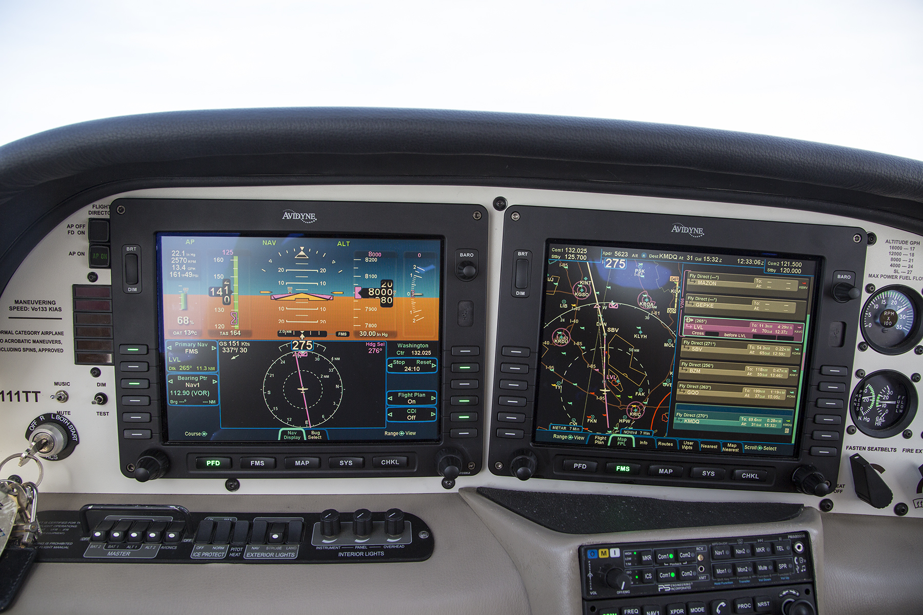
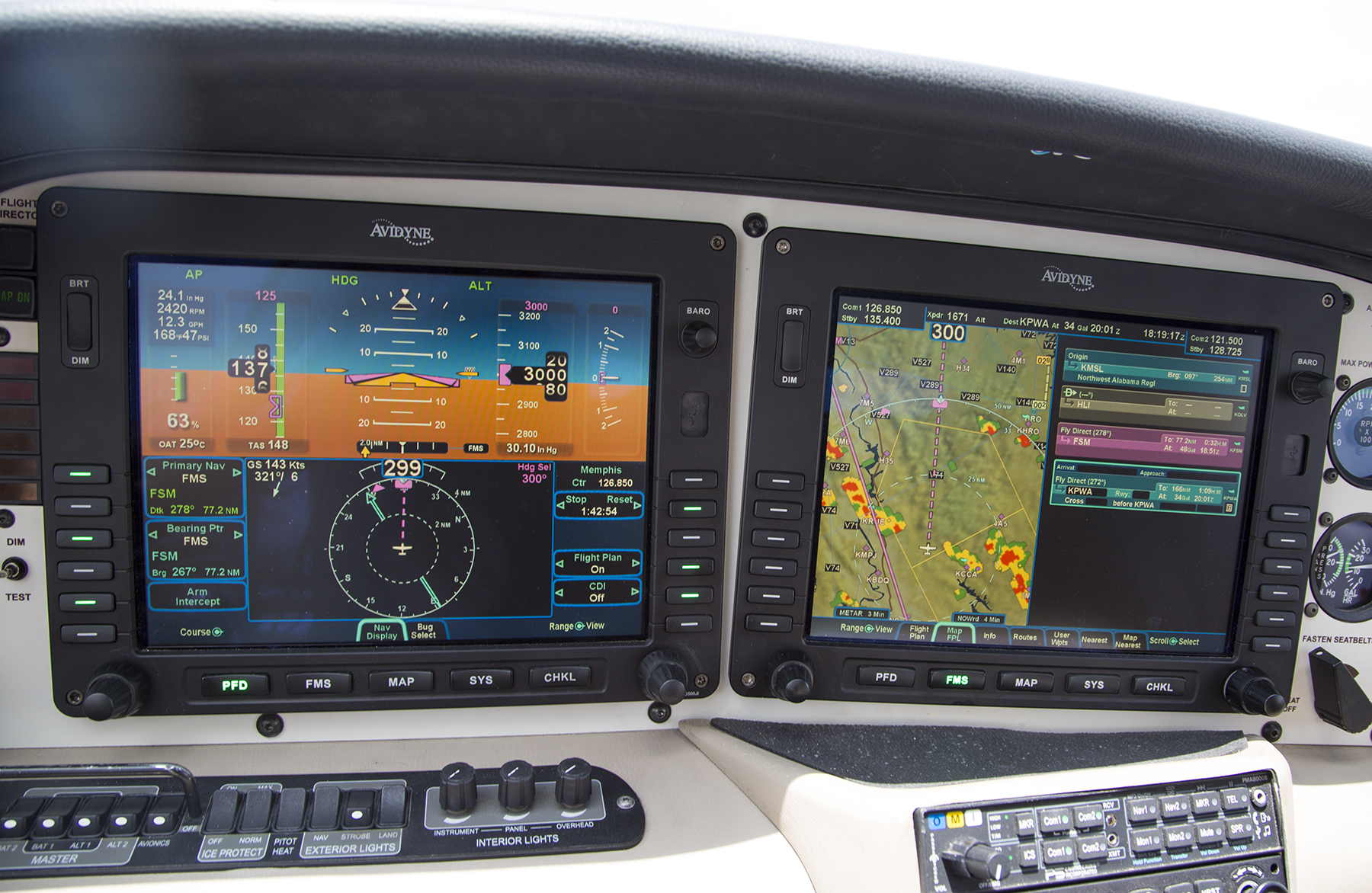
If you are a user of cockpit Multi Function displays, you will note the red flags for low Instrument Meteorological Conditions at aerodromes either side of our ground track.
The solid undercast cleared about an hour after takeoff on a route that would take us near Greensboro, and Charlotte, NC, past Choo Choo and further westward. Near the western North Carolina/Tennessee border the skies looked like this. Hmm, let’s see, we are at 10,000′ and it is still relatively early in the morning, and those cumulus are fairly numerous, many already punching up above our altitude. Hmm. Another flexibility decision point—I changed our destination with ATC, electing to substitute Muscle Shoals, Alabama, near the western border of the Crimson Tide state for the more easterly Huntsville, hoping to get beyond the developing cumulus before the cotton balls turned into full-blown thunderstorms.

That turned out to be a modestly prudent decision, but prudence only goes so far. After the briefest of time at Muscle Shoals, our climb out had me threading the eyes of multiple needles to work our way up to a 12,500′ cruise altitude detouring around innumerable towering cumulus to stay in the clear during the climb and at cruise. Still the gaps between the clouds stayed adequate to continue operating VFR. See, it turns out that the vertical air currents that produce these towering clouds can produce rather nasty turbulence. Staying in the clear even if the pilot and the aircraft are capable of flight in the clouds is vastly smoother, and has the advantage of minimizing the risk of inadvertently stumbling into something, well, more or less like what it eventually came to near Fort Smith, to the NW of Little Rock, Arkansas. It’s that Hmm, thing on steroids, now. We are still nearly 100 miles away from this developing line of fire-breathing thunderstorms at what is now the early afternoon. I could discern a portion of the line with less development at our twelve o’clock position, right off the nose in this frame. I considered diverting ninety degrees left and landing at Little Rock, but figured I could proceed farther westbound before having to commit to that plan, while appraising what was possible in that central slot as time advanced.

If we had been a half hour earlier, I think we could have gone through there at our existing 12,500′ altitude, but as I got in closer, I decided that a more comfortable option would be to drop down low (around 1,000′ above ground level) and proceed through the now-closing gap, using both the onboard radar display and careful visual scanning to sashay left and right diverting from our flight plan ground track so as to avoid the ugliest of the billowing cumulus still observable above us, and naturally avoid the rain shafts wherever they presented themselves. Worked like a charm, and, again was remarkably smooth notwithstanding the seething nature of the cumulonimbus either side of us. You’ll note from the MFD depiction, where the inner, dashed scale ring is 25 nautical miles, that I was unable to secure a gap of at least 20 nautical miles either side of me to where the thunderstorms glowed red. Real world, that generally accepted separation maxim is frequently unobtainable. Incidentally, ATC seems to have learned from past gaffs, and was routinely warning pilots at all flight levels of “an area of precipitation at X o’clock with moderate, heavy and extreme precipitation.” You non pilots should know that the rate of precipitation in thunderstorms correlates directly with the severity of turbulence.
This location corresponded to a chart admonition of caution for “Rapidly Rising Terrain,” which fortunately I was able to keep in sight. But the low altitude eventually cost us our communication link with ATC, who was able to enquire as to our well being by a relay from a passing jetliner up in the flight levels, more or less turning the tables on our comm relay near Greenville, MS while heading eastward a week earlier. Sometimes you give and you get. After fifteen or twenty miles we were now getting west of the worst of it, and I could climb back up to 12,500′ and resume the back and forth avoidance of what was once again merely modest towering cumulus. This is looking back over my left shoulder at the line of thunderstorms as we proceeded away from it westbound. It looked more or less the same off to the right. All better now.

Flexibility resumed its seminal role yet again following our second landing of the day, at Wiley Post in Oklahoma City. Knowing that weather contentiousness near Fort Smith was a distinct possibility we had purposely not made any accommodation or car rental arrangements at our desired end of the day Taos, NM destination. Said more succinctly, it hadn’t been clear that we’d get that far. We refueled at Atlantic Aviation at KPWA, and got busy with the i-Pad and cell phone seeing what we could drum up at Taos. It was now 3 PM-ish, and we could find no room at the inns, nor rental vehicles. How about if we call it a night, and sort this out in the morning? Atlantic quickly arranged for lodging with their crew discount at a nearby Crown Plaza, and handed us the keys to one of their two crew cars. The hotel room was very nice, the bar and restaurant were terrific, and the hotel staff as friendly as that at Atlantic. A real winner.
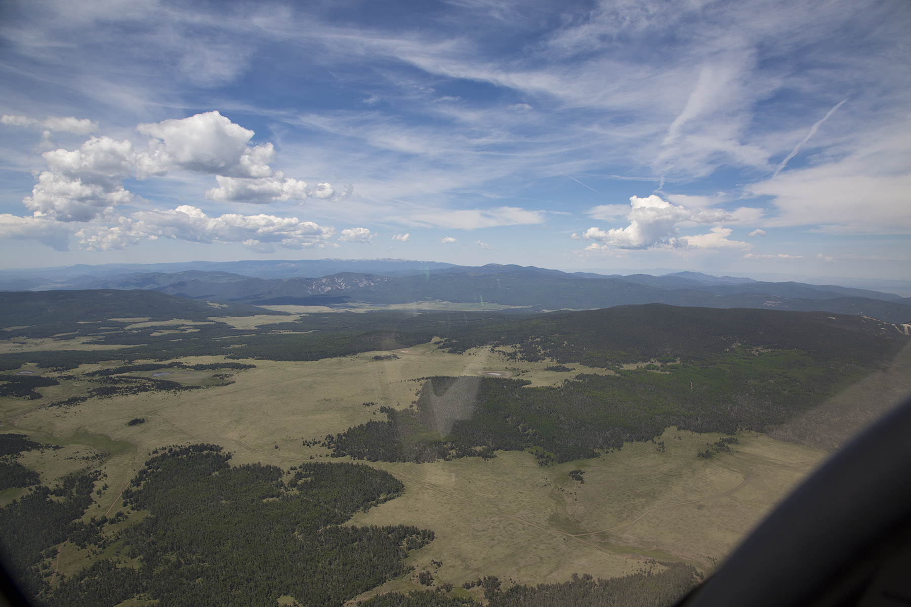
By morning Cathy found a room for us at the Touchstone Inn B & B, and so off we went, still without ground transportation. Oklahoma, northern Texas and far eastern New Mexico are flat, but that changes abruptly as you near Taos from the east. Here we are just to the south of Cimarron, and proceeding to overfly the Angel Fire airstrip in a hanging valley between the middle and most distant mountains ahead. Taos is immediately the other side of the third range.
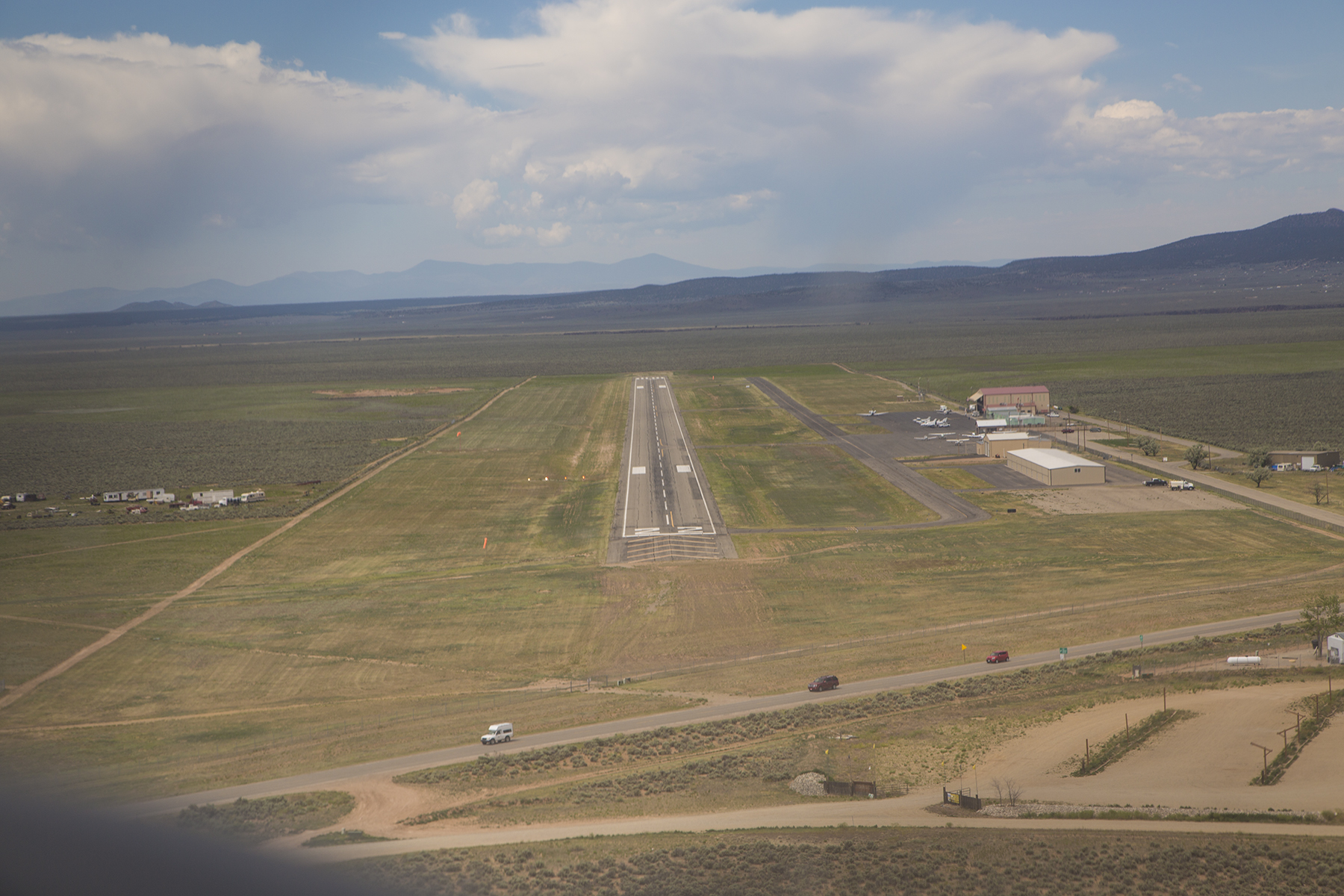
Short final approach to Taos, KSKX. Not much airport development, as you can see. This was another theme at most of our landing sites.
The Big Fella upstairs continued to favor us with His blessings. We shut down, and fueled for our subsequent departure, then learned from Leah—the do-it-all gal and only staff member on duty keeping the FBO humming—that a rental car had been unexpectedly returned this morning. If we weren’t bothered by it being dusty, we had our transportation. She was also a fount of local insider tips including the micro brewery (do you discern a trend here?) just down the road, and the fun that could be had at KTAO, the local solar-powered radio station cum locals’ watering hole. A solar-powered radio station/bar? “Well, Taos is very much a hippy town,” allowed Leah. Happy hour is 4 PM to 6 PM with good cheap drinks and tasty bar food. Well, okay, then. I’m not sure when the radio station broadcasts, but you walk right past the broadcast booth on the way to the bar. Maybe our local public radio station could stifle some of the incessant fund-grovelling if they implemented a similar business model? We managed to maximize what we saw and did during our two days and two nights.
We headed out by the Rio Grande gorge to get in some photos and some Time-Lapse sequences.

Always mindful to look down and enjoy the foreground as well as the vistas.

Cathy spotted this delightful collared lizard. These creatures can run at warp speed on their hind legs. Isn’t he handsome, absorbing the warmth of the rock while surveying his kingdom?
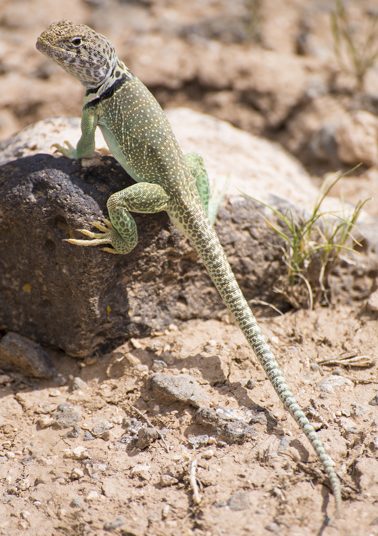
The views of his kingdom aren’t too shabby, either.

And, his atmosphere is as dynamic as is he.
We stopped at the brewery and stumbled on why so many places were booked the night before—a sizable conclave of the Hogs and Heifers motorcycle club that was great for people watching over my IPA. Dinner at a fresh and local cafe with great wines by the glass and literally next door to the Touchstone Inn. The next day we hiked some four hours the Devisadero Loop trail in the mountains east of Taos. Devisadero refers to lookout, and it was a site the Taos Pueblo Indians used for advanced warning of impending raids by other marauding tribes. Nice views of the Pueblo below. And of course, we had to peruse the galleries and shops that are part of the charm of Taos.
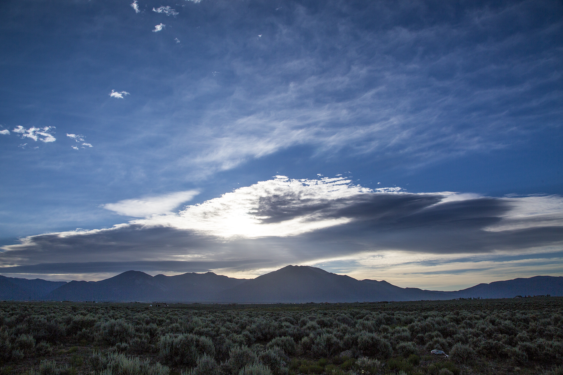
Well, okay, one always has time for sunsets and sunrises.

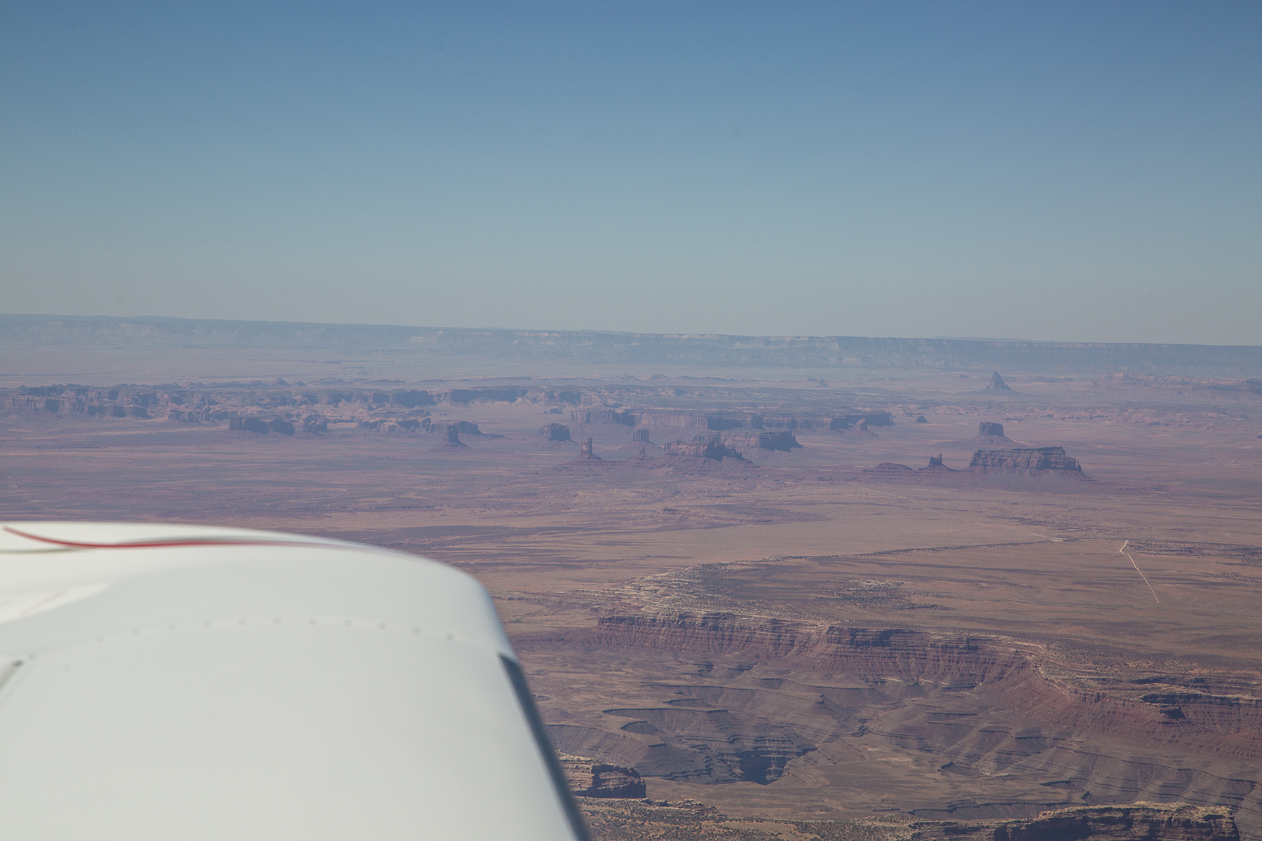
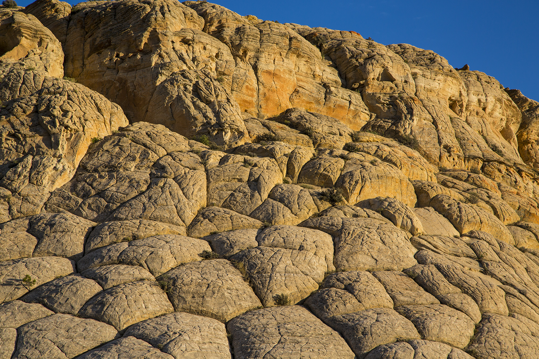
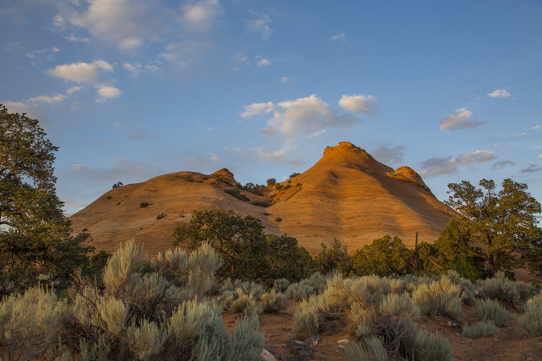
Then time to carry on farther westward, heading to Escalante, UT, for a rendezvous with middle daughter, Paisley who was conducting yoga workshops at the Boulder Mountain Lodge in proximal Boulder, Utah. This is the Four Corners region of the U.S., slick rock country with topography and colors unlike any place on earth.

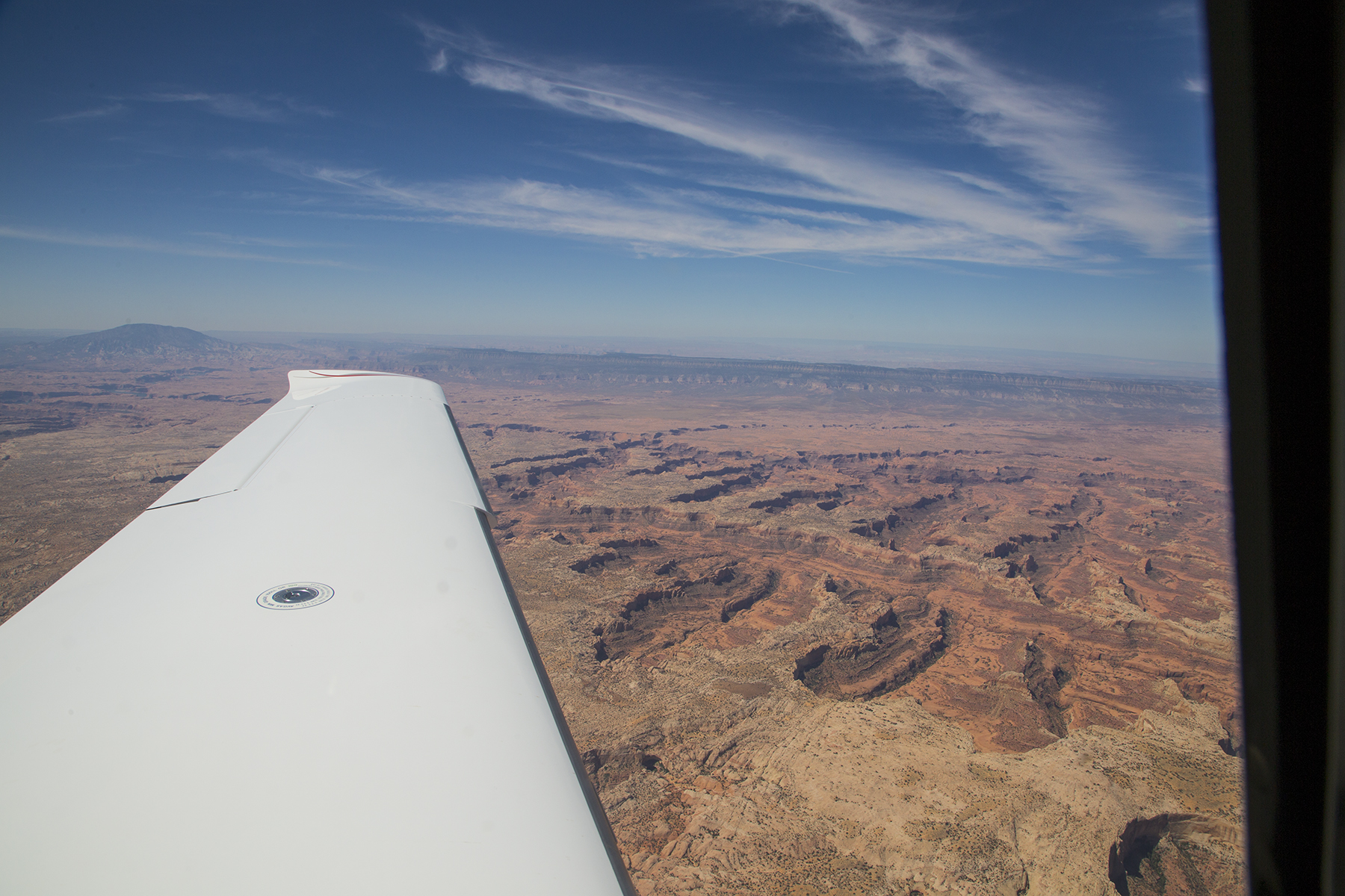

And the scenery from the air was matched by the splendors down on the ground. You fancy Anasazi cliff dwellings alongside a bubbling stream nurturing cottonwood shade?

How about industrious bees and still additional raucous color?

And late in the day, the glow of low light and deep shadows. As I am prone to say…”it’s always about the light.” The fantasy shapes and swirls of the land don’t hurt, either.

Following a gourmet dinner at the Hells Backbone Grill (named for a narrow twisting highway atop a ridge spine leading to Boulder from Escalante) it was time to call it a day. But this is dark sky country, as well, a perfect opportunity for a celestial Time-Lapse, devolving into sunrise, and using the large pond right below our room as worthy foreground for the sequence. Dawn alarm clock? Provided by the ducks and geese.
And then back the 28 miles to the Escalante (1L7) strip, where N111TT was the only airplane on the ramp. Grateful hugs for Paisley being who she is, with thanks for sharing this locale with us, before the southwest flight home on our final day of aviating. First, a stop for fuel in Kanab, UT, just above the Arizona border. Another place I’d never before been, but the maneuvering past a raised plateau just off the north end of KKNB’s runway 19 reminded me of the dance flying the 747 into Hong Kong’s old Kai Tak airport. No checkerboard on the hill, but still, the same bank shot for the runway. Yes, I’m turning base leg to final, and dropping rapidly down between those scalloped ridges on both sides of the airplane.
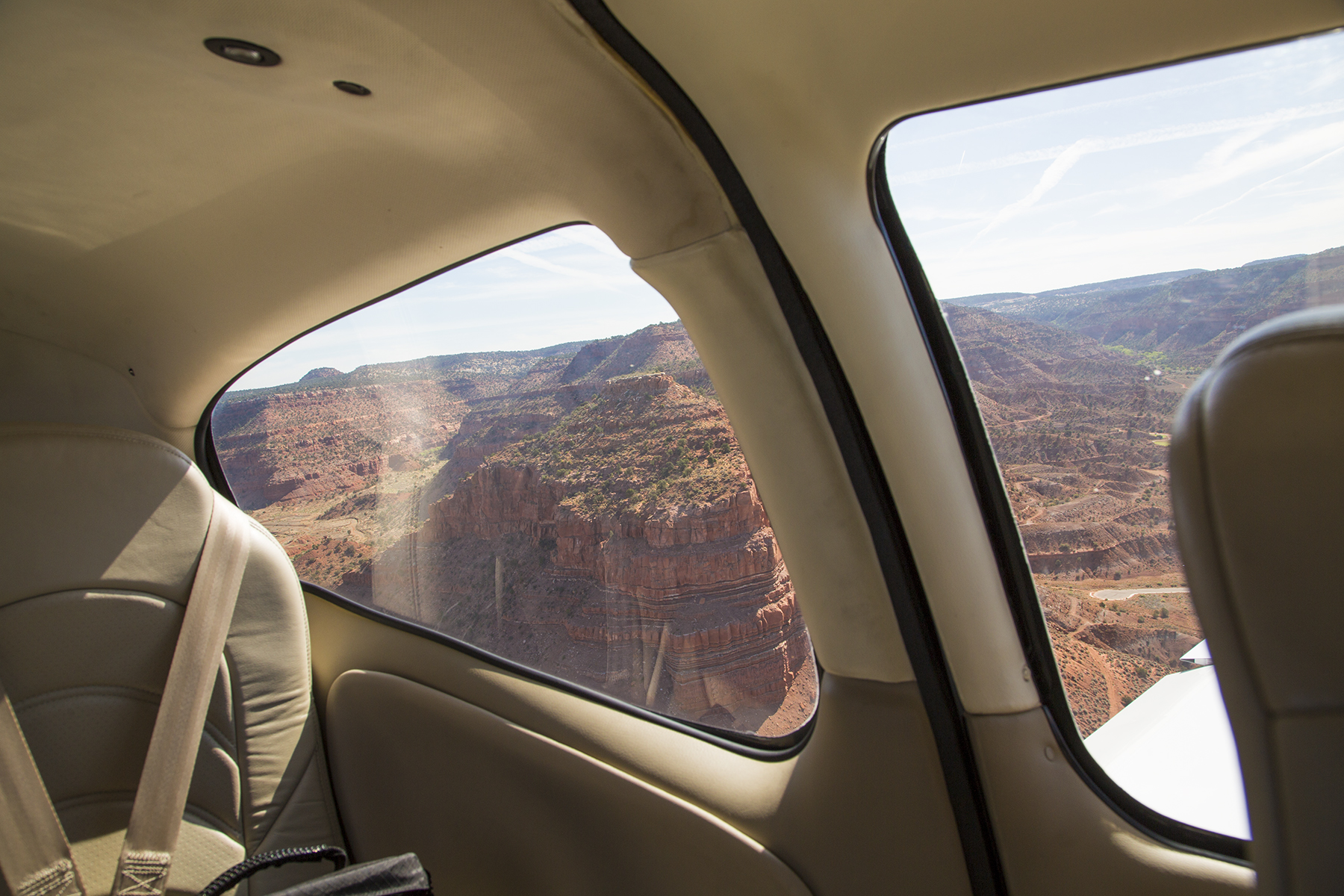
After fueling up it was nonstop to Montgomery Field, including the opportunity for a look at one more icon of the Four Corners region, the Grand Canyon of the Colorado River.

Random reflections. Our country is vast, and the scenery is stunning. If you are feeling put-upon by urban or suburban pressures, let the sights and people of Middle Earth refresh you. There was tremendous variety in what we saw and did, and each day seemed like the best one so far. Our Cirrus time machine provided a means of accomplishing things not otherwise so easily achieved, not to mention doubling as a splendid vantage point for gawking at the earth slipping by, below. Oh, and Texans are fond of saying “y’all,” the plural of which is “all y’all.”
Thanks for letting me carry on with this all y’all. T

Recent Comments