th2ombre
It's ALWAYS about the light
YOUR ISLANDS Await
Posted on August 17, 2021
It’s not exactly Bilbo’s There and Back Again, but any travel in these pandemic cursed times is a bit of an adventure, as was our week-long getaway to Puget Sound, Whidbey and Lopez islands. We weren’t subjected to taking off belts and shoes or mask-fogged glasses while stuffed in a crowded tube, the Cirrus time-machine saving us from that fate. But this year, the 2000+ nautical mile round trip had its own challenges.
As all news media convey, the western United States is going up in flames. Our route had us alongside, between, and over seventeen Temporary Flight Restricted areas established for fire fighting purposes. Our cruise altitude going was 10,000 feet, and returning at 9,000 feet. Neither put us on top of the smoke. Northbound, we were continuously in true Instrument Meteorological Conditions (IMC) from the southern end of the San Joaquin Valley to the Oregon-Washington border, and from north of Olympia, Washington to Ukiah, California, southbound. Not that my logbook needs more Instrument Flight Rules time, but it was legitimate IMC for several hours of flying. No clouds, but no horizon. Like flying around inside a gray pingpong ball that smelled of smoke.
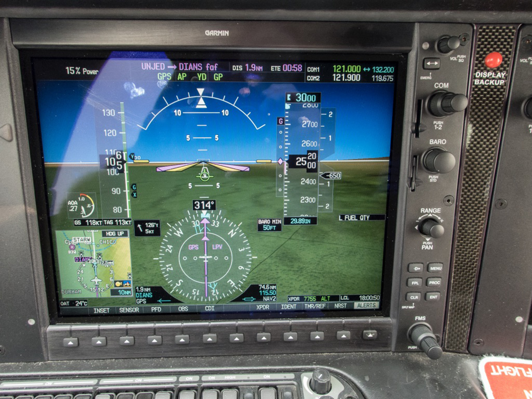
This is the Primary Flight Display look at 1.9 nautical miles outside the Final Approach Fix for Chico, California (KCIC) runway 31R, a fuel and potty break midpoint stop chosen the night before for its favorable fuel prices, and aircraft maintenance service availability if needed. The night before and the morning of our departure, the region was smoky, yes, but above Visual Flight Rule (VFR) minima, and we’d be landing with 1:35 of fuel as an Ace up the sleeve. Our departure weather at Carlsbad Palomar (KCRQ) was IMC with a lowish stratus marine layer and reduced visibility, tops near 2,500 feet. Level in cruise over SoCal, we were in bright sunshine, dealing with early morning quiet ATC, and listening to the classical channel on the Sirius-XM datalink that provides onboard weather and audio entertainment. Don’t worry, it mutes the music when ATC calls. As the saying goes, we were on top, in the clear, and fat dumb and happy. At least that describes me. I’d never verbalize that for ol’ WhatsHerName. Anyway, as we crossed over the Lake Hughes ridge line between the LA basin and Bakersfield, the weather reports on our onboard datalink weather showed KCIC as down to 2 statute miles in FU (not what you might think, that’s weatherspeak for smoke). Pretty much the entire east central San Joaquin valley was that way or worse. Hmm. By the time we neared Chico, the ATIS was reporting 800′ scattered clouds and 2 statute miles in smoke, the wind, south at 3-5 knots. No traffic, so Oakland Center, Chico tower and I conjured up a straight-in to runway 31R served by a WAAS RNAV (GPS) approach with a 250 foot Decision Altitude and 1 statute mile visibility minima. And we needed it. By the time we were halfway between the Final Approach Fix and the runway threshold we could see the ground if we looked straight down, but laterally over the nose it was only smoke and a vague semblance of golden grassland…with no runway in sight. That finally changed below 500 feet AGL, the runway revealing itself as a slowly materializing ghost amidst the vapors . Too much like work after 2:49 of flying, and a 05:30 wakeup call. That adventure thing.
So look, you pilots, here’s some takeaways for our quivers going forward. 800 scattered with 2 sm visibility is technically between requiring Instrument Flight Rules (IFR) and those available by Special Visual Flight Rules (SVFR), but not seeing the runway until below 500′ AGL is anything but VMC. These thoughts are largely tactical. Co-owner, Mason, following us on FlightAware and perusing the regional weather, has wondered strategically as to where we might have gone if unable to land at Chico. The entire region is near the Dixie wildfire, the state’s largest. I had filed Red Bluff (KRBL) as an alternate (and whose weather also deteriorated in FU while en route), but had in the back of my mind that the old USAF McClellan Field (KMCC) would be a reasonable out, and comports with my preference of having an alternate on the near side of the destination, as it effectively means having more fuel since you can drop in before going first to your destination. KMCC doesn’t show weather minima for filing as an alternate, but it has a viable CI ILS available if one chooses to go there. In practice I wasn’t really contemplating using either RBL or MCC, as the CIC weather seemed benign enough—until it took descending below 500 feet to find it. Mason is right—no real easy-peasy strategic choices after the en route visibility degradation. But that 1:35 fuel remaining provided options.
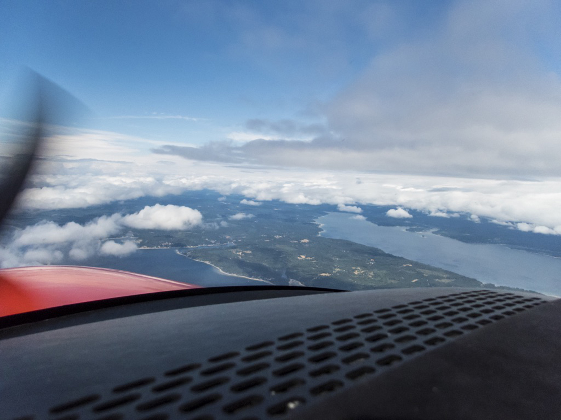
Aircraft tanks filled, and body tanks emptied, we chose to depart on 31R. Straight in, and Straight out. Back up to 10,000′ MSL, and following a route over Fort Jones (west of Mount Shasta) and then mostly up the Willamette Valley over Roseburg, Eugene, Newberg and Olympia to keep us out of the TFRs and to the west of Portland’s and Seattle’s busy airspace. We also flew this leg under IFR because of the relentless horizonless smoke until nearing the Columbia River, but also because it was overcast with rain from Olympia to our destination at Snohomish County, Paine Field (KPAE). At cruise and reported on the surface, the wind was southerly, so a tailwind en route and me planning to go with the ATC least resistance flow, landing south.

I checked into SeaTac approach control with the Paine “Booze News” (Airport Terminal Information Service “Whiskey” information) which reported the surface wind as “150 degrees at 10, gusting to 14, visibility 7 sm in rain, ceiling 1600 overcast, temperature 17 C, dew point 14C, and altimeter of 29.94 ” Hg. Approaches in progress to runway 16R. The CII ILS OTS” (but the CI ILS was useable). I requested the WAAS RNAV (GPS) Y runway 16R approach. Interestingly there’s both an ILS Y and an ILS Z to 16R, and a GPS Y and a GPS Z to 16R. All four approaches do essentially the same things, and even, in some cases, using the same waypoint names. They all have the same 200′ AGL DA and RVR 1800 visibility minima. The missed approaches to a hold SW of the aerodrome are essentially the same as well. The only real difference I could discern puzzling over the procedures is that the missed approach of the Zulus climb to 3,000 feet and the Yankees to 2,000 feet. Speaking with my main squeeze in the first mate’s (pun intended) seat, I allowed as how we’d be flying through rain while maneuvering and when on final approach. As it turns out, these broadcast meteorological conditions portended more than was immediately apparent while flying vectors to the final approach course.

We were following a Cessna Citation biz jet, and when SeaTac Approach switched us over, on check-in, Paine tower advised that the surface wind had shifted to north at 5 knots. Did I wish to abandon the approach and take vectors to the non-WAAS (LNAV+V) RNAV (GPS) approach to runway 34L? The Citation had just landed, and with us both on the same tower frequency, reported it was smooth all the way down, with only those 5 knots of tailwind on touchdown. With a first person PIREP of no wind shear airspeed fluctuations or turbulence, and only a 5 knot tailwind to a 9,000 foot long runway (KPAE is where Boeing builds and flies their wide-body airliners) I conveyed that we’d stick with the GPS Y to 16R, but hold the option of bailing out into a left downwind and land on 34L if needed. Well, we broke out of the overcast at about 1,600 feet alright, wind on final now south at 5-7 knots. And while we could see the aerodrome in spite of the rain, the runway threshold and touchdown zone disappeared from view as I watched. Would you look at that, a genuine roll cloud materializing at right angles between us and the threshold? Maybe a mile long west to east, and a half mile wide, north to south. This could get interesting. Smooth as a baby’s bottom descending on the glide path, and then at about 500 feet AGL we dropped into the gauzy pewter roll cloud, still smooth. I watched the altimeter unwinding through increasingly small numbers, until we finally broke out about 250 to 300 feet AGL. You can exhale now, Tom. Touched down and turned off at A4 leading to to the ramp at the foot of the control tower and where FBO Castle and Cooke and our rental car awaited. I PIREPed our observations on the tower frequency as we cleared the runway, and pondered a very micro local weather pattern, with just the right temperature and dew point forming the cloud right at the juncture of the south wind on final and the north wind on the surface.
Allow me to share a couple more pilot nuggets for the aviators amongst you. While maneuvering, I self briefed both the KCIC runway 31 approach and the KPAE runway 16R approach (both of which I had pre-studied at home and en route). My weather analysis before we left home and with en route datalink weather gave me to expect the two instrument procedures we actually used. Which is to say I knew in advance the missed approach procedures. But given the extant ATIS weather, I had little expectation of a likely missed approach. And yet, in both cases, we were getting inordinately close to the missed approach decision point with no runway in sight. Takeaway? Always be prepared for last minute surprises requiring thought-out codified responses.
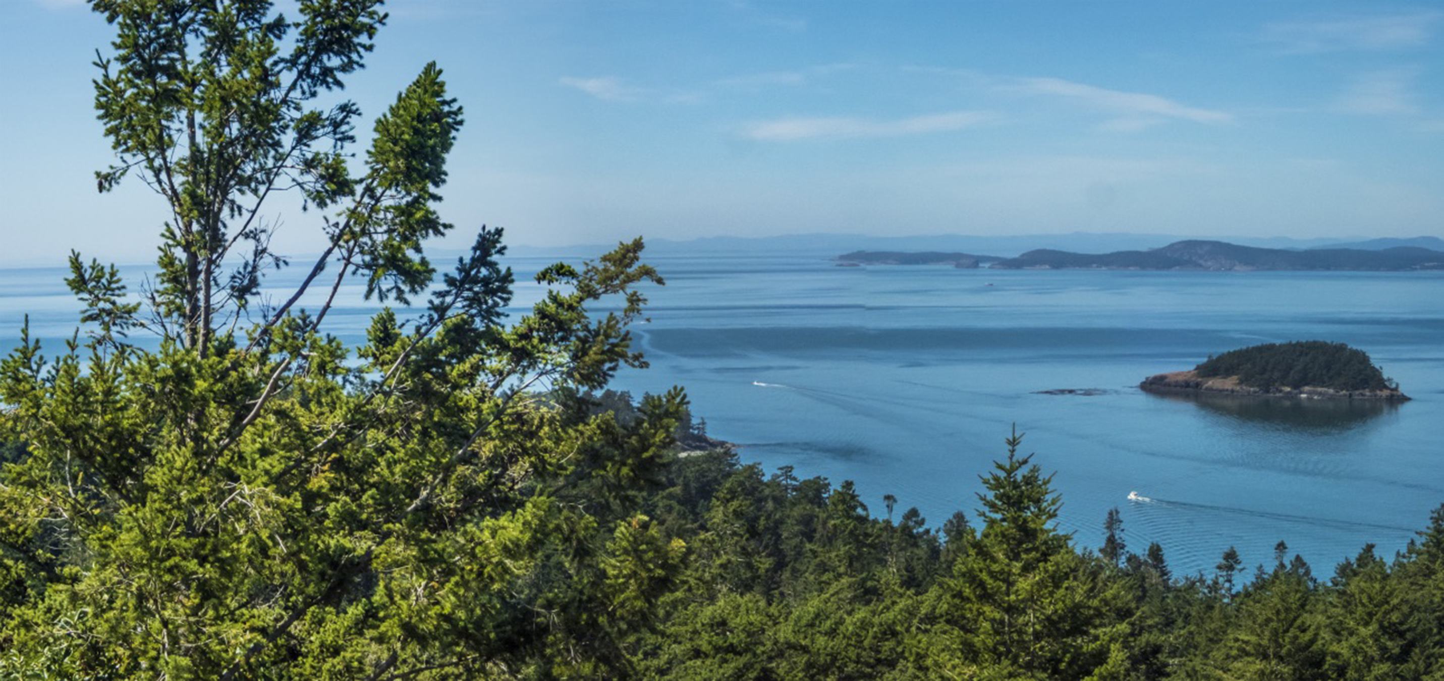
Okay, moving on from getting there, to actually being there. Like rock stars, our rental car was delivered to the plane as we stepped down from the wings onto the ramp. Luggage transferred from plane to auto, our John Hancocks scribbled on the Enterprise paperwork, we were escorted to the exit gate, and navigator Cathy started play by play mobile device directions to the Mukilteo ferry terminal. Lots of indigenous names in the northwest. We stepped onto the steep escalator learning curve of ferry life in the islands of northwest Washington. The roadway shoulder was marked as a ferry-waiting lane beginning about a mile from the actual terminal. We slipped into the shoulder ferry lane and crept to the ticket booth as one ferry departed, relaxing into languid conversation while we waited :30 for the twice-hourly westbound ferry to Clinton, on the SE end of Whidbey Island. A first taste of island pace. At nearly 50 miles in length, Whidbey is purportedly the longest island in the U.S, and the largest in Washington state.
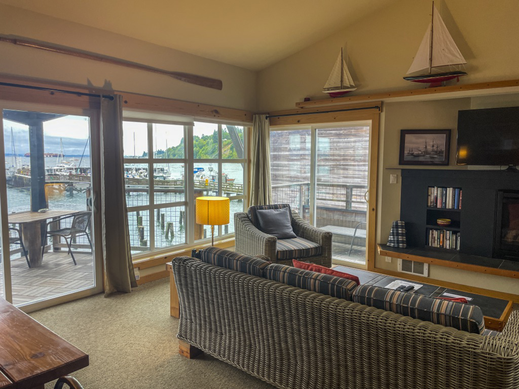
Our lodging was in tiny Langley, population of just over 1,000 of Whidbey’s 70,000 total. Cathy has a knack for finding delightful digs in our travels, and she yet again outdid herself with our Boatyard Inn https://www.boatyardinn.com abode on the water at the harbor, one of thirteen such pied-á-terres.
By now it was late afternoon, and being bushed, we made our way to a local brewpub café, one of several in this town which can be traversed on foot in a few short minutes. On a celebratory whim, I tried a locally distilled gin G&T. Then a draft beer with the meal. Both, yummy. Celebration, insofar as this was only our second getaway since the early January 2020 pandemic implosion. Two grownups as giddy as two kids. Our grownup side, cognizant of pandemic realities, had discerned that the pent-up demand for travel, excluding sketchy international options, meant expectations of teeming domestic destinations. It took some pre-planning time to find available worthy accommodations. Another pandemic effect was watering holes being shuttered on certain days, with the operators apparently choosing their dates in concert with one another so that not everything was closed on the same day or evening. The Langley city leaders convinced the local fire-fighters and Knights of Columbus to operate a barbecue hot dog roast on the Second Avenue sidewalk at noon for the midweek slow days Tuesday and Wednesday lest visitors and locals alike go hungry. Middle America chamber of commerce vibe. In a similar vein, cafés didn’t take reservations, but you could pop in and put yourself on the list and they’d phone your mobile that your table was ready while you wandered around town. But you’d also better start early, as the waits could be longish, and some of the menu items would become unavailable as they ran out of ingredients. And everywhere, the restaurateurs were apologizing for the slow service pace resulting from staff shortages. Your tax dollars at work. But, without fail, the innkeepers, restaurateurs, publicans, and shopkeepers were friendly and so happy to have your presence in these recovering times. And without complaint, everyone was complying with posted signs requiring masks indoors.
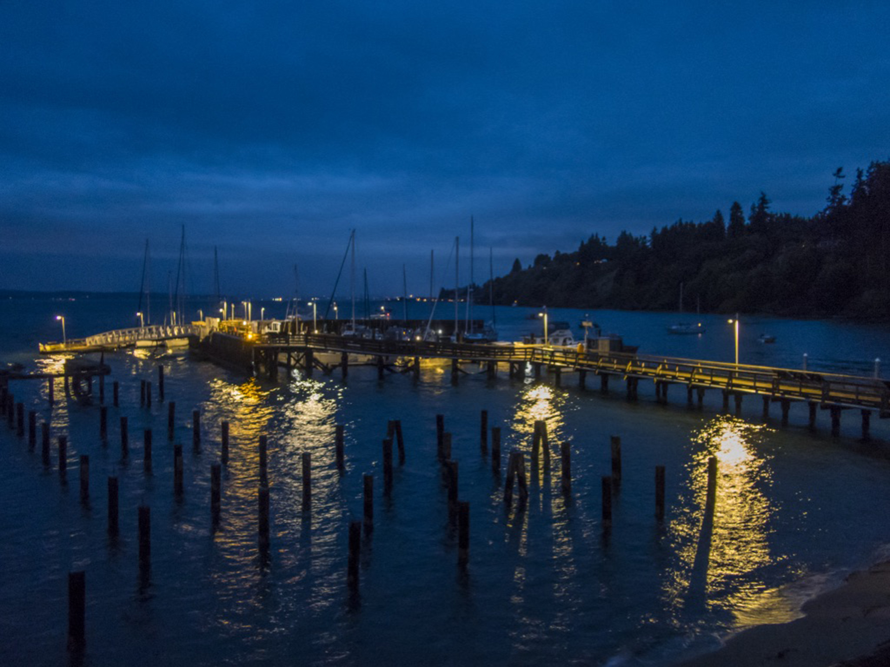
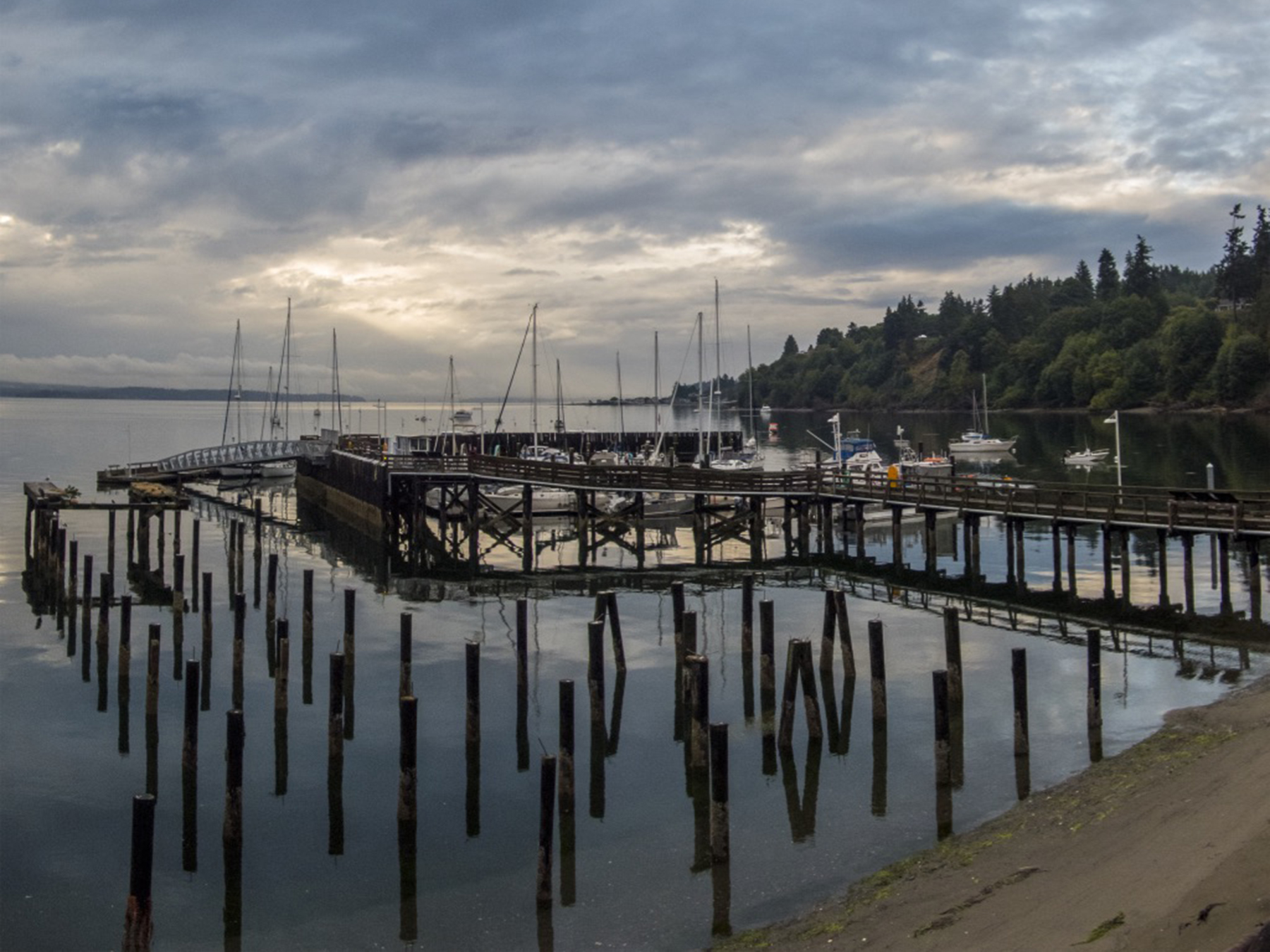
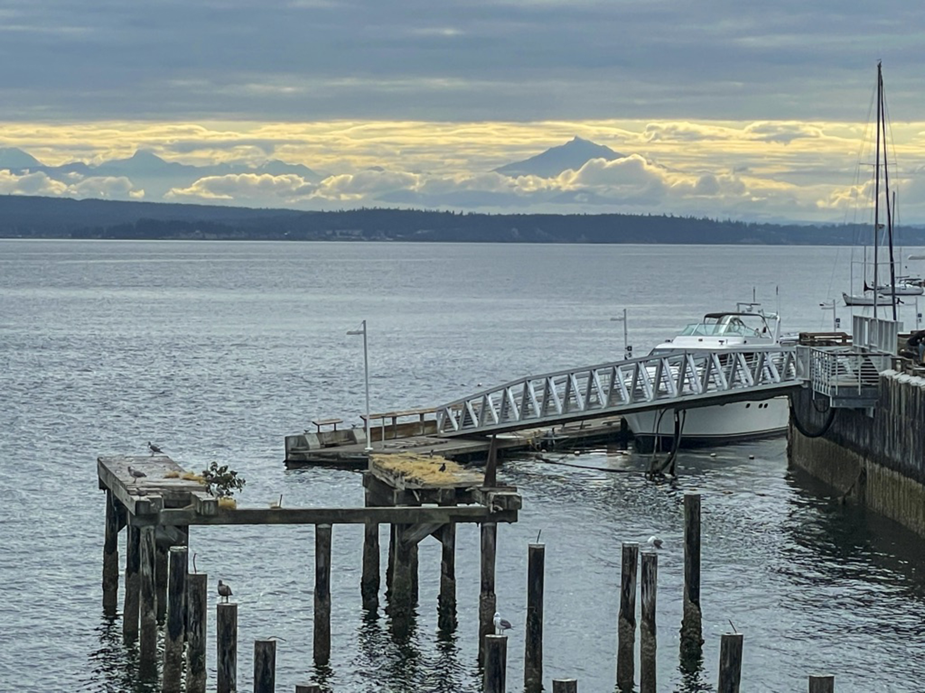
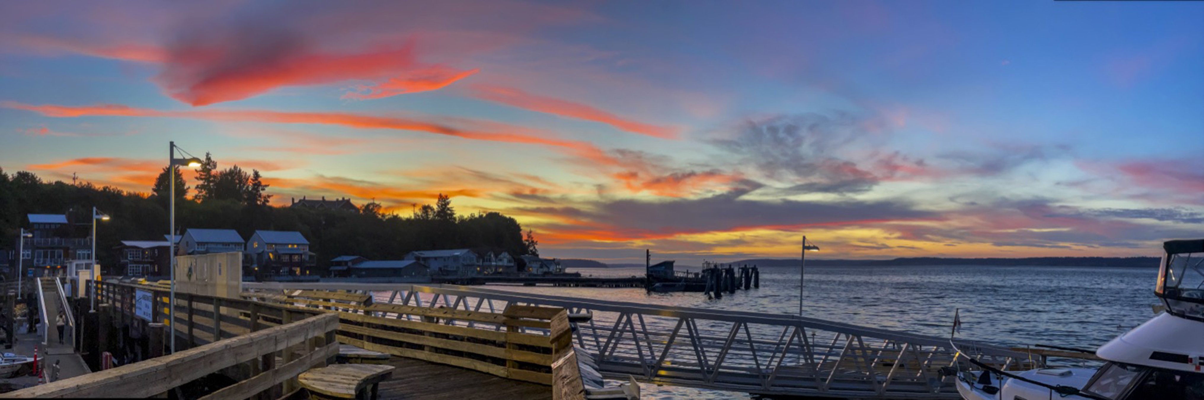
Love it or hate it, Maurice Ravel composed “Bolero” as an exploration of variations on a theme. For non classical music lovers, it was Bo Derek’s musical accompaniment choice in the classic comedy “Ten.” I found I was mesmerized by the infinite moods of this view. Herewith my Ravelian take on this music for the eyes, a kaleidoscope of changing hues, sky cover and tidal lengthening and shortening of piling heights.


Our preference is for vacations that include a modest amount of vigorous physical exercise in nature’s haunts. I can take only so much of the Louvre or the Uffizi, a reasonable amount of ambulating London, Paris or Prague, and almost none of Manhattan’s Fifth Avenue.
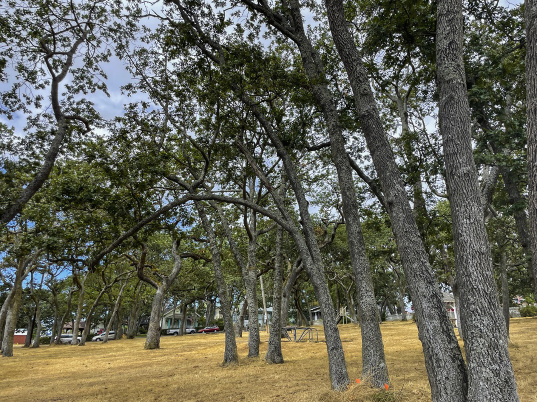
The largest town on Whidbey Island is Oak Harbor, the community next to which NAS Whidbey Island is located. Returning from our first hike near here, this was just too arresting not to capture. The first I’d heard that the King had a preference for a ’55 Chevy convertible. Whimsy.

Islands naturally have the sea at hand. Failing to arrange a sailboat, we chose some hours down and close to the tidal swings, wafting over the kelp and Dungeness crabs drifting by below. At least some of the time we did actually synchronize our paddles…an acquired skill set.


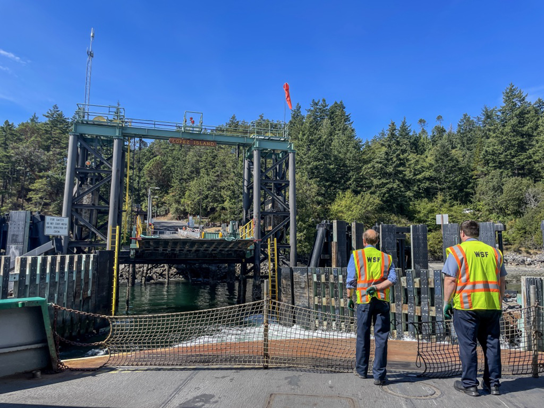
We drove to the Anacortes ferry terminal on Fidalgo Island, across the Deception Pass from Whidbey, parked our rental car and boarded the ferry for Lopez Island on foot. Parking at Lopez is a challenge, and we had pre-arranged two e-bikes (a first for both of us) for retrieval after egress from the vessel. This docking scene suffused me with little kid smiles, it being so redolent of my childhood ferry rides from San Diego to visit my uncle Cap on Coronado.

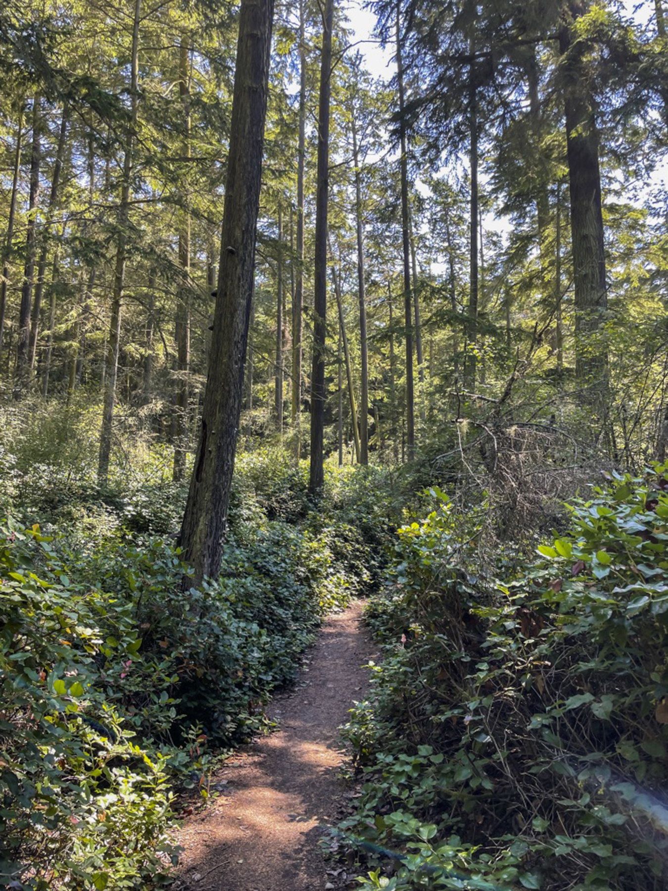
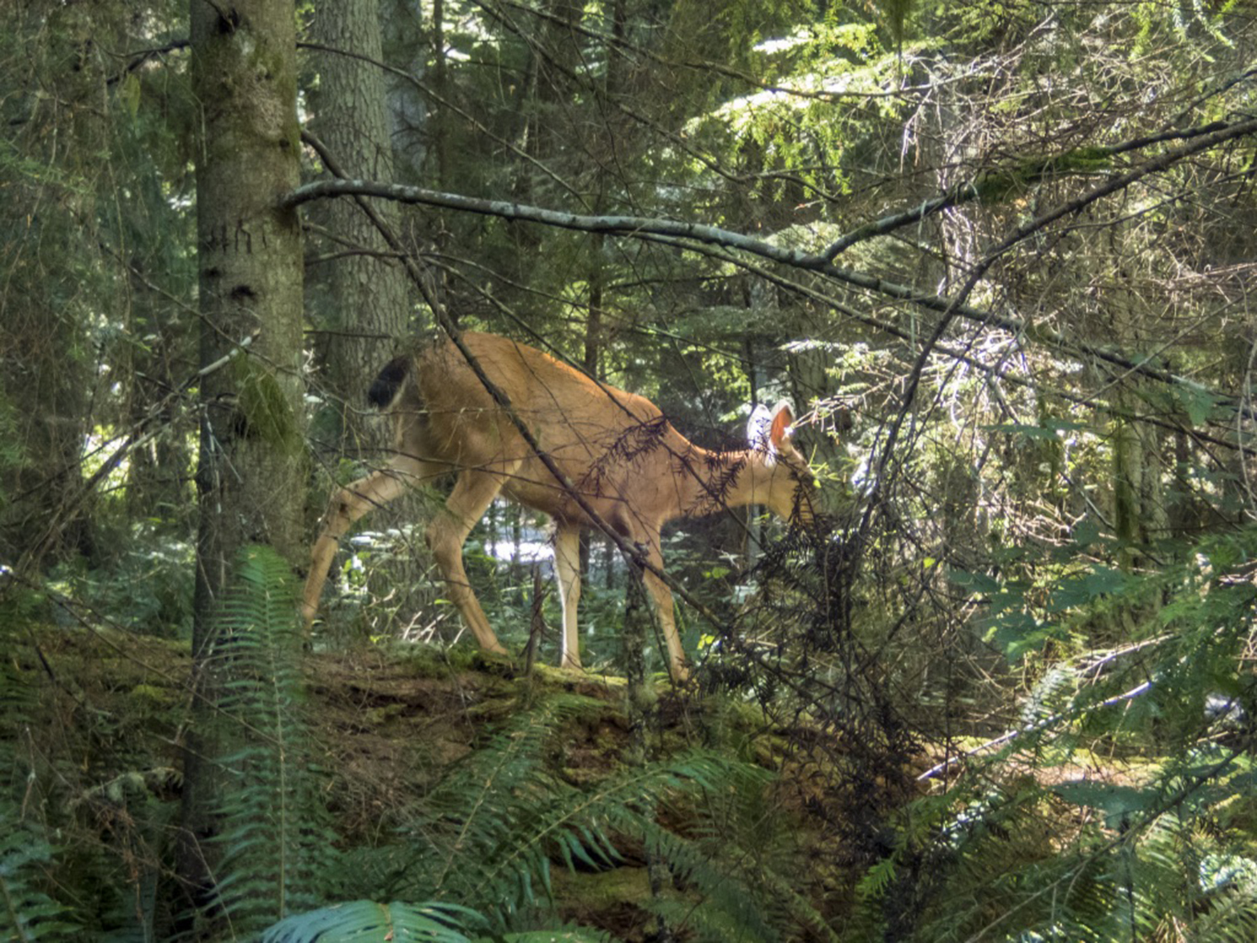
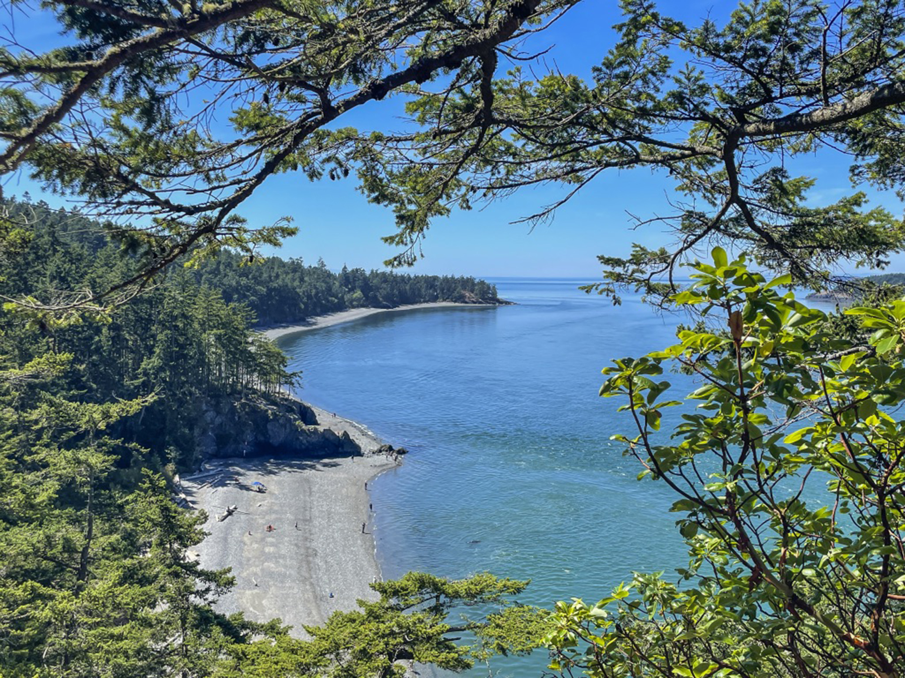
The next day we returned to the northern end of Whidbey Island to do some hiking in the Deception Pass state park. Another day of getting into the island pace, motoring on two-lane roads with only modest traffic, drivers keeping a respectful vehicular distance at an un-frenetic 50-55 mph. Trees and grasses along the highway, and deep old-growth forest hiking trails at the destination.

For our last full day, we motored to the Double Bluff beach along Whidbey’s western shore. The back story is that we learned about this locals’ favorite spot while partaking of a micro brew at Langley’s Double Bluff Brewery, awaiting our “your table’s ready” call to dinner at the Braeburn Restaurant a half block away. The pungent fruit of a getaway without an etched-in-granite itinerary. https://www.dblfbrewing.com https://www.braeburnlangley.com
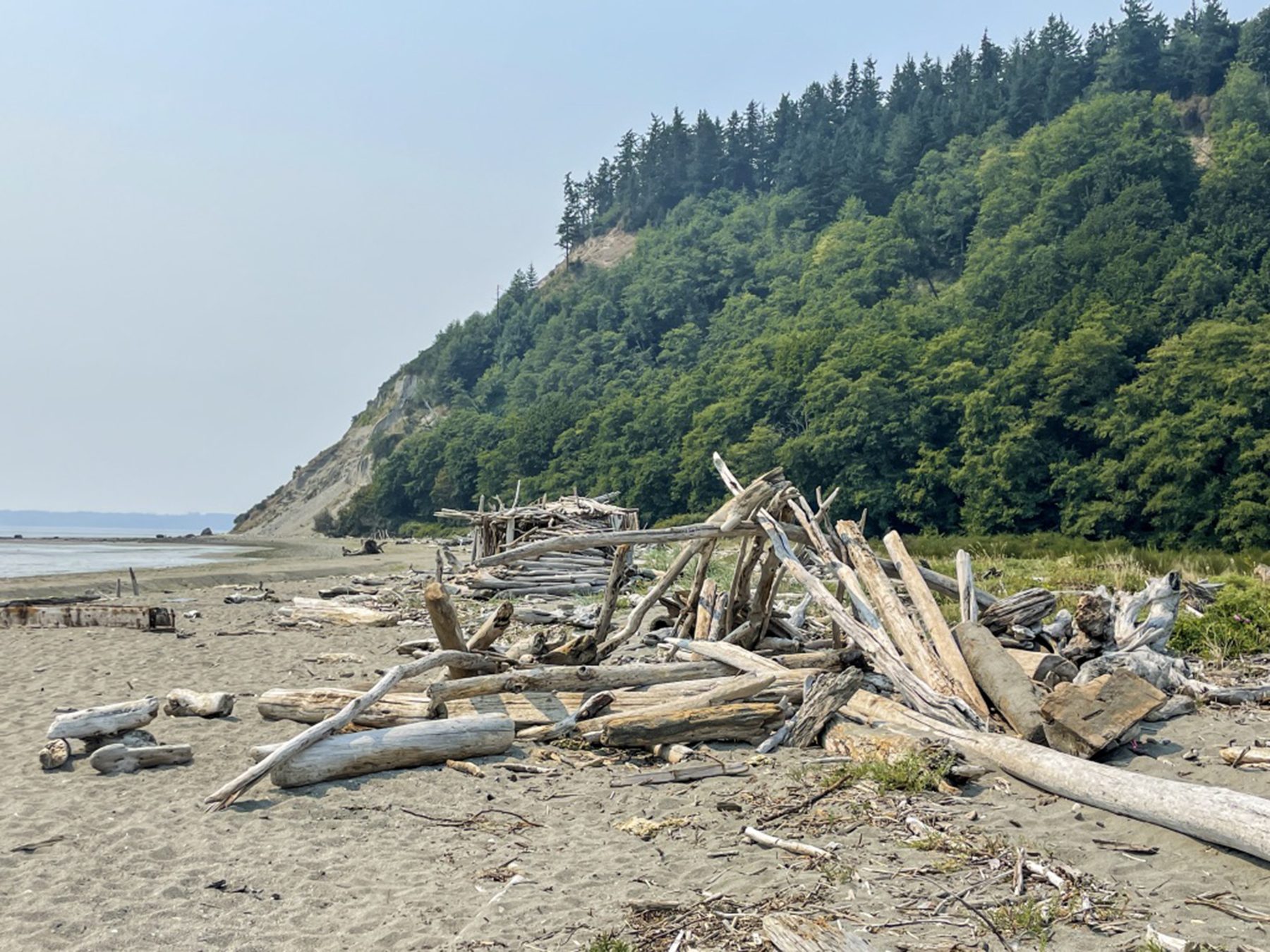
Wading in the shallows, tossing sand dollars, and breathing the fresh air, the serendipity of the unexpected.

.


Recent Comments