Norway, north to south
Posted on October 1, 2025
Never having visited anyplace in Scandinavia was reason enough to explore Norway, a land of stunning topography drawn from a history of plate tectonics and ice-age glaciers, as ocean-centric now as in the time of its Vikings. The straight line coast of Norway is over 1600 miles long, but taking in the undulations of fjords and the circumference of its over 300,000 islands, its actual coastline is 17,991 miles in length. This is a hint at what to expect, and how necessary sea vessels are for getting about. Ours was a curated, self-guided passage built on a suggested itinerary by Inntravel, an outfitter in the UK we have used over the years for less-beaten-path adventures. Getting there and back is not easy from SoCal—San Diego-Montreal-Copenhagen-Bodø, Norway-Svolvaer, Norway…above the Arctic Circle at 68 degrees north and 14 degrees East. The return was Oslo-Copenhagen-Munich-San Diego. Upper Norway is a land of summertime midnight sun and winter perpetual darkness. In September the days were of similar duration to Del Mar, but the celestial bodies favored shallower arcs drifting more purposefully above the southern horizon.
Our outfitter put to rest any worries about conversing in a country whose native tongue has its quirks, including three versions of the “O” vowel of English. And the only one that is pronounced like our “O” is the one spelled as “Å” with a tiny “o” above it, the last letter in their alphabet, btw. English is so widespread and its syntax and pronunciation on a par with right here in Del Mar, that all conversations began with it naturally. We found the citizenry outgoing, friendly and hearty. This is a place of robust elements and the population to go with them.

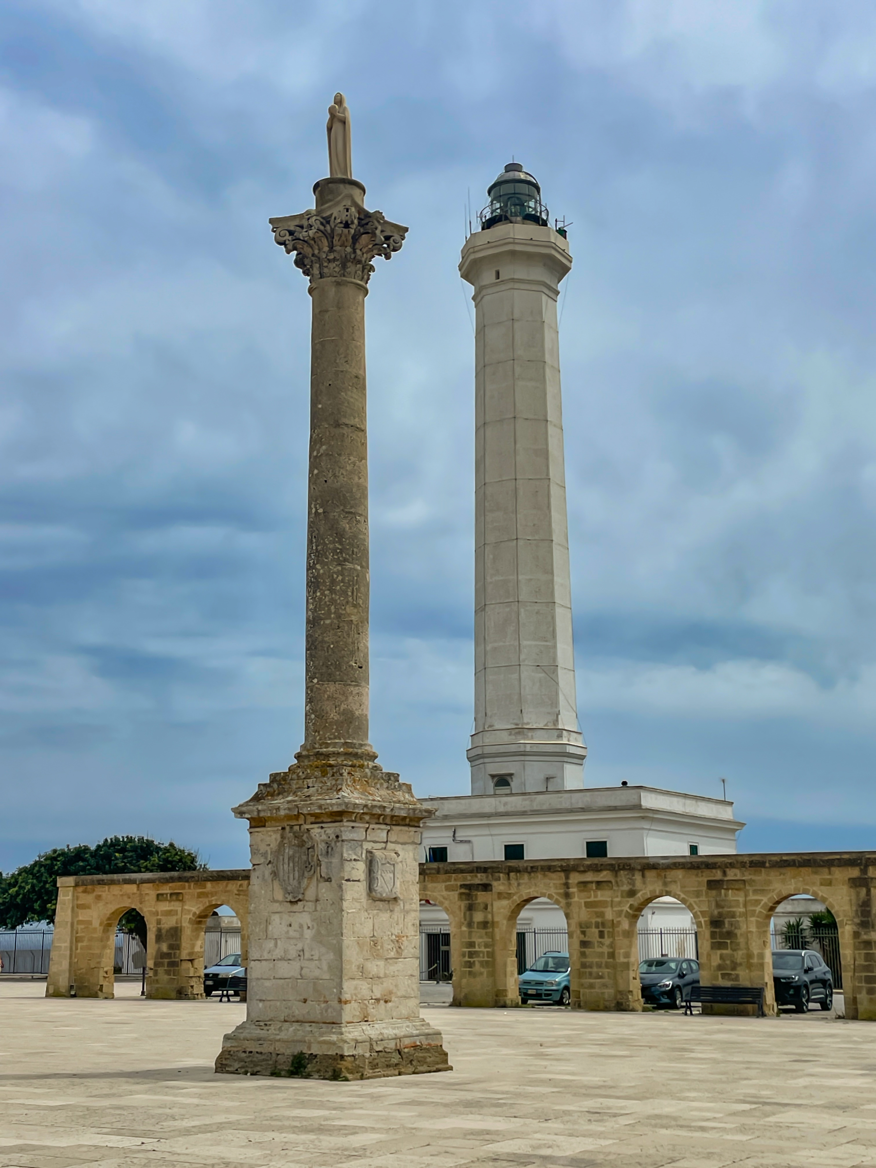
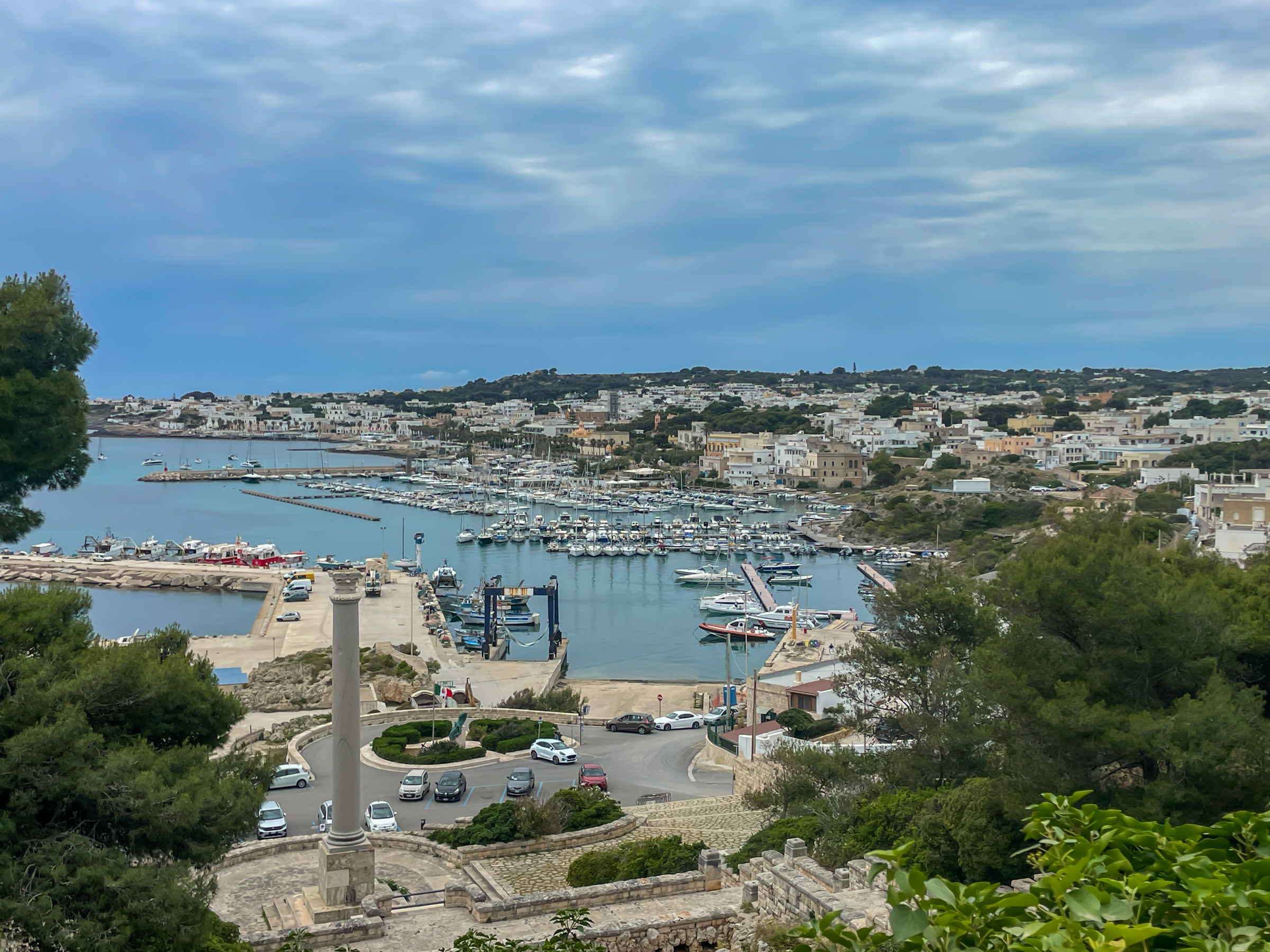
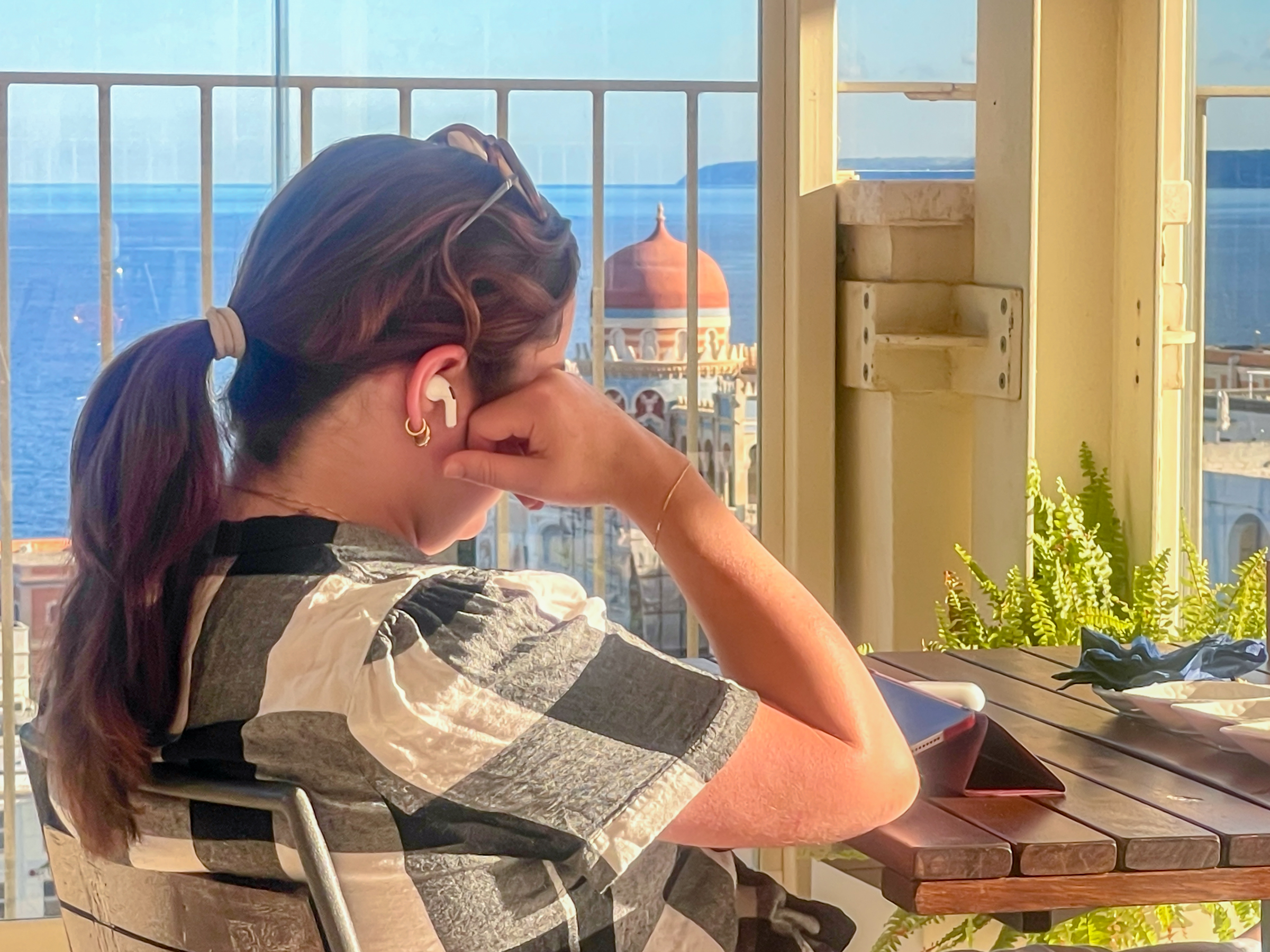
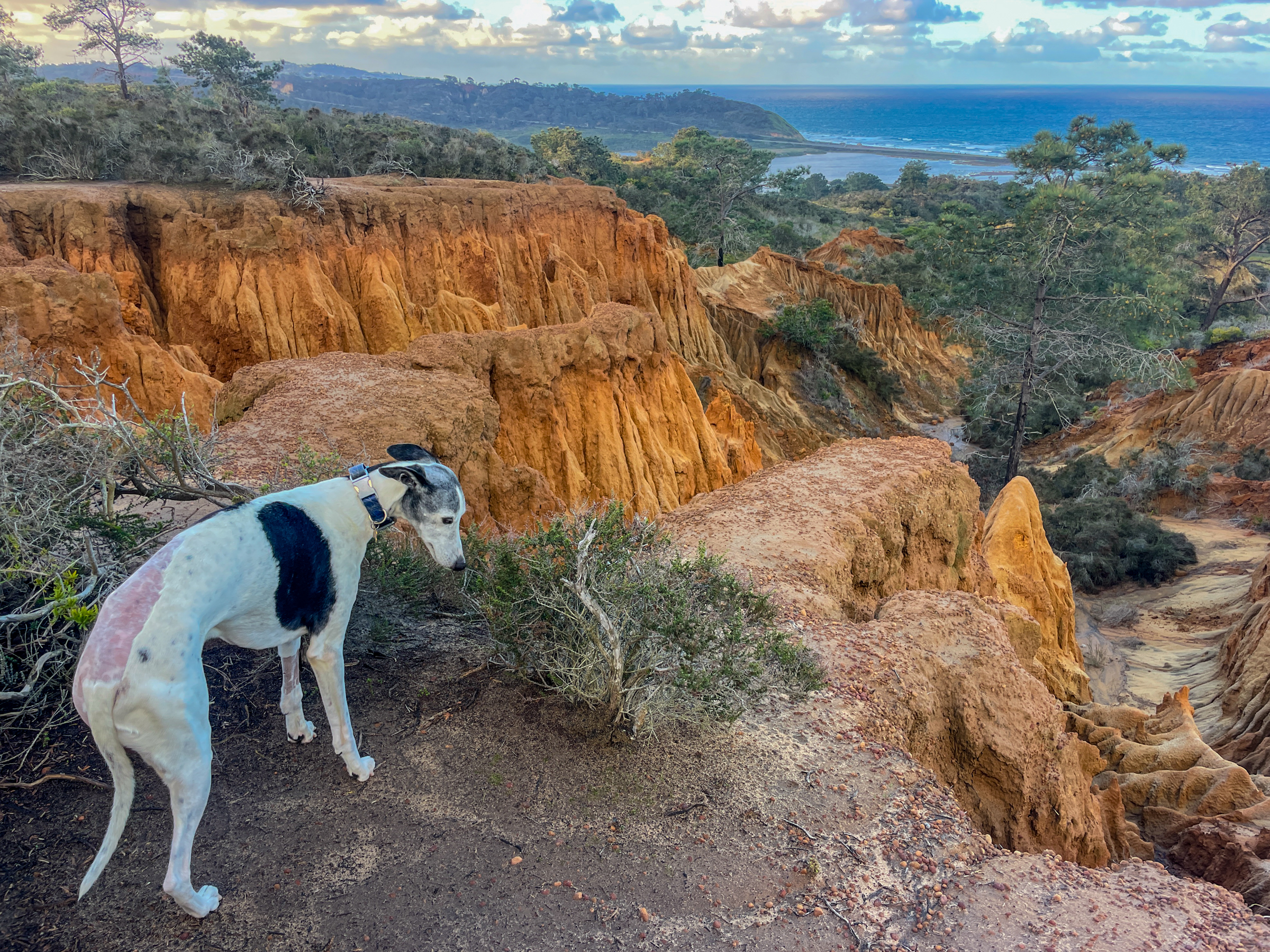
Our Svolvaer lodging, a two bedroom apartment, was on a small peninsula jutting out from the town, proper—the largest “city” in the archipelago of the Lofoten Islands, population 4700. The view, looking south from the balcony of our rooms at 3 AM. The moon never got overhead, staying low to the southern horizon. I was up at this hour in hopes of getting a Time-Lapse and stills of the Aurora Borealis, its green wispy color reflecting in the seawater near at hand, in the above time-exposure.
Turning 90 degrees to the right, the Northern Lights, in full swagger, an ever-wafting dance of the veils above the community’s reflections.
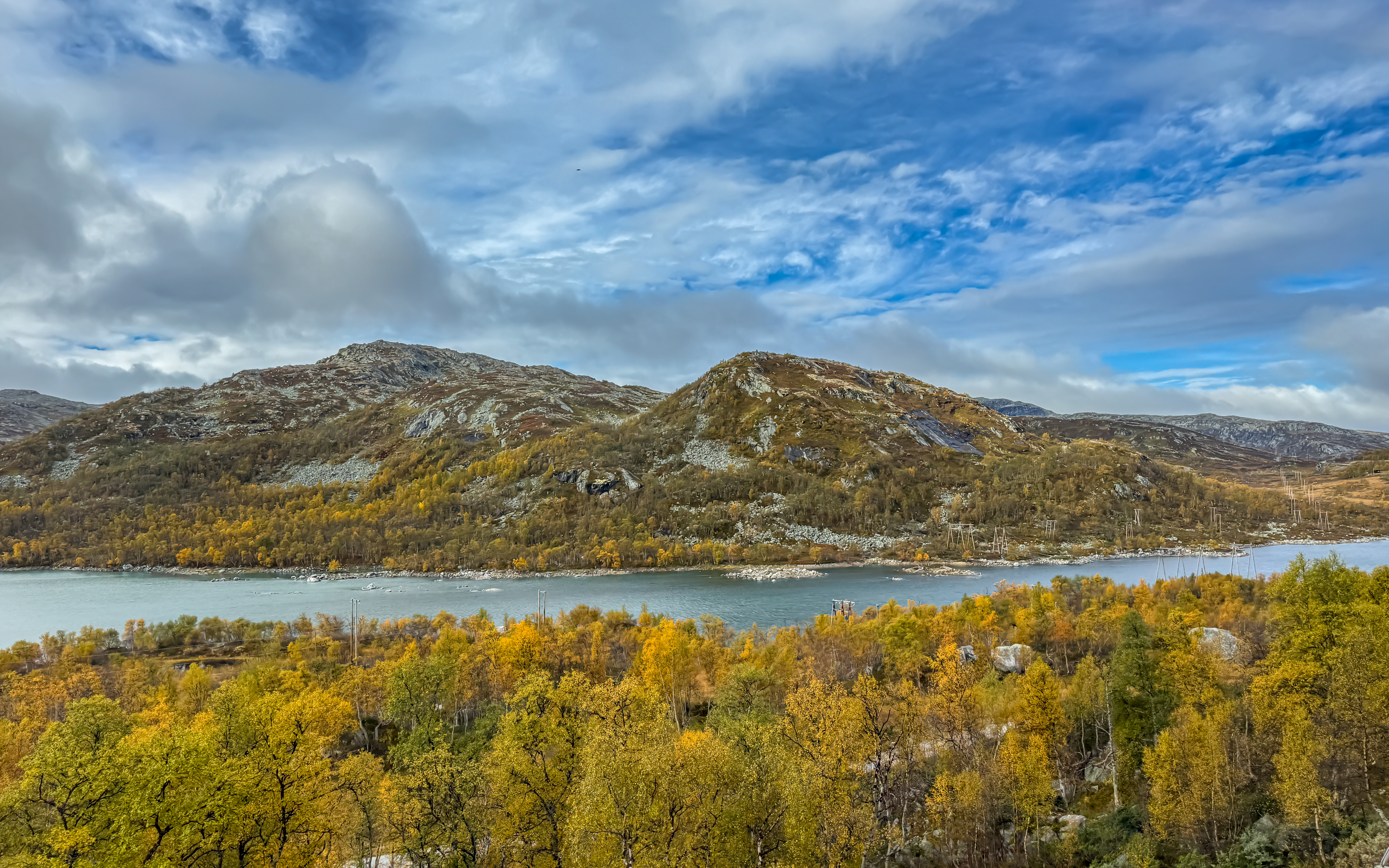
The Lofoten archipelago is comprised of six main islands and countless smaller bumps above sea level. Pretty much everywhere one gets used to jaw-dropping scenery.
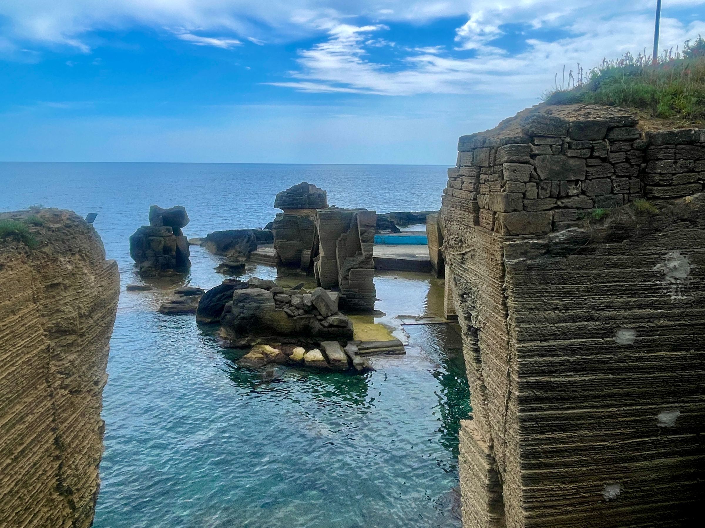
Norway’s west coast is strewn with fjords, like Trollfjord, above. And yes, trolls are part and parcel with Nordic mythology. That Viking thing in another guise.

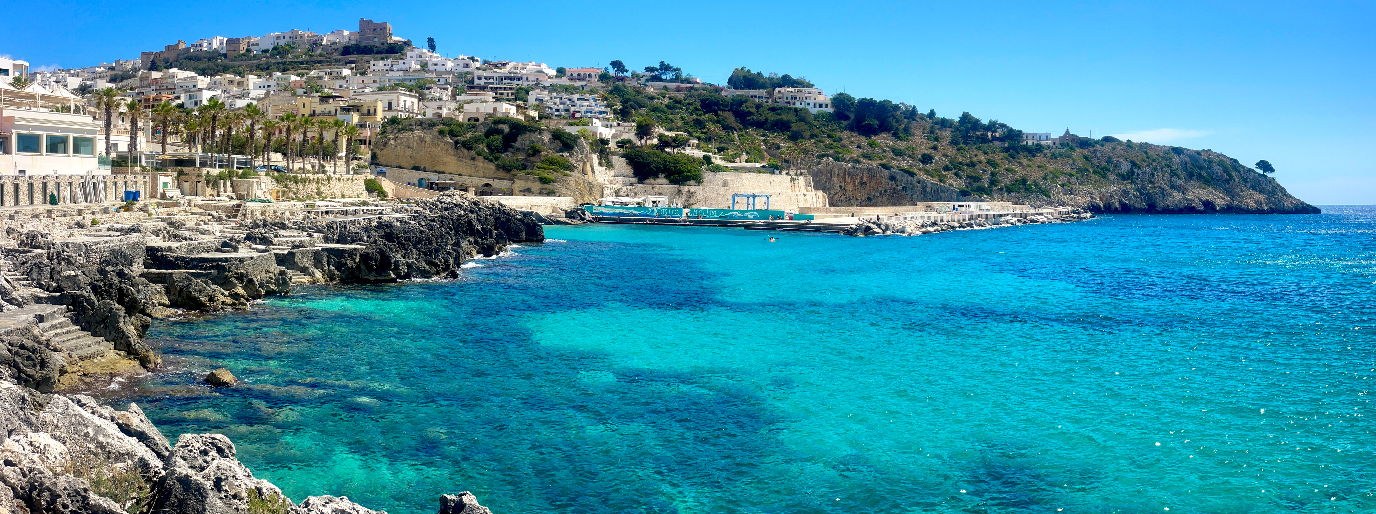
There are other quaint habitations, like Henningsvaer, above, or this inlet a few kilometers away, below. The reflections were so surreal that walking up to get this picture it was actually disorienting—what was rock, and what was reflection? A natural house of mirrors. It’s worth remembering that all of this is seawater, and because the Gulf Stream points right at Noway’s coast, the water temperature felt about like here . I just looked, and as I write, it is 55F in Svolvaer, a bit above our Del Mar winter low.
Above, our last sundown in Svolvaer, before boarding the Havila Polaris, a 179-cabin steam ship running on LNG and electric power, departing at 8:30 PM for a three night/four day passage to Bergen. Not knowing any better, I thought of this as a tramp steamer, given that it made fifteen stops along the way in small coastal and fjord-ensconced villages, the exceptions to “small” being Trondheim and Bergen—Norway’s third and second most populous cities after Oslo. And while I stand by that term, it doesn’t do justice to the refined nature of the Havila Polaris. Neither Cathy or I have ever done any sort of cruise, so I have little to compare with, but this voyage was a mellow passage, always close at hand to jutting headlands, islands and fjords. The views were stunning. The food and drink, and turns around the deck all fine accompaniments.

There are multiple observations to be made here. Norway is a seafaring nation, and has been since the Vikings. That red-hulled ship is a purpose-built vessel serving the oil capture business offshore in the North Sea. Well offshore (pun intended), never seen from our route heading to Bergen. Norway is a highly electrified country, and it gets its electrical energy hydraulically. See pictures of waterfalls, below. The petrochemical take from the sea bottom is sold on the world market to fund the “Government Pension Fund of Norway,” the largest sovereign wealth fund in the world. It is actually two funds, one named as above, and the other, called the “Government Pension Fund Global” where the “global” is a clue to its world-wide investment strategy. Norway, with a population of only 5.6 million, earns money from the oil, and invests that to generate the funds used to run the government and help provide the socially enhanced lifestyle common in Scandinavia. The Krone to dollar math is quite simple for travelers—move the decimal point one space to the left to turn Krone into dollars, e.g. 1,000 NOK more or less equals $100. But sticker shock lurks at the cost of living in Norway for both its citizens and its tourists. A second worthy point to share is the fantastic cloud panoply to which we were treated daily. Unlike our May Gray/June Gloom marine layer blanket, I found the skies routinely showing off four or five layers of clouds, each sufficiently un-overcast to reveal them all. It’s a sky show guaranteed to capture a pilot’s or photographer’s eye.
Below, the wharf area in Kristiansund where we made a one-hour port call. Notice the red forklift which has come out of the red building (a common color theme throughout Norway) and is heading up the ramp to retrieve cargo or to send cargo for on-shipment. Ditto passengers via a separate ramp. The dark-hulled and white superstructure vessel is an auto ferry. They are all over the place along the coast because the fjord-gouged terrain does not lend itself to N-S roads. Anyway, this is supporting evidence to that tramp steamer title to which I default.

Under the heading of “Pilots and Skyscapes” this is one which training teaches aviators to avoid. That is a definitively robust downburst going off just beyond the headland. We rounded the point and took up a courses to the left of the rain shaft. This was a day when there was a shore excursion offered, but which was already full two days ahead of time when we heard of it on boarding the ship in Svolvaer. The excursion was a bike ride to someplace south of Kristiansund, and then transfer to a speedboat to race at high speed to the Havila Polaris as it trundled south at a less clamorous pace. From this, I’ve learned that seasoned cruise passengers select cruise excursions online once one’s bookings are completed, and in this specific case, I take pleasure in not being one of the fool-hearty cruise excursion cognoscenti. Their attire probably needed laundering by the Polaris’ crew that very evening.

Someplace along the west coast of Norway, I haven’t a clue where. Nice sky?

Torghatten mountain, pretty much comprising the entire island of Torget at which we gawked outbound from Brønnøysund. From the backside, it’s just your run of the mill massive rock peak, but from this side, that shadow on the vertical face is a gigantic cleavage in the peak, and at dead center, you can see through to the other side via the natural tunnel that is 35 meters high and 160 meters long. It is a common hiking site in the area, presumably accessed by boat. Given our rocky proximity, perhaps this is a clue as to the importance of careful oceanic navigation, and how abruptly the seashore drops into the depths?

Later that same evening we were treated to yet another near-full moon moonrise, three o’clock in the frame. There’s another of those North Sea platform-service ships. In Bergen I spoke with a crew member of such a ship and learned that they are actually capable of pulling up a drilling platform after closing down the underwater well base, and carting it all to another drilling location to start a new well. Ingenuity.

We arrived early in the morning in Trondheim, founded as the capital of Norway in the Viking times of 997 by the first of two King Olafs, both of whom were instrumental in advancing Christianity in the country.

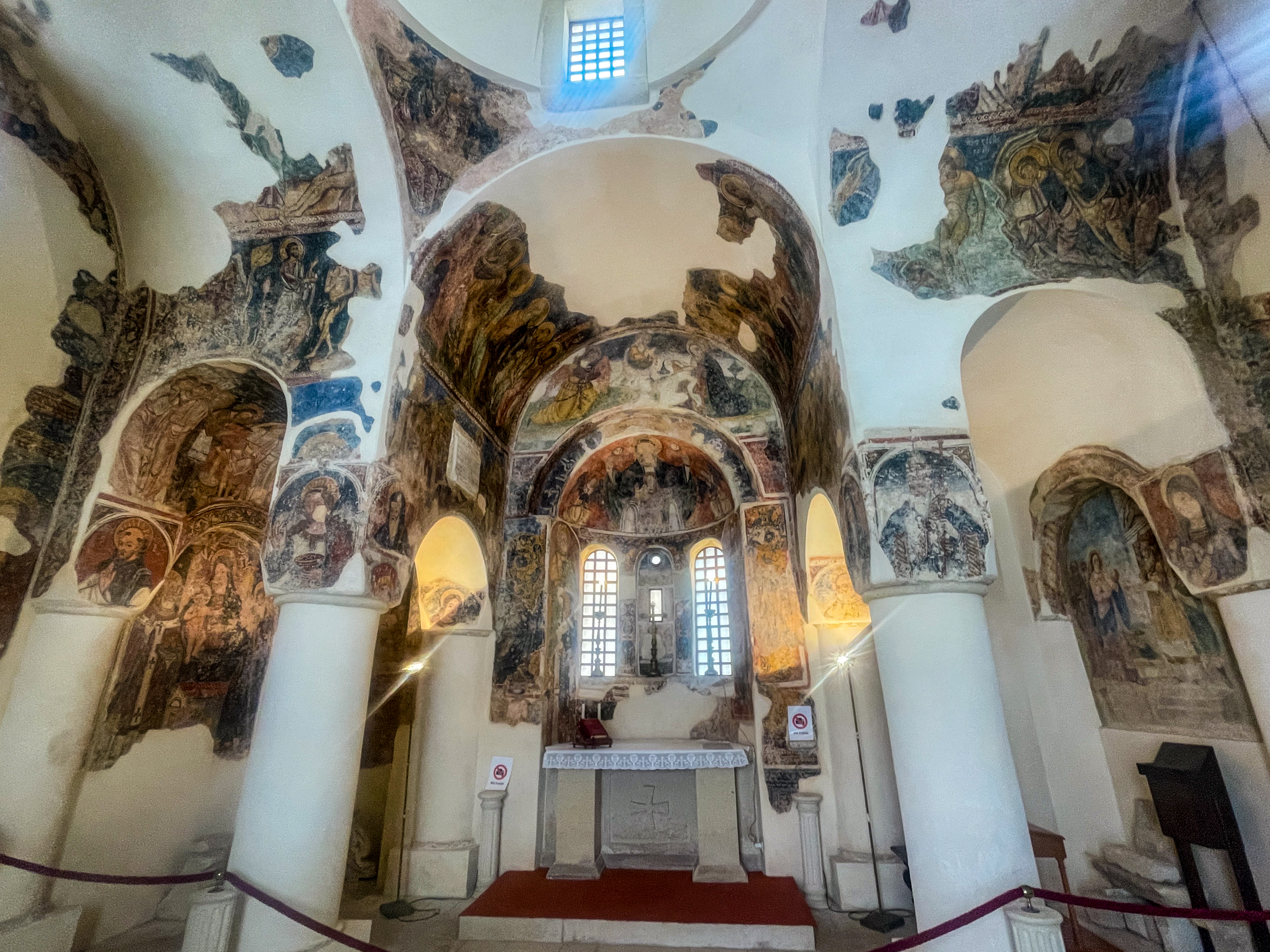
Trondheim was originally called Nidaros, still the name of its beautiful Cathedral, with its vaulted ceilings and three organs, the largest of which has 30 stops for its 1809 pipes. Herewith, a segue to a further sharing of my ill-fit for cruising. When we arrived at those port destinations during civil daytime hours there was sometimes the opportunity to join an organized exploration program, but also we were free to follow our noses to whatever looked promising . The latter generally comports more closely with Cathy’s and my inclinations, but nonetheless runs up against my “there goes the neighborhood” concern. Passengers raced to be first off the ship. I’m ill disposed to join that stampede, but even hanging back and walking slowly, there was no escaping the feeling that we were sullying the ports. Sigh.

Our steamer transport concluded at Bergen, a World Heritage site, and taking over as Norway’s capital in 1299. Its inner harbor demonstrates multiple lighting moods, all of them luscious. A little gastronomy and history. No surprise that fish are an important part of Norway’s diet. A local delicacy is referred to as stockfish—actually cod, fished in Lofoten waters and then dried, hanging on large outdoors open-framed hjell racks during the winter months. In pre-refrigeration days this avoided salting as a means of preservation. An important source of protein, especially in regions where Catholicism meant Friday and festival fasting on terra firma meats. The dried stockfish was vessel-shipped to Bergen, a vital port for commerce throughout Western Europe and the British Isles. Its inner harbor, seen in the next frames, is actually called Bryggen, a bustling area in the Middle Ages with its various trades being plied by the German-derived Hanseatic League. Bryggen’s etymology is from the Norwegian word for “wharf,” and those colorful structures are built to the edge of the water, and beyond, as successful commerce spawned expansion.


Yes, I’m fond of lunar overwatch scenes, as with William Blake’s “the moon, like a flower in heaven’s high bower, with silent delight, sits and smiles on the night.”

We had two nights and three days to putter about Bergen before slipping aboard a high speed catamaran to take us some four hours up the Sognefjord, Norway’s longest, second longest on earth, at 205 km in length and over 4200 feet in depth.

Destination Balestrand. The view from our room at Kvikne’s Hotel, a lodging from the 19th century and thus reminding me of the Hotel del Coronado.

The Del Mar geezer taking in the scene with King Bele of the early fourteenth century. Picture by Cathy. I’m sitting on the bench back (not the UK Parliament’s back bench) because the seat bottom is rain-wet. Staying fanny dry while taking in his view.

Nice scene, your highness. Sognefjord, a local auto ferry finding a pot of gold.
Balestrand is gorgeous, but small. What to do? Hike that ridge to the right in the destination picture above. I’m getting long in the tooth, but I did successfully climb the 1500 feet in some 4 km of up trail, leading, gasping and sweating, with only modest sotto voce grousing….
…to this exemplary view of the upper reaches of the fjord. Waay down there at about 7 o’clock in the frame, the tiny rectangular bump at the shore is our lodging—Kvikne’s Hotel. Looks eensy-weensy from up here.

The same vantage point, except from fjord water level the next day. Looking directly up the Aurlandsfjord, an extension of Sognefjord, leading to Flåm, our next destination.

When in Rome, do as the Balestranders do. This is apple growing country, and the delicious fruit was literally falling off the trees, and then in-town processed into cider.
Following our 1500 foot climb, the trail back emptied into a quiet street on which was Ciderhuset, Cider House in English. Cathy chose a tall cider, and I opted for a cider flight to go with our lunch. Mildly alcoholic according to the chemical analysis, but without perceived effect on the body. Well, okay—after lunch and the final one mile stagger back to Kivikne’s, we availed ourselves of an afternoon siesta. But only because of the hike, surely not enhanced by the cider?
Decamping from Balestrand we took one of the high speed catamarans up the Aurlandsfjord to Flåm, the ship slowing for all of us to marvel at Brekkefossen waterfall. A fine example of how Norway has the means to meet its electrical generation needs with moving water.
Flåm is another outdoors activity haven. We chose to take the Flåmsbana railway the 20 km up valley to Myrdal for an out-in-the-elements return to Flåm. The electrical train stops a short distance from Myrdal to let us passengers stare wide-eyed for :10 at the power of Kjosfossen waterfall with its 305 foot free fall, its deafening roar matched only by the water-strewn air quickly soaking clothing and misting camera lenses. In a nod to tourism sensibilities during this stop the air suddenly comes alive with the tie-me-to-the-mast siren song of Huldra, a forest spirit from Norse mythology whose intention is to lure men into the woods and seduce them. Alongside the tracks, she is portrayed by a woman in red, very near the center of the frame at 3 o’clock in red. Quite the showstopper. I volunteered to join her in the spirit of the production, but Cathy nixed the idea…

The valley views from the train are hard to beat…

…but are nonetheless eclipsed by the views on foot and by bicycle. Near at hand, the steep switchbacks we hiked after disembarking. The train tracks rise 1 foot for every 18 feet, this descent is steeper yet, hence the switchbacks. We had to mince along being careful of our footing to keep from sliding downhill on our bums.

Another of our luck-outs was being there as the fall colors began showing off. Nice trail hike.
After nearly 5 km of downhill hiking we switched to our rental bikes awaiting us at a farmhouse for the 15 or so klicks back to Flåm. The views continued, unabated. Ye olde bike path.

Resting on our laurels to suck up some splendid mountain air. Waterfalls everywhere.

The next day we returned to Myrdal on the Flåmsbana, but now to connect with the Bergen to Oslo train, some five hours duration along an elevated plateau, with its own attention-grabbing views. Just a few km beyond this scene we passed Finse, with its Hardangerjøkulen glacier. Good thing the Norwegians speak English!
Following our afternoon arrival in Oslo Sentralstasjon we used our phone maps (let’s hear it for T-Mobile devices connecting seamlessly in over 200 countries world-wide) to walk to our Thon Hotel Rosenkrantz, then back out the door to explore. We mostly confined ourselves to the mid city and the area near the harbor, including the Nobel Peace Center,

…and the busy waterfront…

…including the Akershus Fortress, with its splendid Resistance Museum, detailing the many small and large resistance and sabotage efforts of the Norse patriots between 1940 and 1945 including their commando destruction of the German heavy water program seeking to develop a nuclear weapon—patriotism and courage worthy of salute.

Later that afternoon, we puzzled out a local train option to the airport, where we caught our flight to Copenhagen in readiness of the next morning’s early flight to Munich and on to Lindbergh Field. Yes, I know it is formally called San Diego International, but it is also where Charles Lindbergh’s Spirit of Saint Louis was made and is still an official name of the aerodrome. When you’ve got it, why not flaunt it?
Torrey, who had held the home front together in our absence, arrived curbside just as we came out of Customs and Immigration. Bogart promptly went bonkers at having us back home. It was reciprocal.
A Moveable feast
Posted on June 6, 2024

Apologies to Ernest Hemingway. The title refers not to struggling Parisian expatriate journalism, nor any unfixed holy date. No, I’m using the term literally. See, we Del Martians have just returned from two weeks of inn-to-inn hiking in Salento, the heel of Italy’s boot. Italy, where fine dining is a way of life. ‘Tis a several miles of walking each day, batteries needing recharge with gustatory abandon, a When in Italy, Do as Italians Do sort of thing.
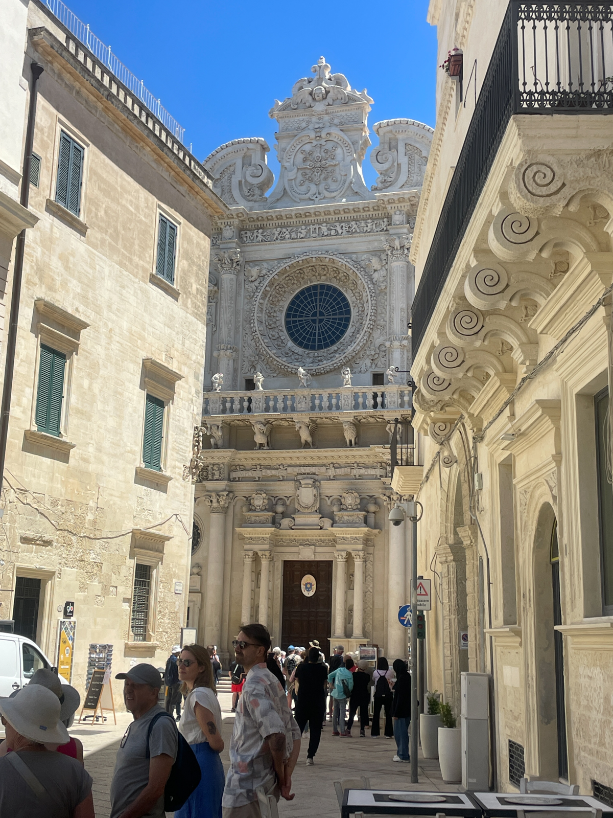
United to Rome Fiumicino/Leonardo da Vinci International Airport. If you’ve got it, why not flaunt it? Airport shuttle line to Rome Termini, and then distance train to Lecce, Puglia, along the way enjoying olive groves rushing silently by. That day’s destination pronounced “Leh Che, Pooliah.” Salento is the southern half of the Puglia region. In Italian, be sure to pronounce all those vowels, and they are more or less every other letter. This produces a lilting sing-song up and down bouncing ball pitch of the spoken voice, and a MLB change-up cadence in keeping with fine opera, no doubt why we love Puccini and Verdi?. Try it now. Say Leonardo… “Leh Oh Nar Dough” and don’t you just feel like Pavarotti in the shower? Puglia is agrarian, producing 70% of Italy’s fruit and vegetables, a third of its olives and olive oils, and a significant portion of its wine, including Negroamaro, a regional varietal, and quickly a favorite or ours. Considered the Florence of the south, Lecce has been inhabited since at least the Fourth Century BC. And I should mention that Lecce is the southeastern terminus of the original Apian Way. All roads lead to, or from Rome.
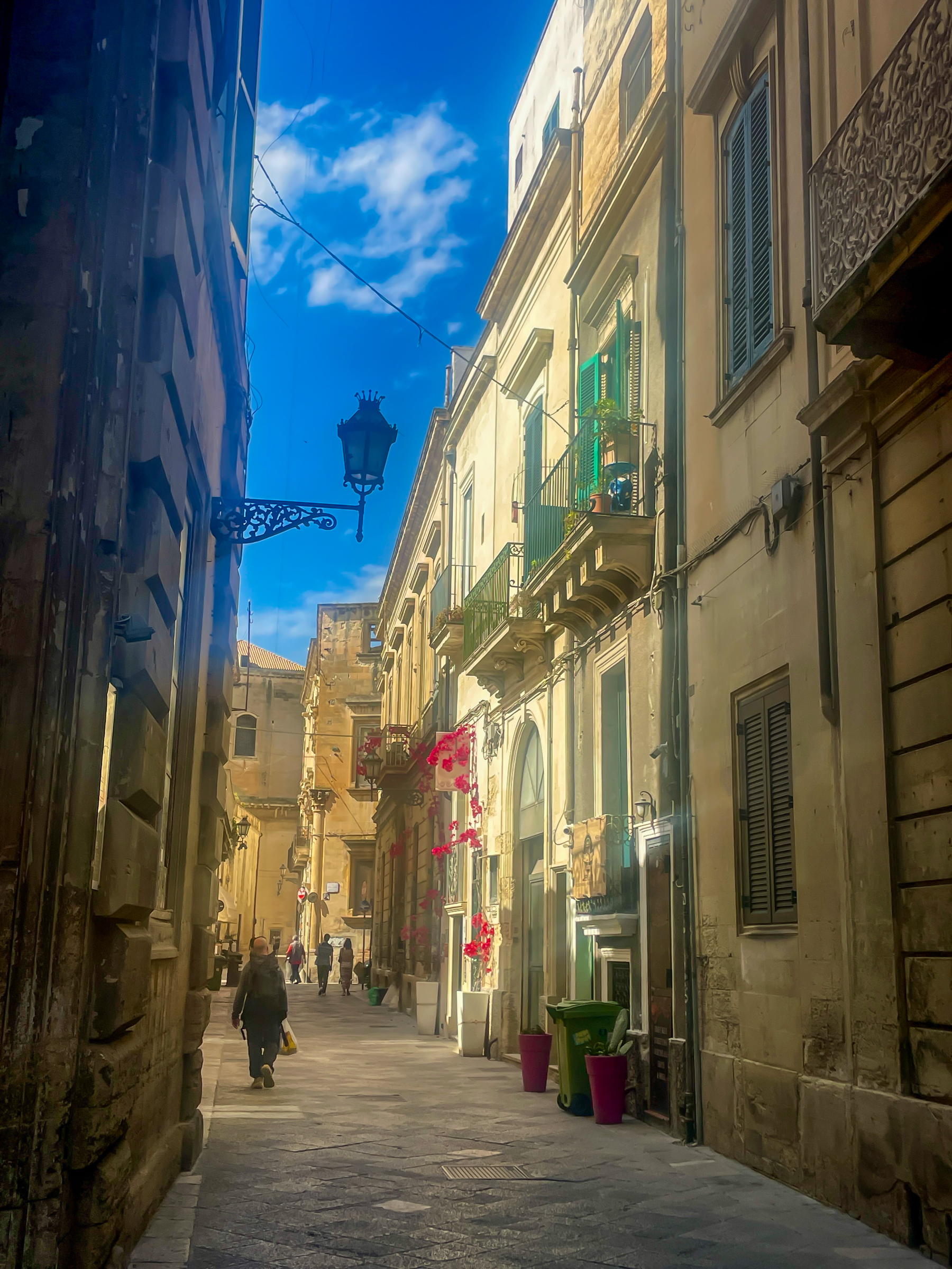
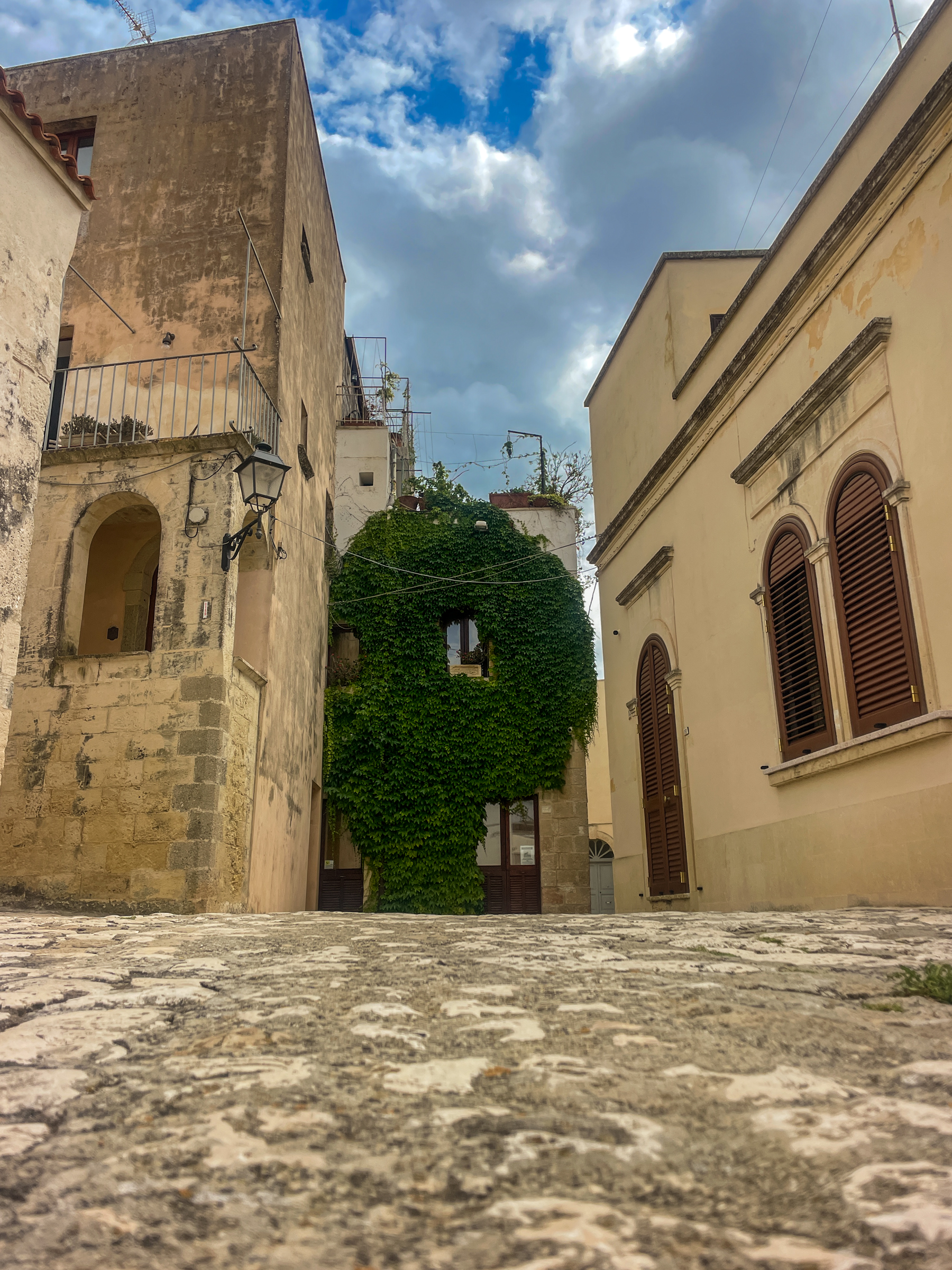
That train ride, a milk-run to Lecce was nearly six jet-lagged hours, of olive groves and tiny towns, then a walk of a quarter hour through the labyrinth of narrow stone-paved lanes to reach our first lodging, Palazzo Rollo, its arched opening on the right just shy of the bougainvillea. Torrey, Cathy and I shared a two-bedroom suite with living room and kitchen. Our outfitter—Inntravel, from the UK, listed this curated, unaccompanied trip as Pathways of Puglia, and this narrow lane fits the bill as a tasty appetizer of things to come. https://www.inntravel.co.uk/walking-holidays/italy/the-south/puglia. Throughout Salento, streets and walkways were without wafting trash and dog logs, absent of graffiti except near train stations, and restrooms in even the tiniest trailside hamlets were clean and equipped with all the niceties. Civilized.
Palazzo roughly translates as palace, apt in this case. The entrance, a calm haven in the midday sun. Lecce has many guided walking tours, and the Rollo was a routine stop, crowds held discretely back by that rope.

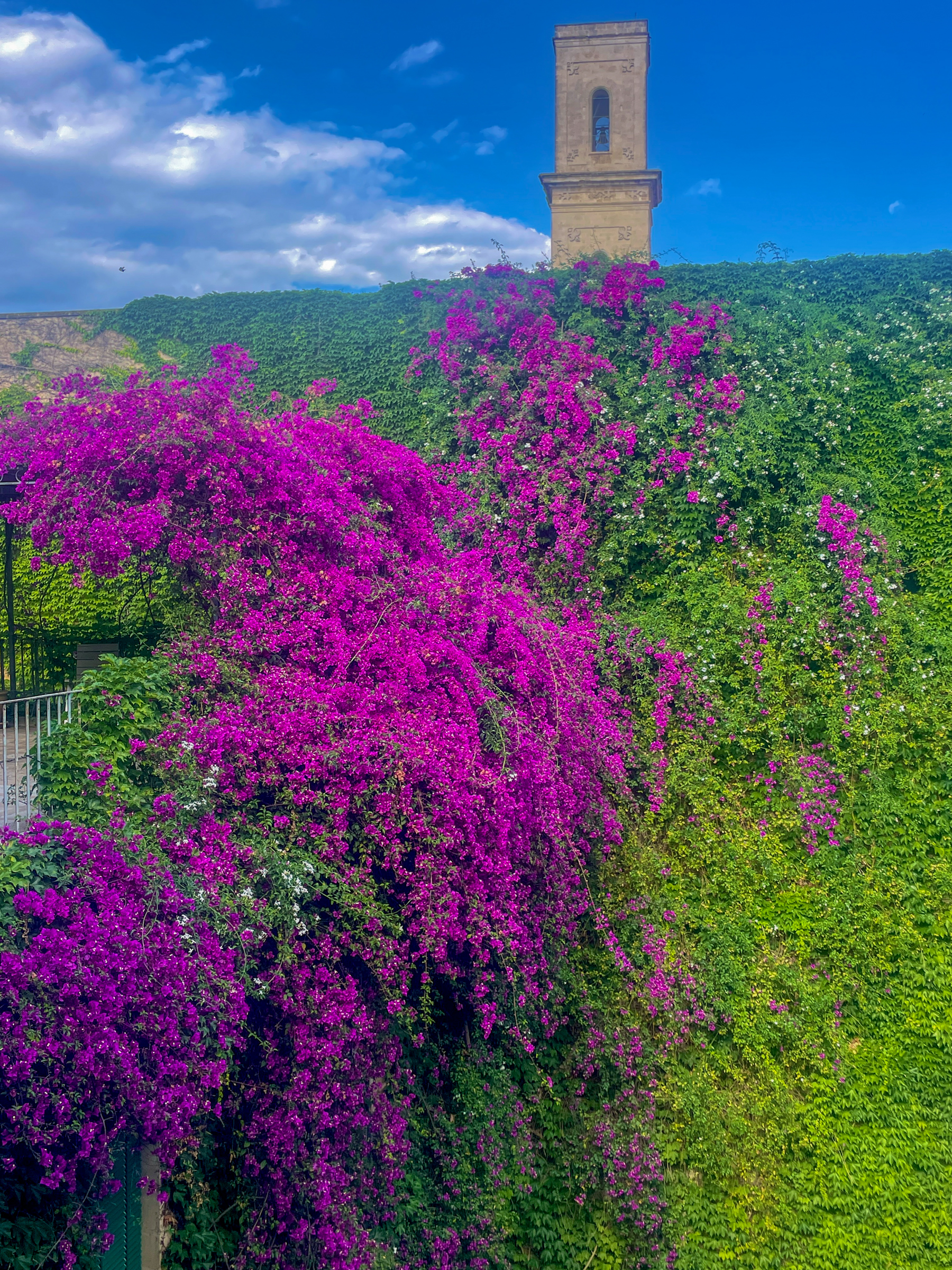
With lovely views from our room of the neighboring Campanile at Piazza Duomo both during the day…
…and at night…full moon rising on the left, seen from the two- floors-up rooftop bar and lounge area.


If you’re reading this, you know me well enough to acknowledge that my Del Mar roomies are foodies? Italy. Food? So, of course, one would expect the ladies have researched and reserved a cooking class. “The Awaiting Table” conducted by acclaimed chef, sommelier del vino, teacher and raconteur Dottor Silvestro Silvestori. We rendezvoused by the amphitheater for a day-long cooking and dining and wining extravaganza, regaled with stories and facts from a unique Puglian perspective. Then a saunter through the old quarter to the green grocer, and next the fish monger before repairing to his school. Everything for today’s class was growing or swimming just hours ago. That movable feast thing.
Today’s class was on making fresh Puglian regional orecchiette (sing it aloud, Luciano) pasta—semolina and barley shaped into little cups and strings—to which will be added for simmering, eggplant, muscles, fish, calamari, and spices. All of it accompanied by aciete de olive. Very virgin aciete de olive.
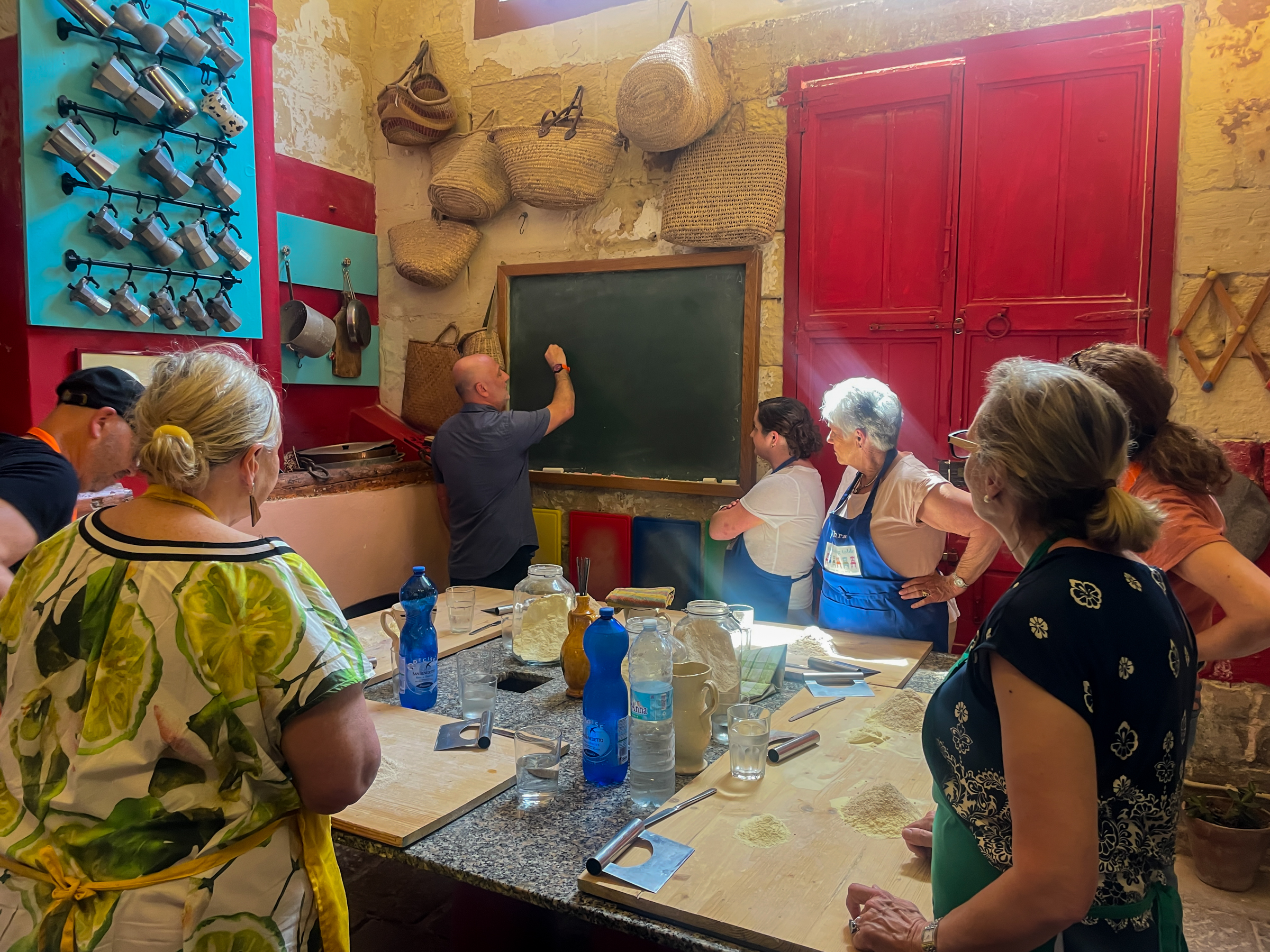
As the meal preparation ended, the serving dishes were taken from the kitchen to the proof of the pudding is in the tasting room for a sumptuous mid afternoon multi-course lunch accompanied with yet more olive oil, and of course fine wines, Rosé being a local favorite. Today’s seven students broke into subgroups to share with one and all each of the many preparatory steps. A little more vino, perhaps? Fueling up for the next day’s commencement of actual inn-to-inn, community-to-community walking.

Of course you know of my inexperience with any cooking involving more than three steps? So what did I do besides observing from the periphery and snatching the occasional photo? I frequently repaired to a handy sofa joined by Dottor Silvestro’s dachshund, Salciccia (Italian for Little Sausage) who took sufficient liking of me as reason to invite herself up for schmoozing. Which reminds me of a dachshund my sister used to have and named Johann Sebastian Bark. I can’t help how my mind works. A blessing. A cross.

The next day after breakfast at the Rollo, we walked back to the Lecce station and boarded a train for Gagliano del Capo, transferring there to an Inntravel pre-arranged cab which delivered us to Santa Maria di Leuca, literally Fine Della Terra—Land’s End. The sole of the boot heel. Where the Ionian Sea to the west abuts the Adriatic Sea to the east. Politely ensconced along the quay with our daypacks by our non-English-speaking friendly and professional driver, who then proceeded with our roll-aboards to Masseria Alcorico. Those suitcases, always taxied without us, would be waiting at that day’s destination either in reception, or typically in our rooms.
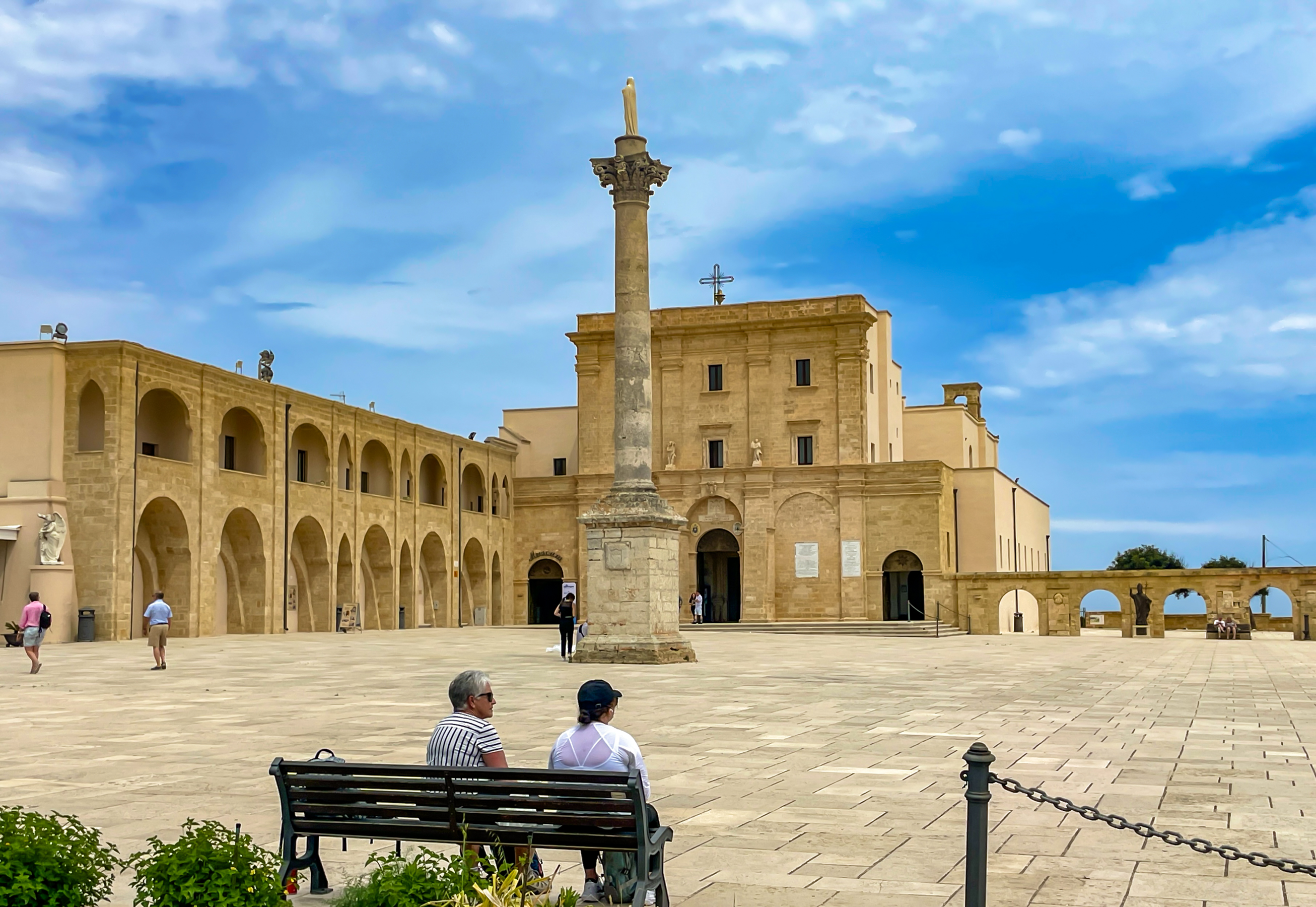
A brief stop at a quayside café for a few add-ons to our Rollo-prepared lunch and then up the steps to the Santuario di Santa Maria for a piazza bench picnic next to the land’s end lighthouse. Crowds? Not so much.
After lunch we continued following the Inntravel written instructions along country pathways on a bluff not unlike the near-the-coast mesas of Del Mar and Torrey Pines. “Along this next stretch (still a surfaced lane) you’ll start to see a number of cone-shaped, but flat on top, stone pajare in the fields…once ancient dwellings and have long been used by field workers…particularly [during] the olive harvest.”

“Follow this country road for 550m to arrive at a X-roads with [a] cycle track sign. Continue SA [straight ahead] here. After a further 300m, pass a road leading off to the R…”
Inntravel specializes in curated unaccompanied walking and biking trips. They arrange for the inns and the taxis…trains and planes, if needed. Their directions are written, and generally quite explicit and up to date. Nowadays they have a GPS program one can download and place into an appropriate mobile device. I’m unfamiliar with the program, and Inntravel reiterates that their written directions are the relevant navigational guide. I’m a Gringo, familiar with English measurements and these are Metric, but I can multiply kilometers by .6 in my head to get miles, then use my octogenarian pace on multi-mile hikes of about :25/mile to calculate a time to the next nav waypoint in the directions. Important when trails are more obscure and trailside overgrowth from Spring rains challenge visibility. A similar technique for distances in meters. A meter is 39.7 inches or about 3 feet. Those 550m mentioned above, multiplied by 3, equate to roughly 1650 feet, or about 0.3 miles when divided into 5250 feet. Multiply 0.3 by :25/mile and you get :07 to :08 from the preceding waypoint to that bicycle track sign. Dead Reckoning is the term in Pilotspeak. Doing it in my head while walking. I had a couple of great audio books in my I-Phone, but didn’t feel I had the mental bandwidth to enjoy the story and not get lost.
“Another 350m brings you to a TJ [T-junction of two pathways] (with sign and Tel no. for Masseria Alcorico here). Turn L to arrive at the Masseria on the RHS [right hand side].”

A few other informative tidbits to share. Masseria is a colloquial for “farm.” Many, like Masseria Alcorico are still a part of the working agrarian regional life in which they are located, but have joined what must be a government-sponsored program known as Agriturismo. You get it, an amalgam of tourism in an agricultural cultural setting. Upscale agricultural, if you get my drift. This day was our shortest, but also possibly our warmest, the temperature somewhere a tad above 25C, or upper 70s F. I made a point of sipping frequently out of my Osprey daypack hydration system, but was still hot, knackered, and thirsty by the time we reached Alcorico in the mid afternoon. Alcorico has a pool. And a full service bar. A quick pitstop in the room, down to my nylon hiking shorts, and off to the pool. Refreshing. “Ana birra, per favore?” Also refreshing, and almost adequate to my trail dust thirst. Almost. I decided vacationing in Italy was authority enough for a second brewski, poolside. I hadn’t yet learned the Italian word for second, which I now know is seconda, quite similar to the Spanish segunda, which I already knew. I gestured like a mute bozo for another and requested “due,” meaning two, as in a second beer. She brought me just what I asked for, of course. Yup, two (due) more beers to go with the first still being consumed from the chilled glass. Along with peanuts and those roasted fava beans that are bar beverage staples in the region. Okay, due (doo eh) means two, seconda means second. Babel translation eat your heart out. I saved the third brew in our room fridge and took it to dinner later. Around 8-ish in Italy. Oh yeah, the second beer quenched my thirst. At least until cena (dinner). Moveable feast.

Breakfast in all of the inns was a variation on the European model. Cappuccinos for the ladies, juice for His Geezerness. Along with bottled acqua minerale—still for the ladies, “fizzante” for me. Tables with cheeses, meats, cereals, granola, yogurt (a particularly delicious and creamy local version somehow mixed with honey), and several varieties of breads, rolls and pastries. I fell, tastebud over tastebud, for a local delicacy, the pasticciotto, an oval shaped semi-soft outer surrounding a custard filled inside. Mouth watering. And thence, submarine sandwiches and fruit loaded in our daypacks, to commence the next 7 to 9 miles of penance from last evening’s feast and self-flagellation preparation for this evening’s feast.
The picture at the outset of this missive is from this next day of hiking. First, a hike along the rural mesa so we could navigate the narrow byways of ancient Gagliano del Capo to exit eastward toward the Adriatic, and down the gorge conveyed in that image sometimes with handrail protection, sometimes not, leading first to glimpses of the sea, and then a no holds-barred nearness to the water lapping at the typical Salento rugged rocky shore.


This stretch was a footing challenge for the three of us. Very uneven ground, a mixture of rocks and dirt. Quite literally ankle-challenging. A good place for walking sticks, but we’d left ours behind as we journeyed with only on-board luggage. Those pointy sticks not blessed by the TSA for the passenger cabin. It went on for rather a long time, but no complaining as to scenery.

After 7 miles we finished in Corsano with a pre-established 3:30 PM pickup at Piazza Santa Teresa by our friendly taxi driver and driven to our next lodging—Palazzo Mellacqua, in Castiglione di Otranto. Another “palace” unimaginable from outside on the street, demurely revealing its elegant petticoats once through the front door. Husband and wife innkeepers who spoke about as much English as I do Italian, but their comportment said it all. So happy to have us as guests, so polite and solicitous, and justifiably proud of their beautiful inn. A birra (becoming a regular post hike event) as we chatted and planned a sumptuous dinner in their elegant restaurant. All of this in a small town with a population of maybe 2,000?
And here’s another moveable feast glimpse at Italian dining culture. The meals were regularly multi course affairs. Aperitvo time for charcuterie…perhaps a seconda birra for me, Prosecco for the ladies? Decide on the first course and the second. Which wine or wines would please us? Something dolce to finish? The innkeepers’ adult daughter was rumored to run the restaurant, but it sure seemed to be the husband who waited table on us, and his wife in the kitchen. M’ladies chose some sort of fish thing as their seconda course, and I elected beef, which brought a question of how much would I like? Not a question I recall being asked in these parts. Some confusion here, resolved by him bringing me out a slab of beef about three inches thick, fifteen by eight inches in planform. He gestured suggested dimensions of my steak, beginning with nearly half of it. I finally talked him down to maybe a fifth of it. And this is how it came out. My only regret is having only one stomach and set of coronary arteries for my tastebuds. A little more Negroamaro, signore? And their fish, a sea bass if I recall, was every bit as big.

The next morning our cab took us to Piazza della Vittoria, a lovely square in Marittima, from which we headed back to the coast in Castro.
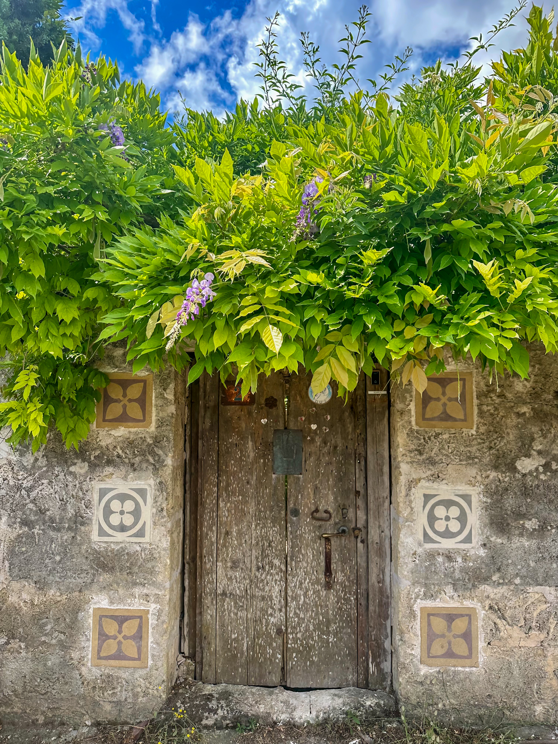
This pathway yielded yet more glimpses of Italy’s quiet side, coming upon another stone-walled lodging with the added flavor of the ubiquitous Vespa scooter…
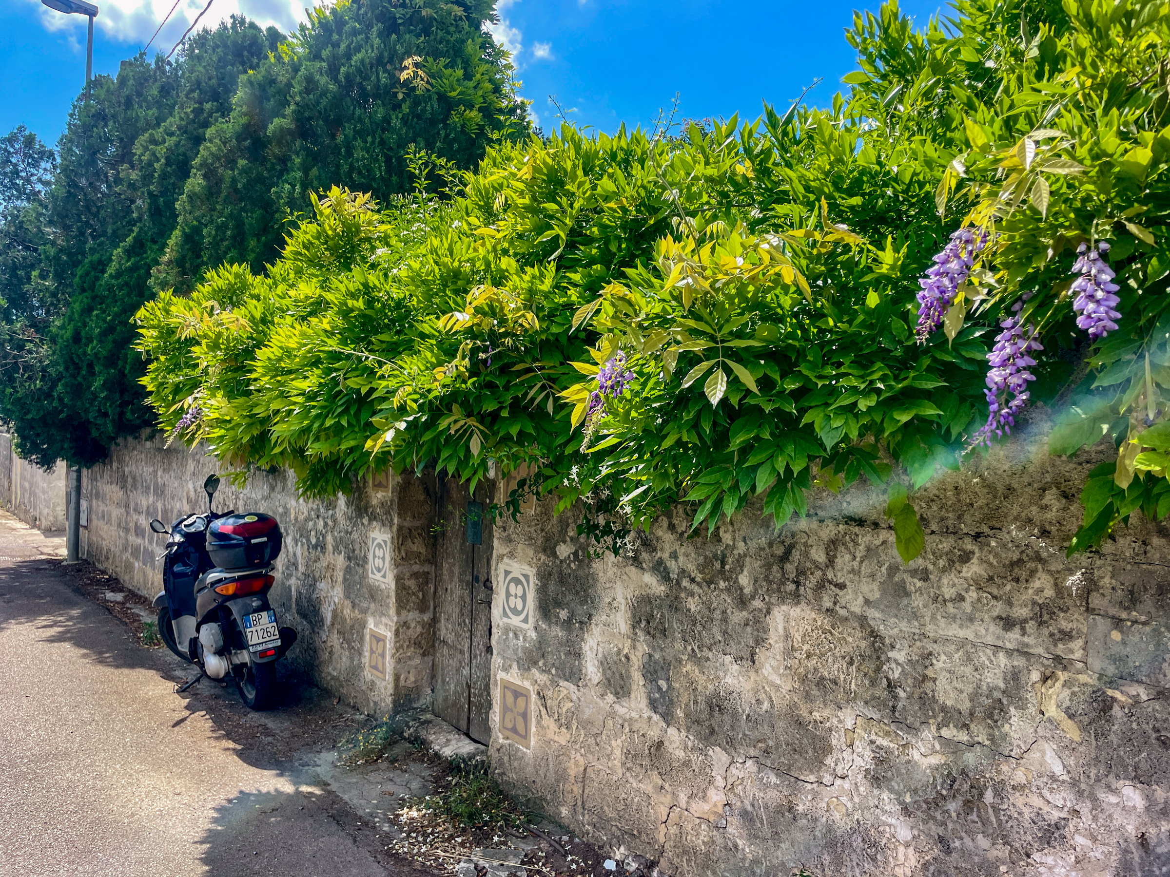
…with such an elegant front door. Photo courtesy of Torrey Close, proving yet again that she has a well-honed target eye.
Glimpses like this are why we choose exploring places culturally divergent from our own. Not to mention glimpses like this one at the bottom of the ravine a kilometer below the walled home. Yes, the water really is colored like this, with the gin-clear water visibility. Ah, you say, but gin is colorless, not aquamarine and blue. Stay tuned for refutation.

This was another 7 mile day, headed first for Castro. with its small sheltered harbor, alongside which we stopped in an outdoor café for cold acqua minerale and a little sit-down time.
Then working our way steeply back up to the mesa passing this handsome church as we began our climb.

On the climb up to the mesa top leading out of town through the Centro Storico (the old town) we stopped to take in the view from a piazza adjoining its 12th century fortified castle, the white buildings of our destination of Santa Cesarea Terme visible in the distance to the north.
Leaving Castro by this colorful street.

You can make out the road sign showing that S Cesarea Terme is straight ahead. But Inntravel will have none of that busy road, shortcut kind of pathway. Leaving the road at what the directions describe as a car park, and which I think might be more accurately defined as an RV park, we were soon back on our typical alone in the toolies tracks. Yes, nature was everywhere, flowers, pollinators and scooting lizards our constant companions.

Destination, Est Hotel in Santa Cesarea Terme, and a little lounge-deck downtime after a shower and with a favorite audio book, overlooking the onion dome of an enormous private residence designed with a Moorish mindset when that style was once in vogue there.
Italy inhabits tectonic real estate. Mt. Vesuvius may ring a bell? Santa Cesarea Terme’s version is sulfur hot water, where the Adriatic is made a toasty 30c, 85F for the rest of us. Steps and stonework leading to bathing areas accessed from prepared and natural ledges.
For our departure day, the forecast speculated thunderstorms, interestingly expected to be most active in the mid morning through early afternoon. You pilot types will smile knowingly of what can be referred to as the duty 2 PM thunderstorm onset, a remarkably accurate old-pilots’ tale accounting for the buildups by terrestrial solar heating producing thermals as a means of cumulonimbus uplift. The early morning already scattering bubbling cumulus offshore, and more inland, a portent of things to come.

Departing town on foot, our directions wasted no time having us leave the road and climb steeply some 210m back up onto the plateau heading north. The climb began with stone steps, devolving into a rocky trail, and steep enough to seriously consider hand over hand on all fours. Trust me, it’s steeper than it looks. And note the darkening cumulus bases already churning at 09:30. Hmm.
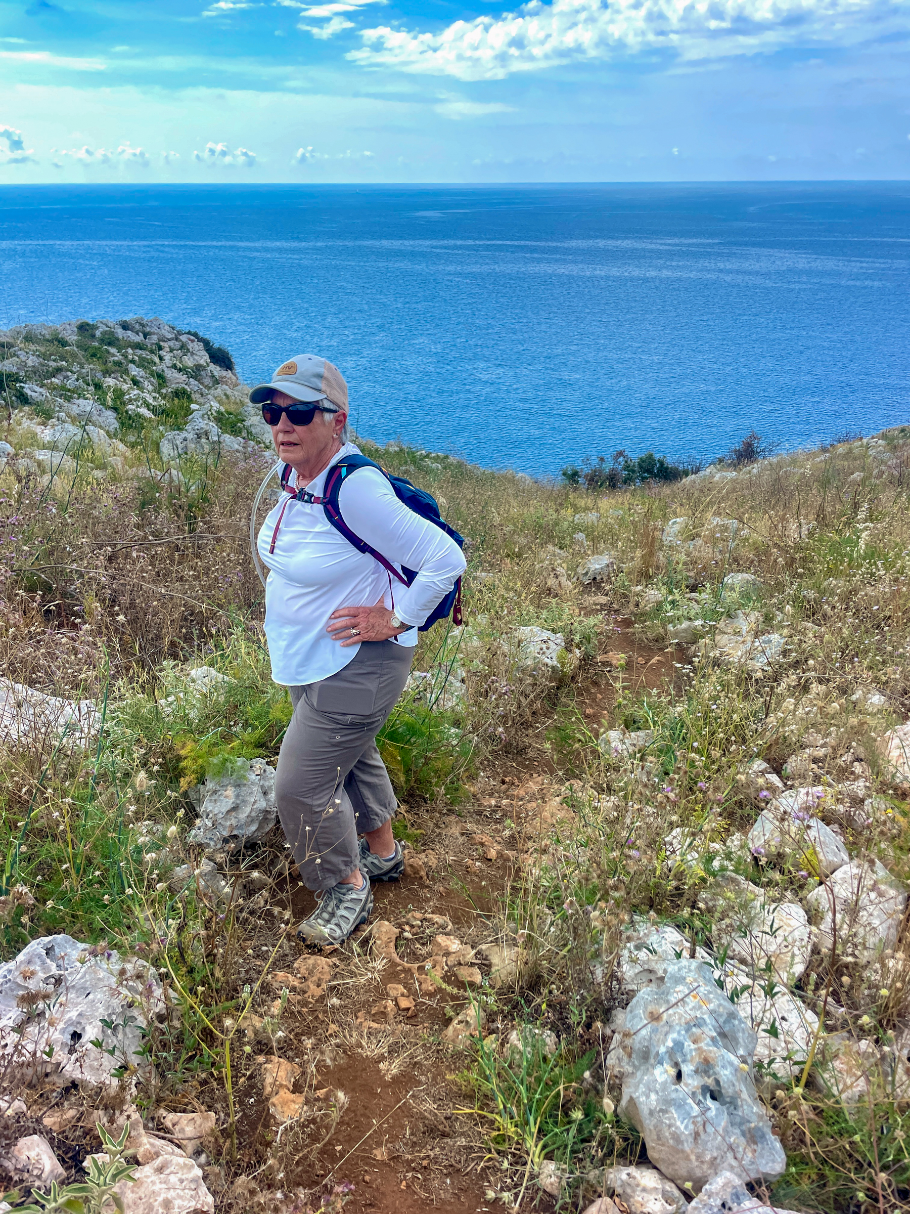
At the top, the missus catching her breath while I do the same. Steady camera a challenge while gulping air. You do see the trail, right?
And then follow the trail, being careful to stay on the straight and narrow. Beginning to sprinkle now, then ultimately coming down hard enough we donned our rain gear, a necessity for only :30 or so. Frequent peals of thunder, Zeus’ tummy growling, but thankfully only one lightning strike well to the inland from our trail.

A long day, weather about. Make sure you take the correct juncture. Fortunately, it was to the right, angling away from the worst of the thunderheads.
Eventually our directions had us drop back to reach the coastline at tiny Porto Badisco, the worst of the tempesta now to the right back from whence we came.

Then the navigation got more interesting. We had to make some allowances because a prominent waypoint—a café—was in the finishing stages of complete removal, only some old rebar sticking out of the ground. The construction workers denied us passage until I informed then we were “on the camino” a reference to the Camino di Salento, a portion of which our route overlaid. Religious sojourning has its place, and here was no exception. But the directions to continue in an arc around a headland were less than clear, yet we made it work on intuition. Eventually coming upon this un-described addition to our day. And which of us two is the black sheep? The sheep began crowding over the path, whereupon the shepherd, sitting on a rock at 3 o’clock in the frame, whistled for his sheepdog to get to work and a few barking forays later the path was again passable. Score one for the camino pilgrims.

As the crow flies, our destination, the Tenuta Sant Emiliano, to the north of here is relatively close. Not so via the trail. From here we arced along the headland with the sea to our right, heading to another climb steeply up onto the mesa, navigating toward and eventually around an ancient watchtower, the Torre Emiliano seen here on the distant bluff, then up close, below. Defensive watchtower for those marauders from the east over the centuries.


Torrey typically walked at a faster clip than us, me the slowpoke more than Cathy, who nonetheless would slow down so that we could hold hands and chat. Torrey is quite adept at following the written directions, but also knows how to use her I-Phone’s map function when it makes sense. A couple of miles after here our directions had us access the main road for 150m, then depart it on a dirt road that was intended to have us arrive at our inn in about 2 km via the back of the property. Torrey had had enough, and stayed along the road following her Google map, which took her unerringly to the front door in about 1 km. I should say that the inn was not visible from the road, nor from the dirt road that we plodded along following the directions. When we were probably only 300m from the inn, the trail seemed to come to an end in the middle of nowhere, the inn still unseen. Lost! No, I was not a happy hiker. Torrey texted us that she was at the Tenuta enjoying a lemon sorbet. We responded that we were lost, and were backtracking to find the error of our (my) ways. I eventually decided to use my phone Maps function, and discerned that using the auto road was the smart move. Our loss added another mile plus to what was already an 8 mile day. Two days later we’d leave the inn by the original directions to it, but in reverse, of course. And knowing where you were made passing through the area where the trail died with tall grass overgrowth easy-peasy. But not so on that long day arriving.
BTW, I sing T-Mobile’s praises, as we had unlimited high-speed text messaging and internet throughout, phone calls if we needed it, e-mail in the bargain. Their coverage is so extensive and the Adriatic so narrow that along some of the Italian shorelines we got pop-up text messages from T-Mobile welcoming us to Albania and Greece. And those folks in pink pay me not a whit for this appreciation.
The Tenuta is another Agriturismo lodging. And just sayin’—the vegetables and salad greens are decidedly freshly from the field. We passed this smiling lady as we left two days later, out the front door and to the right, an underhand pitch from the inn’s front door.

Torrey already outdistancing us as we carried forth on our last leg to Otranto, another 12 km day.
Lots of nice scenery on this leg.

An abandoned masseria. Our trail on the left.

At about 8 km the trail returns to the shore.


That scenery overlooked by Orte Beach Bar-Restaurant. Just a trailside establishment where we took a sit-down with an ice cold Coke Zero and an ice cream bar. Immaculate bathrooms.

A more recent military watch post, now watching over hay rolls, a common enough scene over our many days of walking.

And a couple of kilometers farther on, our path enters the old Roman Empire city of Otranto from its port. This particular day had a “there goes the neighborhood” sense to it with the uncommon arrival of a French cruise ship.

After Lecce, Otranto is the largest community we visited, possessed of a population of nearly 6,000. It has a modern part which we saw only on departure two days hence, and a bustling walled old city overlooked by a substantial Aragonese Castle that is more fortress than palazzo. Our lodging, the Corte di Nettuno (Court of Neptune) is decorated nautically throughout, and is a short walk from both the castle and the port. The castle has been repurposed as a museum with changes of exhibits chosen every several months by its leadership, and currently an historical perspective on Frieda Kahlo. Go figure. The old city is a bustling shopping and dining area laced with twisting narrow stone pathways and considerable visual appeal.

We happened upon the tiny Basilica di San Pietro (yes, that Saint Peter) just as the woman with the keys was opening it up. Breathtaking frescoed walls, so intimately available given the modest dimensions.

The small round glass piece above the cross is designed to let through the dawn morning light to illuminate the chapel.

I decided I couldn’t be alongside the Adriatic Sea without getting in the water, so I took my Kindle, a towel from the Court of Neptune and ventured forth to a beach of white sugar sized and colored sand, a rarity along the rocky Puglian coast. Cathy and Torrey had ventured forth ahead of me looking for gifts and some household goodies, and saw me over yonder purposefully striding to my date with the sea. Old guy still AGAG (All’s Good Above Ground). It was a Saturday, and relatively warm, so the stone boardwalk was like the Mission Beach seawall for people watching. I guessed the water temperature as somewhere between the upper fifties and sixty. Trunking it, it was a short immersion for me, and I noticed few other takers. I found a nice bench to watch the world go by and dabble with Amor Towles’ “Lincoln Highway.”
When my shorts were mostly air-dried, I suited back up and sent a text message to the ladies so that I could join them, which as it turns out corresponded to a mid afternoon lunch at L’Ortale, a literal hole-in-the-wall gem that Torrey had researched online. You have to know it’s there, and be willing to enter in spite of the closet-sized entryway. Like a speakeasy, what you get is not what you can see from the entryway, but an outback courtyard that ambles up to a couple of dining and imbibing levels. They take your order and you pay at the entry way, then proceed outback with the proffered vibrating and buzzing “your order is up” device. The offerings are all the usual beverages including coffees, waters, sodas, artiginale (artisan) brewskis, Salento wines, and…get ready for this…a large selection of locally crafted gins…and an equally expansive selection of locally produced tonic waters. The barista engages with you as to your tastes, then provides multiple shot glasses with tasting-sized samples from which to choose, then repeats the process for your selection of tonics. My reference to gin-clear water that doesn’t necessarily mean colorless?
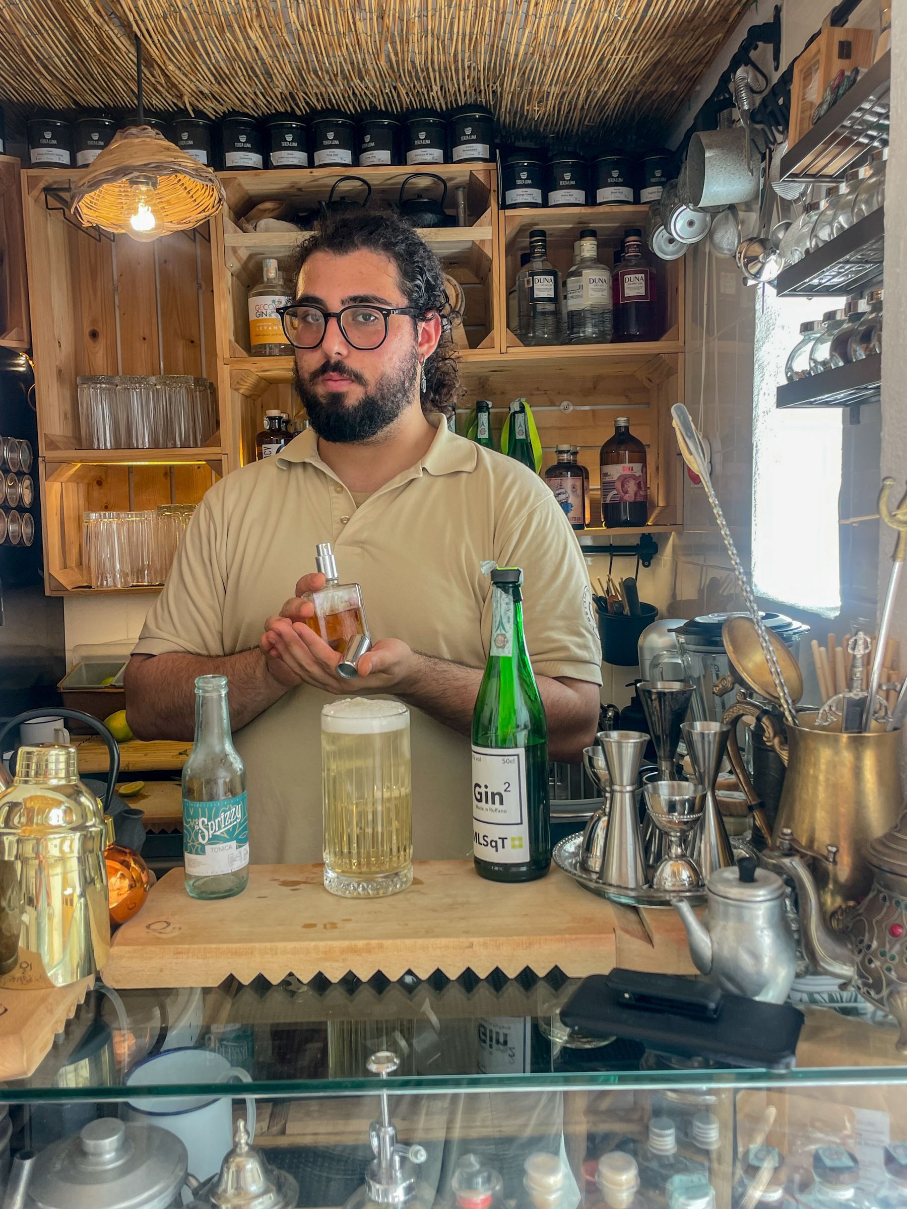
That’s the color of Gin-squared, not the color of the clear Sprizzy tonic water. I just now see my I-Phone holster on the bar top. We chatted (in English) while he prepared my beverage, me resting on a white-cushioned stool near the wall behind me. Sitting there, I felt a gentle pushing against my backside. Turning around I found el gatto stretching languidly.

The seating area outback has both an overhead lattice and trees and vines for outdoor shade. Very peaceful and unpretentious. Oh, I must mention that the audio system plays a continuous mix of 40’s Big Band favorites. Lemmesee—a swim in the Adriatic, watching the boardwalk walk-bys, reading a fine novel, joining my ladies for lunch with a curated G & T in a walled old city dating from Roman times with this as my stool-side view while serenaded by Glenn Miller? Priceless.
That Moveable Feast thing? In our last evening in Otranto we ended up in an outdoor café near the walled old city arched entryway. We ordered two pizzas and a salad. That morphed into two salads. This could easily have been accomplished with one pizza and one salad…for the three of us. Small portions? No way.
Last look at the Moveable Feast. Breakfast at Corte di Nettuno. How do you get your honey? It just drains with that angled comb holder. And yes, I chewed some hive in the bargain. Yum.

I wish to end by singing my praises of my traveling partners. Both adventurers, particularly as compared to my age-advancing stick-in-the-mudness. If there’s a culture, they want to explore it, all the more so if it involves fine dining. Fancy, refined lodgings certainly, but miles of twisting dirt pathways? Bring it on. I am a most fortunate man, my whole life through, and all the more on moveable feasts like this one.
Ciao, Tommaso
Supernova of the Soul
Posted on February 16, 2024

At midday today, Friday 16 February 2024, a soul with all the brightness of a supernova left this place of space and time. Having surrounded him with love and soothing pats and strokes…conversations and most reverent wishes, Cathy and Torrey left the two of us lads together with the veterinarian at the hospital who would help send him forth to the Elysian Fields so worthy of Sawyer Close. At high noon, I supported his head with my left hand and rested my right on his classic Whippet ribcage, feeling the beating heart of earthly life. I kissed his head, fondled his soft ears, and whispered the depth of my love for him as the medicines were administered by IV. He didn’t stir, he just lay quietly and soon my right hand told the both sad and happy news. His pain and his curtailed life were over. I’m aware that some would lean on theistic pedantry and deny that dogs have souls. I care not a whit about such a viewpoint. Anyone who has observed this last decade of Sawyer and me, the “Y” chromosome soulmates, would know what a silly, patently false supposition that is. My higher authority on the subject is Will Rogers, who opined…”if there are no dogs in Heaven, then when I die, I want to go where they went.”
Perhaps I should go back aways. The picture above is of him as a thirteen week-old puppy as we began our family life together. We acquired him from a breeder specializing in Whippets. He was one of a litter of twelve, and from the get-go as we made two trips to Fallbrook discerning behavior, he showed himself as happy and interested in us humans. He engaged with us. And he has continued to do so throughout the decade we’ve shared this mortal coil.
A gentle soul completely absent of vitriol or aggression, unless you happened to be a squirrel with the temerity to run across any of our hiking paths.

Whippets are sight hounds, and that says rather a lot about their genetic predisposition. Possessed of keen smell and hearing to go with fantastic vision, they are constantly alert to the chase of prey. Squirrels and coyotes, both immediate triggers. Zero to a Hundred in the blink of an eye. Oh, my goodness, what a thing of beauty to watch at full sprint.
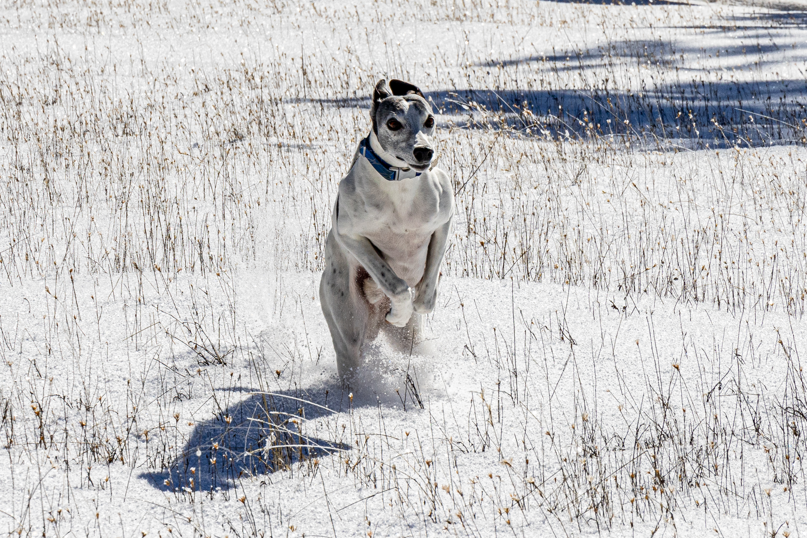
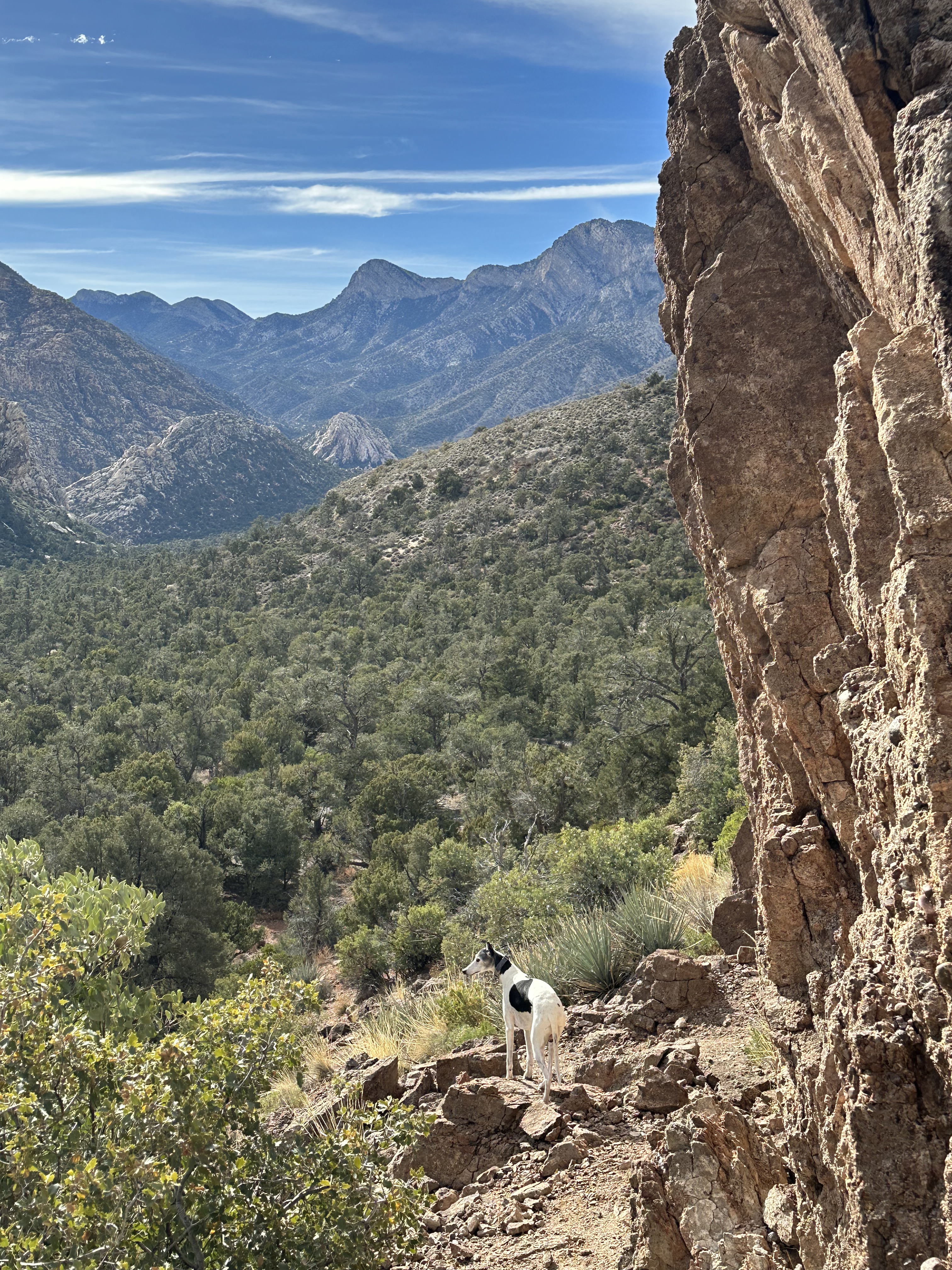
Real or imagined prey in sight, rearing up for the explosive launch of “all ahead, flank speed.” Whippets have a very high metabolism, their thermostat likewise set way up there. He’d look for shade on warm sunny days, and relished cool temperature including snowy fields and trails. His feet never seemed to bother. In fact snow in the mountains really amped him up. We hiked mountain trails and those in the local mesas all the time.

And we didn’t just walk. He was keen to go mountain biking because then I could sally forth at a worthy speed for him. Uphill I might struggle for a generous pace, and downhill where the trail would allow twenty mph, he’d still be right with me, I swear, a grin with that lolling tongue, tucked in at the 5 o’clock or 7 o’clock position beside me. Except for the times he was on Point, and I’b be tasked with keeping up with him. Look closely and you’ll see my odometer is at 6.2 miles, and we’ve yet a goodly ways to go. Not just speed, but endurance. I could ride 8 miles, and he’d run at least 10 on the same jaunt, racing off trail, bounding over bushes and boulders, sharing his joie de vivre with me and the entirety of the outdoors.

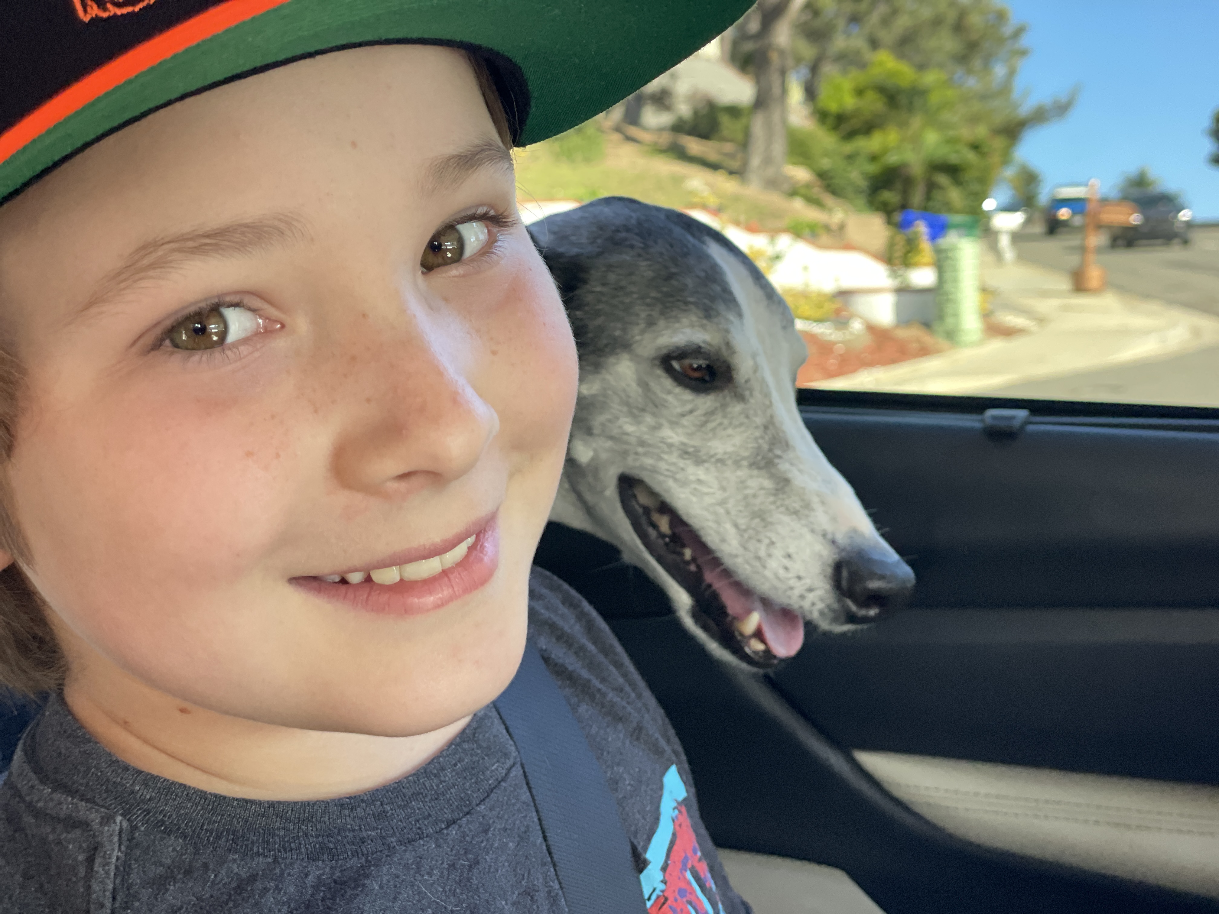
Now I don’t mean to imply that I got all of his face time. Cathy and Torrey and I were his home pack, I mean it literally. And if you were in with this Del Martian in-crowd, by extension you, too were part of his pack. And you know who you are—both other family members and friends. He’d gladly head off on the next jaunt if you were on his Sawyer team. Torrey and the lad hiking in the Sierras.

Or grandson, Matty and Sawyer, with me, embarking on the next adventure…grand or small.
If any of us three housemates gave the slightest hint of heading out, say the jingle of car keys coming out of the entryway drawer, Sawyer was Johnny-on-the-spot, nose to the as yet, still closed front door, an unspoken FOMO query of “where we going now?” Unspoken, because, as you Whippet cognoscenti know, they are silent, stealth technology in a dog. Silent foot plants and none of that yipping or barking at passing dogs or people. The one unique Sawyer exception is a low in the belly guttural combined bark-growl when in full flight after prey. If any of us managed a casa disembarkation without him, you could plan on a couple of things. He’d go to the laundry basket and drag a bit of clothing (the more scent-laden the better, if you get my drift) to his kennel in our master bedroom. He never damaged it, no matter how delicate the fabric, but it would be there as his personal remembrance of the presently departed. Whenever we couldn’t find a garment, the mental lightbulb would come on, and sure enough it was tucked into or under the blanket or doggie bed in the dimness of the kennel. The unknowing might think a wire-metal box would be an unkindly thing to offer a beloved dog, but for Sawyer it was both his safe zone and his lair. Anyway, the other thing you’d expect—upon return, a joyous wiggly, tail metronome at Allegro Vivace. Torrey, would receive nibbles on the tip of her nose. Cathy got ear nibbles. And I’d get him pushing his head into my person, presumably a trading of guy smells, a claiming of ownership, as often as not in my groin. I know. It’s a guy thing, I guess. But several times a day. Every Day. We’d be off together to explore this Eden called Earth, finding places near and far to churn away the miles, and revel in the exercise and the quiet times of rest and reflection.

And not infrequently upon return, a little rest might be called for. He never faltered in the outdoors, but that’s not to say that he didn’t know how to chill out when the charging was over.

You may know that I tinker with photography. And to say that Sawyer was photogenic is a world-class understatement.

I can tell you that hundreds, if not thousands of times over our decade, we’d come upon passers-by who would announce without solicitation, “What a beautiful dog!” I’d mostly politely agree and add a thank you, but my impish side would occasionally get the better of me, and I’d ask “What about me?” Embarrassed titters, the happy result. But more to the point, his true beauty was his heart and soul, his inner charm, his flagrant love-no-strings-attached self. He was an all-in antidote to any incipient human churlishness. You always knew where you stood with Sawyer, and it was front and center, every bit the embodiment of Christ’s admonition to treat others lovingly as you would dream to be appreciated and embraced yourself. Damn, but I already ache in his absence.

Oh, those eyes. Liquid amber, a well of his magnificent soul. And how lovingly they could look at you.
This is a remembrance and celebration of life, so let me share how we got here. Some two to three months ago Sawyer came down with a modest limp and disinclination to put weight solidly on his left rear foot and leg. We were in the process of trying to find a new veterinarian after the retirement of the wonderful vet we had for the past ten years. We heard good things about a splendid veterinarian in nearby Solana Beach. Dr. D B is all we could have hoped for, and I’ll be happy to provide referral contact information upon request. She cajoled us to agree to an x-ray, which wasn’t good, showing a large and darkly sinister shadow of a mass on the femur. We were referred to a veterinarian oncologist, and the diagnostics involved CT scans, x-rays, bone biopsies and other in-depth labs looking for either cancer or fungus, which can also produce masses like the scans showed. The labs ruled out fungus, and the biopsies (three or four different places along the femur) produced no cancer cells. Sawyer started a regimen of anti-inflammatory and pain medication and meds with demonstrable anti-cancer benefit. And then a watch and see, because Sawyer was otherwise symptom-free, in all respects his normal life-engaged self. At first recurrent x-rays showed no change in the femur mass, or a mass the CT had shown on his spleen. You could palpate the femur and he never flinched or yipped. But then, as we now know in our perfect twenty-twenty hindsight, Sawyer was the paradigm of stoicism. As long as he got to be with his pack, and continue to engage with life, you’d never guess he was suffering. For instance, in the midst of his travail we did a 10 km hike in the mountains of the Red Rock Canyon nature conservancy outside of Las Vegas. It was a combined pack thing with our daughter Paisley and son-in-law Aaron and their dog Lizzy. The two pooches blazed away, this way and that, adding additional cross trail miles to our 6.2, and also taking in the vistas solo. Hard to tell in the image, but his left rear foot is only touching the ground on his toes, a clue, but about the only one.
His new veterinarian and the veterinary oncologist both sought ways to bring us around to the recognition that with the continued bulge to his thigh, amputation was likely unavoidable. A hard pill to swallow for his guy buddy, especially with the biopsies revealing no cancer. Of course a negative biopsy is a sometimes equivocal one. And, in time it became obvious that the leg bulge was growing. So we sought a third opinion at another local veterinary hospital, this time with a veterinary orthopedist, yielding the same recommendation. And so, a week and a half ago, Sawyer and I did his final four-legged walk, a lovely morning with greenery and light fitting for the momentousness of it all. Here he is taking a short, and bad leg lop-sided sit down break on our way back to the trailhead. One word—stoicism—one look, bespeaking the same.

That afternoon he underwent surgery. The vets all told us the same thing, and it is largely true. Dogs get on fine without the limb, and in fact he hadn’t been using it for the last couple of months. He came home the next day, and the day after that he and I walked a favorite haunt of ours, a maybe half to three-quarters mile near dawn jaunt in the Del Mar Torrey Pines extension. The white curvature is his tail, not his missing left rear leg, the pinkish flesh from the shave before the surgery.
We probably should have curtailed our post-op walking to less and shorter, but he seemed keen to follow our history. The result became more pain and some swelling along the incision line than his meds were controlling. Two nights ago he descended into intractable whining, loss of appetite, and general lassitude. At four in the morning we headed to the veterinary ER. This coincided with the arrival at the veterinary hospital of a definitive osteosarcoma diagnosis from the removed limb. This is a particularly aggressive cancer of the bone. The wait and watch was fine at the outset following the earlier equivocal diagnosis, but in the past week, his cancer took off like a malevolent someone had thrown a switch. Also, ultrasound now showed a second mass on his spleen. An aggressive treatment plan would require hospitalized stabilizing the pain and inflammation (without infection) of the amputation site, then surgical removal of the spleen with its two tumors, and when healed and stabilized from that, chemotherapy. We were told that a very successful result from chemotherapy might extend his life six to twelve months. Of misery. Of inability to live the life he was born for. Or the life we were born to share. It was a relatively easy intellectual decision to choose euthanasia, but an absolute bitch of an emotional gut-check. I can’t hardly see my monitor as I type right now, and you know why. Damn, but I miss that guy. I wore a deep groove in the prayer ground between me and our Maker. Some of it was answered in an earthly-knowable timeframe, the part where I asked for all the help I could receive to cope with this and to be strong for Sawyer. It has been an honor these past few months to be there for him as he has always been there for me. Carrying him up the house stairs when he was having a particularly challenging three-legged day. Holding him and gently stroking his head and back and whispering my best calming voice when pain shown through or agitation would surface. Gently picking him back up when a perhaps drug-induced instability had him suddenly fall onto his side while doing a short night piddle foray in the back yard. None of it an easy thing for him to accede to, but a true honor to be the giver. He deserved better, but it’s all I had, and given his physical response, I know he accepted it with God-given grace.
I shall close with these snapshots of beauty in this terrestrial place and time. That photography habit. When I’d stop to set up a shot, Sawyer would patiently stop, sit down and wait for me, including this wonderful Spring wildflower moment in the June Wash area of the Anza Borrego desert during the height of the COVID lockdowns. We had each other, and we had nature. Both created for each other. Take your time, dad.

I make frequent mention of this time and place. It exists, no question. But, as a Christian, I see this as just this particular reality. I am fully on board with the promise of the next stage being without the brokenness of this one. C.S. Lewis likens this life as to being the mere frontispiece of the book of life, and when our mortal time concludes, we turn the cover and step forth into the next chapter in the eternal book. I look forward to taking my seat at the table with all my loved ones who have gone on before me. And I relish the time to exult in Sawyer racing, full tilt in those Elysian Fields. Go with my eternal love, Sawyer. Save some trail time for me. We’ll have some catching up to do. Love, Dad.

Southern africa
Posted on June 29, 2023

The sun. Source of illumination so essential to life…and the wellspring of the visual arts’ nourishing power. Integral to life’s circadian rhythms, and the daily cycles of chill and warmth. In lockstep with earth’s planetary axis wobble that gives us seasons and climate. And chronometer to the passage of a life. In my case, eighty solar orbits on, I find myself a wizened version of the little kid I’ve always been—gobsmacked by the magnificence of nature in all of its raw power, beauty and diversity, and comforted by its nurturance of my life view of an architecture, and thus an Architect.
Those eight decades done, awakening a recognition of the diminishment of the time, energy and health available to relish big adventures. Pondering the bucket list, Cathy and I concurred that it was high time to visit the south of the Dark Continent. We chose Thomson Collection https://www.thomsoncollection.com the outfitter of our two previous trips to Africa and one to Peru to help us select locales and bush camps therein. They exceeded all expectations for planning, reservations, and pre-smoothing out any possible travel and transfer kinks. In all respects their help ensured this was literally and figuratively a move to the front of the line trip.
It’s half a world away geographically, and more than that in the cultural and nature experience—first to Johannesburg, South Africa, then directly on to Botswana, Zimbabwe and Zambia. Our time there being both their dry season and their winter, at between 19 and 13 degrees south latitude. Morning game drives dawn-chilly low 50s, high 80s mid afternoon for a little siesta or dip in the pool, and the temperature plummeting dramatically back to nippy following the afternoon game drives’ “Sundowner” and the night game hunt return to basecamp and dinner. We went for the game viewing and were smitten by the gracious politeness and courtesies of everyone we met. Not just the conciliatory camp staff, but everyone whose paths we crossed in our game vehicle or on foot, kids and adults radiating unsolicited smiles and waves, fresh air to the polarity and incivilities of my beloved U.S.. And as to nature? It’s been awhile since I’ve seen elephants or hippos on my daily dog walks.

The camps have turned hard core game hunting into a refined experience. “Tents” with hardwood floors, King-sized beds with Goldilocks’ just right lump-free firmness, fine linens, gossamer mosquito nets (largely unneeded, us seeing almost no pesky insects during the dry season), electricity and lighting, air conditioning or fans, hot and cold potable water, Architectural Digest baths— flush toilets with gentle-down seats for his geezerness, bathtubs, and both indoor and outdoor showers situated for privacy and killer immersed-in-nature views. A luxuriant take on the bush experience, but make no bones about it, this is insertion in nature, no holds barred. Above, looking into our hooch at the Khwai Leadwood camp in Botswana’s vast Okavango Delta waterway, me framing the shot from our shaded deck and outdoor seating area ten yards from riverbank trees. We were awakened in the middle of the night by a high decibel arboreal crashing and shearing of an elephant choosing his nighttime branches snack of just those trees. Right. There! Shall I mention the nearly continuous day and night basso profondo bellows of hippos, a Foley artist’s dream concoction akin to a mixture of contrabassoon and didgeridoo? No leaf blower sounds, thank you, but plenty of tropical bird calls and the “predators about” warning cries of baboons. Okay, then there’s the camp staff singing you an African-toned acapella welcome song on your arrival. It’s humbling when they already know you by your first name before you’ve even introduced yourself. Cool dampened rolled wash cloths to remove the trail dust on every game drive return along with a shot glass non alcoholic local ingredients digestive…and, oh, your hooch mini bar stocked with your preferred adult libations (thank you Thomson!). Spoil me, boy howdy!

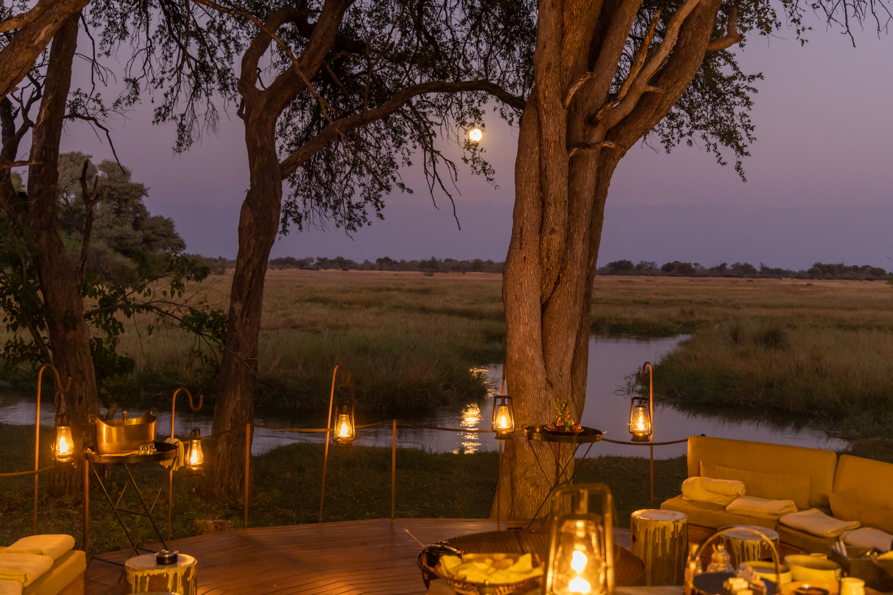
The Bushcamp day begins with the camp staff awakening us at 05:30, leaving fresh coffee and juice. A half hour later we’d be ushered by torchlight (it’s still dark, and the predators wander here) to a crackling wood fire for a light (African continental) breakfast of porridge, fruit, meats and cheeses, bread and pancakes. This meal is just to tide one over until the real “hot” breakfast or lunch—or both—four and a half hours later after the morning game drive. Saddle up in the vehicle with our guide as driver and head out to the morning hunt at 06:30. There is no set path to follow, only hunches and expert knowledge on where this or that species might be found. The “roads” are convoluted twisting trails, a track each, for the wheels on the left and those on the right and suitable only for heavy duty off-road Cruiser or Rover vehicles. Midway through the morning drive we’d repair to a shady and view-sumptuous spot for coffee, tea, juice and biscuits. Then back to two more hours of the hunt, all of it tailored to what we’ve conveyed we’re hoping to see. Then the downtime in the midday heat while the animals hide in the shade of thickets and we can partake of that late breakfast or lunch, perhaps a swim in the pool, read a book, go over the morning game images, or succumb to a Spain-be-proud siesta. High Tea at 15:30 with fresh-made yummies and beverages of your choice, then the afternoon game drive beginning at 16:00. Pause for a “Sundowner” break of finger food and drinks—verrrrry British G & T’s a common accompaniment—then the after-dark return to camp, searching for nocturnal critters along the way. A quick freshen up and dinner by candlelight with cocktails, beers, and wines paired to this evening’s chef selection. These aren’t cooks, don’t you know. They are trained chefs expertly preparing yet another sumptuous repast. Follow with a torchlight chaperoned return to the hooch. Collapse exhausted in that comfortable bed and drift off to the symphony of night forest sounds. Rinse and repeat.
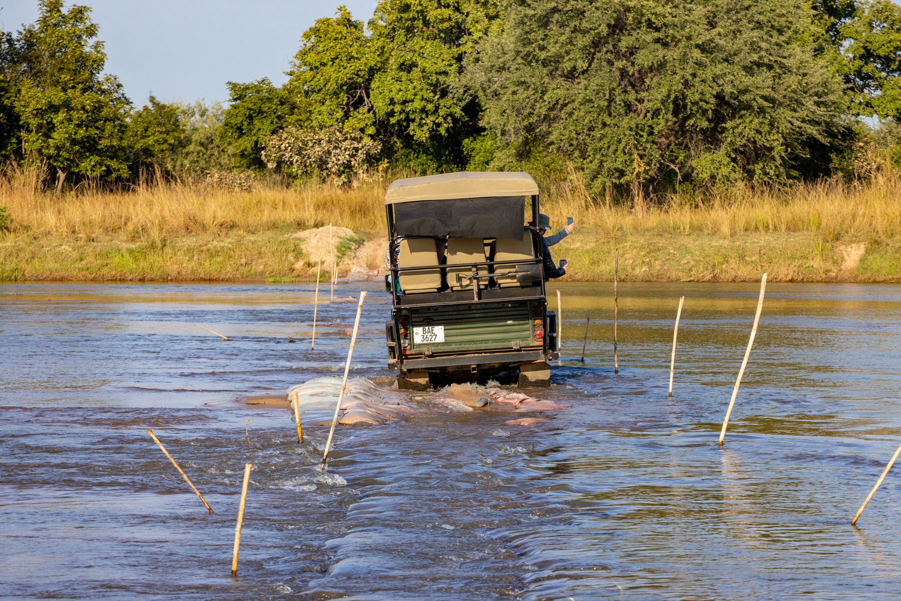
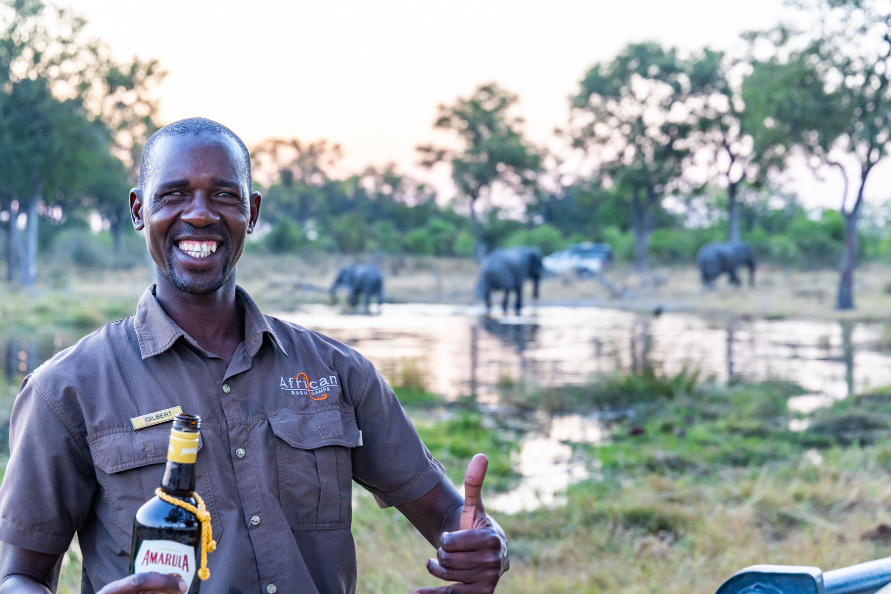
Our guides were Gilbert in Khwai Leadwood/Botswana Okavango Delta https://africanbushcamps.com/camps/khwai-leadwood, Elijah at Lolebezi (lower Zambezi River, Zambia) https://africanbushcamps.com/camps/lolebezi/, and Thomas at Billimungwe (South Luangwa National Park, Zambia) https://bushcampcompany.com/bilimungwe/. Calling them professional hunter guides understates the reality by orders of magnitude. Generally local histories, then formal guide school followed by apprenticeships. Driving those two wheel tracks, they constantly would pull off into the bushes on the left (British colonial, driving from the right seat) so as to look down at the dirt, reading the animal tracks. Yes, game often walk those same roadways. “Lions, quick stride in the opposite direction.”

Or they’d come to a stop, shutting off the engine to listen to the creature noises—”baboons raising alarm”… and we’d suddenly be bushwhacking through shoulder high grasses to a tangle of trees and brush searching for elusive leopards.

Gilbert in the morning chill

Our game drive vehicles were purpose-built, hell for stout Land Cruisers or Land Rovers with six passenger seats in a theater-style rise from front to back. We had times with all six seats occupied and others with just Cathy and me plus our guide. The vehicles were windowless open air all around, but with a rip-stop canvas top for shade. Hefty off-road suspension, and that was necessary. When game was sighted or intuited by animal cries or behavior we routinely exited the rugged two wheel roadways, bushwhacking into terrain and foliage that looked impassible to the uninitiated. This is a breezy affair, and spoiling us rotten, we were issued woolen-covered hot water bottles and hefty blankets for the chilly morning drives, and of course we dressed in layers. Here’s an opportunity to speak of game drive “refreshments.” Secure insulated boxes for food and beverages were stored in a compartment at the back of the vehicle. During mid morning tea breaks and afternoon sunsets, a purposely designed part of the vehicle’s front steel buttress would be flipped forward, forming a countertop on which a tablecloth would be placed, then covered with distilled spirits, chilled wines and beer, fruit juices, sparkling water, sodas and numerous finger food options. This is also when nearby thirsty trees and shrubs would receive our humble human offerings.

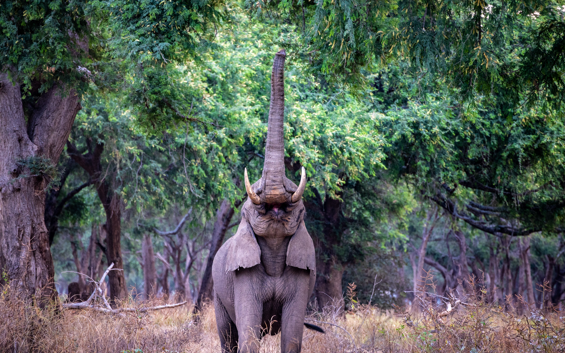
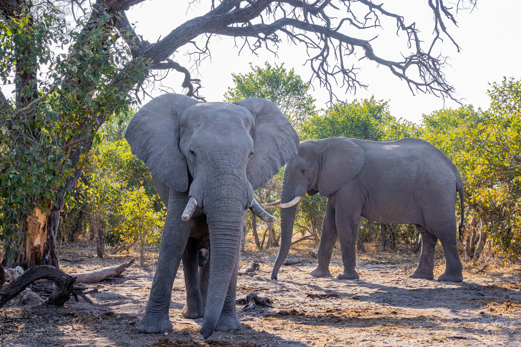
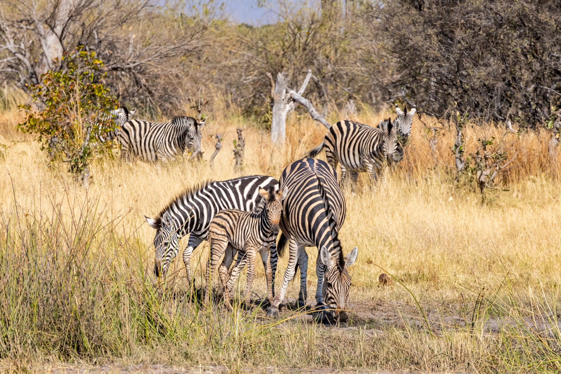
But we came for the game-viewing and my camera lenses grew white-hot with all the shooting in such a target-rich environment. I didn’t leave home with a pre-defined list of favorites, but soon found myself embracing wonder at the majesty of elephants and giraffes. My anecdotal take is that anti-poaching efforts in Botswana and Zambia must be paying off. Elephants were a staple on our game hunts and numerous times we encountered large herds of the pachyderms.

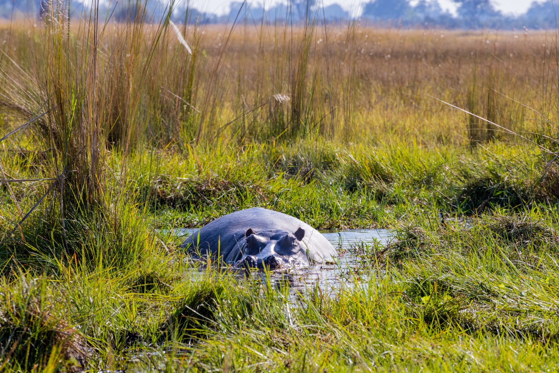
Elephants like their baths. A just finished mud bath above, and wading into cool Lilly-strewn water, below. One of the ubiquitous termite mounds in the foreground.

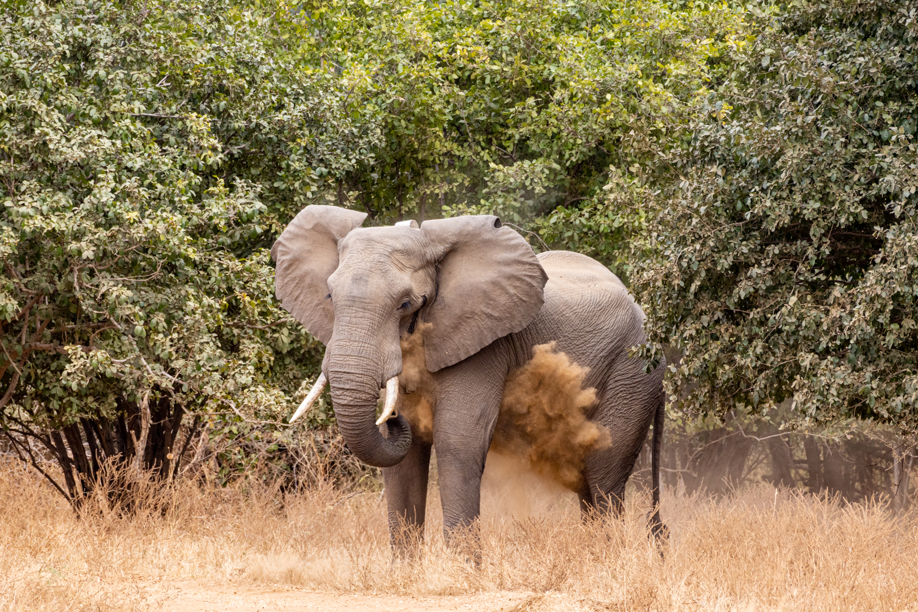
Their fondness of dirt showers effected by sucking up soil with their trunk, then shooting it wherever if feels oh so right.

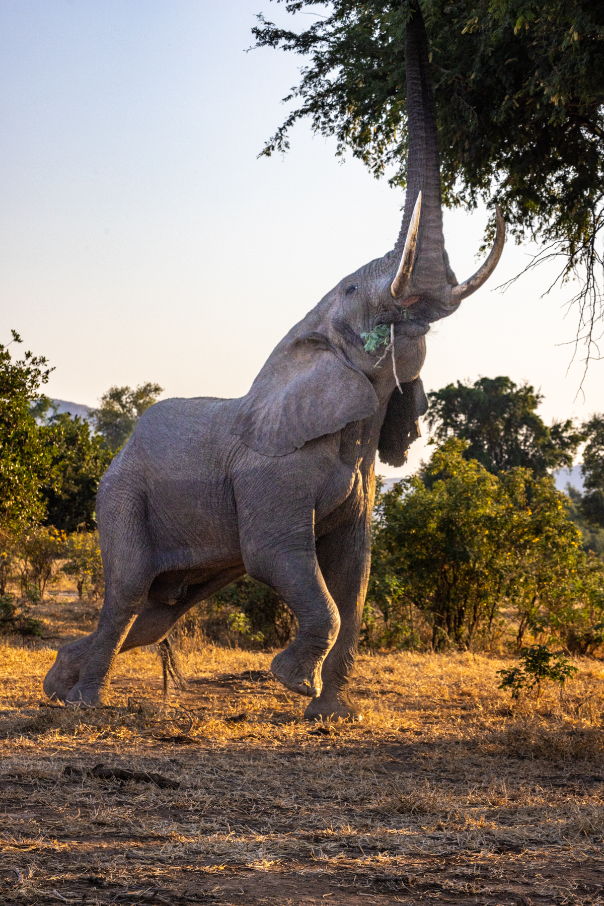
The beast above had a well-honed technique for those hard to reach high branches. He’d first ease his whole torso downwards a foot or two, like an air suspension bus about to disgorge passengers, then ease the left hind foot backwards to a toe-tap, and raise his right forefoot in elegant body-English as he arched his back and extended his trunk to reach up and tear off his vegan snack.
Below, he’s jaw grinding a branch and leaf morsel. Whether by accident or on purpose, when he brought down the limb he’d torn from the overhead canopy, it rested across his tusks, and he used his trunk in a leisurely stripping of leaves and twigs to stuff into his mouth. There’s some pollen on his right eye that wafted away as he sauntered off, meal consumed. Some insider backstory, perhaps? Elephants’ feet are modestly cushioned, which is why their walking foot plants are ever so quiet. Their front feet are nearly round and bigger than their somewhat oval rear feet. The tip of African elephants’ trunks have two opposing extensions and they wield them like our thumb and index finger for a prehensile grasp. Asian elephants have only one such grasping terminus. Elephants’ trunks possess 40,000 muscles, the control of which takes some learning by the little ones. African elephants not only can trumpet, but can also emit a low frequency guttural rumble from their body, a sub-woofer emission that their chums (and us) can hear and feel. Elephants have relatively inefficient digestive systems. About 40% of what they consume results in digestive success, the 60% inefficiency showing up in their large elephant pie droppings. They have two longish molars on each side, top and bottom, eight teeth total, and have six sets of teeth in their lifetime, their version of our human baby and adult teeth. They mix up their diet, the variety helping stave off the wear down loss of the molars. When the last of those are finally worn out, death may come from starvation. In an intriguing bit of natural selection, a genetic twist has produced a certain portion of African elephants without tusks. This makes them unappealing to poachers. A decade ago they made up 6% of the population. That has increased presently to 20%.


Here’s a whimsical tidbit. I’ve mentioned the mid-morning game drive coffee break cum bush watering? On this particular morning Elijah chose a lovely stopping spot in the shade of a large tree, angled so we could watch the hippos cavorting in a nearby water pond, waterbucks and impalas peacefully grazing on grasses. Ever the gentleman, I waited until Cathy had returned from her comfort break before aiming at the base of the tree behind our vehicle. No sooner had I wandered back to partake of some juice and biscuits than a large bull elephant slipped silently and effortlessly through the brush right where I had just zipped up my fly! He was the first of a bachelor group of four, and we and our vehicle were directly on their path to the water. Elijah quickly gathered us on the other side of the Cruiser and whispered for us to get inside, stay low and quiet. The lead bull came along the right side of our ride, not ten feet away, stopping to gauge our threat level and his response. He stood there still and rigid before relaxing his trunk, and resuming his ear fanning. Then he and his chums carried on to drink and spray the water.


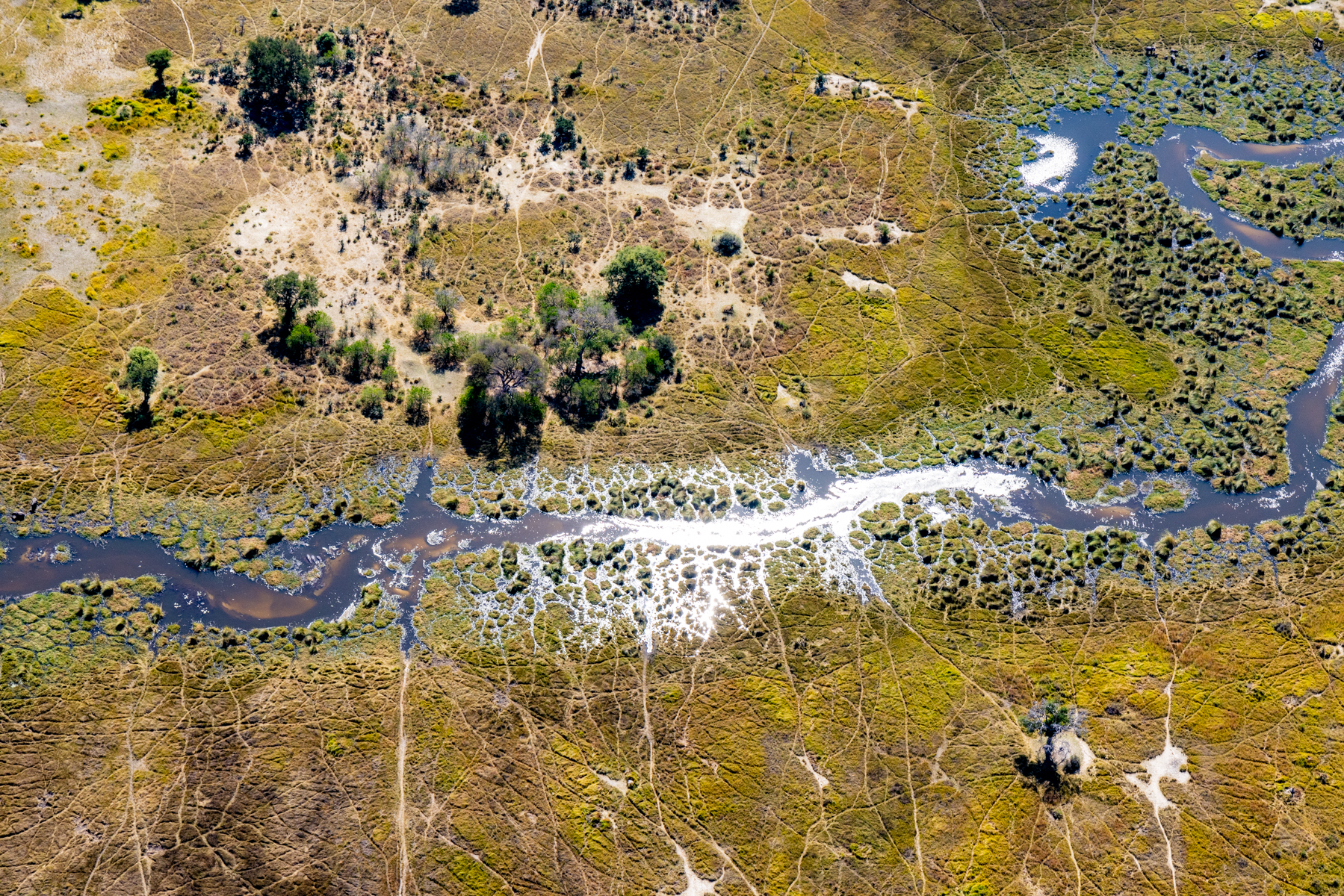
To our typical twice-daily game drives we added other exploratory variations, including a helicopter overflight of the areas we’d been exploring on the ground. This is a labyrinth of water and grasses, trees and termite mounds interspersed by animal trail furrows, terrestrial stretch marks oft created by the heft and size of elephants and hippos.
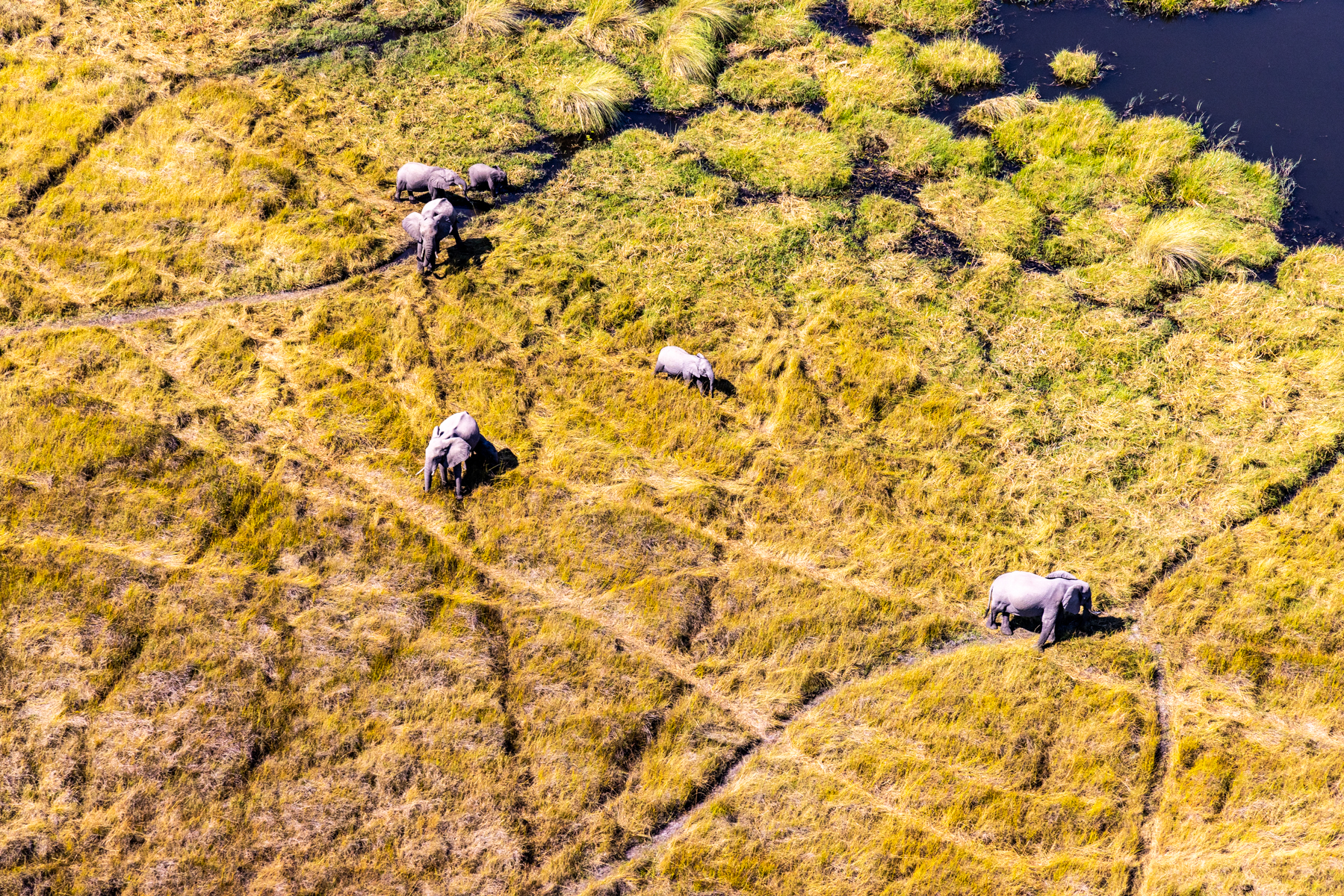
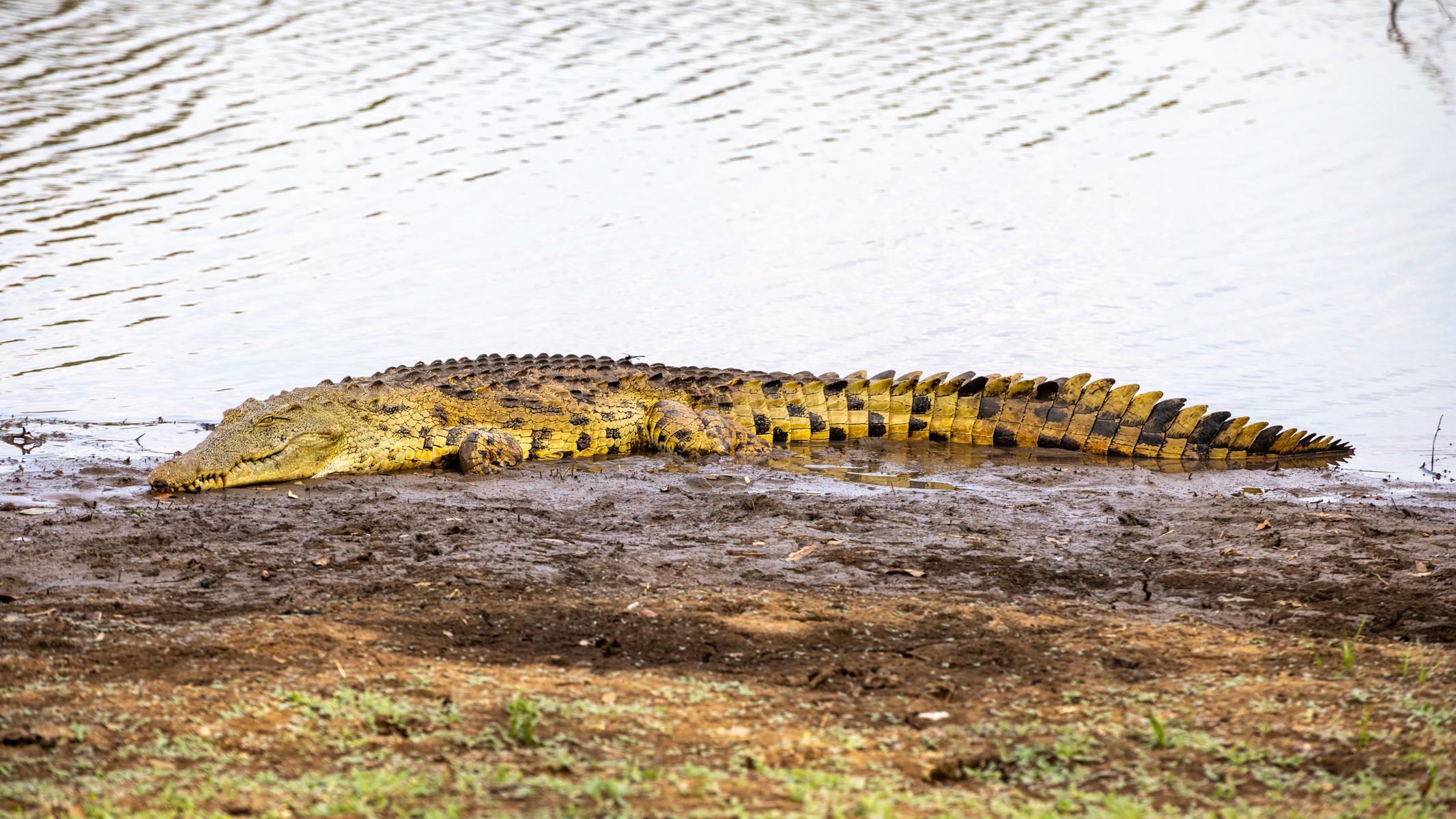
And where there’s water, besides hippos one should expect crocodiles. I count 16 large crocs in this one frame. Very glad we didn’t have engine trouble resulting in a forced landing.


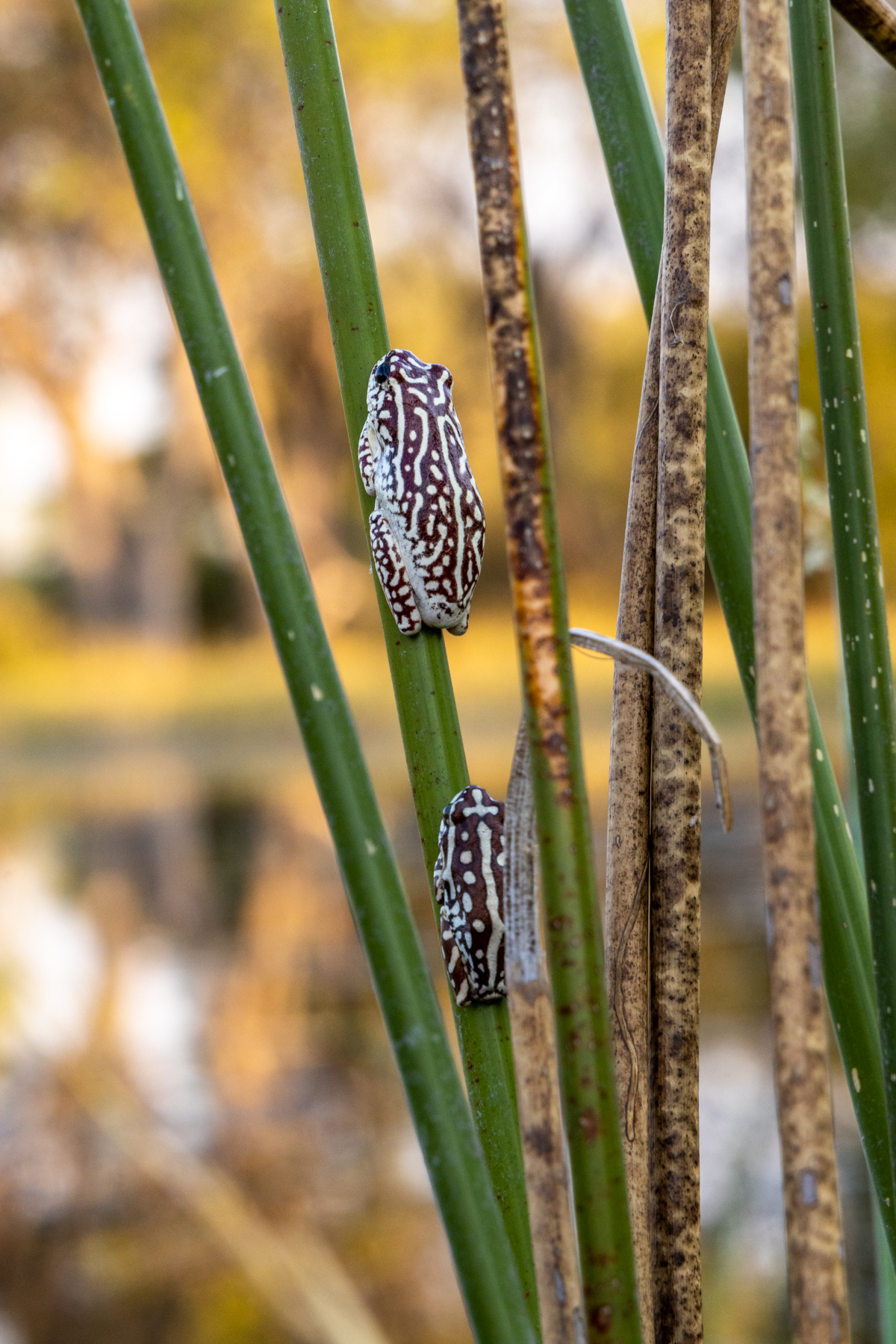
For another twist to the traditional game drive we enjoyed a mokoro skull in the waters of the Okavango Delta. Mokoros are a dugout with us sitting down inside and the guide poling us like a Venetian gondolier misplaced to Botswana. With our guide’s keen knowledge we found Angolan reed frogs hanging on water grasses. This is a big thing because they are such a little thing—about the size of your little finger nail. We were told that they’d begin their song to the night about when we were just grinning our way into our evening twilight Sundowner.
In the African bush, the most likely thing to expect is the unexpected.

As we returned to our put-in/take-out spot, the sun dropping quickly below the treetops, we found ourselves treated to first one, then countless members of a large breeding herd of elephants. Breeding herds are matriarchal. As males reach sexual adolescence they are sent off, which leads to both wandering single males and bachelor groups.

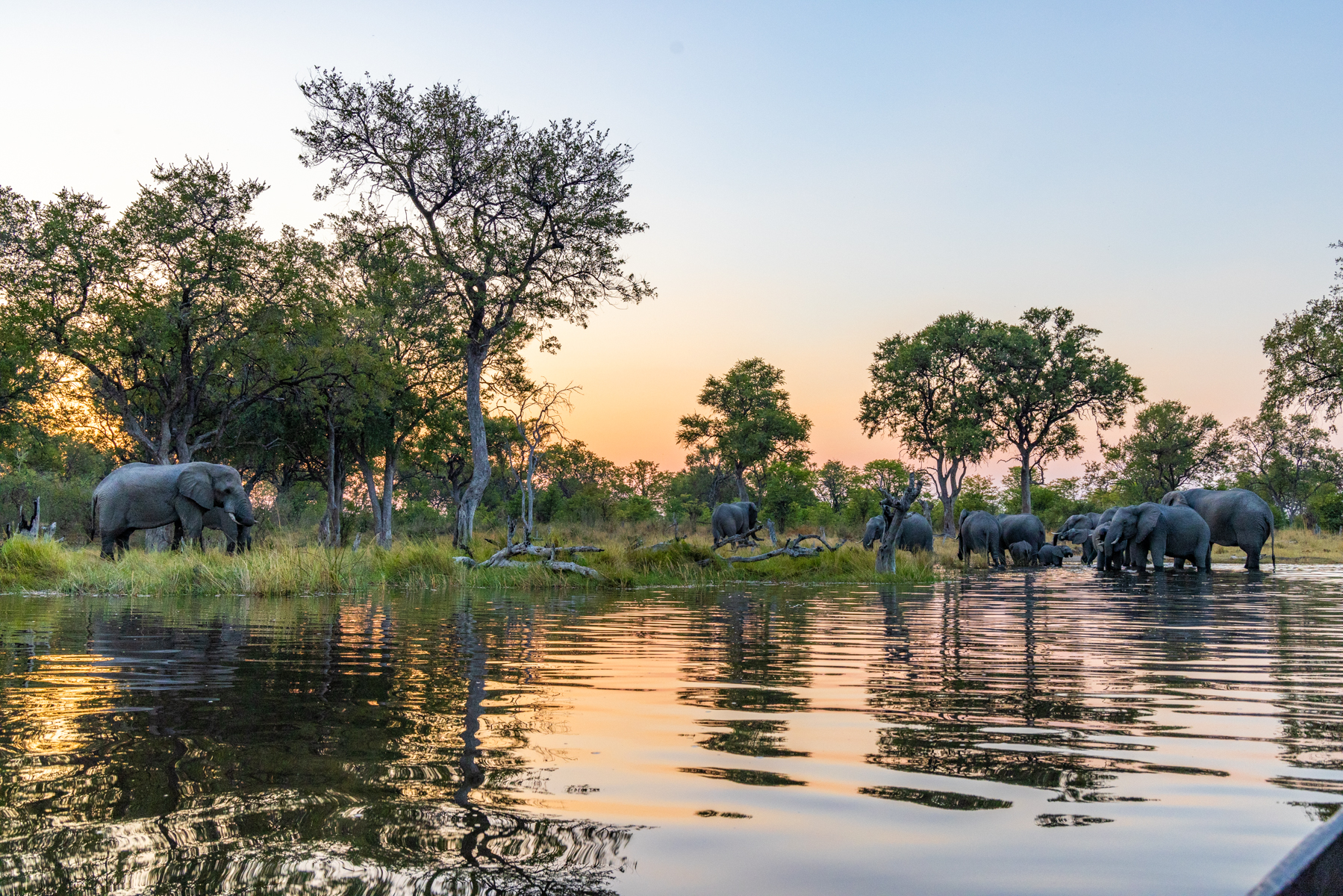
The herd congregated at their spot along the bank some forty yards from our bush cruiser. We settled into our Sundowner while the elephants enjoyed their own version. And right on cue the Angolan frogs filled the air with their mysterious song, a continuous coloratura soprano hum exactly like a roomful of humans delicately clinking their crystal stemware with their knives. Yet another time when nature favored me with a jaw drop.
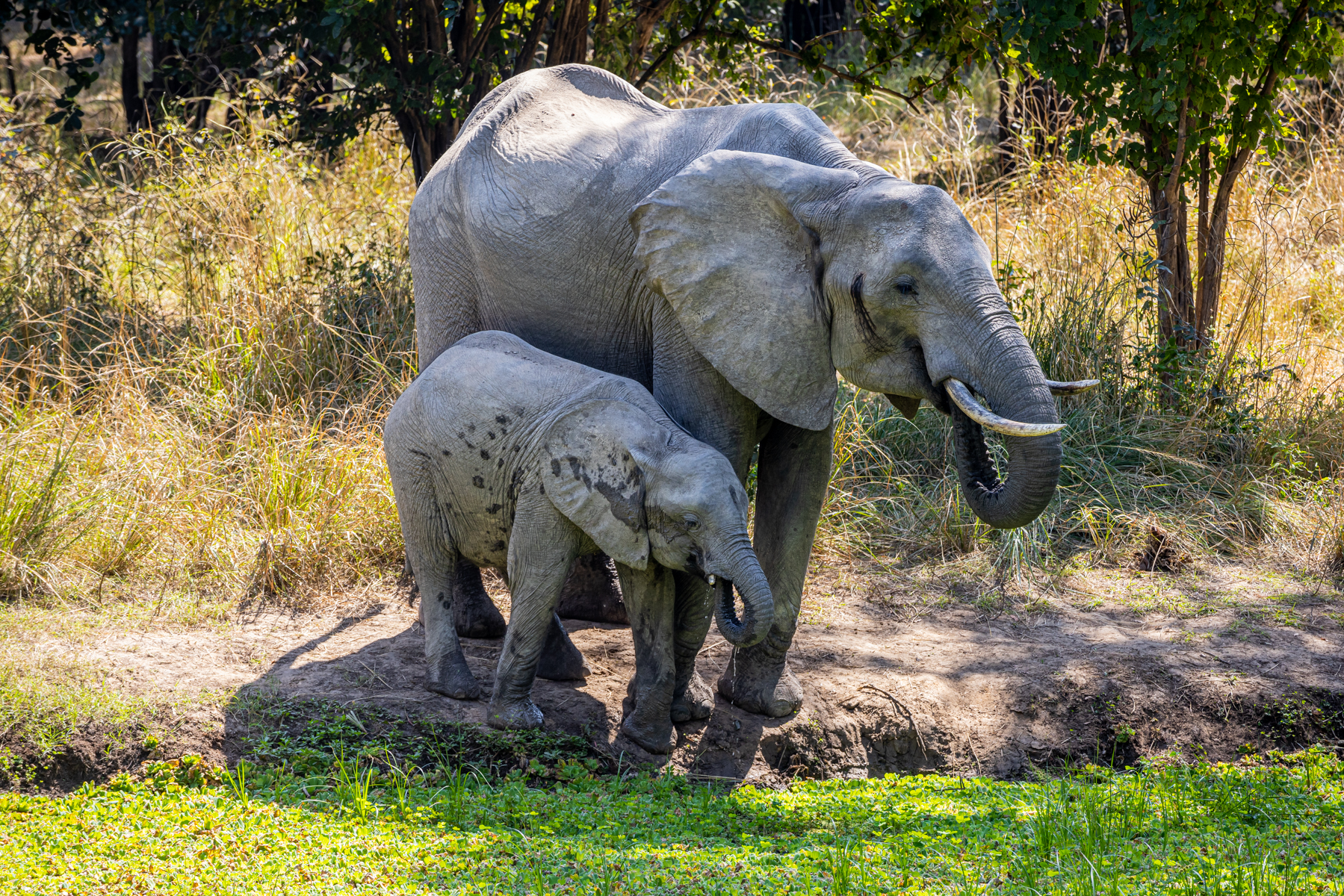
May I recommend for your viewing pleasure the documentary “The Elephant Queen” available for streaming? It conveys not only the matriarchal nature of elephants groups, but wonderfully highlights the species’ sense of togetherness, of close bonds within herds, of the mentoring and protection of young by old. This played out quite personally for us at Billimungwe, our last game lodge, in Zambia’s South Luangwa national park. Coming back from a morning game hunt, a bit knackered and favoring a little nap, an idea made preposterous when a seven member family moseyed up to the waterhole over which our hooch was located. Oh, my. Mom shepherding her calf to the water’s edge, clearly mentoring how to wield its trunk for a drink. The little one decidedly copying its mother’s motions.
A slightly older sibling or cousin wading right into the swim of things.

Then the two youngsters, thirst quenched, turn to walk back to the adult in the pond, a bout of maturity dashed when the youngest, succumbing to a “why not?” moment beyond its control, revels in rolling on its back in the dirt, punctuated with a finishing exclamation point of a trunk blown dust shower. Somebody’s gotta do it! Sooo good.


Well, speaking of mothers and little ones. Mom patiently holding still while junior nurses.

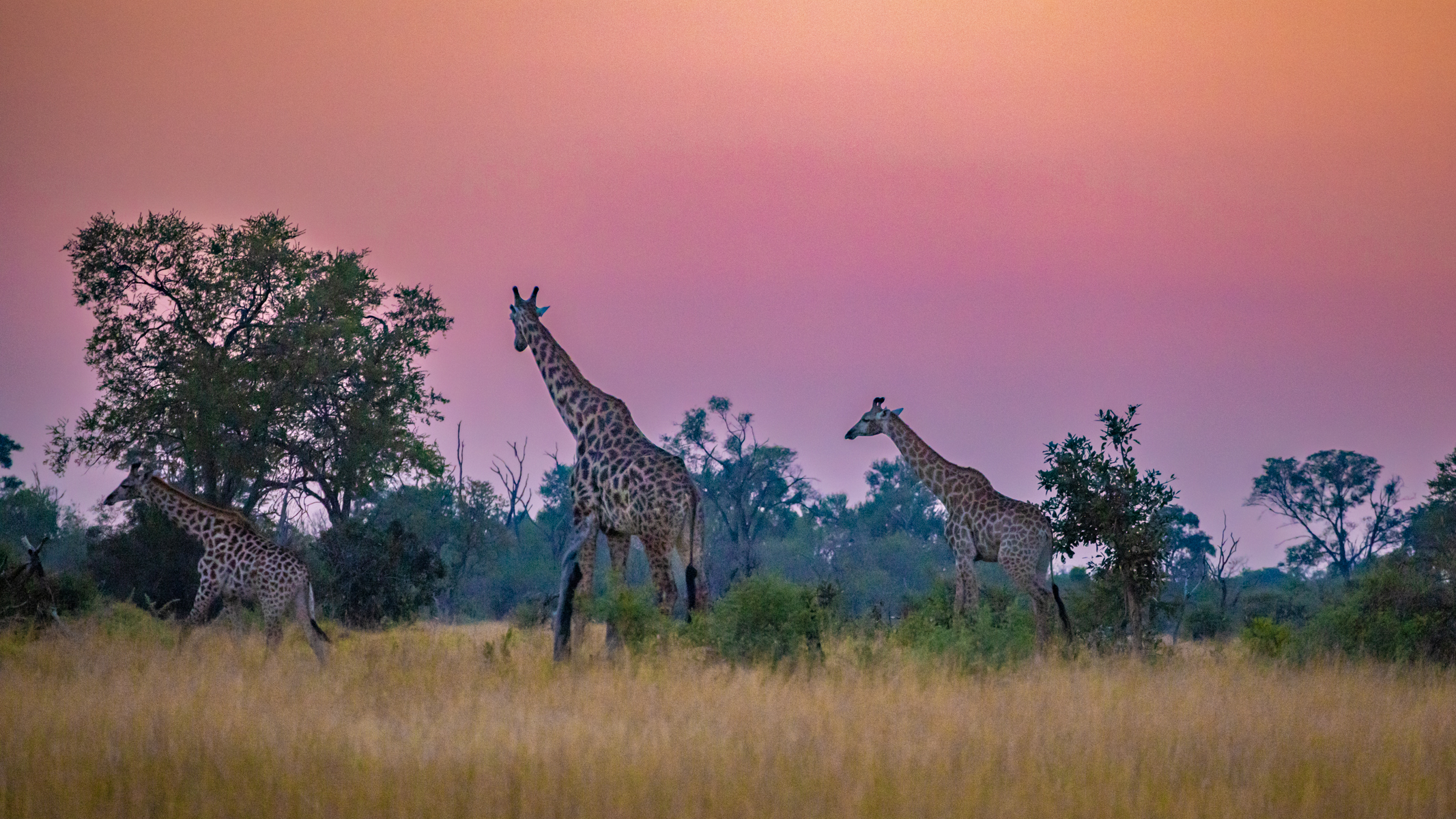
Elephants’ bulbous bodies make me want to chuckle. I can’t help it. Nor can I help thinking that giraffes look like elegant statesmen, who wouldn’t surprise me in morning suits. I’m none too subtle about my reverence for the rich low light colors of dawn and dusk. A nice byproduct of early and late game hunts. The times are chosen because that’s when the animals are about, but who am I to complain about the atmospheric pastels?

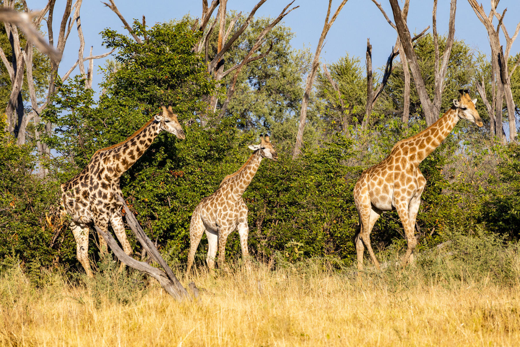
There’s an anatomical reason giraffes’ gaits are of such languid svelteness, and it’s more than their tall spindly frames. Commonly four-leggers not running, but walking, do so in a reptilian fashion, left front and right rear together and vice versa. Giraffes’ walking gait is two right legs together, then two left together. Neville Chamberlain never looked so proper.

Yes, bird cleaning of insects and other pests is their lot in life for giraffes, hippos, and cape buffalo. Maybe they are effective at ear wax removal, too? This would be a male, as his horns are bald. Male pattern baldness jokes aside, females’ horns are furry on top. I nabbed the picture below at a one-day stay to decompress from jet-lag when we first arrived in Africa, at a place called Thamo Telele, which translated from Setswana, means long legs. It is a sanctuary for giraffes, a creature that by all appearances is gentle and calm. Except when males set their sights on females in estrus. The resident biologist showed us a video she’d taken right there in the sanctuary of males fighting. Standing alongside one another, leaning down and back, then violently swinging their entire neck and head into body blows of their opponent. Visualize this as a MLB slugger cocked, then releasing into a whole-body over-the-fence home run, the giraffe’s neck and head being the bat. There’s a lot of momentum with their body dimensions. Crooks in the neck and concussions would seem inevitable.

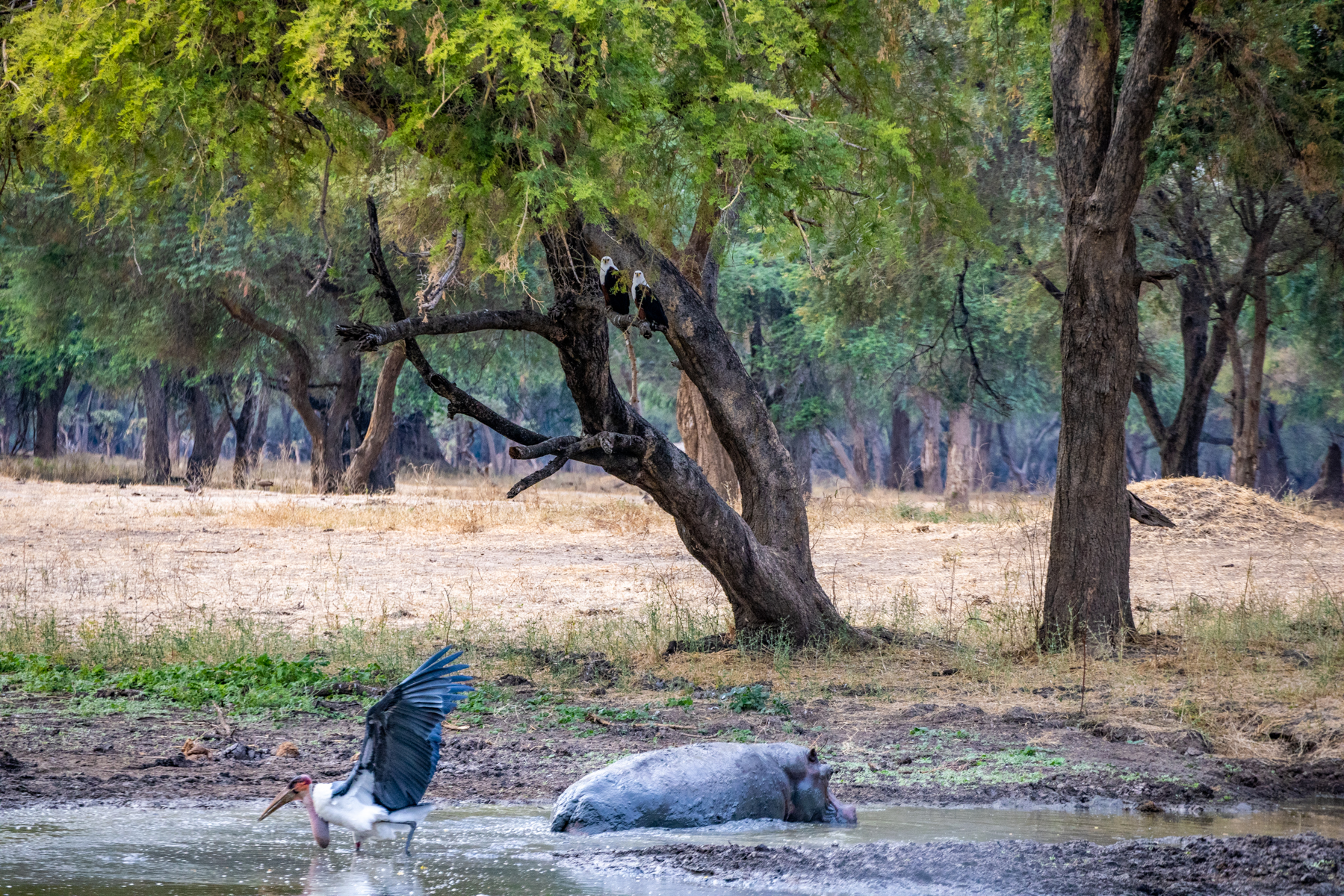
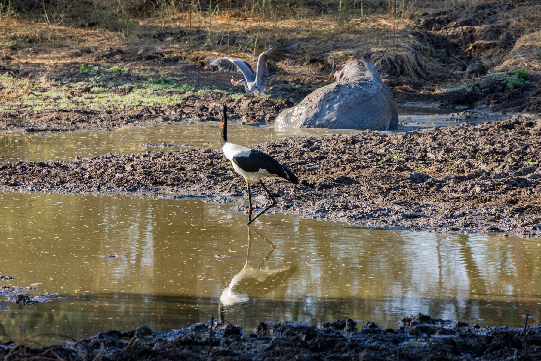
Hippopotamus. Hippos. On dry land, surprisingly agile and fast for their size. And not a creature to be trifled with. They spend much of their day immersed in the water, a load lightening for their huge bodies, but also a means of avoiding sunburn on their sensitive skin. My octogenarian dermis can relate.
During our time at Lolebezi Bush Camp in Zambia we elected to take one of our afternoon game hunts as a canoe journey on a side arm of the Zambezi river known as the Discovery Channel, and begun literally right in front of our particular lodging. This is a hippo strewn waterway with a moderate current, and in our instance, a 15 foot crocodile just yards from our eventual takeout spot. And that was after numerous paddle course adjustments for the countless hippos. Not quite Steven Spielberg, but it conveys a sense of safari adventure. Volume up.
The hide scars, blatant testimony to an ungentle comportment. And those enormous canines give as good as they get.


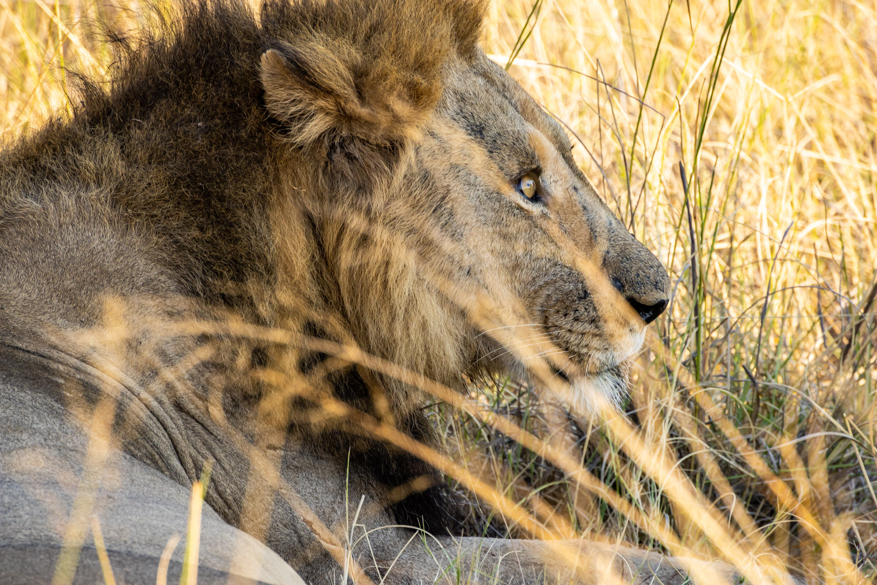
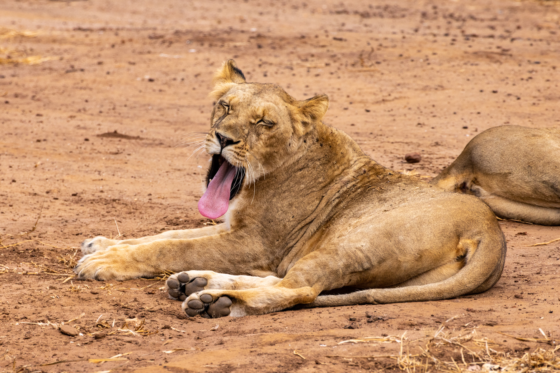
Lion. Simba in Swahili. Tau or Podumo in the Setswana of Botswana. I have no idea the term in any of the 73 native languages of Zambia. King of the African cats. Alpha predator. Males can hold their own in hunting, although females are often as not doing the, well, lion’s share as a pack, with the males showing up after the kill to claim their share.

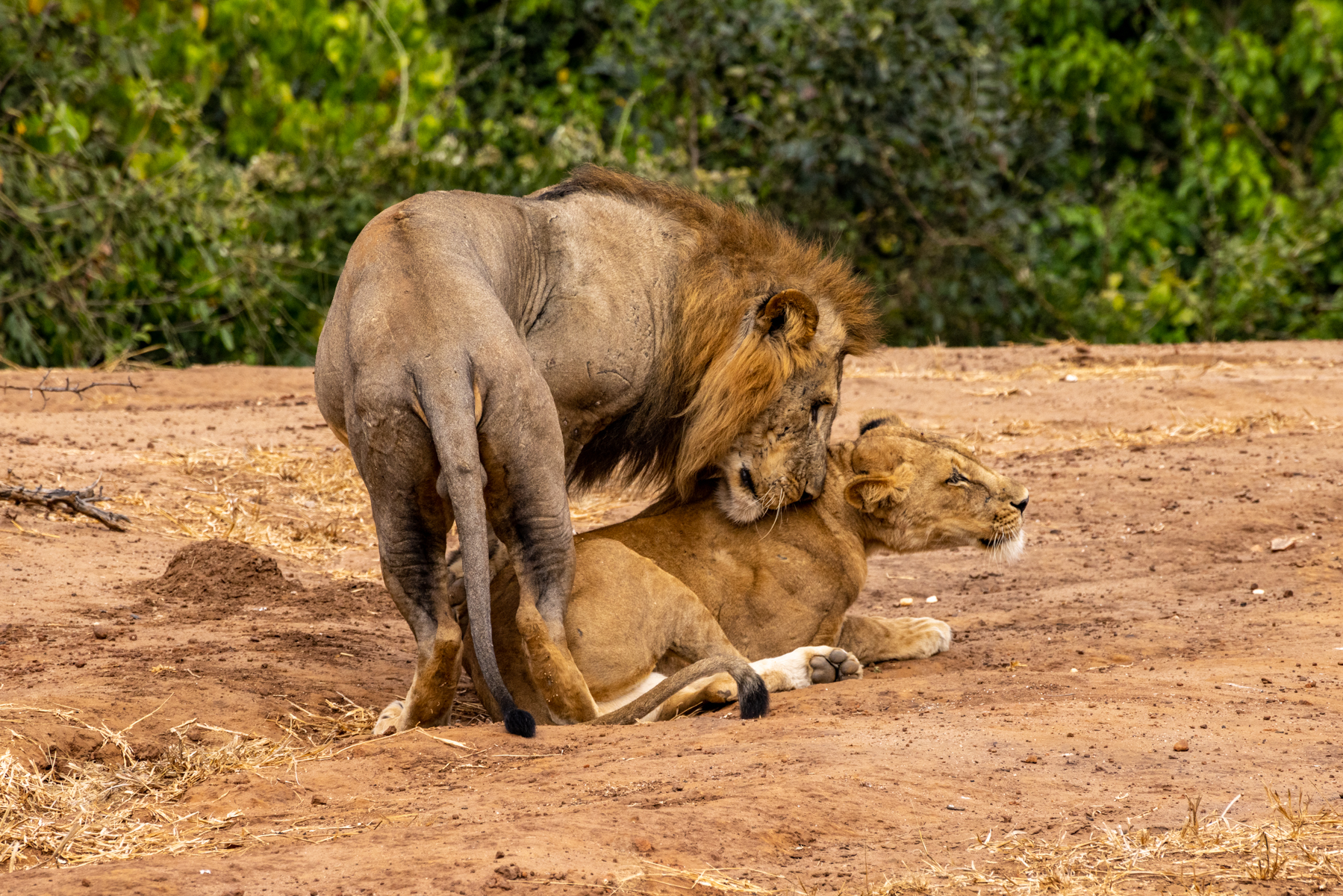
There’s an interesting glimpse into lion behavior with the male in the next three shots. He lounged some 20 yards from a female on the other side of a thicket, who though single at the moment, was part of a pride that didn’t include him, a solo interloper. Apparently sensing him before he showed up, she had hidden her two cubs and somehow conveyed to them to stay hidden and quiet, as the reason he was in the neighborhood was to kill the cubs and claim her as his seminal own. Lionesses who lose cubs in this way go quickly into estrus to be mated with multiple times per day for a few days by that male, who wants the perpetuation of only his own scion.


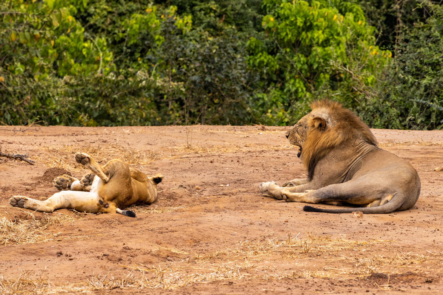
After some diligent searching and radio updates with other game drive guides we came upon the pride we were told the female belonged to. Here’s another lion behavior glimpse. The pride had just finished off gorging on a kill, and repaired to the grass in the shade of a handy tree. Perhaps you’ve had one of those “I can’t believe I ate the whole thing” food comas where collapsing supine with bulging tummy was inescapable? That paw across her chest, testament to the moment.


Do not enter this next segment if you take offense at graphic sexual depictions. A male doing his best to impregnate a female.


Predators quite literally live off prey.


Our travel between bush camps used smaller aircraft operating into dirt airstrips and paved regional airports. After departing the Delta, our travels took us by Cessna Caravan to Kasane aerodrome in the northeast corner of Botswana tucked in between a panhandle of Namibia to the north, Zambia to the northeast, and Zimbabwe to the east, to visit Victoria Falls. Like our Grand Canyon, it’s one of the seven wonders of the natural world. The falls are a precipitous drop of 355 feet of the Zambezi river into a gorge, and form the border between Zambia (the former Northern Rhodesia) and Zimbabwe (Southern Rhodesia). The Zambezi, at 2574 km in length is the fourth longest river in Africa. Named for England’s Queen Victoria (who never visited the falls) by David Livingstone when he came upon it in 1855. Yes, that self-same “Dr. Livingstone, I presume?” The indigenous name is considerably more apt—Mosi-oa-Tunya, which in English translates as “the smoke that thunders.” Does it ever. Staying to visit the falls can be done from the Zambian side or Zimbabwean side. We literally scored by accident when Thomson suggested a stay at 528 Victoria Falls Guesthouse https://528victoriafalls.com in the small Zimbabwean town of Victoria Falls. A truly scrumptious B&B. And seeing the falls from Zimbabwe is from the perspective of the water coursing over the edge. The mists thrown up by the crashing water shift viscerally from cloud to fog to sudden rain showers.

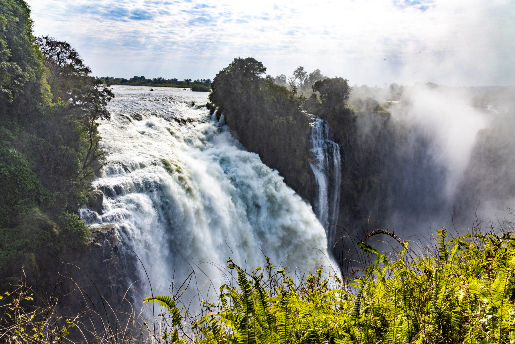
Oh, my goodness!

Below, the fruits of my effort to try local concoctions. Note the indigenous name and waterfall graphic. We also taste tested and taste tested Okavango Gin in Botswana and Zambezi Gin in Zambia. Did I mention taste testing the local gins? Whimsical fun.

After two days at the Falls, we flew into Jeki airstrip (elevation 2165′ MSL) to access Lolebezi bush camp in the Britten Norman Islander (8J-UAS) in the foreground.
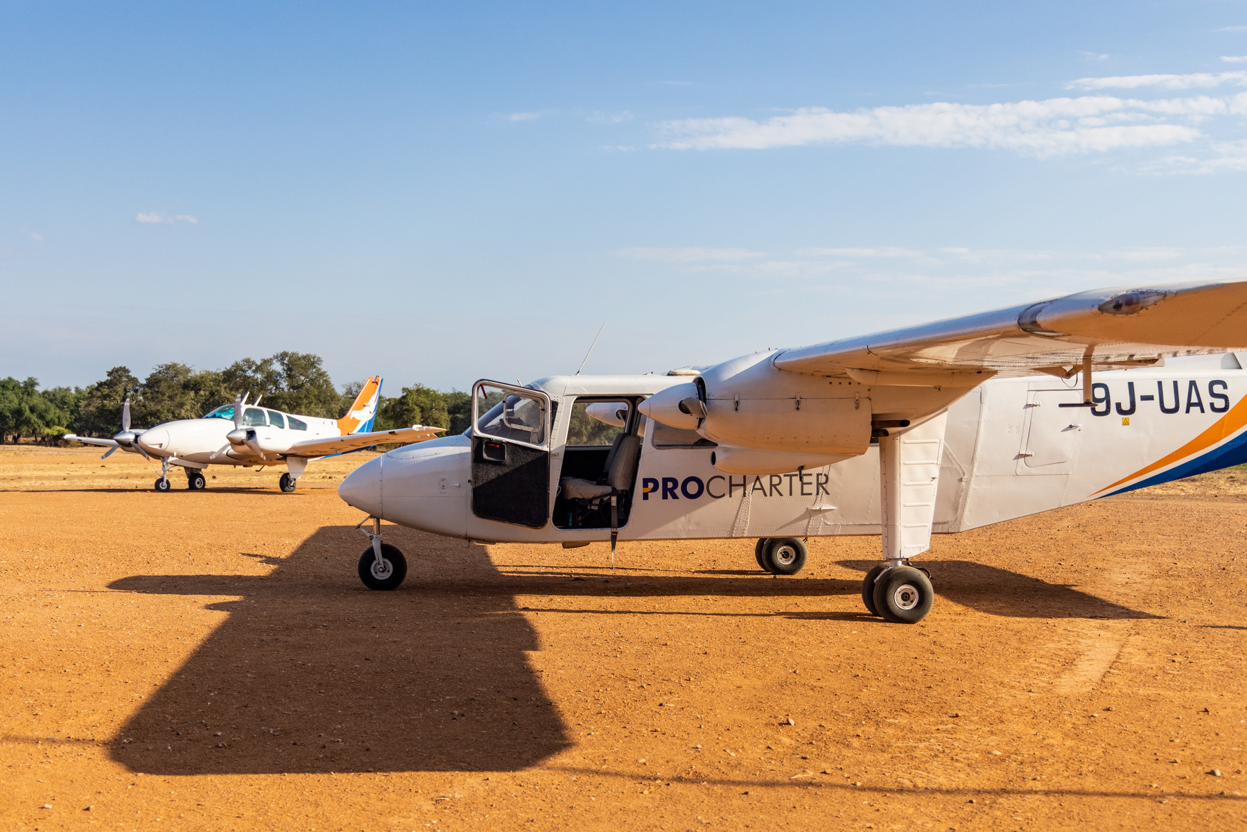

We departed Jeki three days later in the Beech Baron you see in the background of that airstrip picture, first to Lusaka thence Mfuwe aerodrome for Bilimungwe (it means chameleon) bush camp in South Luangwa. For the record I did part of the flying in the Baron, which had 5800 hard-working hours on the Hobbs meter.
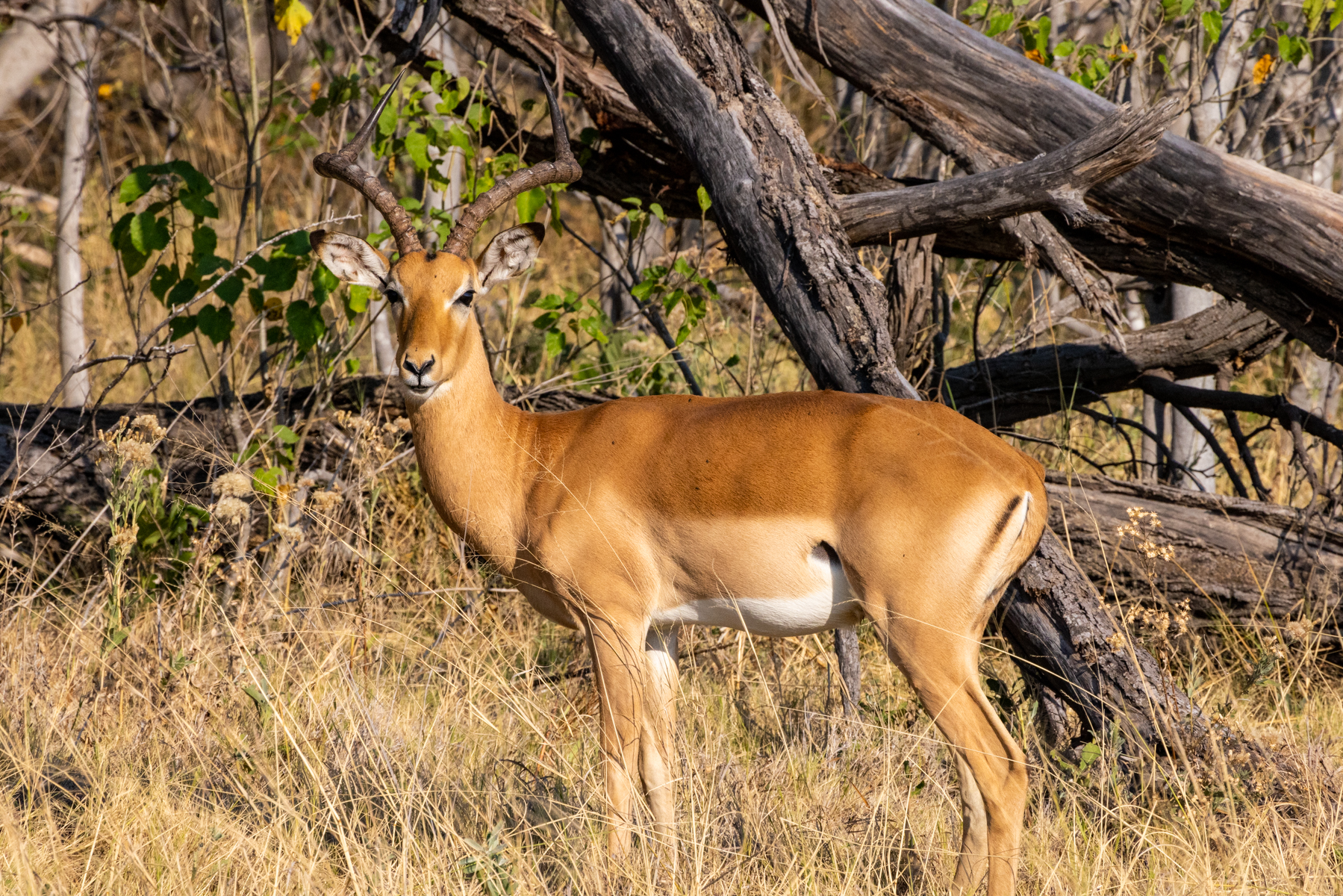
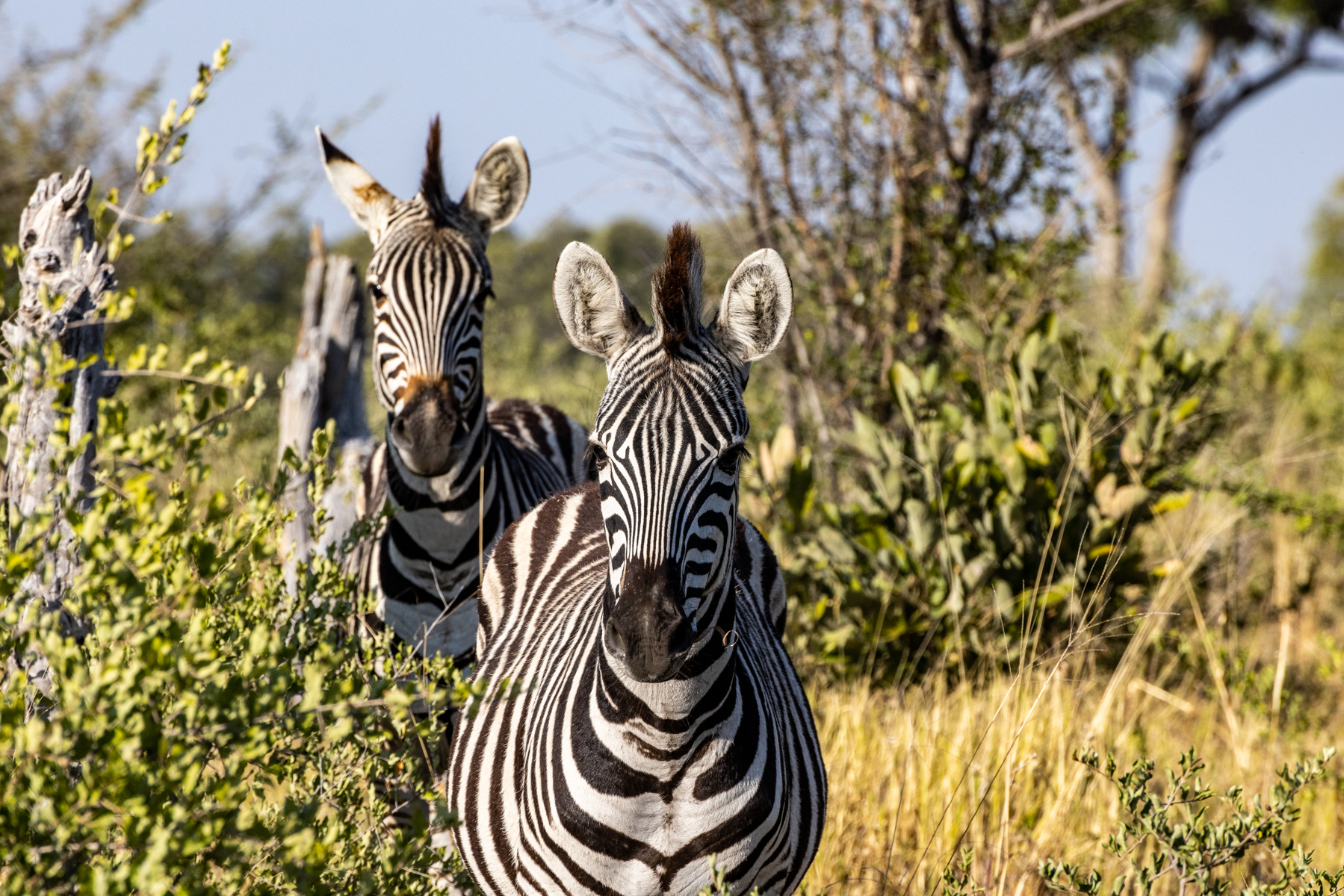
Prey? The impala, a male above, his harem, below. Creatures found everywhere in the bush.

It turns out that an impala amounts to both a few days’ tummy fill and an up-a-tree hoist able weight for the elusive leopard, who does so to avoid defending the kill from other predators such as hyenas. I fantasized about getting some daylight closeups of leopards. No such luck. They are hidden at all times, but because they hunt prey at night, our guides Elijah and Thomas were both tenacious and skillful at finding these stealthy creatures, then maneuvering the vehicle to put me tight to the action. All of these shots are in the dark of night. Per my request, and no surprise to them that I made it, they directed a hand held game light off subject, allowing me to use the penumbral light for focusing and exposure.


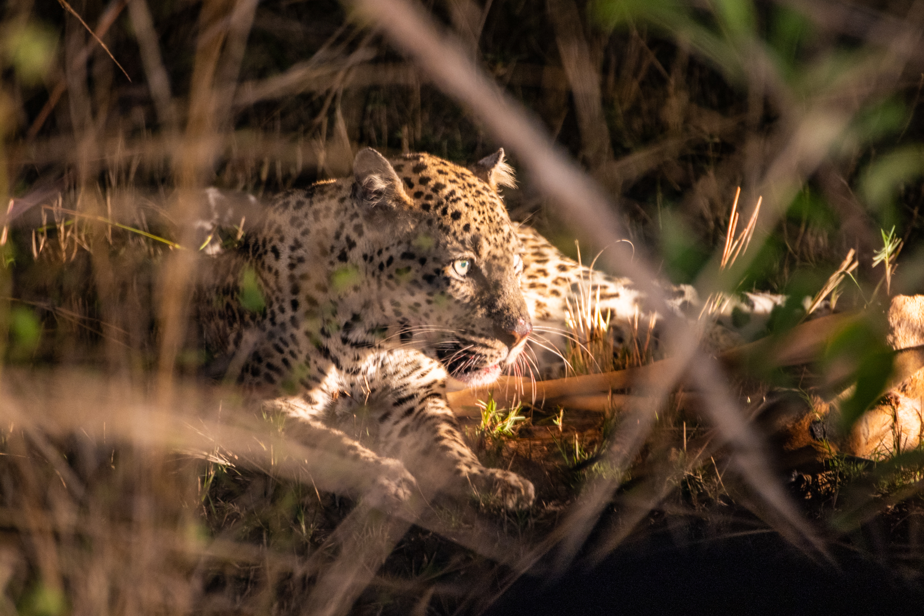
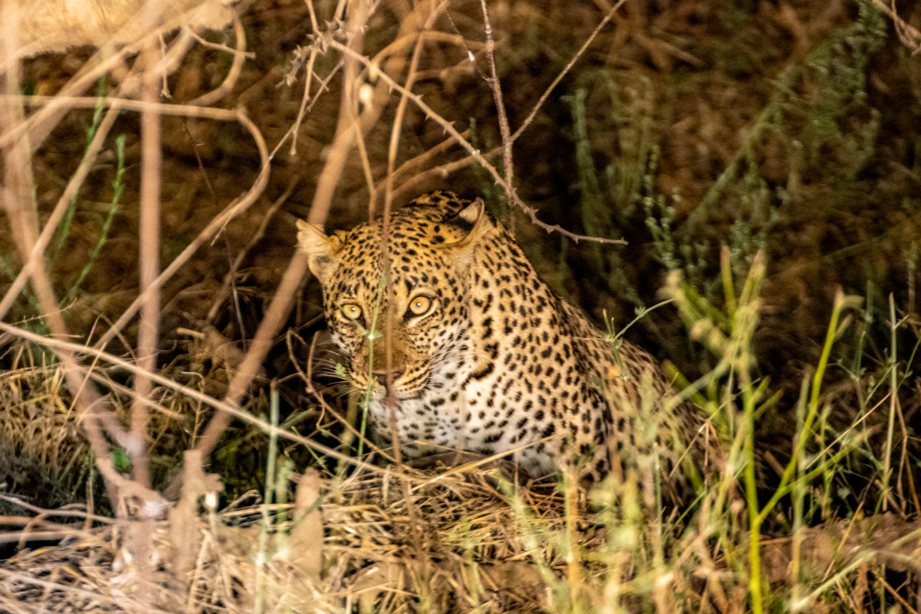
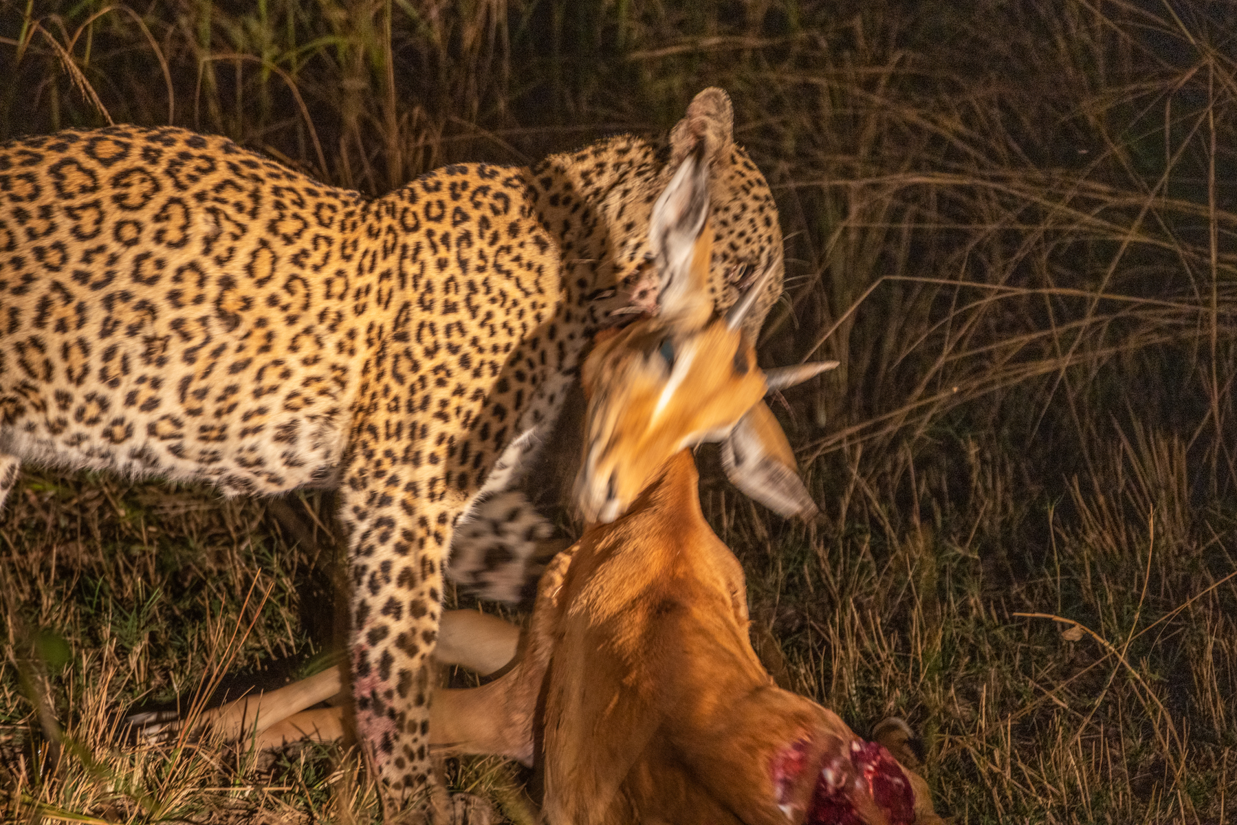
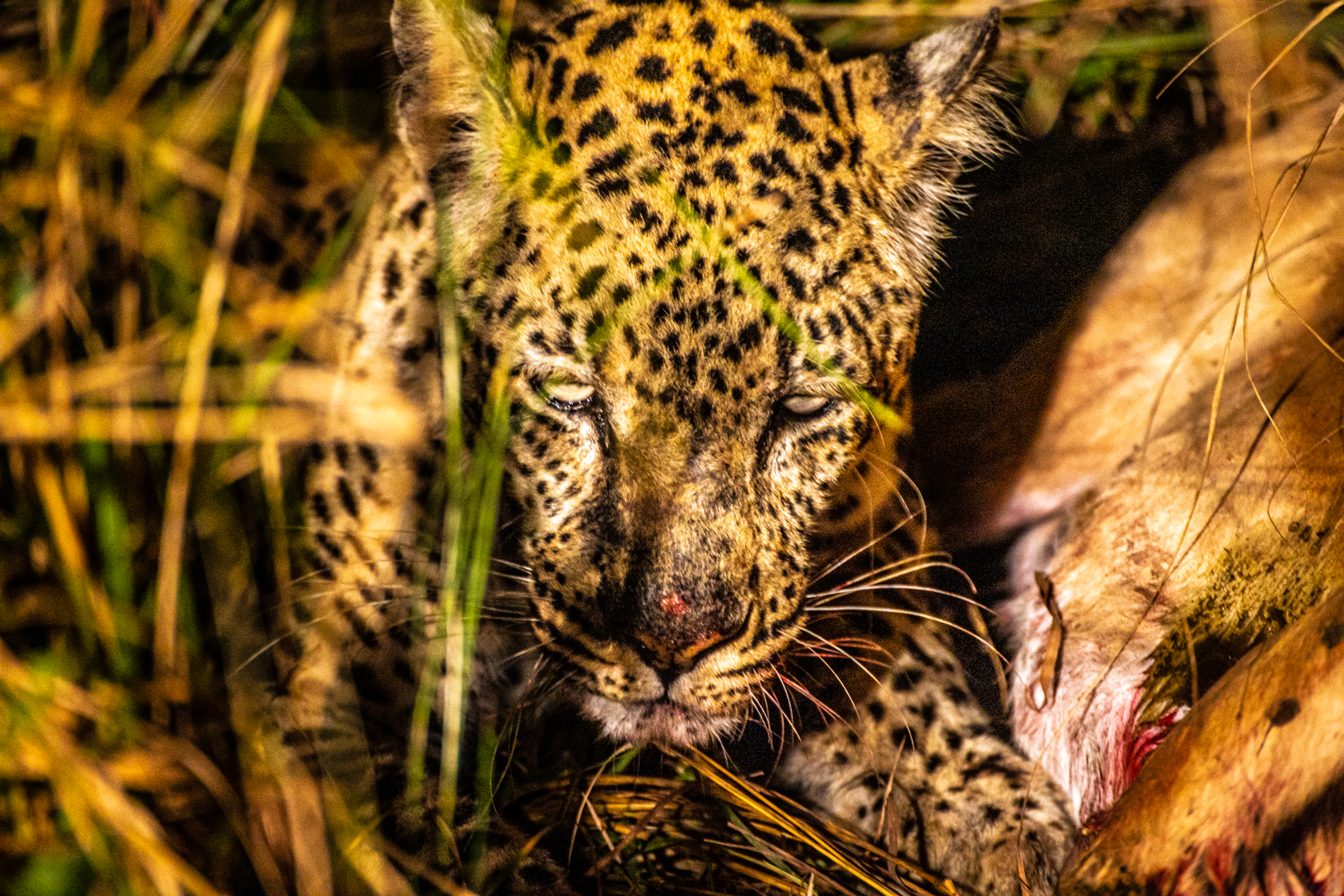
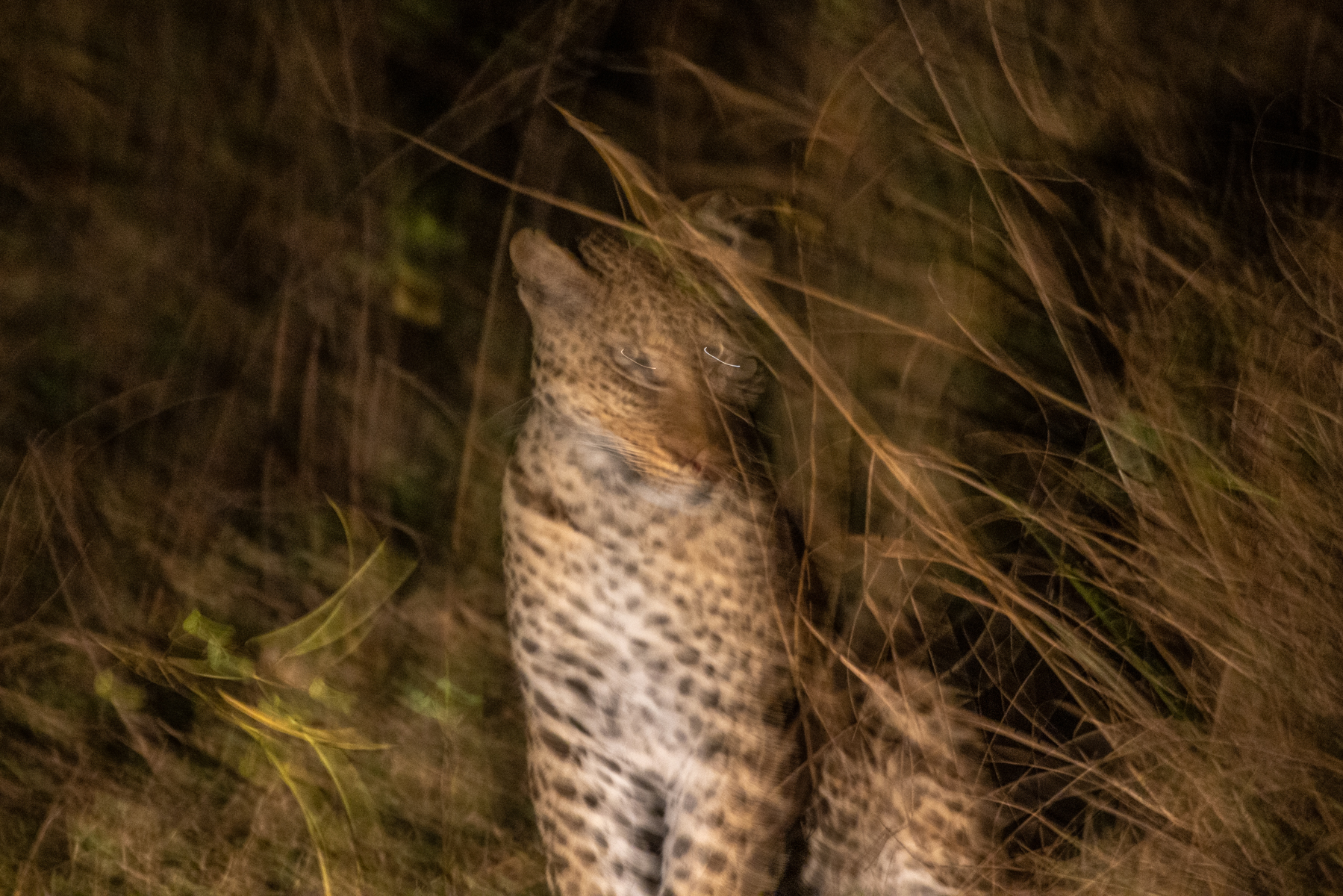
In discussing the dangerous creatures of Africa, reference is often made to the “Big Five”—elephant, lion, leopard, buffalo and rhinoceros. Rhinos have been poached for their horns into nonexistence in the areas we visited, but are being reintroduced into Zambia’s North Luangwa National Park. Expectations are the same for the future in South Luangwa where we were. So no rhinos, but there was plenty of African Buffalo, a big and potentially cranky creature.

That’s a male, above, whose horn structure makes me think of Darth Vader. Below, on an afternoon game drive, the sun dropping towards the day’s Sundowner, generating a theatrical light shaft in the dust the buffalo have trampled up in their grazing.
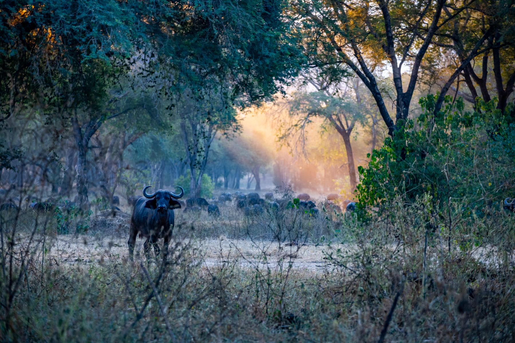
Hyenas aren’t on the Big Five list, even though they are dangerous in their pack hunting, more than just scavengers. Crocodiles also fail to make the cut. Nor do wild dogs, another pack hunter. Arguably an arbitrary list. We didn’t see a single wild dog on our trip, not for lack of trying. And when it came to hyenas, we had plenty of ravaged carcass, fresh footprint and laughing call evidence, but our only sighting was of these two pups who had been left by their mother for the time that our paths crossed. That’s some creature’s bone on which they are gnawing and playing tug of war. Training for adulthood.


Primates we commonly saw were baboons, up a tree particularly when predators were seen nearby, their raucous calls a warning cry particular to the danger.
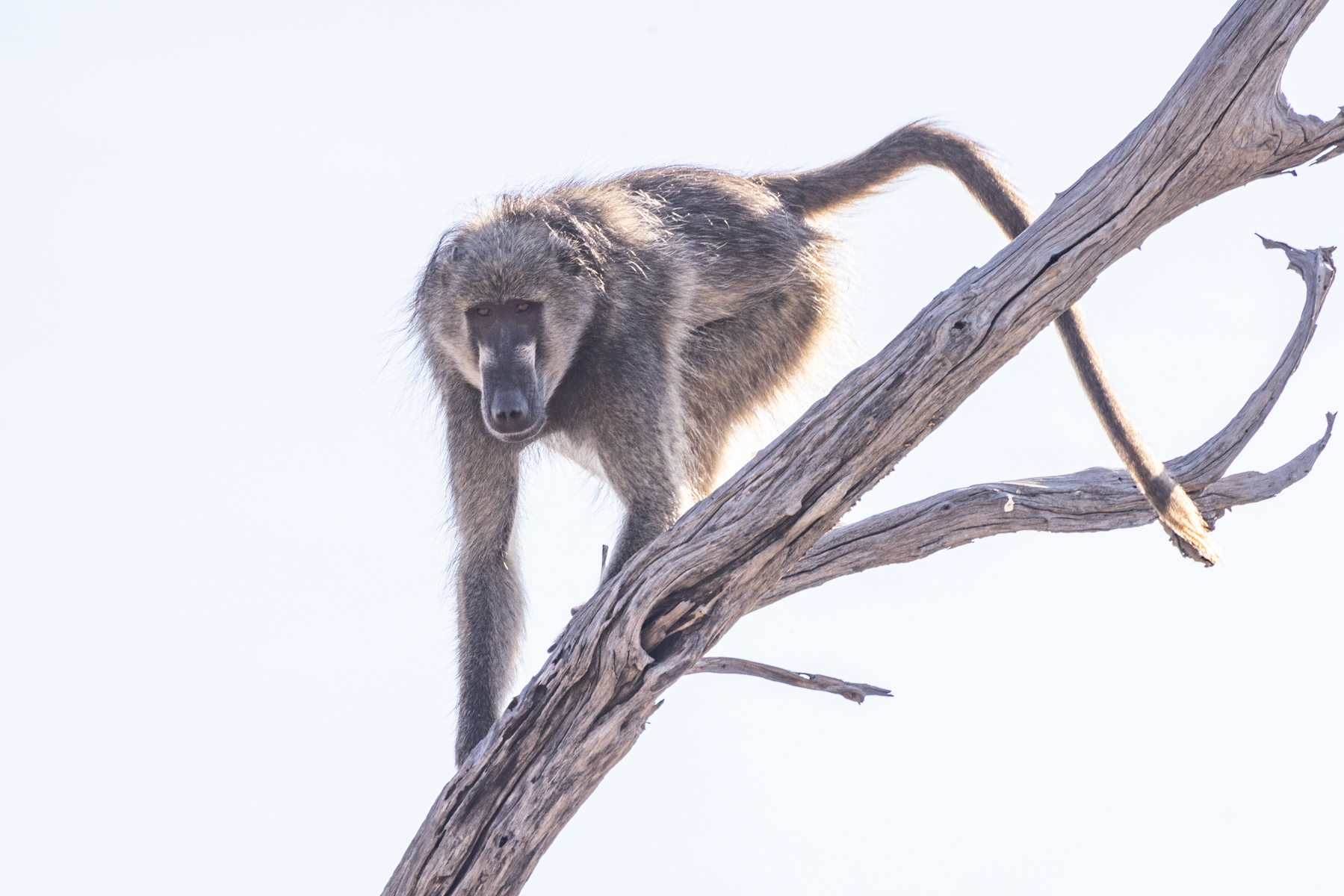
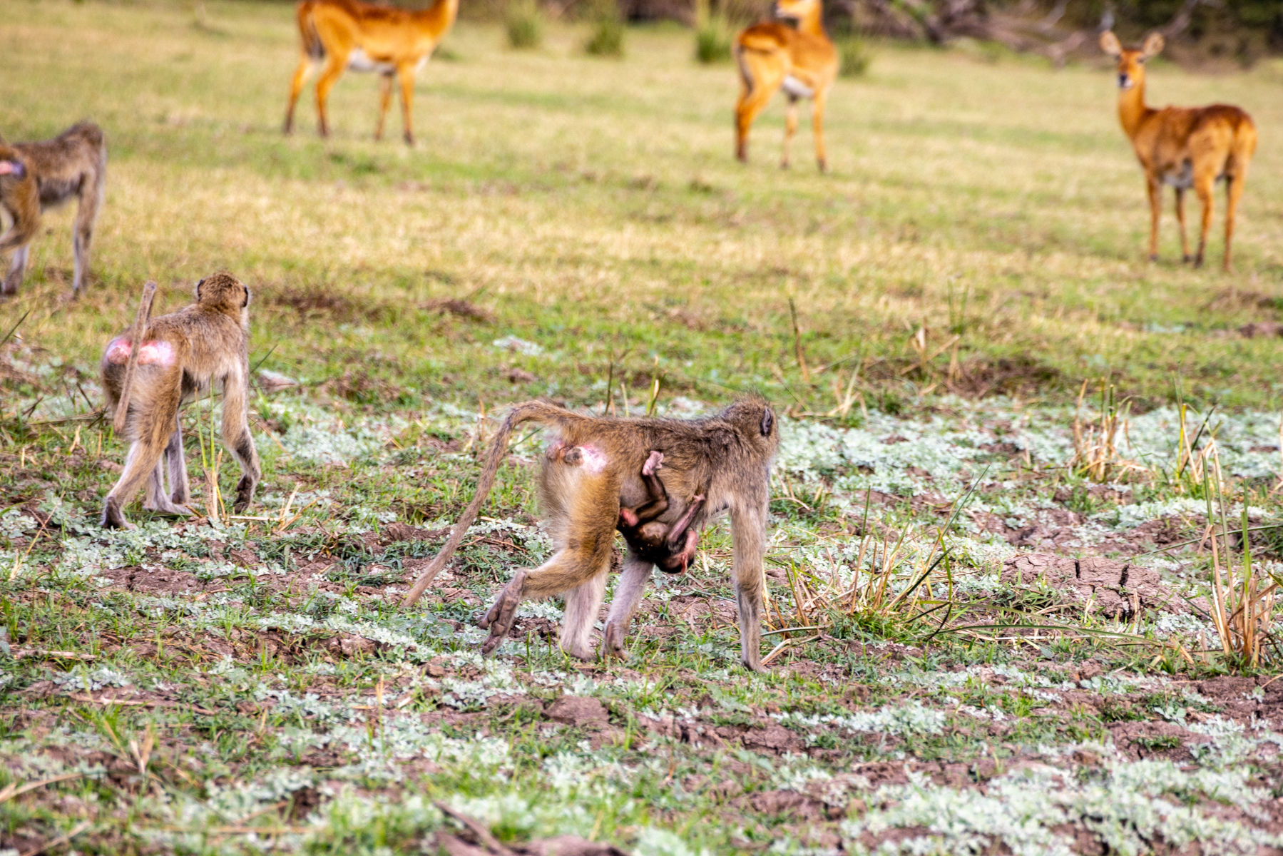
I find vervet monkeys possessed of a more appealing appearance and behavior. My anecdotal take is that they confined their ground time to the area immediately near their arboreal home, and, aloft, showed absolute mastery at racing along tree limbs and long airborne leaps between branches. Quite entertaining to watch.


There are many visitors who come to these Southern Africa regions principally for the birds, and there’s a plethora from which to choose.

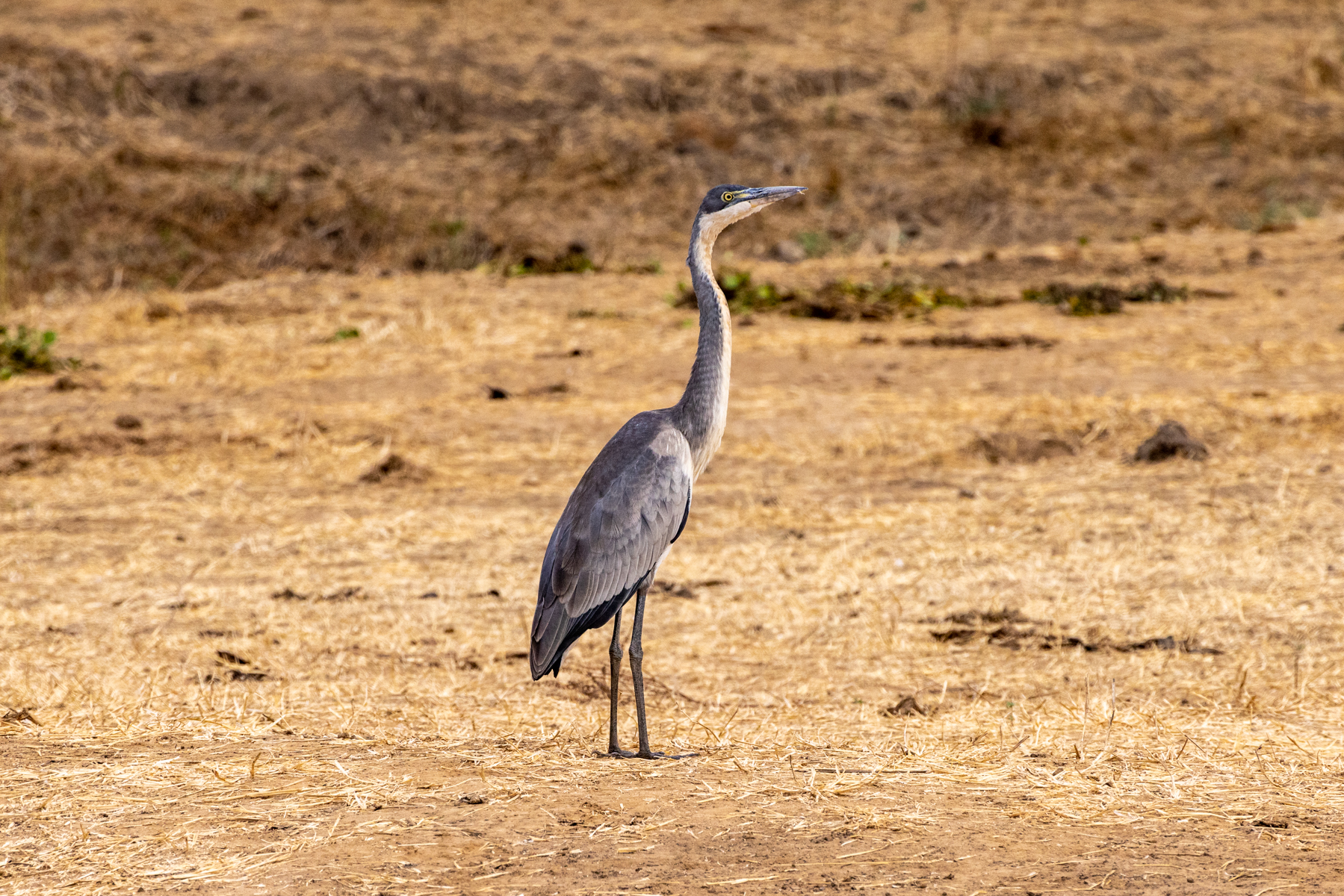


Below, the Lilac-Breasted Roller, about the size of a Robin, possessed of both gorgeous plumage and intriguing courtship behavior. They zoom rapidly upwards a hundred feet or so, then dive vertically downwards rolling about their longitudinal axis as they descend. I’ll have you all resorting to a Google search as I mention that his Aresti diagram would be a vertical descending line with a curved bisecting arrow. That, too, is a part of my eighty orbits of earth’s day star. Fond memories of wrenching about in my own colorful bird.
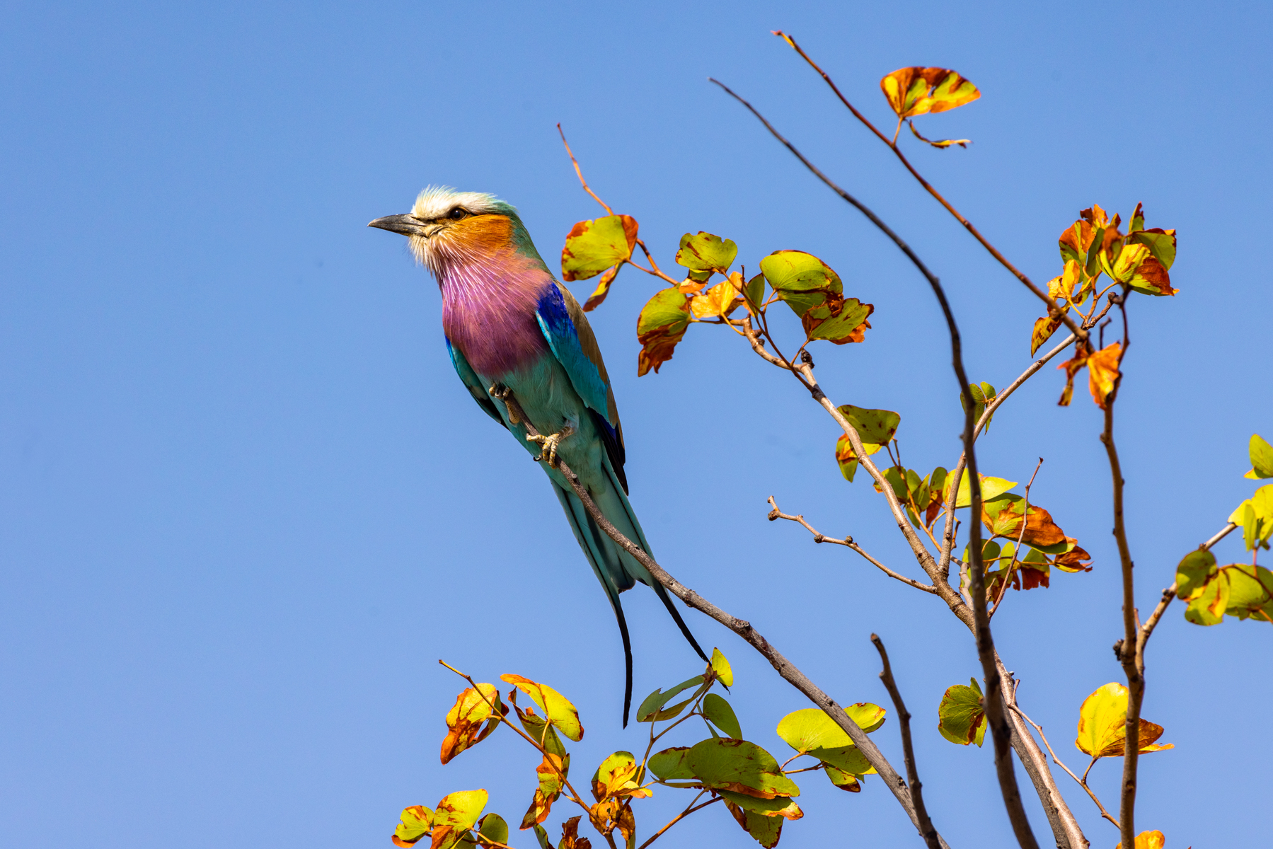
I should mention another mode of game hunting. Whether we hunted them, or vice versa, who knows? On one South Luangwa morning we switched to a foot safari. That’s Cathy, below, following our guide, Thomas. I was behind her, framing the shot, followed in turn, by our shyly comported porter/guide-in-training Ishmael. On point is park ranger Kelvin carrying his elephant gun, a .408 caliber bolt-action rifle. Five rounds in the breech, more on his person. He accepted my good-natured teasing when I’d ask “how’s your temperature?” at least after I explained the scientific scale. And, not that I have any Melville expertise, but with Ishmael I allowed as how his given name carries some highly regarded literary reference. And here is a segue to another serendipitous moment in our trip. These are intelligent, field-educated people possessed of knowledge depth for their where and what, but not necessarily considerable experience of the things for which we might turn to Google. One evening Sundowner twilight, returning from nearby bush watering, I looked up at a crescent moon, and a bright shiny Venus. And then, “whoa” rapidly transiting the vault above, stage left to stage right, was the incredibly incandescent International Space Station. I rushed to our little group and abruptly interrupted the conversation to point out the rapid passage of the ISS. They were thrilled to learn that there were humans up there orbiting our planet and conducting scientific research. With nothing resembling an internet connection, this moment of shared education was all verbal. In salutation, everyone of us raised a task-appropriate libation to this common moment.
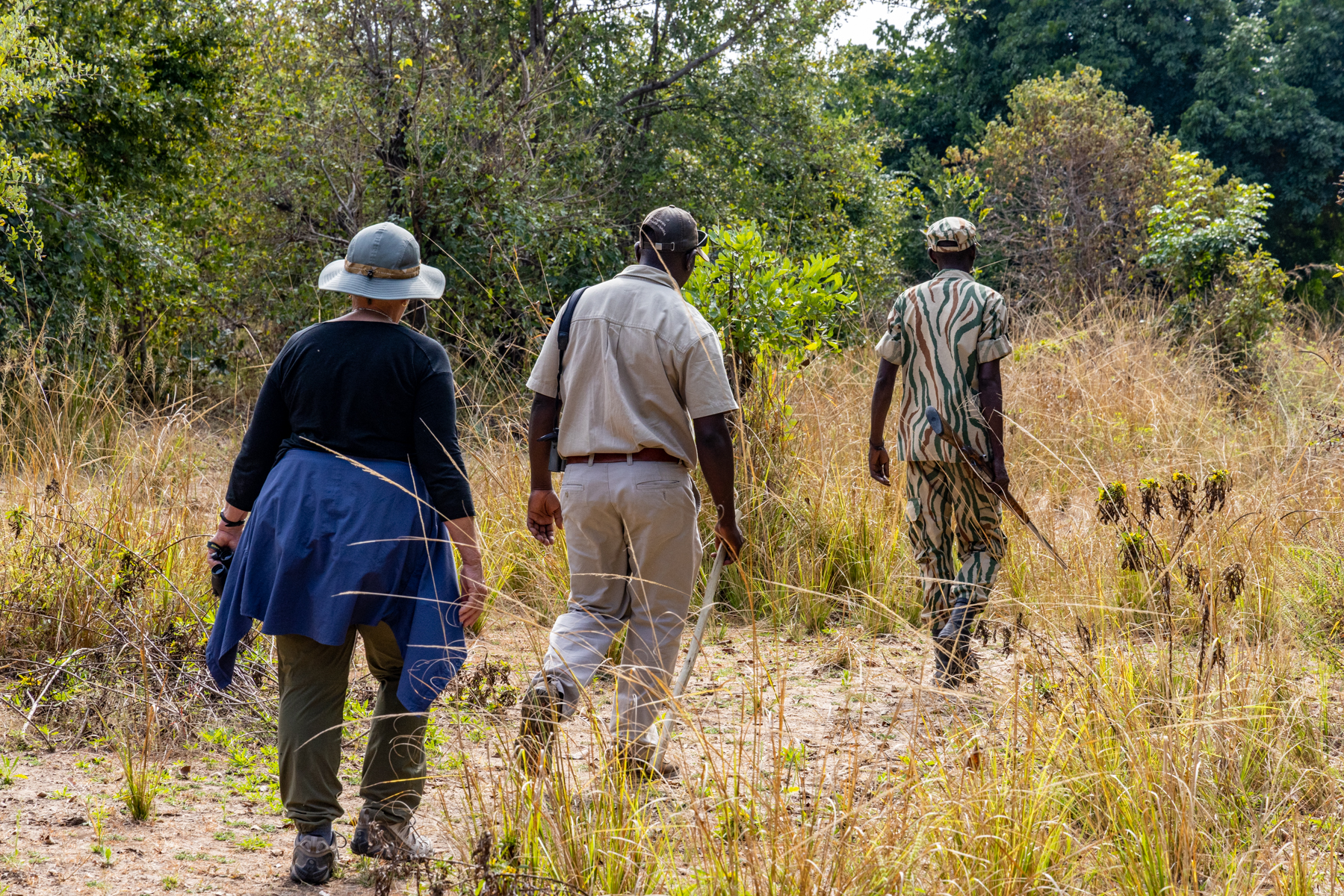
A few shots that are just intended to convey the beauty of the region.
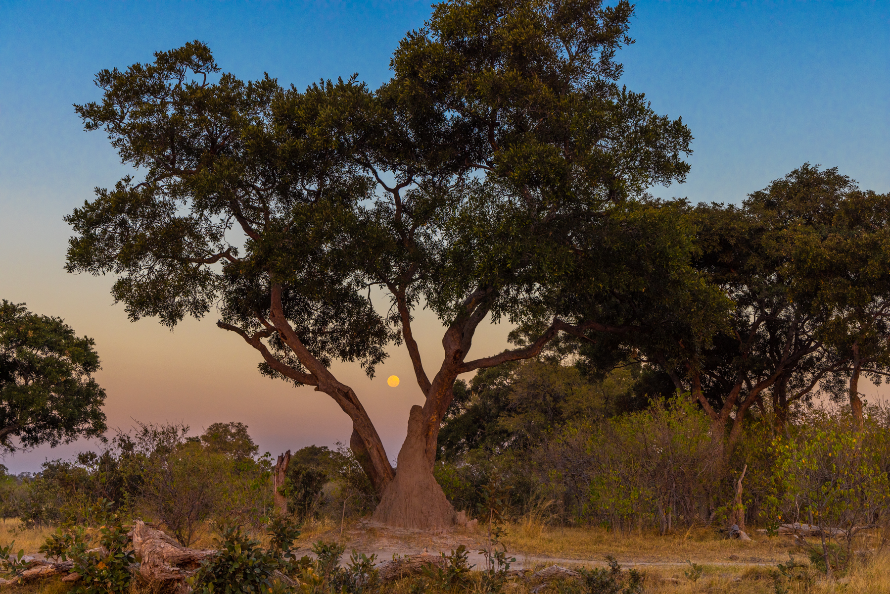
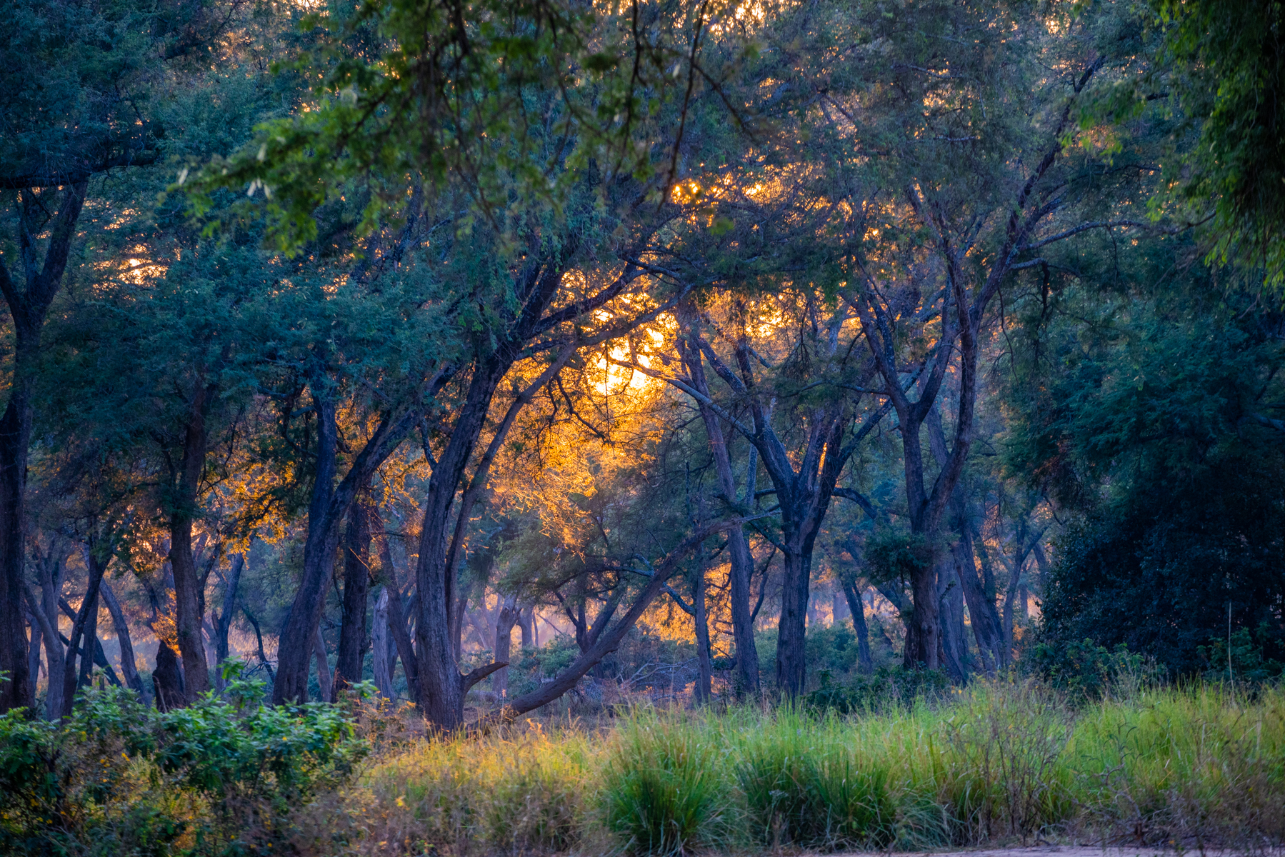

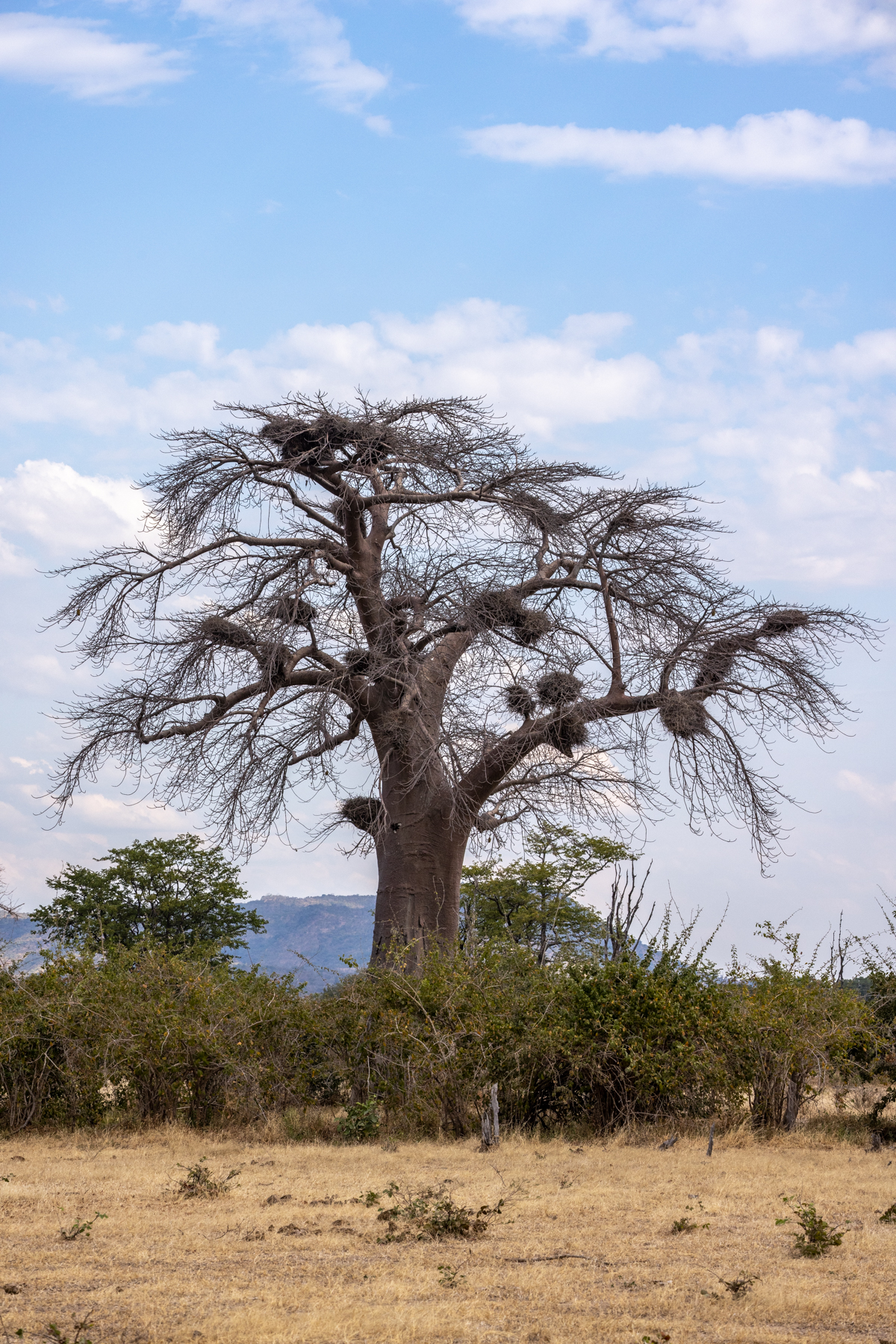
A two-part Time-Lapse of our last night’s Milky Way starscape and last morning’s breakfast sunrise over the Zambezi river, South Luangwa National Park, Zambia. I find it fascinating that in the southern latitude the sun rises and arcs to the left as it climbs. Here, it arcs to the right.
And after all the weeks’ problem-free game drives in and through the deep bush, as it was time to climb aboard for the four hour drive from that sunrise to Mfuwe aerodrome to begin our 43-hour flight saga back to Del Mar, there was this moment of levity. A flat tire. Don’t bother to call AAA!

Cheers, Tom
Beautiful British Columbia
Posted on August 12, 2022
The license plates of Canada’s most southwesterly province proclaim “Beautiful British Columbia.” And how. A verdant land of lush forests, tall mountains, and water, still and moving. And a country of solicitous and friendly people, all of it beckoning in the time of Covid.
We sidestepped the summer airline travel laments by saddling up our Cirrus—N711QT—for the 1017 nautical mile flight each way between our home ‘drome of McClellan Palomar-Carlsbad (KCRQ) and Victoria International Airport (CYYJ) on a peninsula at the SE corner of Vancouver Island. There’s lots to see during the six hours and change to fly this route, including a nice shoulder glance at severed-top Mt. St Helens and Mt. Adams. Calmer now than when I flew United 443, a B727 into Portland, Oregon, on May 18, 1980, arriving just as St. Helens blew her top. It literally looked like a nuclear mushroom cloud, billowing up into the highest reaches of the atmosphere. I’ve just reviewed my contemporaneous logbook entry remark—”Mt. St. Helens Erupts—WHAT A SIGHT!” But a more tranquil sight on July 21, 2022, when this image was taken.

We mostly plan our own getaways, with an eye to fresh air and restrained adventure. Sometimes the planning fails to cover all the details and unexpected adventures arise. I had sweated over online filling out the user-unfriendly governmental e-APIS (electronic-Advance Passenger Information System) documents a lot more than the actual flight plans covering the navigational courses, the time en route, the fuel requirements, weather and such. e-APIS, a byproduct of Nine Eleven, is the way that countries know the names and passport information of whoever is traveling by air across international boundaries. They want to know where you are going to cross the ADIZ (Air Defense Identification Zone, the actual in-flight cross-border boundary) and when—for us, DISCO, a waypoint over the Straight of Juan de Fuca, 18 nm SE of CYYJ, eleven minutes before touchdown. There’s no line in the sky or on the sea below to mark it, and the actual ADIZ there makes a dog’s hind leg look straight. Aviation authorities are picky about this stuff, and garfing it up could actually result in a fighter jet pulling up alongside to usher you to an official comeuppance. As an aside, our chums to the north also have an online ArriveCAN document that no one told me about, but which I discovered on my own before departure, and which calls for conveying passport information and scans of traveler immunization documents with attestations of no Covid symptoms. Coming up on DISCO almost to the minute, could have had me wallowing in self satisfaction over my flight planning and aviating prowess, but just about then, while in descent, an ALT 1 warning light came up on the Primary Flight Display, and a glance at the engine page of the MultiFunction Display confirmed that our #1 Alternator (there are two) had failed, a fairly important irregularity in an all-electric airplane. I dug out the checklist to assure not missing any important steps in the procedure, and at first got ALT back on line…until it failed again. Still barely in U.S. airspace, I requested a diversion to Paine Field, Washington, off to our right, and enquired of ATC the straight line distances to both KPAE and CYYJ. Victoria was barely a few miles farther on, and that is where our vacation lay—hotels, rental cars, ferry reservations and such. Damn. I reset the ALT one more time, and it came back, so I talked ATC into a clearance Direct To CYYJ without the normal circuitous Standard Terminal Arrival. And naturally, the alternator then chose to fail again, permanently so. Pilot mea culpa, here—electrical abnormalities generally call for one chance to correct it, not multiple tries, and a diversion begun is probably better continued, and what your plans are upon landing should be the bottom priority for diversion considerations in the first place. I’m human, and weighing the variables, chose to continue to Victoria. So shoot me. Victoria Control, obliging as they were, enquired if I had the aerodrome in sight. Never having been there before, not at first glance. But then it appeared, and below is the Canon R5 view as we entered the traffic pattern on a bearing that was part downwind and part base leg to runway 09, the runway somewhat parallel to our current track as we descended toward the boats in the water at 9 o’clock in the frame. Per the checklist, I had shut down the alternator, and deactivated all the unnecessary electrical draws normally powered by that alternator, but still the #1 battery which powered things without the alternator function began a slow bleed down of voltage. News clue, this is the battery used to turn the propeller for engine start. Hmm.

We touched down, and per the tower’s request exited at taxiway W, which led directly to the Shell ramp, the official Canadian Customs and Immigration location for arriving private aircraft. And this is where the second unexpected adventure began. I had missed an important substep in the official arrival documentation. It turns out that neither e-APIS or ArriveCAN tell their Customs and Immigration that you are coming. e-APIS apparently tells their Air Traffic Control, but not Customs and Immigration. Before departure I had looked for a Victoria C & I phone number to enquire if I had accomplished all they desired? I could find no such number. So then I called the Viking Air Fixed Base Operator on the field where our airplane would be parked during our vacation, and asked them if there was any special procedure at this particular international airport? “Nope, you just use the CanPASS phone at the Shell location after you land.” Such phone is located next to where they have you shut down the engine, and another, just inside at the flight planning cubicle (and near the all important restrooms). I used this latter phone to call 1-888-CANPASS denoted on the adjacent wall, and after being on hold for nearly a half hour got a real human, who proceeded to edify me that I should have told them we were coming by calling their toll-free CANPASS number from the U.S. within 24 hours of our estimated time of arrival. So now we had to wait on the plane for two customs ladies to come and check us out. They were very official and very armed, but also very Canadian, which is to say they were quite pleasant and polite while giving me a warning not to arrive unexpectedly again, or I’d be cited or whatever. But there were more unexpected twists. Deb, the lady in the Shell FBO, who had told me that she could tell me where the CANPASS phone was at the flight planning station, if she could tell me anything, but which she couldn’t because until the armed customs agents arrived we weren’t officially in the country yet, but then after the customs agents did arrive and admonish me, arranged to have her (Deb’s) assistant drive us to the airline terminal to get our rental car which couldn’t be delivered to the Viking Air FBO where our plane was to stay, and she (Deb) would waive the $60 per night Shell aircraft ramp fee because we were both birds of a feather airline types (she an ex-flight attendant whose husband is a retired Canadian airline pilot, and whose son is now) this in deference to the fact that the modestly depleted battery possibly hadn’t enough juice to start the engine so we could taxi to Viking Air, and besides it would require waiting until the next morning because the folks at Victoria Air Maintenance, Ltd. who would actually work on the alternator and who had the tug needed to tow the plane had just gone home for the day at their 5 PM closing. You following? Well, that’s about how convoluted it played out in real time with a mechanical problem, a Customs problem, a car delivery problem and such. You can’t make this stuff up. Once we got the car, we were happy to find that our map navigation applications in our mobile devices would work in spite of Verizon’s goofy Canadian usability, and we repaired to our Brentwood Bay Resort lodging and its lifesaving pub, where a BC micro-brewed pilsner put things in a better light.

Above is the source of our lament, as found by Vic Air Maintenance mechanic Patrick Lee, and shown to me the next morning before heading to Butchart Gardens for the first day’s planned tourism. Patrick, having gotten my voice message from the afternoon before now knew of our predicament, and had proactively gone to Shell and tugged the plane to Vic Air. A portent of amiable pro-active engagement things to come. Just below the center of the frame, pointing toward you is the cooling baffle “through-bolt” from the gear-driven #1 alternator, to which is normally attached the hefty wire that carries the current to the airplane’s motherboard known as the Main Control Unit. The wire is the black line you see running up and to the right, and feeding into the white rubber insulating sleeve, out of which at the bottom is a blackened and deformed (melted) cable terminal that is supposed to be screwed down tightly to the bolt. But the bolt-securing nut had worked its way loose, and then exited the airplane. leaving the cable end to alternately connect and disconnect from the through-bolt, arcing and searing itself and failing to provide usable current to the MCU. The bolt isn’t so much out of focus, as melted and deformed. Fortunately, the shutdown step in the irregular procedure precluded this devolving into a genuine electrical fire emergency. But the fix has required a new alternator, a new through-bolt, a new cable end, and a new Field Control Module in the Main Control Unit. You don’t want to know the cost of all this unless you are sitting down and on to at least your second pilsner. The Big Guy upstairs apparently likes us, besides avoiding a fire, nudging us on to CYYJ vs. KPAE and delivering us to both our vacation and to superb maintenance. Patrick and the folks at Vic Air Maintenance are first-rate aviation repair types, and they coordinated with Jared and Reuben at San Diego’s Coast Air, the local Cirrus service facility that normally takes care of the plane, to get the right repair procedure guidance and parts delivered from Cirrus and Boeing in the U.S. to effect the repairs. We didn’t have parts availability supply chain issues of the sort reported these days, but both Boeing and FedEx dropped the ball on keeping the parts coming. It took a week of daily phone calls and text messages by Jared and me, to get the parts to the Victoria FedEx delivery center, and then Patrick showing Canadian can-do moxie, to personally go and hand retrieve them. I frankly do not know what sort of maintenance options would have been available at Paine Field in Washington, but they could not have been better than Vic Air, and the two-week vacation would have been as toasted as that cable end in the picture. So, some anxious unexpected adventure that turned out to the good.
I know you are true cognoscenti, and therefore have heard of, if not in fact visited Butchart Gardens. You don’t have to be a garden or flower aficionado to appreciate this magnificent floral site, but if you weren’t before visiting, you’d leave with your jaw-dropping muscles grown tired. Once a mining and quarry location, it was turned into this world class floral venue 118 years ago.

Busy bumblebee pollinator.

“That which we call a rose…by any other name would smell as sweet.” William Shakespeare, Romeo and Juliet.

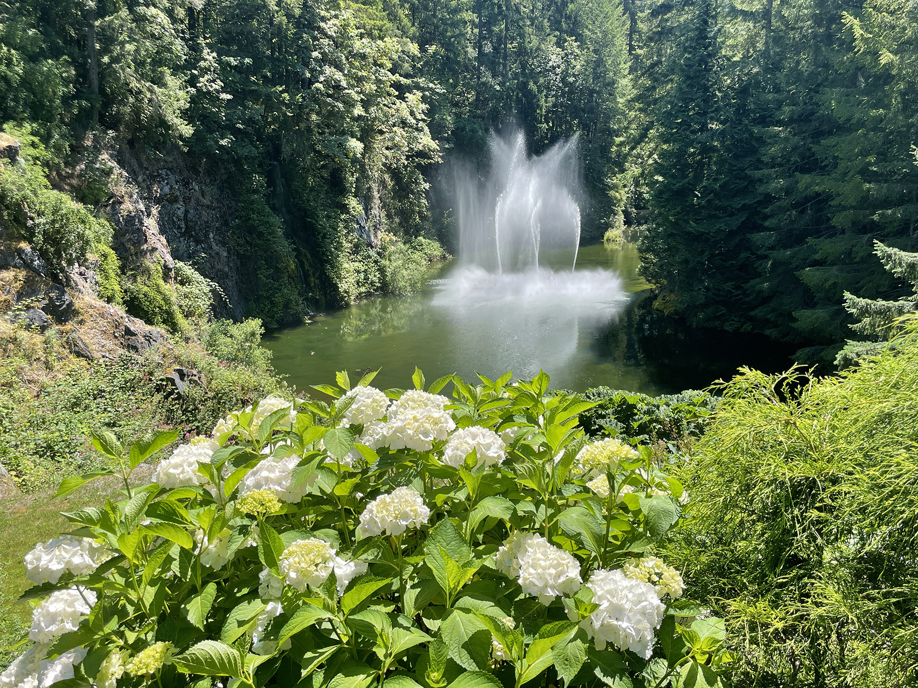
I’ve mentioned water in British Columbia? Here’s the view outside our room at the Brentwood Bay Resort, where, on day three, we took the ferry to Mill Bay, and thence began our 3+ hour drive to Tofino, on the west (Pacific) coast of Vancouver Island.
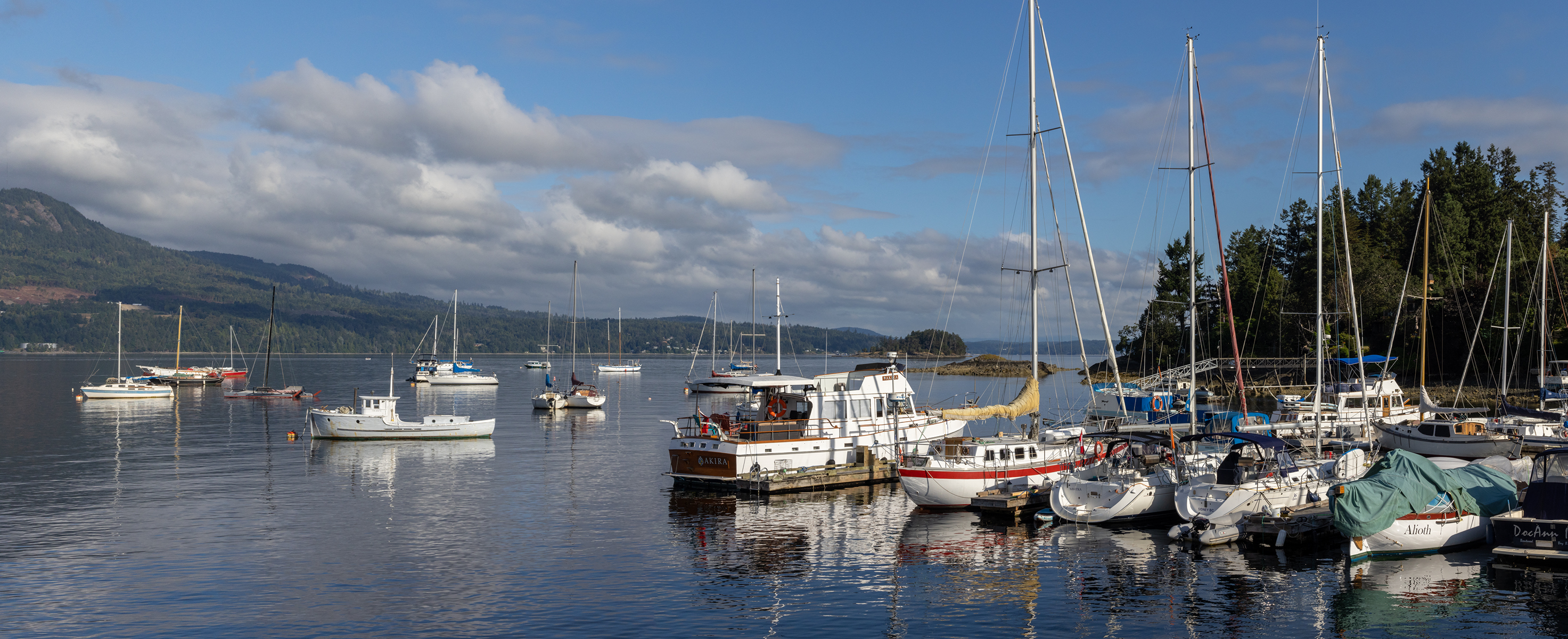
Cathy is an inestimable lodging discoverer. Brentwood Bay is one example of her search prowess. Another is the Middle Beach Lodge on a rugged headland awash by the Pacific near Tofino, BC. She called weeks before our planned getaway and they allowed as how it was very unlikely that a room would be available at this high season time of our wandering, but they would look. “Wait, we have a waterfront room that has just become available.” Naturally, this sort of happenstance was not very far in the back of my mind when weighing diversion options with that ALT 1 warning displayed. The Middle Beach Lodge room came with both breakfast and dinner, along with the incessant metronome of the waves washing the shore right below our room.
The beach was frequently softened by early morning low clouds and drifting fog.

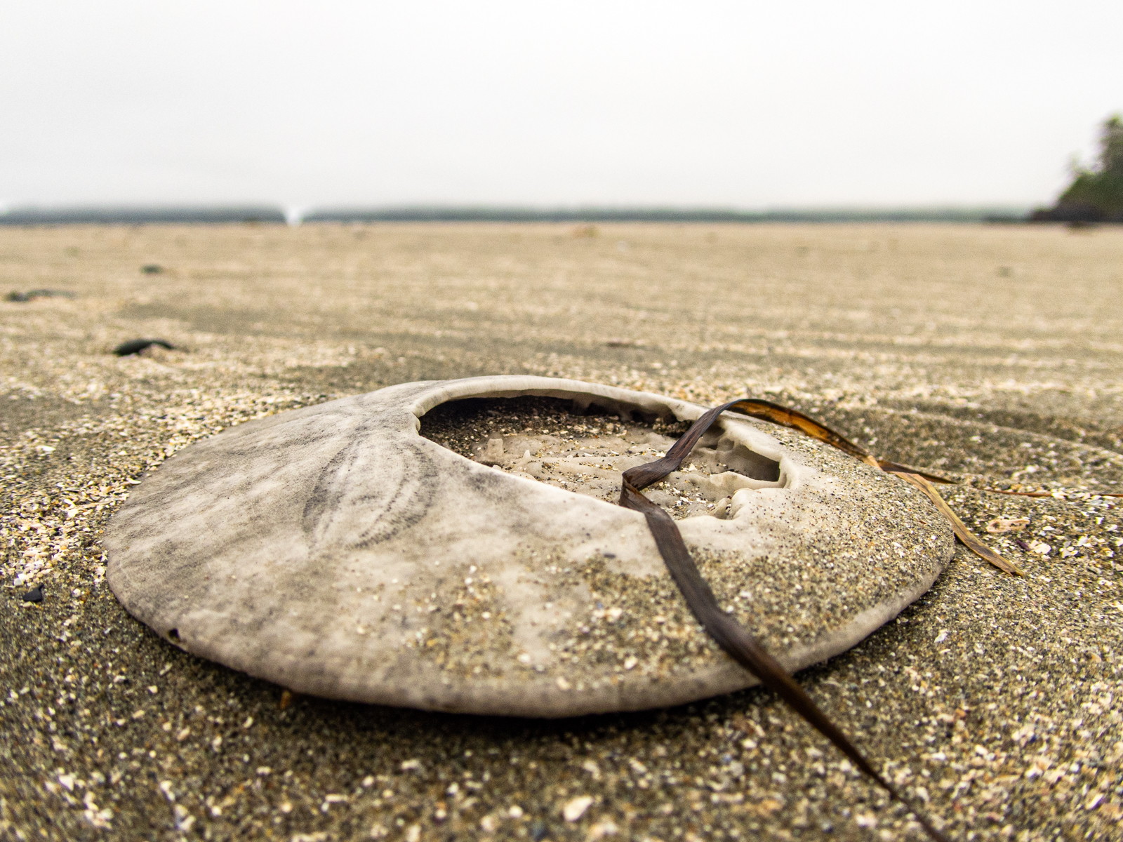
And then clearing for blue skies during the day, and orange sherbet at sundown.

During the day we explored Tofino proper on foot, in this region of First Nation dwellers.

One day we rented e-bikes (a head nod to advancing age) and rode 70 km down the island toward Ucluelet, on a magnificently laid out and maintained bike path. The battery power helped, but not with the derriere.

At the end of that day (and the others) we settled into our favorite table in the Lodge great room to have an adult libation, to read, and to take sustenance. As I’ve none too subtly implied, Cathy knows how to pick lodgings, and at this stage of our lives we have no qualms about relishing modest indulgence.


The unexpected came visiting again, literally. After savoring sunsets like this from our second floor balcony (9:15 PM, by the way)…

…we naturally left open the door to enjoy the sea breeze and the somniferous affect of the waves’ advance and retreat. On the second night I was awakened by the sounds of an intruder in the room—a raccoon that had climbed up that tree trunk, jumped to the balcony, and proceeded to rifle through my open suitcase, finding the plastic bag containing all of our electronics charging devices to its liking. I hollered in half-asleep alarm, and chased it whence it came, a trail of electrical cords and plugs prima facie evidence tracing its burglar intent. Thereafter, the door stayed closed, and we contented ourselves with screened windows flung wide.
After four nights we carefully timed a drive across Vancouver Island to catch our reserved ferry from Comox, across the Strait of Georgia (named by Captain George Vancouver, originally as the Gulf of Georgia in 1792 to honor King George III) to the BC “Sunshine Coast” at Powell River. Life along the coast of Washington state, and British Columbia, is life frequently timed to the ferry schedule. There’s a particular rhythm to it, and some rather first-rate people watching in the bargain. I was seven years old when this 1950 Buick came off the assembly line. Boys of that age, and this, appreciate the flames and channeled lowrider bodywork. Nice way to wait in the queue for ferry boarding?

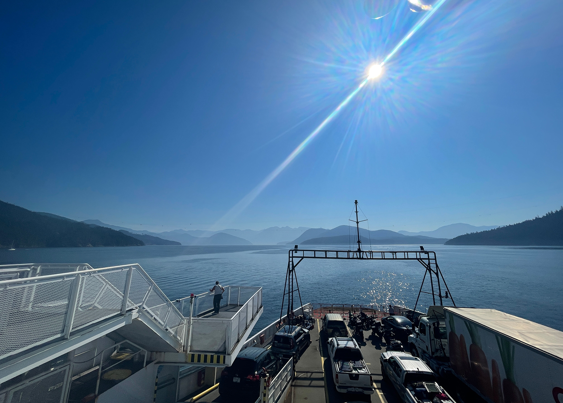
The Sunshine Coast is aptly named, at least in July and August. There were several clear-skied days when we were there with temperatures in the Fahrenheit mid nineties. We were making our way to yet another Cathy primo destination, a stay at the West Coast Wilderness Lodge at Egmont, BC. Backstory—Egmont was a Dutch nobleman who led the Flemish resistance to Spanish rule of the Netherlands in the 16th century, and is the nominal source of Goethe’s play, and Beethoven’s overture of the same name. I haven’t a clue why the Canadians chose to reference all that in the name of this tiny spot on the Jervis Inlet, the longest fjord in British Columbia, but if you love Ludwig, as I do, it’s icing on the traveler cake.
If one consults a map to get the lay of the land and the water, you can see that this inlet is very convoluted and, at over 50 miles South to North, contains a great deal of water fed by and drained to the oceanic Strait of Georgia with its four tides daily. There’s a particularly tight narrows at Skoocumchuck reached from a quirky trailhead with associated cafe.

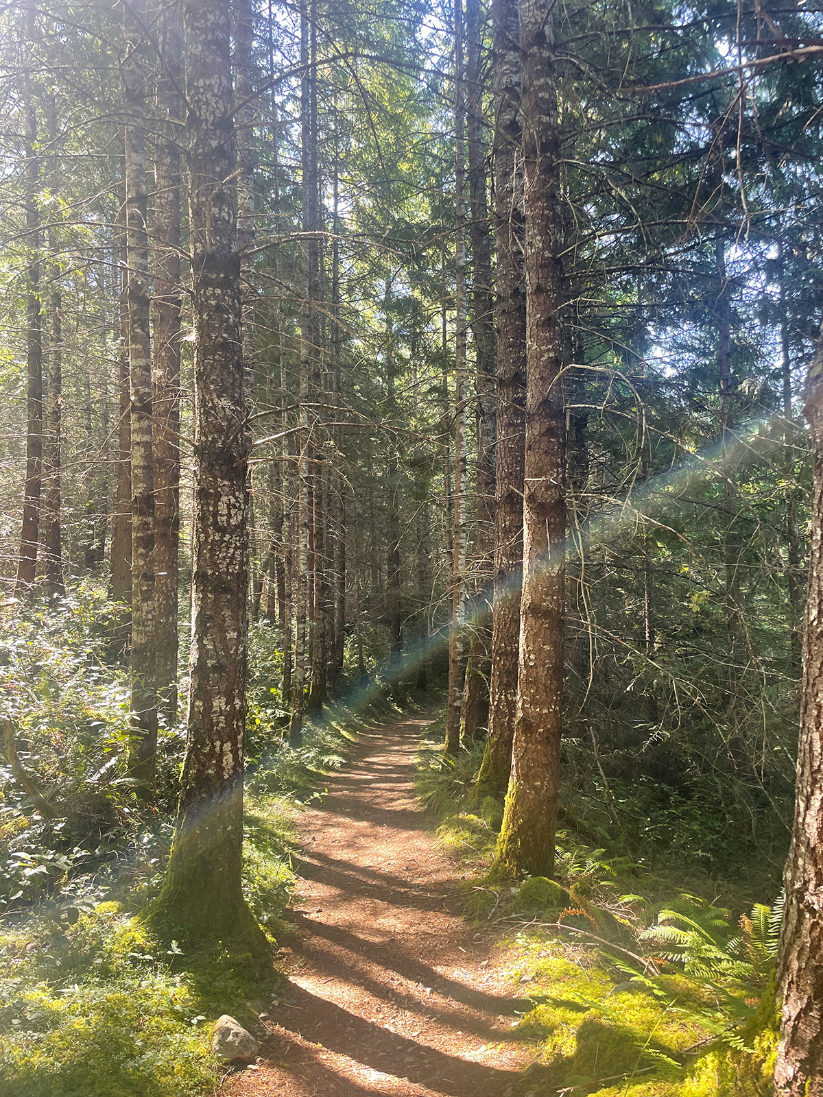
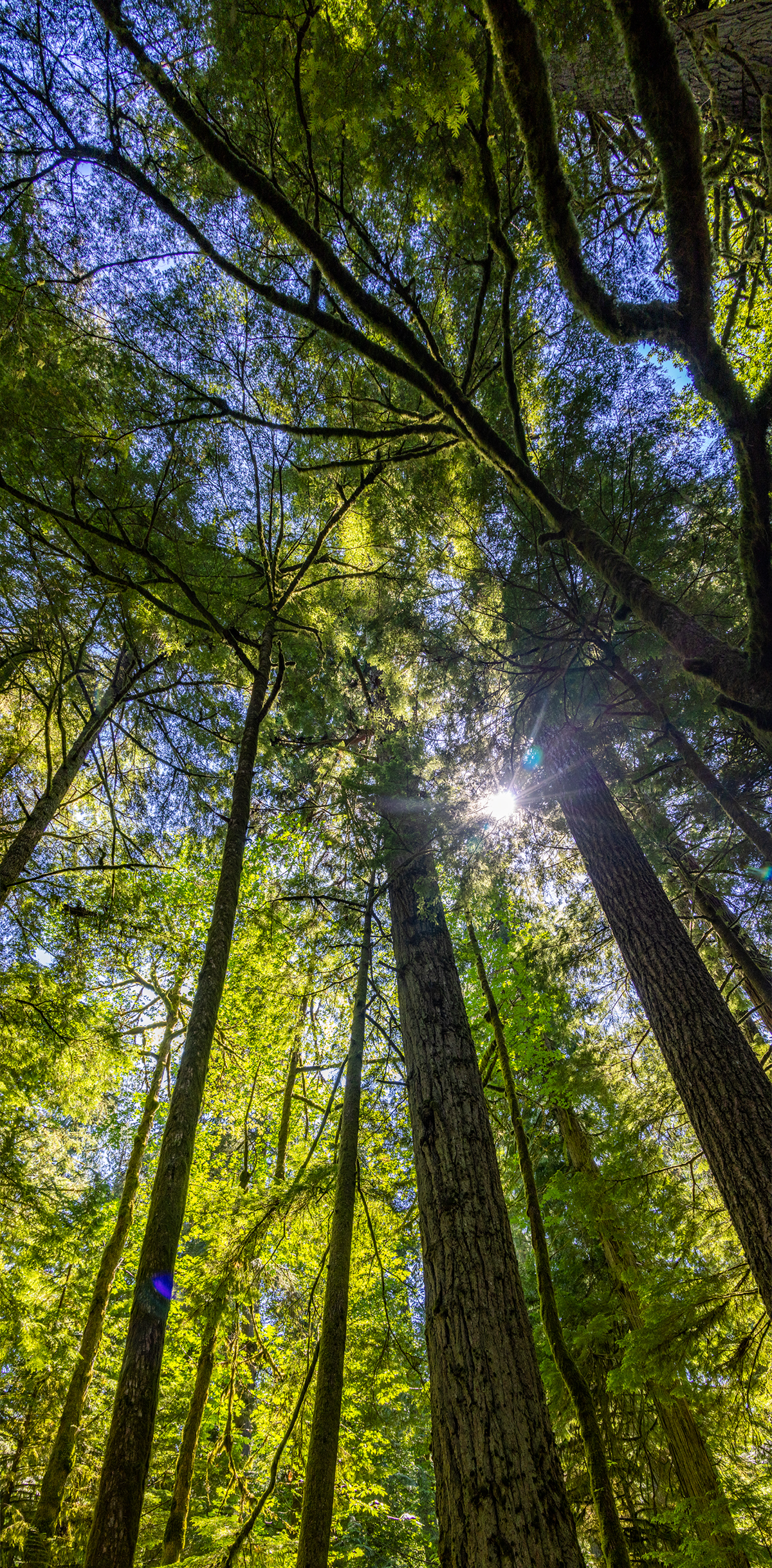
Not to mention the Canadian maple leaf national symbol.

We were near a new moon, which you other water types will understand means a time of large tidal swings, translating to a current of over 16 knots through the Skookumchuck narrows. There’s a website which can be accessed via mobile device that pinpoints the optimal time to see the raging current form as the high tide reverses and the entire Jervis Inlet begins rapidly draining, and that corresponded almost exactly with when we could get there after driving off the ferry from Saltery Bay to Earl’s Cove. In comedy, as in tidal swings, timing is everything.

While the West Coast Wilderness Lodge is off the main roadways it definitely isn’t roughing it. Breakfast and dinner were included, and they were sumptuous affairs. One tiny downside—during the heatwave, with daytime temperatures in the mid nineties, the lodge had no AC. But they had fans which were quietly up to the task, as were the chilled evening adult beverages. Daytimes found us on the water.


There’s a spot within the Jervis Inlet, maybe 40 miles up the fjord, between what is charted as the Princes Royal Reach and the Queen’s Reach where the sightseeing boat skipper shut down the motor and we drifted in the deafening silence to take in this view, with peaks around us over 8,000′ in elevation and the depth of the water over 2,000′. Serene, and still snow-capped in the last days of July. We were told that this was the home of the indigenous Sechelt people who lived here numbering in the tens of thousands, the land and the water providing ideal providence to support them in harmony with nature…before the arrival of Europeans and cholera.

Resuming our sojourn up the fjord, having borne left from the above vantage point, we came to the narrows that leads to the Princess Louisa Inlet, an emotional highlight for me, as it was a sweet memory lane time for my main squeeze, who had twice spent time at the Young Life “Malibu” camp that she now gazed upon as a mature woman vs. her young girl past. A time of unbridled fun with other kids and young adults while discovering the trailhead of her particular faith journey.
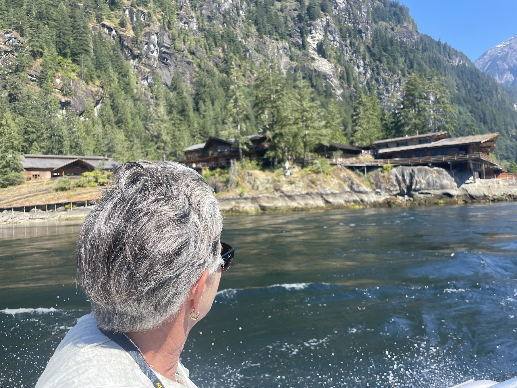
At the end of the inlet, now 50 miles from our starting point, we came to Chatterbox Falls, apparently named for the continuous roar of the water racing to the inlet. This is the terminus of about five other falls on the surrounding peaks above coming together in answering the call of gravity.
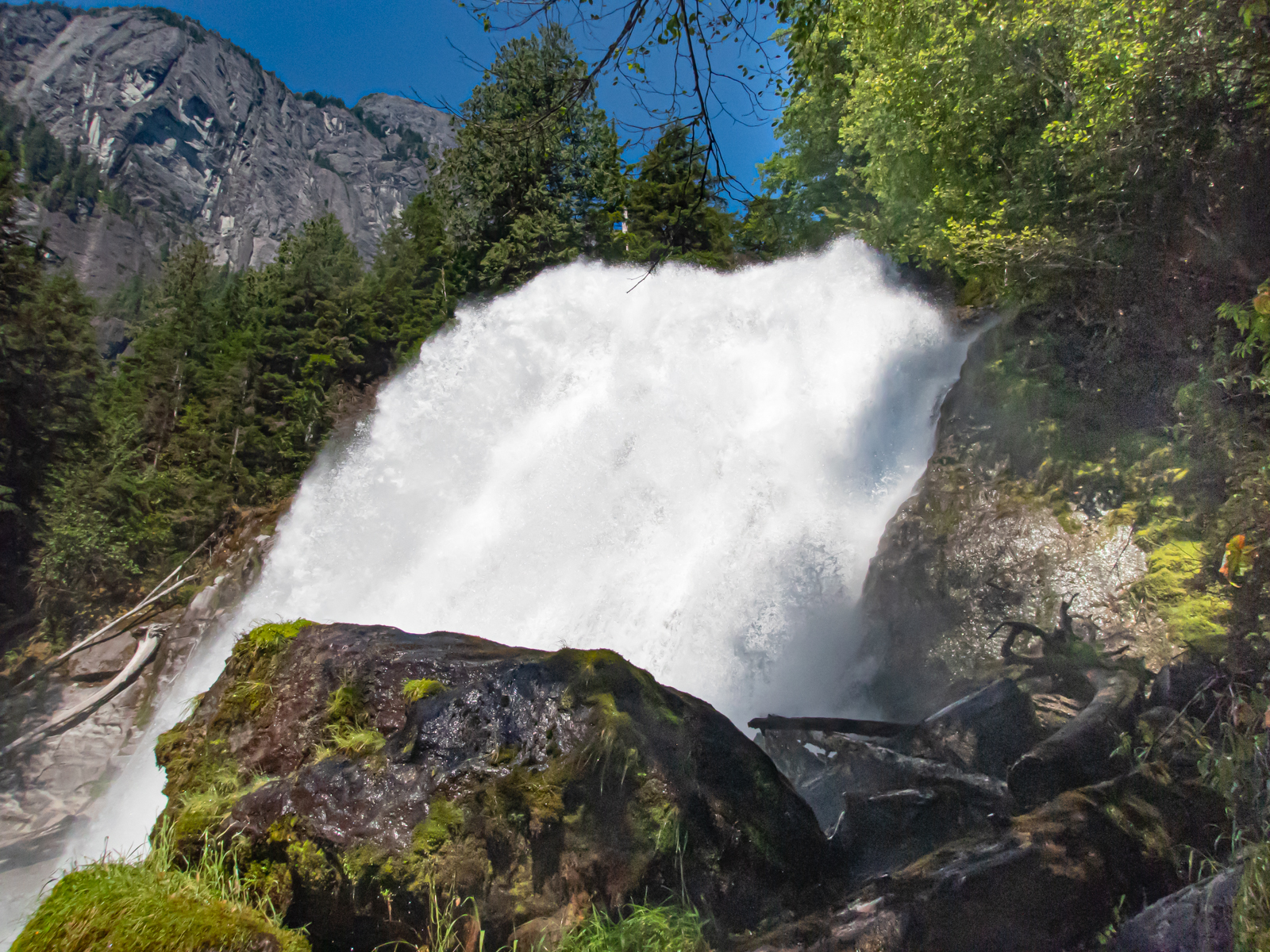
Ours was an aluminum-skinned, canvas-pontooned vessel appropriate for the wilderness. One of the pontoons had experienced a partial deflation at the starboard bow, and the skipper’s seat matched that with its own boondocks bubblegum and bailing wire gestalt. OSHA and NTSB be damned.
Meanwhile, returning back at the ranch, life went on as it should, De Havilland DHC-2 Beavers on floats a regular means of transport.

Speaking of transport—at the end of the day, savoring the last light and the glow of wind-whipped cheeks abetted by a local brew and vino over a multi-course dinner, one can marvel on how the rich are different than the rest of us. Both islands either side of the above Beaver belong to a Vancouver developer who comes up by helicopter on weekends to get away from, well, whatever. Greta Garbo’s “want[ing] to be alone” taken to new heights. Yes, after the helicopter drop off, he can rest on his laurels, or putter about in the yacht in the near shadows.
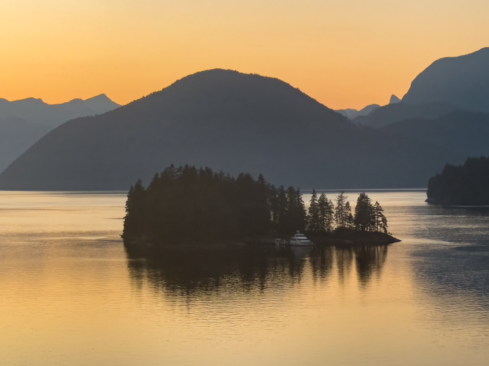
Eventually calendar and wallet whispered their reality check, and it was time to begin the journey driving and ferrying back to Victoria, where Patrick had succeeded in putting the new electrical parts where they were called for. We made it a leisurely meander, getting in a hike to an overlook of Ruby Lake, the trailhead for which was reached in a one-car-wide dirt track climbing steeply up a mountain shoulder.

We had a lodging at Sidney, a mere :05 drive from Victoria Air Maintenance at CYYJ, and an early the next morning load and launch. Bags boarded, bottle of single malt handed to Patrick as thanks for his above and beyond maintenance care and shepherding, and we fired up the time machine to make good on our ATC Instrument Flight Rules clearance, e-APIS documented ADIZ-crossing, and heads-up phone call to U.S. Customs and Immigration. First, across the upper reaches of Puget Sound.
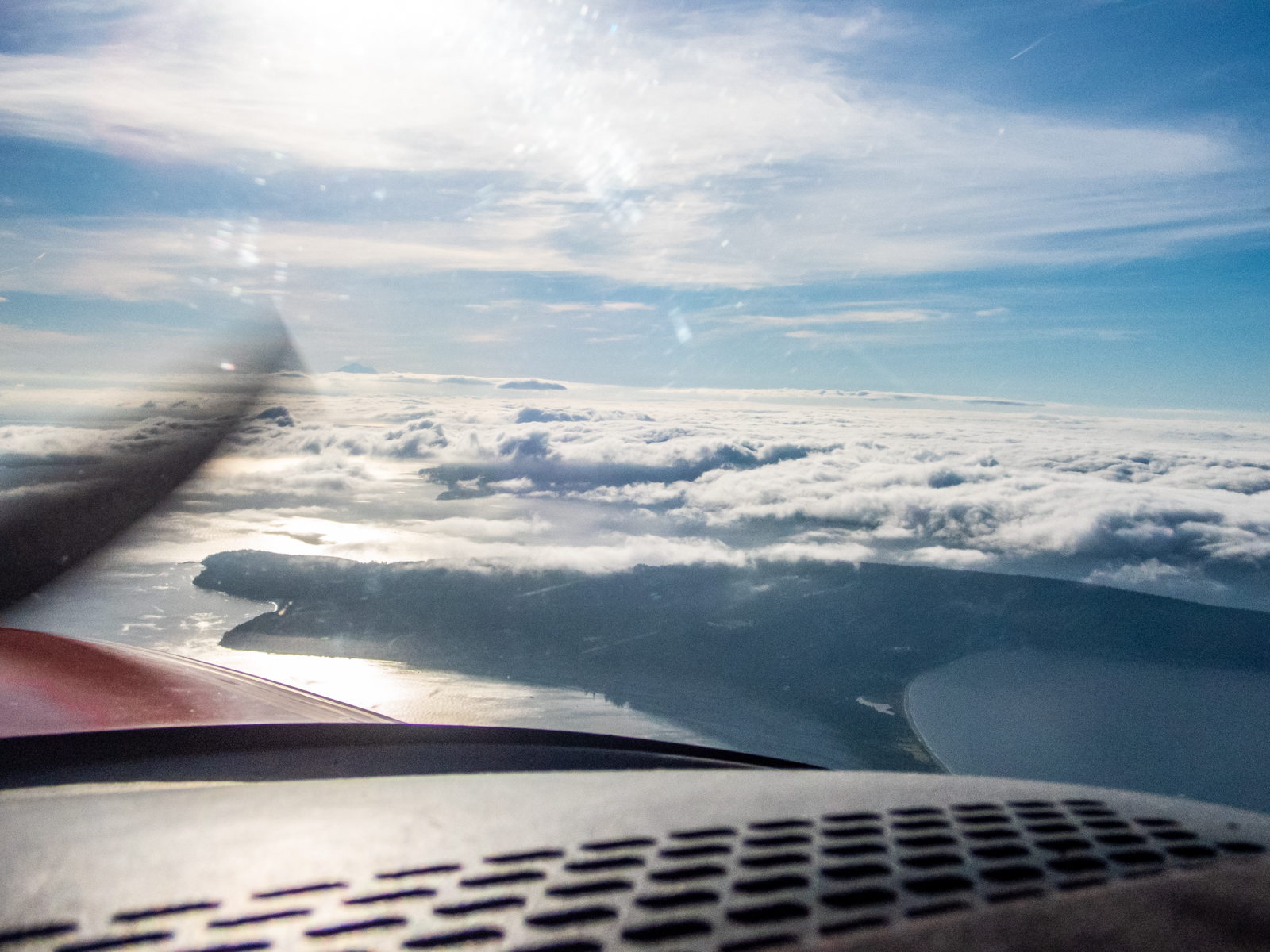
Yes, an instrument flight plan was called for, the sunny hot weather finally giving way to the marine influence.

Below, short final approach on the Bellingham, Washington (KBLI) RNAV (GPS) Runway 16 approach. We had the fuel tanks topped, took care of the official paperwork, made a last tap of the kidneys and were on our way in fifteen minutes. I emphasize this as contrast to the customs and immigration experience we’re used to as arriving airline passengers. No removal of belts, shoes, or the keys in your pocket. Nor did anyone hassle me over my mustache scissors. Flashback. No kidding. On September 14, 2001, the first day of resumed flight after 9-11, I was captain on United 897, a B747-400 flight from Los Angeles to Tokyo, and was stopped at security leading to our departure gate to have confiscated the mustache scissors in the shave kit in my suitcase. I politely pointed out the absurdity of this by holding up my cockpit key (also made of metal) which I was about to use to access my office and saddle up with some 400 passengers and crew members, but that trust did not extend to my personal grooming device? Those were crazy times, were they not?
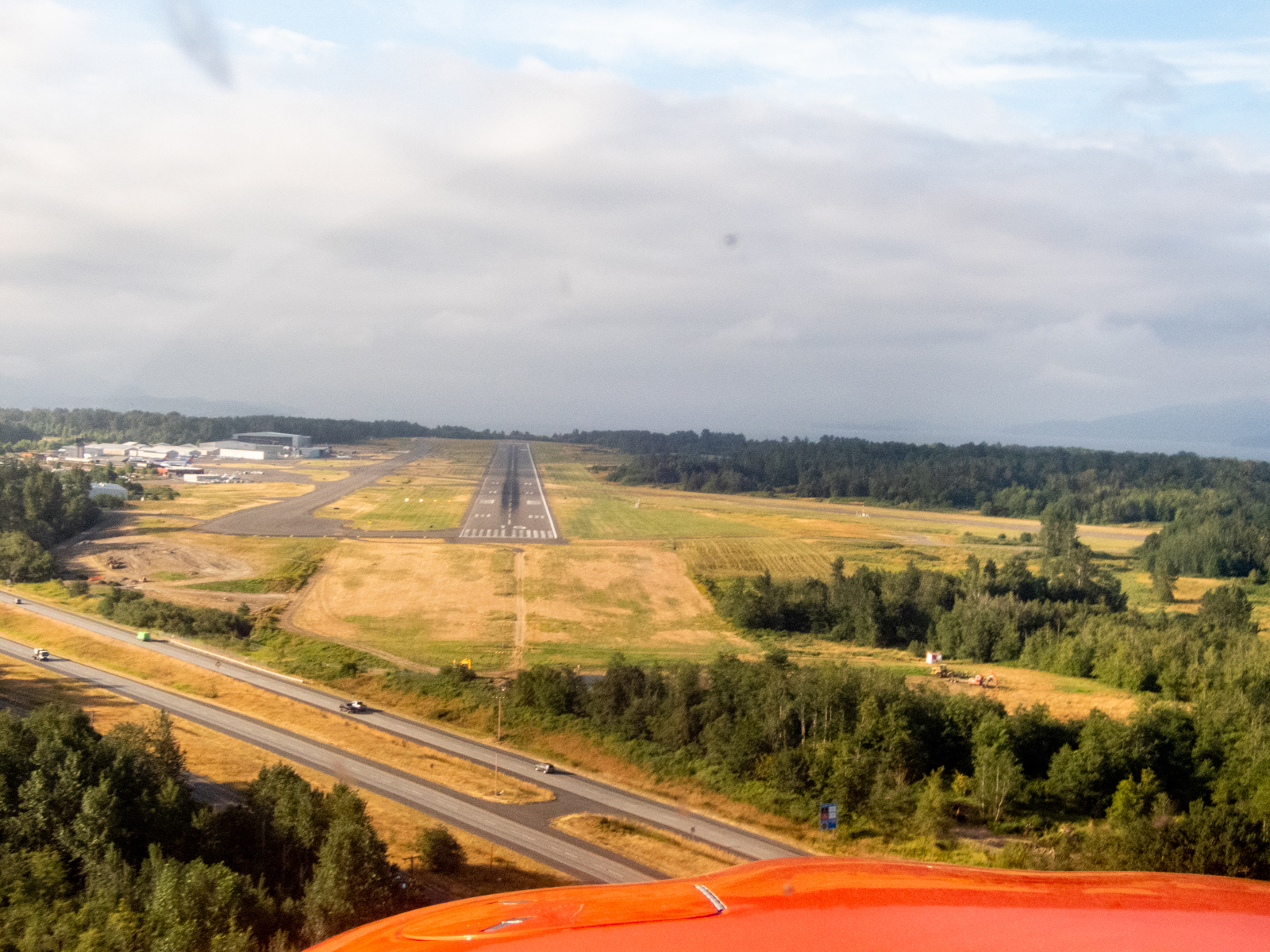
And so it was that on Tuesday, August 2, Cathy and I spent the morning and early afternoon comfortably ensconced in N711QT, navigating the entire length of the U.S. west coast back to hangar 36 at McClellan Palomar-Carlsbad airport. Some clouds, lots of blue sky, avoiding wildfires including the McKinney fire near Siskiyou. One thousand and seventeen nautical miles after clearing customs.

I choose to end this missive sharing an unexpected dark irony. Arriving safely home at the Del Mar digs from a safely accomplished longish airborne cross-country, I stopped in front to collect that day’s mail. In it was a letter, two months coming, from the FAA’s aeromedical branch, having completed their exhaustive review of my exhaustive annual medical tests, labs and cardiological evaluations. It’s that having had a stent placed in 2020 thing. They concluded that my completing a treadmill stress test with concomitant ECG and echocardiogram to the maximum heart rate without hiccups, that and the MRI of my chest showing normal cardiovascular output and such convinced them that I’m no more liable to croak than anyone else who’s never had these sorts of treatments, tests, and evaluations. The letter authorized my Senior Airman Medical Examiner to conduct his physical exam of me to renew my Airman Medical Certificate. That was accomplished two days ago, and I now posses a new unrestricted Class II Medical (Private Pilots only need a Class III Medical. A Class II enables me to be a paid Pilot in Command on Bizjets and such.) Anyway that very evening, digging through the mounds of communications at my desk and computer awaiting our return, I opened an e-mail from my aircraft co-owner, who had shouldered dealing with the insurance agent marshaling the annual insurance renewal of N711QT with the universe of aviation insurance underwriters, which renewal would recycle five days later. The insurance agent appears to have gotten lost in the annual Air Venture aviation extravaganza at Oshkosh, and failed to keep us apprised until this last moment. Embedded in the proposal was a requirement that pilot Thomas Close could be insured to fly his own airplane only if all future flights were conducted as “dual,” i.e., with a Certified Flight Instructor along to keep me out of trouble, or at least keep the insurance underwriters out of trouble. The reason? I seem to have begun my eighth decade. In short, blatant arbitrary age discrimination promulgated by a bunch of pencil pushers, with very little data to confirm their sagacious conclusion, and no data whatsoever about this specific pilot. It’s not possible to convey the degree of umbrage I take in this. Not only “no,” but “HELL NO!” I do not know how this will sort out, but a life without loving the atmosphere as I dance through it, embracing the elements in their most elemental form, is akin to taking in a deep breath with no oxygen inspired. Imagine the sun not guaranteed to rise in the east tomorrow morning? I do not exaggerate. We’ve been given a 60-day extension of our current policy while the agent tries to engender a more realistic proposal. This has nothing to do with flying per se, but means that one could not insure a rather robustly valued asset. The fact that I’ve been doing this for nearly six decades without accident, incident, violation, or claim seems not to matter.
Truly yours, Tom
YOUR ISLANDS Await
Posted on August 17, 2021
It’s not exactly Bilbo’s There and Back Again, but any travel in these pandemic cursed times is a bit of an adventure, as was our week-long getaway to Puget Sound, Whidbey and Lopez islands. We weren’t subjected to taking off belts and shoes or mask-fogged glasses while stuffed in a crowded tube, the Cirrus time-machine saving us from that fate. But this year, the 2000+ nautical mile round trip had its own challenges.
As all news media convey, the western United States is going up in flames. Our route had us alongside, between, and over seventeen Temporary Flight Restricted areas established for fire fighting purposes. Our cruise altitude going was 10,000 feet, and returning at 9,000 feet. Neither put us on top of the smoke. Northbound, we were continuously in true Instrument Meteorological Conditions (IMC) from the southern end of the San Joaquin Valley to the Oregon-Washington border, and from north of Olympia, Washington to Ukiah, California, southbound. Not that my logbook needs more Instrument Flight Rules time, but it was legitimate IMC for several hours of flying. No clouds, but no horizon. Like flying around inside a gray pingpong ball that smelled of smoke.
This is the Primary Flight Display look at 1.9 nautical miles outside the Final Approach Fix for Chico, California (KCIC) runway 31R, a fuel and potty break midpoint stop chosen the night before for its favorable fuel prices, and aircraft maintenance service availability if needed. The night before and the morning of our departure, the region was smoky, yes, but above Visual Flight Rule (VFR) minima, and we’d be landing with 1:35 of fuel as an Ace up the sleeve. Our departure weather at Carlsbad Palomar (KCRQ) was IMC with a lowish stratus marine layer and reduced visibility, tops near 2,500 feet. Level in cruise over SoCal, we were in bright sunshine, dealing with early morning quiet ATC, and listening to the classical channel on the Sirius-XM datalink that provides onboard weather and audio entertainment. Don’t worry, it mutes the music when ATC calls. As the saying goes, we were on top, in the clear, and fat dumb and happy. At least that describes me. I’d never verbalize that for ol’ WhatsHerName. Anyway, as we crossed over the Lake Hughes ridge line between the LA basin and Bakersfield, the weather reports on our onboard datalink weather showed KCIC as down to 2 statute miles in FU (not what you might think, that’s weatherspeak for smoke). Pretty much the entire east central San Joaquin valley was that way or worse. Hmm. By the time we neared Chico, the ATIS was reporting 800′ scattered clouds and 2 statute miles in smoke, the wind, south at 3-5 knots. No traffic, so Oakland Center, Chico tower and I conjured up a straight-in to runway 31R served by a WAAS RNAV (GPS) approach with a 250 foot Decision Altitude and 1 statute mile visibility minima. And we needed it. By the time we were halfway between the Final Approach Fix and the runway threshold we could see the ground if we looked straight down, but laterally over the nose it was only smoke and a vague semblance of golden grassland…with no runway in sight. That finally changed below 500 feet AGL, the runway revealing itself as a slowly materializing ghost amidst the vapors . Too much like work after 2:49 of flying, and a 05:30 wakeup call. That adventure thing.
So look, you pilots, here’s some takeaways for our quivers going forward. 800 scattered with 2 sm visibility is technically between requiring Instrument Flight Rules (IFR) and those available by Special Visual Flight Rules (SVFR), but not seeing the runway until below 500′ AGL is anything but VMC. These thoughts are largely tactical. Co-owner, Mason, following us on FlightAware and perusing the regional weather, has wondered strategically as to where we might have gone if unable to land at Chico. The entire region is near the Dixie wildfire, the state’s largest. I had filed Red Bluff (KRBL) as an alternate (and whose weather also deteriorated in FU while en route), but had in the back of my mind that the old USAF McClellan Field (KMCC) would be a reasonable out, and comports with my preference of having an alternate on the near side of the destination, as it effectively means having more fuel since you can drop in before going first to your destination. KMCC doesn’t show weather minima for filing as an alternate, but it has a viable CI ILS available if one chooses to go there. In practice I wasn’t really contemplating using either RBL or MCC, as the CIC weather seemed benign enough—until it took descending below 500 feet to find it. Mason is right—no real easy-peasy strategic choices after the en route visibility degradation. But that 1:35 fuel remaining provided options.
Aircraft tanks filled, and body tanks emptied, we chose to depart on 31R. Straight in, and Straight out. Back up to 10,000′ MSL, and following a route over Fort Jones (west of Mount Shasta) and then mostly up the Willamette Valley over Roseburg, Eugene, Newberg and Olympia to keep us out of the TFRs and to the west of Portland’s and Seattle’s busy airspace. We also flew this leg under IFR because of the relentless horizonless smoke until nearing the Columbia River, but also because it was overcast with rain from Olympia to our destination at Snohomish County, Paine Field (KPAE). At cruise and reported on the surface, the wind was southerly, so a tailwind en route and me planning to go with the ATC least resistance flow, landing south.

I checked into SeaTac approach control with the Paine “Booze News” (Airport Terminal Information Service “Whiskey” information) which reported the surface wind as “150 degrees at 10, gusting to 14, visibility 7 sm in rain, ceiling 1600 overcast, temperature 17 C, dew point 14C, and altimeter of 29.94 ” Hg. Approaches in progress to runway 16R. The CII ILS OTS” (but the CI ILS was useable). I requested the WAAS RNAV (GPS) Y runway 16R approach. Interestingly there’s both an ILS Y and an ILS Z to 16R, and a GPS Y and a GPS Z to 16R. All four approaches do essentially the same things, and even, in some cases, using the same waypoint names. They all have the same 200′ AGL DA and RVR 1800 visibility minima. The missed approaches to a hold SW of the aerodrome are essentially the same as well. The only real difference I could discern puzzling over the procedures is that the missed approach of the Zulus climb to 3,000 feet and the Yankees to 2,000 feet. Speaking with my main squeeze in the first mate’s (pun intended) seat, I allowed as how we’d be flying through rain while maneuvering and when on final approach. As it turns out, these broadcast meteorological conditions portended more than was immediately apparent while flying vectors to the final approach course.

We were following a Cessna Citation biz jet, and when SeaTac Approach switched us over, on check-in, Paine tower advised that the surface wind had shifted to north at 5 knots. Did I wish to abandon the approach and take vectors to the non-WAAS (LNAV+V) RNAV (GPS) approach to runway 34L? The Citation had just landed, and with us both on the same tower frequency, reported it was smooth all the way down, with only those 5 knots of tailwind on touchdown. With a first person PIREP of no wind shear airspeed fluctuations or turbulence, and only a 5 knot tailwind to a 9,000 foot long runway (KPAE is where Boeing builds and flies their wide-body airliners) I conveyed that we’d stick with the GPS Y to 16R, but hold the option of bailing out into a left downwind and land on 34L if needed. Well, we broke out of the overcast at about 1,600 feet alright, wind on final now south at 5-7 knots. And while we could see the aerodrome in spite of the rain, the runway threshold and touchdown zone disappeared from view as I watched. Would you look at that, a genuine roll cloud materializing at right angles between us and the threshold? Maybe a mile long west to east, and a half mile wide, north to south. This could get interesting. Smooth as a baby’s bottom descending on the glide path, and then at about 500 feet AGL we dropped into the gauzy pewter roll cloud, still smooth. I watched the altimeter unwinding through increasingly small numbers, until we finally broke out about 250 to 300 feet AGL. You can exhale now, Tom. Touched down and turned off at A4 leading to to the ramp at the foot of the control tower and where FBO Castle and Cooke and our rental car awaited. I PIREPed our observations on the tower frequency as we cleared the runway, and pondered a very micro local weather pattern, with just the right temperature and dew point forming the cloud right at the juncture of the south wind on final and the north wind on the surface.
Allow me to share a couple more pilot nuggets for the aviators amongst you. While maneuvering, I self briefed both the KCIC runway 31 approach and the KPAE runway 16R approach (both of which I had pre-studied at home and en route). My weather analysis before we left home and with en route datalink weather gave me to expect the two instrument procedures we actually used. Which is to say I knew in advance the missed approach procedures. But given the extant ATIS weather, I had little expectation of a likely missed approach. And yet, in both cases, we were getting inordinately close to the missed approach decision point with no runway in sight. Takeaway? Always be prepared for last minute surprises requiring thought-out codified responses.
Okay, moving on from getting there, to actually being there. Like rock stars, our rental car was delivered to the plane as we stepped down from the wings onto the ramp. Luggage transferred from plane to auto, our John Hancocks scribbled on the Enterprise paperwork, we were escorted to the exit gate, and navigator Cathy started play by play mobile device directions to the Mukilteo ferry terminal. Lots of indigenous names in the northwest. We stepped onto the steep escalator learning curve of ferry life in the islands of northwest Washington. The roadway shoulder was marked as a ferry-waiting lane beginning about a mile from the actual terminal. We slipped into the shoulder ferry lane and crept to the ticket booth as one ferry departed, relaxing into languid conversation while we waited :30 for the twice-hourly westbound ferry to Clinton, on the SE end of Whidbey Island. A first taste of island pace. At nearly 50 miles in length, Whidbey is purportedly the longest island in the U.S, and the largest in Washington state.
Our lodging was in tiny Langley, population of just over 1,000 of Whidbey’s 70,000 total. Cathy has a knack for finding delightful digs in our travels, and she yet again outdid herself with our Boatyard Inn https://www.boatyardinn.com abode on the water at the harbor, one of thirteen such pied-á-terres.
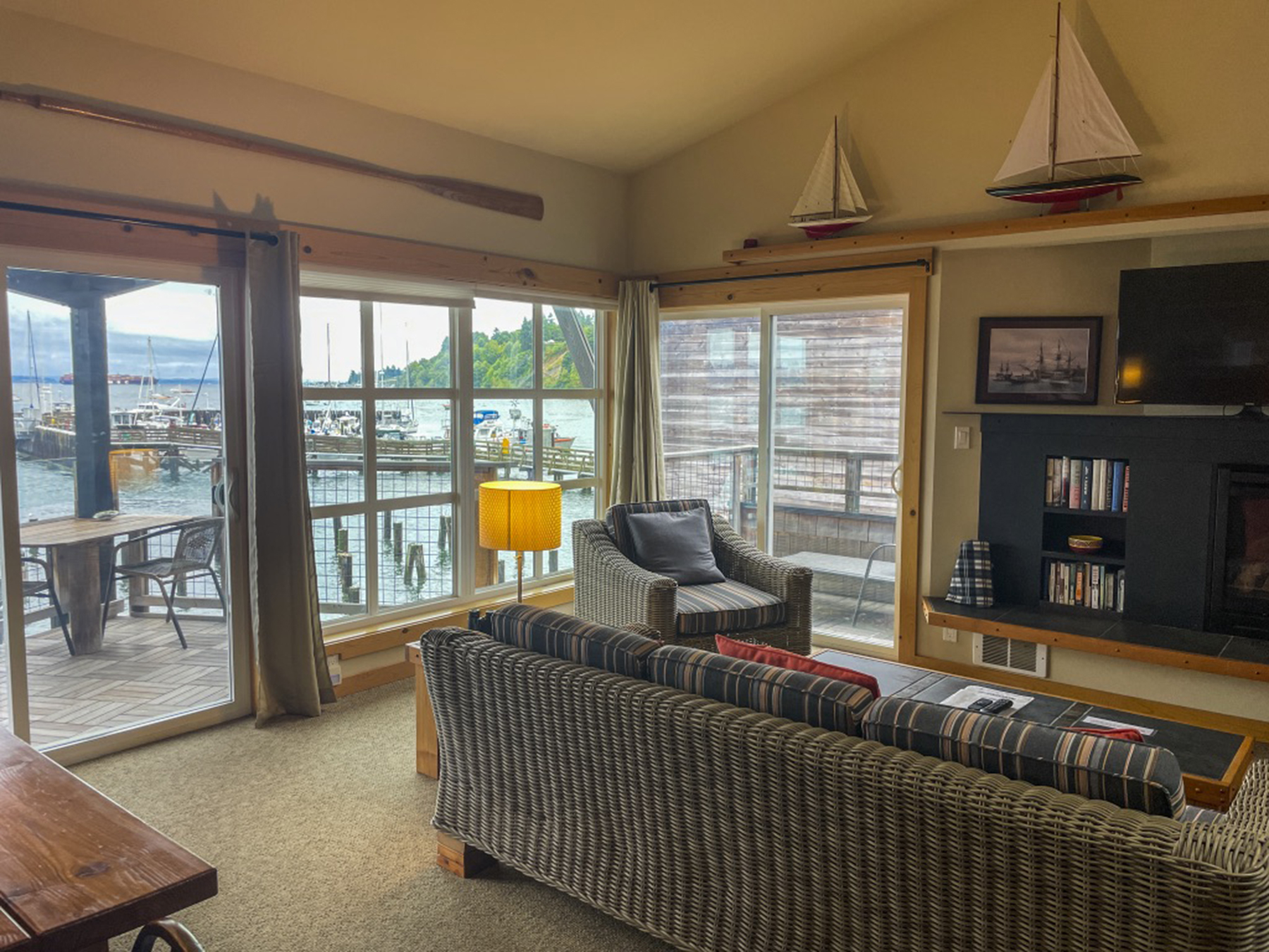
By now it was late afternoon, and being bushed, we made our way to a local brewpub café, one of several in this town which can be traversed on foot in a few short minutes. On a celebratory whim, I tried a locally distilled gin G&T. Then a draft beer with the meal. Both, yummy. Celebration, insofar as this was only our second getaway since the early January 2020 pandemic implosion. Two grownups as giddy as two kids. Our grownup side, cognizant of pandemic realities, had discerned that the pent-up demand for travel, excluding sketchy international options, meant expectations of teeming domestic destinations. It took some pre-planning time to find available worthy accommodations. Another pandemic effect was watering holes being shuttered on certain days, with the operators apparently choosing their dates in concert with one another so that not everything was closed on the same day or evening. The Langley city leaders convinced the local fire-fighters and Knights of Columbus to operate a barbecue hot dog roast on the Second Avenue sidewalk at noon for the midweek slow days Tuesday and Wednesday lest visitors and locals alike go hungry. Middle America chamber of commerce vibe. In a similar vein, cafés didn’t take reservations, but you could pop in and put yourself on the list and they’d phone your mobile that your table was ready while you wandered around town. But you’d also better start early, as the waits could be longish, and some of the menu items would become unavailable as they ran out of ingredients. And everywhere, the restaurateurs were apologizing for the slow service pace resulting from staff shortages. Your tax dollars at work. But, without fail, the innkeepers, restaurateurs, publicans, and shopkeepers were friendly and so happy to have your presence in these recovering times. And without complaint, everyone was complying with posted signs requiring masks indoors.
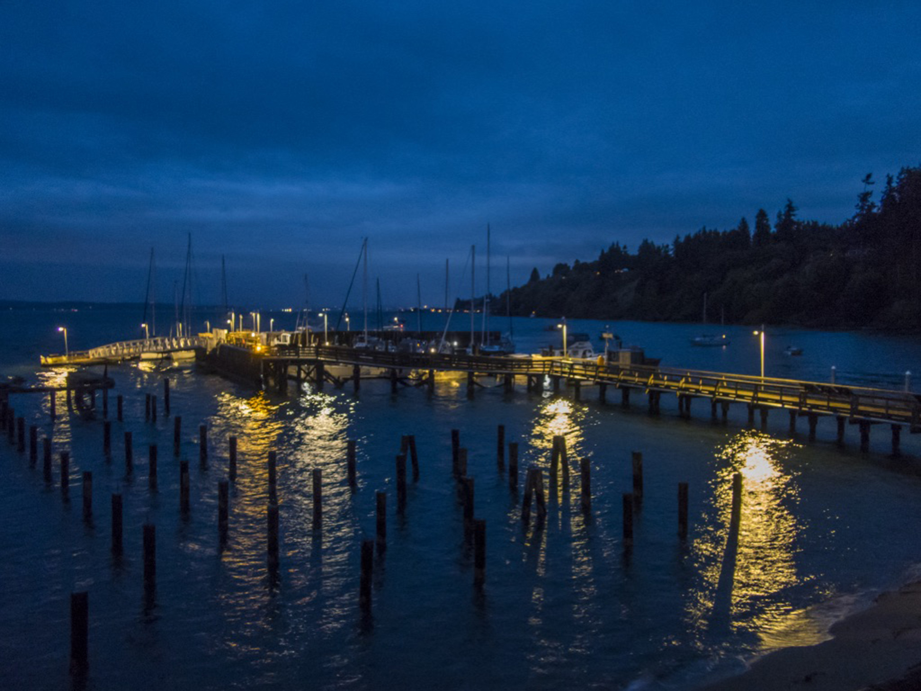
Love it or hate it, Maurice Ravel composed “Bolero” as an exploration of variations on a theme. For non classical music lovers, it was Bo Derek’s musical accompaniment choice in the classic comedy “Ten.” I found I was mesmerized by the infinite moods of this view. Herewith my Ravelian take on this music for the eyes, a kaleidoscope of changing hues, sky cover and tidal lengthening and shortening of piling heights.
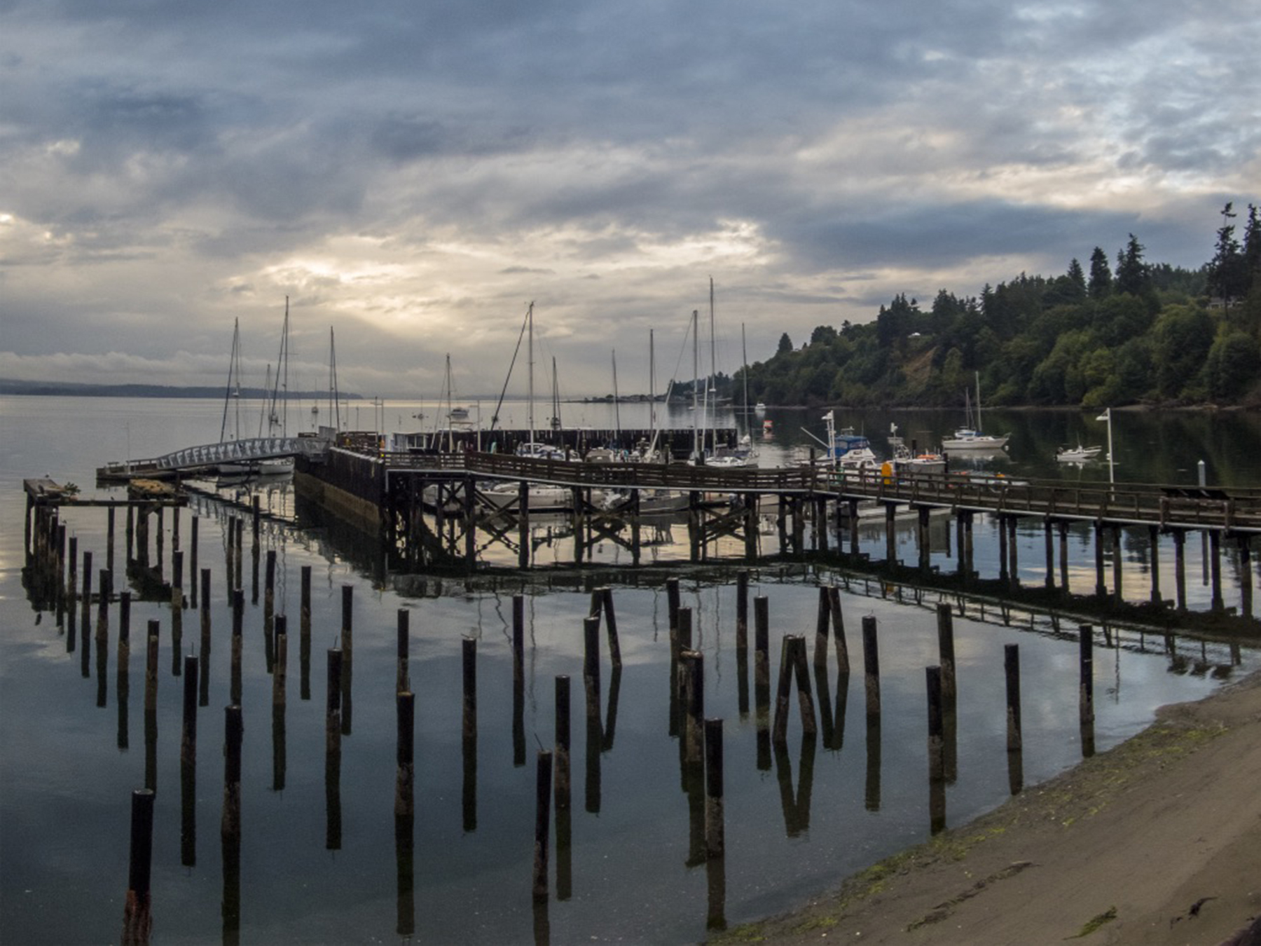
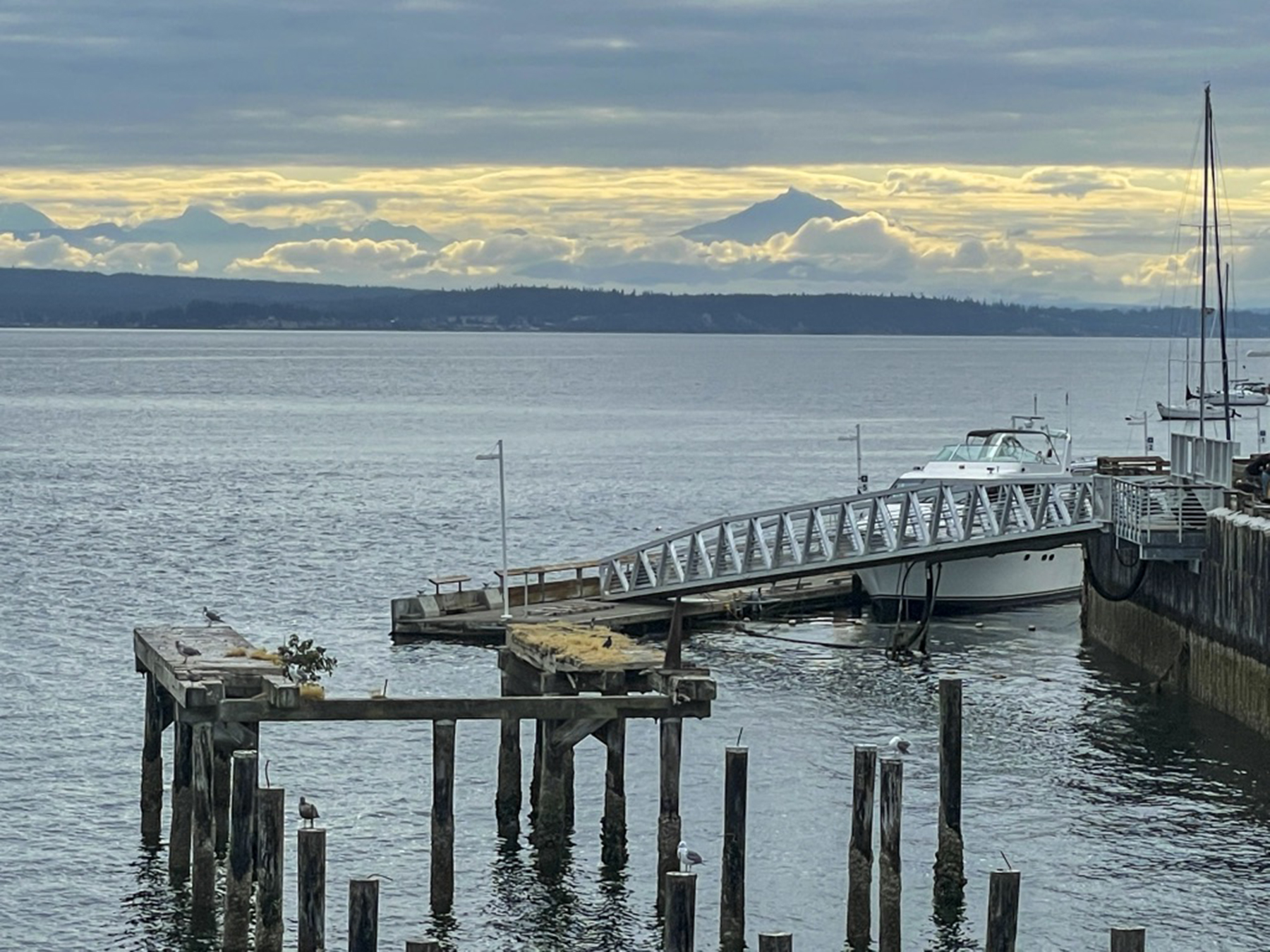
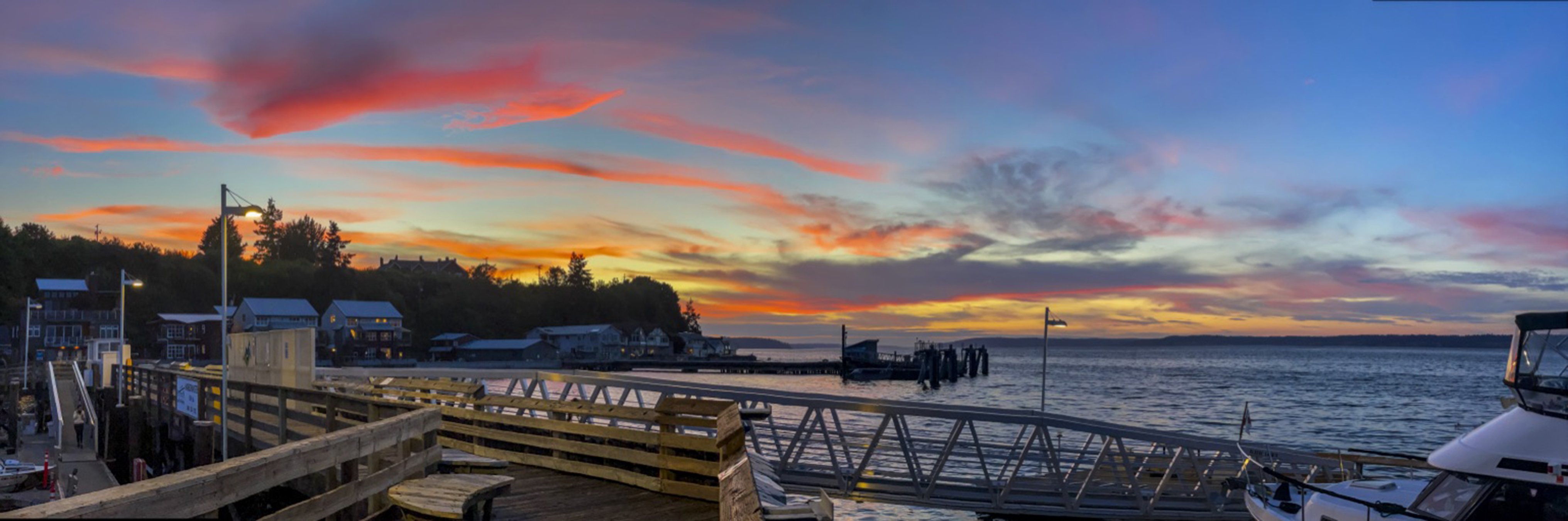


Our preference is for vacations that include a modest amount of vigorous physical exercise in nature’s haunts. I can take only so much of the Louvre or the Uffizi, a reasonable amount of ambulating London, Paris or Prague, and almost none of Manhattan’s Fifth Avenue.
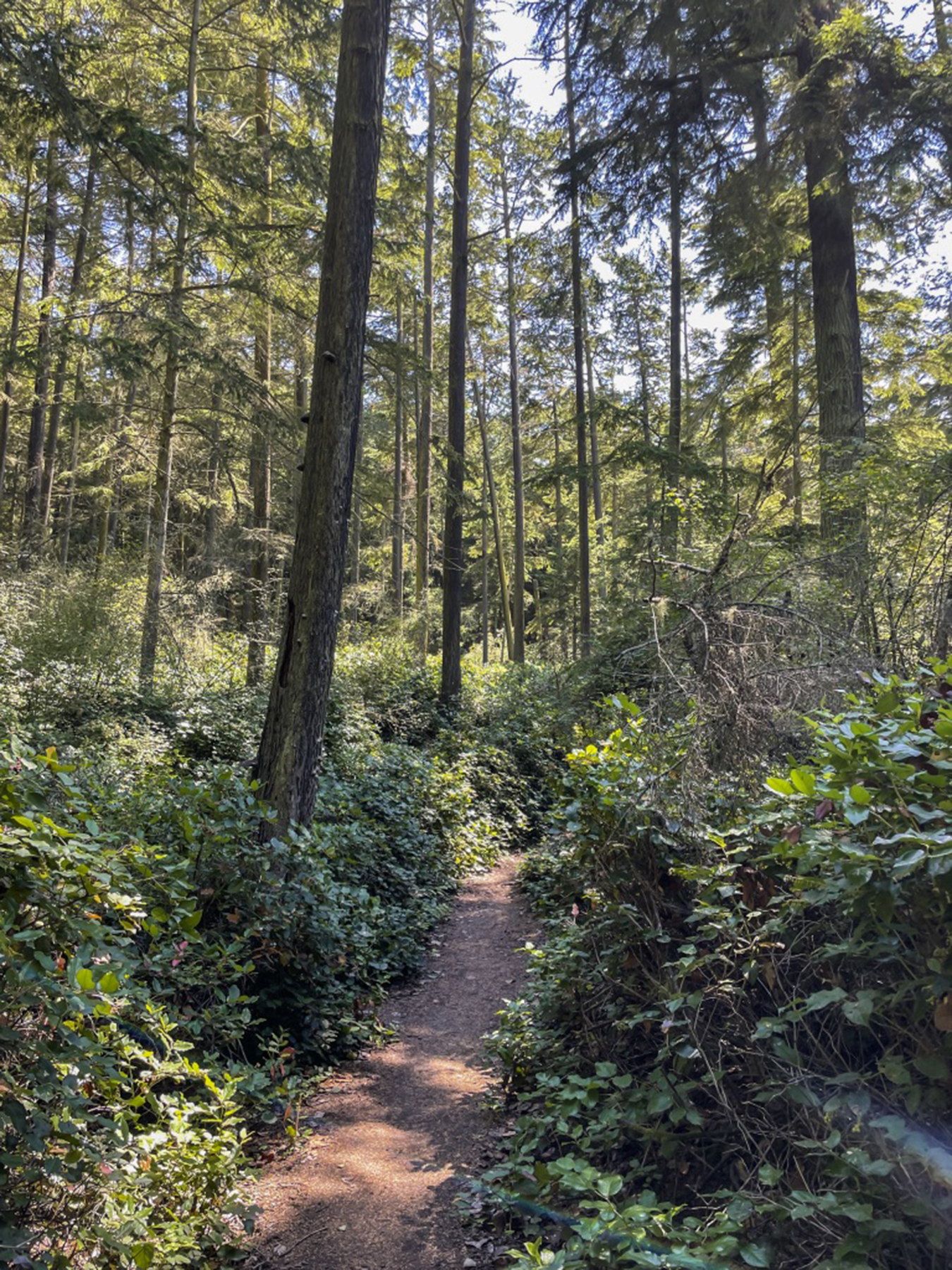
The largest town on Whidbey Island is Oak Harbor, the community next to which NAS Whidbey Island is located. Returning from our first hike near here, this was just too arresting not to capture. The first I’d heard that the King had a preference for a ’55 Chevy convertible. Whimsy.

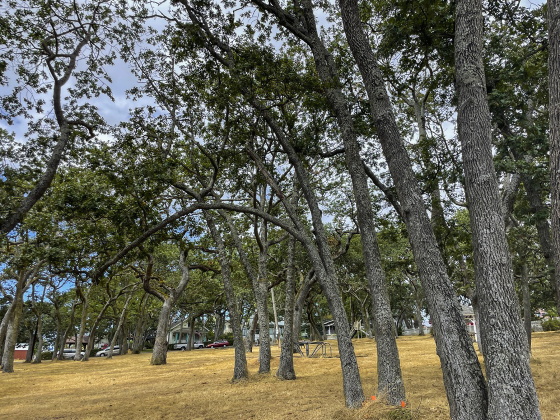
Islands naturally have the sea at hand. Failing to arrange a sailboat, we chose some hours down and close to the tidal swings, wafting over the kelp and Dungeness crabs drifting by below. At least some of the time we did actually synchronize our paddles…an acquired skill set.


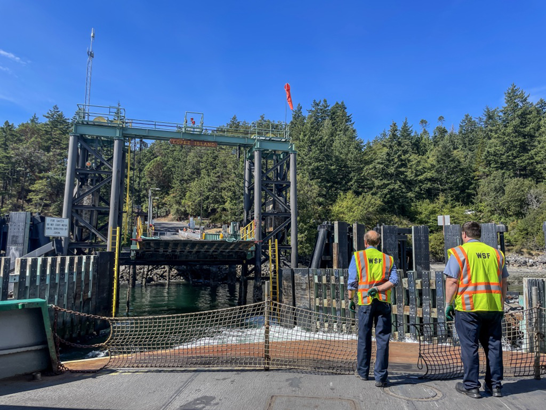
We drove to the Anacortes ferry terminal on Fidalgo Island, across the Deception Pass from Whidbey, parked our rental car and boarded the ferry for Lopez Island on foot. Parking at Lopez is a challenge, and we had pre-arranged two e-bikes (a first for both of us) for retrieval after egress from the vessel. This docking scene suffused me with little kid smiles, it being so redolent of my childhood ferry rides from San Diego to visit my uncle Cap on Coronado.

The next day we returned to the northern end of Whidbey Island to do some hiking in the Deception Pass state park. Another day of getting into the island pace, motoring on two-lane roads with only modest traffic, drivers keeping a respectful vehicular distance at an un-frenetic 50-55 mph. Trees and grasses along the highway, and deep old-growth forest hiking trails at the destination.

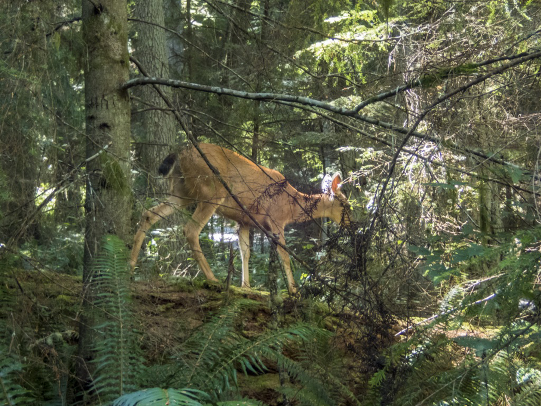
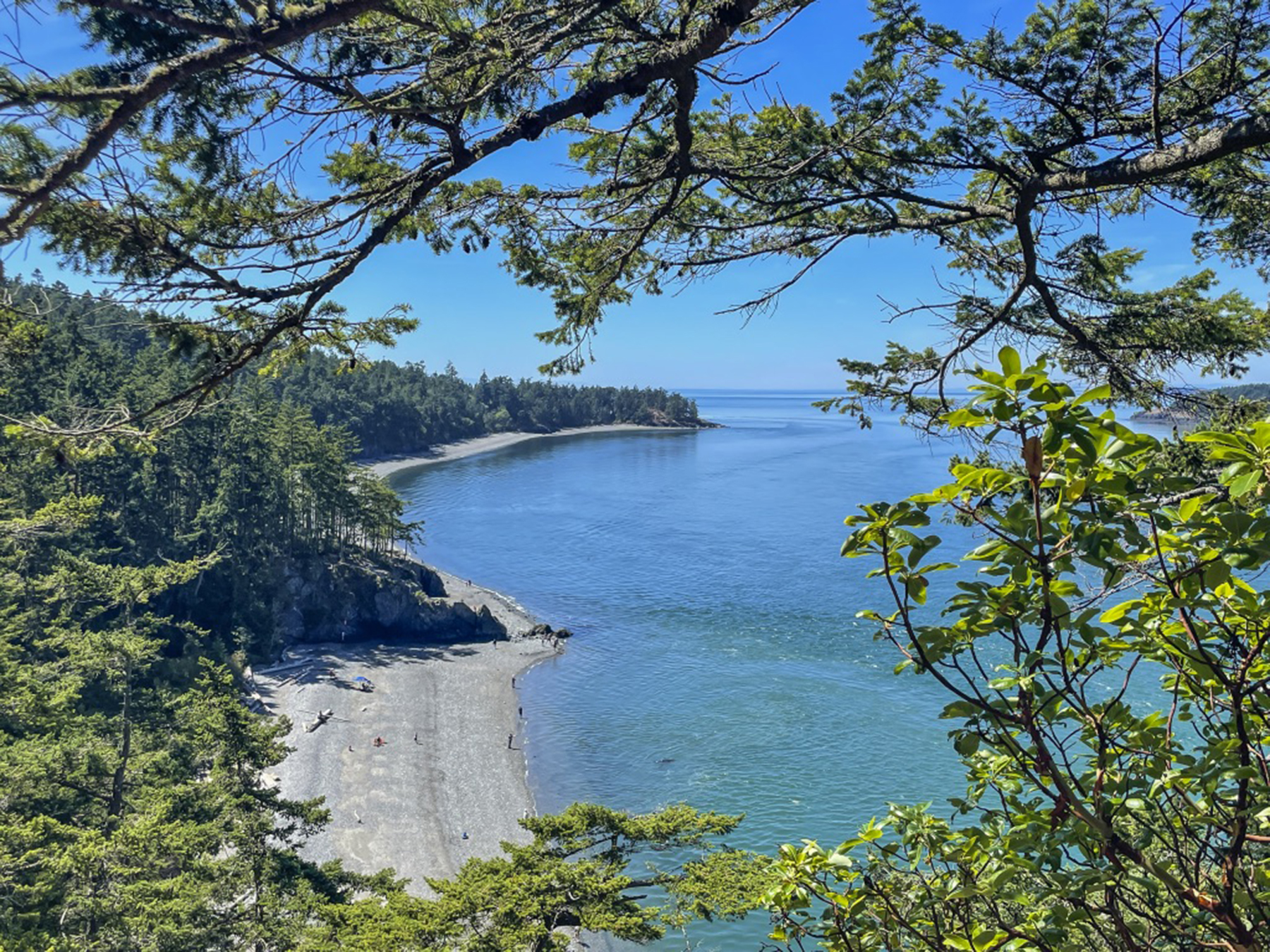
For our last full day, we motored to the Double Bluff beach along Whidbey’s western shore. The back story is that we learned about this locals’ favorite spot while partaking of a micro brew at Langley’s Double Bluff Brewery, awaiting our “your table’s ready” call to dinner at the Braeburn Restaurant a half block away. The pungent fruit of a getaway without an etched-in-granite itinerary. https://www.dblfbrewing.com https://www.braeburnlangley.com
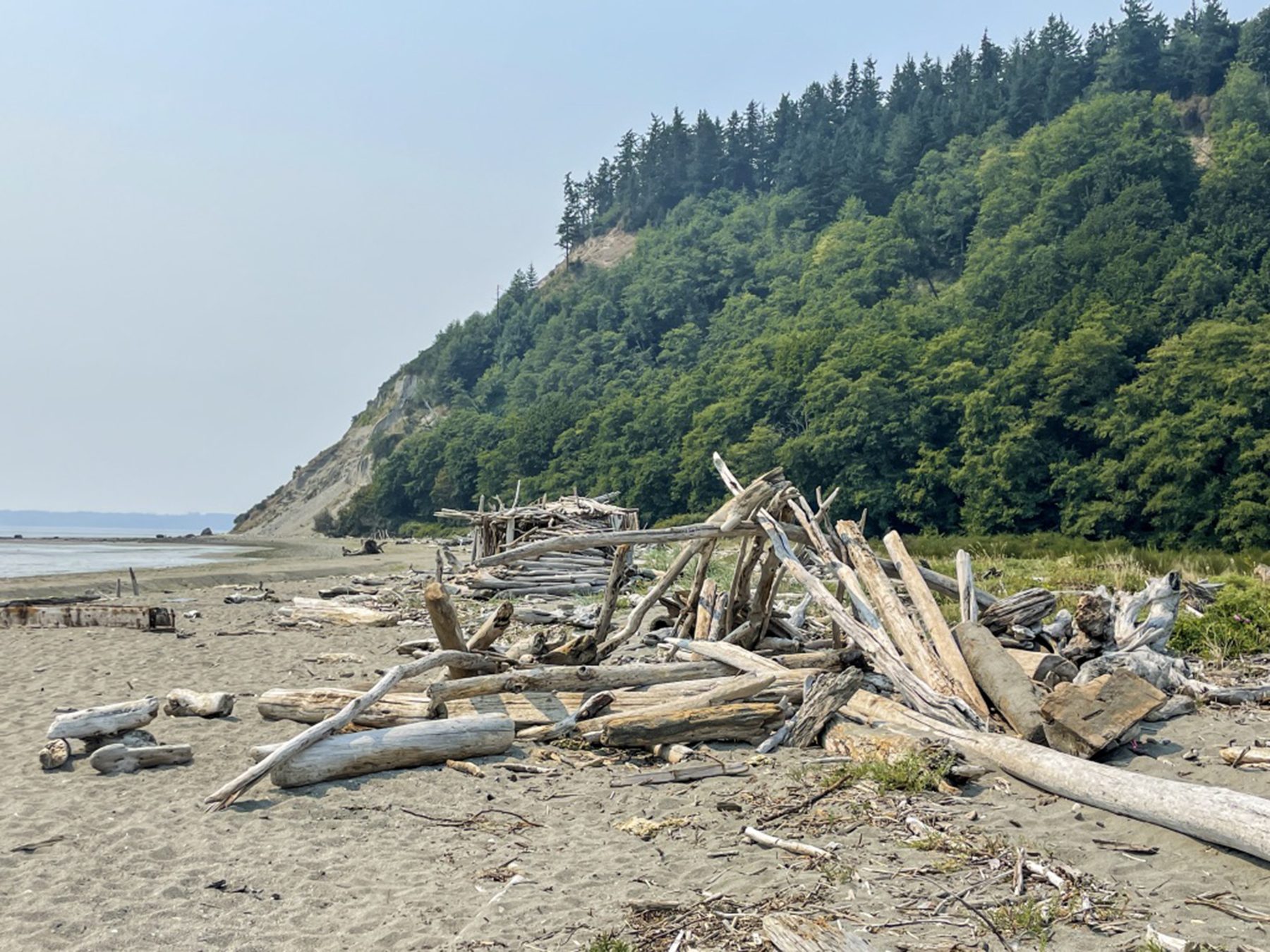
Wading in the shallows, tossing sand dollars, and breathing the fresh air, the serendipity of the unexpected.

.

Hope in the age of COVID-19
Posted on April 4, 2020
March 19, 2020
Except for a very few centenarians, this time of the novel coronavirus is unprecedented for all living humans. Easy to get pulled down by the weight of it. Beauty is God’s creative gift, and an antidote to hopelessness. Herewith my modest way of ameliorating the uncertainty, disquiet, fear, dismay, whatever troubles you in this troubling time. I will reach into my files each day and seek out an image that speaks to me about the world as we would have it, and send it on. I hope it finds favor, and lifts spirits.

Dawn moonset, seabird, the folding energy from thousands of miles away
Day two
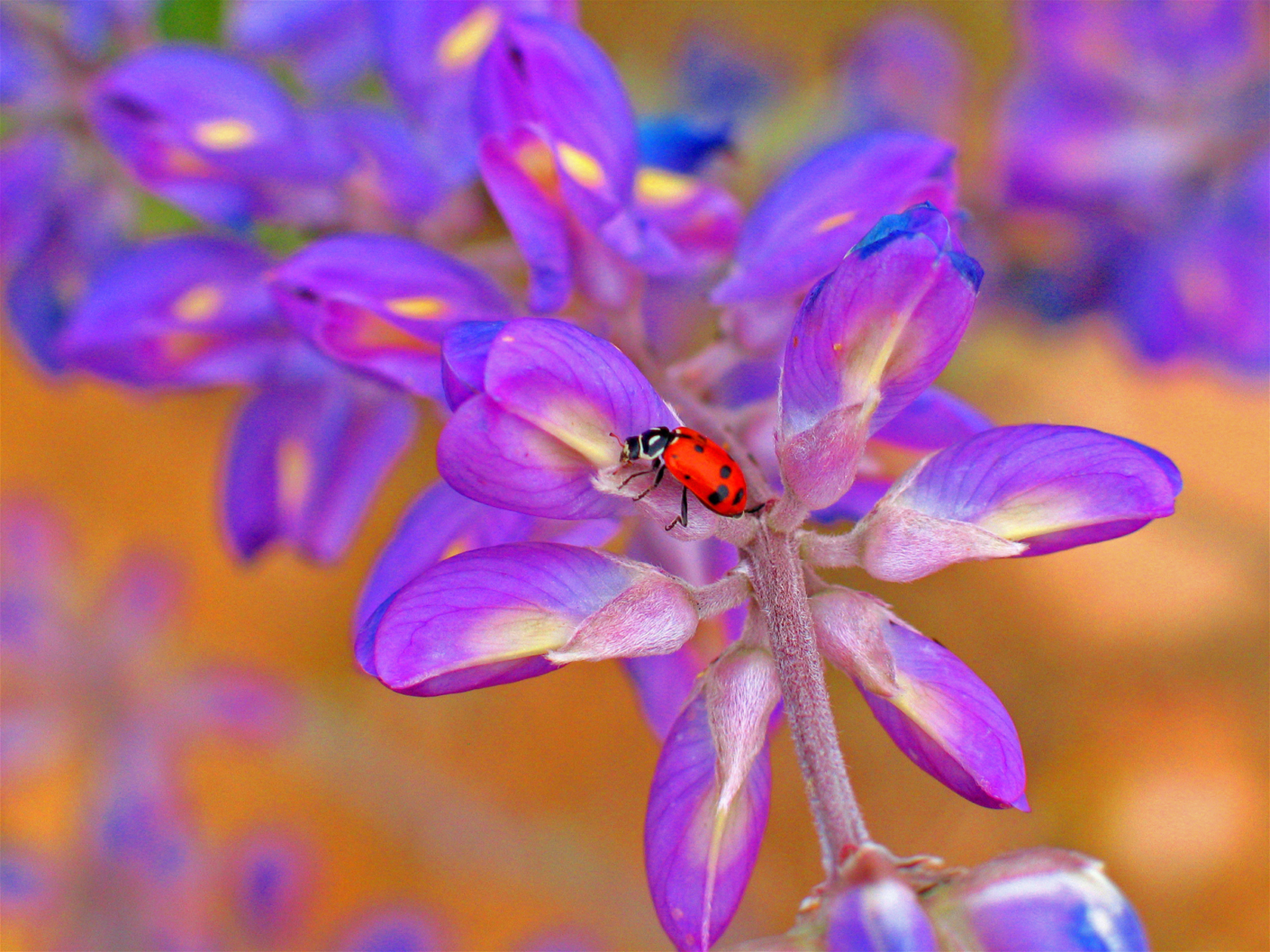
Julian ladybug
Day Three
Take your medicine. Coronavirus #3.
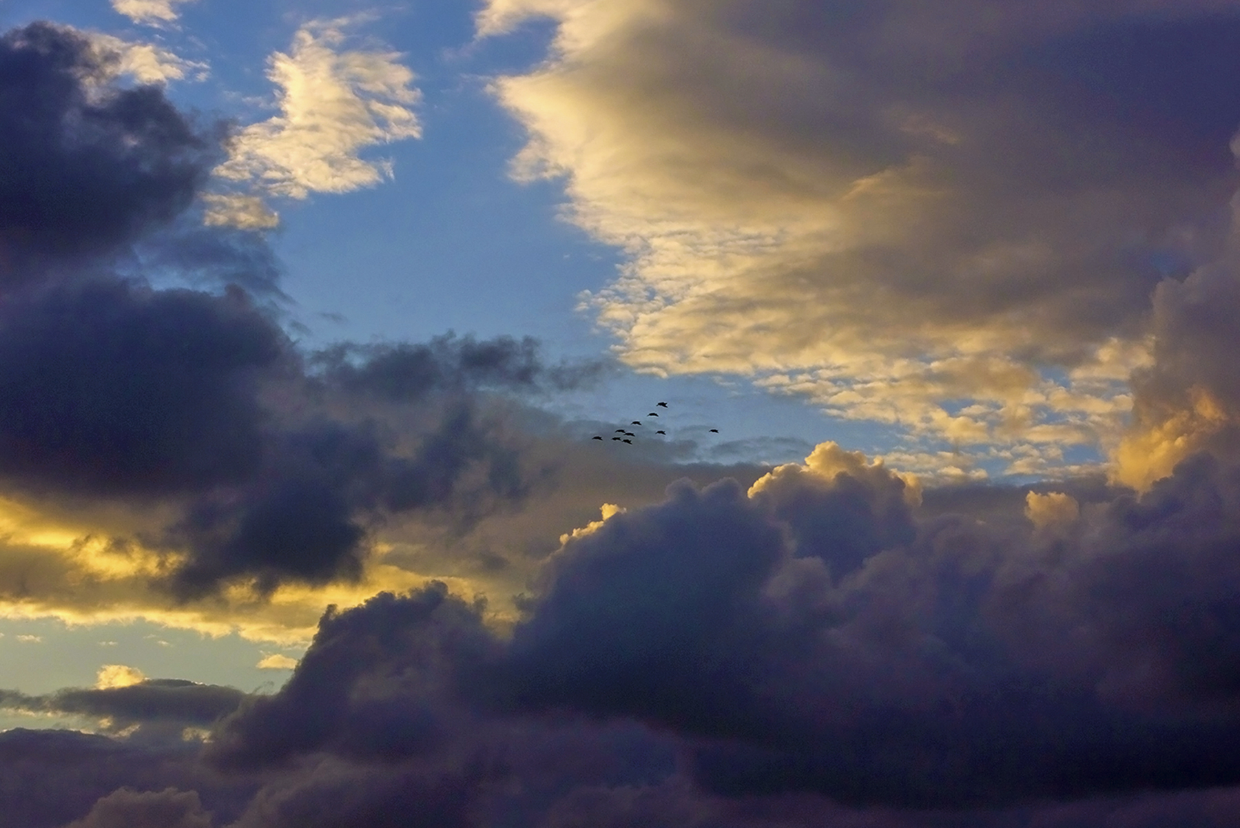
Sunset pelicans
Day Four

Pamplona Citadel trail
Day Five

A Smoky Mountains morning
Day Six
We’re in decidedly stormy times. Trite, perhaps, but looked at from a different perspective, we can’t have rainbows without rain….and sunlight. I see rainbows in the sunlight way people are looking out for one another.
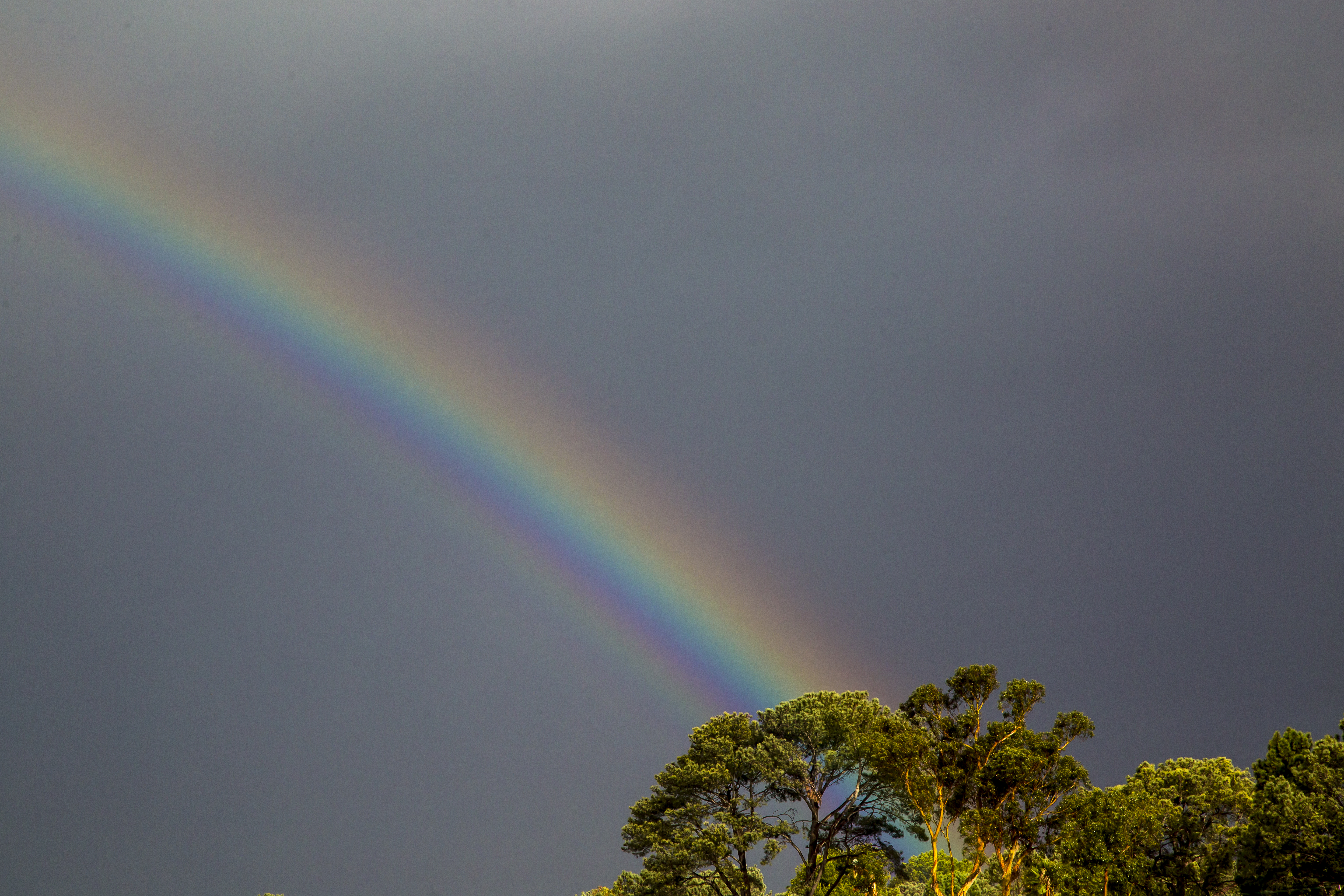
Pot of gold at the rainbow’s end
Day Seven

Solar corona
Day Eight
Isolation is tough on us gregarious humans. Sometimes nature offers up its own example of solitude. A blazing carpet of spring wildflowers, and a solitary tree, leaves back, after the winter barrenness. Focus not on the singularity, but the connectedness of colorful life, of which the singular is but one part of a greater whole.

Solitary tree
Day Nine
Cabin fever starting to close in around you? Then step out into these nearly 180 degrees of separation, La Jolla on the left, the cliff bluff near 9th Street, Del Mar to the right. An August panorama with the sky that subtropical upper atmosphere from Baja occasionally provides.

August sundown
Day Ten
I cull through my files looking for images that speak to me in hopes they will lighten our load in these troubling times. My file system is abysmal, so the results of the hunt can be all over the map. Pure happenstance, or karma, or divine intervention, today’s choice? A dark image for dark times. You can see for yourselves the similarity to Mona Lisa’s smile, or, if you prefer, the Shroud. Reflective light on the ocean at 05:56 of a setting moon on October 25, 2007— the redness a result of major San Diego county wildfires tinging the atmosphere. That was a locally catastrophic time. This is a globally catastrophic time. I found this image in an area of my files I don’t routinely meander. Happenstance? Something else? Ponder away.

Predawn moonset ocean reflection
Day Eleven
The lowly pelican. An earthbound appearance only a mother could love. But magnificent airborne gliding prowess, ridge-soaring mere inches above the lip of pitching waves, and here doing so six feet separated from one another.

Dawn patrol pelicans
Day Twelve

Desert wildflowers
Day Thirteen
A pre coronavirus epoch. But a lad minding his parents’ admonition to stick around. Granada, Nicaragua. I love Latin America’s color fearlessness. Our courage is likewise called upon.
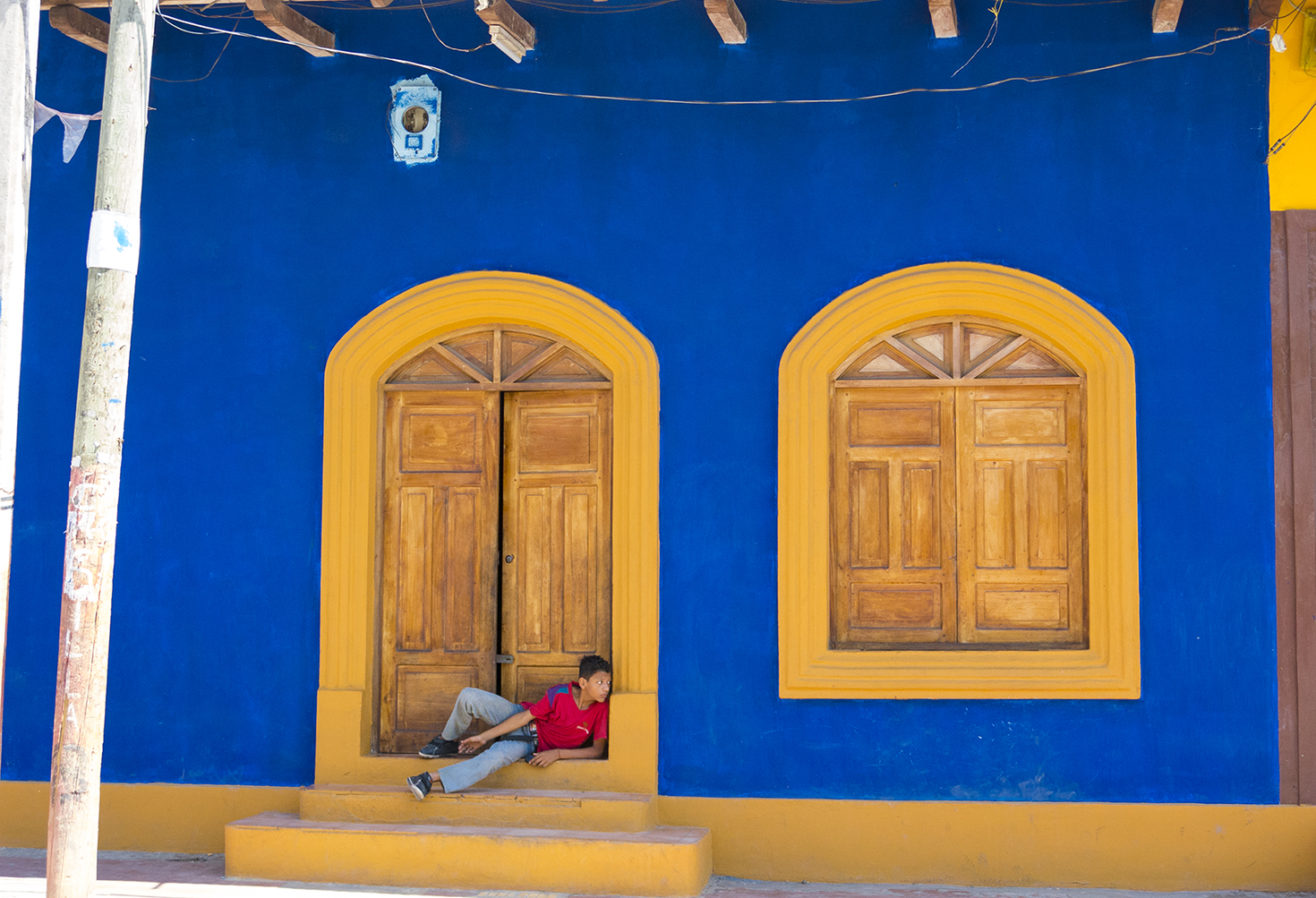
A lad in the ‘hood
Day Fourteen

Anasazi prayer room
Day Fifteen
Restaurants closed, takeout and food delivery are proliferating. Sit-down dining exemption.

Food delivery

Feeding time
Day Sixteen

Dragonfly
Day Seventeen
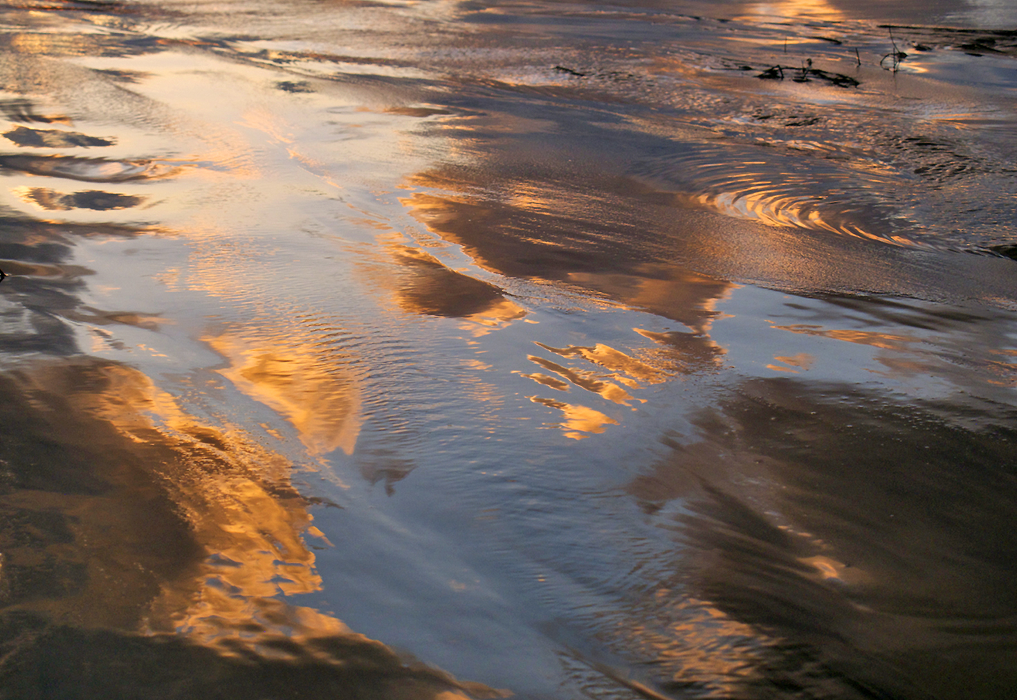
Golden reflections
Day Eighteen

Moonrise over Mt. Woodsen
Day Nineteen
During this coronavirus tumult, our lives are changing daily, if not hourly. Assumptions we’ve used for years no longer fit the new reality. It’s hard to navigate our days, our beliefs, our fears, our annoyances. It takes regular reassessment of our mental and emotional latitude and longitude, to see where we are, where we might be heading and to even get a grip on what our personal destination might look like, encompass. Sometimes that might involve following in others’ footprints. Sometimes navigating our own singular path. I wish to remember to take it easy on myself if I get a little disoriented or need to verify that I’m staying on course centerline. Wise to be patient with ourselves and those around us. Wherever we go, we leave a little of ourselves behind. I’m seeing a lot more of that being good and unselfish than before we awoke to the all-in-this-together realization of present. Do this for yourselves and those you care about: pause and look back over your shoulder at your footsteps in the sands of your time, then turn forward and see what is before you. Square your shoulders, adjust if needed, and go forth with hope.
Footprints in the sands of time
Day Twenty

Light, swathed in darkness
Day Twenty-One
We keep hearing, and I keep seeing, that we’re all in this together. There’s a symbiosis in that, each of us a supporting cast member in this global drama. Some have named parts, others walk-ons. There’s the individual scene and the big picture into which it fits, just like pollinator and flower, two scene members of the larger Spring. Spring, as in the hope of regrowth. Returns every year.
Cactus flower pollinator
Day Twenty-Two
For Christendom this is Holy Week. Yesterday was Passover for Judaism. For many their faith is a bulwark against the uncertainties of life in the time of coronavirus. For the ancient people of the book their vision of Yahweh was a burning bush. For me, a less discussed aspect of Christ’s import for humankind was that he quite literally put a face on God. For Christians its much more than that, of course. Nowadays these theological musings do not suffuse the thoughts of many who just want to make sense of what they can see and touch. We’re all different, including what to make of the impact of coronavirus in our lives, personal or universal, but we are all in this together. Beauty helps, I think. As is, or as a stand-in for Deity. You’re call.
Torrey Burning Bush
Day Twenty-Three
Cumulus Crown
Day Twenty-Four
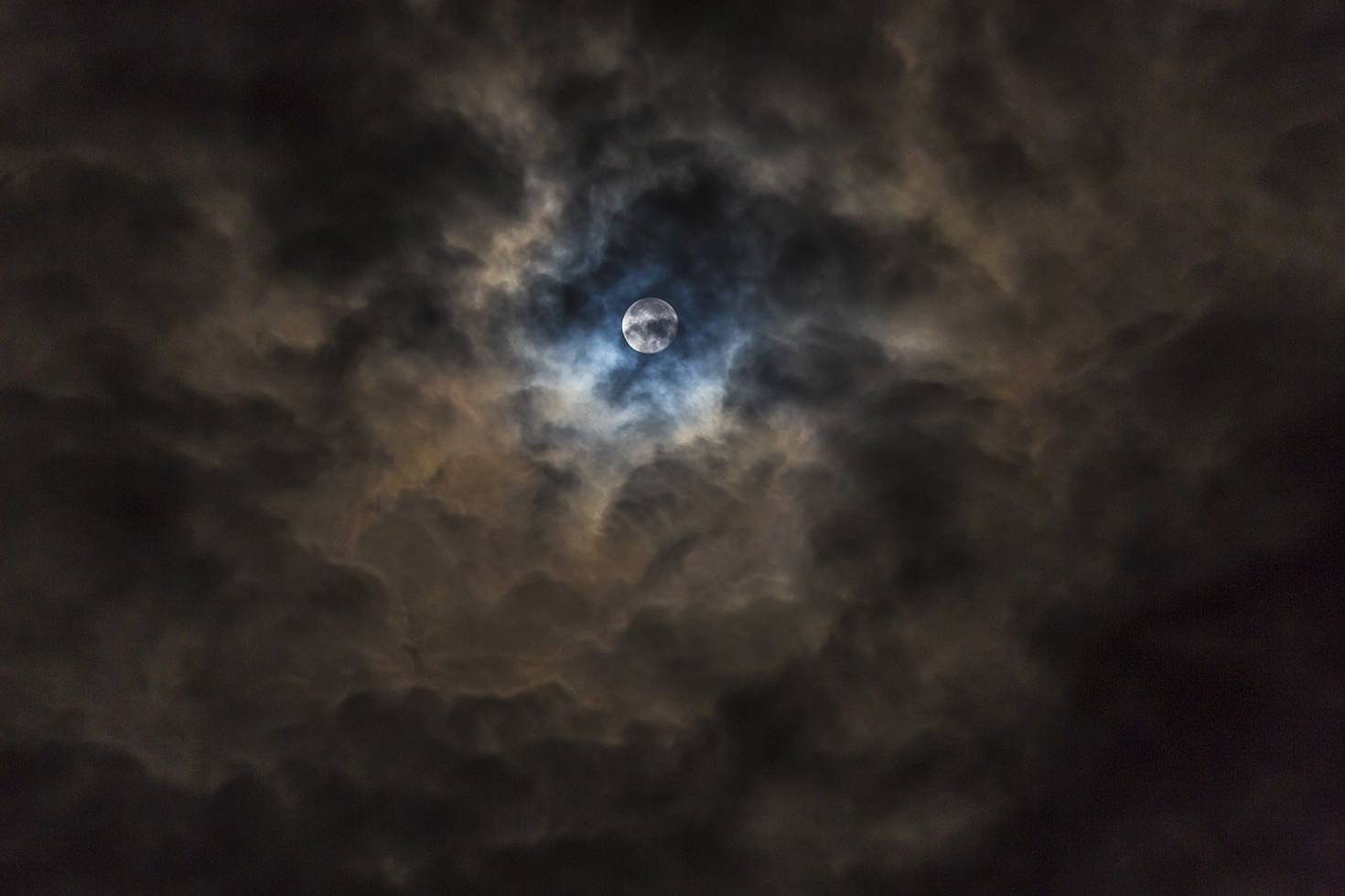
Cloud cave moon

Poppies of the field, considered
Day Twenty-Six
Doesn’t it seem that often the little things denied are those that loom most large? For me that prominently includes barefoot on the beach, stopping to retrieve treasured gifts from the sea.

Seashell and sand
Day Twenty-Seven
The degree to which I get out—while honoring the virus restrictions—exposes me to the affinity we all have for associating with family and loved ones, everywhere evident when crossing paths with other walkers. This social isolation thing is unnatural, and can’t be behind us soon enough for me.
Two dolphins, cavorting beneath the prow of a boat while underway off the coast here. Playing together, at decidedly less than six feet. The fun of their association glowing from them as happy radiation. Like Pavarotti, holding a long High C. They’re doing it because they can. I’m looking forward to more of that.
Dolphin company
Day Twenty-Eight
Tides. Four a day, each different from the last and the next, while also common with them. There’s the back and forth we can see, and yet more below the surface we cannot, until ebb tides reveal what they may. There are seasonal changes as well, and of course the lunar monthly effects, not to mention the impact of storms. If you’re a water person like me, these changes quite literally impact daily comings and goings, what to do, when and where. And all of that affects my moods and energies as well. See any parallels here to a coronavirus tidal impact for the day, for the season, for life more expansively? I’ve mentioned many times how I’m witnessing a below the surface change in people caring for one another, the we vs. me effect. Have you noticed that with this existential tide, people are generally not rushing pell mell to the barricades knocking others out of the way? There’s a civility in which humankind ought to take consolation. It’s compelling to focus one’s gaze to observe features in all this which reflect new ways of looking at old realities, as well as new realities that have changed the bedrock.
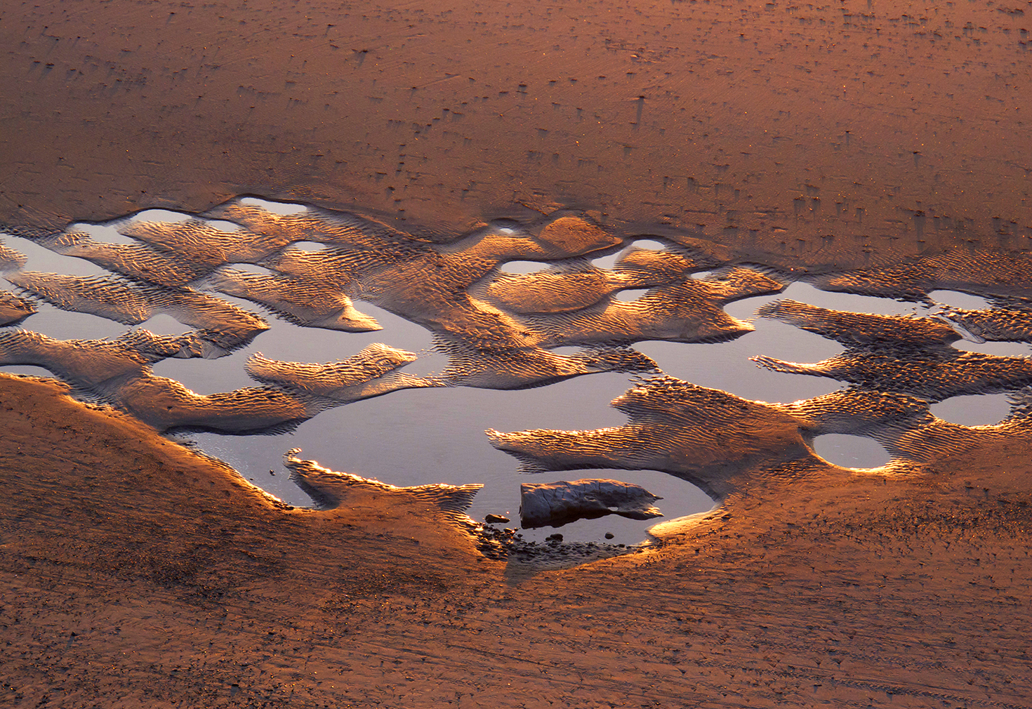
Marimekko Sand
Day Twenty-Nine

George, Thomas, Teddy, Abe. The Donald?
Day Thirty

Weeping stone palate
Day Thirty-One
Cactus flower
Elsewhere along the trail, I was stopped, well, “dead” in my tracks, gawking at this, no electron microscope needed. But oh, my, it leaps out at me as visually parroting the coronavirus. And while I was sizing up how to get in tight, lens not shadowing the shot…

Coronavirus flower
… I flinched with surprise as two Navy Blue Angel FA-18s burst from silence with deafening roar, racing by, nap of the earth, at our elevation and a stone’s throw away, a blur of crackling power. Now that was movement. If this was a graphic novella, about here is where the plot would turn, and the species that could design and wield a technological marvel like the FA-18, would breakthrough, and its scientists, one of whom was flying the lead jet, epiphanize the creation of the salvation serum. Instead, I fist-pumped while hollering “THE SOUND OF FREEDOM!” You had to be there. It was only after getting my heart back into my ribcage, that I framed up the flower above.

Blue Angels
There are things afoot, media reported, or heard as scuttlebutt across the backyard fence. Even in the most virus-devastated areas infection and mortality rates appear to be trending favorably. Just as cabin fever has us all aching for even the most modest return to normalcy.
There are so many ways to look at what has been happening to us individually and as a people depending on the perspective lenses we wear and the degree of personal impingement experienced. Is the medicine as bad or worse than the curse? As to the pandemic time signature, would this plague run a temporal course very much the same with a less severe lockdown medicine? So little is known in the midst of this battle, and great questions will be asked with the perfect visual acuity of hindsight. Our policy makers and the policies promulgated have been imperfect, but it seems to me that any negation is not for lack of sincerely trying to get it right. And our essential workers, first responders and medical caregivers daily show mythical courage at helping in the midst of dark confusion.
My faith view keeps showing me the beautiful light of common decency. I’m witness to people helping people and society broadly in ways large and small, a manifestation of steely resolve or open embrace of soulful urging. Different as a function of how you see it, each perspective valid to the particular observer. But all of it showing light amongst darkness.
Northern San Diego County’s nearshore has been experiencing what is called a Red Tide. Under daylight the ocean has a somewhat opaque burgundy tint from the infusion of marine bioluminescent plankton. At night the darkness is illuminated by a surreal glowing blue light. Light that shows only amidst the darkness. Another way of looking at the darkness of this particular night.
The attached time-lapse sequence and still were from last evening. A sign of the lockdown times, I snuck in under cover of darkness to a bluff top overlooking the ocean. Not full camouflage or blackface, but stealthy individual force recon, just the same. Down closer to the water was an INS vehicle on duty, guarding against I know not what. I found a place surrounded by high coastal scrub brush and began looking for light to share. It was fully dark, my shooting beginning about an hour and a quarter after sunset, and staying with it for another hour. The exposure revealing clouds, stars and surf, results from time exposure per shot and diligent post production work in the digital lightroom. Modest results to report back to Division HQ, but yessir, there is light out there, sir.
Be strong. Be healthy. Witness kindness and human compassion all around us. Ponder why it is so. Give thanks.

Bioluminescent Light Amidst Darkness
Day Thirty-Three

A proudly patriotic sunset
Day Thirty-Four

On course, headed home
Day Thirty-Five
Bedroom window open, chilled ocean air carrying loudly the sound of the sea all night. Just the right combination of elements. Wave size surprisingly not always a factor, but tide, wind and direction, atmospheric temperature and humidity often factors. An invitation to go forth and see what the new dawn conveys. An early light misty glow of Torrey pines? Trails now reopened in many places, Sawyer and I will scamper paths somewhere. Well, he’ll scamper, I’ll nimbly plod. The news, so breathlessly changeable in this time of the virus, but nature, ever beautiful is ever constant in her nurturance of the soul. Join me in drinking deeply from that cup.

Misty Torreys dawn
Day Thirty-Six
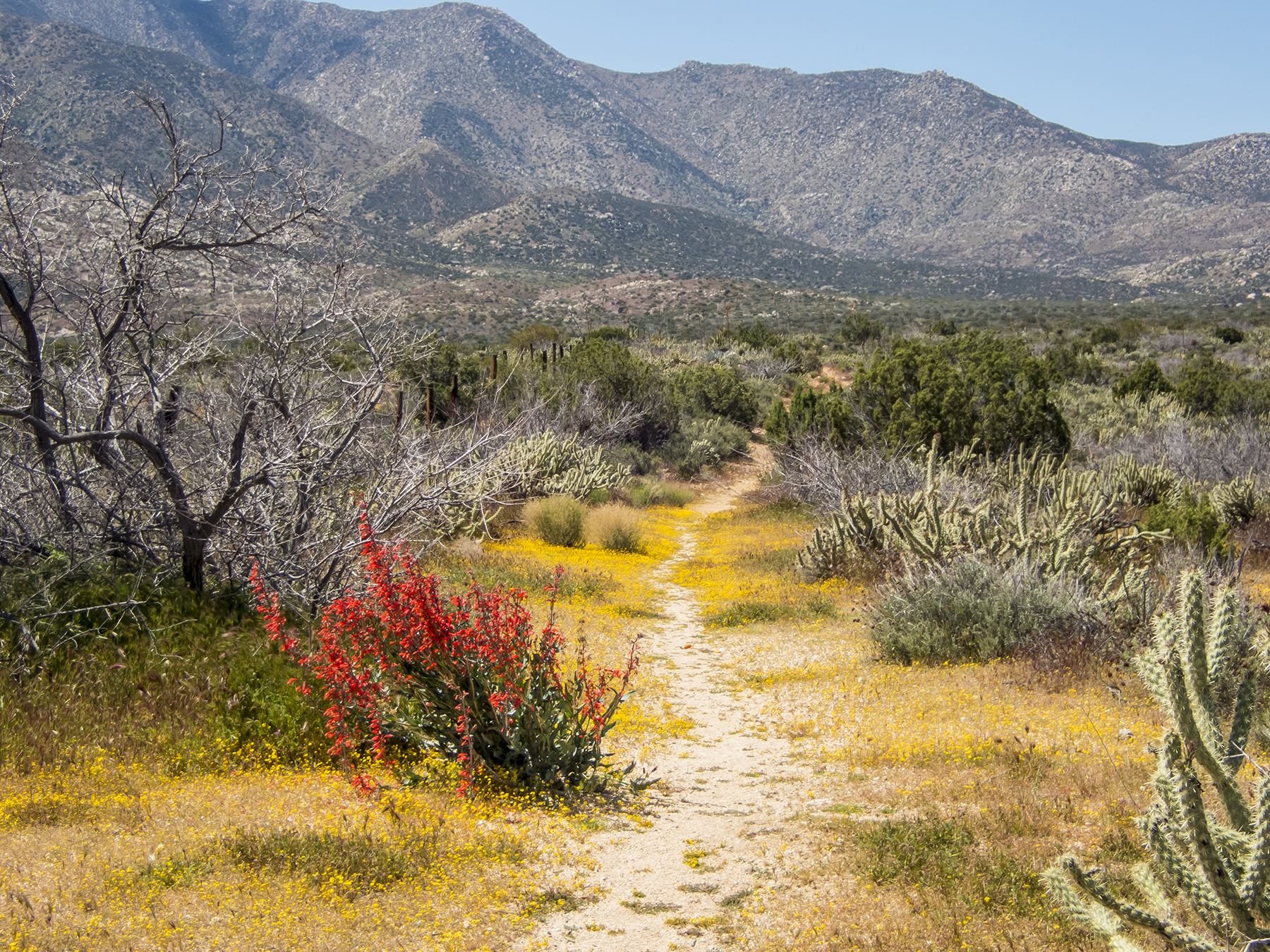
The path is paved with gold
Day Thirty-Seven
Phases. Something that goes around and comes around. As with the moon, which is “new” right now, its feline smile in the west at the end of the day. The lunar calendar describing when Judaism celebrates Passover, Christendom celebrates Easter, and the Islamic umma celebrates Ramadan, which begins today. This particular novel coronavirus is new to humankind, but there have been others, including the big ones like the Spanish flu, SARS, MERS, not to mention the vanilla flu, even the rhinovirus of the common cold. History, and scientific pundits tell us that we will get over this one, but the pathway isn’t a straight and clearly defined one, nor does it appear to be particularly short. We seem to be in a phase easing out of the worst of the societal medical uncertainty, followed by a similar clarifying of society’s economic miasma. We’re not where we want to be, but at least we have some recognition as to where we are. As a society. Now, at the personal level, the phases are as different as the individuals and their particular circumstances. Make the most of what little illumination we have now, and take solace in history and science conveying that the illumination, and with it, clarification, will continue to improve. Peace be upon us all.

Twilight New Moon
Day Thirty-Eight
You ‘re looking at the silhouette of a 5,000 year-old tree, a tree that was already old at the time of Abraham. Yeah, that Abraham. It stands vigil in a grove of bristlecone pines in the rarefied air at over 11,000’ MSL in the White Mountains near the California-Nevada border. Truly a Patriarch, whose perspective on having seen it all over the millennia, stands as testament to resilience in the face of the challenges of each new age.

Bristlecone Patriarch
Day Thirty-Nine
Take care of yourselves. Get out, but keep moving at a distance.

Spanish Steps
Day Forty
Lung power. The wind in our sails begun with that first gasp at birth. Powerful and natural. Easily taken for granted until confronted with COVID-19 or other cardiopulmonary illness. Loosening of lockdowns will provide more opportunity for robust respiration. We can take advantage of that, feeling our internal sails billow, while plotting a sensible course in distancing and hygiene, that we avoid a return to the doldrums, physical or economic.

North swell spindrift
Day Forty-One
The isolation of the novel coronavirus is one of its most unpalatable features. A good reminder to physically or emotionally touch someone you love and care about. Be there for them, and let them be there for you.

Hand tree
Day Forty-Two
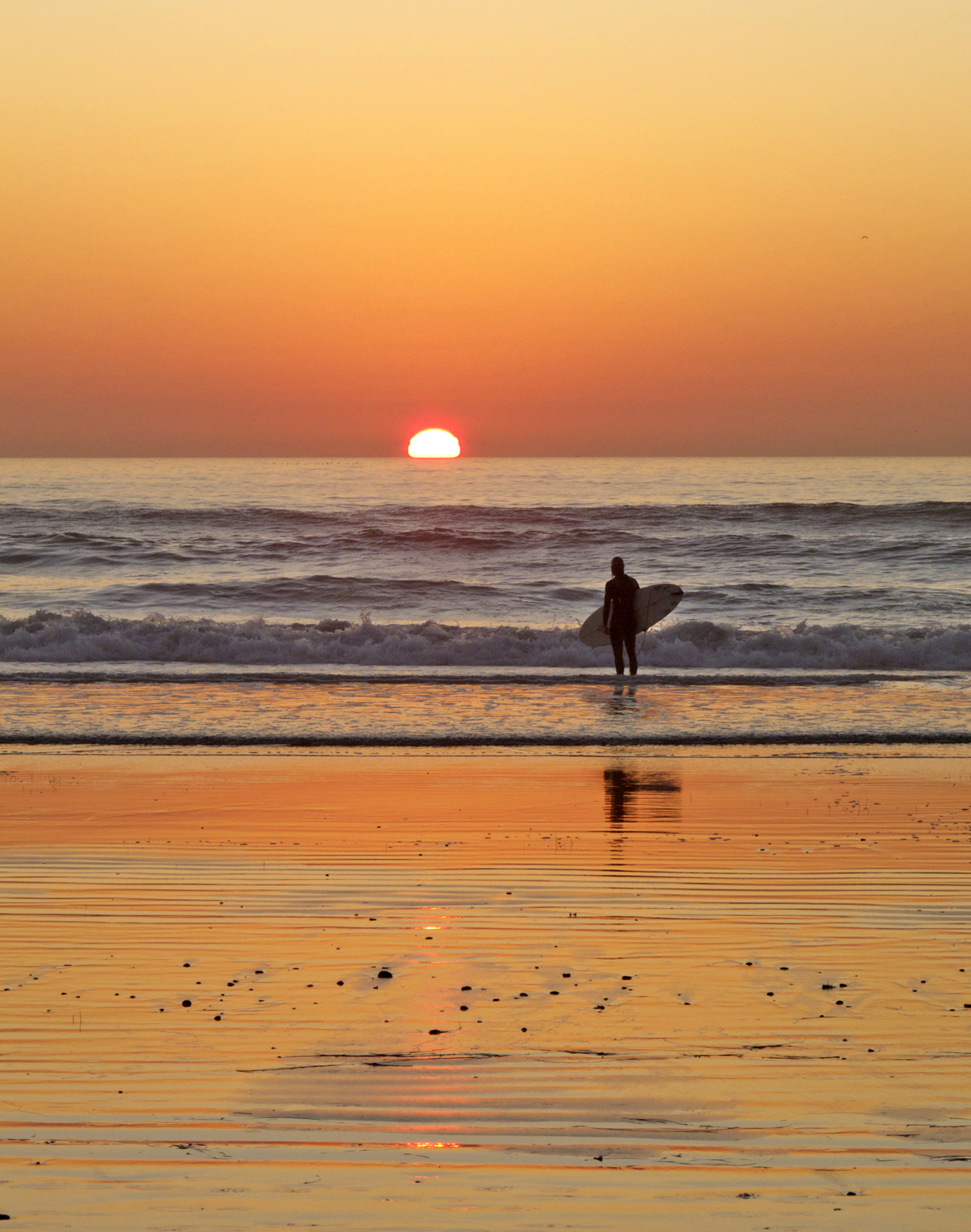
Surfer sundown
Day Forty-Three
Skies have been dreary here on the coast the last few days. Mirrors the dreariness of the coronavirus nexus. Let’s color over all of that with some brightness.

Light vs. dark
Day Forty-Five
I’m feeling the drag of coronavirus fatigue, and just didn’t suit up for yesterday’s image. Sound familiar? The morning dog walk is simultaneously the morning surf check. The waves aren’t visible on foggy mornings, but fortunately those are great mornings to wander the local canyons, the wetness suffusing the air with the smell of earth and chaparral. The spider webs all glisten, strewn with a thousand tiny droplet diamonds. And the Torrey Pines needles collect and hold water, each drop a lens revealing the bigger picture of the forest it inhabits and creates. This virus isn’t tiny, but it is revealing things about human nature, both good and less so. More of the former I think.

Lens on it all
Day Forty-Six
Help is on the way
Day Forty-Seven
The elusive green flash. If you’re a SoCal beach bum like me, you’ve seen your share, but they are an inconsistent event, and very difficult to capture as an image. I suspect that’s at least partially because some of the flash results from our rods and cones responding to that spectrum at the last moment of sundown. But if your as-yet unfulfilled bucket list is to take in a green flash, here you go. Green flash is better than coronavirus news flash to my thinking.

Green Flash. Blink and you’ll miss it.
Day Fifty
04:48 Muse call. The overnight cirrus clouds had given way to a gauzy marine layer offshore. Only a hint of the red tide luminescence with a full moon brightening the sea surface. Still, aside from the hour, a nice way to start a day in the time of the plague.
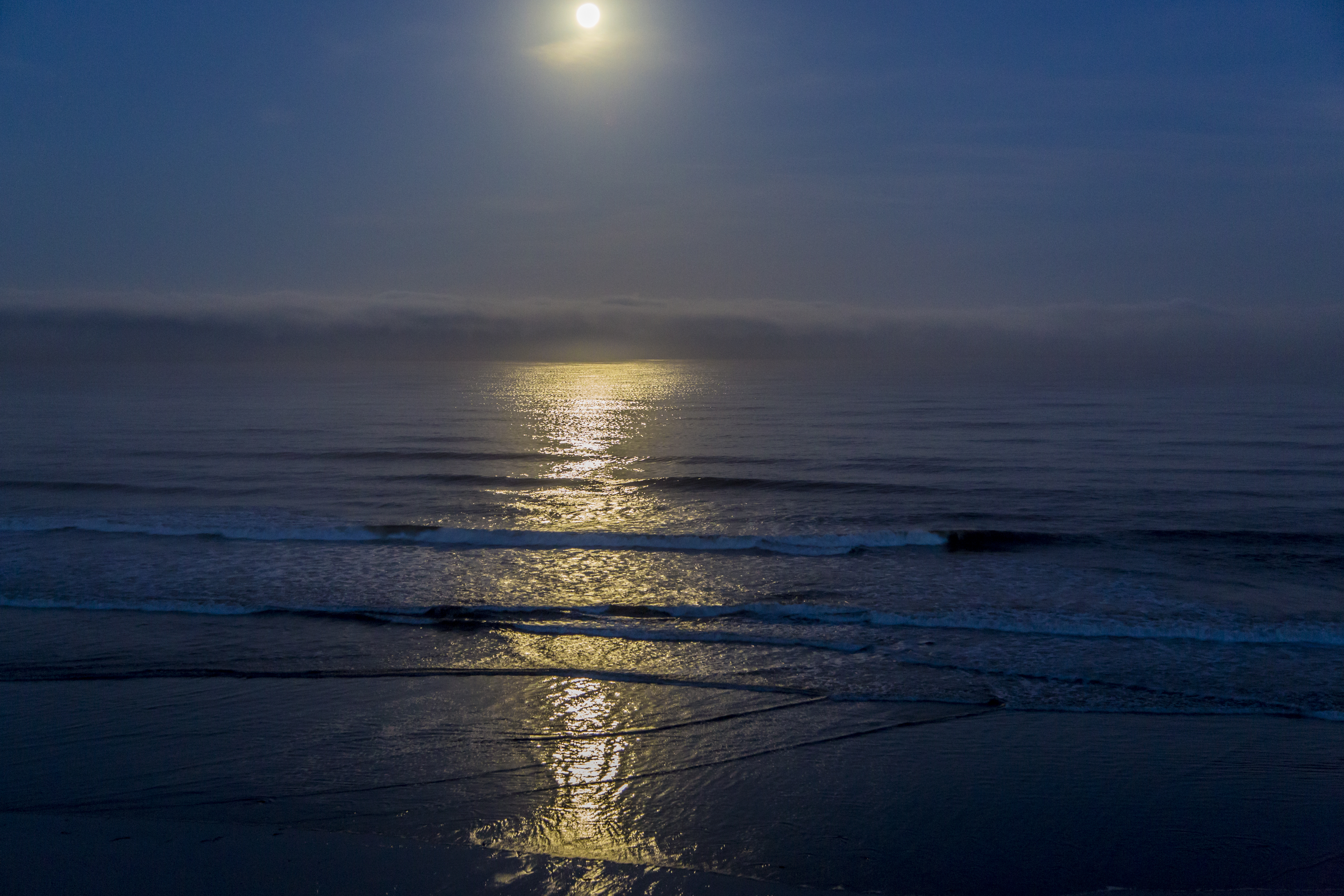
Red tide moonset
This Doesn’t Look Like Kansas
Posted on December 19, 2019
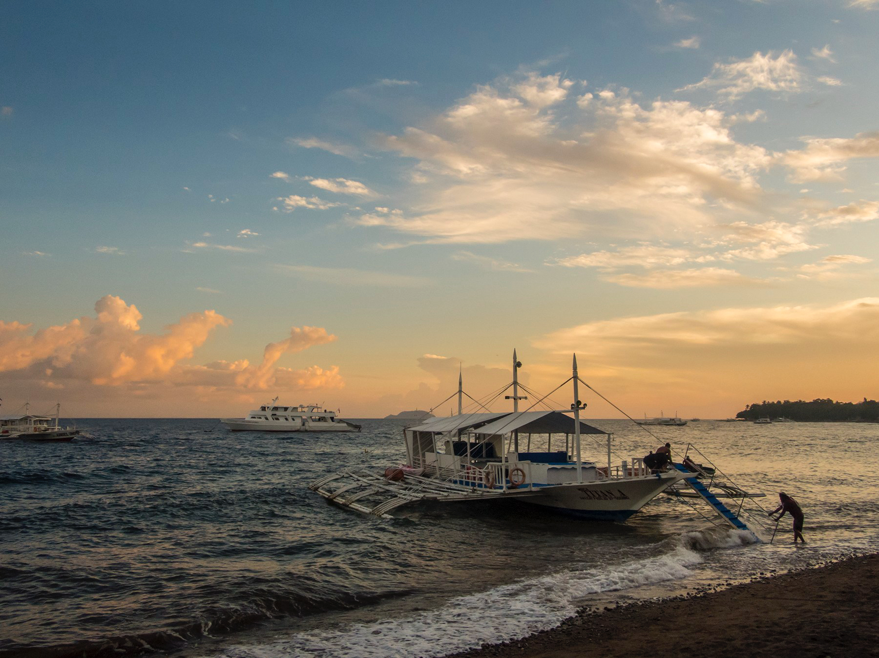
Dive boat after the afternoon dives
Cathy and I joined friends and preeminent underwater camera shooters Howard Hall and Marty Snyderman celebrating their 70th orbit of the sun with a group diving splurge for ten days at the Atlantis dive resort at Dumaguete, on Negros Island in the Philippines. Having previously only flown over the Philippines, this provided an opportunity to put sandals on the ground and fins in the water. At 9 degrees north latitude, Dumaguete boasts an unchanging weather pattern of 78F at dawn rising to 87F by mid afternoon, drifting cumulus clouds, the occasional passing rain shower, and an ocean temperature stuck at 80F. A two mil spring suit for me and a 3 mil long suit for Cathy tells the tale.
Diving up to five dives a day, we were pretty tuckered out by the time we finished dinner, so collapsing into slumber was 9-ish early, which meant that we were back awake before dawn, allowing us to savor both ends of the day, which began and ended more or less like this:
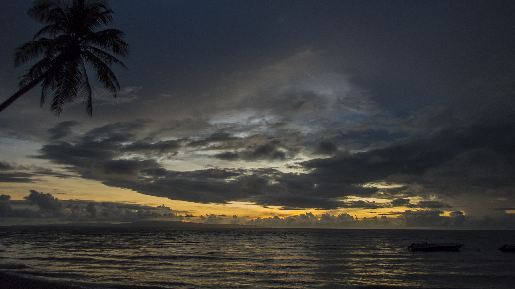
Dumaguete dawn

Negros and Apo island sundown
The mango daiquiri or alfresco dinner view before trundling off to the land of nod:
-
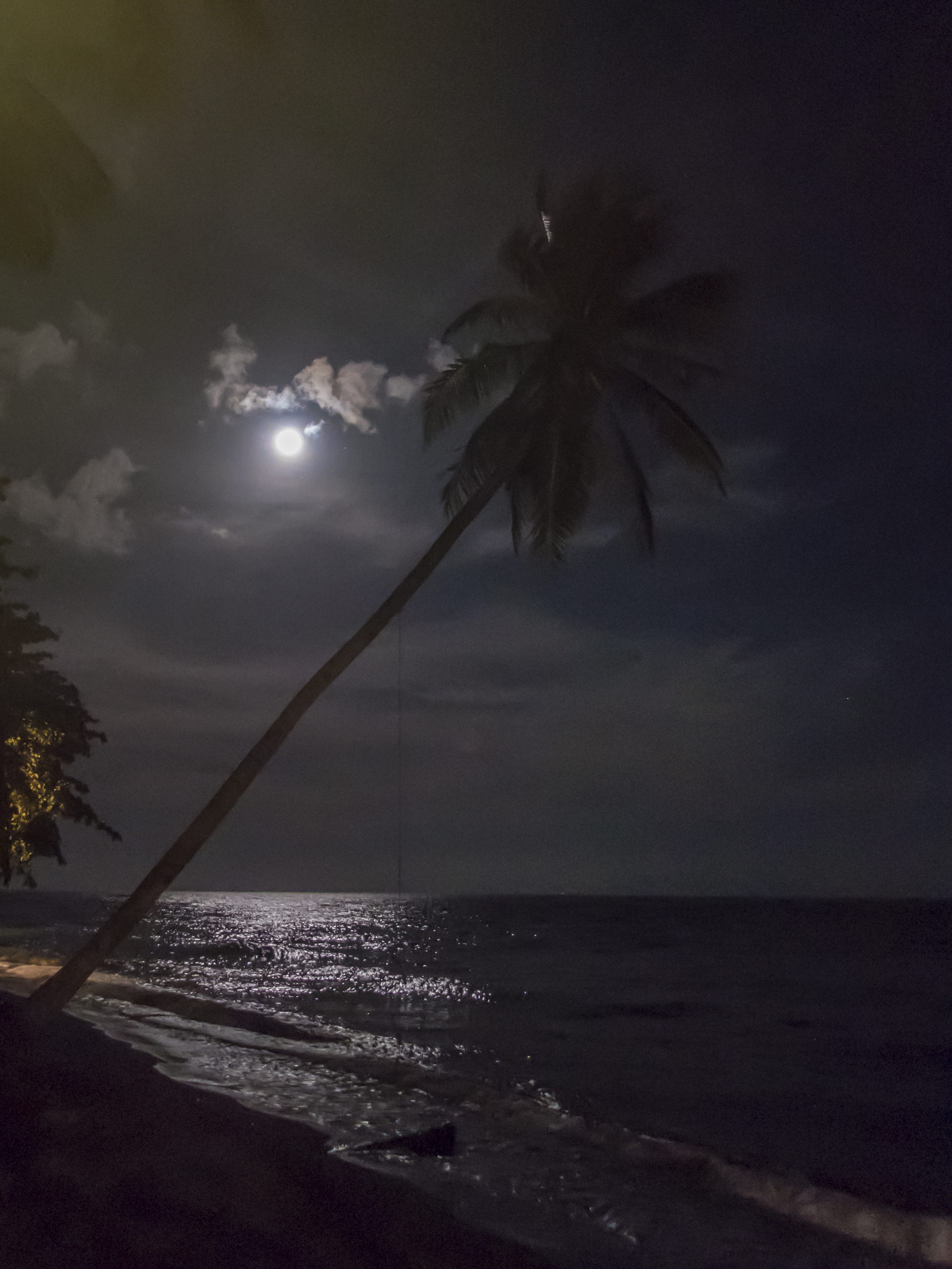
Moon glow
Ambulating the Atlantis Resort https://www.atlantishotel.com/dumaguete-resort/ is by flagstone pathway meandering amongst the comfortable rooms dotting the lush tropical greenery past the pool and full service spa leading to the bar and adjoining restaurant. There’s an extensive dive gear area and dedicated underwater camera room. Meals were large, delicious and beautifully presented. Filipinos have always seemed friendly and smile-prone. The resort staff has been selected and trained with that solicitousness exuded at every interaction. By the end of the first day they unfailingly knew and called us by our first names. Everyone did. Let me introduce you to Seraphim, the groundskeeper with an aptly angelic smile and twinkle in his eye, who stopped me early on my first pre-dawn morning stroll to ask my name and shyly offer his hand. This is him raking the beach, proudly doing his part to ground our stay in decadence:

Seraphim—his given name— raking the beach
The very first picture above shows the sort of dive boat which took Cathy and me to numerous dive sites within the Dauin marine sanctuary. It fascinates me that in so many global regions, watercraft of a specific local design DNA evolve to prevalence—the Chinese junks, the Indonesian long sailing craft, the dhows of equatorial Africa come to mind—and these pointed prow vessels with bamboo outrigging in the Philippines. We would come aboard and leave by the ramp you see leading to the sand bottom next to the shore. For our dive water entries we scissor-stepped in full gear the off either side of the bow to a splash-in some four feet below before almost immediately dropping below the surface alongside our dive guides Art, Genie and Wing-Wing. Our return aboard was by an angled stairway, facing aft and lowered into the water for each of our dives, just observable at the eight o’clock position in the unclear frame below, taken, my head bobbing at the surface, with the water still sloshing over my underwater camera lens housing—the outriggers on the right, the boat’s hull on the left. Dark below in the water, but a nice twilight for our return to the mother ship. For each dive return, Captain Ernie, or boatmates Mario and Bahil would meet us on the stair at the waterline to relieve us of our tanks and buoyancy vests and help get our fins and camera gear so that we could walk up the stairs to the deck where we’d partake in snacks of cookies and fruit during a surface interval and often passage to the next dive site. A couple of dives in the morning. Return to the resort for a three course lunch, then repeat in the afternoon. Night dive later? Happy hour at the bar, or along the shore’s edge, then three course dinner. Collapse into sleep. You getting this?

Just-surfaced view at sundown
Given their preeminence in the underwater film and stills universe, Howard and Marty’s friends are seriously into getting good imagery in the can and have the requisite equipment and skills to accomplish the job. This is several hundred thousand dollars of camera and housing gear before leaving the resort for the morning’s dives. Gear fit for a lunar exploration or a full Hollywood production.
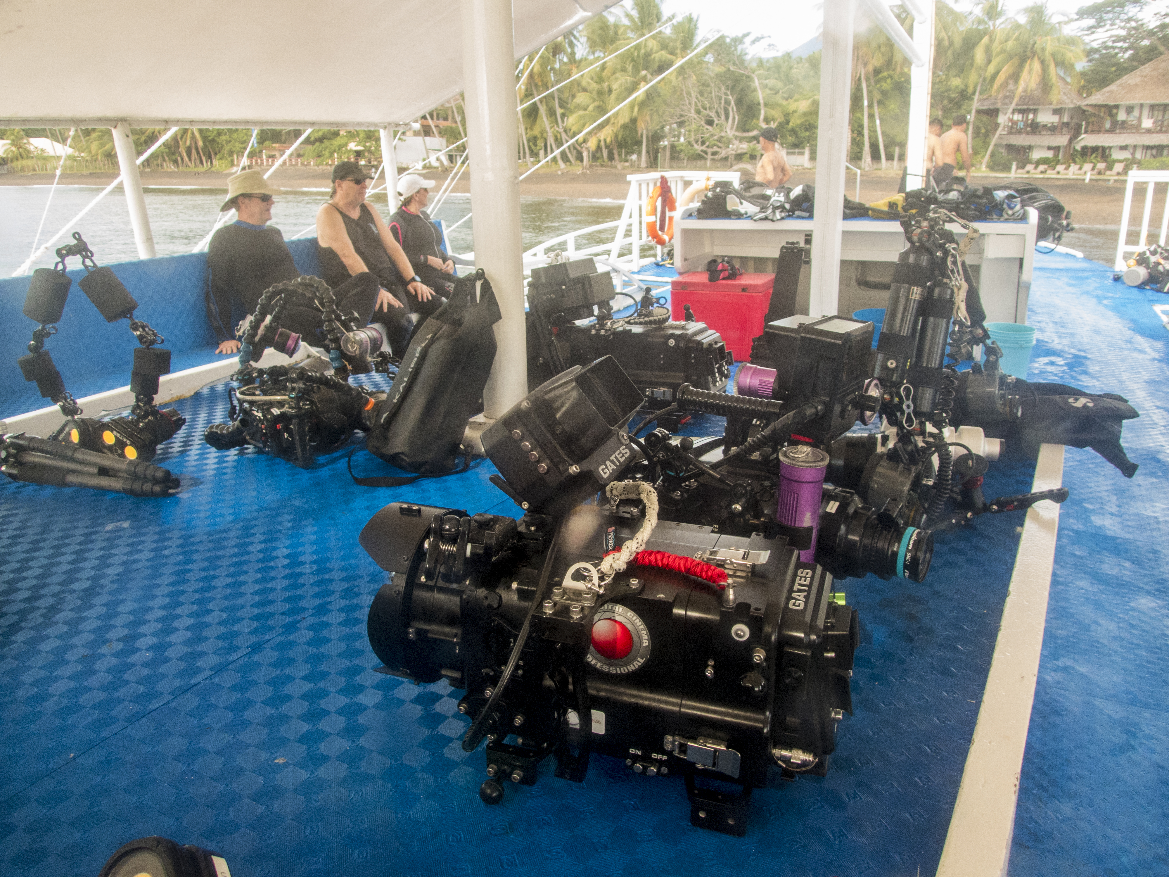
Serious camera gear for serious dive shooters
Hearing a different drum beat, I chose this year to embark upon my own pathway to relative simplicity, modest size and light weight, acquiring specifically for this trip and the future a uniquely capable fully professional palm-sized Olympus TG-6 camera in an underwater housing with Sea&Sea strobe and focusing light. Which is segue enough to get to the point about what was a significant point of this trip—what’s down yonder.
What lurks below in the tropics is generally off-the-charts colorful and bizarre in appearance and function. You should know that I get positively giddy about nudibranchs, the undersea version of our garden slugs. They are regularly quite small, often an inch or less in length and absurdly gaudy.


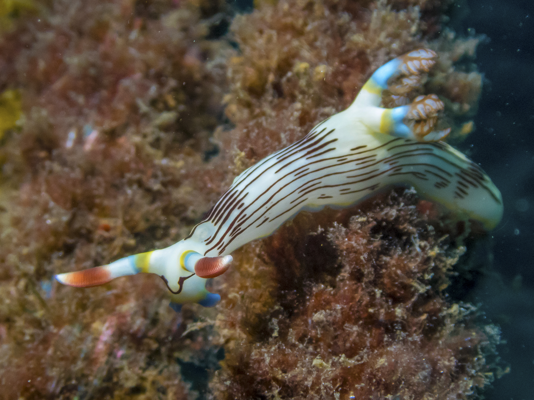


George Lucas-like, without any scale it could be Jabba the Hut’s cousin about to devour a space speedster. In life, about an inch long.
And this is a fit place to discuss the focusing ability of my new camera and the capturing of images generally. The camera can focus so close in macro mode that the front of the lens can essentially touch the subject. For these frames, the front of the lens port—the part of the waterproof box housing the camera that the lens looks through—was maybe a half inch away, the lens itself maybe another half inch behind the glass of the port. First you have to find the subject critter, with most of the shots on this trip taken somewhere between 25 and 70 feet down, which is one way in which the local dive guides really earn their keep. But first they aid in keeping you safe. For instance, Art came to my immediate aid at about fifty feet down when I developed an instantaneous debilitating charley horse in my right calf, him grabbing my right knee and pushing it down straight-leg while simultaneously pulling the “toe” of my fin up toward my corpus, providing instantaneous relief to absolutely debilitating severe pain in the calf. Don’t try this at home. But dive master guides also know the local sites and where one is likely to find this or that specimen. Sometimes they were in the open and I could actually discern them myself, but oft times they’d be hiding under this or that overhang or in some crevice, and you might be head down trying to position your body and camera to frame and nail that shot, getting in close, not banging into and harming the coral or yourself, not stirring up any sandy bottom to cloud the whole scene, not to mention bending the strobe arm so as to have the light illuminate the critter, not some other spot off scene. You gotta have light on the subject to get tight focus and to reveal the magic of their color in a world where the water medium skews everything to the dim blue end of the spectrum. It is an attention-riveting experience.

Speaking of nudibranchs, here’s a rosette, a batch of a gazillion nudibranch eggs attached lightly to corral, wafting in the surge for all the world like a red rose, its petals waving in a breeze.
I have no idea what this creature is, but it looks like some huggable kid’s toy or a bubblehead in a car’s rear window. 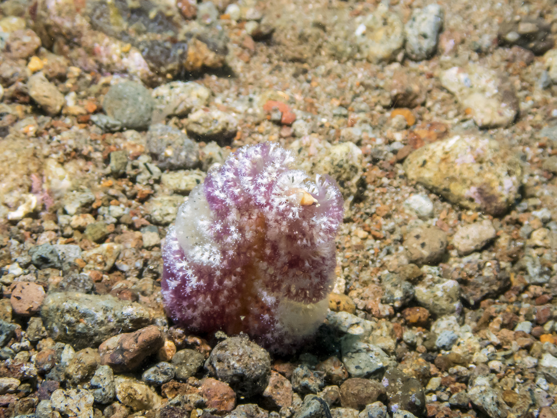
Not something to hug, but delightful just the same. Carapace about four feet long. Chilling out while munching coral.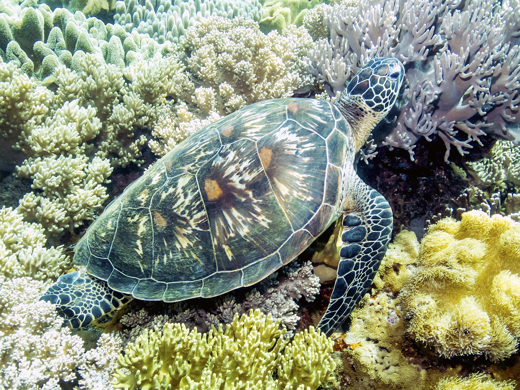
Things big, and things small.

Candy Crab on soft coral
Art really helping out here. We dove with aluminum pointers about 18 inches long and the diameter of a Ticonderoga pencil. Besides a pointer, these underwater devices can be used to fend off a slow-motion collision with a reef, or to push down into the sand to lock yourself in position against current to keep on station while framing and capturing a shot. This is a minuscule-sized candy crab at the nine o’clock position, almost dead center in the frame, looking like it is standing on the pointer, it’s red bug eyes atop its yellow body looking straight back into the lens. Perfectly camouflaged for the soft coral where it lives with its maybe 3/16ths of an inch body size.
Camouflage, often the rule for survival.
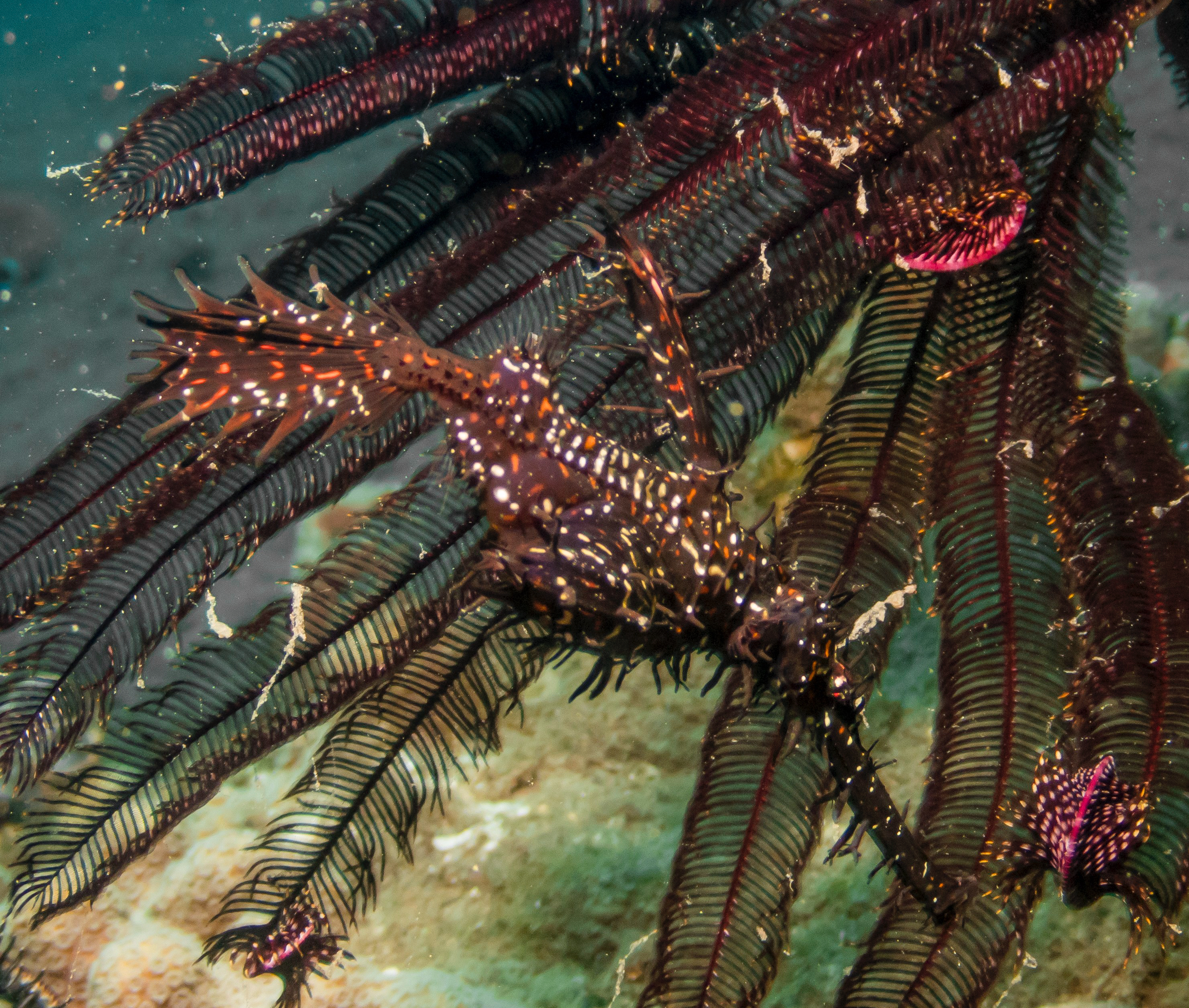
Ornate Ghost Pipefish in situ
Hiding rather effectively amongst the arms of a crinoid above, male and female adrift in the clear, below. The larger is the male, and the belly bulge below the pectoral wings, only hinted at in the frames, is the result of him carrying their young like joeys in a kangaroo.
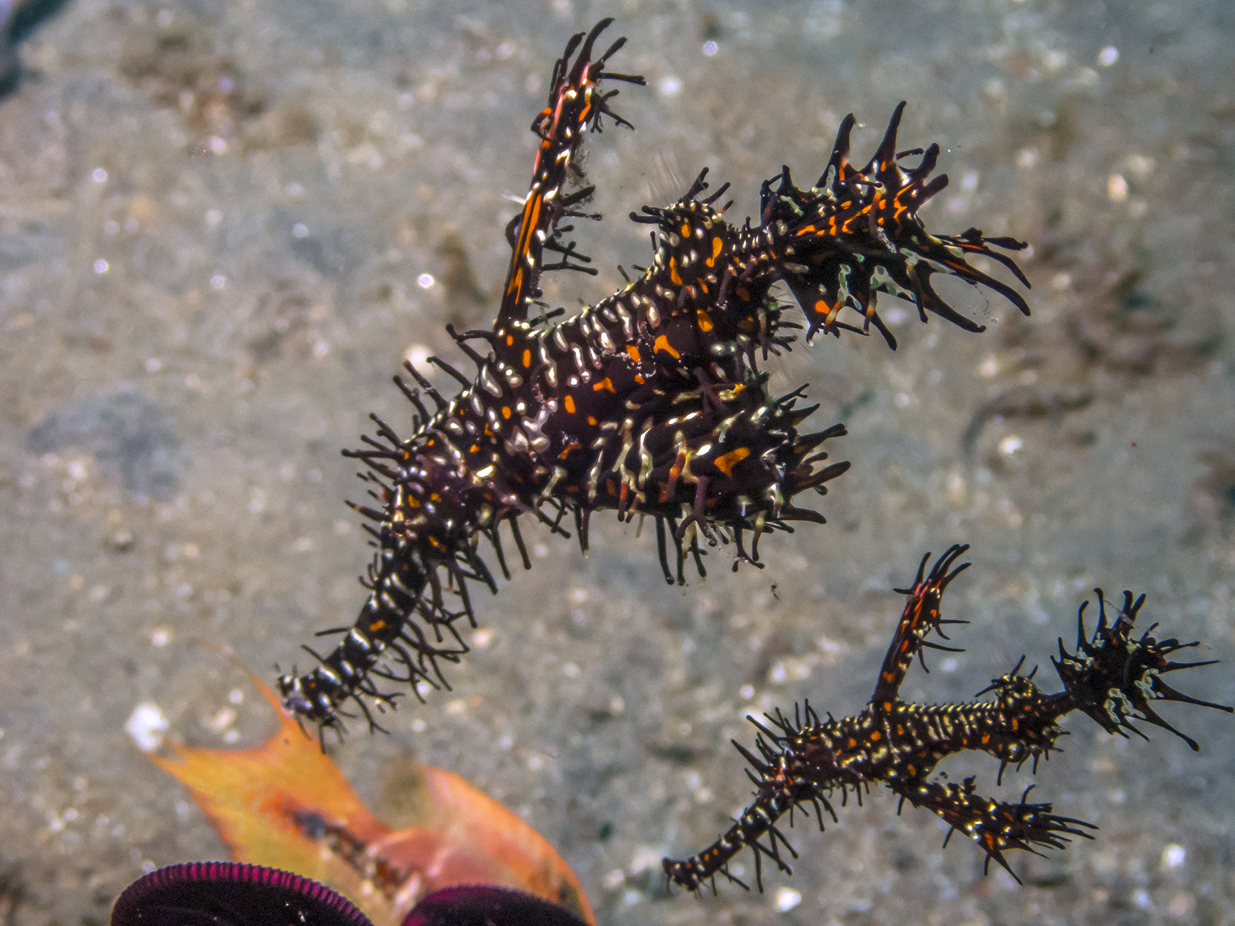
Other creatures also use look-alike camouflage, and also have the males carry their young in belly pouches.
Something like three inches tall.


A tiny shrimp colored to disappear amongst its surroundings. Twelve o’clock in the frame.
Masters of camouflage are the octopus, one of the undersea’s smarter creatures, fast when the mood moves them, and with the ability to change their coloring and texture to reflect their surroundings. In my previous experience, octopi have been stealthy, preferring to hide in holes and under rocks, more prone to come out at night. But here they could be found on open debris-covered sandy slopes.

Below, the rock to the right is an octopus. Then, the same one, moments later, having scooted to a new spot with less rocks to look like. The bodies of all of these are about the size of an adult human fist. tentacles much longer.


You see this fish, right?
Or these two, different versions of scorpion fish? The dorsal spines are to be avoided. The one on the left has spike-claws beneath its ventral fins, and moves about with small movement of its fins and actually placing the talons forward and walking into the new position. The one on the right looks like it has the ducted fans of an UAV.


Hiding comes in other ways. The anemone tendrils are toxic, providing protection from predators not immune to the sting like this crab.
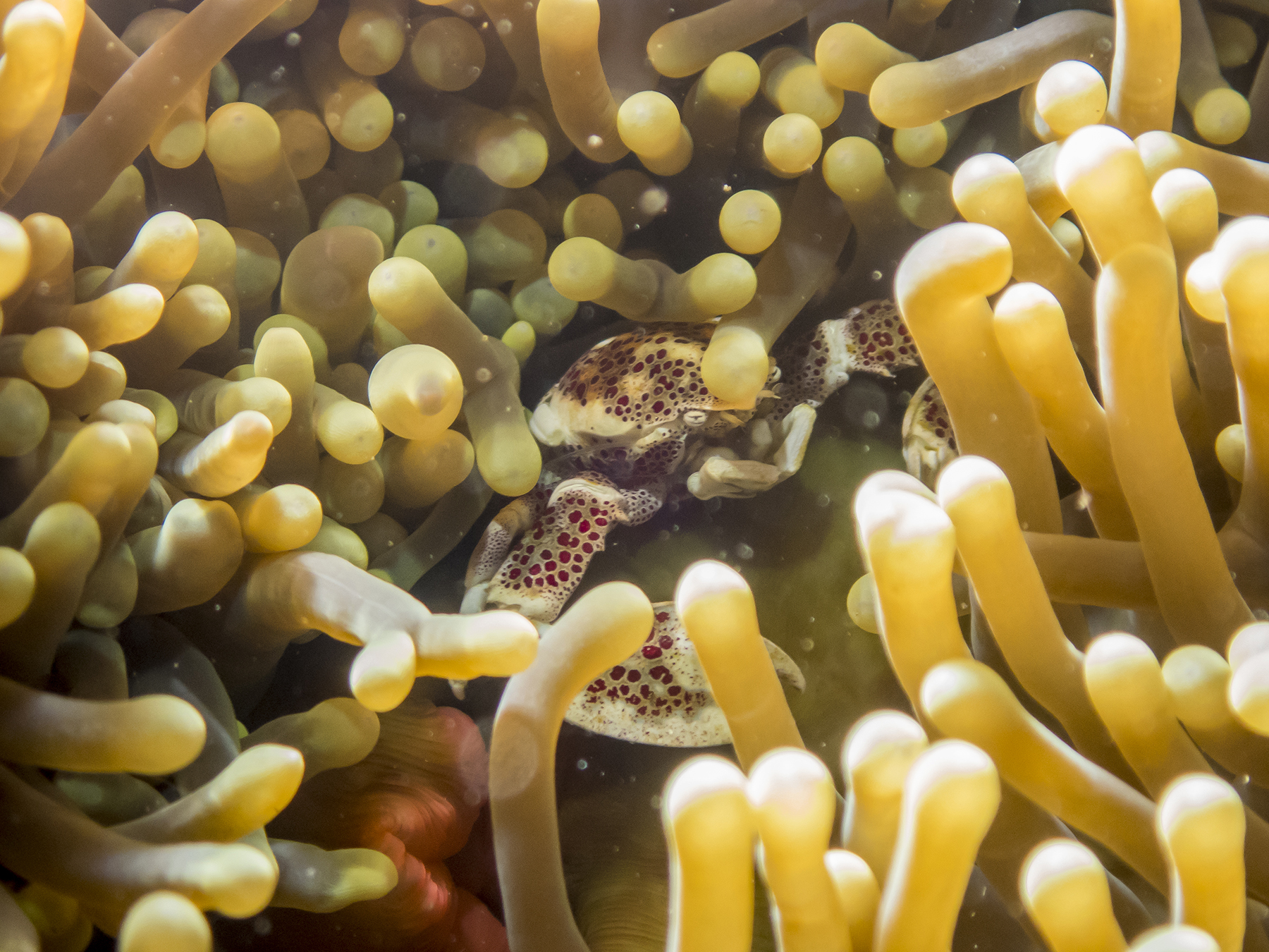
Anenome crab
I caught this one in the open, it constantly turning to face me, its claws up provocatively like a boxer in the ring. Carapace maybe 5/8ths of an inch across.

Another form of concealment is clearly to disappear from view including being truly shrimpy diminutive in size. When I was an elementary and junior high school kid we used to free dive for abalone off Point Loma and La Jolla. I remember how improperly named was Jacques Cousteau’s captivating “Silent World.” The undersea with shrimp in it was downright noisy to me with the scraping and clicking of their pinchers. Now, after multiple tens of thousands of hours of jet engine noise, I hear none of that. Quite lamentable.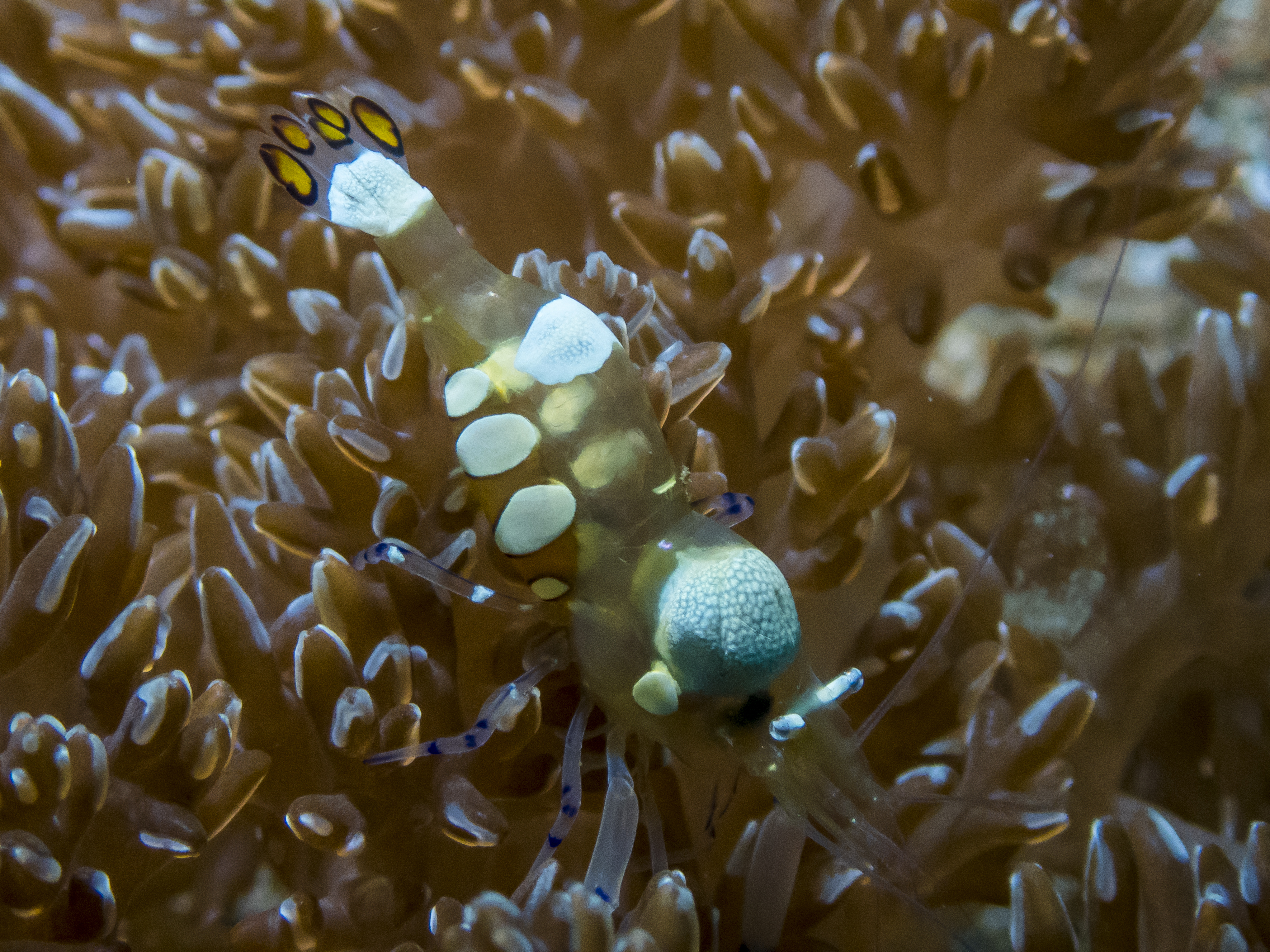

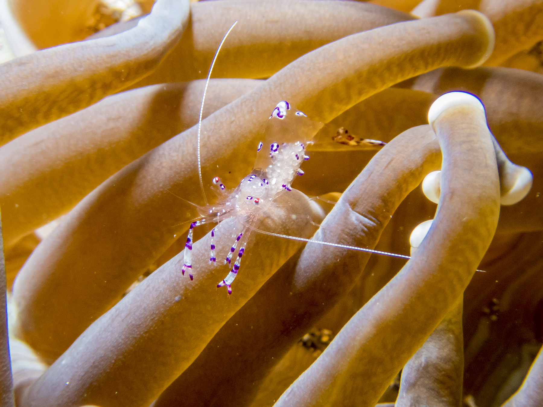

Then there are shrimp that are decidedly more colorful.
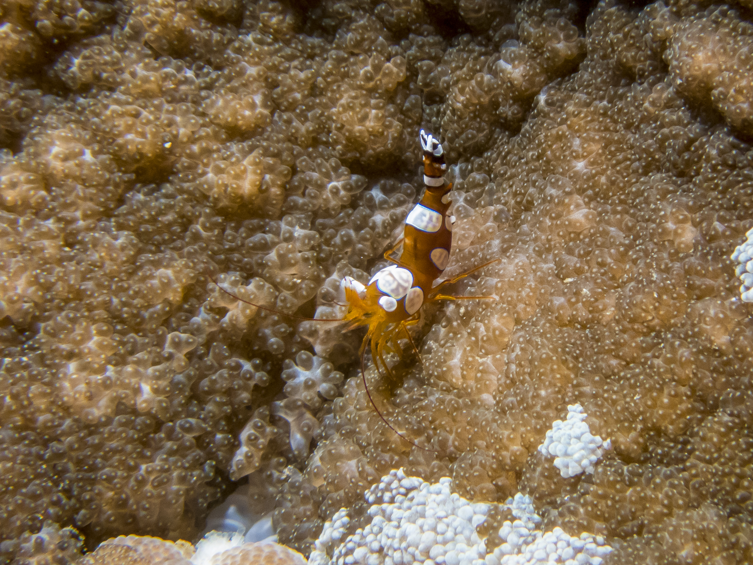
Sexy shrimp—so named because it dares to raise and shake its booty
Harlequin Shrimp. Iconic beauty.
The name says it all. When you’ve got it, why not flaunt it? Besides the kaleidoscopic color, as to this shrimp, maybe eight inches long, researchers tell us that those two amethyst colored eyes can turn and gaze independently, have individual hemispheric stereoscopic vision, and depending on the sub-species can see between 11 and 16 colors. Our paltry human vision is composed of mixing only three colors—red, green and blue. Can you image the brilliance of this creature’s visual world?
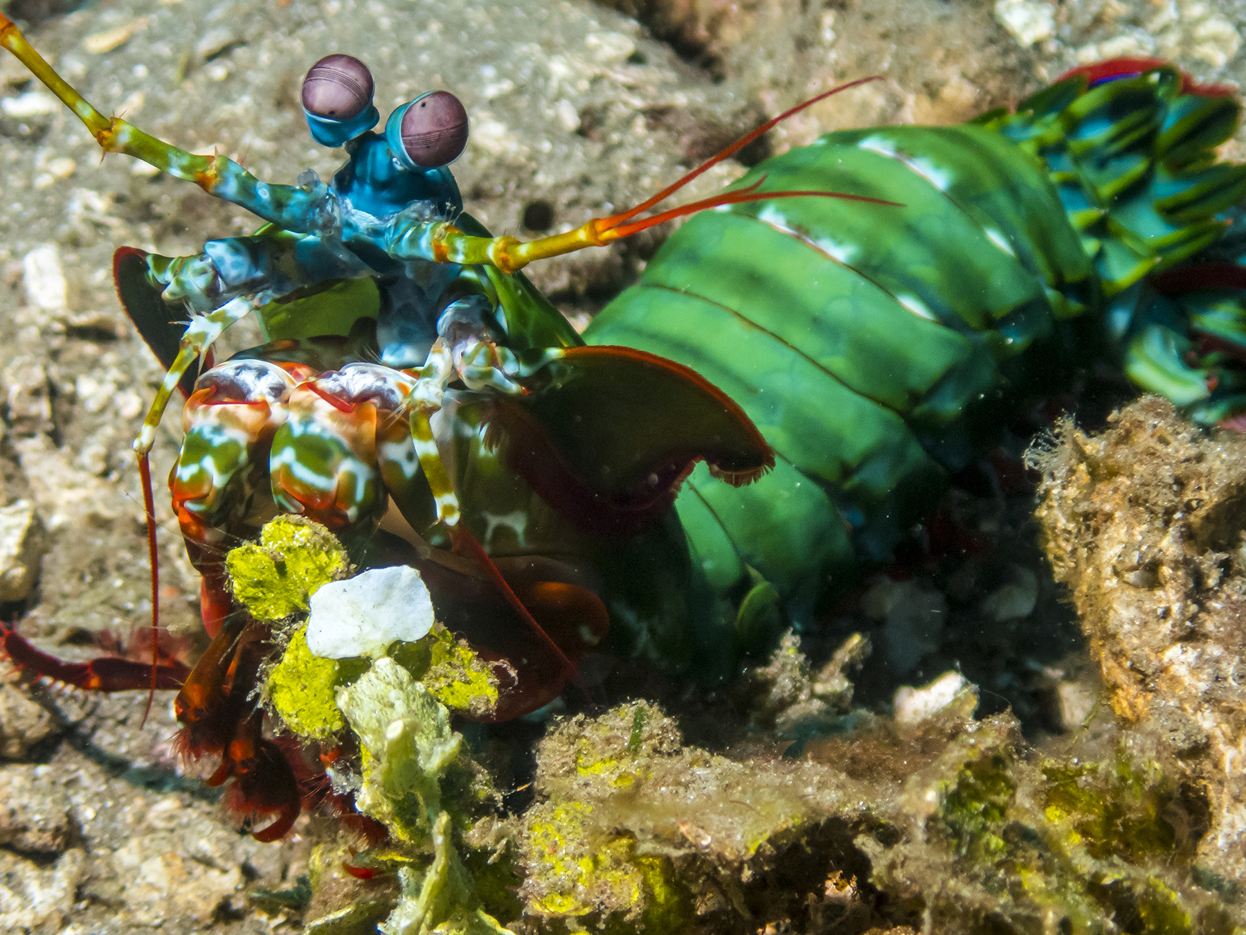
Peacock Mantis Shrimp
On a more domestic and prosaic level, there’s this mantis shrimp. She’s carrying a mouthful of her eggs. And this subspecies proved itself positively pugilistic on this trip, proactively attacking me by launching itself to collide, clanking noise and all, with the lens hood of my camera, and doing so on that particular dive, to two other diver photographers. 
Not behaviorally aggressive but a creature deserving of your hands-off respect are the lion fish. Presumably named for the mane-like aura of its spiny fins, which are magnificently beautiful and exceedingly toxic. In my limited experience, they are often found with their heads away in whatever milieu they inhabit, pointing their posterior outward. I suspect that is because this means a predator has to go past all those poisonous spines to get at the body. 
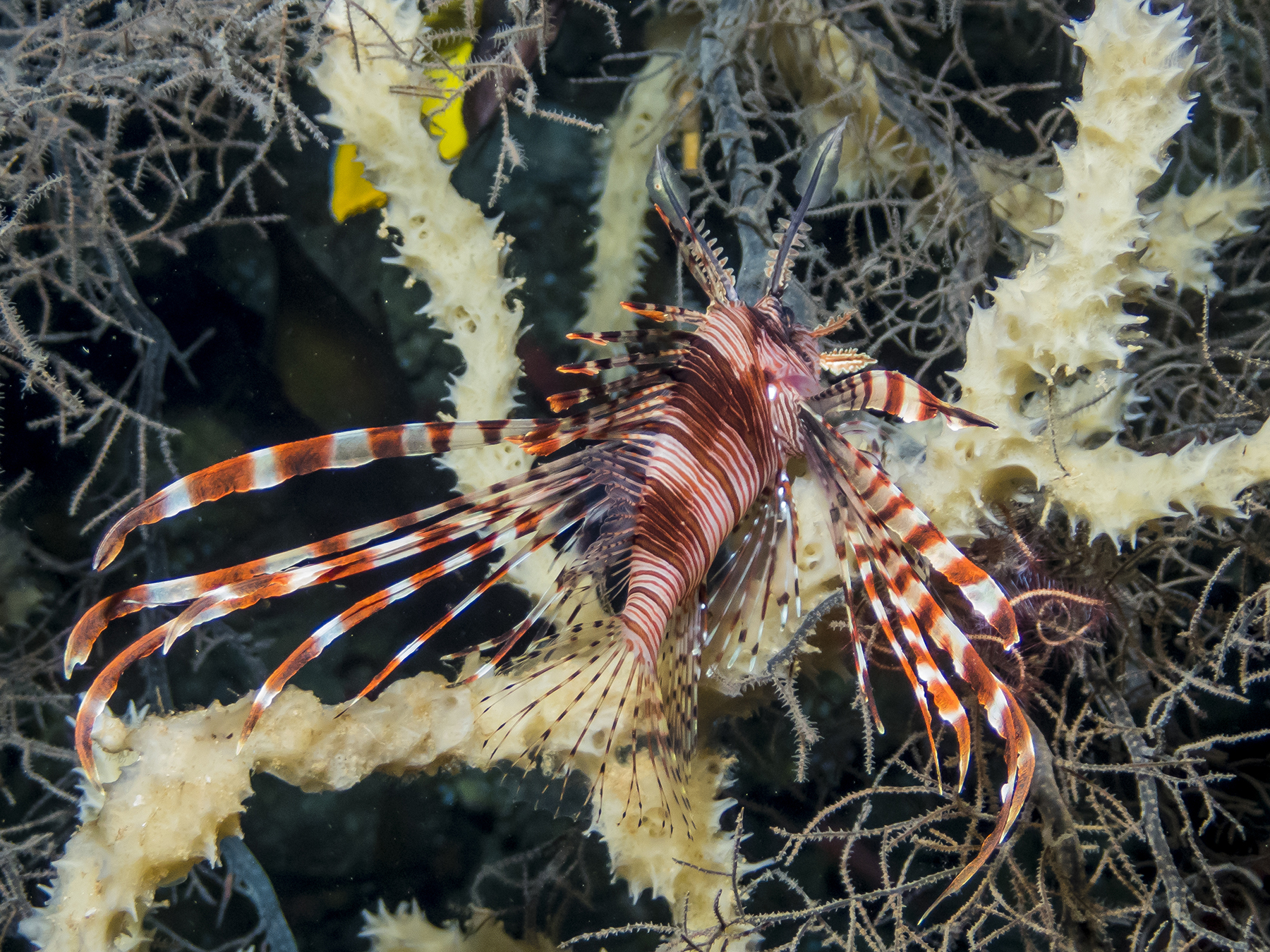
Frog fish, a creature whose appearance only a mother could love.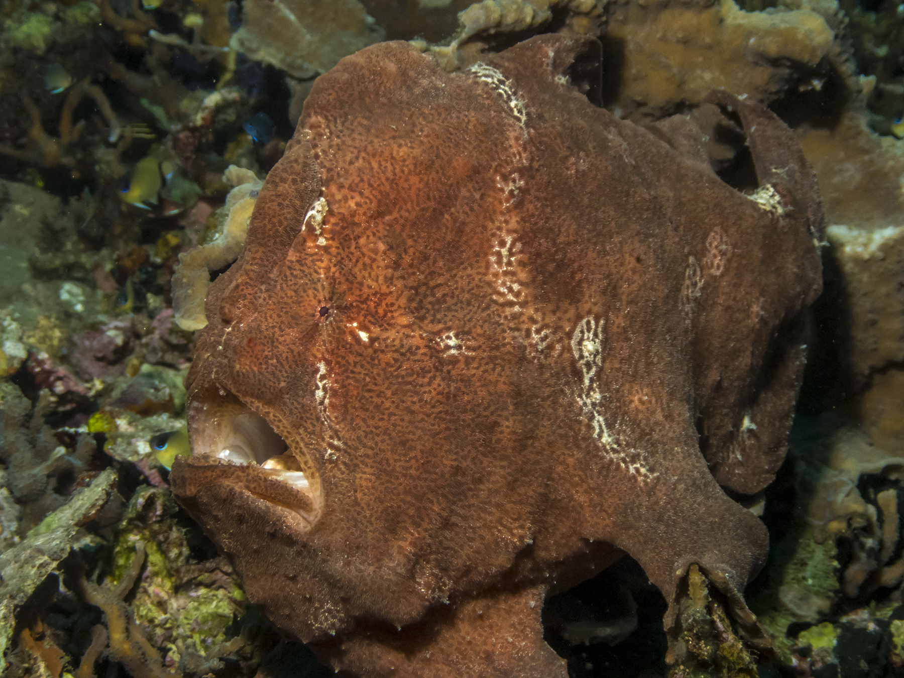
They are mostly sedentary, sitting on those ventral fins as if they were hands, and moving about when they do, as much by walking on them as by swimming with their tail. This must be a boring existence, because every so often they open widely in an enormous yawn. Did you know that I was once a zoology/pre-dental major at SDSU? I’m forever glad that I took up wings over mouths.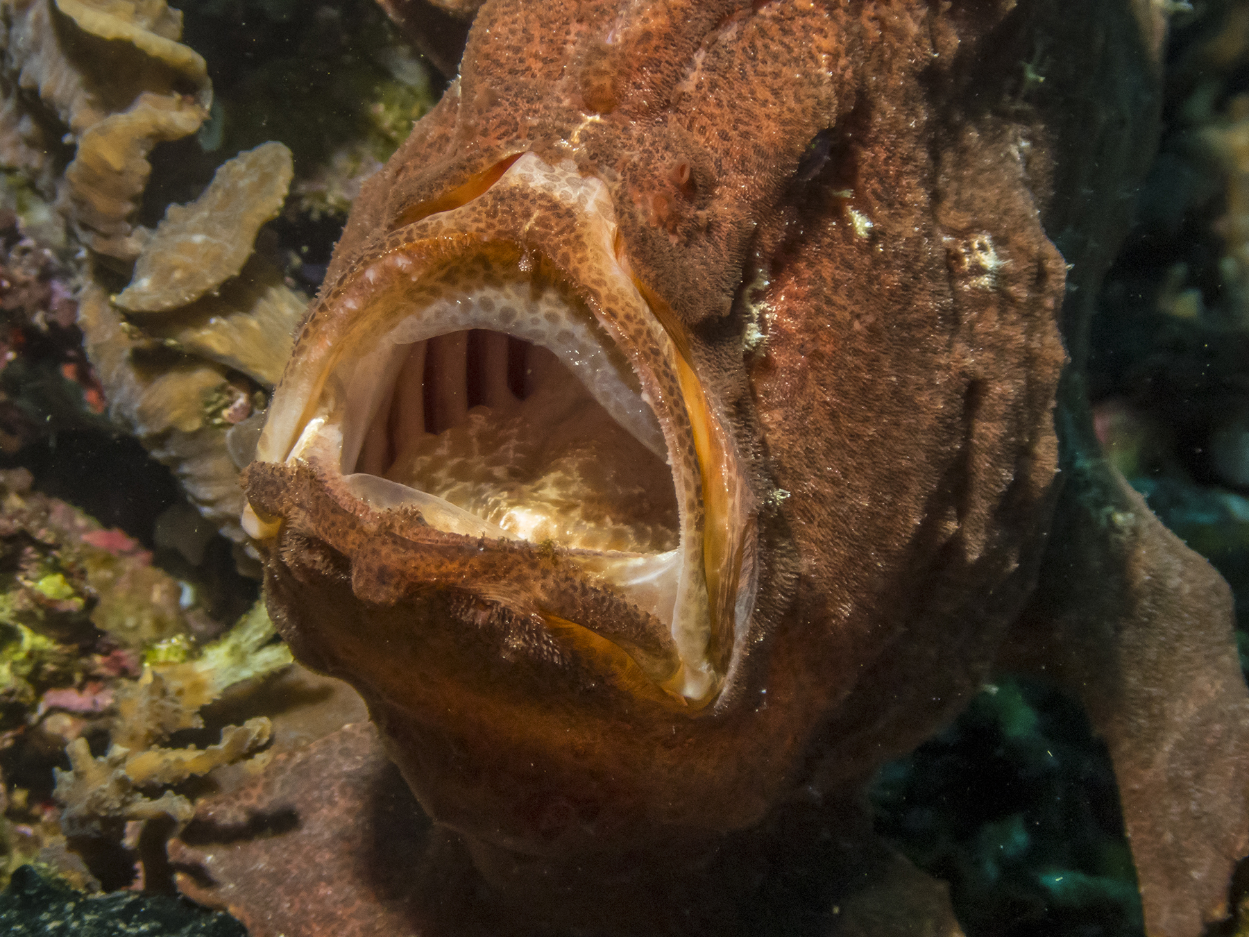
This was an especially uncommon experience. Art, Cathy and I swimming along, and here before us was a conclave of frog fish. Three in one spot at the same time—green with garlands on the left, brownish in the center background, and black, dourly scowling on the right. Like the fellow above, each of these is sized somewhere between a football and a basketball. Butt-ugly, but a fascinating niche holder in the undersea world.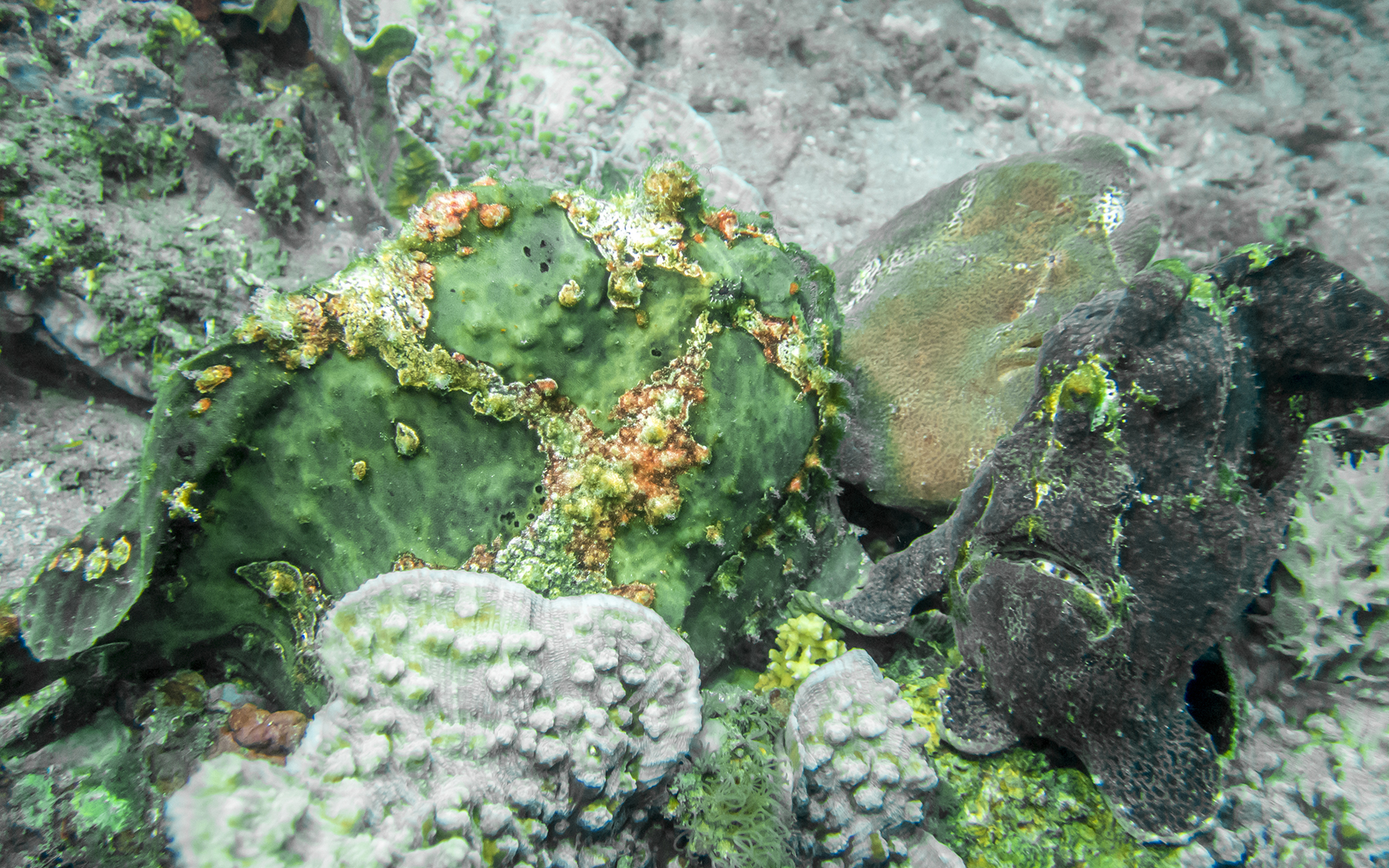
As peculiar as the large variety above, there are also miniature frog fish, their size making them seem much cuter. These are all about an inch long.

Miniature frog fish

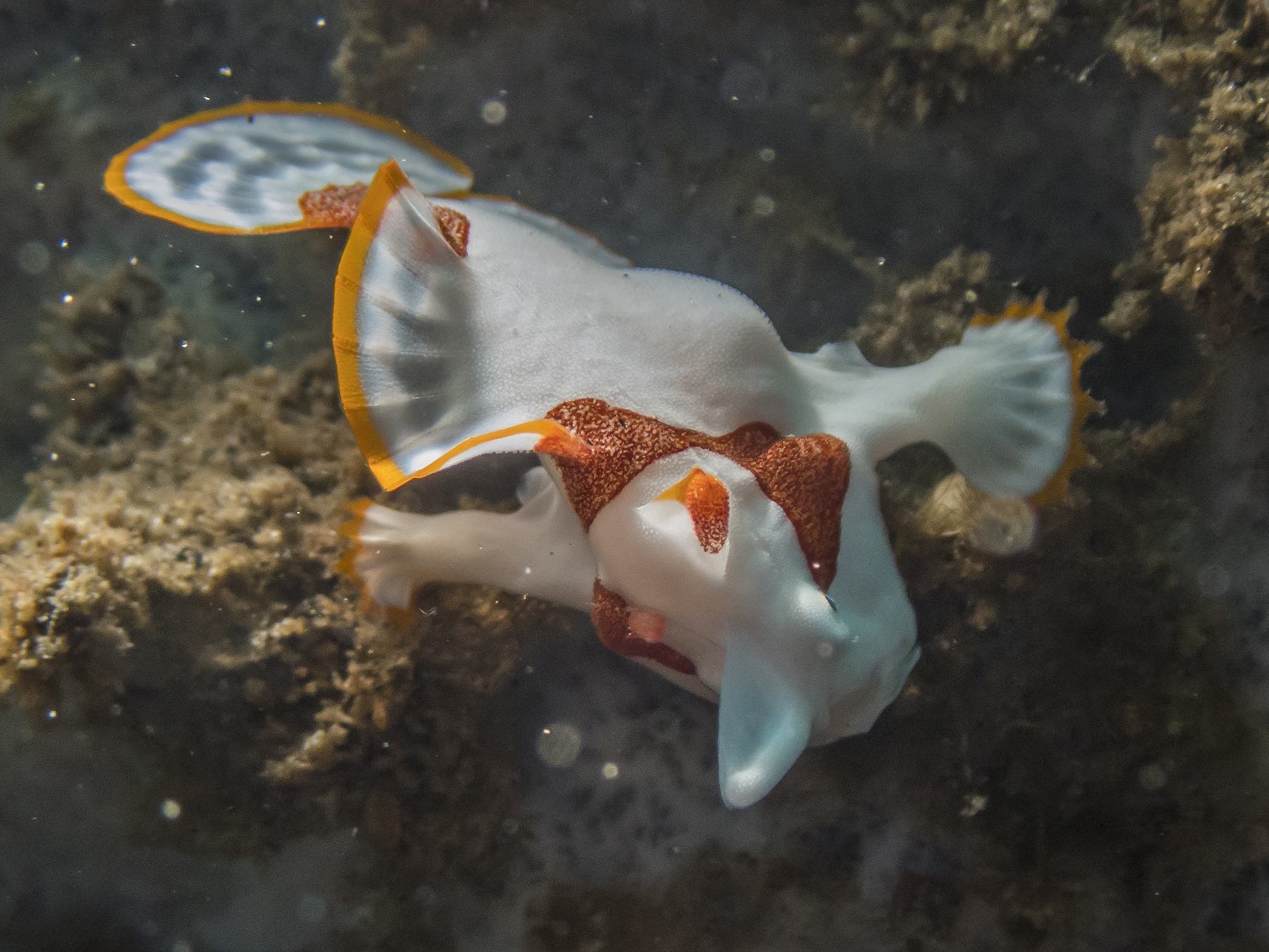
Closing in on the end of this missive. There’s a remarkable symbiotic behavioral relationship of what is known as the shrimp goby pair. The goby fish and its buddy shrimp share a hole in the bottom. The fish comes out and surveys their domain, on predator watch, perhaps, while the shrimp busies itself tidying up their hole home, pulling up and pushing outside debris not to its liking.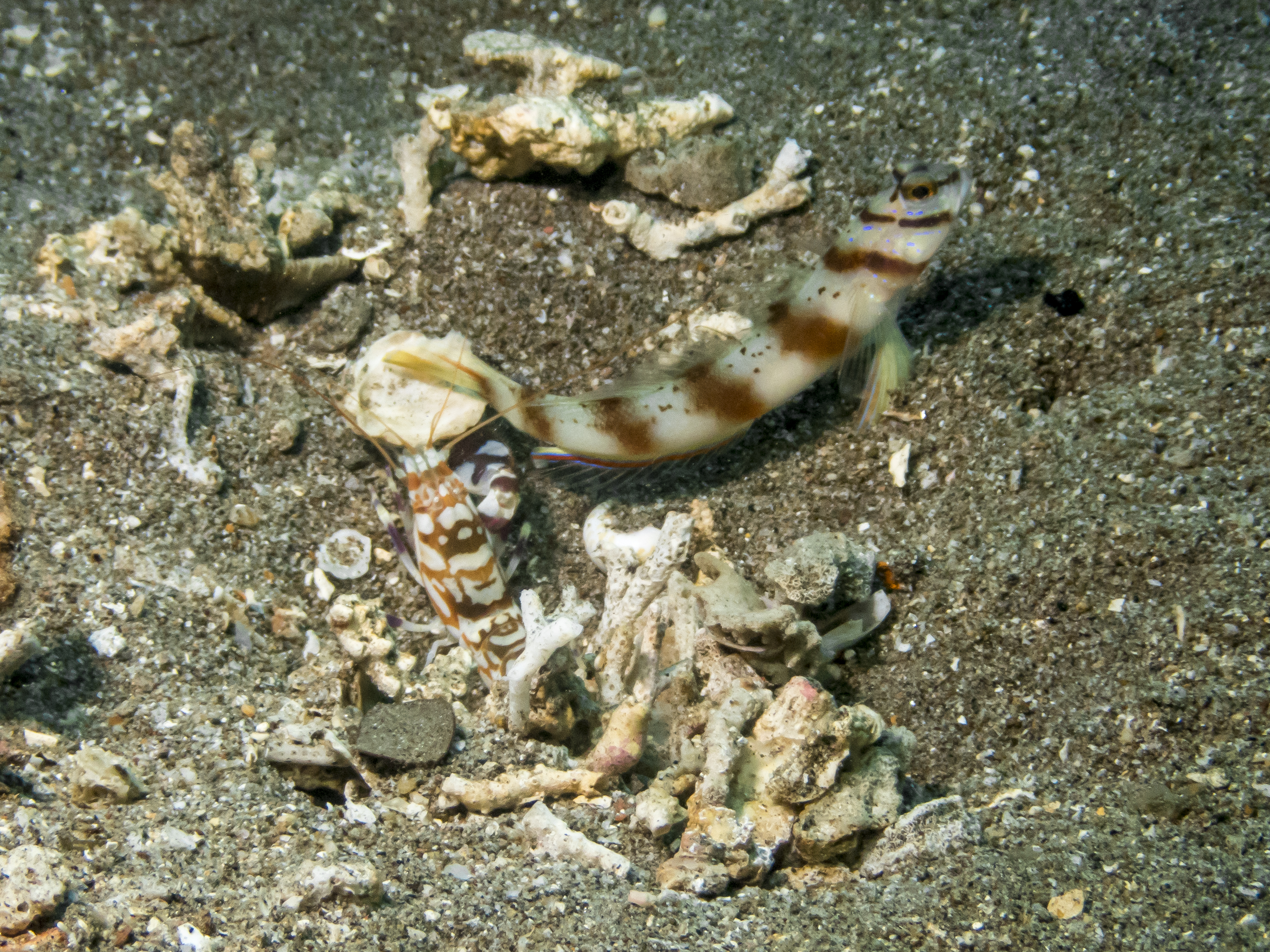
The flamboyant cuttlefish is a most extraordinary creature. We came upon this one, about two inches long, which dive guide Wing-Wing recognized was not a gray blob of bottom dirt. As soon as we took an interest in it, it changed to this amazing technicolor dreamcoat. Like its fellow cephalopod, the octopus, the cuttlefish can change its color, and skin appearance at will, and likewise jet about on streams of water pushed out as with a jet engine. One moment it was this or that combination of colors, and a moment later those shades and hues would change before your eyes in real time. And the more fascinating part is that the colors would race fore and aft along its body like the advertising signs on the Goodyear blimp.

Flamboyant Cuttlefish. The name couldn’t be more apt.
I shall close with a couple iconic anemone clown fish shots. Ubiquitous, but always fascinating to watch, and often very capable of striking just the right pose.
Nemo lives!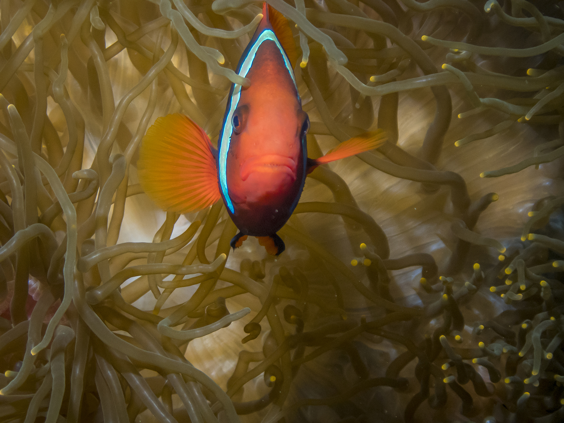
Great trip. Great friends. Great diving. Great escape from winter. Great to share.
Yours, truly. Tom
Three-Quarters of a Century On
Posted on December 16, 2018

L to R: Nick Pasich, Joan (Purdy) Ritter, Janice Stephany, Pat Nipper, Judy Lyle, Carol (MacLeod) Mulcahy, Thomas Close
What we’re looking at above is 525 years’s of earthly experience. No small thing.
This year I attended a fund-raiser for an organization arranging for WWII veterans to visit the Washington DC memorials and to tell their stories while they are still here to share them with us.
It occurred to me that the story sharing would be a fitting goal for the somewhat colorfully self-annointed MBOF group—Mission Bay Old Farts. It’s an ad hoc group of us members of the Mission Bay High School Class of 1961. I think the F word was affixed by LTC John Quesenberry, USA, Ret., as an appropriately informal designation for what some might refer to as a bunch of aging beach bums. Anyway, every couple of months varying numbers of us get together for lunches JQ got us started on.
Sadly, JQ, an Army aviator, has “Flown West,” pilotspeak for passing on, and that has figured prominently in this Quixotic quest of mine to have my fellow classmates share their reflections, observations, and stories in their own words from this perspective of three-quarters of a century since our first breaths. Man, that sounds ancient, and I’m pretty nearly clueless as to how I got here. Anyway, I’ve had no idea what each of them would say, and I didn’t help by providing any outline as to what I was looking for, not wanting to skew their thinking into sharing what they thought I wanted to hear. In fact I had no idea even as to what I would say. For all of us, our own voices have come forth on their own wings. At any rate, our early years were a time of great turmoil, then a uniquely halcyon period, followed by more tumult over the decades. These years have had an impact on us, and vice versa.
Herewith, our sharing, in reverse alphabetical order, maiden names for the ladies. I’ve edited these only as to obvious typos or inadvertent misspellings, but the vocabulary, syntax and grammatical construction are all as provided me.
Janice Stephany:
In September 22, 1943 my sister Janet Stephany and I, Janice Stephany, were born in Paradise Valley Hospital. My sister came home first. Due to complications I came home later. We had a older brother Gary Stephany.
We lived on Market Street across from Greenwood Cemetery in which I drove my daughters to see and found out is now a offramp of a freeway. We attended Chollas Elementary lived on a cul de sac and had block parties.
After elementary we attended Pacific Beach Junior High after moving to Pacific Beach. My parents bought a house there for $10,000. My sister and I worked in the school library under the supervision of Mrs. Green during the summers and went to the beach.
Went to Mission Bay High and graduated and was member of the drill team.
After that my sister and I went to work for the Pac Bell Co. We both worked there and bowled at Aztec Bowl. That is where my sister met her future husband. The wedding took place in the back yard and that’s where I met my future husband Gary Thomas.
We were married later on in Las Vegas. We had two beautiful daughters Char and Tina 9 1/2 years apart. Since he was in the Navy he came home earlier than expected. We had what I thought was a happy marriage. We moved to Mississippi and Pennsylvania and came home with my daughters.
I found a job at Industrial Indemnity. No longer there. I joined our volley ball team, ended up with a broken ankle and tibia. My daughters both went to Mission Bay High School.
In the year 2000 I brought in a liver transplant after being on disability for five years waiting. All went well. My church even stood up and applauded according to Tina.
Now I have been retired for a while. I am just taking it easy doing some volunteering, exercise, walking and crocheting and enjoying life.
Joan Purdy Ritter
I was born in San Diego, CA, and a 3rdgeneration native San Diegan. I was born one day before my father left for boot camp during WWII. Thank goodness I was one week early. My dad lost his hearing a couple of days before leaving for Germany. He received a medical discharge, and returned home. He was a San Diego Fireman, but was unable to return to duty, even though some of his hearing had returned. Since a lot of the men in San Diego were away at war, he went to work as a fireman for Convair, and the airport. After several surgeries, his hearing improved. He was with Convair/General Dynamics for 38 years. My father and mother were wonderful parents, and influenced me greatly. We moved to Pacific Beach when I was 7 years old, and I attended Pacific Beach Elementary School. My sister and brother were born a few years later. I had a good childhood, and loved playing outside, roller skating, riding my bicycle, climbing trees, and playing at the recreation center. I even rode my bike down Loring Street hill. Very Scary! I enjoyed high school, my friends, drill team, school clubs and the beach. When I was about 14 years old, I was at the dentist, and he let me assist with the young patients. I knew then that I wanted to be a dental assistant. After high school I attended San Diego City College, and received an AS degree in Dental Assisting, and later an R.D.A. I also met my husband in college, and we were married in Oct. of 1964. My husband became a San Diego Police Officer. We welcomed our first daughter in 1968. In 1974 when our second daughter was 3 years old, my husband was critically injured in the line of duty. Through the grace of God he survived. In 1975 we welcomed our 3rddaughter. In time my husband returned to law enforcement. I have participated in many activities over the years, a Girl Scout leader, taught swimming, softball mom, youth director, Sunday school teacher, taxi driver for 3 busy daughters and their activities. Built loft homes in Mexico with our church, went on a Medical Mission trip to Honduras, where I cleaned over 200 children’s teeth, and taught them how to brush. I also helped in a hospital with very sick children. It was a wonderful experience, but also heart breaking, and something that I will never forget.
Now that retirement is here, and life has slowed down, Ha Ha, it’s our time. We love to travel, and enjoy learning the history of different places and countries. Cruising is our favorite.
We also enjoy our 6 grandchildren, aging from 2 to 24 (3 boys and 3 girls). They are the joys of our lives. Overall, I feel I have lived a wonderful life. I have a great husband, wonderful daughters and son’s-in-law. I thank God every day for my blessings.
A Few Thoughts From Nick, by Nick Pasich
Wow! Time sure has flown by. It doesn’t seem like that long ago that I was getting ready to attend a dance at the PB Rec featuring the “Ramblers” with “Cookie Taylor” singing songs by “Little Richard”. Gosh, that was all the way back in the 7th grade!!
Well, times have certainly changed. It seems like kids “now a days” have been cheated of the opportunity to have fun like we did. We weren’t “tied down” to cell phones and computers. We had a wonderful time together, whether running through the hills (North PB), going to the beach, RecCenter dances, shooting our 22 rifles and shotguns at Miramar (then it was wide open), roaming together down Garnet Ave, etc.
After graduation from Mission Bay High it was time for more fun. George Negus and I spent a month on Catalina Island. We came back and promptly left for Mazatlan Mexico and I returned home after 3 weeks. Me, Danny M. and Dick B. started working at the Burger Chef to make some money to travel to Alaska. We bought a 1948 Chevrolet panel truck and painted it black and white with an Igloo on the side. We made it as far as Seattle WA. The truck was falling apart, so we sold it. We ran out of money after 3 weeks and returned to PB via freight trains (what an adventure that was).
I began experimenting with various drugs which later became a very controlling part of my life. It started out with using Marijuana and Pills (uppers and downers) and later graduated to Cocaine and Acid.
My good friend Bobby Foster and I joined the Air Force with the main focus of staying out of jail, traveling and learning a trade. I always loved electronics and was able to get training in radio maintenance. I was able to control my drug usage during my Air Force days. The Air Force was great, but I turned down the opportunity to re-enlist.
After my tour in the Air Force, I ended up interviewing with PacBell and taking an aptitude test for electronics knowledge. After the test they called and said they had a job for me and I could start “right away”. I then began a career which lasted over 23 years. I started out as a telephone installer and quickly advanced to a PBX installer and then to a PBX repairman. I then went into management and was responsible for a PBX installation crew. I was on staff for awhile and then went into the Field Services Control Center where I was selected to be a Systems Administrator for a newly developing computerized order system. This involved delving into the UNIX computer world which was just being developed by AT&T. I learned several software programming languages and got “hands on” experience with computer hardware.
I was able to control my drug usage during working hours at PacBell, but after work and weekends was a different matter.
During my early years with PacBell I got married and because of my selfish drug seeking ways, we were divorced after 7 years. A wonderful blessing came from that marriage, my daughter Heather.
The combination of my drug usage and the divorce had a very negative impact on me mentally and I spent a month in the old Vista Hill Hospital in Chula Vista. During my stay at Vista Hill, I met an occupational therapy aid by the name of Barbara. Her and I got along very well and ended up getting married. She had a wonderful daughter, Lenora whom I adopted. Heather and Lenora were very happy to be sisters.
I was still under the bondage of drugs and alcohol and it was starting to take a toll on our marriage. While I was a service order routing supervisor at PacBell my hours were from 12 noon to 9pm. I watched TV before going in to work and one day I ran across a program called the 700 club. It was a Christian program telling of lives being changed by Jesus Christ. The stories were all depicted by a short video enactment. Many of those stories were of people that were in the same situation as me. There was a guy at work, Jerry L., who used to be very heavy into alcohol and he was changed by accepting Jesus into his life. Well, the combination of seeing Jerry’s life changed and all the different stories on the 700 Club, I decided to ask Jesus to change my life also. At the end of each 700 Club program, an opportunity was given to invite Jesus Christ into your life. It was a very simple prayer….
“Jesus, I admit that I’m a sinner and ask for your forgiveness. I believe that you are the Son of God and that you died for my sins on the cross, were buried and rose from the dead on the third day. I ask you right now to come into my life and be my Lord and Savior. Thank you for the gift of eternal life… Amen”.
That was the best decision that I have ever made. The power of God is overwhelming. He removed the desire for drugs and booze. This isn’t something that was done by attending meetings or going to church. It was done supernaturally through the Love and Power of Jesus Christ.
Eventually, the whole family believed and received the Love and Forgiveness of Jesus. Our life’s direction changed forever and it’s all because of Jesus Christ.
Growing up in Pacific Beach by Carol (MacLeod) Mulcahy
When I was born in 1943 my family lived on the Pacific Beach side of Mt. Soledad in San Diego, California. At that time there were 11 homes between our house and the Cross, which sat at the top of Mt. Soledad. My father and mother, Ken and Elaine MacLeod bought Kate O. Sessions estate on Los Altos Road in 1942. After WW ll, he divided the property, selling the big house with an acre and keeping an acre of land on which he built our family home in 1949.
In the 1950’s, living up on the hill, was like living in the country with our dirt roads, nurseries, a dairy and even an egg ranch. Also, a neighbor on Los Altos Road had horses in a corral and a barn, which I would pass by on my walk to Pacific Beach Jr. HS and home again.
I think most kids walked to school in the 1950’s. In kindergarten I walked to Crown Pt. El. from our home on Crown Pt. to the elementary school on Ingraham St. Miss Curtain was our teacher for the half day. There were at least seven other classmates in her class with whom I would go through all 12 grades of school. I also walked to PB El. from 1st grade through 6th grade. By cutting through vacant lots on well worn foot paths, it was less than a mile to either school. It didn’t take much time to get to school because half the distance was down hill. Coming home it took me much longer as I trudged up the short steep hills.
By the time I was 15 I was determined that I would have my own horse in our own back yard. The neighbors had moved their horses out to their ranch in Poway and my father said the zoning now prohibited having horses. I wasn’t sure he was right so I called the City to discover that we could have up to two horses if I could provide a 10,000 sq ft corral which had to be at least 75 ft from any neighbor’s home. Dad agreed with my calculations and gave me a post hole digger and said if I wanted a corral then I could build one! So I set my plum line and started digging. My sister was dating a man that worked the lines for the telephone company and he brought me old 4X4 cross beams with holes about every 20 inches which I intended to use for posts. I acquired old used lead water pipes that would fit through the holes of each 4×4 post. I didn’t have all the material I needed to complete the corral, but I would handle that problem when I came to it! I was digging the last post hole when dad walked down to tell me he would help me assemble the post and pipe corral and buy what was needed to finish my quarter acre horse corral. Before long the corral was finished. All I needed now was a horse!
We bought the first horse we looked at in Del Mar. Sheba was a 14 year old Morgan/Arabian, red chestnut mare with a white blaze and two white hind socks. She was spirited and known to run away with inexperienced riders or even experienced riders if she could get the bit between her teeth. To correct the problem of her running away, I replaced the bridle and bit with a roping hackamore.
Towards the end of my senior year at Mission Bay HS a classmate, Bill Costello and I started running together as buddies along with his friends Vic Rogers and Kenny Prudhomme. Add my girlfriends to the mix and 1961 was a summer of parties, going to the beach and part time jobs as we waited for college to begin. I introduced Bill and his friends to my two pretty blonde cousins Deena and Gail who had their own horse. Deena lived in Solana Beach and she would ride down and meet me at a cafe on Torrey Pines Road (where UCSD campus is now) then we’d ride up to her house or back to my house.
While together at Deena’s we rode our horses on the beach by going under the railroad tracks and HWY 101 using the trail the thoroughbreds took from Del Mar race track when they exercised their race horses in the salt water, and of course, we raced our horses on the dirt race track when it was closed for the season.
One early morning when Deena was visiting me with her horse Sue, we rode down to the ocean. Bill rode double with Deena. We knew the law: no horses are allowed on San Diego beaches south of La Jolla’s Scripps Pier. It was 8:00 am and the PB beach was mostly empty of bathers. So, being teen-agers, we thought we could get away with a ride on the beach. As we rode our horses out from under the south side of Crystal Pier, a lifeguard yelled at us from his station to get off the beach. Bill waved to the guard to acknowledge we’d heard him, and we turned the horses around to leave the beach. Apparently, the lifeguard mistook Bill’s wave as a “finger salute” and called the cops. When we reached Tourmaline St. exit, a San Diego police Officer was waiting for us and gave all three of us a ticket. We went to court and told our story to the judge. We were stunned when he fined each of us $50! But, thankful when he suspended $45 of each fine.
The summer of 1962, my cousins and I were visiting my grandparents’ ranch in Shelton, Washington when Bill and Kenny surprised all of us by driving up to visit. For two weeks they made themselves at home sleeping in our old unused bunkhouse on the ranch. Well, my grandfather had enough of us girls being distracted from our summer chores. We picked gallons of wild blackberries when visiting in the summer from which we made dozens of jars of jam as well as blackberry pies which were put in the freezer for my grandparents to eat over the winter. Another way we would help my grandfather was to go with him into the woods (he owned 200 acres of prime fir trees) where he would use a winch on the front of the jeep to pull out dead fall trees, and using a chain saw (to this day when I hear a chain saw running I think of Shelton and I can almost smell the scent of evergreen forest) he cut the logs to size for use in the kitchen and living room stoves. Our job was to throw the cut wood into the back bed of an old army jeep truck , deliver loads of wood to the wood shed and then stack it up in cords for my grandparents to use in the coming winter.
Bill and Kenny had moved off the property and set up camp down an abandoned logging road. There they lived out of their car in a small clearing. Bill was hired at the big saw mill in town. Kenny never did find a job in Shelton. Shelton was known as “The Christmas Tree Capitol of the World! At summers end we girls returned to San Diego and college in the fall. It wasn’t long after our return that Bill and Kenny came back too.
Over the next few years our friendships grew deeper among some of us while other friendships faded as we went our separate ways. I sold Sheba to a local man who rode her in several Rose Bowl Parades. I was one semester shy of earning a AA degree in commercial art when I married Jim Young and moved to Durango, Co. I lost track of Kenny, but Bill married and owned a dive shop here in Pacific Beach. Upon my return to San Diego in 1988 I was given the sad news that Bill had had a massive stroke that eventually took his life.
So much has changed since growing up in the 1950s in PB compared to today. In 2018 most children do not walk alone to grade school. Most children don’t work hard to get what they want before it is given to them. Children now have instant communication with their parents or other responsible adults, unlike the freedom we had as children exploring the backcountry on foot or horseback. Still, some things never change: love for our children, love of our parents, love for friends and love of the life God has given us.
Bill’s Letter, by William Horn


My name is William G. Horn. I was born on February 18th, 1943, in my grandfather’s home on the corner of Second and Elm Street in downtown San Diego. World War II was in its fourth year and U.S. Marines had just scored a huge offensive victory in Guadalcanal. My father was in the Army Air Corps and my mother took a job at Convair where she was a real life Rosie the Riveter. We didn’t have much money but we had a happy childhood.
I guess you can say I’m about as Southern California as they come. I spent my early years in South Mission Beach until my family moved to Pacific Beach. I attended Pacific Beach Elementary, Pacific Beach Junior High and Mission Bay High School. When I wasn’t in class, you could find me in and around the water. I was your typical blond-haired, blue-eyed, perpetually tanned beach boy who surfed just about every day at the end of Law Street. It was great fun, didn’t cost any money and there were always plenty of pretty girls hanging out at the beach.
I learned at a young age to appreciate the satisfaction and independence that came with making my own money. At 12 years old, I was offered a seasonal job at Lloyd’s Bike Shop on Garnet Ave. They needed help assembling bikes during the holidays. I loved having my own money to spend, but I also enjoyed saving money and watching my savings grow. I landed a job working as a janitor and every Saturday, I cleaned medical suites in a doctor’s office. I kept that job through high school and college. Over time, I earned enough money to pay for my own flying lessons at Montgomery Field. I also discovered I could make extra cash by offering to wash the airplanes. By the time I was 14 years old, I had earned my pilot’s license.
In high school, I joined the Army Junior Reserve Officer Training Corps (JROTC). I graduated from high school in 1961 and attended San Diego State University where I double-majored in history and accounting. At 19, I had the opportunity to buy the 7-11 convenience store where I had been working while attending school. It was the first of many businesses and properties I would eventually own and manage. I graduated from college in June of 1966 and was drafted by the Army the following week. I decided to enlist in the Marine Corps so I could go to Officers Candidate School (OCS). In January, 1967, I began my military service in OCS on the Marine Corps Base at Quantico. I married my college sweetheart, Kathy, on July 2, 1967. We just celebrated our 50thwedding anniversary.
My years as a Marine Corps Officer were a defining time in my life. The experience made me who I am today. I was exposed to other cultures and countries including Cuba, Japan and Vietnam. I was one of the legendary ‘Boys of ‘67’; a group of Marine Corps officers who trained together, went into combat in Vietnam in 1968, and suffered the most casualties. My class lost 39 officers. One of the greatest honors in my life, and most humbling, was to command 270 Marines in combat for one year during the Vietnam War in 1968. I was 24 years old. When I finally made it home, I was a Captain with decorations that included a Bronze Star, Purple Heart, and four Vietnam Crosses of Gallantry. Semper Fidelis.
After active duty, I served in the Marine Corps Reserves for seven years. I also welcomed my three children into the world: Julie, Angie and Geoff. In 1975, I started a real estate business, managed property and built houses. In 1985, I travelled to Israel to drill water wells for three years.
In 1989, I was elected to the Escondido Union High School Board. I also served as President of the Escondido Rotary in 1995. At about the same time, I was in a land battle with the County of San Diego. The County wanted my land for a park but I didn’t want to sell it. I sued them and won. I decided I could do a much better job managing County business. I ran for a seat on the San Diego County Board of Supervisors, representing District 5, and won in 1995. I have been Supervisor for the past 24 years and Chair of the Board five times.
In 2013, I met a young African named Moses who changed the path of my life. He told me how he and his wife have paid for six children from their village in Uganda to go to a Christian school. He described the severe poverty and the large number of orphans in his village. His story moved my heart so deeply that I decided to go see for myself if this was true. I traveled to Uganda in 2015 and after touring the village, I purchased 10 acres to build an elementary school. In 2016, I purchased 19 more acres and built a high school. Currently, I have 735 students enrolled in the elementary school, 150 students attending the high school and 42 Ugandan teachers. I have also built a corn processing plant to help sustain the school and also employ 15 local villagers. My work in Uganda has been one of the greatest blessings in my life.
I currently own and operate a number of apartment buildings, businesses and homes. I am also an avocado and citrus rancher. In 2015, I purchased a hotel in Solvang called the Atterdag Inn. I am in the process of expanding the hotel and adding on a second building with 33 new rooms.
I will officially retire from the County Board of Supervisors in January 2019, after 24 years in office. At 75, I still have a lot to keep me busy with my properties, businesses and work in Africa. I also plan to spend more time with my family, including my 8 grandchildren, and I hope to travel.
From the earliest years in my life, I learned the undeniable value of hard work, saving and investing. It has been the foundation for all of my financial decisions. I am honored to have served this great nation during the Vietnam War and I deeply respect all service members who choose to make that sacrifice. I am proud to be a Marine Corps veteran and to call the United States of America my home. I am also very proud of my years on the County Board of Supervisors and that we are recognized as one of the best run counties in the nation. Finally, I am blessed with the ability to continue my work in Uganda. That, and my family, fill my heart with purpose and joy.
Gayle (Myers) Gordon [Editor’s note—I am using Gayle’s name as it appears in our high school yearbook, “Taroga.” Her maiden name is Myers, but she and Larry Gordon married before graduation. They went on, with Floyd Smith, to build the famous surfing brand of Gordon and Smith. Larry, who was a couple of years ahead of us at Mission Bay, has also passed on, yet another reason for trying to collect and share these missives.]

I remember going to the movies with some of my girlfriends. It was about this country called Vietnam. It was 1959. We all looked at each other and said where is that place?
Little did we know how our early adult lives would be radically changed because of a war that would last over a decade.
In my first year at State College I can remember giving up classes so guys could qualify for their deferral to keep them out of the war so that they could finish college.
The brutality of war on our generation created great discord between generations and our age group suffered in many ways. The increase in types of illegal drugs changed our communities in many ways. Our class of 1961 grew up real fast. [As to] the war in Vietnam, you have to know that our fathers had fought the kind of wars against evil forces that most of America agreed needed to be stopped. There was a universal commitment which the war in Vietnam did not inspire. It was also generational in that our WW2 dads were fighting for freedom all over the globe for all of mankind and Vietnam was a failed war started 20 years before which the French could not win against the communists. So our country was divided. There were demonstrations against the war and riots. Every cause, from drugs to black power, to ignoring and not understanding our returning soldiers or our college kids being drafted right before graduation. It all fed the chaos. I for one will never forget the fall of Saigon. I also will not forget the influx of Vietnamese in San Diego in the 70s. Life for our generation was altered and our class of 1961 was in the front lines from the beginning, and some, through to the end. The thing I learned through it all is that our class hung together. We learned that by drawing on the strength of those who knew us best, we could make it. Friendships are valuable. Friendships that last a lifetime, irreplaceable. We have been blessed, haven’t we? Thank you class of 1961!!
Years later, the week before our High School reunion we had 9/11
It was again a time to come together and to be strengthened
by those we had grown up with. This class of 1961 is still holding together and I thank you all for your steadfast friendship through the journey we have made together.
You are all very special people.
My Take on my History, by Tom Close

The sea and I have shared a pas de deux for longer than I have memory, surely hearing the sea’s ceaseless sounds while still in the womb, born to and raised in my home at 703 Zanzibar Court abutting the concrete boardwalk in north Mission Beach. I remember evenings as a toddler staring from my upper bunk at effervescent ocean reflections dancing on the ceiling of the bedroom I shared with my brother Ted. There were times when winter storm waves broke over the seawall and deposited kelp and sand along the boardwalk, down the court sidewalk and in our front yard. Our unofficial front yard was the beach itself, and my folks devised the use of loudly tweeting a coach’s whistle so we could hear over the sound of the waves when they called us home for meals or to end our day of outdoors play. Mission Bay used to be mudflats we could walk across towards Crown Point during minus tides, prior to the hoses and pipes crossing Mission Boulevard to transfer sand to the ocean beach when the bay was dredged to form the aquatic playground it is now. There were times when the Marines made training landings on the sand, coming ashore in olive drab Ducks at the foot of Pacific Beach Drive. We had a Flatty sailboat that Ted and I would sail. And when we started surfing in elementary school, it took three or four of us kids to collectively carry a twelve-foot varnished balsa and redwood plank borrowed from neighbor Ed Stotler (an early San Diego lifeguard, later police detective) into the water. We went to The Army/Navy Surplus down by police headquarters (near today’s Seaport Village) and bought WWII Kapok-wrapped Navy rafts, harvesting the balsa within and gluing together pieces to form the blanks from which we hand-shaped our first boards. This was before polyurethane foam, before wetsuits. I remember surfing in the winter in just trunks until we were so cold that we literally couldn’t stop our teeth from chattering. We’d come in and build a fire on the beach, hovering close enough to warm up, then head back into the water and start the next cycle. In summer we’d surf from first light until about 10 AM, when we’d come in and consume an enormous breakfast, then head back into the waves until 2-3 PM when we’d have lunch, then back out until darkness, followed by dinner and collapsing exhausted in sleep. Every day, except those days we were free-diving for abalone, which we’d thin slice, batter and bread-crumb, then sauté in a pan over an open fire on the beach along with corn on the cob and baked potato cooked in the coals. And, in adulthood, I’ve added SCUBA to my aquatic repertoire. I’m a water guy, through and through.
Living with the ocean has taught me reverence and humility. I love nature, which I deem a God-given gift. I learned early that I could not overcome the ocean, but could get along with her if I attuned myself to her moods and forces, accepting that I’m a small part of a much bigger picture. This is probably foundational to my religious beliefs now. I do not see this earth and the forces and processes of life as a cosmic accident. I don’t understand all the details of nature’s blueprint, but I have no doubt that there is a design and a Designer. This isn’t to say that I’m oblivious to Darwin’s theory, but consider the described process as just one of God’s chosen tools. And His time frame isn’t ours.
I imagine most of my fellow graduates of Mission Bay High School, Class of 1961, share with me the sense of appreciation about our time and place as youngsters growing up. Born in the midst of WWII, to bring us into the world, our parents must nonetheless have felt a sense of hope in spite of the immense political forces at play. My folks were both high school teachers—my mom, Rea, of business courses and my dad, Frank, of music. Dad was always a musician and an oil painter. He was too young to serve in WWI and too old for WWII, but he made up for it by being in charge of musical entertainment at the Armed Forces YMCA on Broadway in downtown San Diego. Mom took a child-rearing break from her business work and teaching of business courses, to which she returned as I matriculated to junior high school. This is what our parents did, finding ways to contribute and hold down the home front—no small feat with my sister Andrea, brother Ted and I.
We grew up in a time of richly abundant love and the unquestioned presumption that we could accomplish anything to which we set our hearts and minds. That’s not just our family background, but a sign of the times, our country having fought the righteous fight and prevailed against forces of profound evil. This time of great expectations and opportunity buoyed us when we were youngsters like the proverbial incoming tide.
Nowadays you hear youths complain about being unappreciated, misunderstood, or abused by their family while growing up. I haven’t a clue what that could be like. I had great parents and questioning their love and guidance would never have made the least sense had anyone asked. Their abiding love and have-our-back guidance was an a priori given. These were not times of affluence, at least if affluence is defined by today’s instant gratification consumer indulgence. More than once I went to school with cardboard between my foot and holes in my shoe sole because it wouldn’t be until payday that we could afford the cobbler’s repair. Socks were darned. Hand-me-downs from Ted were just part and parcel. But never did I feel poor.
I was a member of a self-reliant family, and began work in elementary school working odd jobs in the neighborhood, and biking my dawn paper route delivering the San Diego Union. I think a personal vignette may illuminate the positive vibe of this period of my youth. Weekdays I folded papers in the carport at home, stuffed them into canvas bags and climbed up a wooden stair that I’d hand crafted to allow me to get high enough to place that heavy saddlebag over the rack on the back of my bike, then head out for my deliveries. For reasons I can’t remember, the baled stacks of the big Sunday edition were delivered for me at a real estate office a half mile away on Mission Blvd. I’d be there on the sidewalk by myself before dawn folding the papers into the saddlebags and then off for delivery. Before dawn? Elementary school boy? Hooey, my fingers ache now just thinking about how cold they were on some of those bone-chilling winter mornings. Can you imagine kids doing this now, or their parents being okay with it? And, of course, there was the going door to door each month to collect for that month’s already-delivered subscription, the accounting for which I had to keep track of, and with any non-payment coming out of my pocket. I believe these themes of self-reliance and a strong work ethic were a result of coming out of the WWII crucible, and also a byproduct of parents who had lived through the great depression—need to do, can do. At any rate, it shaped our lives as a family, as kids growing up, and to this day, as adults.
I’d wager that most of my contemporaries remember their first day in elementary school? I can still feel my mom’s hand holding mine as we walked between the chain link fence and the northwest building of Mission Beach Elementary, rounding the corner and into the kindergarten classroom. Next up, Pacific Beach Junior High, with shop classes, band, and English with the famously strict Mr. Shepherd.
I now see that I didn’t immerse myself as fully in the high school experience as I now wish that I had. I’m a bit of a lone wolf, and a shy one at that, plus the ocean and surfing exerted that siren call. Furthermore, looking back, I apparently took graduation from high school as just another day in the life. I belatedly decided, probably with gentle urging by my parents, to apply to college, doing so as near as I can remember just in time for the ‘61 fall semester registration at San Diego State. I really have no recollection of planning this out, nothing like the concerted efforts of students and families today, spending years in aligning the planets for the perfect school, driven by a clear idea of major study emphasis. I stumbled in and found time to study while catching waves, working in various jobs to earn spending money. I took five years to graduate, but with enough semester hours for a baccalaureate and a master’s degree, a byproduct of changing my major three times—zoology, chemistry and philosophy.
The pure luck stumble methodology seems to have been a theme. When majoring in chemistry, I needed to check off a general education requirement, and decided psychology sounded about right. In those days, class registration was in the library with volunteers at tables taking hand-written cards from student applicants. The line in front of psychology was inordinately long, and I am inordinately impatient. I looked in the catalog and discovered that philosophy, which had no line, on the adjoining “P” table, also provided the GA credit I needed. Just like that. When I wandered into my first philosophy class, professor Harry Ruja, PhD, was physically uninspiring, with thick glasses tilting at a 20-degree list to starboard, probably a result of his one gimpy leg several inches shorter than the other. Physically underwhelming, but when he opened his mind, I found that thinking of the nature of things had an unparalleled beauty and majesty. I never knew it growing up, but I was dark loamy soil for philosophy. My view of life to this day runs along these lines—to both my great appreciation and angst. Not a switch I can turn off, for good or bad.
What do you do with a Bachelor’s degree in Philosophy and Chemistry? Here’s another chapter in the stumble history. In college I worked in a men’s store in Ocean Beach and at Christmas time, needing additional help, the store hired a Navy submariner who had free time while his boat (submarines are boats, not ships) was in dry dock at nearby Ballast Point. He had enough free time to take flying lessons, and a day came when he asked me if I would like to come along on a cross-country training flight with his instructor, delivering a chief petty officer to LAX to catch a plane home for the holidays. Immediately bitten by the bug, I started lessons during the following semester break, and continued building hours and getting first my private, then commercial license. While a senior at San Diego State, Ted saw an add for interviews by United Airlines in the old Jim’s Air offices atop the original Lindbergh terminal on Pacific Highway. He told me I should give it a go, but I demurred, not confident that I was what they had in mind. Ted was both bigger and faster than me, and when he said he’d kick my ass if I didn’t go, I acceded to diplomatic agreement. I guess they liked what they saw. I am one of those unbelievably fortunate people having spent my entire adult working life pinching myself daily to make sure I wasn’t dreaming the dream vs. actually living it.
So here I am at a story juncture not to miss sharing. As you can see there’s more than a little good luck in my paddling through life. I’ve no doubt that a fair amount of that was stage managing and marionette string pulling from the Big Fellow upstairs. My dad grew up in the western plains of Colorado and graduated university there, then added advanced music degrees from USC. My mom graduated from Cal with her emphasis in business subjects. When dad was a young boy, his father took him a few miles over yonder to a farmer’s field from which a biplane was sortieing with barnstorming flights for the locals. When they arrived at the field, the “official” pilot had gone into town, but the mechanic taking care of the plane shyly allowed as how he was also a pilot and could take my young dad up if they wanted. Sure enough, and up they went. Years later, in 1927, while working at the music store in Greely, the store’s sound system interrupted the normal radio programing to announce that Charles Lindbergh had just landed in Paris, which pretty much stopped dad in his tracks, because that was the mechanic/pilot who had taken him up barnstorming. It gets better. The Spirit of Saint Louis was made at Ryan Aeronautical at the aerodrome subsequently renamed Lindbergh Field. My mom worked in the business office while the plane was being built there. Ryan’s hangar was just a stone’s throw across the approach end of runway 27 from where I had that interview Ted insisted on. Kismet?
Flying, it turns out, is remarkably similar to surfing. Both are driven by fluid dynamics, the physics for both being essentially the same, not to mention the almost infinite variety both the sea and the sky can provide from gentle to powerful. If you like variety in life, and an appreciation of developing nuanced and agile footwork in dealing with nature’s curveballs, then one couldn’t find a more rewarding career path. I have to say, it was a privilege to be able to take all those passengers to their appointed rounds—newlyweds, grandparents, worker bees, sports teams, soul-liberated bodies to their final resting place, military types, vacationers, old, young, you name it. I’ll share s few highlights along my aviation way. As a new copilot at United Airlines I had to take command of a flight when the captain became subtly incapacitated, which we learned later was due to blocked carotid arteries. I chose to divert for an unscheduled landing at Chicago’s O’Hare field. The subtlety of his symptoms was so equivocal, I had to wonder whether I was ending his career if he was truly ill, or mine, if he was not. He received treatment and medically retired, and later humbled me, coming to my home with his wife to give thanks for what I had done to get him on the ground for treatment, while assuring our passengers’ safety. My love of the palpable joy of flight was such that I built my own single seat aerobatic aircraft in which I competed for several years. For a few years I was a Check Airman at United, and at one point received an award as the Los Angeles Captain of the Year. During my time on the B747, I enjoyed multiple years of doing human factors research flying for NASA. Present day, I contribute, serving as an Angel Flight West command pilot taking people to and from distant locations for medical care that they cannot accomplish by car. In sum, I have enjoyed a lifetime of meaningful work held in favorable societal esteem.
And, of course there’s the visceral joy of flight. You know how fun it is to stick your hand out the car window and flip your wrist to have your hand fly like a wing up and down? The stuff of kids’ glee, and I got that for the kid within every day at work—the connection with nature’s thrumming forces, palpably alive in my fingers on the control yoke, my feet on the rudder pedals. And oh, there have been so many magical moments aloft—a B767 night flight to Paris passing north of Hudson Bay, and out my left side window, comet Hyakutake and it’s glowing iridescent tail doing a dance of the veils peeking in and out of a translucent curtain of the northern lights. Cathy and Torrey were aboard, and somehow seeing that show, knowing they were safely back in the cabin made it all the more special. Then there was the time descending into Sydney, New South Wales, the first hint of dawn’s light filling in from behind my left shoulder, arcing into a left turn over the Opera House, Circular Quay, and the filigree of the Harbor Bridge, then heading for a landing on Runway 16 Right, banking playfully left and right either side of the southerly course to dance clear of dawn-lit towering cumulus in mirthful abandon. I can and do savor a lifetime of work and exhilaration being one in the same—putting their stamp on me, and vice versa.
At the end of my first year on the line, flying the DC6 (does anyone remember what that was?) I got that infamous “Greetings, your country needs you” missive—a two year draftee hiatus for the U.S. Army, including an all-expense paid year’s visit to the Republic of Vietnam. The stumble factored in here, as well. I was made an OJT (On the Job Training) weatherman right out of basic training, stationed at Libby Army Airfield at Fort Huachuca, Arizona, southeast of Tucson. I guess the Army figured that if I used the weather in flying I could probably figure out how to collect and disseminate it for others. From there I got orders to the 3/18thArtillery Battalion in I Corps, the northern portion of South Vietnam, with postings outside Chu Lai and a bunch of firebases known only as hill XXX, where XXX was the hilltop elevation in meters. I was supposed to send up weather balloons to determine winds aloft, for refining the projectiles’ trajectory. However the Army just called the Air Force for the data. Not knowing what to do with me, and our battalion unable to get medics, officially trained ones “attrition”-dedicated to the infantry, the surgeon in charge started me on OJT for that gig for my year in country. I survived the year, and came home with all the body and mental parts with which I deployed.
Vietnam was a seminal pivot point in our country’s history, and there are a couple of observations I choose to share from my perspective. Fair to say the conflict was low in the popularity ratings, and large swaths of draft age males were unabashedly of the mind that we had no strategic national interest in being there, and the Domino Theory was pure nonsense. I wasn’t exactly thrilled to get the call, and take a leave of absence from my life, marriage, and career, but citizenship isn’t free, and this was a time to pay for all the advantages our country had provided me. I was called. I went. Some will hold that it was an unwinnable war, and I’d agree at least from the perspective of too much meddling by the policy-makers inside the DC beltway, wet fingers held overhead in the political wind. But as to the Domino Theory, I had a bit of an epiphany years later on a United layover in Singapore, unaffected by political correctness or U.S. media-think. I stumbled on a regional history museum in that strategically important spot at the tip of the Malay peninsula, astraddle the shipping lanes between the Indian Ocean and the South China Sea, vital to the transport of petroleum and goods. The museum’s carefully researched and conveyed history left no doubt that in the period, the Chinese and Russians were doing their level best to turn all of southeast Asia into a communist redoubt that would have made today’s meddling among the Spratly Islands comparative small potatoes.
That’s big picture, but I also had a much more personal moment in the winter of 1991. Captain of a regular passenger flight into Spokane, Washington, we had on board a dozen or so soldiers in desert camouflage returning from the arbitrarily ceased 100-hour Desert Storm stomping of Saddam Hussein. We arrived at the gate, and I stood by the cockpit door saying goodbye as our passengers deplaned, and a special goodbye and thanks to the troops. Then I walked the jetway into the terminal, and found the gate area swarming with loved ones and dignitaries, balloons and welcome home signs, a band playing patriotic music, flags, flowers, ribbons and garlands, the whole shebang of worthy and heart-felt appreciation. In that split second I was viscerally slammed with the comparative remembrance of my return home from Vietnam. I had arrived back stateside at Fort Lewis, to be mustered out of the Army, a process that took nearly a full day, and which was completed at about midnight local time. A jeep drove me to SeaTac airport and dropped me, in uniform, unceremoniously in front of the terminal. There would be no flights until the morning, so I was forced to sleep on the floor in the gate area shown for the first flight in the morning, on which I’d be trying to get a space available seat home to San Diego. I wasn’t spit upon nor did people scream “baby killer” in my face, but it was a disdainful unappreciative finish to serving my country just the same. Fortunately these days, society is waking up to the short shrift we Vietnam vets were given at the time. Watching that welcome home in Spokane was a humbling, bittersweet gut-punch I hadn’t seen coming, and I’ll not soon forget.
Life resumed, moving up through the fleet at United until FAA-mandatory retirement at age 60. That’s blatant arbitrary age discrimination by the very government that sues companies for age discrimination. Go figure. Now, as then, I have a wonderful and supportive wife, three terrific daughters (Alicia, Paisley and Torrey) and three fabulous grandkids (Izabella, Emma and Matty). Cathy and the kids extend my timeline beyond the day to day. They’ve put up with, and helped reshape my quirky ways. As a family we’ve done a lot of travelling of the world, to all of the continents except Antarctica, which is on the bucket list with enough other spots to fill out my days. Like others my age, I’ve got 400,000 rough road miles on a 100,000 mile human chassis warranty, so the parts are wearing out, but I’m still fit enough to board and body surf, and hike and bike, dive and fly. Hanging in there in spite of the rust and creaks.
For several years now, I have embraced digital photography, both with stills and with time-lapse video clips. It appears that my dad’s right hemisphere apple has fallen not far from the tree. I should add that while art creation seems a byproduct of my dad’s genes and influence, the choice of photography as the medium surely reflects on my maternal Uncle Cap, an engineer and life-long still and movie photographer. Many’s the time he helped me snap away, then delve in the darkroom to bring forth the images. Anyway, I find the creative process essential to my being and integral to my appreciation of life, with great satisfaction received from sharing beauty with others. This is very much in keeping with dad’s views. It may sound too high falutin’, but he felt, and I agree, that beauty, which is all around us, is God’s gift to us mortals. To the degree that we embrace it, we embrace Him, and to the degree that we try to render our own creations of our hands, hearts and minds, we both give flight to our soul and in our small way render homage to Him as our creator. Creativity is letting free his breath within us. Sorry, too much for some perhaps, but that’s where I’m coming from, and it’s right there with my philosophical and theological inclinations trying to make out, and make of, the Grand Blueprint’s details.
While my dad’s seed was creative, my mom’s was practical and analytical. It’s the basis for my fiscally responsible side, the side that says if a job’s worth doing, it’s worth doing right and doing until finished. And keeping an attentive eye on the technicalities reaps benefits as a pilot, knowing in depth the aircraft systems, the operational procedures, the weather details, and so on. In short I’m a happy amalgam of both parents.
I’m a child of God, though I’m a little blasé with the elements of liturgy. Nor am I a serious student of the bible or a proselytizer, but I have enjoyed modest studies of the historical perspective of the biblical stories conveyed in the gospel. Through the natural world, I daily feel God’s pulse in His creation. While I embrace the admonitions to revere Him and to treat others as I would wish to be treated, I’m the poster boy for brokenness. As the saying goes, Christians aren’t perfect, only forgiven. Good thing for me. Under the heading of “Walking the Walk,” we Del Mar Closes put time and effort and resources into outreach, volunteering around our community, building houses for the poor in Mexico, working alongside the Mixtec indigeños of mountainous Oaxaca, supporting a young boy trying to steer clear of gang violence in El Salvador, contributing time, funds and skills for Angel Flight passengers and so on. The hope is that this glorifies God and makes a difference in the world one family at a time, Jesus’ heavenly rubber meeting the earthly road.
I’ve gone on long enough, while barely scratching the surface, yet I am compelled to add one more observation from this three quarter’s of a century vantage point. I’m a patriotic guy, who can be stirred to tears by our flag, the nobility of soldiers or first responders, or ordinary Joes or Janes who have sacrificed themselves for others. From this perspective, our country troubles me greatly these days. Identity politics, and ideological extremism don’t look like anything I saw growing up in the forties, fifties and sixties, and it ill-serves our country and the world. In the lead-up to the 2016 elections, I kept thinking “Is this the best we can do?” Sadly, at present it seems so. Self-interest and a me-first mentality have us sliding rapidly to a has-been event horizon for this greatest country on earth in which I grew up. I’d dearly love to hand over to my grandkids a functioning government and civility within society where it’s okay to politely disagree and rationally address common issues for the betterment of all. I don’t know the answer, but what I’m seeing at present isn’t it.
Lastly, I miss John Quesenberry. John inspired the MBOF (Mission Bay Old Farts) group of us 61’ers that meet now and then for lunch and cammaraderie, and his spirit lives on in it. John’s passing is personal motivation for my seeking my classmates’ telling of their stories while we’re still here to share our voices. I salute you, JQ. Save a place at the table for me.
As ever, Tom.
Patriarchs and Aspens
Posted on October 17, 2018
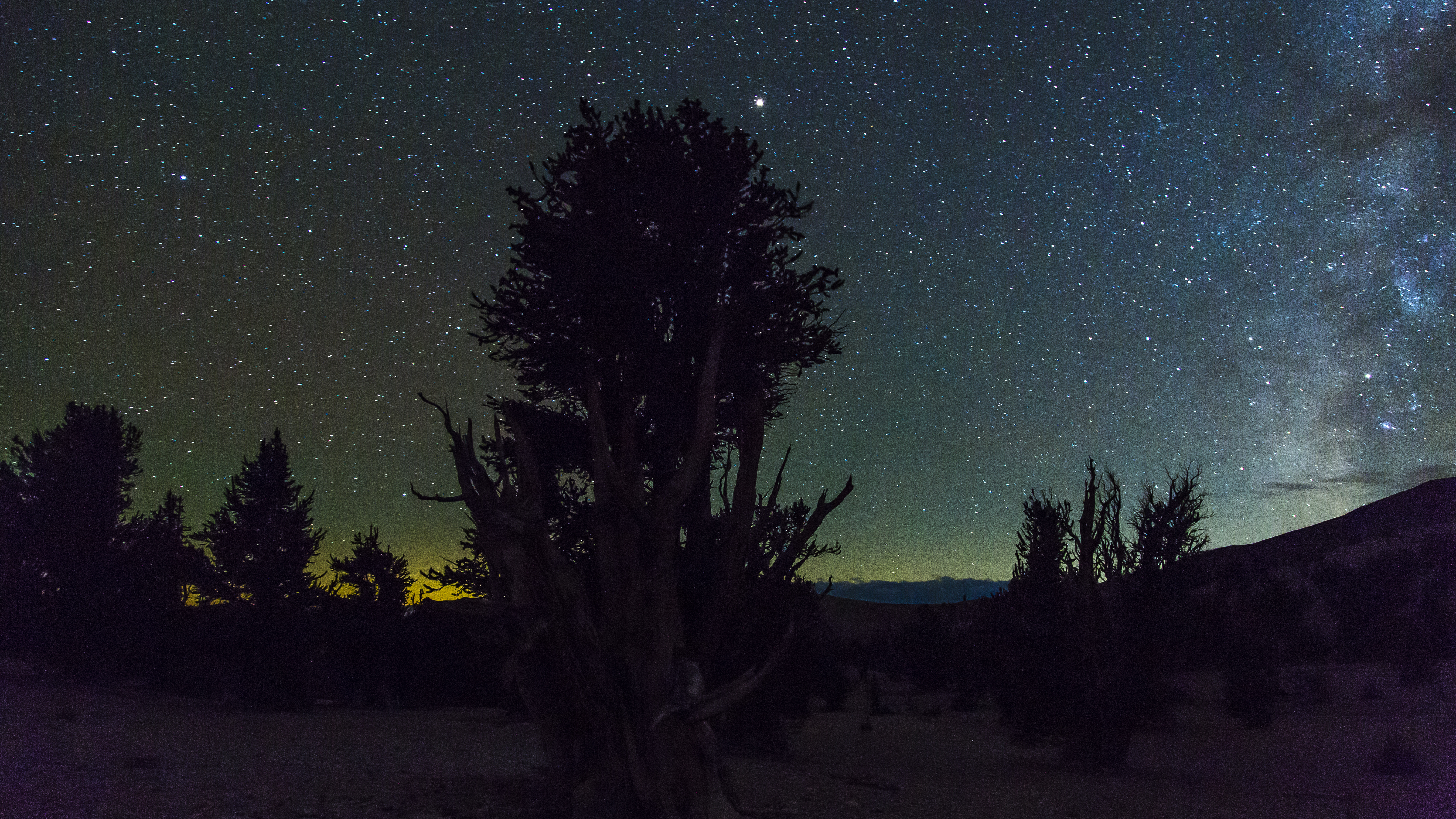
I’m beguiled by nature, and the more colorful, the better. Southern California does have seasons, all be they more subtle than other regions of this country. Autumnal light annually speaks to Cathy and me, and again this year we acceded to it its siren call. Our plan was to drive north some 330 miles, up the Owens Valley to Big Pine, thence turn northeast and climb up into California’s White Mountains near the western boundary with Nevada to visit a strand of Bristlecone Pines in what is known as Patriarch Grove. Once finished with our homage to those ancient conifers, we set upon forays into the Sierra Madre west of Bishop for this year’s dose of raucous fall foliage.
Bristlecone Pines are the oldest living things on earth. The trees in Patriarch Grove are generally thought to be nearly 5,000 years in age. If you think in religious terms, one can’t help but be humbled. These magnificent specimens, nature’s prophets, if you will, were ancient before the time of Abraham, let alone Moses or Christ. And still they live. For me, to see them, to walk amongst them, is as if I’m in a magnificent cathedral, compelled to humble quietude, to a gulping reverence of their stately eminence gris. And in my own aging arthritic progression, they call to me as kindred spirits of our gnarled twisted corpuses. Brokenness is Beautiful?
The first part of our mission was to seek solitude with the patriarchs in the grove, a fairly challenging thing to do, given the remoteness, and the harshness of the environment. From tiny Big Pine it’s first about 23 miles climbing steeply via a paved narrow twisting single lane mountain road, and then another dozen miles by a very rough and slow-going dirt road to the scree-covered, altogether lunar site. The grove is above 11,000 feet, above what would be the tree line for many species, with these extraordinary specimens growing out of rocky alkaline soil unfit for most trees, but clearly inhabiting their own unique biological niche. As you can see, they are quite literally half dead and half alive, with the dead part giving itself that the remainder may yet live off the minuscule nutrients, the tree structure twisting in response to the harsh winds over the millennia.

Shh. Camping is not allowed at the grove, yet we were alone in that remote location, and chose to stay the night camped in the back of the van. Shh. I set out the camera atop its tripod, facing south, attached the intervalometer programmed with appropriate delays and intervals and began the capture of over 3,000 single frames to be sewn together for a “day into darkness into dawn” time-lapse, linked below. The timing was every two seconds in the light, then 25 second exposures every thirty seconds in the dark of night, with my hiking camera also pressed into service for still frames in their own right. The image above, is of the camera set up and shooting the subject bristlecone, the intervalometer hanging down next to a tripod leg. Light, camera, action!

The deep nighttime darkness of their natural habitat provides a heavenly vault upon which we twenty-first century travelers can gaze as if we were shepherds of biblical yore. Perchance to revere the ancient ones and a sky’s billions’ of years attestation to creation? To drink up the spilled celestial smear of the Milky Way closeted with those twisted souls who have watched over this for us these past five millennia? The stuff of dreams, of an unfathomable appreciation. Cosmology entwined with biology. Heady stuff.

Saturn in a star-filled sky, calmly watched by a Patriarch sentinel
Looking skyward was to figuratively stand upon a bicycle wheel hub and gaze radially upward at the “cloud” of Milky Way that arced in a continuous rim from northern to southern horizon. Lap it up.

The southern arc of the 180 degrees of north to south Milky Way
Given the elevation and the season, we knew it would be cold up there, but I’d made multiple checks on the weather forecasts which indicated clear skies to drifting high cirrus clouds without precipitation. Years ago at an FAA flight instructor meeting, where the guest speaker was a weatherman, colleague Rick Lanphier, a Navy Chief in his day job, took the “Any questions?” bait by the speaker. Slowly uncoiling to standing up all six feet five inches of his bulky frame, he boomed out “YEAH, DO YOU GUYS HAVE ANY WINDOWS WHERE YOU WORK?” Rick would be shaking his head were he with us at the Patriarch Grove, when clear skies turned into a snow storm blowing in at 02:30, lasting until after first light. I had to parka up, and trudge, slipping and sliding, the 150 yards from Odyssey van sleeping bag to find the snow-coated camera in the drifting flakes and fog, shut down the shoot and put the gadgets away with fingers dispossessed of feeling. Cold? Boy howdy. It was a sleepless night as I worried about being snowed in on those dozen miles of rough, now snow-covered dirt road. No chains, no 4WD, no cell coverage, fleeting images of the Donner party hovering in my subconscious periphery.
The early light revealed nature’s revelry, and a fantasy landscape, magical beyond anything I could have imagined or hoped to have scheduled for the shoot.
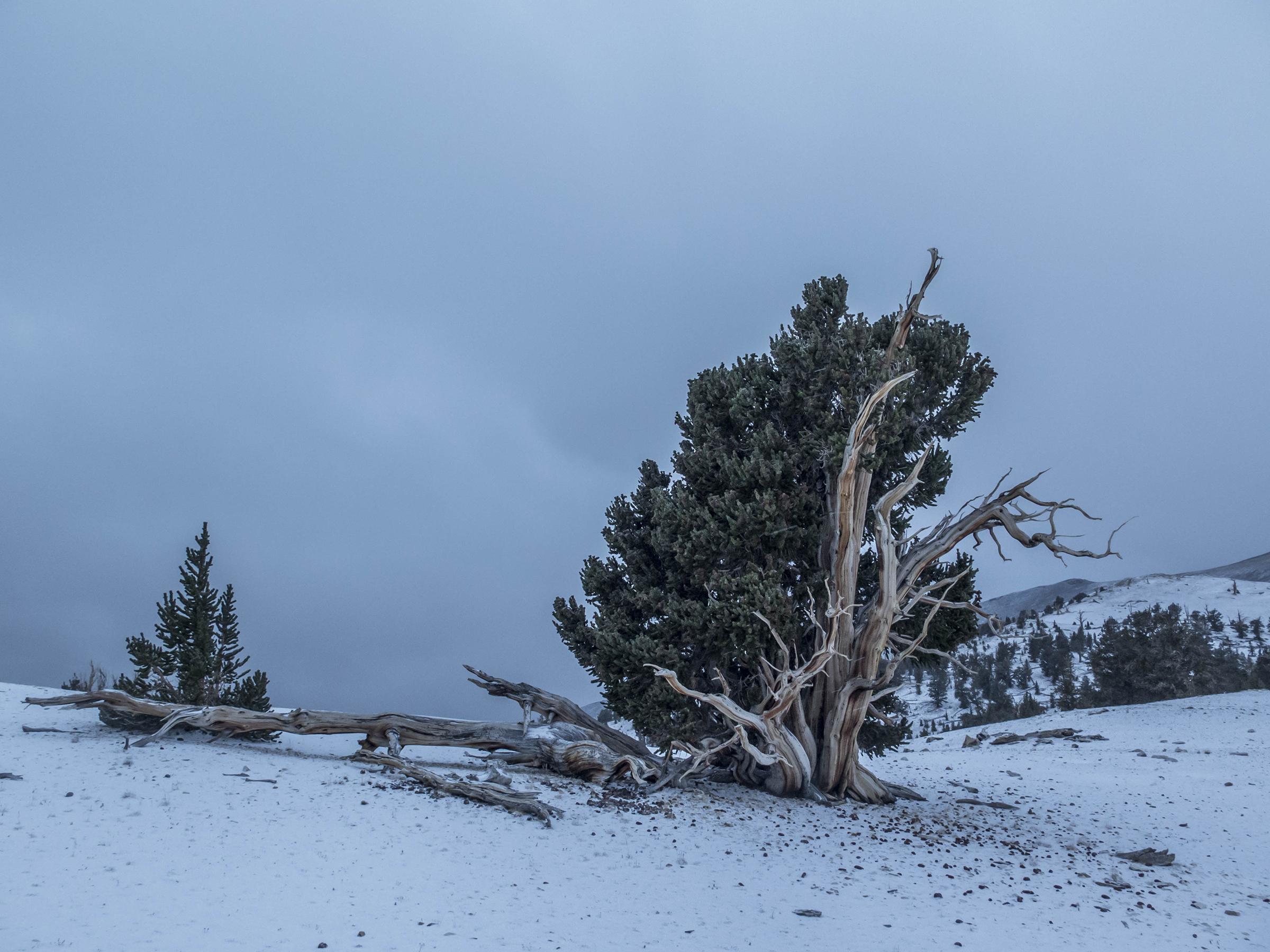


Maginot Line
Intriguingly, snow covered the landscape, but appears not to stick to the bristlecones. One of their longevity secrets?

Tolkien’s Treebeard


Before 9 we were done with the T-L and began our slow descent from the mountain. By the time we’d lost a thousand feet we were dropping below the snow. Still farther down we were treated to a nice view of the lower portion of the White Mountains, and a snippet of the Owens Valley, with the Sierras in the distance all sporting their own white ridge tops.
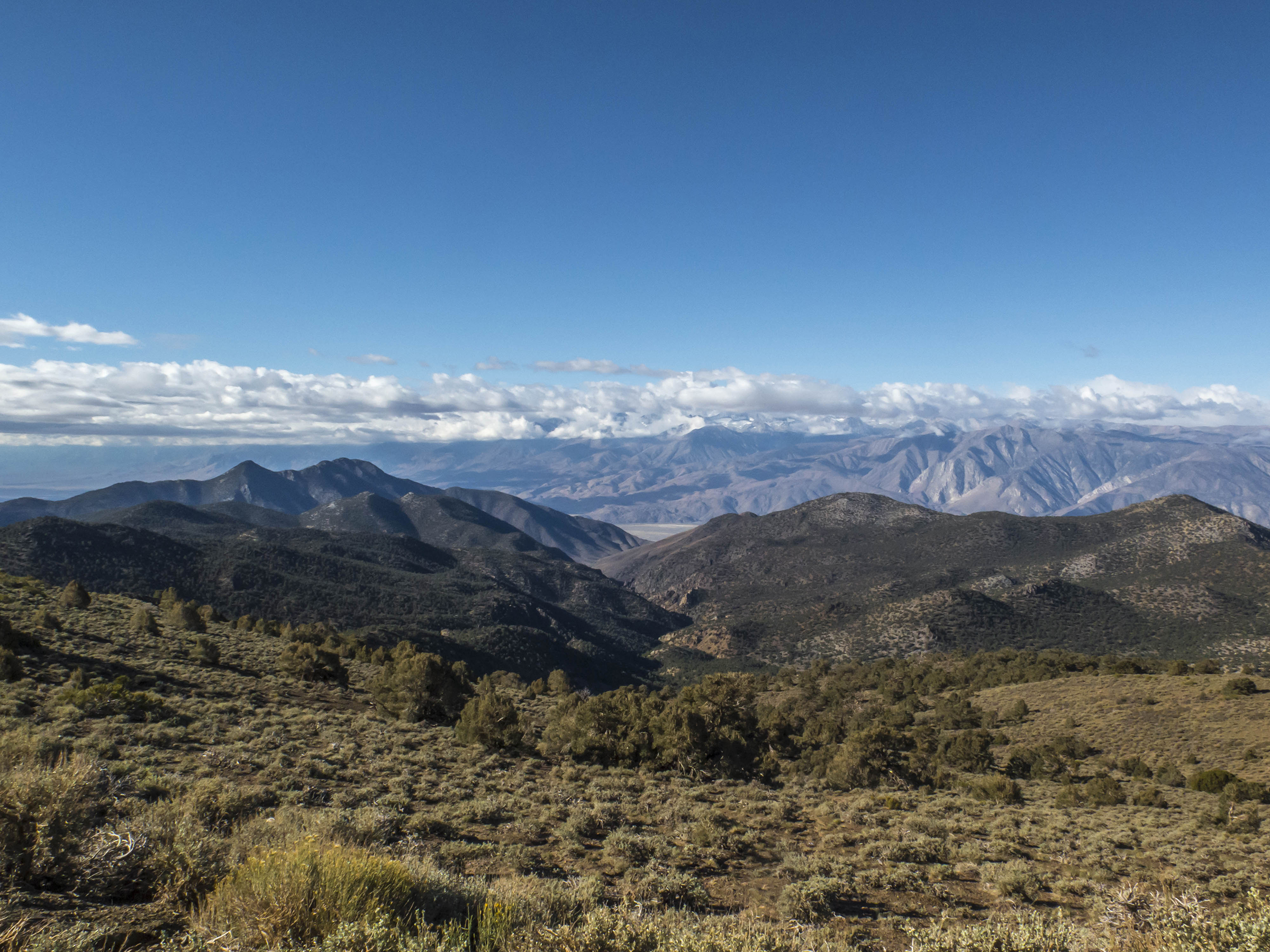
That Saturday was a recovery day, getting checked in at a lodging in Bishop, about 15 miles north of Big Pine via Highway 395, getting some rest after the sleepless night, and rendezvousing with middle daughter, Paisley, and her pup Lizzy, playmate to Sawyer. At the end of this day, the weather that had been predicted materialized with more snow and gusty winds.
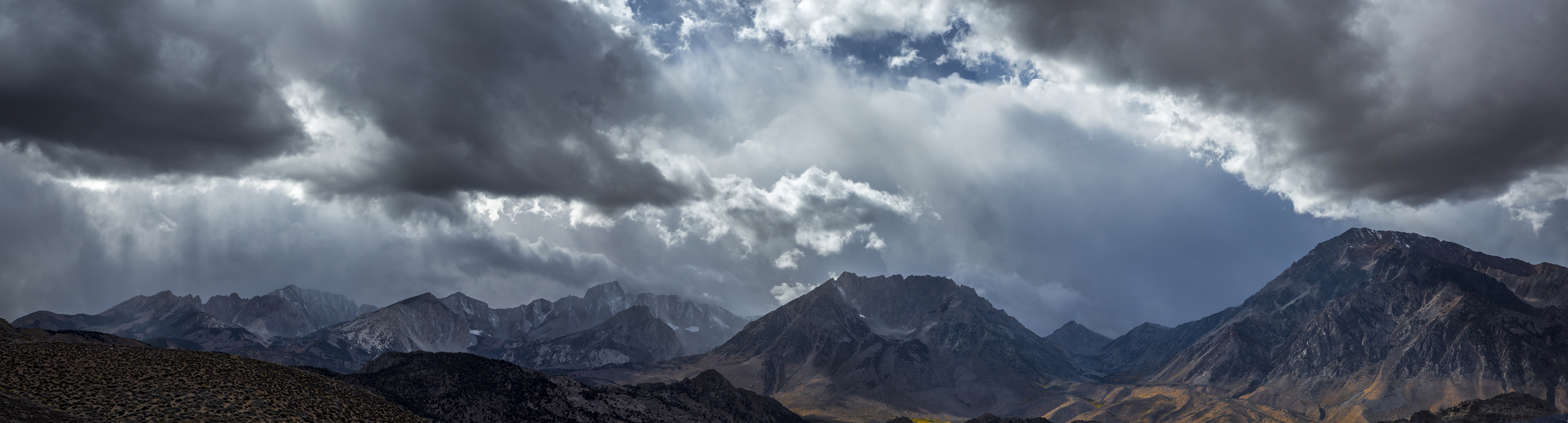
Snow flurries, granite and Aspens
The following morning and the rest of our time there was picture postcard perfect great hiking weather. Clear skies, early morning temperatures in the upper forties, and middays in the upper sixties to low seventies. Proceeding westward up valleys into the Sierra Madre, the roads were like something out of Arizona Highways, and of course drawing out numerous leaf-peepers, although as you can see, we could find unpeopled stretches as well.
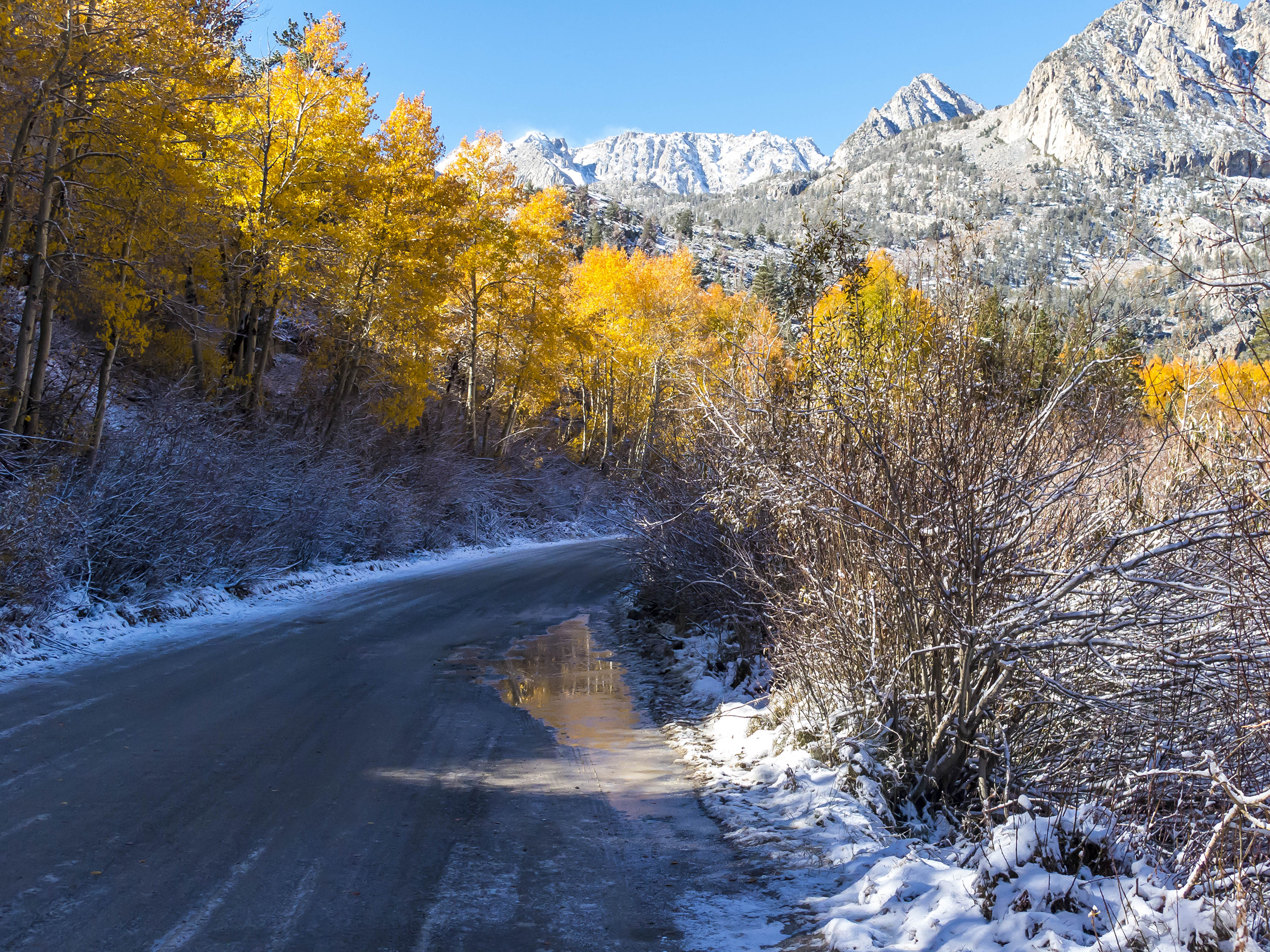
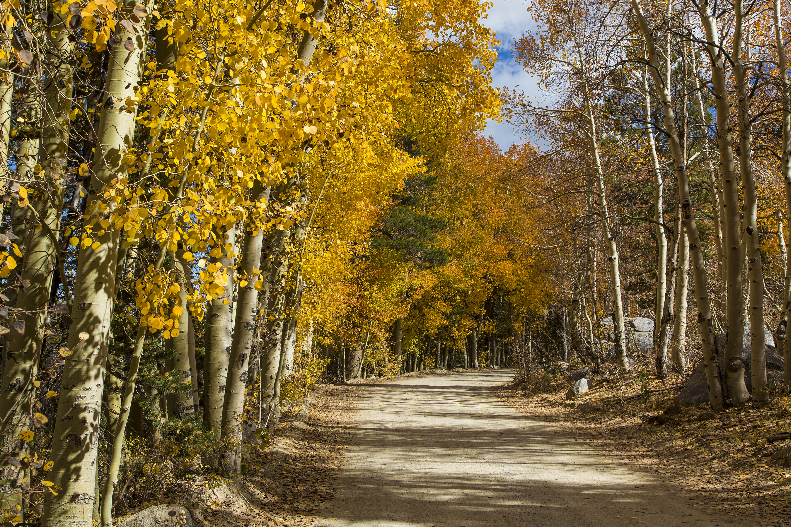

Our purpose was to put trailheads behind us, hiking into the mountains in search of exercise and agreeable vistas of golden Aspens in nearly peak color, especially after the snowfall. It was on the hiking trails where we could find solitude and more extravagant beauty.
The lower portions of the trails, if 9,000 feet can be called low, were mostly snow-free…

Antidote to rush hour traffic jambs.
…while climbing higher was on snowy, leaf-strewn trails.

The overnight snow came with wind, and a golden carpet on and beside the trail in the morning.

Sawyer gets thoroughly amped with snow, running hither and yon, chasing prey real and imagined.
This day’s hike was about a four mile roundtrip with a climb of almost exactly 1,000 feet, leading to Grass Lake.

Grass Lake at just over 10,000 feet
We came for the color, and nature did not disappoint.
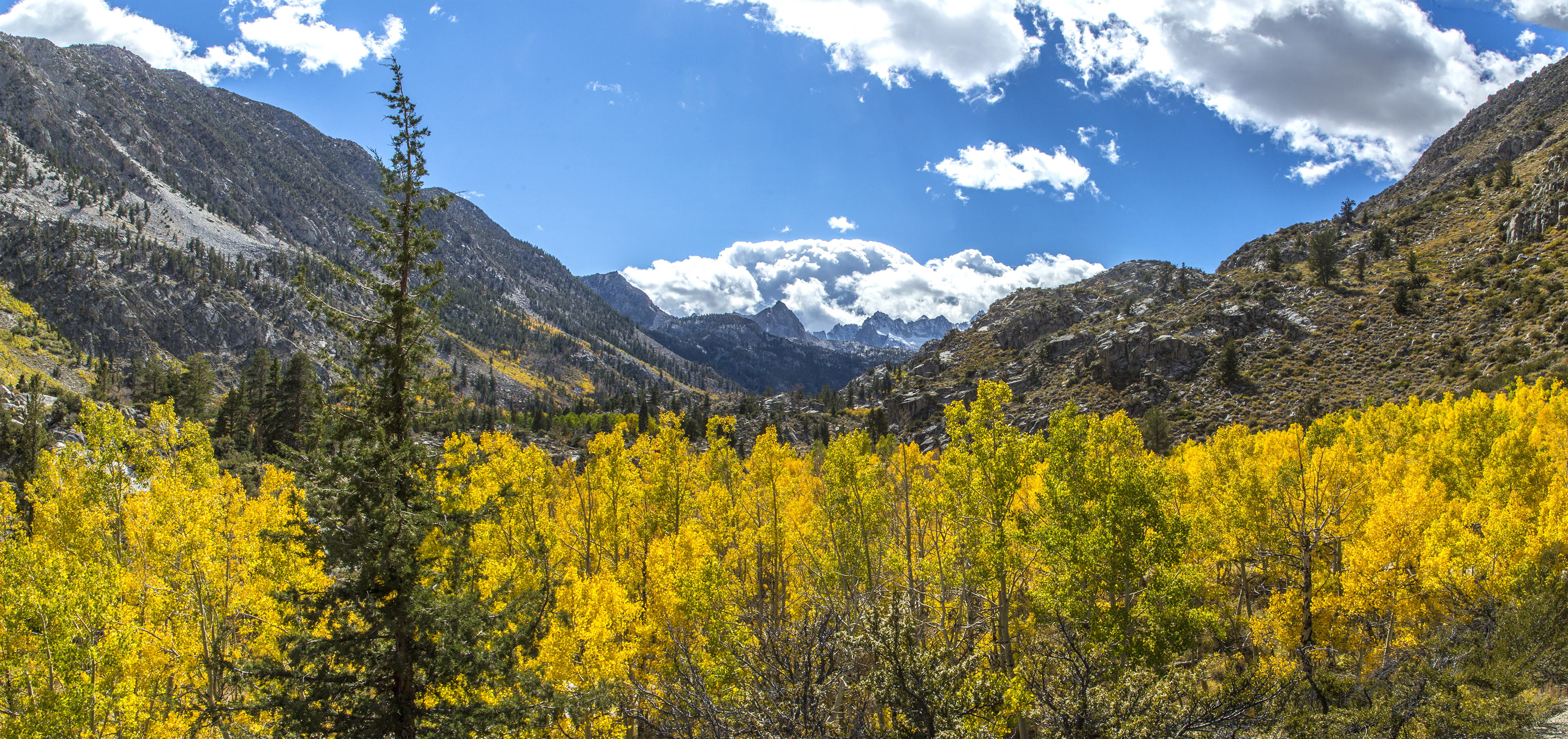

Some of the Aspens were gilded, and some still green.
If you’re from my generation, you may remember the disinfectant merthiolate, now banned as it contained mercury? What I recall about it was its vibrant umber color. As you may know, while these Aspen groves are full of individually trunked trees, they are actually all part of the same plant and root structure. The groves spread underground, propagating countless individual tree trunks.

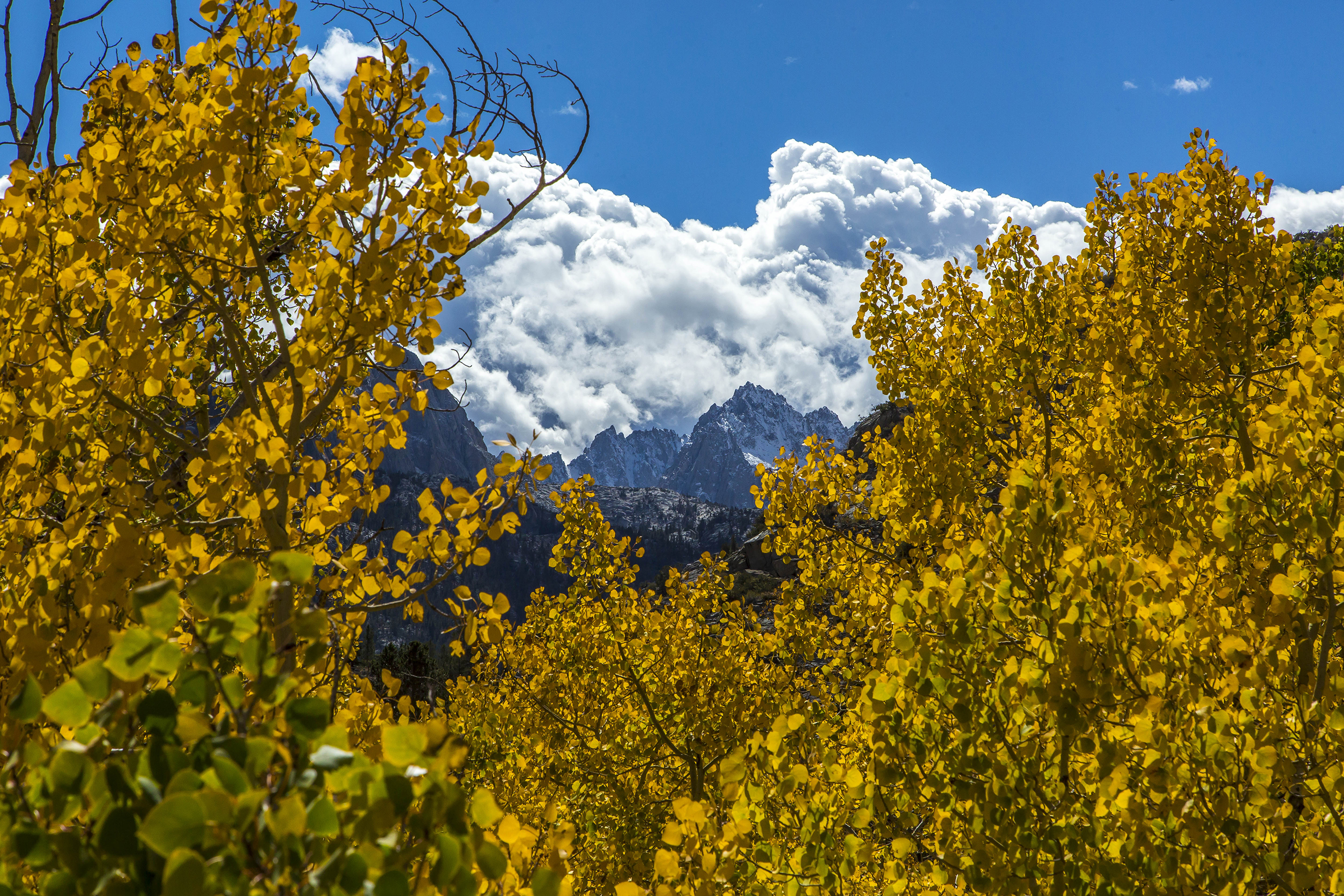
The next day’s hike was closer to five miles with a 1,700 foot climb, leading to Long Lake.

Cathy and Paisley trying to keep up with Sawyer and Lizzy

Aptly-named Long Lake
The lakes drain down valley with numerous streams.
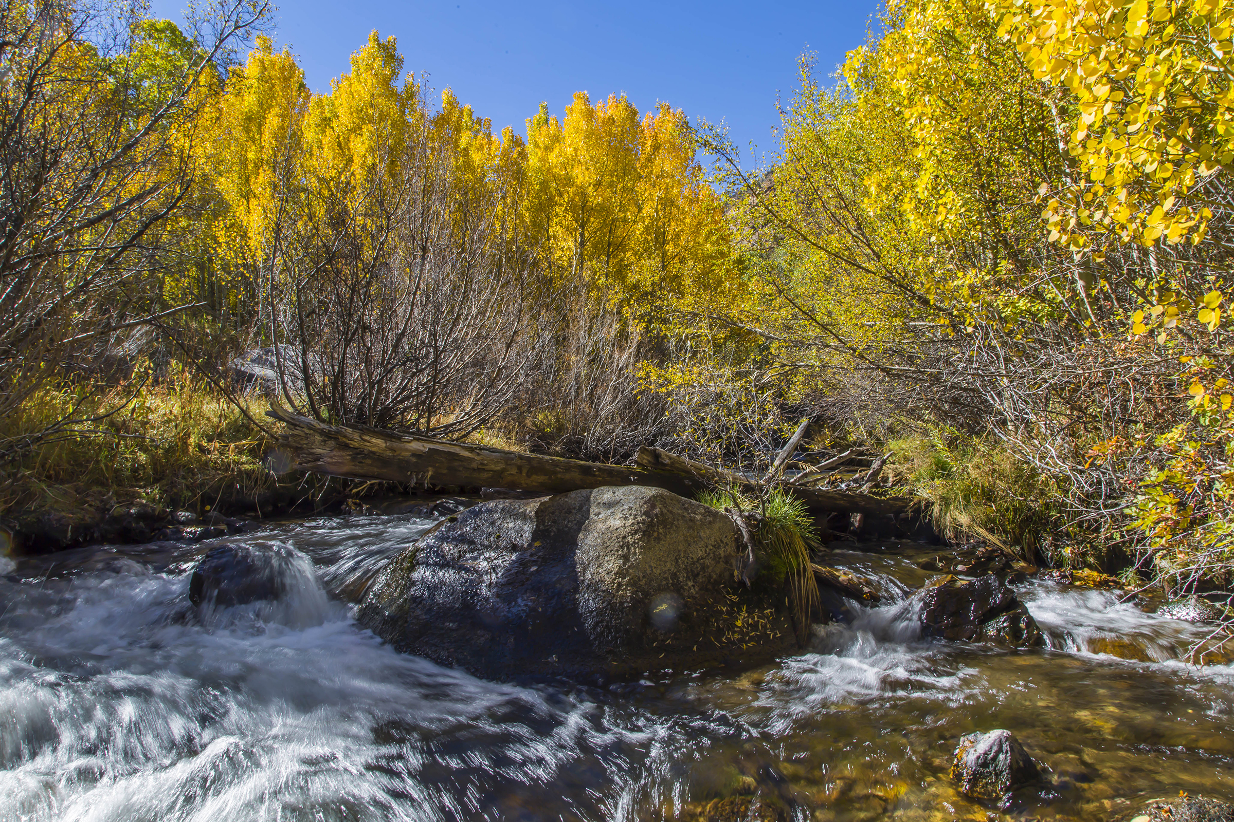
A fallen log crossed this gurgling steam and two happy dogs fearlessly took advantage of it to explore, with Paisley in pursuit.


There are placid streams as well, bordered by dense and shaded Aspen groves. Walking in the groves is a calming experience, though the closeness of the trunks calls for care in movement and foot placement. It’s natural to look up, and be rewarded.
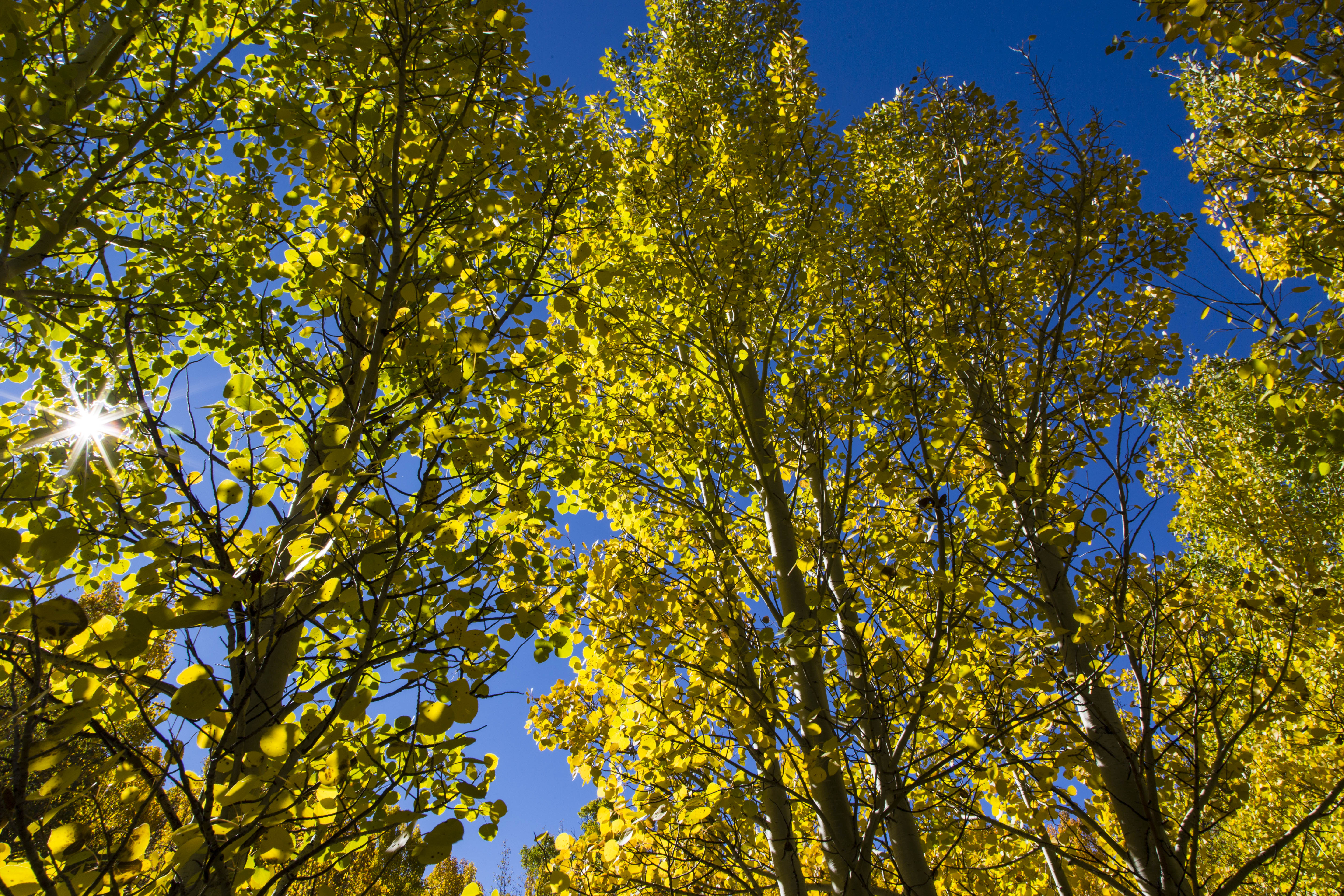
Aspen sunburst
The more complete name is Quaking Aspen. Each leaf is individual, at the end of a long delicate stem, attached to slender branch ends, the branches swaying, and the leaves shimmering and quaking in the breezes.

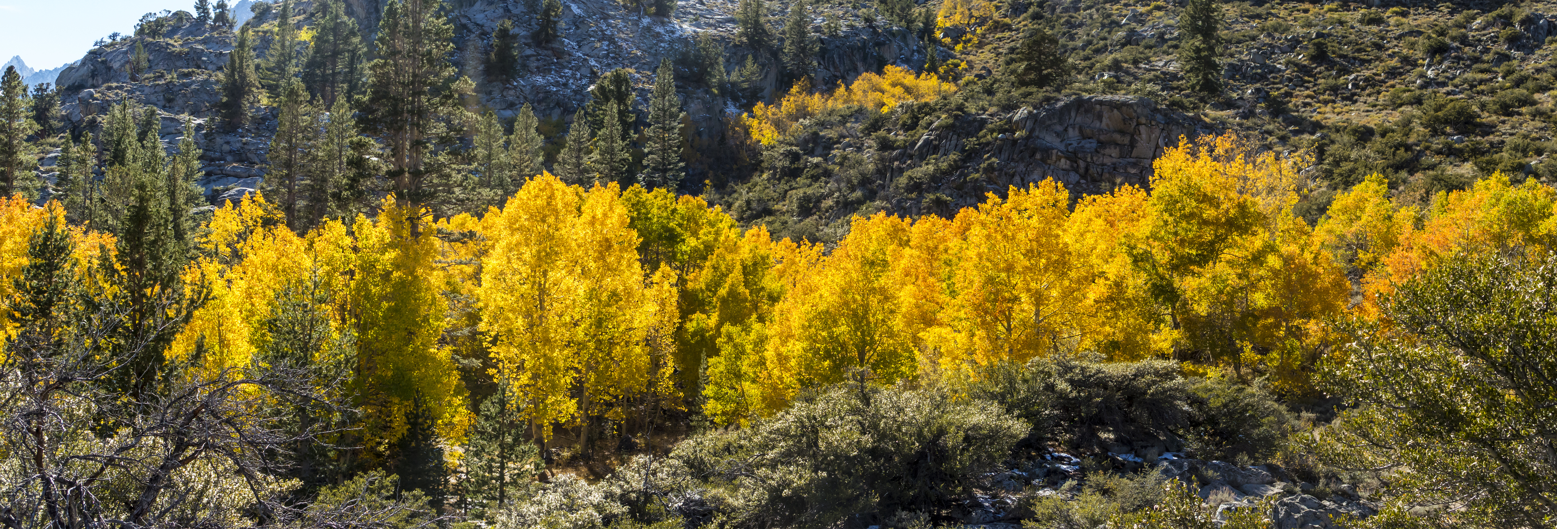
Another autumn, surprises added to the mix. Home safe and color-sated. It’s in the can. A wrap.
As ever, Tom

Recent Comments