Paradise Taveuni, Fiji
Posted on August 31, 2016
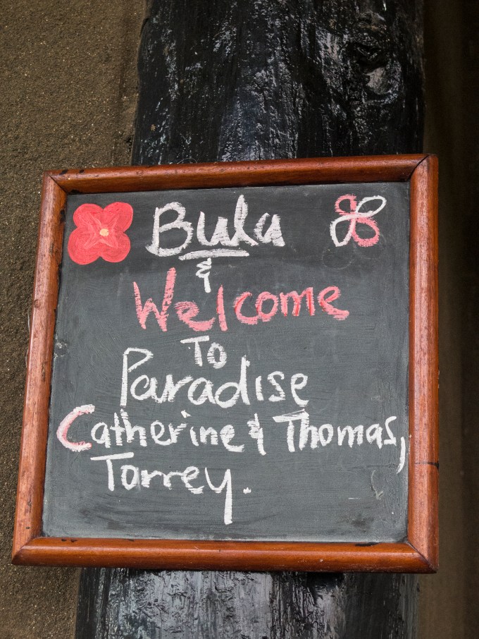
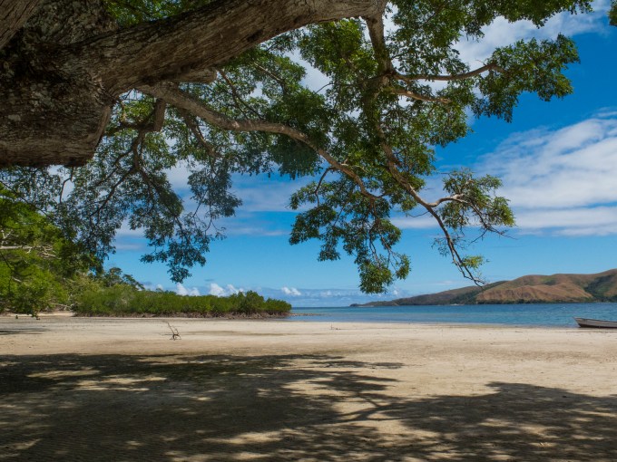
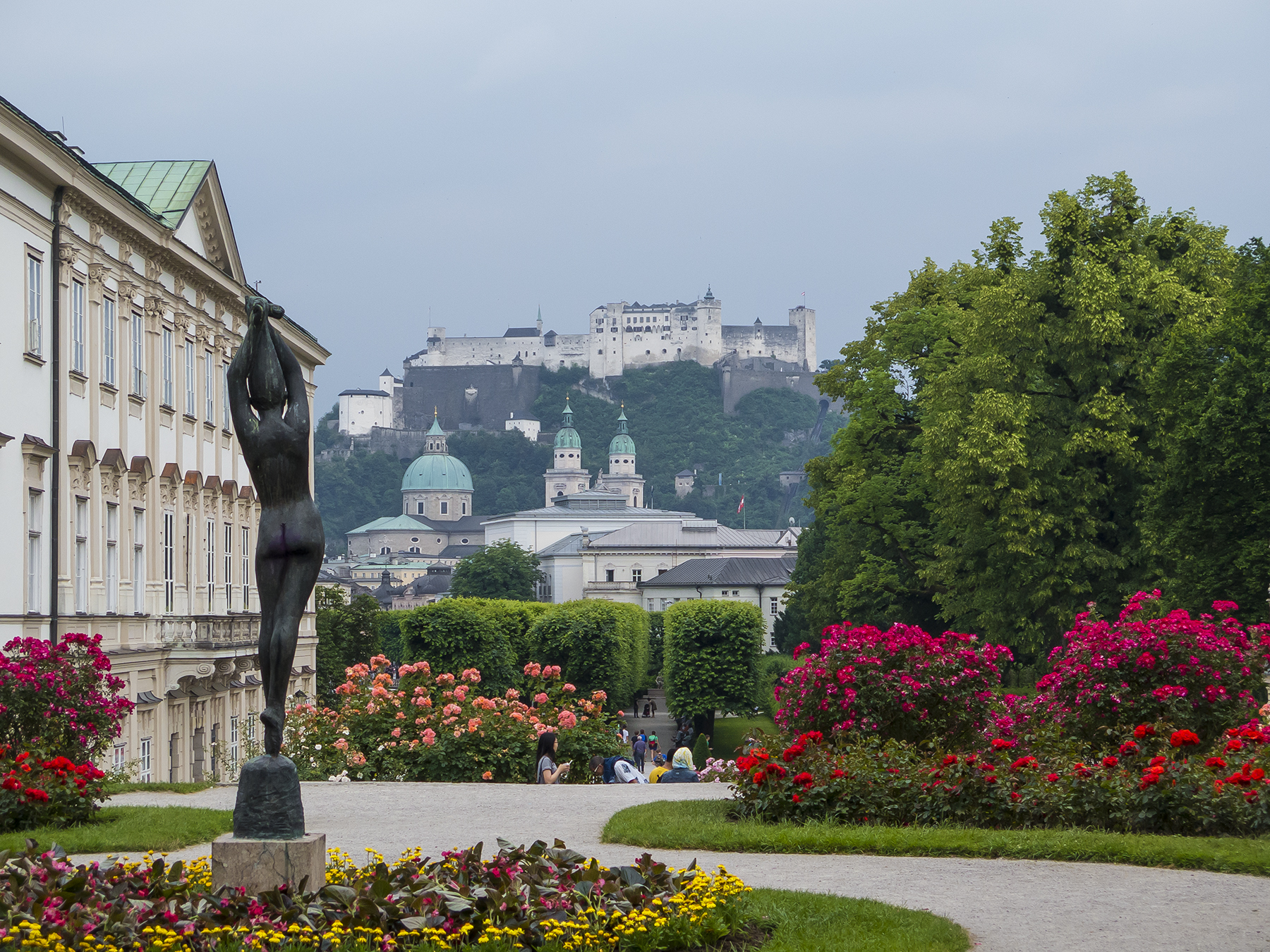
It’s a welcoming place
It having been too long since we’d taken a family dive trip, we decided to explore a new site in the Fijian islands—the Paradise Taveuni Resort.
Getting there from SoCal is modestly straightforward—a 10:20 nonstop from LAX to Nadi (pronounced Nandi) on the main island of Viti Levu, then an hour’s flight by De Havilland DHC-6 Twin Otter to Taveuni, and another hour’s drive along a rugged, mostly dirt road to the southern end of the island.
Fijians have a well-deserved reputation as among the friendliest people extant, and the welcome we got at the resort was a perfect example. The staff warmly greeted us by name right from the get-go, and throughout the days engaging us with a smile-suffused “Bula”—the Fijian equivalent of Hawaii’s Aloha. Literally translated as “life,” it is routinely used as a hello greeting. These are people who smile with their eyes, and routinely stop what they are doing to engage with you.
The resort is lovely and small, and recently rebuilt.

Our lodging
The view from the room, a perfect place to read in the shade after the morning’s diving, and before the sundown libations or dinner.

Morning view
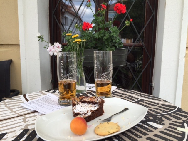
After lunch on our first afternoon, we did a single tank dive off the resort dock to verify equipment functionality and to confirm that we still knew how to apply basic underwater skills. Then we settled into relaxing with a book and an adult libation as the sun settled toward Vanua Levu across the Somosomo Strait. Jet lag be damned!

Wasting away in Margaritaville
That’s the resort dive boat, by the way. Small, but seaworthy and capable of keeping something like eight divers comfortable in shade from the tropical sun. The resort sits at 16 degrees south latitude, and take your pick—180 degrees east longitude, or 180 degrees west longitude. The international date line takes a zigzag to the east so that the entire island nation is in the same time zone, not to mention the same day. Taveuni is five hours earlier and a day later than California. In fact, Fiji begins the new date for the world. Keep that in mind for your next New Year’s Eve.
The resort is renting that dive boat, because the three they had operated were destroyed last February by Cyclone Winston. There’s much to say about this beast. Cyclonic circulation is rotation around a low pressure system in the same direction as the earth’s rotation, a circulation, that due to coriolis effect, is counter-clockwise in the northern hemisphere, and clockwise down under. Common names for cyclones are hurricane, chubasco, and typhoon. Winston was the strongest cyclone ever recorded in the southern hemisphere, and that means all oceans and seas. It came ashore, its eye near the resort, with 185 knot winds. If you’re not “knotically” inclined that’s over 210 mph! This exceeded the normal velocity standard that maxes at Category 5, so Winston got it’s bad boy rating of 5+.
The resort was totally destroyed, and the inhabitants at the time survived in a shipping container located behind the main office/dining area and wedged between coconut palms. The resort staff is from nearby local villages, and those villages and the homes were likewise obliterated. Resort owners Allan and Terri Gortan, Aussie by birth, and Fijian by current citizenship, were denied even the benefit of insurance, which dropped coverage for any cyclone over Category 4. They set about building a dormitory for their homeless staff, and then rebuilding the resort, itself. Providing a place to live, food to eat, work and earnings, and the opportunity for all to come together for a common purpose. Team effort.
Not at first grasping the magnitude and import of all this, we were the beneficiaries of introductory rates as they bootstrap the resort back to its former glory. The resort is lovely, but there was a modestly attenuated level of poshness than what jaded jet-setters expect, and thinned out vegetation. It took about a day for us to realize that we got the glorious end of the bargain, and I’m not talking dollars. We got to be the honored recipients of this team effort, tangentially contributing with our stay, to the industrious way these proud, hard-working people were elevating themselves, the resort and their communal lives. The vibe was infectious and sincere at every turn. This is something you can’t buy at a Hilton or Marriott.
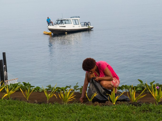
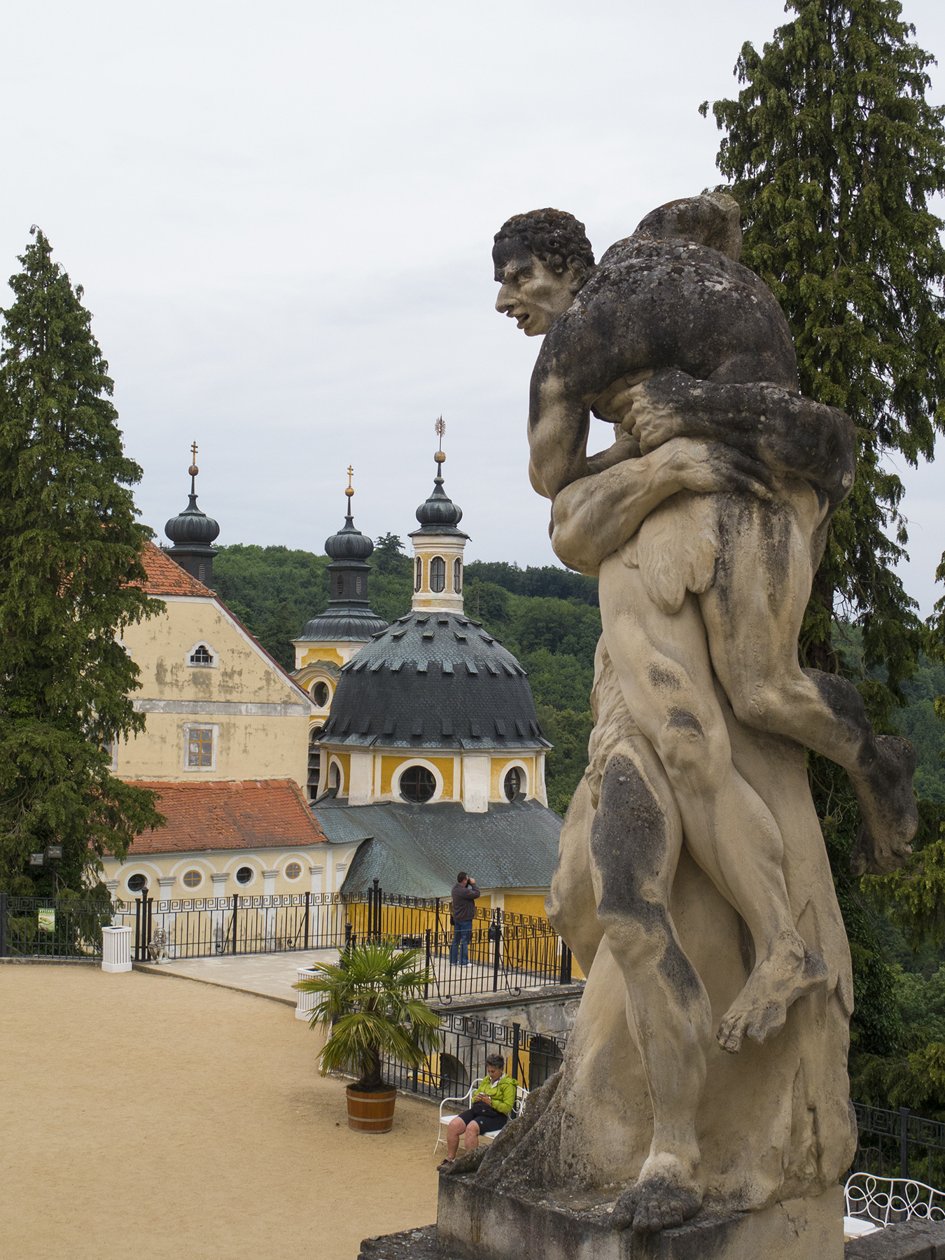
Quiet, steady resilience
As the saying goes, one picture’s worth a thousand words. The captain readies the dive boat to come from its mooring to the dock for the day’s dives, and this quiet, shy woman is hand weeding the newly replanted pathway. Each day began this way. Sharing in this rebirth was the most satisfying highlight of our stay.
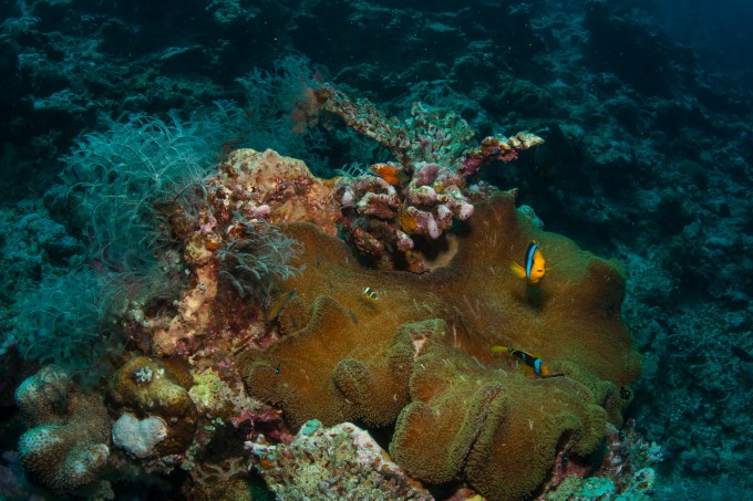
But we’d gone to Taveuni for the diving, and that was certainly a stellar feature. Most of our dives were along the 13 mile long Rainbow Reef in the Somosomo Strait, and Vuna Reef along the southern tip of Taveuni. Common depths we dove were between 50 and 110 feet. Water and air temperature were about the same at 80 degrees F, and water visibility somewhere between 60 and 150 feet. Oceanic decadence.

Torrey and Cathy taking in the myriad corals and crinoids on the Rainbow Reef
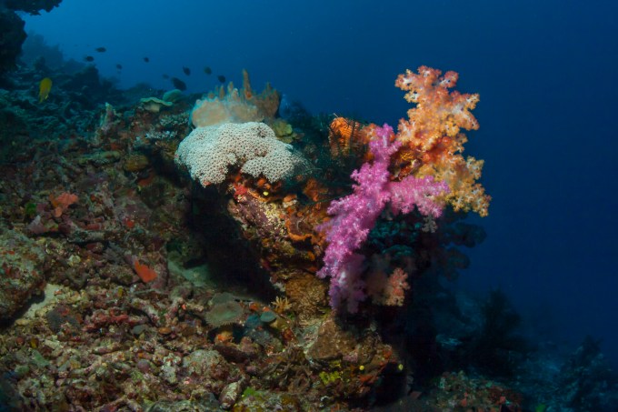
Soft corals
Nurtured by nutrient rich currents that wax and wane with the strait’s tidal changes, Rainbow Reef is noted for its soft corals, exuberant testament to nature’s kaleidoscopic palette.

A cloud of tiny orange Anthias, punctuating the soft corals’ color statement

White soft coral
Another byproduct of the currents are fan corals.

Sunlight through a fan, as Torrey and Cathy swim by
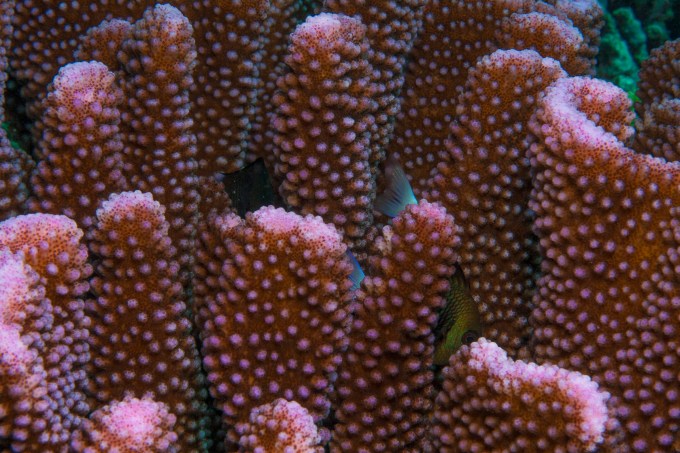
Corals, of course are living organisms. They are sensitive to the nutrients of the water, but also its temperature, its pH, and man-made toxic runoff. Scientists partially gauge the health of the aquatic environment by the health of the corals, which are central to the symbiotic interplay of fixed and swimming creatures.

Symbiosis
Two fish hiding in this colorful coral. One dark eye peering back at me

Tiny, finger joint-sized nudibranch
Typically the dives last approximately an hour underwater, then an hour on the surface, followed by a second dive. This surface interval reflects the physiology of the body’s processing of air, which is just under 21% oxygen and 79% nitrogen. We consume the O2 to power our bodies, but the nitrogen, being inert to respiration, dissolves in the tissues and bloodstream under the pressure of the depths and is slowly exhausted at the surface lest bubbles form in tissues and joints producing the debilitating experience of “the bends,”which can literally bend the body in response to painful nitrogen-infused bubbles in joints.
One of our dive days was a three tank gig. After the second dive we boated to a crescent beach on Vanua Levu for an alfresco lunch to increase the interval before dive 3. Our dining table was a fallen coconut palm. The cafe view was none too shabby.
Alfresco lunch setting
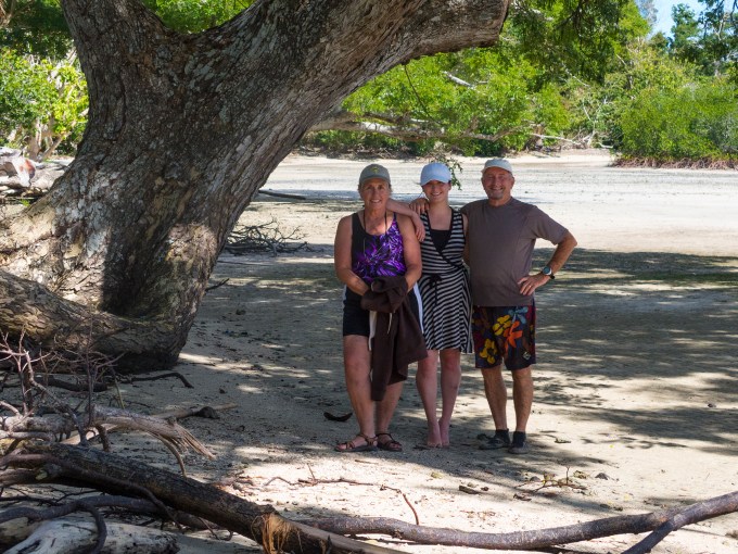
After lunch, between dive 2 and dive 3
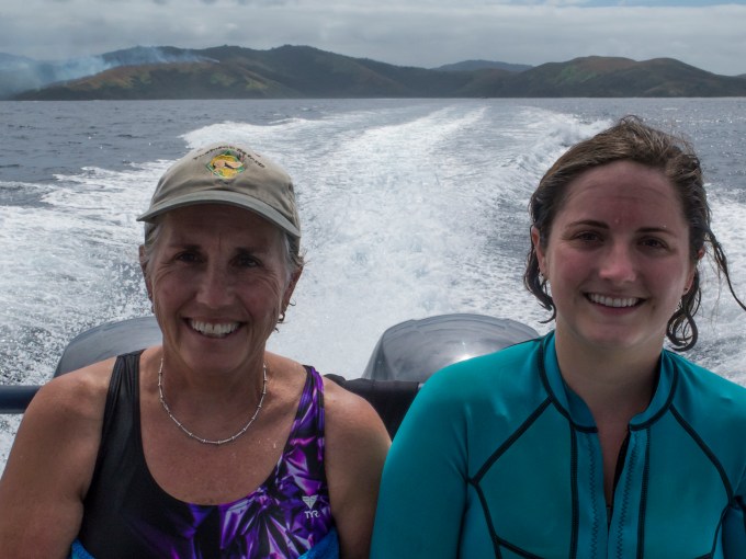
Each day began with a boat ride to the day’s dive sites…

Morning clouds enveloping Taveuni
…and following the dives returning us to the resort.
After the dives, returning to the resort. Happy faces with mask imprints.
On two tank days we’d enjoy a delicious lunch from a daily-changing menu, then repair to that hooch overlooking the water, perhaps a swim in the pool—or as often as not for me, a brief nod-off three or four pages into whatever book I was reading. Vacation, redefined.
There were also days when we explored some of Taveuni’s ground-based options.

Tavoro waterfall
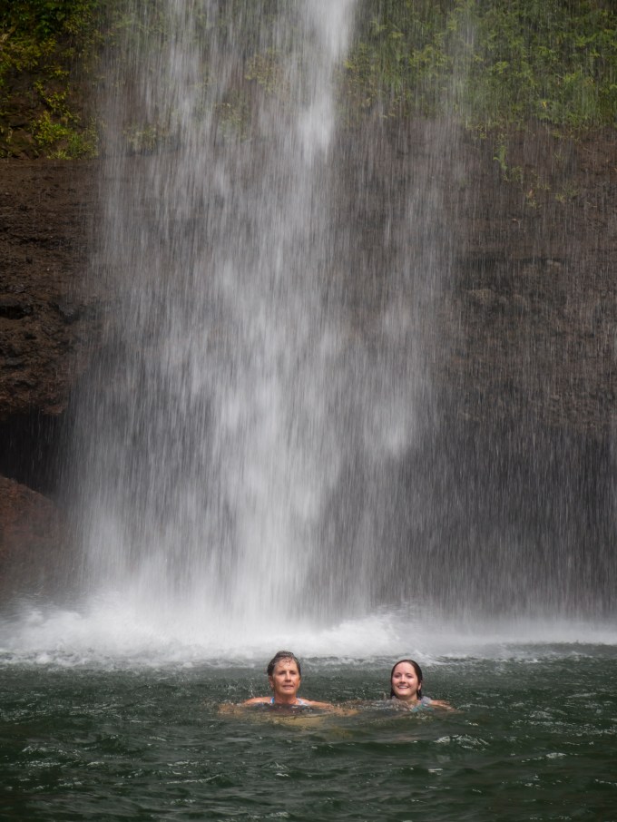
Waterfall swim

Straddling the 180th Meridian—right foot in today, left foot in yesterday
Early in a long day’s island exploration with our driver guide Jim, we stopped to visit Wairiki Catholic church. Built in 1909 (and honoring a French missionary who suggested a successful strategy to defeat a Tongan war party) replete with stained glass, but replacing pews with palm floor mats.
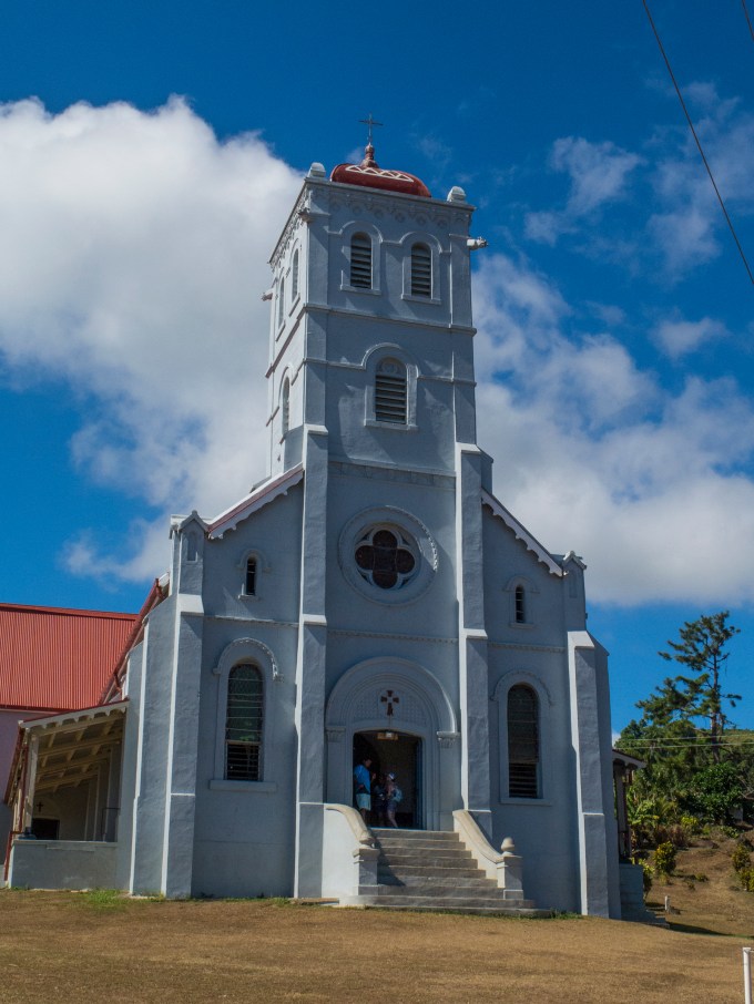
Wairiki Catholic Church
We came by in the midst of an island-wide childrens’ Rugby tournament. Fijians are perennial Rugby powerhouses. Imagine a stateside soccer tournament, with kids’ games going on throughout the day, the families rooting on their brood from the shade of trees encircling the pitch…and being watched over by Mary in white vestments.

Rugby kids, Wairiki church portal. Somosomo Strait and Vanua Levu in the background.
There’s a backstory here, as well. We learned that Jim, who also had picked us up at Matei airport when we arrived on our first morning in country, was also a minister in a very small church that he started after being moved by The Spirit on a visit to Brisbane, Australia. Much against his personal inclinations, this quiet man of faith, heeded the call, seeking to share Christ’s story with his Fijian counterparts.
On our return that day we were treated to a rain falling and a lovely down-sun rainbow. Our bure (room) is framed by the notch in the double palm and its hammock.

A paradise rainbow
But still there was more diving to be had, reefs to explore, and creatures to gawk at, including two lionfish. They are invasive and destructive creatures with very venomous fanning fins.

Lionfish
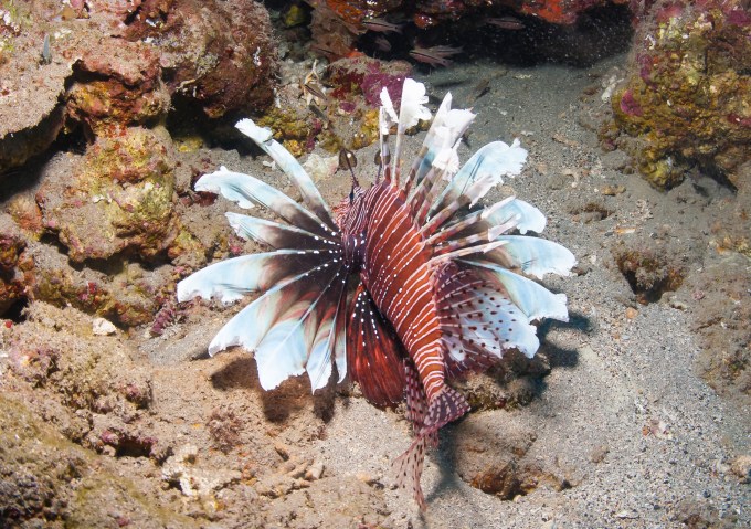
Docile, but venomous. Check out the outrigger paddle eyebrows.
I managed to find a couple of giant clams, several feet across, and similar to the one that holds up the coffee table in our living room, if you’ve been to the Del Mar digs.
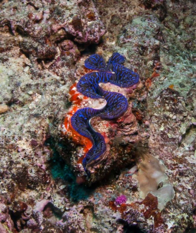
Colorful clam
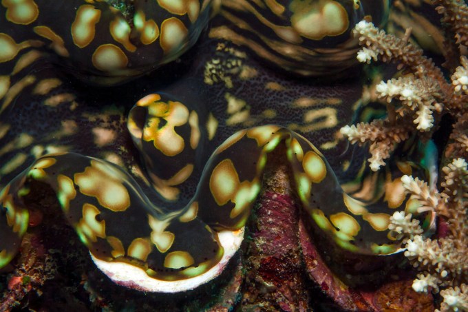
Delicate camouflage of a giant clam

Leaf Scorpionfish. Feathery, translucent and well camouflaged.
And we also encountered some larger creatures. This picture lacks the brightness and color of my underwater strobe because this six or seven foot shark was shy, and my “there goes the neighborhood” arrival disturbed its bottom chillin’, scooting away before I could get close enough to do the image justice.

Shark and remora
For me, the highlight of the dive creature encounters happened as I was running out of air, and starting an ascent to a nitrogen out-gas safety stop at fifteen feet under. Looking down, past Carolyn (a delightful French film producer living in London) two six-foot across black speckled stingrays were fluttering together in a mating pax de deus, their fins’ periphery a lilting dance of the veils. I can assure you, we were lost to them in the heat of their amorous ardor.

Giant rays’ mating dance
Perennial favorites of dive photography are anemone fish. They live embraced by the anemone tendrils, which are quite toxic, but for which these Clownfish (their coloring) are immune. A safety mechanism that keeps predators at bay.

Clownfish, immune to the stinging tentacles of the anemone undulating in the surge.
Clownfish generations amid anemone—newborn, juvenile and adult
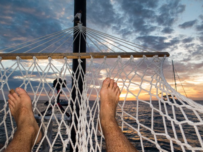
And when the diving day is done, maybe a Fiji Bitter and a bit of quiet time taking in the approaching sunset? Here, I’ve started a time lapse and am nursing my brewski while reading a book. Hammock-borne multi-tasking, Paradise Taveuni style.
A time-lapse underway. Chill out time with a Fiji Bitter
Or stills from this and other sundowns. The first is of a catamaran that came to the mooring to pick up a group of U.S. physicians who took off by the vessel to provide pro bono sick call at multiple small Fijian islands. A nice way to give back.
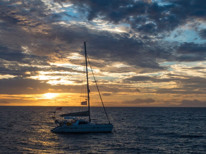
Physician transport
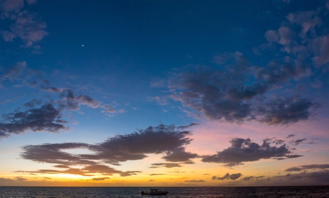
Taveuni twilight with crescent moon


Taveuni sundown

Dive boat sunset
So yes, our bridging the hiatus of family dive trips was accomplished in an exemplary and altogether satisfying fashion. The Fijian subaquatic environment is healthy and beautiful, Fijians the warm, exuberant people of our recollection. And Paradise Taveuni was lovely and getting posher through the ministrations of Allan and Terry and their entire staff. Vinaka vakalevu. Thank you very much.
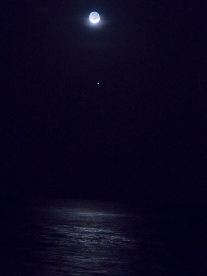
Moon and planet light on the water
The Nature of Nurture. The Nurture of Nature.
Posted on August 31, 2016

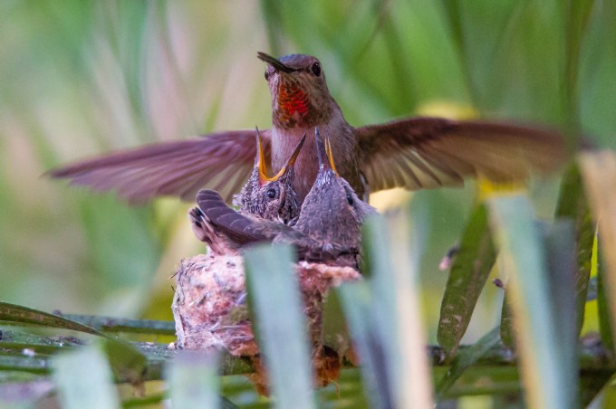
Mom—the ever watchful and nurturing Sweetie
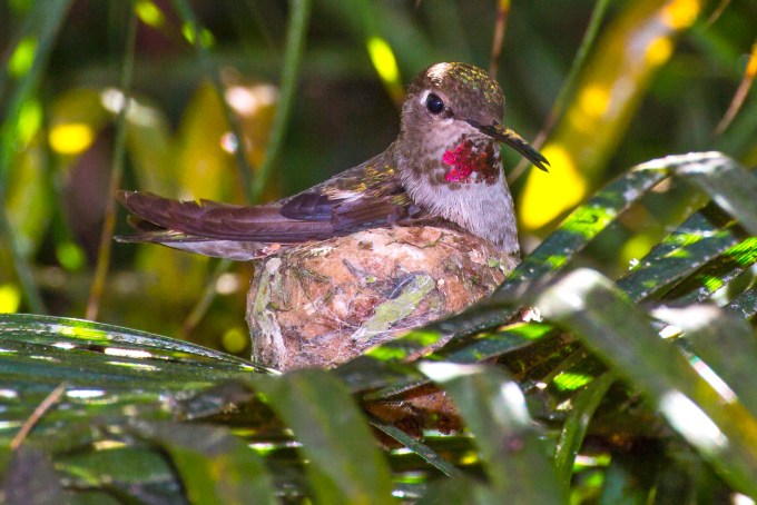
Over the past few years I’ve had the opportunity to watch three hummingbird mothers go through the process of raising a brood, but each time there were logistics challenges documenting the process. Then, this March, we discovered a nesting female in a palm abutting our front porch. I’ve surmised that she may have been a first-timer, with only a single egg and placement of a shallow insecure nest on a fairly fragile frond. The upshot was that a nighttime gusty early Spring cold front rocked the tiny nest so strongly that by morning the egg had been blown to the ground below, shattering its future.

A sad morning sight.
I selfishly fretted over the lost opportunity to chronicle their family-building. Then on May 7 Cathy noticed a hummingbird frequenting another palm in the same area, and sure enough, we found a sturdy, deep nest located securely on a strong frond, well protected by foliage above and below, and facing directly at our front door! Watching until she vacated the area I quickly got a ladder into position to look into the nest.
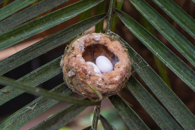
Two eggs
Hallelujah! Given a new lease on bird-voyeur life, I set about trying to make the most of the opportunity, setting up the 5D with a 600 mm telephoto alternating with occasional spells of the G16 in macro mode. This turned out to be a technically challenging endeavor, with fronds wafting in and out of the frame and confusing auto-focus enough to make it nearly useless, dim light on the sheltered nest confounding exposures. Depth of field with such a long lens located maybe ten feet from the nest meant that focus was always of the shallowest few inches variety.
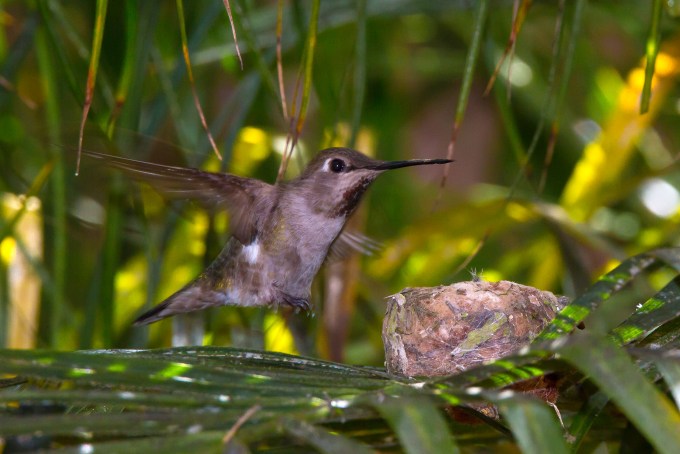
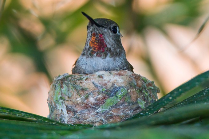
Given the hyperthyroid exertions of their flight profiles, hummingbirds need formidable amounts of energy ingestion in the form of flower nectar, tiny insects and such, which translates to much coming and going for food, interspersed with quiet downtime sitting atop the nest to incubate the eggs, ideally kept at 96 F.


I struggled to personalize the experience first with a name for the mother and eventually her brood, receiving several great suggestions from friends following the developments on e-mail. And then one morning I realized that for days I had been stepping out the door in the morning for newspaper retrieval or surf condition checks, smiling at her on the nest, and saying something sappy like “good morning, Sweetie, how’s it going?” The name stuck. I hope she liked it.
Ruby-throated hummingbird incubation is in the range of 14 to 16 days in temperate SoCal. We first discovered the nest with eggs already in place on May 7. On May 18 the first egg hatched, followed two days later by the second. 
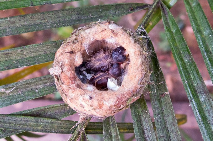
Hatchlings one and two.
At breakout, the hatchlings’ eyes are closed and they’re mostly bald, save for a fuzz down their backs akin to Phyllis Diller on a bad hair day, make that any day. Their skin is crenulated, about like mine these days, seven + decades into a gazillion roentgens of solar energy absorption. In fact, new little hummers would be good stand-ins for progeny of the Creature from the Black Lagoon. There, I’m dating myself, and if you don’t know the reference, Google it. Also, at this stage, they are as yet unable to maintain body temperature, so the reptilian association is perhaps even more apt. This creates even more challenge for the Sweeties of the avian world, with the effort to feed herself juxtaposed with the hatchlings’ need for both warmth, and feeding.

Idle time with ptew tongue machinations…
…alternated with feeding returns to fuzzy-headed hatchlings.
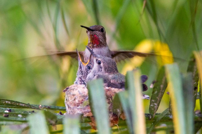
Hummingbird hatchlings double their weight in the first five days, and do so twice again within the next few days, so growth is rapid, and Sweetie was constantly inbound and outbound, as well as sitting quietly atop the squirming youngsters. As with mom, their names just came to me out of the blue—Bert and Ernie, in that chronologic order.


This shot reminds me of a helicopter, pitched over and accelerating out of a hover.
Bert, getting pinfeathers, while Ernie is still bald and closed-eyed.
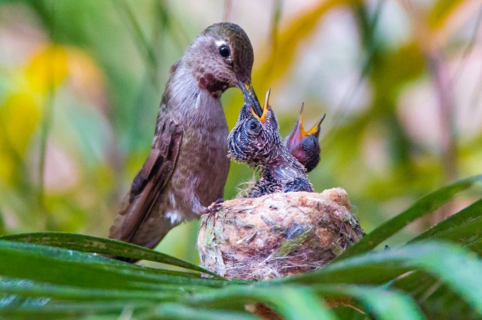
And then there was this moment when I just had to gawk and wonder what Sweetie was thinking as to the kids’ capacity to ingest, or her own, for the matter of that. Grasshopper tenderloin, still twitching and trying to extract itself. Darn near as big as she.


In short order the kids began stuffing the nest, feathers rapidly fattening their bodies, although Ernie still is modeling cornrows—Bo Derek, but no Dudley Moore.
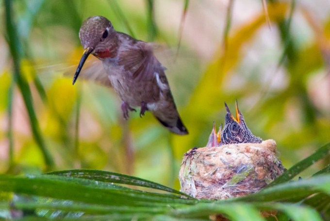
Click for a Sweetie food delivery
In time they were bulking up enough that it was often one inside the nest, and one hanging around the rim, usually the elder Bert.
Bert, being older and bigger, frequently got first dibs when Sweetie came in on a food delivery, but she was careful to feed Ernie as much. Check out the small bead of regurgitant about to transfer from Sweetie to Bert. Given that pooched out stomach, I expect Sweetie to let go with a 6.5 Richter belch. 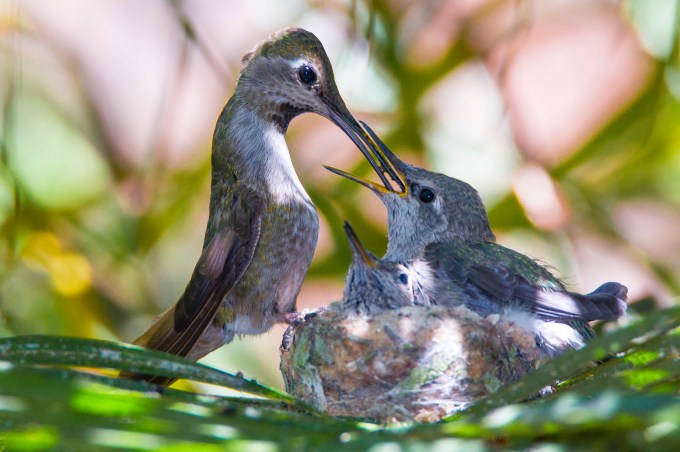
Mom, we’re hungry!
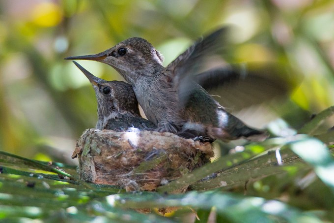
As the maturation progressed, Bert, in particular took to frequent self-preening. Whether to fluff up his feathers, or just basic fastidiousness, I can’t say. 
However, this behavior seems coincident with the testing of wings. Bert showing his stuff in the next six frames.

His full power pre-takeoff exercise was impressive, but he often collapsed in exhaustion right where he was, Ernie getting squashed by all two ounces of the elder sibling. 
A countenance of pure concentration.
Getting very close to turning a high power run-up into breaking those surly bonds of earth
Watch out!
OMG!

Bert, get back here before mom sees you!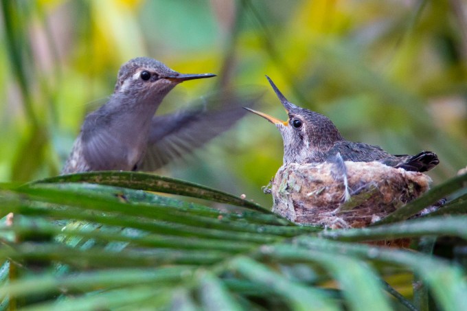
Let me catch my breath. This is so rad, Ernie!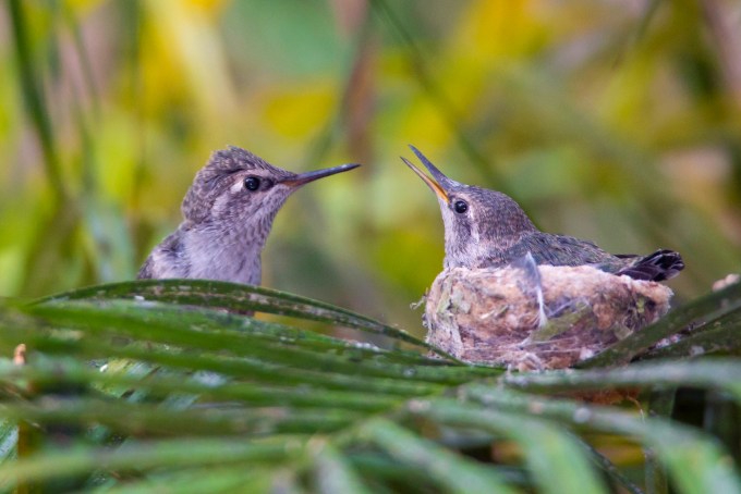
Mom, mom—look what I can do! Ernie, cringing and pretending it didn’t happen on his watch.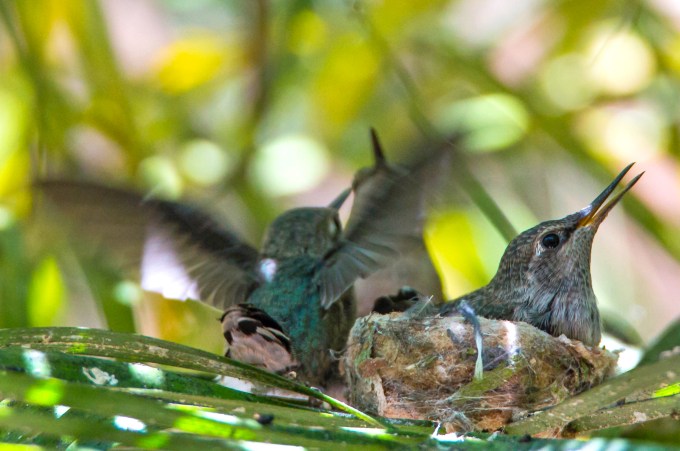
Landing gear down. Check. Flare for the touchdown. 
And then, the next day, the 10th of June, the inevitable…
Remember, you saw it here, first. Outta here. Look out life, here I come.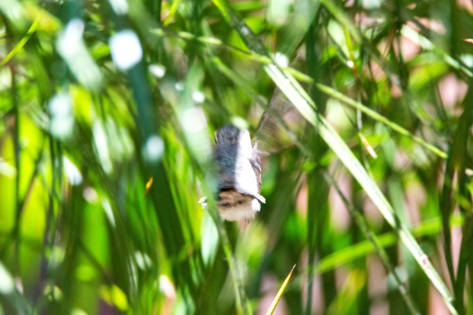
A singularly sad state of affairs…
…but at least, Ernie now has room to spread his wings.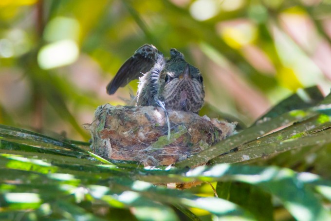
The next day we had grandparent (human) responsibilities up in Montrose, CA. Ernie was still solo in the nest when we left in the morning. But by the time we returned at the end of the day, I was heartbroken to learn that I did not get to chronicle his launch to freedom.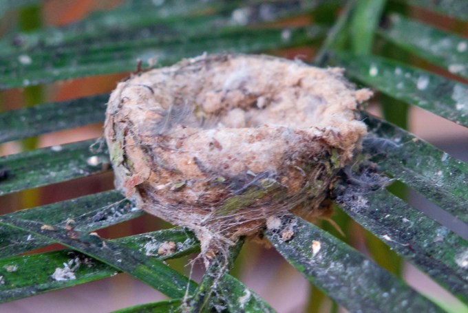
In closing, let me share a modest measurement of the scope of this magnificent event, the matriculation from tiny egg to feisty terror of the skies. It should help put our own lives in perspective.

!WOW!
Sorrow. And Joy.
Posted on December 24, 2015
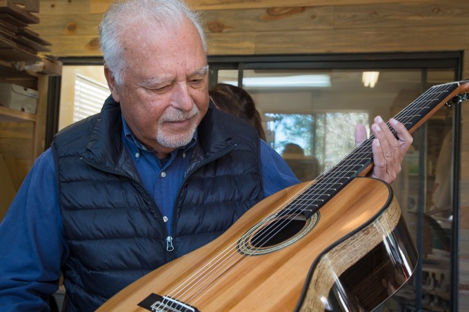
“Imagine the amount of sorrow this wood has seen,” said Pepe. “And Joy,” countered his son, also Pepe, of the surprisingly heavy wooden plank I held.

Spanish pine plank from Hospital Real, Granada, Spain
These would be Pepe Romero, my dear friend and neighbor, preeminent concert guitarist, and Pepe Romero—the son, whom I will refer to as Pepito, for differentiation—my growing friend, and masterful luthier, as guitar-makers are more properly called. And ukulele-makers, too, in his case.
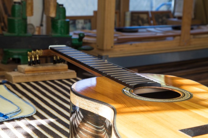
The rough-hewn plank of Spanish pine, its stubbly surface, coarse to my touch, was the point of reference in this discussion. And there, an arm’s length off my left shoulder were two magnificent, audaciously beautiful just-completed examples of Pepito’s craftsmanship—as yet unstrung Spanish concert guitars. Their faces glowed the pine’s rich honey gold, the sides and backs contrasting with the dark and light grains of rosewood.

Guitar on the workbench
The backstories of these guitars compel my sharing. Granada’s Hospital Real was built between 1502 and 1522 at the behest of queen Isabela and king Fernando of Spain, those monarchs who had bankrolled Christopher Columbus in 1492. This is when Spain, under these Catholic monarchs succeeded in pushing the Moors from the Iberian peninsula, the apogee at the time of Islamic expansionism. Originally used in caring for soldiers injured in the battle to retake the city, the structure then became the first European lunatic asylum, then hospital again, and now an edifice of the University of Granada’s library.

Golden hues
A Granadan artisan carpenter named Paco Montañez, who specializes in repairs and reconstruction of ancient historical buildings like the Alhambra and the Hospital Real, was employed by Pepe in a rebuild of his and esposa Carissa’s European-away Granada home. Paco had replaced a Hospital beam, and wood from that was being used in the Romero residence. Visiting Paco’s workshop and hearing the beam eerily singing as the saw cut into it, Pepe attested such apparently musical wood should be saved for use by Pepito in constructing guitars back in his Del Mar workshop.
Alone with Pepito the next day, he mused on the history of this wood, a massive beam five hundred years ago when laid in the hospital, yet having begun life a tiny seed dropping in the wind from a tree maybe a millennium before then.
What a humbling thought. What an exhilarating thought. How metaphoric for his own family tree, a story of the seed truly not falling far from the tree. And is it too far a reach in this season to not see parallels to the Christmas story, a humble beginning in a stable with the wooden manger, of a gift of love, of beauty and peace? The thought resonates with me, much more fulfilling than the hypertension of the malls.
The family, longtime residents of Del Mar, hails originally from Málaga, Spain. Pepito’s grandfather, the inestimable Celedonio, revered for his performance prowess and compositional genius, ever the gentle poetic romantic, and sire of the first family of the Spanish guitar—Celin, Pepe, and Angel. Concert guitar performances could be in any combination of numbers from solo to quartet, and all three sons are famous musicians the world over. Celedonio, and his wife Angelita have passed on, and the quartet now performs with Celin and Pepe, as well as Celino and Lito, Celin’s and Angel’s sons.
Pepito has shared with me that there had once been unspoken, yet palpable expectations that he, too, should join the family performance dynasty. But he heard and has embraced a different muse, turning his hands to crafting the instruments themselves, exquisitely creating beauty for the eye, the ear, and the tactile. Having known Celedonio for many years across the backyard fence, I find Pepito’s thoughts and philosophical expressions very… in tune… with his abuelo. I have no doubt that Celedonio smiles proudly at the broad curves and nuanced details of Pepito’s work and words. I know first-hand that his father does. For what it’s worth, so do I.

Rosette closeup
My dad, both a musician and a painter, conveyed that he saw human creativity as mankind’s modest recapitulation of God’s seminal expression of creative love—by humans, at once an homage, a touch of the sincerest form of flattery, and a fulfillment of mankind’s destiny as breathed into humankind at creation. I express it poorly, and for some this will sound too too. Whatever, for me, it is essential truth. It is why I love beauty as the fruit of creativity. And it is basic to the natural resonant camaraderie Celedonio, his sons, grandsons, and great grandson, Bernardo and I share.
The creation of music and the tools for its performance, its composition, its transcriptive adaptation, the philosophy of its place in the world, the appreciation of its beauty and redemptive powers, even the poetry flowing from those who would embrace all this is the family tree that lives from the seed of Celedonio. And it glows quietly and exquisitely in Pepito and his creations—his gifts to the world.

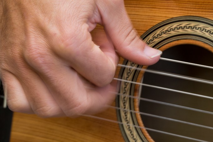
Pepito, testing the timber’s timbre
Generational hand and the wood’s lyrical voice
Uncle Celín savoring the new guitar

Oldest son, grandson, and a very Spanish Spanish guitar. And my, but the young Pepe resembles his grandfather.
I referenced the season and the Christmas story above. Let me add a whimsical tangent for you non Latin or Catholic scholars. Both of the Pepes are actually named José, the Spanish version of Joseph. Joseph is considered Pater Putativus, or “P.P.”—Latin for “father in name only.” In Spanish, the letter “P” is pronounced approximately as in “pay,” and PP would be pronounced Pepe—the Spanish nickname for José. Who knew?
‘Tis the season of giving. Each of us having received the gift of life and the gifts of our living. It’s the season in which we take stock of our blessings and seek to share blessings with others. My neighbors give the gift of music to the world, caretakers of their unique capabilities and lineage, a human parallel to the sojourn of the pine seed. Beauty shared with us all. From my father, I inherit a particular affinity for this sort of thing, and I relish my proximal opportunity to convey this modest story as my Christmas season gift to you.
As Ever, T
A Super Blood Moon
Posted on September 28, 2015
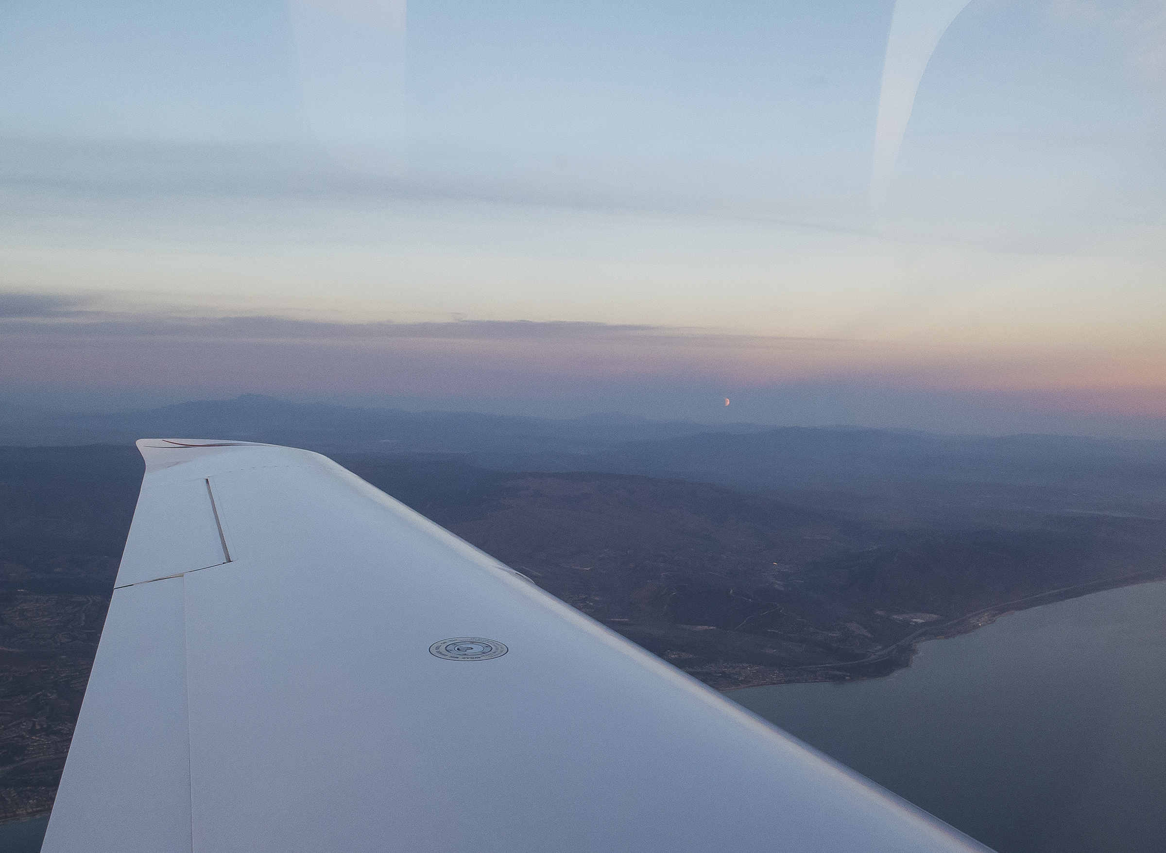
Eclipsed moonrise. Honest, just to the left of the peak on the right.
As is widely known, last evening’s so called Super Moon also treated us to a Blood Moon total lunar eclipse in the bargain. A sufficiently infrequent event that I was positively salivating at the prospect of using multiple cameras to get both a time-lapse and still images.
Then, just this week we got word that Cathy’s brother Steve Zeisler had selected yesterday, Sunday, September 27th as the day he was retiring as the senior pastor at Palo Alto’s Peninsula Bible Church after a 43 year run there, following his time as a Stanford University student and football athlete. Another sufficiently infrequent event, that it, too, was not to be missed. We took trusty N111TT and flew up for the day, the plan being to leave there in time to return to Montgomery Field, put the plane away, and rush to my chosen photo site along a ridge in the Torrey Pines Reserve. Boy, but there were a lot of well-deserved testimonials from the Stanford and Silicon Valley types that are the parishioners there. Steve and his bride, Leslie are such a class act, so genuine salt of the earth types, and the affection of their friends is so sincere, this was a thoroughly touching event, and an honor to be there. We quickly forgot the scooting out midway through plan, and Cathy, Torrey and I stayed until everyone repaired to the patio for munchies and drinks, then scooted out.

Steve and Les

Dynamic Duo

Steve reflecting on forty-three years of service to the lord and his parish
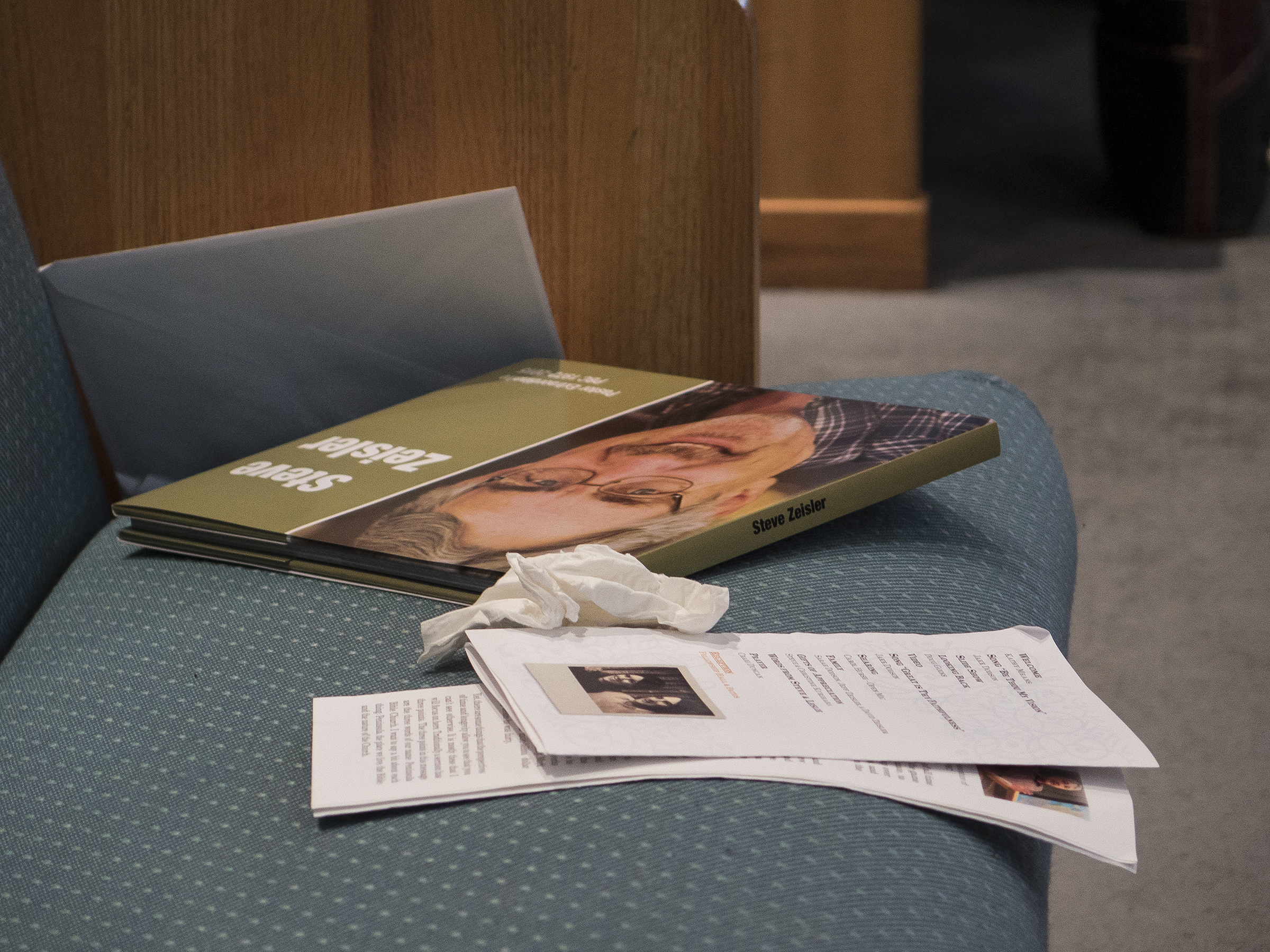
Pew reading of a different kind
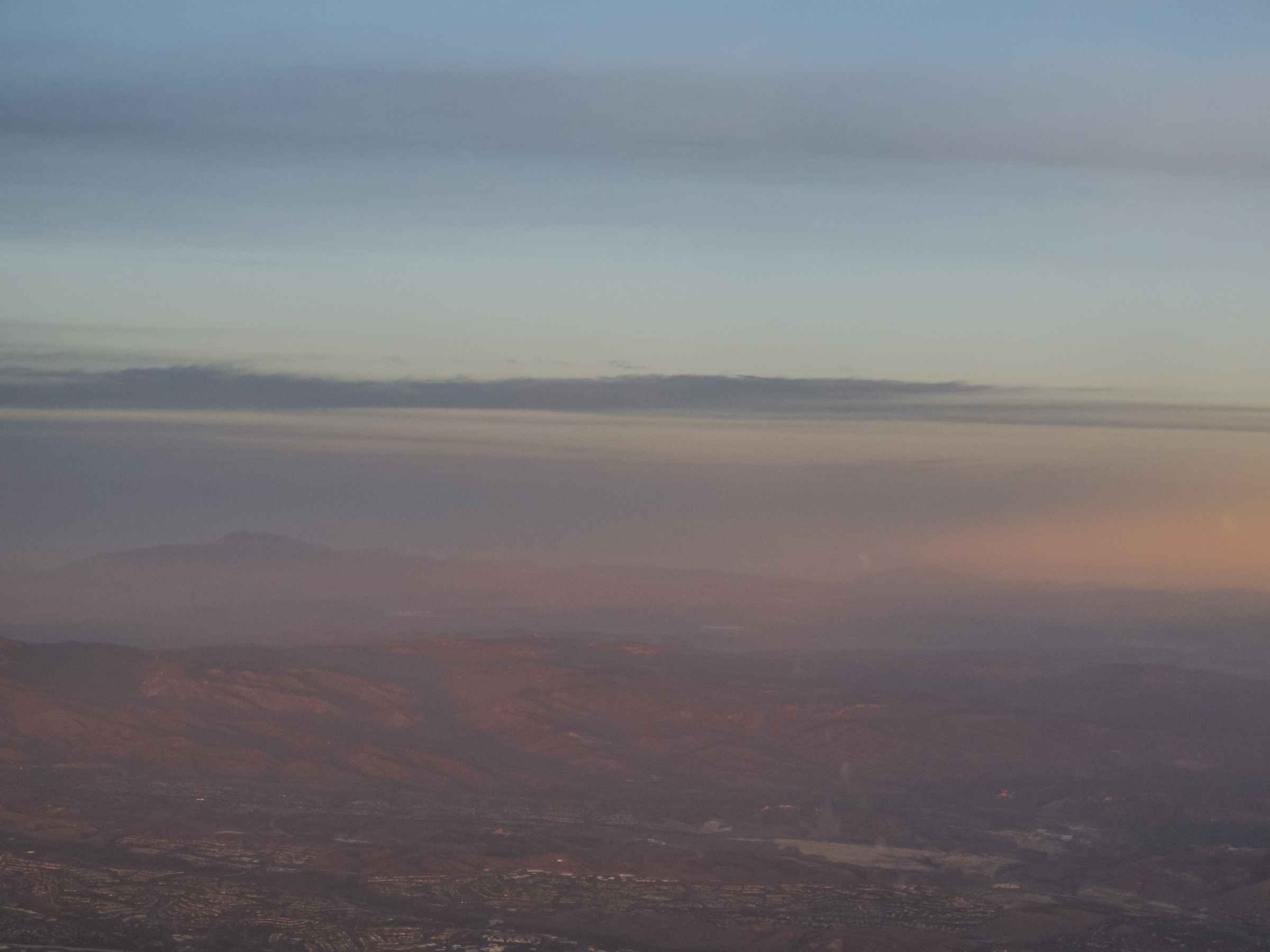
We took an Uber ride back to Palo Alto and were shortly ensconced at 9,500 feet on a nearly direct southeasterly course. The flight was smooth and scenic in both directions.
Near Avenal. Surface convolutions the Fault of San Andreas plate tectonics

Near the Simi Valley. Nice avionics reflections in the windscreen.
While still at the church I figured if we got off by four-thirty, we should be able to catch the initial moonrise while near the Orange/San Diego County lines, and that is exactly how it turned out. As promised, the moon broke the horizon already showing the penumbral shadowing of a partial eclipse heading toward totality—best seen on the initial image, above.
Laguna Beach moon view
A Torro Peak moon

Peaks and moon
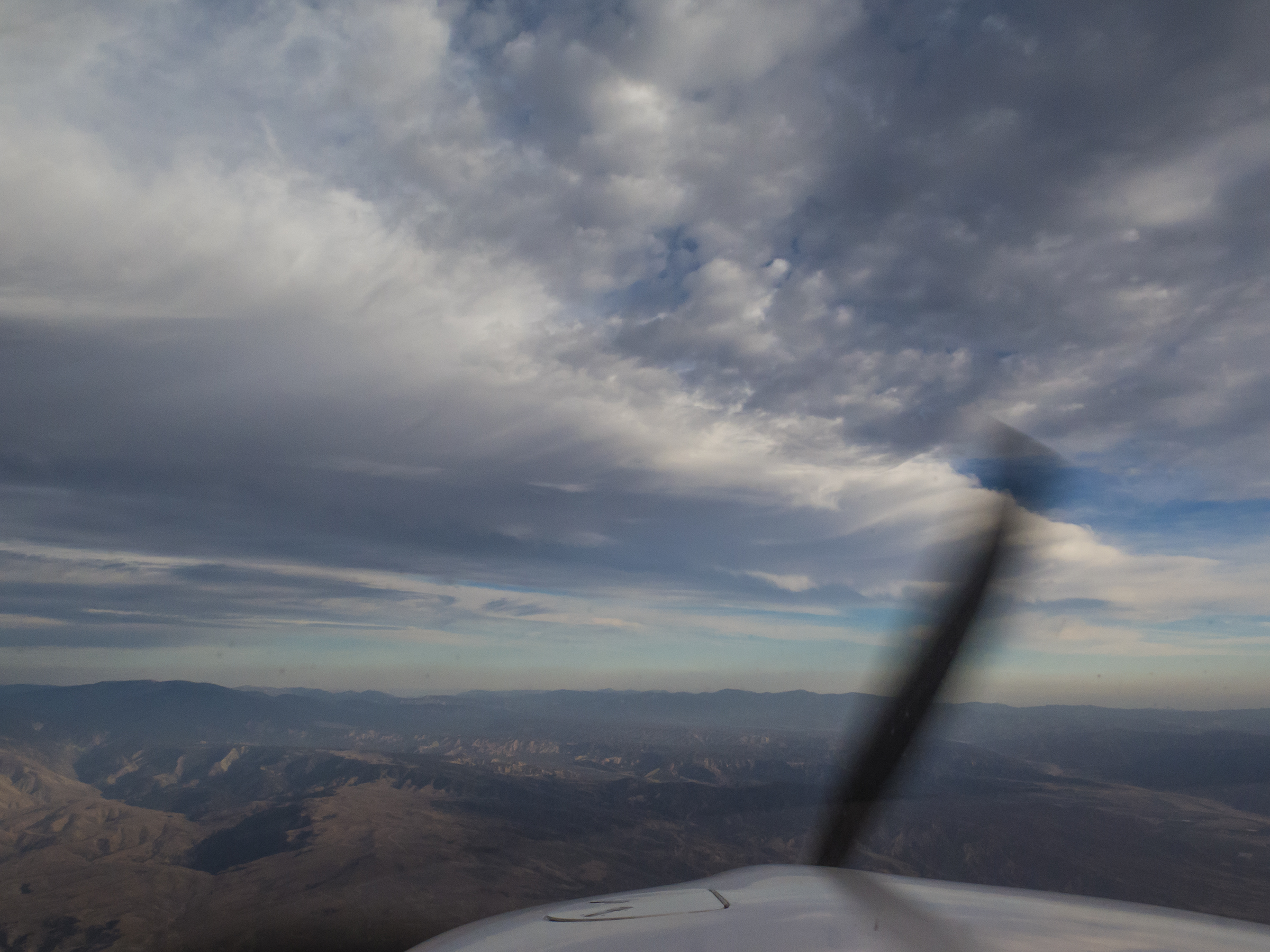
Arriving and maneuvering for our landing, I eschewed my usual hand-flown descent and made liberal use of the autopilot to free me up for images of the rapidly advancing umbral shadow of the developing total eclipse. What a great platform to accomplish all this.

Off La Jolla Shores on descent. An indicated airspeed in keeping with the desire to get the camera and tripod set up on the ground.

Entering left downwind for Runway 28R
Airplane back in the barn, I was able to set up just off taxiways Bravo and Hotel for this positively glowing view.
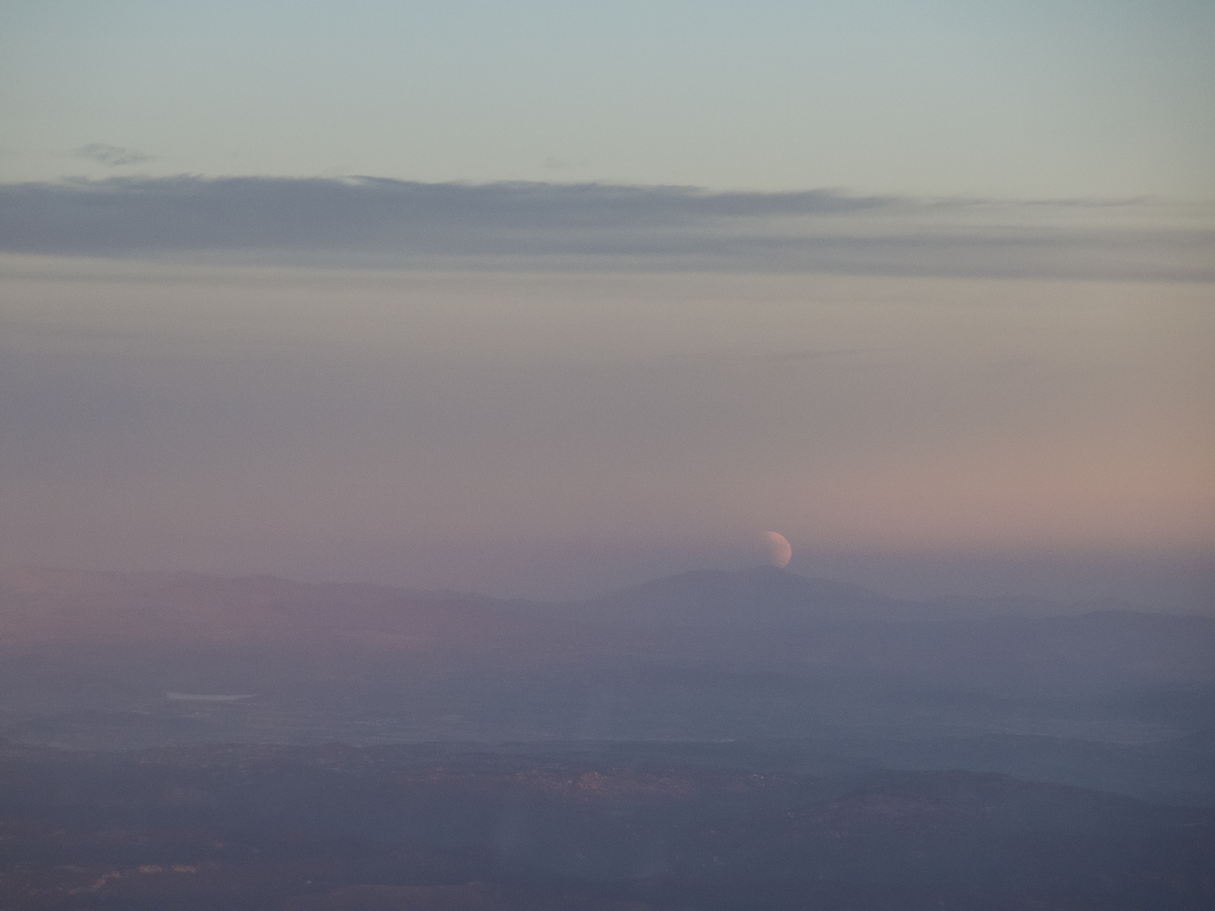
Cowles Mountain moon
A few more shots there, then back to Del Mar for additional images of the various stages of the Blood Moon, which is not easy for me to shoot well. The dimness of the eclipse makes focusing and exposure a challenge, especially if you want to bring out the lunar surface features.

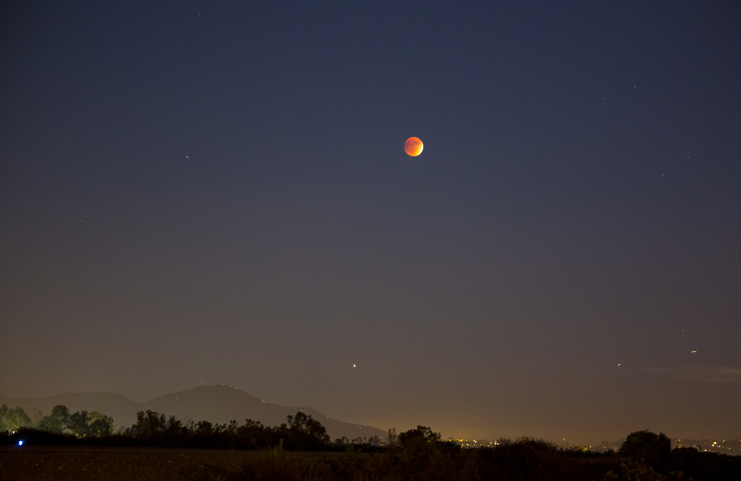
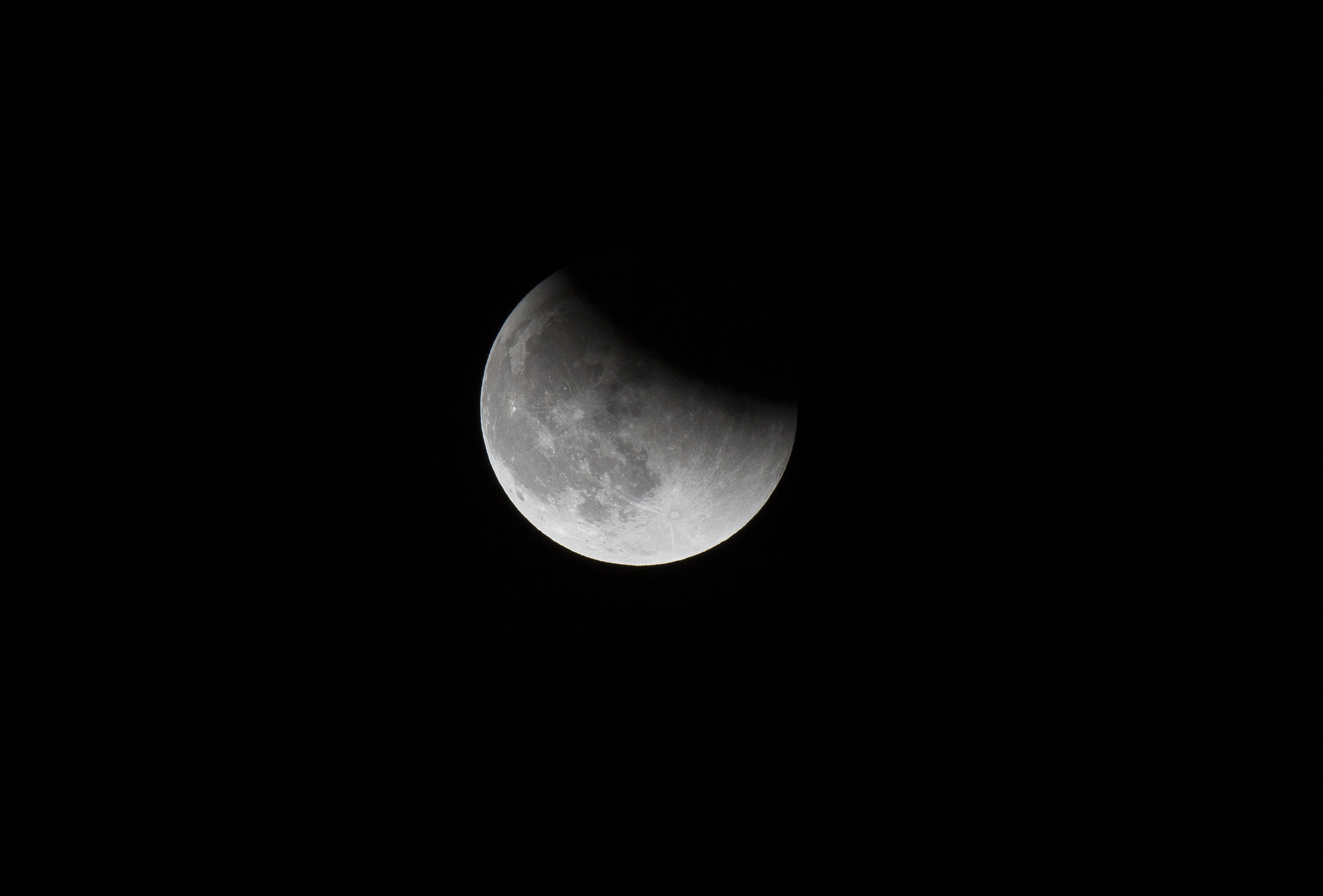
Blood super moon, nearly at totality

Just after totality, with the umbral shadow retreating and the penumbral easing in from bottom to top
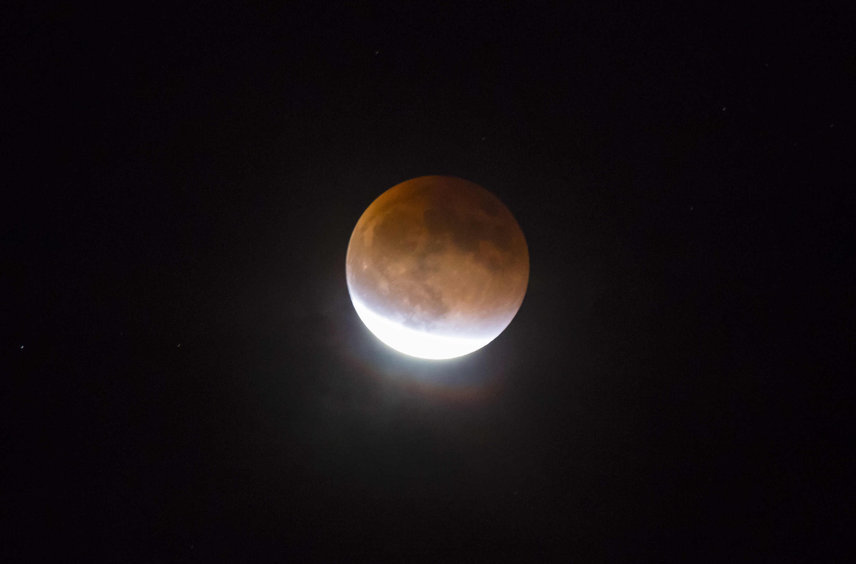
Waning umbral blood moon
The farther the shadow retreated, the easier it was to focus and reveal the surface mare, craters, and green cheese.
Lesser eclipse

Nearly over
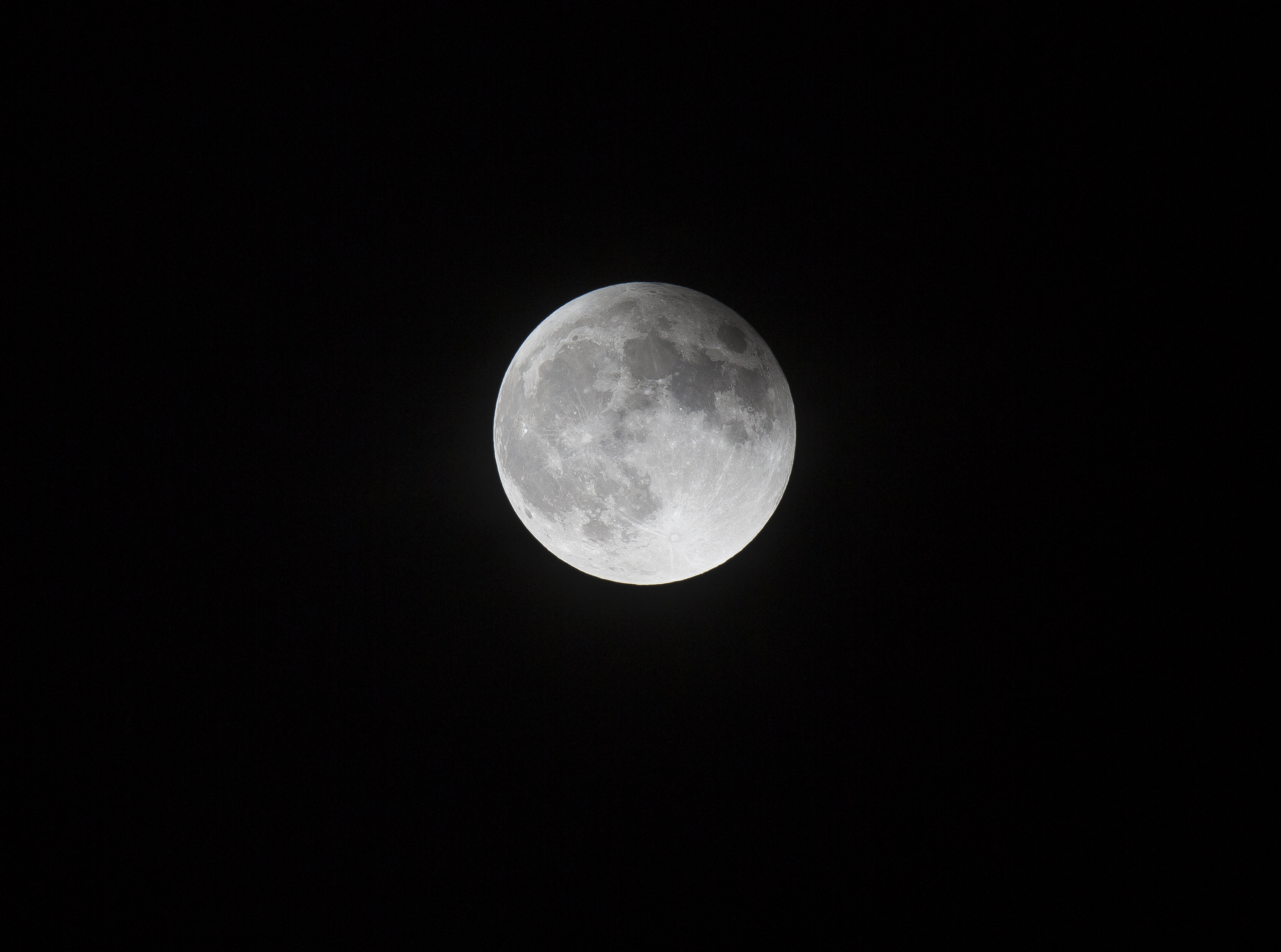
Super moon
I had researched the moonset, as well, which was this morning at 07:15. I made my usual mental request for the muse to awaken me if there was going to be a viable show. I awoke at 05:45 and discovered pea soup fog had enveloped us, so I rolled over trying for more shuteye. Then about 06:30 the muse alarm went off, and I discovered a fog reprieve.

Hidden moon. Look closely, the moon is dead center in the frame, peaking through a narrow horizontal gap in the cirrus clouds.
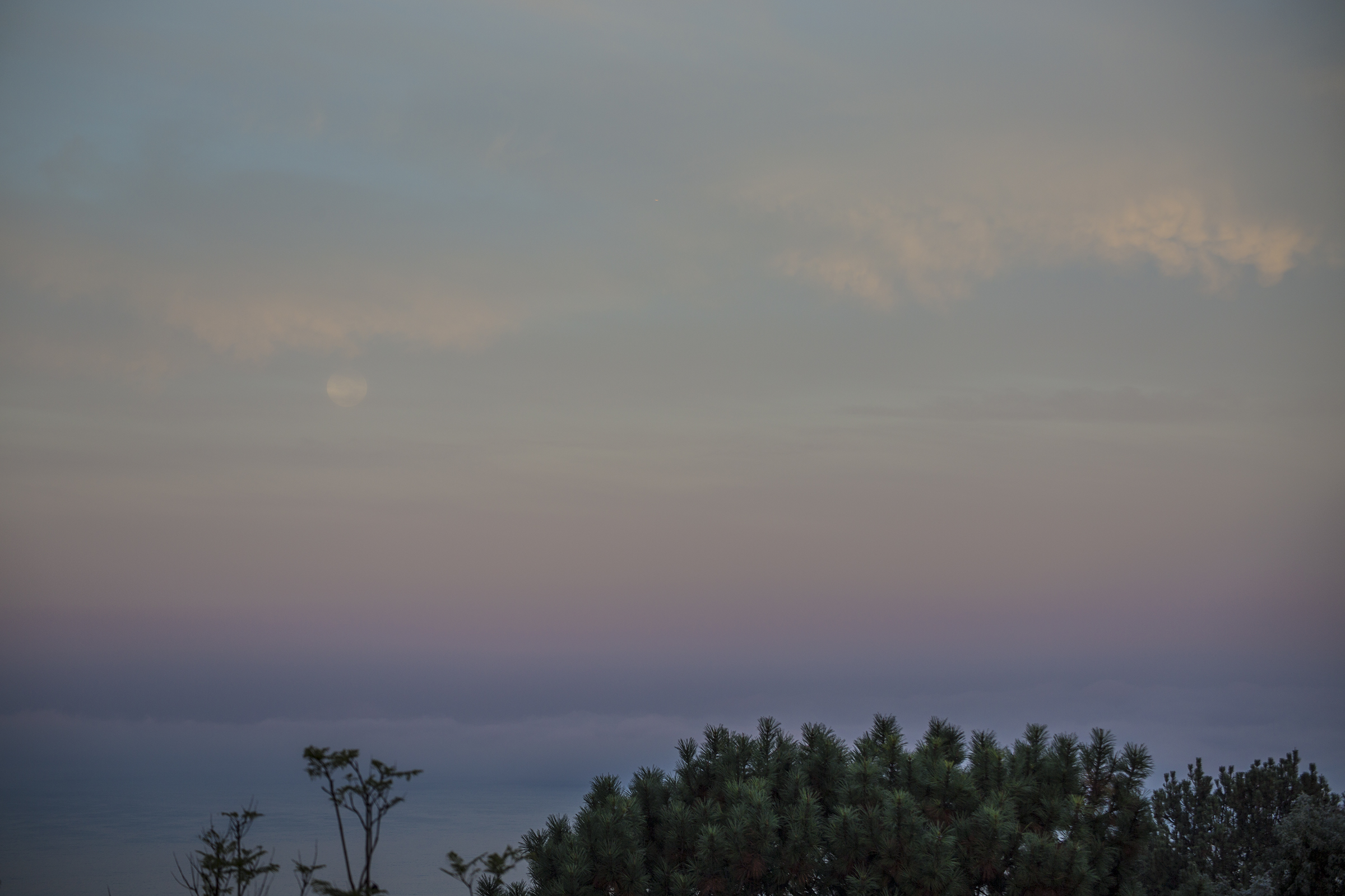
Descending into dawn, the temporarily retreated fog just offshore.
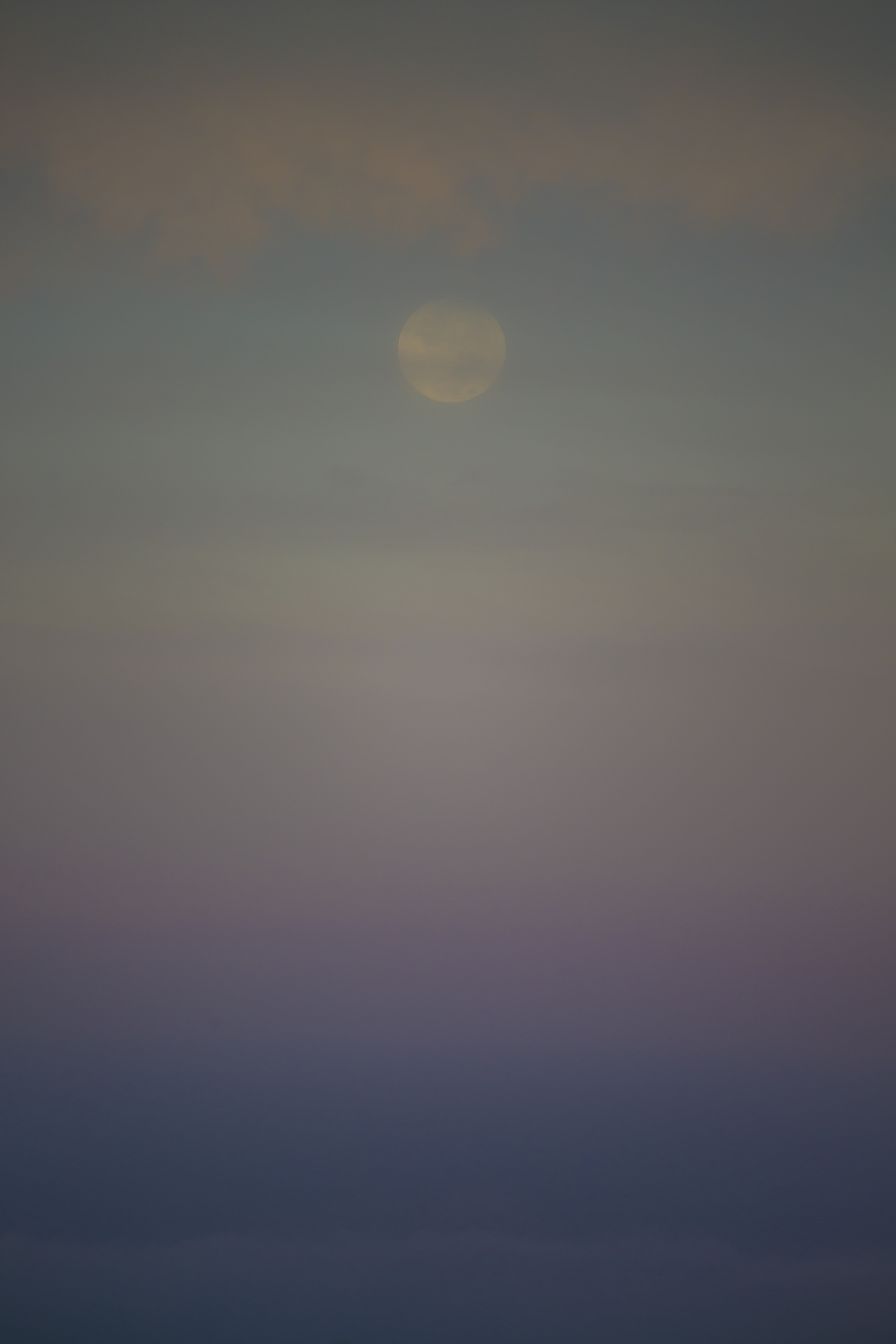
Pastel moonset

Serendipitous moon bird
So, all in all, a nice day in the life. Great for we three Del Martians, bittersweetly reinforcing for Steve, Leslie and family. As ever, TWC
There and Back Again
Posted on July 5, 2015

Like Rumpole of the Bailey, I am wedded to “She Who Must be Obeyed,” also known as “Ol’ What’s Her Name,” affectionate titling for my bride of THIRTY YEARS! this month. Trying unsuccessfully to keep up with my dotage, Cathy nonetheless managed to qualify for Medicare in May, ample motivation for a celebratory trip, adventurously worthy of age denial and anniversary exultation. Naturally, I obeyed her summons, and agreed that biking some 255 km (160 miles) across undulating bucolic southern Czech Republic topography fit the bill handsomely. “Yes, dear, whatever you say, dear,” sayeth Brer Rabbit, eyeing this central European briar patch. Perhaps I should mention that the Czechs exceed, by orders of magnitude, other countries’ per capita beer consumption? Pilsner is named after the Czech city of Plzen, after all. This is a country where pivo, as beer is called, is a daily part of the fabric of life.
In her inimitable way, Cathy’s research turned up a splendid outfitter in Loren of Pure Adventures www.pure-adventures.com specializing in self-guided bicycle and hiking trips. Loren, a European ex-pat, now living in Scottsdale, and his Czech in-country counterpart, Tomas, promptly fielded every request and lame question with equanimity, putting together a trip that challenged us without breaking us. Every detail was covered from navigation to accommodation, from surface transit to electrical plugs. Loren and Tomas must operate in a 48 hour per day universe, they were so capable of patiently responding to our every concern. Everywhere we had quality lodging, routinely the best place in each town, as often as not, on or just off the main square. We provided the propulsion, but Pure-Adventures took care of the logistics. Each day we sallied forth with bicycle panniers and handlebar bags carrying day gear, leaving our suitcases with hotel staff. By the time we arrived at that day’s destination, our bags had been transported ahead, awaiting us in our new lodging’s rooms.
I wish to step back and approach our adventure somewhat chronologically, mentally ambling as I go. We decided that as long as we were going to be in “the neighborhood,” why not begin by exploring Salzburg and Vienna, Austria, and finish with Prague? And then there’s the matter of a gateway to get there and return. Somehow or other we managed to find space available for pass riding on United from San Diego to Munich—then surfaced to Salzburg at the outset, and back from Prague at the end.
Salzburg, with a population of some 146,000, is a delight to the senses—the birthplace of Mozart and the setting for The Sound of Music, an approachably-sized city, redolent of western culture, and bisected by the Salzach river. Our Hotel Elefant lodging was thoroughly modern within, notwithstanding being a 750 year-old baroque structure in the exclusively pedestrian cobblestone pathway Altstadt (Old City) just steps off the river’s left bank, and loomed over by the Festung (fortress).

The Salzburg fortress overlooking the Salzach

Sunset over Salzburg’s Salzach river
Festung Salzburg from the Mirabell palace garden

A regular sighting—musicians about town, Salzburg
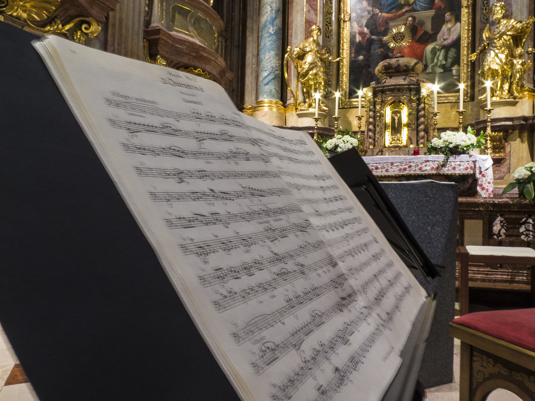
As I say, Salzburg is suffused with culture, a fitting nurturance for Wolfgang Amadeus, with art and music everywhere. Here we began what turned out to be a recurring theme, walking to a marvelous early evening concert of piano and violin sonatas performed in the acoustically live Schlosskirche Mirabell (Mirabell palace church) followed up with dinner at a walk-side cafe. You’ll notice that we had front and center seats, this event drawing maybe thirty attendees—not a testament to the quality of the music, but rather the number of such events available nightly.

Mozart Sonata for Piano and Violin in C-major. Schlosskirche Mirabell, Salzburg
On another evening we took sustenance just across the street from Mozart’s birth house.
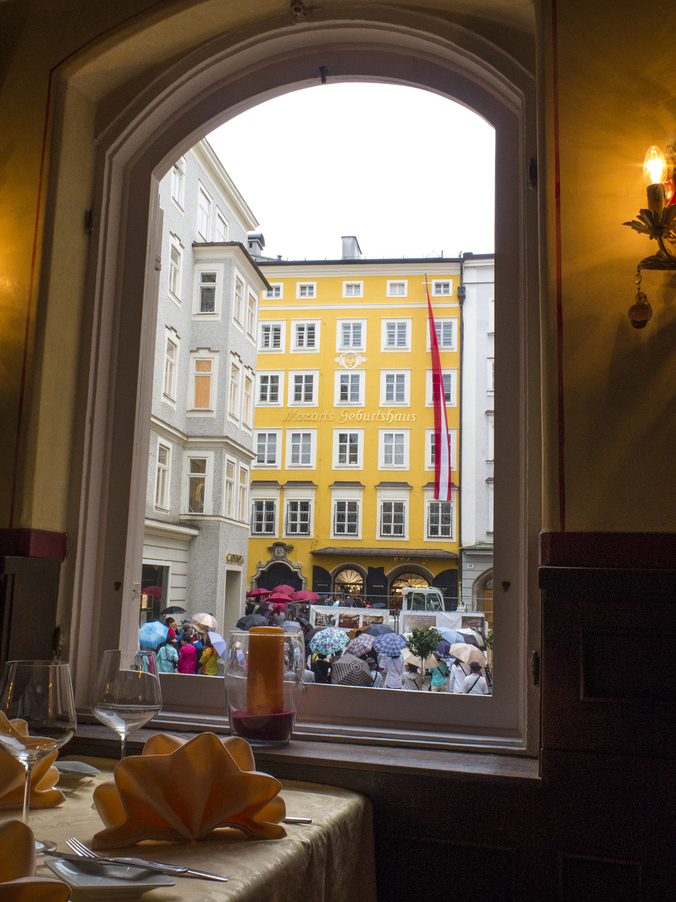
Mozart’s birth house
And what could be more fitting than strolling to the Augustine monastery’s brewery beer garden on a warm afternoon? Sit in the deep cool shade of the trees, consuming delicious beer drawn right into your mug from wooden barrels to quaff down grilled sausage and potatoes, while people watching and conversing in rusty Deutsche and English with the table of gentlemen next to us. A vignette—free WiFi is ubiquitous everywhere in Austria and the Czech Republic. One of the gents, just off the frame to the right, looked exactly like NFL coach and commentator John Madden. I pulled up Madden’s photo on my i-phone and showed it to him as conversation ice-breaker. Not that much ice breaking is needed after consuming a couple of half liter mugs of cold brau.
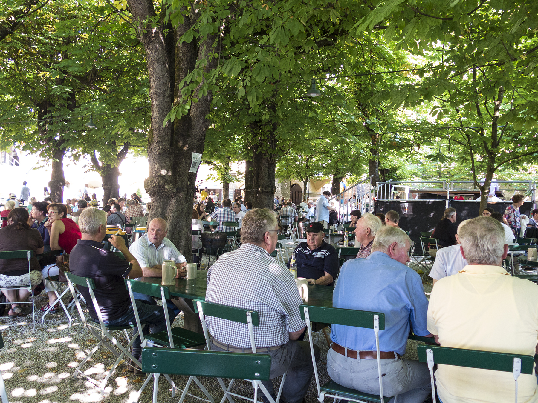
Augustinerbrau Biergarten, Salzburg
From Salzburg, we took the WestBahn train on to Vienna, no reservation needed. The train leaves just about hourly. Pick a seat, and pay by credit card when the conductor meanders by. Two hours later we de-trained, and grabbed a cab to our Hotel Mailberger Hof, just off the main Kartner Strasse pedestrian pathway, and two blocks from the famous Vienna Opera House.
Cathy and I found Vienna a bit excessive, as compared to the more embraceable scale of Salzburg. But there is much to love. This is the musical city of Mozart, Haydn, Beethoven, Brahms and waltz king Johan Strauss.

Vienna Johann Strauss monument
It is a city of monumental cathedrals, castles and parks, the Danube flowing by on its way to Budapest. Residents and visitors are at once immersed in all this. An interesting aside, perhaps modest testimony to the egalitarian nature of Austria—Cathy and I cannot remember seeing a single police officer in either Salzburg or Vienna. Also, another quirky aside—what’s with languages changing another country’s place names? To Austrians, this city is Wien, not Vienna, and Prague is Praha up in the Czech Republic.

Vienna Stephansdom Cathedral

Upper Belvedere, Vienna

Maria Theresa, Hapsburg queen and mother to Marie Antoinette and fifteen others, including two Holy Roman emperors. The “Let them eat cake” Marie Antoinette.
Across the street from the Opera House is the Hofburg Palace, and its lovely Albertina art museum, where one can take in works from the likes of Michelangelo Buonarotti, the creator of Florence’s statue of David, the Vatican’s Sistine Chapel ceiling and marble statue of the Pieta. Here’s a sketch by the master, a study for the statue, perhaps?
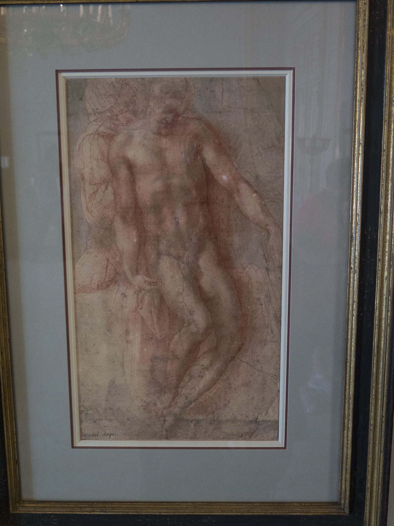
Michelangelo Pieta drawing, Vienna Albertina
It had been quite warm while we were in Salzburg, and afternoon thunderstorms attenuated that as we arrived in Vienna. Our hotel was here, on Annagasse, another cobblestone pedestrian-only pathway. Gasse is the German diminutive for Strasse, or street—gasse, being too modest to call a true strasse street. The name Anna refers to the church Annakirche, the steeple of which is reflecting in the residual rain puddle. That’s an Italian cafe, upper left, where we had a late lunch on our first day in Wien. The next table over had two singers, conversing in English as their common language, starring as Leporello and Donna Elvira in that evening’s performance of Mozart’s Don Giovanni, tickets in hand for the sold out performance, which we had already acquired from a scalper dressed in 18th century attire. You just can’t make up this stuff.

St. Ana Church spire, Vienna

Wiener Staatsoper Cathy

Vienna State Opera House from our box seats
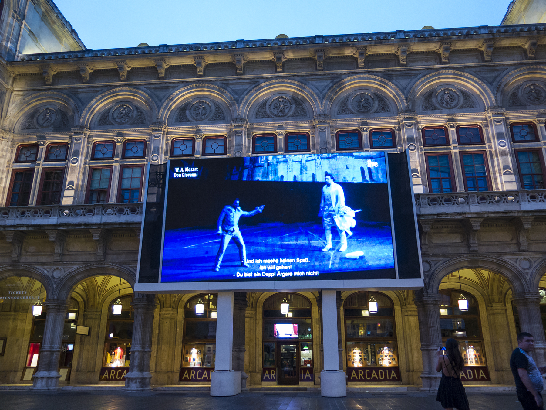
Jumbotron of Don Giovani live for passersby, Vienna State Opera House
Okay, it’s not every Del Martian beach bum who can claim to have climbed the gilded stairway of the world famous Staatsoper Wiener, and then watched a Mozart opera from a box seat, before wandering outside after intermission to capture the action with culture-embracing street people. But I am a pushover for smaller ensembles in baroque settings with the tight acoustics of stone, granite, and gilded statues beneath lofty arched ceilings. For our second evening in town, I secured tickets to a string quartet performing “right next door” at the Annakirche. Oh, my, what a glorious setting and what beautiful music.
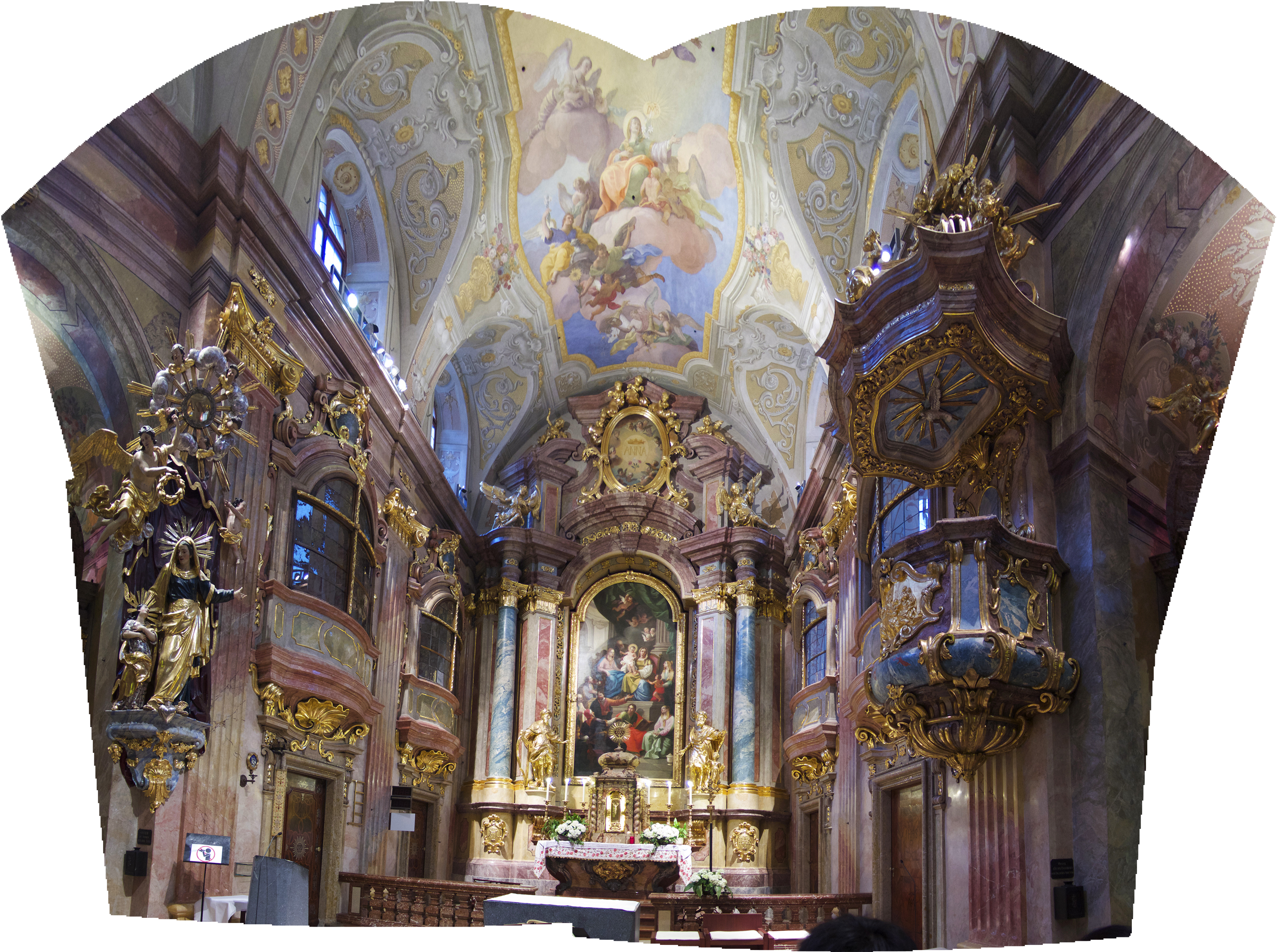
St Ana Kirche panorama
I know, but to clean up the panorama composed of four images, is to cheat you on the vaulted splendor of this place, which nonetheless was only about the width of twenty parishioners side to side. They don’t make them like this anymore.
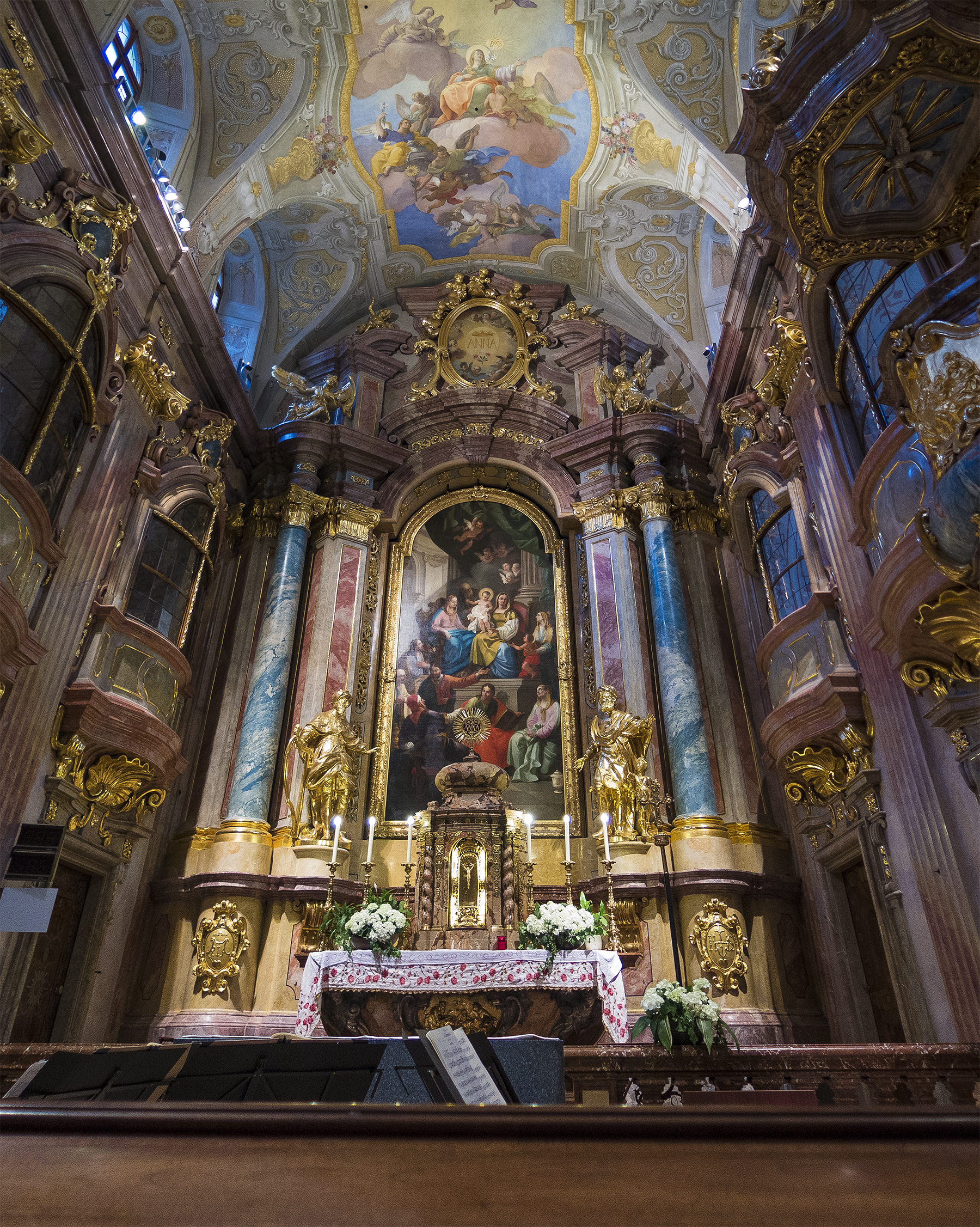
St. Ana Kirche, Wien
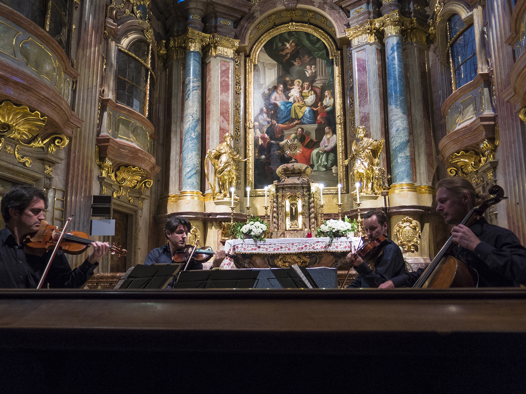
St. Ana Kirche Quartet
Yes photos, surreptitiously snapped, without flash, were allowed at all of our small venue performances in Europe. I asked first, and was very unobtrusive in the taking. Chamber music just isn’t the same on a recording. Being up close with small ensembles in tight hard-surfaced venues you not only hear the nuances of each instrument individually, but feel them viscerally. The horsehair of the bow literally vibrates across the strings and comes at you like some sort of wondrous musical washboard road. And do you not feel like royalty wafted along in gilded splendor?
A Haydn score, St. Ana Kirche, Wein
Another snippet from my goofy noodle. Hollywood Boulevard is a Johnny-come-lately to the sidewalk stars, which are scattered all over central Wien. This one is for fellow United pilot retiree Pfred Hayes (he mocked himself with his silly spelling) who was a music major in college. One of his professors had been an oboe performer in an orchestra conducted by Maestro Toscanini. At the end of a rehearsal, one of the oboist’s valve mechanisms structurally failed, and he dutifully and nervously presented himself to the maestro to explain his plight. Mr. Toscanini just stared quietly into space for a few seconds before replying that this would not be a problem, as that particular valve would not be needed at any point in any of the pieces being played that evening. The maestro had mentally fast forwarded through all the evening’s scores to render this judgement. Apocryphal? Perhaps, but what a juicy story.
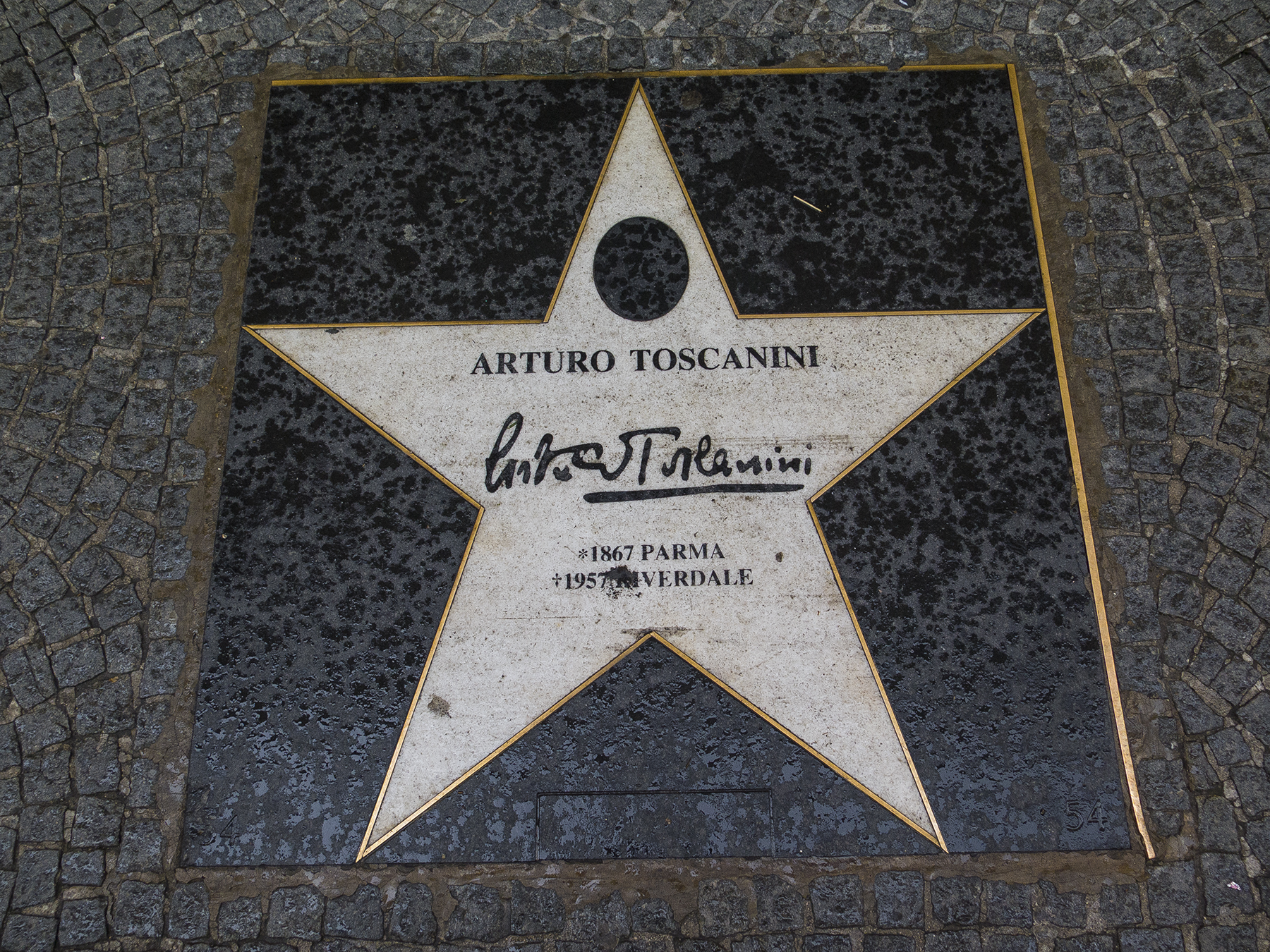
Rockstar
The Vienna Bucket List box checked, it was time to take the train to the Czech Republic. A couple of side stories, here. We were planning on taking a trolley to the Meidling Bahnhof (train station) but I slipped up and got us on a local bus. It got us to the station, just fine, but as a milk run through multiple Viennese neighborhoods en route. Part of the fun. Our train took us to Breclav, which is pronounced Brehslav, and this is a fitting segue into the Czech language, which I admit intimidated me as we pondered this trip.
Like Hungarian, Czech is a language unique to itself, seriously challenged by the lack of vowels where our tongue would wish to place them, and with pronunciations at which even the Czechs shake their heads. For instance we pedaled through Znojmo, which is pronounced “Noy-mo,” and stayed the evening in Telc (Telsch) and Trebon (Chey-bonya). Go figure. Loren’s instructions gave us to understand that English would be little used or understood at the small places making up our biking venue, although we could hope for some English in Prague, or is that Praha? And we’re biking through here on our own? Gulp. I’m happy to report that we found that English worked fairly well amongst younger people in the small towns of the south of the Czech Republic, and our Google translator phone apps and Pure Adventure mini-glossary helped. That and smiles, and dumb “who me?” looks generally got the job done, especially when older cafe-keepers would call out their young offspring to translate. A case in point, on one day, nearing Trebon, we needed a stretch and butt break, so peeled off at a tiny cafe abutting our two bike-width path. We sought food and a libation, which turned out to be goulash and a mineral water. The goulash really called for a pivo, but we still had kilometers to ride ahead of us. Pondering the menu was greatly assisted when the owner called in his high school age son, and before we knew it we were honored special guests, given a wonderful pamphlet (in Czech, English, German, and Spanish) extolling the region we were biking through and would we please except a free serving of their in-house specialty of fish something or other? The kid was great, keenly interested in all things English language, especially when he learned we came from the U.S., evidencing frustration that as yet his vocabulary was insufficient to convey all he wished to share, and assuring us that English was his favorite subject in school. A pathway lunch stop turned into an iconic cultural moment. Why we travel.
Another sub-tangent, here. The Czech are a proud and conscientious people. Their geographic location between Germany to the west, Austria (as in Austro-Hungarian empire) to the south, and Russia to the north, has produced its fair share of subjugation, recently during and after WWII, about which more, anon. For now, recent history reminder is that Vaclav Havel and other intellectuals effected the Velvet Revolution to throw off the Soviet yoke in 1989, and the Velvet Divorce, to separate the Czech Republic out of the former Czechoslovakia four years later. This is the nation through whose countryside we bicycled, on a route designed by Tomas to give outsiders a sense of the beauty, history, and culture of his land, apart from the tourist sites in Prague. I can’t overstate how glad we are that we got to experience this.
Navigation is clearly an important aspect of a self guided trip in an unfamiliar country with a language and alphabet all its un-pronounceable own. The following scans from the very documents we had arrayed daily before us in our clear plastic-covered handlebar bags—the bicycle version of an aircraft Heads Up Display—give a hint at the thoroughness with which our routes were prepared. The actual maps were scaled such that each grid was one square kilometer, which made estimating distance simple, although estimates were unnecessary, given that the textual guidance was accurate to the 1/10th of a km, and our two GPS units were accurate to 1/100th of a km.
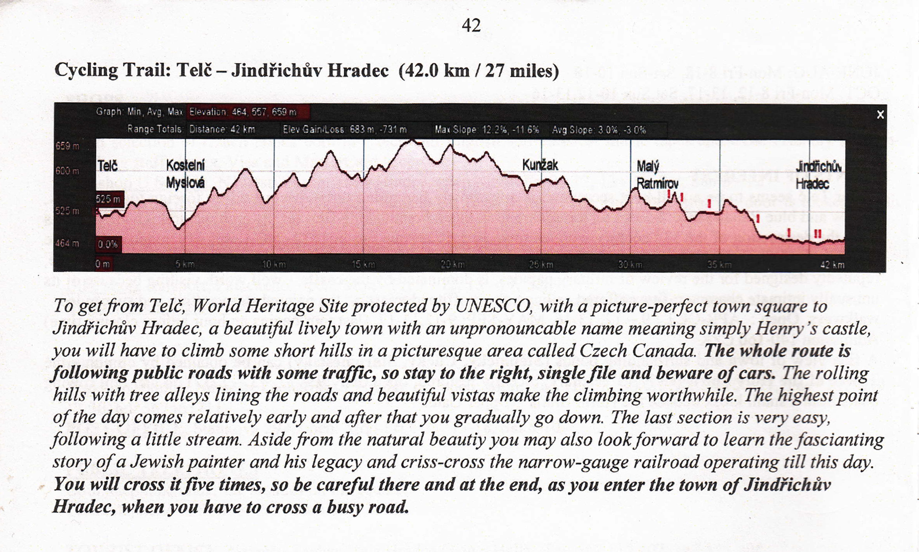
Telc—JH topo overview

Telc-JH text
Yes, the yellow highlighting was already on the maps when Tomas provided them and walked us through the basics of the travel package at our excellent pension in Valtice, CZ.

Telc—JH map
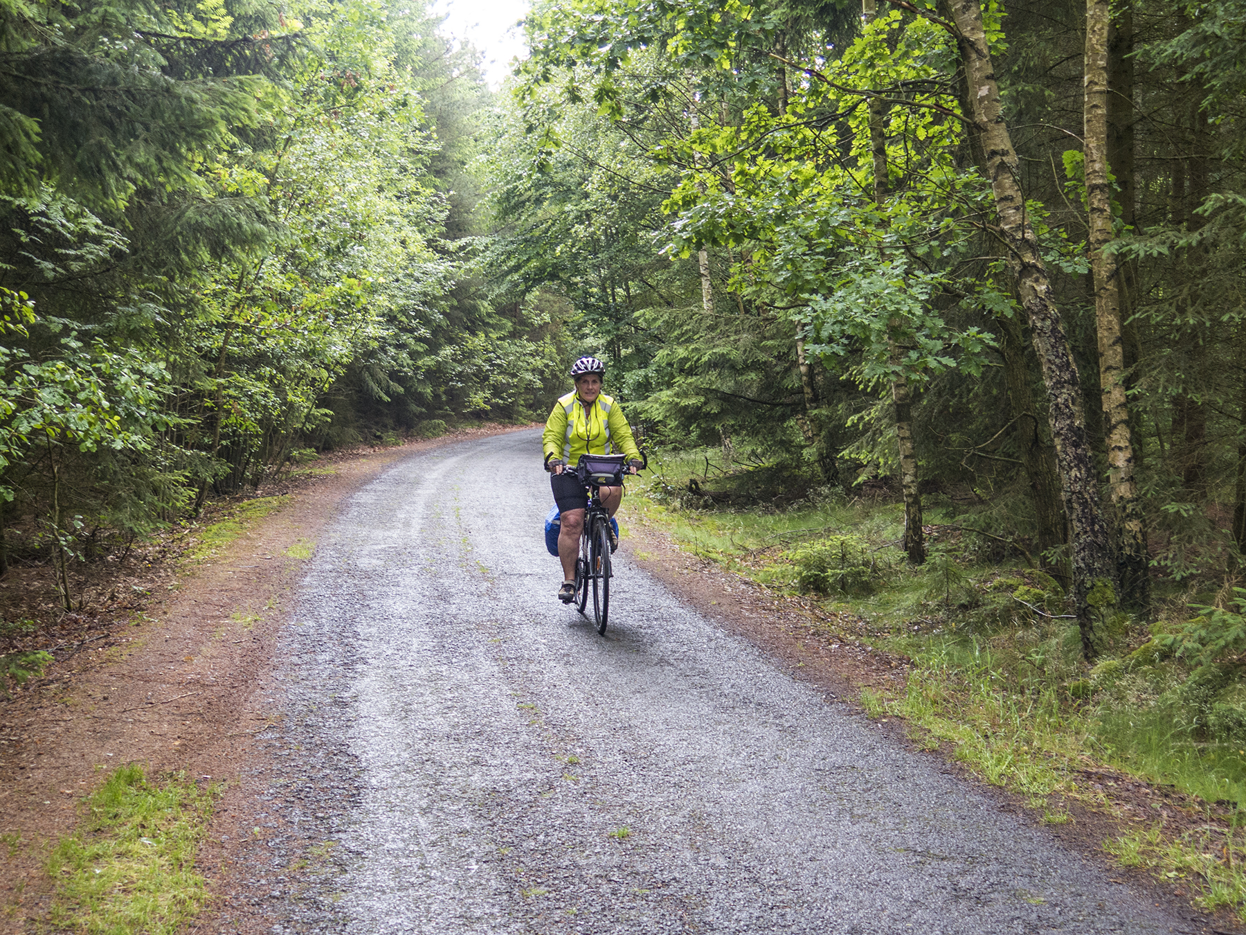
Out on the road, the Czech Republic provides clear guidance. CZ is a bike-friendly place, with bicyclists and bike routes encountered regularly. I wonder if biking’s ubiquity is because they are a healthy robust people who like the out-of-doors, or maybe if some of that became a necessity when under Nazi or Soviet thumbs? At any rate, the signage was great. This sign was at a juncture of two hardpack dirt paths in the middle of a forest.
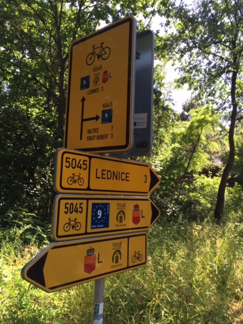
Czech bike sign
When we were on roads they were generally tertiary or secondary paved country roads with minimal auto traffic. The Czech drivers were routinely courteous, angling to the far side of the road as they passed us, and the roads were invariably clear of glass and other bike tire-damaging debris. And with each town one entered, there was a sign telling you the name of the place, and another as you left, indicating that you were now leaving that named place. Good information, itself, but also, precisely to the tenth of a km, accurately annotated on the textual directions. I quickly learned that passing these signs, it was invariably beneficial to re-zero the second of the two kilometer readouts on my GPS, as this micro-updating kept us out of trouble when we might encounter confusion as to which juncture to depart from the small town square, say. For example in one tiny town, the GPS, updated when we passed the “Entering” sign, coupled with the textual directions, told us we should be at a picket fence, where we would discover a tiny bike path angled off in the direction we needed, but a hundred or so meters out of sight over yonder. A woman and her adult daughter saw us circling and pondering, and came out asking which language—”Deutsche or English?” then, looking at our map, pointed us in the correct direction. Another cultural exchange moment. In sum, we never got lost in six days of pedaling, but we did have the occasional 0.2 km back track, or put the foot down moments, comparing the map/text/GPS with my innate sense of direction. Not too disquieting or stressful, but caution-inducing. And a few hours after departing we would arrive safely at our next lodging, the bags up in the room, legs happy to be done for the day, and smiles on our hearts and faces.

It translates as “Welcome to Kramolin” with the official CZ “Entering Kramolin” sign just behind the community version. Update the GPS as you pass the official CZ sign
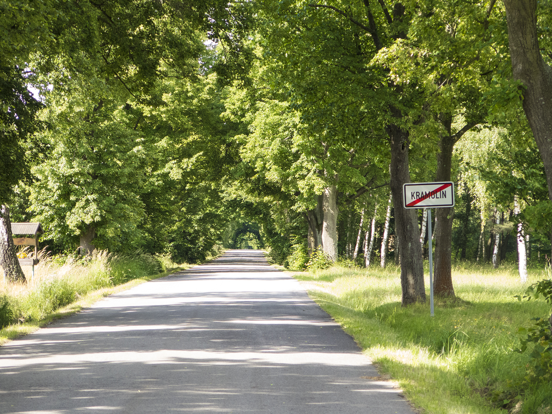
Leaving Kramolin. Update the GPS again as the sign passes your right shoulder. A typical Czech road for this trip.
This missive begins with a picture the innkeeper took for us, as Cathy and I began our bicycling from the small town of Valtice, CZ. The Pension Prinz, with maybe six to eight rooms, was immaculate, and thoroughly modern in every respect, beds to bathrooms, t.v. to free Wi-Fi, which as I say, was the rule everywhere in the Czech Republic—the U.S. is terribly backwards in comparison. The kind innkeeper with limited English, and her English proficient eighteen year-old daughter made sure our every need was met, and as with all our CZ lodging, this included a robust breakfast to give us the energy for the days’ endeavors. Cereal with homemade yogurt and fresh fruit, eggs as you like them, juices, coffees, hot chocolate or tea, ham, salami, multiple types of cheese, hearty breads and rolls, fresh preserves, and the Czech equivalent of crumble-topped fruit-within coffee cake or Danish breakfast sweets. Oh so civilized.
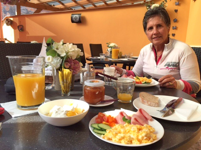
Bikers’ breakfast. Pension Prinz, Valtice CZ
We were typically on the road by nine, a little earlier on the longer days. The trip was nominally six days of biking, to which we added two additional rest and recon days in Telc, and Cesky Krumlov, so it was eight days biking total, averaging just under 27 miles a day, some shorter, some longer. This was the view, fifty meters from where sat at table, above.

Prinz breakfast view—Our Lady of Assumption
Our first few days, we were in the Czech region of Moravia. This is the Czech vineyard region, and we took the opportunity to test drive several varietals with our dinners. This is also the region in which the Liechtenstein family held power for years—yes the same folks for whom the small country between Switzerland and Austria is named, a country now with the highest per capita GDP in the world, a finance and insurance enclave. The progenitors obviously wielded great wealth, as we discovered on day one. Our textual guide gave us precise locations of several “Follies” as they are called—erected in the middle of the forests by the Liechtenstein families so that they could properly enjoy outings there with guest visitors. Then, as now, there are the superrich and the rest of us.

Further along on day one, our route had us biking a levy berm alongside a meandering river, one of many lakes and rivers we cruised beside. And here’s as good a time as any to discuss the weather and riding conditions. This day was mostly sunny, with scattered cotton balls, but a good part of our week we had multiple scattered cloud layers that summed up to overcast or nearly so, sometimes darker than a well-digger’s nether parts, and looking altogether threatening. We saw rain hither and yon, but actually encountered it only twice—once just after we pulled into lunch under a broad umbrella at a directions-recommended cafe to the north of Hardegg, the smallest town in Austria, just across the border to our south. The rain, heavy while we ate, passed on by the time we resumed bicycling. Camelot. And finally, it began raining on us the last 2 km of our longest and final day of riding, as we entered Cesky Krumlov, actually causing me to don my rain jacket, carried all those kilometers in the pannier bag mounted over the rear wheel. The other meteorological aspect was relentless headwinds, every day. Not blow you off your bike strong, but just enough to wear you down by the end of the day. This was an east to west routing, and I suspect the prevailing winds are westerly. A little penance for the privilege. That said, the cloudiness and winds came part and parcel with unseasonal cool temperature—Fahrenheit low fifties when we started in the morning, to mid sixties in the afternoon. Ideal exercise temperatures.

Bike path scenery
I’m usually behind the lens, not in front of it, but here’s a treat from Cathy’s i-phone of a little light-hearted abandon by me on this first day’s ride. As we exited a forest trail, here was this lake and a handy parent-for-kid made wooden plank swing just sitting there as engraved invitation.
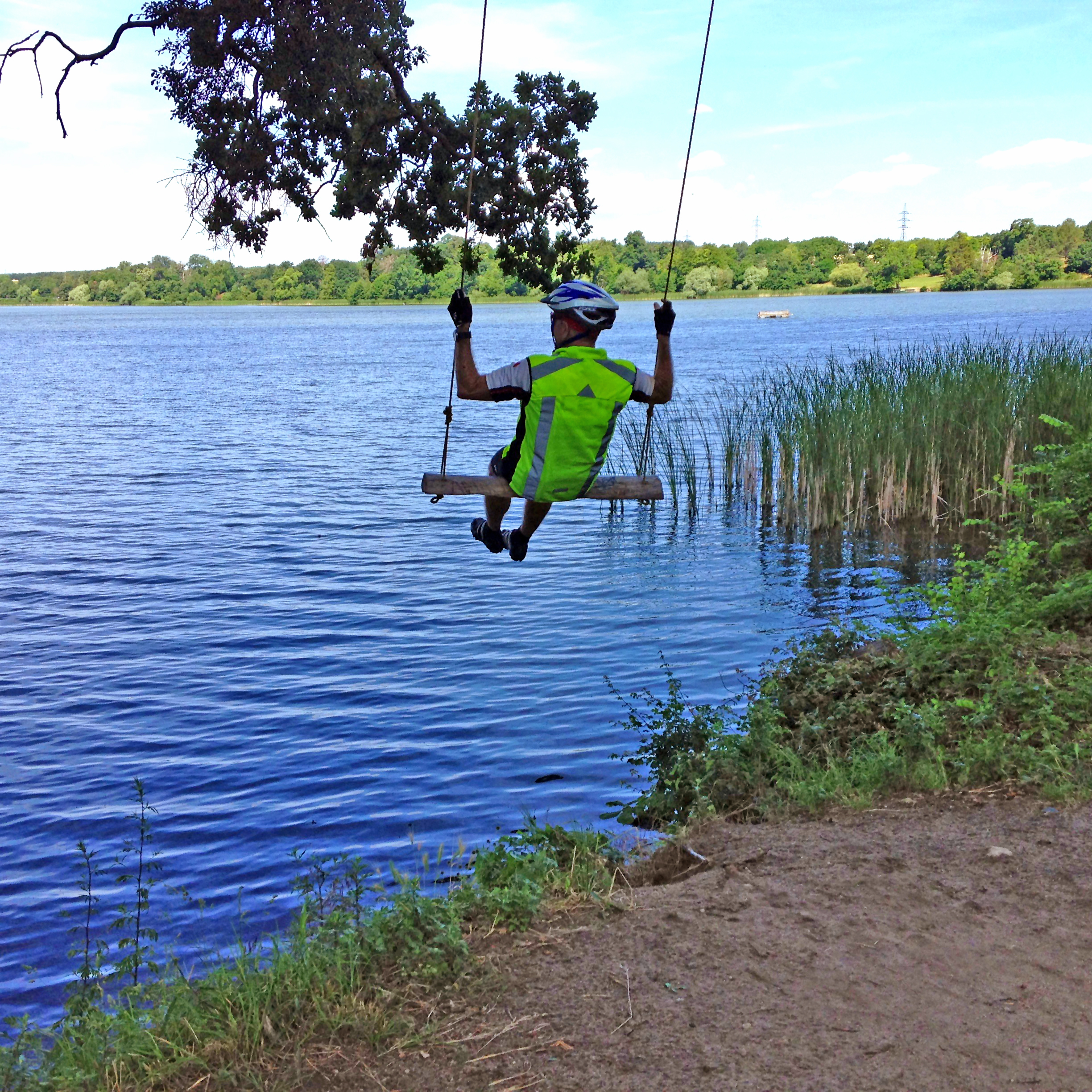
Fun is where you find it
Our first day destination was Mikulov, with this being its town square, “namesti,” in Czech. This Czech name tickled me throughout, given its similarity in sound and spelling to the Sanskrit “namaste,” the greeting of hello and goodbye in Nepal, and meaning roughly “I bow to the spiritual within you.” Not a bad name for the greeting place that is the center of all these small rural communities in the Czech Republic. Our Hotel Galant was just that, and located about a block off the square, where I bought a nifty linen ball cap from one of those tiny wooden sidewalk sales casitas you see beyond the statue.
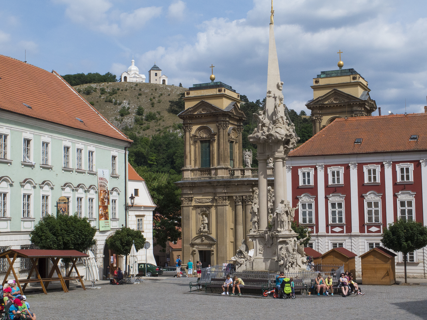
Mikulov namesti
I’ve mentioned the Czech affinity for relaxing with a brewski, and I felt duty bound out of respect for the culture to do my part to fit in. We walked up the hill, taking in our guidebook suggestion to visit the ancient Jewish cemetery, which like all cemeteries, stands as quiet testament to the history of an area. On the way we had passed a small neighborhood square with a recommended sweet shop, itself, right next door to a delightful version of a Czech “Cheers” watering hole. What’s a guy and gal to do? Note the renaissance structures reflected in the window, and the page torn out of my guidebook beneath my 0.5L Pilsner Urquell. This became a recurring theme of our time in CZ—big breakfast which lasted for most, if not all, of the ride, then an afternoon snack like this one after biking, followed by dinner later in the evening. All the food groups here—pivo, chocolate, a cookie, and a fresh apricot. Somebody’s gotta do it.
Mikulov afternoon idyll
The next morning we launched for Vranov nad Dyji. I have absolutely no idea how to pronounce that last word in the name. Clueless. It was a fairly longish day, with lots of hills to climb, the steady headwind, and the aforementioned rain just as we pulled into the “U Svestku” pub for lunch. This area was littered with WWII pillboxes, concrete bunkers for soldiers to watch for the onslaught of enemy troops. Our textual directions also suggested we stop and take a look at a remnant of the Communist Cold War after the Nazis had been defeated and prior to the Velvet Revolution. I’ll return to this theme as my commentary takes us to Prague, but this scene is a sobering reminder of the bastard case that was Soviet communism. This barbed wire, these barricades and watch towers were not put there to keep others out, but, like the Berlin Wall, to keep the citizens in. Think on that for awhile. So much for the workers’ paradise.

Iron curtain reminder near the Austrian frontier
Here’s Cathy arcing through another small town on the way to Vranov. Don’t you find it fascinating that the red octagonal stop sign is near universally the same the world over, with the textual admonition in English? The church itself, was mentioned as a navigational check point to the nearest tenth of a kilometer, of course.

On, toward Vranov nad Dyji
And here’s how things looked on the descent into Vranov, and the next morning, from our Hotel Zamecky before starting the climb out of town for a visit to the chateau (née castle, or zamecky, in Czech) on the hill.

On the descent to Vranov

Vranov morning reflection
Vranov is a small market town on the Dyji river. The name translates as Vranov over the Dyji river. We tried to find a recommended restaurant near a dam on the river, but went the wrong way, to the dam upstream, not the one downstream (here’s a recommendation for a small refinement to the guidebook, Loren). We didn’t find the cafe, but we did encounter this unexpected delight in the late afternoon glowing light. Eye candy.

Vranov marionettes
This is an area famous for marionettes, and here was a collection quietly hanging out in a resident’s window beside the river. Serendipity. Dinner at the hotel was just fine, then exhausted sleep before the next day’s ride beginning with an ugly climb, stopped as soon as it was finished, to visit the Vranov chateau. These had all once been castles, but later were renamed chateaus. We had to wait about :10 for a set tour of the chateau, dating from the 11th century, and remodeled in the 17th when renaissance architecture was all the rage. Cathy is literally checking her e-mail with the chateau Wi-Fi while I look for perspective on the statue of Hercules fighting off some beastly sort from the underworld.
This is the view, when looking back down on the town and the river. Our hotel is dead center in the frame, right next to where the curving road crosses the river.
I think I got the name of this hall correct. The Althanns, who did the remodel, wanted to extol their heritage.
Hall of the Ancestors, Vranov chateau
This day’s ride, another longish one, ended up in the town of Slavonice, where we boarded one of two afternoon trains to Telc, and our planned two night stopover. Telc is yet another Unesco World Heritage Site, and a perfect place to calm down and enjoy some R&R. Our Hotel Celerin was the lynchpin of one corner of Namesti Zachariase, the town square. Throughout the Czech republic we found buildings colored in various pastel shades. Telc is noted for the colors on the square.


Telc spires

Telc statue
The first evening we discovered a restaurant not (yet) mentioned in the guidebook recommendations, called Zach’s, named for the Namesti Zachariase square on which it is located. It was rather modern in decor as compared to the more baroque cafes we often frequented. The food was excellent, as was the local pivo, and a fine Moravian Reserve Frankovka red wine. Penny pinchers take note—at this top notch restaurant with fine service, we had a mug of beer and a glass of wine respectively to go with our appetizer, then the bottle of reserve wine with our sumptuous dinners, followed by a marvelous apfel strudel with vanilla ice cream for desert, and the tab came out to around $55 USD with the tip. Total. The Czech Republic is part of the European Union, but it has retained its own currency, the Koruna, or “Crown.” The official rate of exchange is approximately $1 USD = 24 CZK. It took awhile to get used to the fact that the coins we had were not fractions of a Crown, but whole Crown denominations of fifty or less, and it took awhile longer to realize how inexpensive travel in the Czech Republic is. If you want to visit a terrific place where you can stretch your dollar, this is it.
On our second day the townspeople had set up a small community stage in the square, and there were local youth musical groups performing songs and dances. At one point, while enjoying an afternoon pivo and sweets break, we heard gospels, sung a cappella in English, and discovered another bit of serendipity. A high school choral group on summer tour from a Chicago suburb was traveling from a prior performance in Prague to one in Vienna. One of the students discovered that he had left his passport in the Prague hotel room, so the group leaders created an impromptu stop in Telc, awaiting the passport, and got permission to join in the Telc day of song and dance. And they were terrific.
Rested and onward to Jinrichuv Hradec, which our guidebook refers to as unpronounceable, meaning simply Henry’s Castle. Hotel Concertina was right on the main square, and as you can see the bike-friendly Czechs provide guidance to locking bike rack parking just off the square.

Namesti Jindrichuv Hradec
CZ’s a bike-friendly country
And Jindrichuv Hradec has its own take on pastel facades. Here, Pure-Adventures outdid themselves, literally. They had upgraded our room to a suite, but I had to request a more modest room when discovering that the bedroom was a loft up a narrow circular staircase from the living area, and more importantly, the bathroom. For us gentlemen of a certain age, that becomes a worthy nocturnal consideration. Ahem.

Jindrichuv Hradec
Next up, a relatively short 29 km ride to Trebon, sitting next to a large lake, and possessed of a chateau which we declined to explore internally, in stead taking in the grounds via a stroll.
Trebon Chateau
And there was another activity to undertake—a tour of the 700 year-old Regent Brewery. The tour was a bit much, conducted in Czech with brief asides in English, although the tasting directly from the storage vats was a nice finish. And this detail of an old brewing device appealed to me. Don’t ask as to its use, I couldn’t even pronounce the Czech name for the gadget, let alone translate it. But I like the look of it just the same.
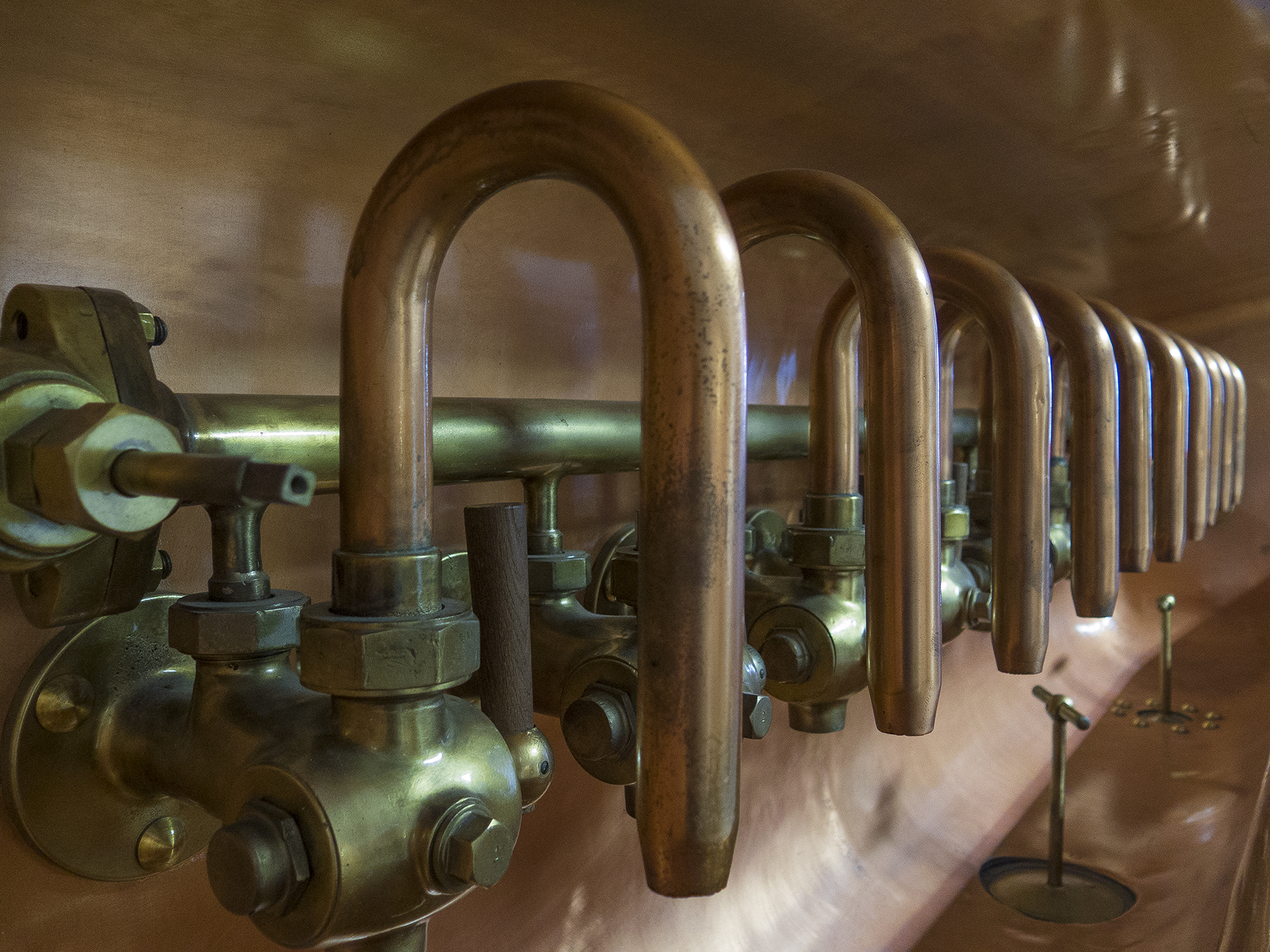
Brewer’s gadget
Trebon is situated in that part of what by now had become Bohemia, the part where they cultivate fish in the lakes strewn about, which is why we had a fish dinner at Supina a Supinka following the brew sampling.
And then the next day, our longest journey of the trip—62 hilly, blustery kilometers to Cesky Krumlov. I’ll begin with a few images of the ride.

A shadow of myself

It seemed that we had descents into each town, and climbs leaving them

72, and still pedaling
Here’s a couple of random recollections. Throughout our biking we were constantly wafted along by the beautiful lyrics of song birds. They were a delight everywhere we pedaled. And cherries. Multiple times we came upon cherry trees chockablock loaded with ripe fire-engine red cherries, their branches overhanging the bikeways as open invitation to sample the tangy sweet treats along the way. Yum.
A common forest trail
Ol’ What’s Her Name resting on her laurels while I rearranged the three maps that were needed for keeping up with this day’s navigational niceties.
Just a few more minutes, please
And then, there was an opportunity for an impromptu picnic lunch break consuming the sandwiches we had made at breakfast in Trebon, along with some fresh fruit and nuts.
Alfresco lunch break
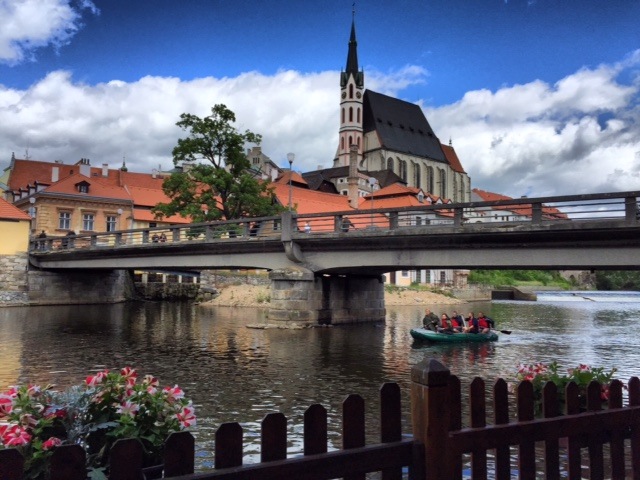
Following another forest tunnel through trees, we had a steep descent into the Vltava river valley where Cesky Krumlov is located, the entrance per our directions pretty much set the stage for the place, which could well have been created on a Hollywood sound stage for a baroque period story complete with massive castle and gothic church.

Out of a forest path and through this entrance into Cesky Krumlov
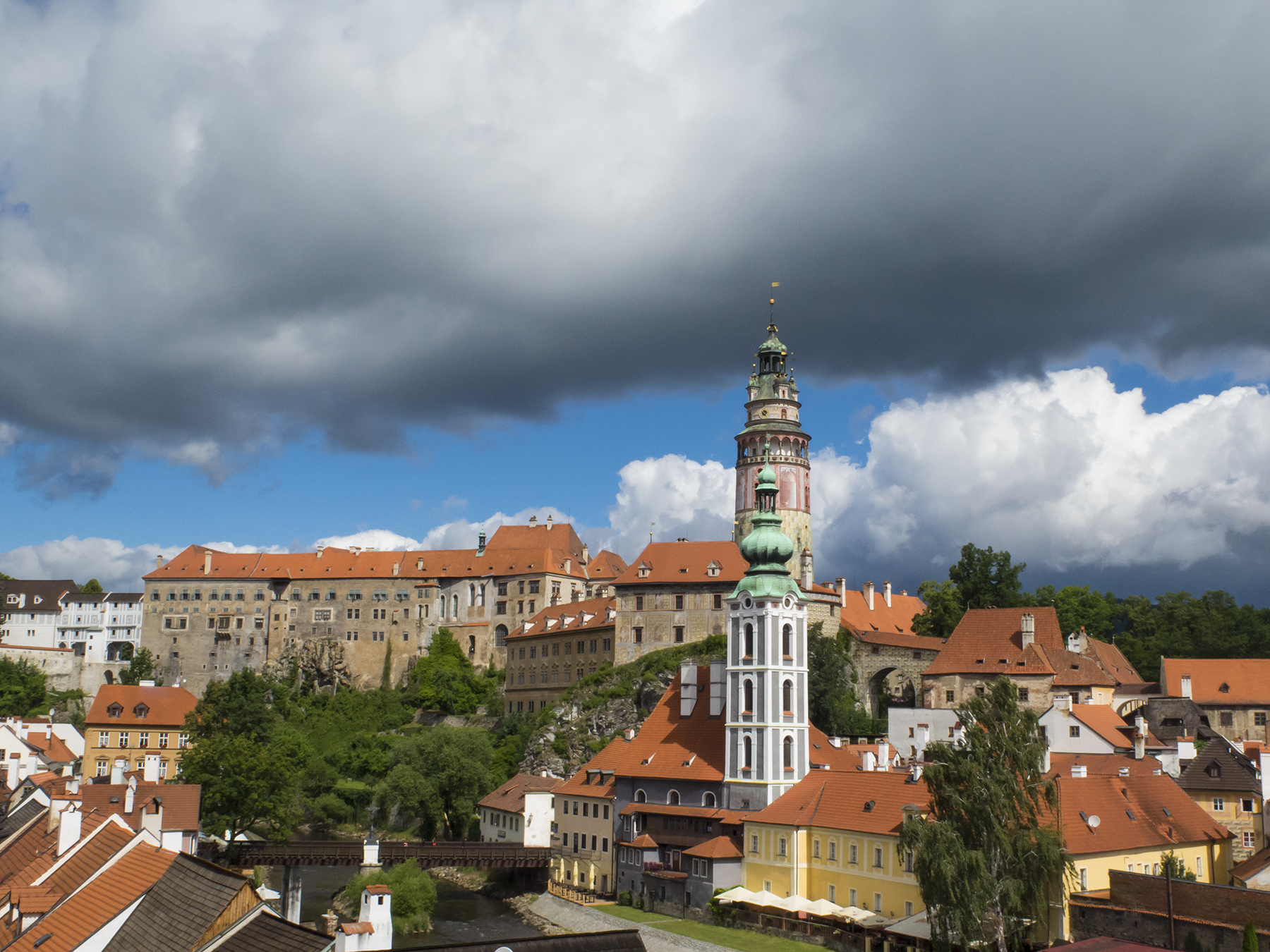
Cesky castle
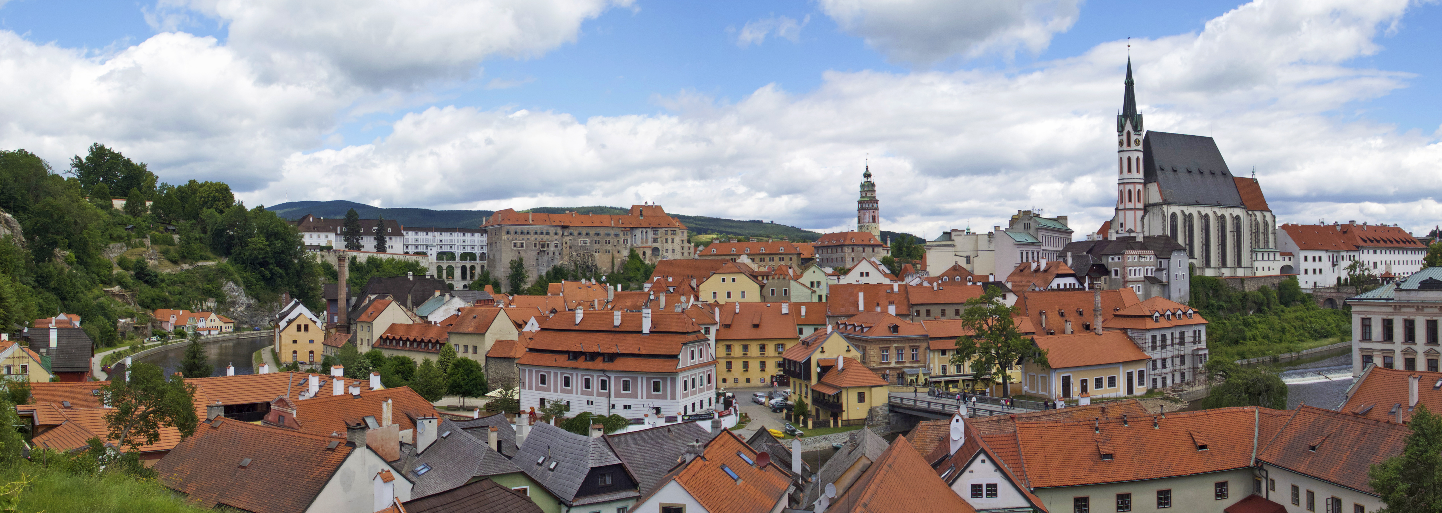
Cesky Krumlov
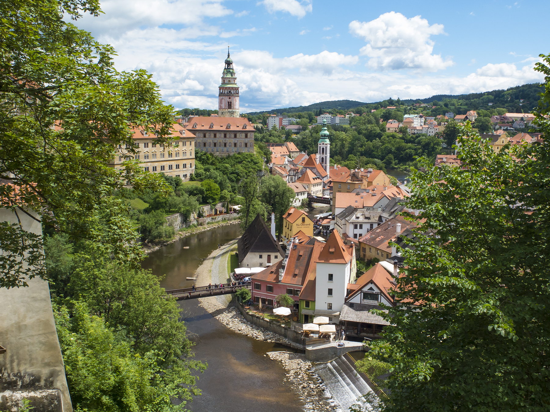
The Vltava in Cesky Krumlov
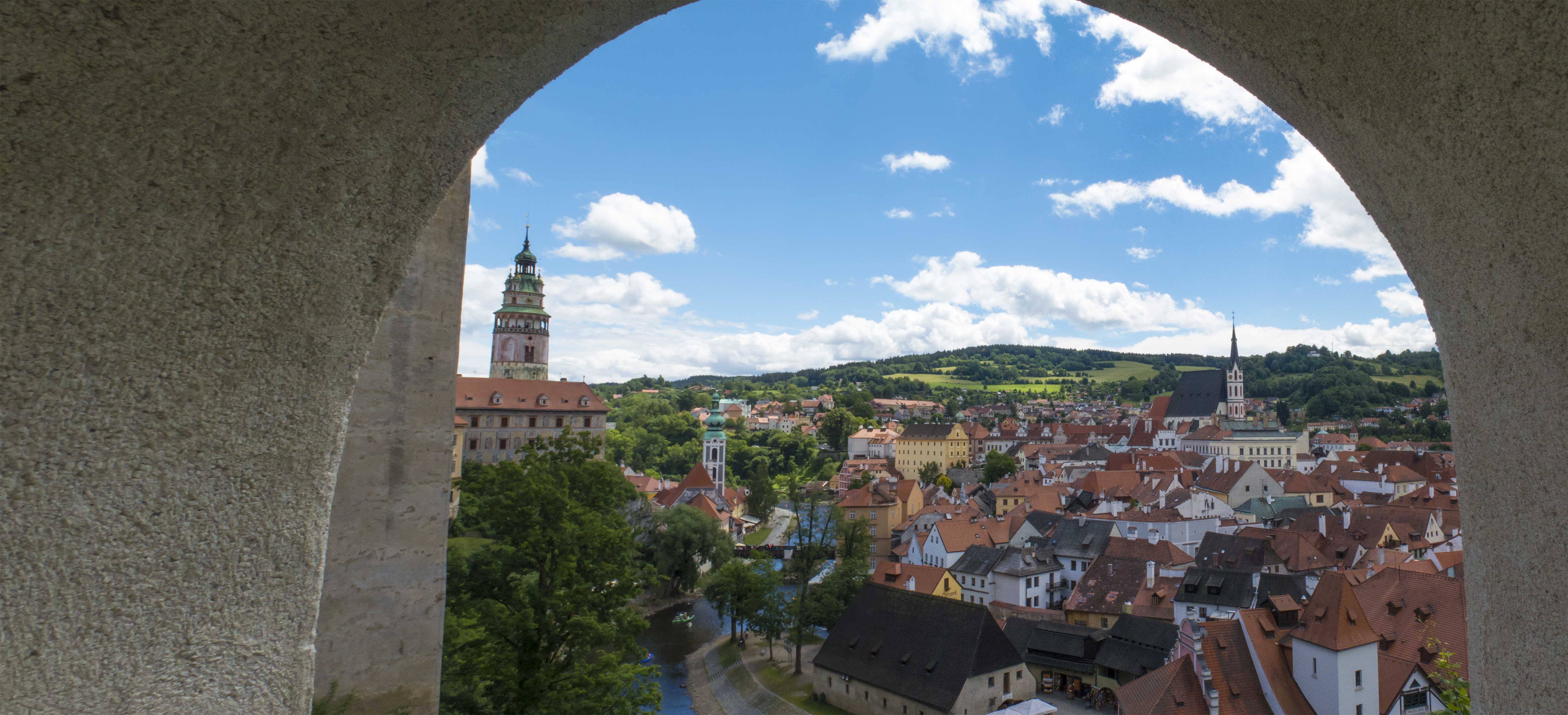
Cesky castle view
The Vltava is more commonly known in the U.S., by its German name—the Moldau, musically memorialized by Czech composer Bedrich Smetana in his orchestral piece Ma Vlast (My Country). It flows south to north, here on its way to Prague, and Smetana’s composition delightfully recreates its bubbling currents. This is a decidedly eye-popping place, whose only down side is quaintness situated just right for inclusion on tourist bus itineraries between Prague and Vienna—a there goes the neighborhood sort of inevitability, I suppose. Besides the medieval Cesky, there’s also a modern play version with kayakers and rafters drifting along, as here, where we had stopped our pedestrian meanderings, beginning to suffer from castle overload, to take in a rejuvenating snack of Czech sweets.
Cesky Krumlov cafe view
After refreshing our energy we walked the short distance on this bank to an un unexpected delight—a museum dedicated to the early 20th century work of photographer Josef Seidel. The museum is a period remodel of his home/studio. It’s like walking back a hundred years and seeing not only what his personal life and work methods were, but enjoying pictures and artifacts that let you see and feel life at this tumultuous time before the First World War, and then the new realities devolving from WWI and WWII. This wasn’t revisiting war so much as experiencing the region, and him, as they got on with the day to day business of life. It seemed an honor and privilege to gaze on Mr. Seidel’s life, and how he viewed the world around him, as here, on a bellows camera with its inverted and reversed ground glass rendering of his garden and Cesky Krumlov beyond.

Josef Seidel view, Cesky Krumlov
A glimpse of St. Vitus’ spire across the Vltava, the scene gentled by the warpage of olden glass, the window etching and the comforting shade of green window frame. I spent my entire time in his home and studio in whispered reverence.

Joseph Seidel window view
To give you an idea of the sort of accommodations arranged for us, let me show you our room in Cesky Krumlov’s Hotel Ruze, a former 16th century Jesuit dormitory. The view out the window, just out of sight on the far left of the frame was of the river rushing by. We kept it open all evening, lulled in slumber by Smetana’s rushing water sounds.

Hotel Ruze room
We ate dinner at two CK cafes listed in our guide. Krcma Satlava was only so-so. Our dinner, the second evening, next to the river at Papa’s Living Restaurant was most excellent, prepared and served by a staff that provide not just typical Czech dishes, heavy on meat and starches with rich sauces, but also southern European and South American entrees, and extraordinary salads. I had a goat cheese salad that must have taken an entire herd of goats to cheese up for me. Portions here, and at all Czech restaurants assured that no one went away hungry. By the time we were done and had walked back across the river to the Ruze, it was time to take in a gentle sunset, at 8:56 in the evening, two days after the Summer Solstice.

Cesky sunset
The next morning we were met by a driver arranged by Pure-Adventures and taken to the bus station for our drive to Prague, where we were met by another driver to take us to our Hotel Constans on one of the small pedestrian streets in Lesser Town, located just a block from the U.S. Embassy and about a :05 walk to the western portal of Charles Bridge. This bridge was originally the only one across the Vltava, and now is unquestionably the most popular with tourists, a vibrant artery in a vibrant city.
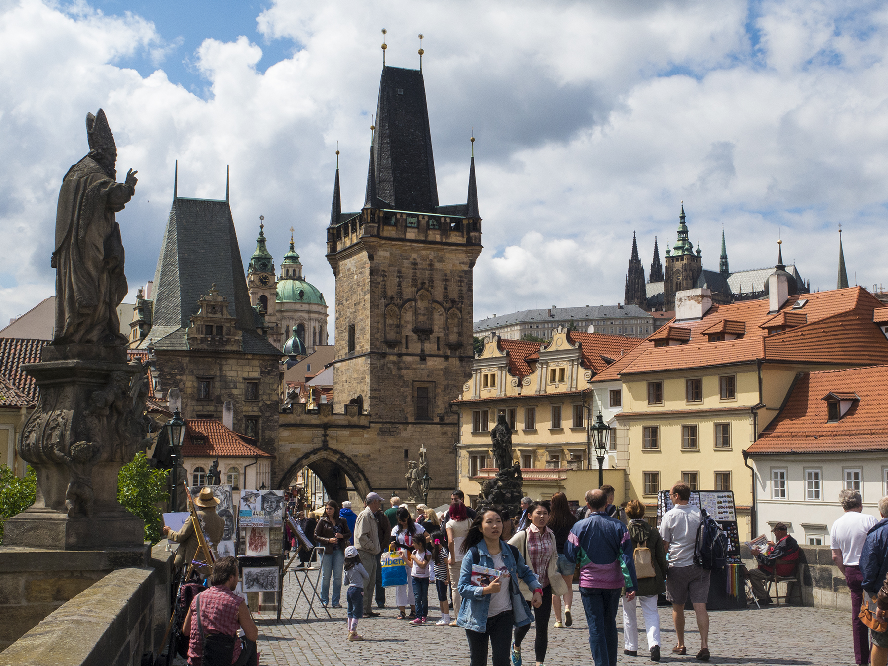
Prague’s Charles Bridge west portal

Lesser Town from the Charles Bridge west portal

Charles Bridge

Religious admonition? St. Vitus cathedral and the castle from Prague’s Charles Bridge

Charles over the Vltava

Charles Bridge crucifix
Every time I had mentioned Prague to others, I’d heard back nothing but gushing accolades. Nor shall I disavow that mindset. If there is a downside it would have to be summer crowds. This is a city with vast areas dedicated to foot traffic, and Prague seemed on a par with the masses one experiences in Hong Kong. I have never seen so many cameras being wielded at the too numerous to count sights. It’s like those videos one sees of people on cell phones stumbling off unseen curbs, or walking into closed glass doors. Not that I was any better, but the entire world seemed to be ambulating Prague’s pathways with their faces transfigured with permanent camera transplants, or frozen arms extended to a glassy-eyed 14 inch distance staring single-mindedly at their smart phone LCD screen. Then, there were the Asians. I’m sorry if this seems prejudicial, but it would be impossible to count the number of Chinese and Japanese tourists, usually frenetically scurrying in large groups, then stopping to deploy their divining rod “selfie” devices extending their smart phones out before them for yet another “here I am in front of the XYZ” photo. The generous way to address all this is to say that wondrous Prague is a target rich environment. You may fire when ready, Gridley, which is pretty much constantly in Prague.
Over on the east (right bank) side of the river is Old Town, with its endlessly appealing Namesti, the Clock Tower, and the cathedral of Our Lady Before Tyn. Nice 360 degree views from the Clock Tower, but also delights that are closer in.
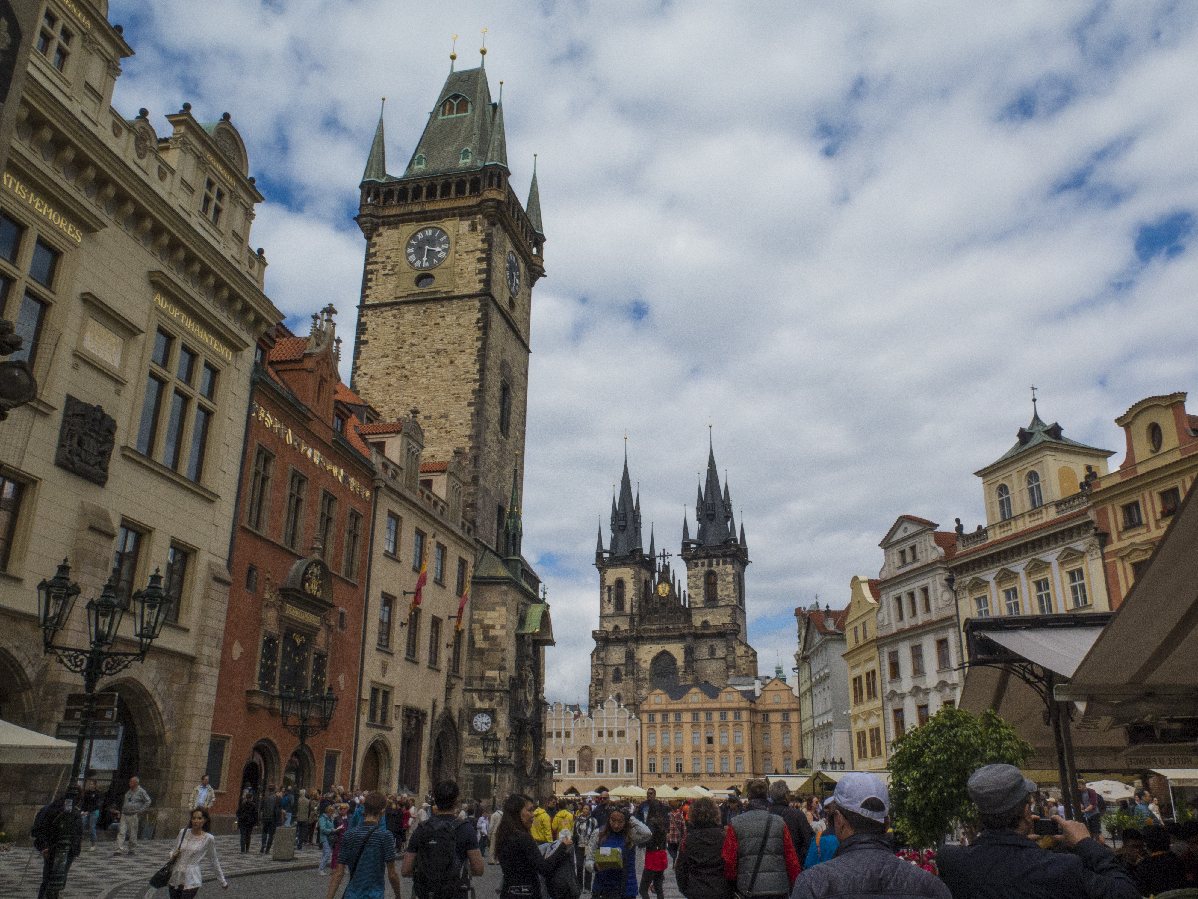
The approach to Prague Old Town Square

Prague’s Old Town Square from the Clock Tower

The spires of Our Lady Before Tyn, from the Prague Clock Tower
Shortly after arriving at the square we were treated to a wonderful surprise—the open area of the square, shown above, blocked off for a military review. I have no idea what the occasion was, but we spent a delightful hour witnessing the parading of colors, marching and close order drill, all accompanied by military bands surely putting a smile on John Phillip Sousa’s divine countenance. What fun.
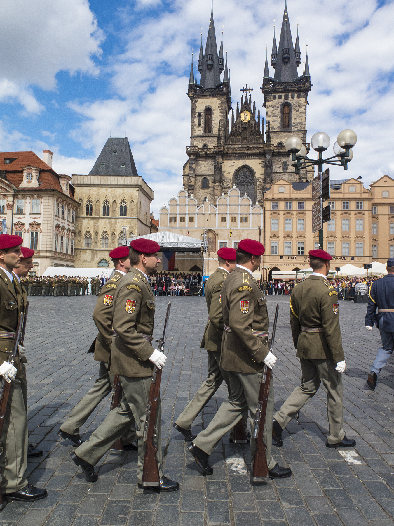
Old Town Namesti parade grounds
The Clock Tower not only keeps time, topside, but down near street level there is its famous Astronomical Clock. I’ll shortcut paraphrase the Lonely Planet Guide description of this paean to 15th century Prague concerns, which goes through its ritual on the hour throughout the day. Beginning :10-:15 before the hour, enormous crowds begin massing before it for the roughly one minute action. The four small figures you see near the middle, bestride the clock, represent medieval anxieties of Vanity, Greed, Death (the skeleton, natch), and Pagan Invasion. Down lower are the Chronicler, Angel, Astronomer, and Philosopher. On the hour Death rings a bell and inverts his hourglass, and the starred-in-blue-window covers open to reveal the Twelve Apostles parading by to take in all the gawkers arrayed below, finishing with a crowing cock and the ringing of the hour. As to Mr. Pagan Invasion, I wonder if there is some way to get ISIS to rethink their caliphate dream’s C-4 and beheading M.O. and replace it with something as embraceable as this? Sorry, that just slipped out.

Astronomical Clock
Prague has both a Metro and the ever-present trolley. Buy your ticket for 90 minutes, a day, or three days, and get on and off from either as often as you want. The Mrs. and I managed to figure out the process and the routings to beneficial relief of tired feet. That said, we nonetheless walked mile upon mile through the Czech capital. The trolley is a delightful way to get around, and makes you feel like one of the locals, even if they know better.

The ubiquitous Prague trolley—at once transportation and cultural icon

Flower boxes and light
A lunar charter, Charles Bridge, Prague
My convoluted thought processes seem to find association in what comes next. Bear with me. As with Salzburg, Prague’s river meanders betwixt hills, on one of which is the enormous castle and equally large St. Vitus Cathedral. Throughout our travels I found myself taking an inordinate number of photos in portrait vs. landscape layout. Upon reflection, I concluded this was a natural byproduct of tall churches and castles built in communities laid out and built in keeping with the narrow confines of ambling oxcarts, and thus providing insufficient space for a photographer to pull back for perspective. St. Vitus cathedral is certainly such an edifice. I’ve heard descriptions of these extraordinary cathedrals as reflecting the architectural and religious sensibilities of the time—the spires metaphorically pointing to heaven’s zenith. Makes sense to me, and I don’t wonder that evoking God’s transcendent throne on high would be a necessary motivation to undertake construction of such an incredible engineering project, accomplished in more than multiple generations’ lifetimes. But to what purpose in present day, ever more rigidly secular Europe? We never seemed to be nearby for Sunday mass (and both Austria and the Czech Republic are nominally Roman Catholic), but I can’t help but notice that these churches, large and small, were either shuttered other days, or lost to tourist exploration. This Protestant sees Pope Francis as a breath of fresh air to 21st. century Roman Catholicism, and he seems deeply concerned about the Church’s relevance in the eyes of the citizens of nominally theistic-accepting countries. I hope he succeeds in better integrating the church and aligning its potential with humankind. Arguably a worthy and profoundly beneficial goal.
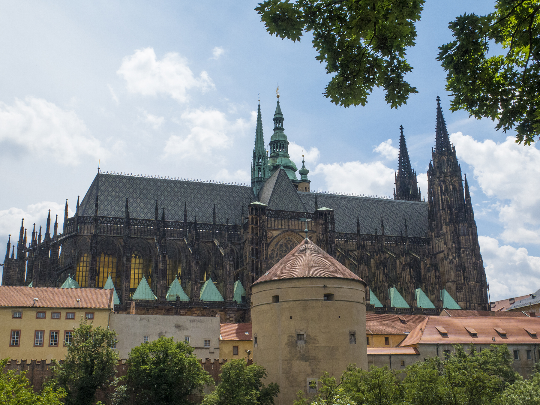
St. Vitus cathedral from the Royal Garden

St. Vitus spire

St. Vitus Bully Pulpit
Hold on, as there’s a second facet here. I mentioned the Czech geopolitical realities, a byproduct of its geographic location in a continent with a long history of conflict. Prior to the blitzkrieg grab of Poland, the Third Reich employed the anschluss to annex Austria, and then decided the Sudetenland, including Moravia and Bohemia should also be part of greater Germany. As the tide turned in 1945, the Russian bear came barreling along in the opposite direction. By VE Day, the map of European spoils had been redrawn, with Czechoslovakia now under the “patronage” of the Soviet Union. The 1989 Velvet Revolution was hard on the 1987 heels of President Reagan’s call to General Secretary Gorbachev to “tear down this [Berlin] wall.” The times, they were-a-changing. What better example of communism’s reversal of fortune, than this image, taken just off Prague’s Na Prikope, shopping district thoroughfare? Eat your heart out, Vladimir Putin.
A bit of communist irony
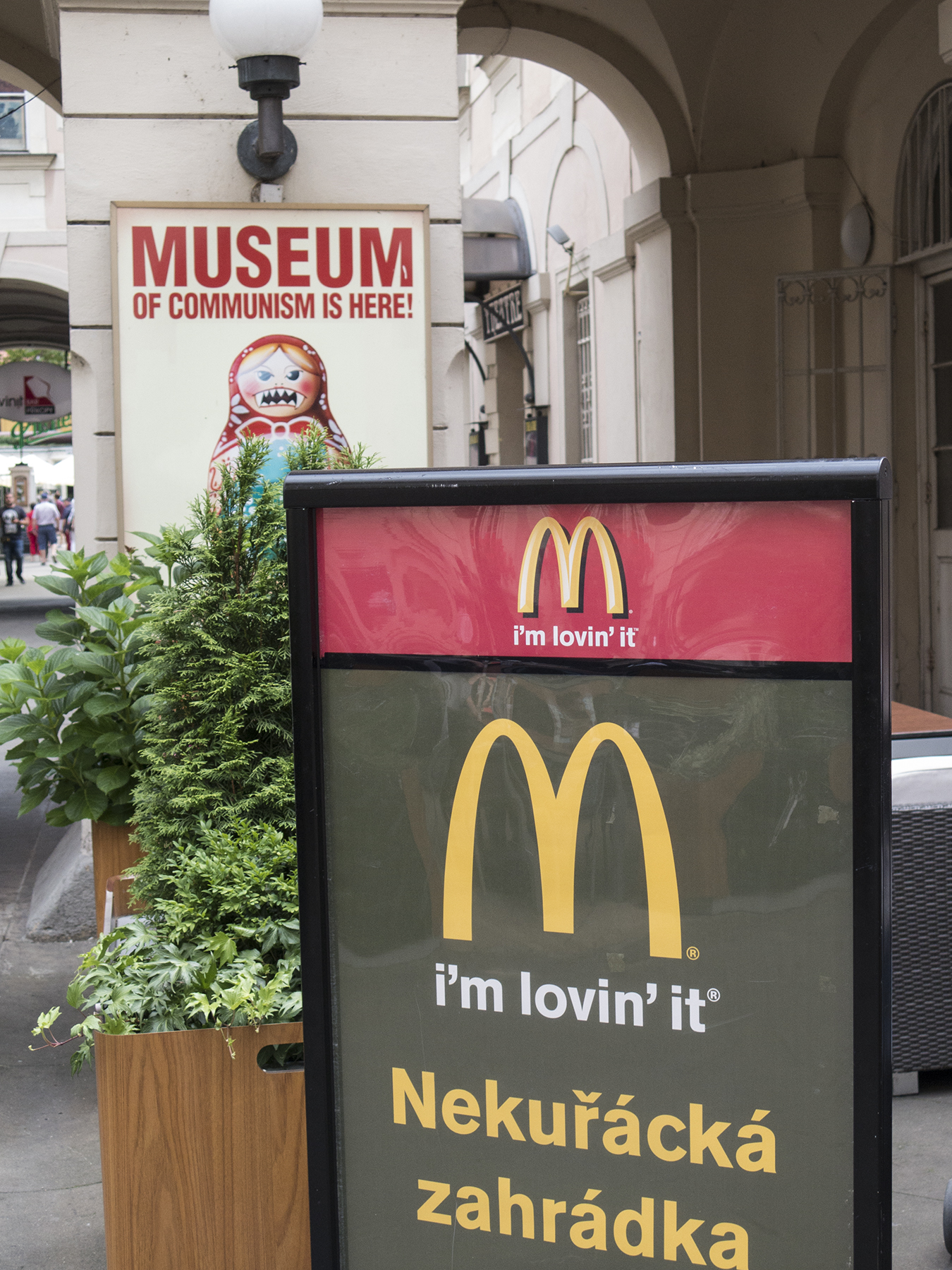
Cathy and I walked the Prague pathways in this area near Wenceslas Square where the 1989 crowds, no longer tolerant of their communist overlords, surged back and forth in nearly bloodless rebellion. The Museum of Communism was well worth the sobering time spent seeing laid out, through Czech eyes, the promises, deceits, failures and eventual collapse of Czech communism.
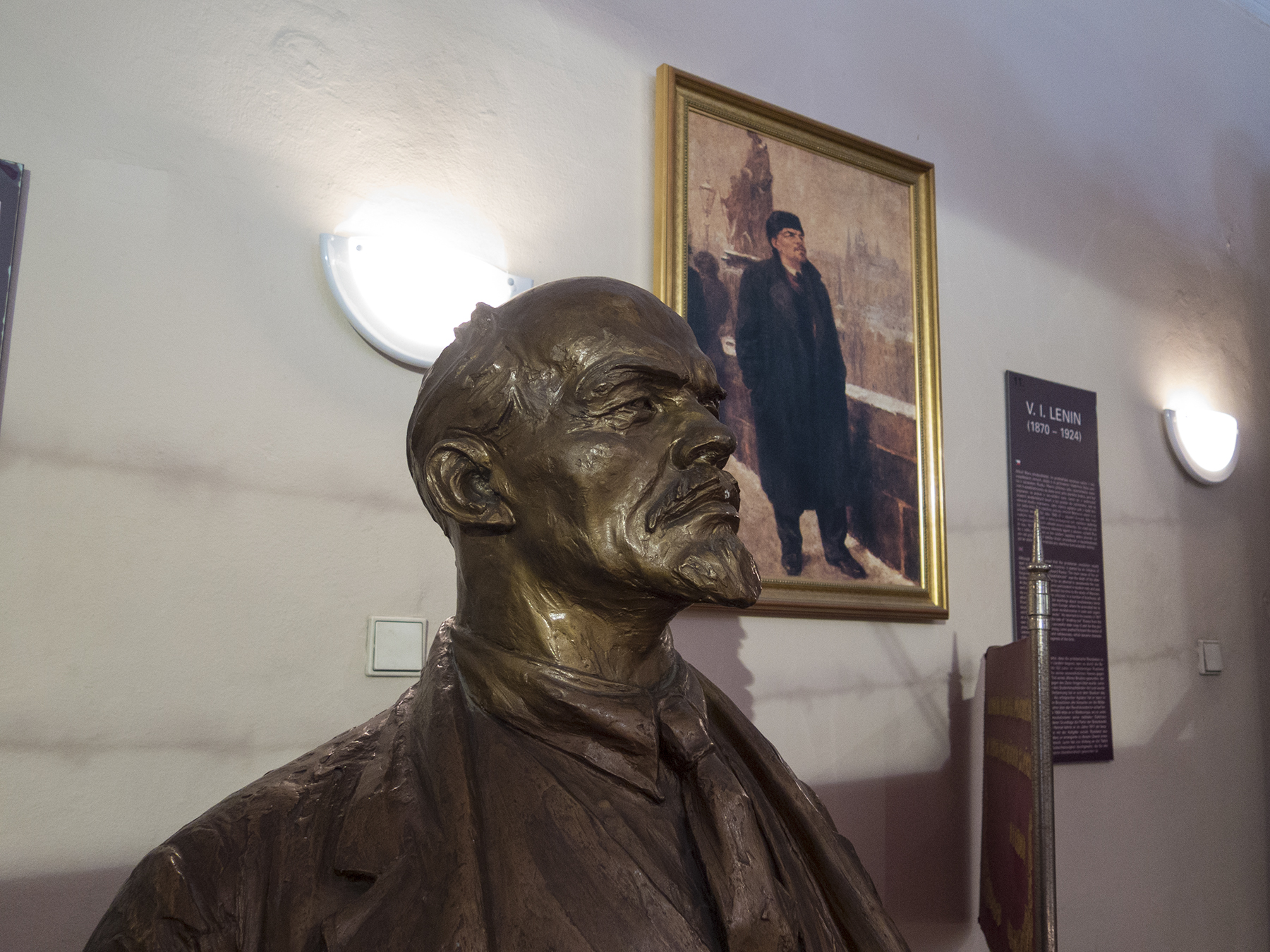
Comrade Lenin
I’ve failed to translate this, but it would appear to be Nazi propaganda warning about the evil hand of godless Soviet Socialism reaching for St. Vitus Cathedral and the Castle. And then after the war, there were those watch towers and barbed wire.

German and Communist sleight of hand
Near the statue of St.Wenceslas is this small memorial to two young Czech men. Their deaths were in early 1969, shortly after the Soviets had crushed a popular uprising in Hungary. Two days before his death by self immolation, Jan Palach wrote “people must fight against the evil they feel equal to at that moment.” He died a martyr protesting the Soviet occupation of his Vast. Jan Zajic also martyred himself by self-immolation—on the 21st anniversary of communist domination. This small memorial was placed here after the Velvet Revolution, which two decades later finally gave Czech nationalism the light of day.
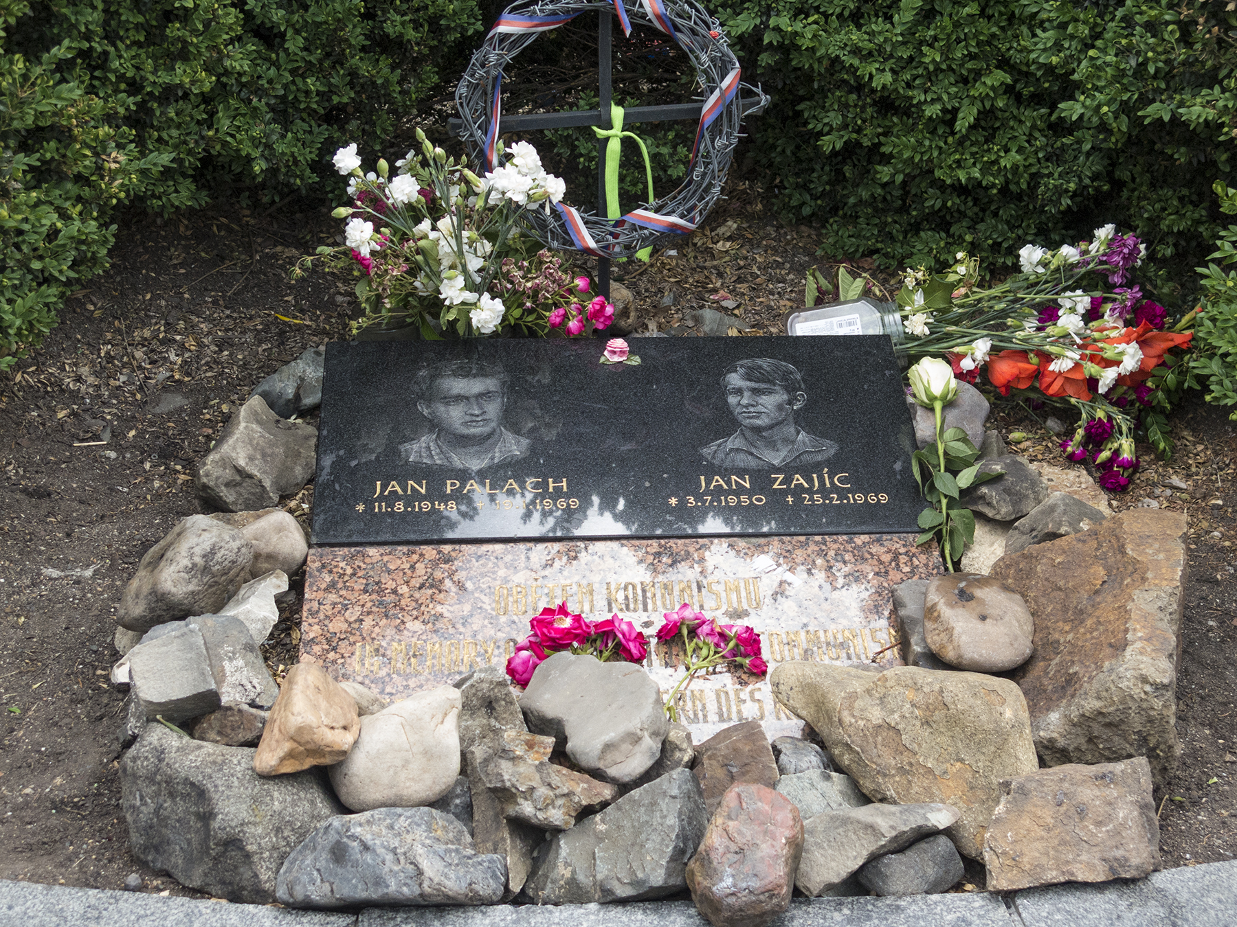
Fiery martyrs to Czech freedom
So, religious relevance and unshackled nationalism sharing one rough patch of mental ground in my psyche? My fervent pondering is beyond my conclusions at present. While I don’t have a stake in the Czech circumstance, I find much fondness for the resilience of the Czech people and wonder what the future will hold for them and like-minded peoples the world over, including right here at home?
Nearing a merciful close to this long-winded amble, I return to the treasure that music posed on our trip. By the time we had reached Cesky Krumlov, accessing the internet by free Wi-Fi, we had scored reservations for two more concerts—in Prague. On our first evening we walked across the Charles Bridge and entered the Mirror Chapel, a small oasis in the block-square Klementinum edifice on the way to Old Town Square. The ensemble was a string quartet, a soprano, and a pipe organist, performing in various combinations, selections from WA Mozart, Antonio Vivaldi, Tomaso Albinoni, Johann Pachebel…

String quartet and more in the Prague Klementinum Mirror Chapel
…and Johann Sebastian Bach and Franz Schubert. Bach’s Toccata and Fugue in D Minor and Schubert’s Ave Maria. I hope the Musician’s Union will forgive me. Anyway, that’s a video link which can give you a small hint of what it was like there. Remember, I had to be surreptitious about video—they’d said that photos without flash were okay, but the subject of videos was never entertained….
And on the next evening in Municipal House we attended performances of the Prague Symphony of Schubert’s “The Great” Ninth Symphony, Richard Wagner’s Die Meistersinger von Nurnberg, and vocal selections from Tannhauser and Parsifal.
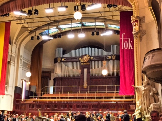
Prague symphony hall
A parting snippet of Close household silliness. From past trips to Alaska and northern New England, we’ve got an in-house game of who is going to make a given trip’s first sighting of a Moose. As you probably know, Moose are a beast of North America. But on the very last morning in Prague, just minutes before our pickup for the train station to catch our uber bus to Munich for the flight home, I nailed a biggie, that will surely go down in the Del Mar homestead archives as a monumental score.

A successful Prague moose sighting
Enough, already. If you’ve gotten this far, you deserve a gold star for perseverance and indulgence.
As ever, TWC
Upwards and onwards with Lawrence
Posted on May 22, 2015

Santa Monica ahead
I’ve been a pilot for over a half century now, and a water person longer than that. Getting long in the tooth on both. The latter is not so far distinct from the former as one who does neither, might imagine. The surf can be soothing or roiling, it is sustaining, and offers up glorious opportunities to ride its currents. Immersed within its embrace below the surface, a diverse world awaits to dazzle one with its immense diversity and sheer beauty. It’s just like the atmosphere—liquid in a vapor state (and sometimes a liquid state in the bargain). I’m here to tell you that flying is nothing like wielding a joy stick in a computer game—the atmosphere is alive and thrumming in your hands and against your rudder pedal feet, you can feel its energy as a dynamic force by which manipulating the controls produces changes in the aircraft attitude and direction. Exactly like dropping in on a pitching peak breaking at my favorite local reef—a little bend in the legs, and then off the bottom, a leg and upper back extension as the shoulders dip to drive the board off on a side rail in the direction of travel across the wave face. Energy imparted from the body and returned by the “atmosphere.” Lucky me, I get to revel in these experiences in both of earth’s fluid atmospheres. I check the waves daily, and when they fit my old guy parameters, I paddle out. I also watch the sky daily, and look for times that just call out to me to be soaring, untethered by the two dimensions that mostly constrain terrestrial life. And sometimes other opportunities present themselves to waft about in ways at once delightful per se, and altruistic. Let me introduce you to Angel Flight West, and what it does, by introducing you to Lawrence Greenberg.

Lawrence, radiating
Lawrence and I are the same age, and he has me beaten, hands down, in the smile department. His grin is like a shaft of bright sunshine breaking out of the billowing clouds seen over his right shoulder as we cruise northwest in Cirrus N111TT. A lawyer by training, he has a keen mind, and a robust curiosity and interest in what is happening around him. He misses nothing, and knows how to engage with the moment or hold back as circumstances dictate. He has been fighting cancer for some time now, and is enrolled in a treatment protocol provided by a physician associated with UCLA. He has to get back and forth between his home in the San Diego area to Santa Monica for his treatments, and this is a challenge given the frequency of appointments, early morning times of treatment, the impact on the body for returns at the end of the day, and so on. Care providers and social workers are tuned into these necessities, and work to connect patients, support givers like those helping Alzheimer’s individuals, adults or kids with developmental disabilities, and other challenges with Angel Flight West, a non-profit based at Santa Monica Airport. Angel Flight West http://www.angelflightwest.org coordinates those needs with pilots and surface transporters—known as Earth Angels—to get folks where they need to be. I am consistently impressed with the skill and efficiency of AFW staff in interfacing with need and opportunity, matching patients, pilots and planes for effective transportation. Even more so, I am humbled by the heart that AFW staff has for both those needing help and those providing it. This isn’t just a job for the staff, it is a calling, and they give it their all, gladly and consistently. I have had the honor of attending Celebration of Life services with AFW staff for patients who eventually were overcome by their illness—these people care, and all of us who use their service are individuals they know with surprising intimacy. AFW is a Non Governmental Organization, and the sort of service AFW provides just wouldn’t be the same consuming tax dollars with government’s one-size-fits-all functionality. Not to belittle government workers, but the spirit and sincerity of AFW is hard to replicate without the get-it-done heart and mentality of individuals like the staff at AFW. There’s a place for both in society, and AFW inhabits its place with a particular grace. AFW has developed web-based programs to keep track of need and opportunity connecting both sides of the equation, providing follow up and the other mundane but necessary aspects of care-giving, all of this overseen and kept humming by staff in their office a short amble from Santa Monica’s Typhoon restaurant. I get daily e-notes providing overviews of mission needs to which I can respond for when my operational opportunity aligns. On Monday I got such a note about yesterday’s Thursday travel need for Lawrence. A quick scan of forecasts on my pilot flight planning sites suggested this was a mission that could be completed with only minimal weather impact likely. I clicked on “Request this Mission,” and a couple of hours later was assigned to be Command Pilot to take Lawrence from my home base of Montgomery Field to Santa Monica. I followed up on the contact information and we agreed as to time and meeting place for a departure providing for his his early morning arrival up yonder. AFW likes to have Mission Assistants aboard flights, in case assistance underway might be needed, and while they also try to pair MA sorts with pilots, I often prefer to offer the position to one of my pilot chums, thus providing mission assistance and pilot redundancy at the same time, and oh, by the way, sometimes connecting future command pilots with an organization about which they had only maybe heard about before. For this mission, I was pleased to be assisted by local pilot Mason Bailey, with whom I have flown to places near and far.
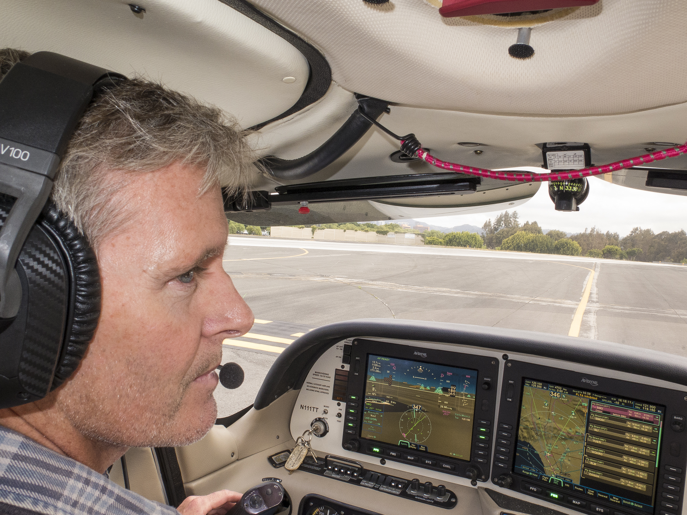
Mason, spelling me before takeoff from Santa Monica
The three of us rendezvoused at Gibbs Flying Service and proceeded directly to my hangar, where I had the airplane at the ready, already preflighted and serviced. We loaded up and taxied out as call-sign Angel Flight 6520, aboard my Cirrus SR22. I had filed an instrument clearance for the cloudy, occasionally rainy morning the night before, and our clearance via the San Diego November Nine routing was enacted before launching straight out toward Mt. Soledad at the Pacific shore, then a turn northwest paralleling the coastline, in and out of cloud layers, detouring a little here and there around bigger billowing cumulus. Surfers, three, sweeping about the “white water.” SoCal TRACON (Terminal Radar Control, i.e., ATC) directed us into a Santa Monica left downwind between LAX and SMO, and called out a B777 crossing our path left to right ahead, and restricted above us. There it was a moment later as we both found a clear sky moment amongst the morning’s clouds. A few left turns later we were lining up with the final approach course just outside Century City’s high rises, and south of the famous Hollywood sign on the hill, although it wasn’t visible amongst the clouds. As we broke out of the clouds both laterally and vertically, the tower asked for reports on bases and tops to convey to other pilots, just as had Montgomery tower on our San Diego departure. Early birds like us are sometimes pathfinders for those keeping bankers’ hours. Forty-seven minutes after rotating aloft, I managed to find the ground with modest aplomb, more or less where I thought it and our main gear tires should be co-located, and we rolled out and decelerated. A left turn clear of the runway, and trundle via “Bravo” taxiway to a rock star parking spot before Typhoon’s front door. Earth Angel Margot Bernal was there and waiting for us as we deplaned.

Larry and Earth Angel Margot
Morning greetings, all around, and Lawrence and Margot were off to his treatment center. Earth Angels like Margot are an essential part of this paradigm enabling that last leg of the journey from airport to treatment. I know from personal experience that Margot does this on a regular basis. Kudos. Meanwhile, Mason and I walked the fifty or so yards to the Angel Flight Office where I could introduce Mason to the folks that make it all work, and hopefully plant a seed for his future as an AFW pilot. Back on the ramp, we saddled up and taxied out for our takeoff from Santa Monica’s runway 21, departing via their quirky somewhat 270 degree turning departure to back overhead the runway and then via the Santa Monica November 22 routing back to San Diego’s Montgomery Field. I used the opportunity to switch seats with Mason and give him the chance to see how the Avidyne Revision Nine avionics suite in our Cirrus differs from the Garmin-driven package in his Cirrus. Colleagues collaborating on things flight. An Area Navigation (GPS) approach back to Runway 28R, from which we had departed about two hours before, and back home for a dog walk and bike ride. Takeaways? It is an honor to have the opportunity, equipment and skill-set to give back to those with demonstrative need, and to be able to respond to coordination offers from Angel Flight West. Lawrence is a great guy, and his need is being answered by terrific people, and even a reprobate like me! At a personal level reflecting my specific quirks, I love the sky, I love the fluid dimension, and I love being able to share in all that with others, especially if it does some good in the bargain. I’m a lucky man. Oh, and because, as readers of this site have likely already discerned, if that day with the elements involves maybe a sunset amongst the clouds with the sky and the sea in attendance, it is icing on the cake. This is how yesterday ended up.

A break in the clouds

End of the Day
And, here’s a time-lapse view of this Thursday cloudset.
As ever, your scribe, Thomas.
El Buen Viaje Mexicano de Invierno
Posted on March 6, 2015

Isla Angel de la Guarda
Chilly February. In multiple winters and springs past we have journeyed south in trade of chilly for chillies and the warmth of near tropical Mexico. This year there was the additional motivation of a group flight rendezvous arranged by COPA—the Cirrus Owners and Pilots Association. Climate change reversal of fortunes. We departed a distinctly habanero San Diego (daytime eighties) for a decidedly minty (sixties) Baja California Sur, with rain showers en route and at our destination. The COPA planning had nearly two dozen Cirri arriving in Loreto from multiple western (and one Pennsylvania) departure point on Friday the 13th. Saddled up in N111TT we arranged an in-trail takeoff from either side of Montgomery Field’s Runway 28R centerline with chums Dan and Jackie. Whimsical happenstance, but nonetheless emblematic of our political roots (?), we took the right side of centerline, while N907DR rolled on our left. (Dan and Jackie have had active rolls in Democratic administrations.) ATC on both sides of the border was completely nonchalant as to our proximity underway. House of mirrors over the Sea of Cortez—Jackie taking a picture of me, taking a picture of her.
Hold that pose
South of Bahia de Los Angeles we got our first look at the atypical winter Baja weather, a modest detour to the left of course providing a gentle lluvia plane wash.

Baja rain showers
We landed at MMLT three hours after takeoff, refueled and meandered the Byzantine pathways of Mexican Aduana (Customs), Migra (Immigration), and flight permits, in my case stirring up a tempest in a teapot because I had had the audacity to refuel first before attending to the formalities. Once the dust settled, Cathy and I were off to Item One on our adventure checklist—launching for the Matancitas (MTB) dirt airstrip at Puerto Adolfo Lopez Mateos abutting Bahía Magdalena. The strip extends to the edge of the water, at a port thriving on commercial fishing, and this time of the year, tourist ponga visits with the migrating baleen Gray Whales. The protected water of the bay is strewn with small islets and shoreline convolutions, making it an ideal winter nursery and the southern tether for the females, who give birth there and train their young on the exigencies of life involving the longest mammalian migration on earth.
Bahia Magdalena
We overflew MTB, then did a left-hand circuit to land on Runway 28, rolling to the west end next to the fishing fleet, and utilizing a handy concrete parking pad minimizing the amount of sandy dirt and seashells the prop would pick up on the subsequent pre-departure engine start.
Short final approach to Matancitas runway 28
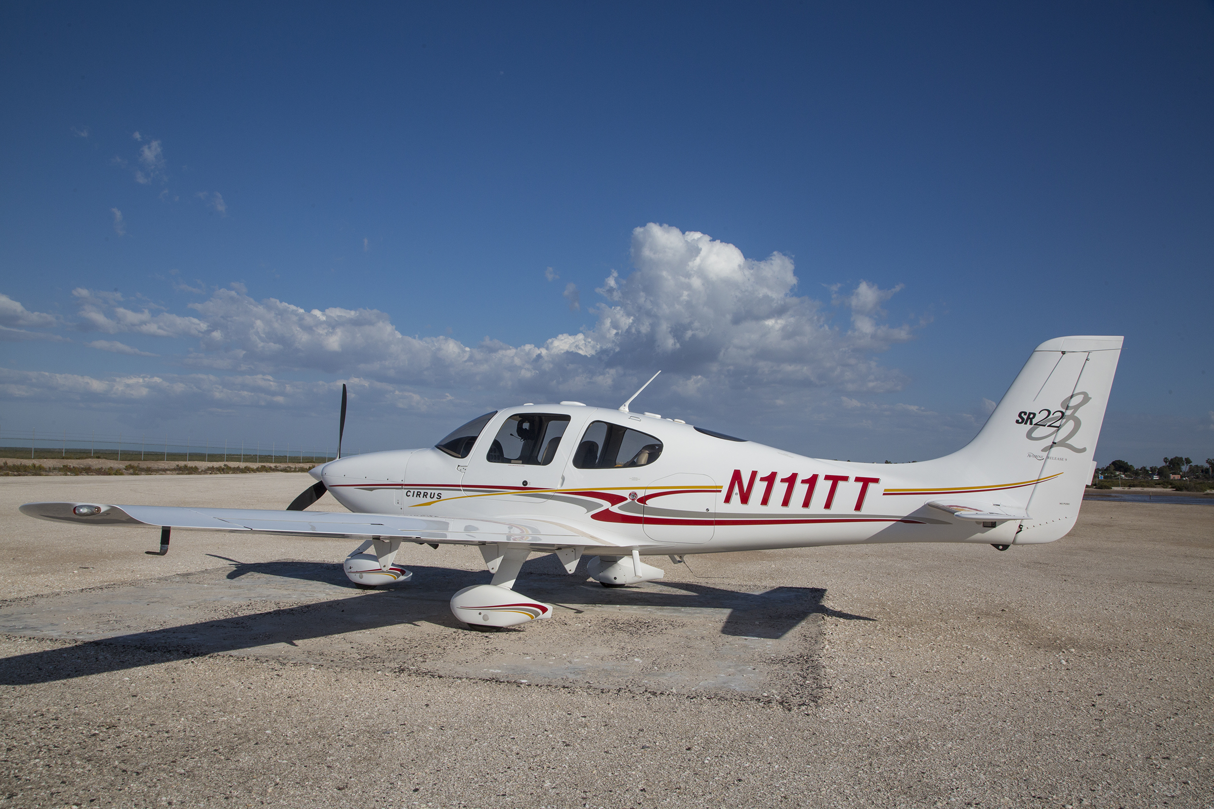
Parked on a Matancitas pad
By the time we deplaned, the local airport overseer met us to collect a landing fee and help us board a minibus that took us to the ponga fleet some :03 away. We donned our life vests and almost immediately felt the thrumming of the sea below us and the fresh salt air tugging at our hats at the outset of a very successful search for las ballenas.

Ponga central
Yes, you do get close to these wondrous creatures. Baleen whales lack teeth, and adults feed on krill and other tiny sea denizens by sucking in water and forcing it through sieve-like baleen bristles. The bay is filled with pairs—the recently born calves nursing on their mother’s rich milk, adding blubber as insulation for the oceanic cold. Adult females give birth to 15 foot-long, one ton calves in the bay this time of year, and are impregnated for next year’s birthing season. In the spring they depart for the roughly 6,000 mile journey back to their summer Bering and Chukchi Sea arctic feeding grounds. Surfacing gray whales affirm their mammalian credentials with a respiratory whoosh from their spiracles, visible at considerable distance, and damply, at close range. No detectable halitosis, by the way.
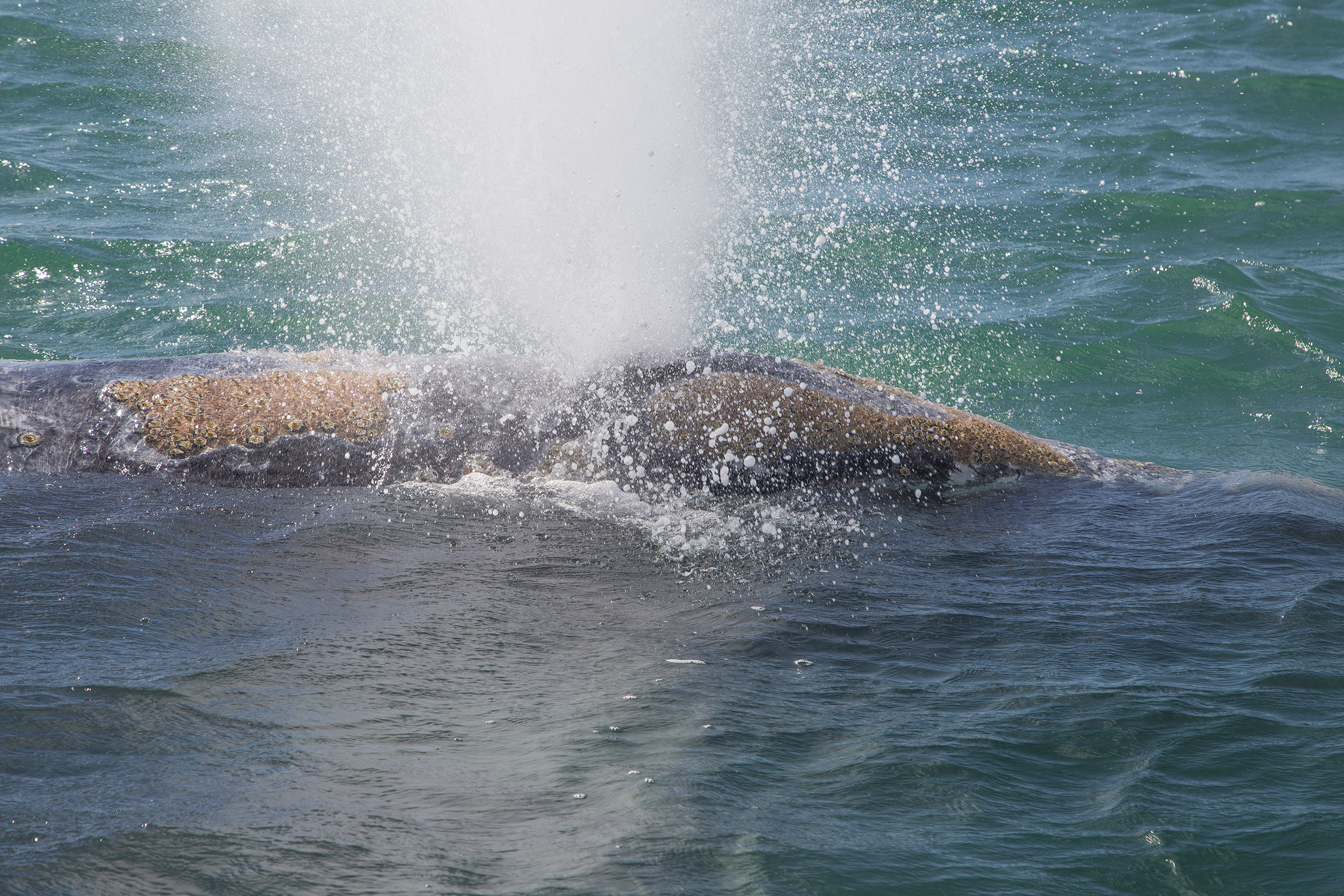
Baleen breath

Nice meeting you two
Mother and baby develop close bonds, aided by affectionate embraces.
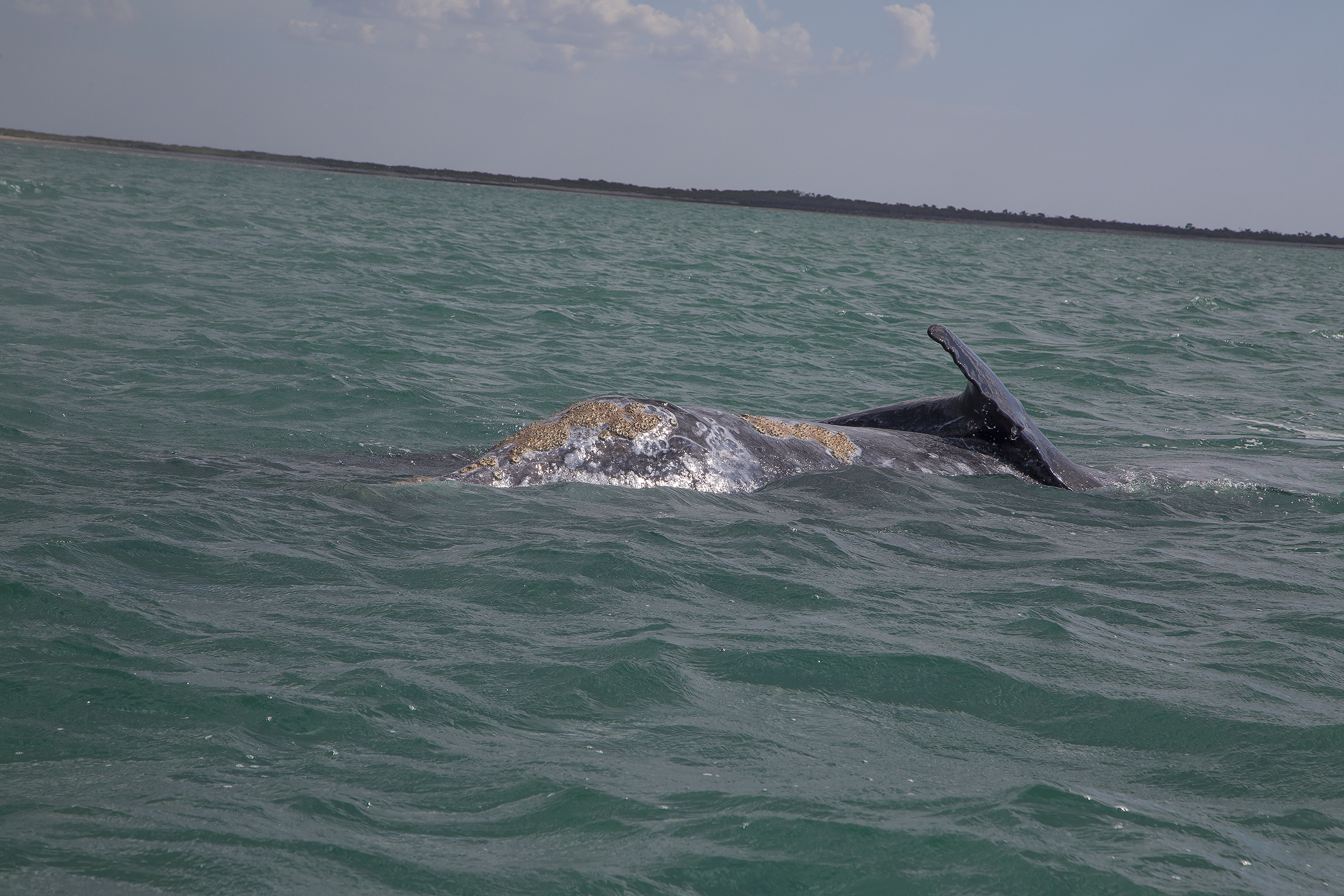
Ballena embrace
Youth is always curious, and the infants gave us many look-overs.
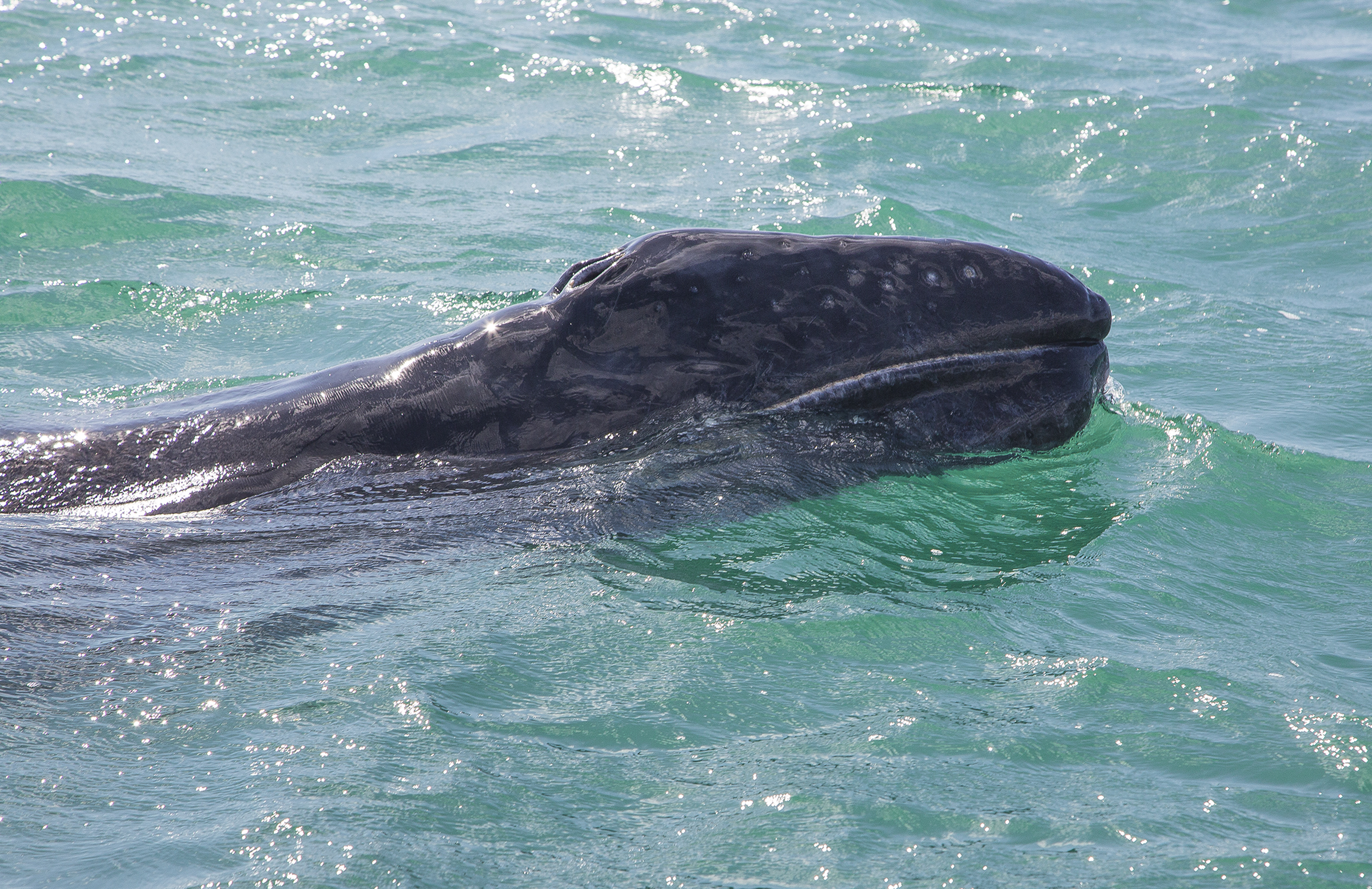
Ballena calf
Spy-hopping allows mom a different perspective on what’s happening in the neighborhood.
Mom, spy-hopping
Following our whale visit, we returned on a :20 flight back to Loreto, which had us crossing the Gigantic Mountains. These are the peaks amidst which is located the lovely Jesuit Misión San Javier, established at its present site in 1702.
Montañas Gigantes
Clearing the peaks requires a steep descent to a left base entry to MMLT’s runway 34.

Loreto runway 34
The COPA lodging choice was the Villa Palmar resort, a half hour south of the airport.
http://www.villadelpalmarloreto.com
The Palmar is a very new resort with fine dining and attentive staff, but frankly Cathy and I prefer the quaintness of central Loreto, so on day two Dan, Jackie and we two taxied into town to snoop about, do a little window shopping and consume a “gigante” margarita.

A glimpse inside a Loreto door

Loreto iglesia
The Palmar’s extraordinary view of the coast and offshore islands provided ample evidence of the unseasonal weather, which was the source of consternation and considerable careful planning for the next day’s intended flight across 100 nautical miles of the Sea of Cortez and on to the silver mining pueblo of Álamos, Sonora. There was rain this afternoon, and more the following morning, sometimes combined with lowish ceilings and reduced visibility.
Loreto coast view from the Villa de Palmar
This blog site belongs to a pilot. Sorry, that means you’ll get an inordinate share of pilot-speak and flight images. Deal with it. The pilots and passengers were forced to split into thirds because of transportation requirements between the resort and the airport. We four friends were in group two, which ultimately became group last, as deteriorating weather precluded group three from undertaking the crossing. Those pilots made prudent time-specific Go/No-Go decisions which allowed them adult libations at the Palmar and benign flying weather the next day. I commend their decision-making. Remember that the Cirrus is a single-engine airplane, so altitude is your friend when over inhospitable terrain or open water. The weather dampened the 11,500′ cruising altitude that I’d have preferred, and here’s what “Feet Wet” at 3,500 feet over the middle of the pond looked like on the flight deck instruments. In the synthetic vision display you can see the blue ocean beneath us, and what would appear to be blue sky above. Fortunately the engine hummed merrily along without a hint of the “auto rough” one anticipates with single-engine oceanic crossings.

Feet wet, not quite half way
In actuality, we were flying between layers, rain pelting the windscreen, and a building cumulus line ahead. I was ship one in group two, and decided to trundle on, giving time sensitive updates on flight conditions to the in-trail aircraft, which I’m told helped alleviate uncertainties for the group. Did I mention that we were operating under Visual Flight Rules? Were we able to stay uniformly clear of clouds? Whatever do you mean? Ahem.
Feet wet, between layers with rain
The other side of the gulf also required some do-si-do maneuvering to avoid the worst of the budding cumulonimbus, first approaching a pre-planned group turn-in Initial Point and then the final approach to landing at Álamos (MM45 ICAO identifier). Proceed up to the reservoir, then a right 90º turn to final approach for…

Álamos IP
MM45’s runway 13. Duck under and you’ll drop in on the casa just shy of the runway threshold.

Álamos runway 13
Over the next few minutes, the birds of Group Two alighted and taxied to the ramp.

Hand-holders Dan and Jackie, having just landed at Álamos
Álamos boasts a hacienda retreat that holds its own in luxury no matter your judgment standard. It is the many decades’ result of Americans (and Mexican residents) Jim and Nancy Swickard, who also recognize the benefit of a worthy hangar for guests’ private aircraft. We filled it to the brim. N111TT is the second aircraft back in the center of the scrum.
Álamos hangar
This field has the benefit of an on-site military garrison, which does mean you’ll be met with armed soldiers, and drug-sniffing dogs. It also means that your airplane is not liable to be stolen by narco-traffickers. Formalities complete, we were whisked away to the opulent retreat in the midst of the small pueblo.

We’re being followed
Proceeding through town we passed a motor-driven vehicle, construed as a carriage “pulled” by a team of fiberglass horses. This was the Sunday before Lent, and the town was hopping with local holiday vibrance, including families in the carriage, and kids riding the horse team bareback. OSHA be damned. This marked our second time at the Hacienda de los Santos, and the understated elegance hits you right at the door.
http://haciendadelossantos.com/site/
Hacienda de los Santos

Hacienda handle view
The Hacienda is actually a melding together of multiple 300+ year-old haciendas from the Mexican silver-mining past, artfully restored and decorated to a fair-thee-well. If you don’t want to be spoiled and pampered, go somewhere else. De rigueur of Mexican haciendas, the outside is merely a high wall, hiding from view the delights within. Once through the portal, however…

Arched inversion

Hacienda pool
… as well as the delights within the within. I think we had the finest room in the place. And I suspect everyone else felt the same. The rooms were each named for one of the saints (santos). As to our room, I could never decide if I liked St. Bernard’s bedroom, sitting room, fireplace or the outside poolside deck the best. Decisions, decisions.

San Bernardo habitación
Snuggle multiplier on a cool evening
Elsewhere on the grounds, amidst the flowering bougainvillea, there was a small grove of agave, the raw ingredient of tequila. Tequila in Mexico? Who knew?
Agave
We four chums struck out that afternoon and evening to take in the Álamos sites and sights, gravitating toward the zócolo, a square, central literally and figuratively to the fabric and life of Mexican villages, typically adjoined on one side by the church. This was the Sunday before Lent, and the community was festively engaged in all manner of pleasurable pursuits. The history of Mexican zócolos is as meeting place for the community, young people circling the square, boys and girls in opposite directions, sizing up each other in the ageless dance of the genes. Álamos’ zócolo boasts a delightful gazebo that provides lovely glimpses of the church spire.

Gazebo night view
The square is also a haven of calm repose amidst the tumult for more seasoned couples.

Time with your main squeeze
As might be expected in overtly Catholic rural Mexico, the church is a prominent and unabashedly faith-based part of the skyline and community life.

Álamos iglesia
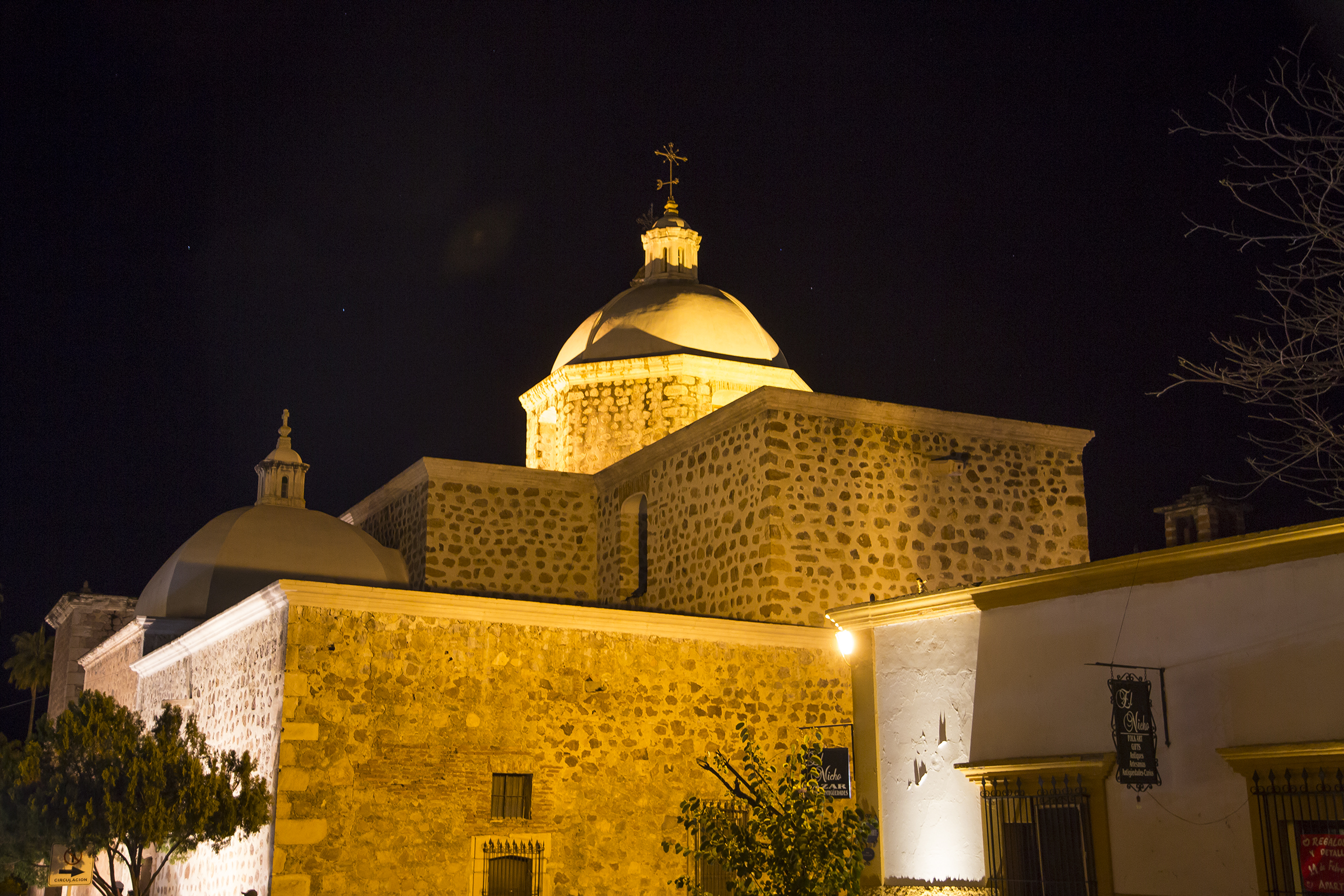
Álamos cupola
This evening, the square, and the nearby streets effused youth-engaging activities. There was a beauty pageant at the town administration building, which was lit in the national colors.

NIghttime Álamos town hall
I was taken by this male-dominated happening, boys working on their upended trick bicycles while being “serenaded” by young guys doing mouth-based grunt and click timpani exhortations over warbling amplifiers and acoustically-challenged speakers. Such unassuming unbridled fun. Do you know where your kids are? At the zócolo.

Biker youth
A regional favorite is a mirthful activity of kids, using emptied eggs that the community women prepared, filled with confetti, which the youngsters would use, chasing their friends about the square to break atop their heads. Giggles, guffaws, and gleeful hoots and squeals everywhere. Eventually we returned to the Hacienda. The majority of the COPAns were savoring a fancy dinner, while we four chose to head for the tequila bar, giving our best to depleting the demon agave concoctions, vino and lighter dining fare. Let’s see, that is a Bohemia Oscura, an emptied shot of high-end Reposado, and a fine Sauvignon Blanc from Mexico’s Guadalupe Valley, with an absurdly delicious slice of carrot cake. No worries, I wasn’t flying anywhere the next day, and could crawl to habitación San Bernardo, it’s four-poster bed and crackling fireplace. Eat your heart out.
Decadence, defined
Notwithstanding the evening’s hedonism, I was up at the crack of early and investigating the morning light opportunities, camera in hand. If you know me, you know by now that I am gaga over color and light. If you know Mexico at these latitudes at this time of the year, it is a photographer’s target-rich environment. And this first image of a gloriously vibrant wall, is in shade, for goodness sake!

Mexico is unafraid of color
There are myriad stream beds in mountain-surrounded Álamos, arched bridges for passage, and rock foundations of adjoining structures. The near bridge was only for foot traffic, and there were many children and adults who crossed it on their way to their Monday morning school and work assignments.

Arches
A guileless elementary school girl, passing by, questioned if I might be looking for the trail up the Mirador (Viewpoint, in Spanish), which was nearby, but not immediately apparent. Following her directions, up the hill I went for splendid morning panoramas.

Mirador view; airstrip at 1 o’clock in the frame
Iglesia from the Mirador
Arched cupola
There were puddles from yesterday’s rains to reflect on.
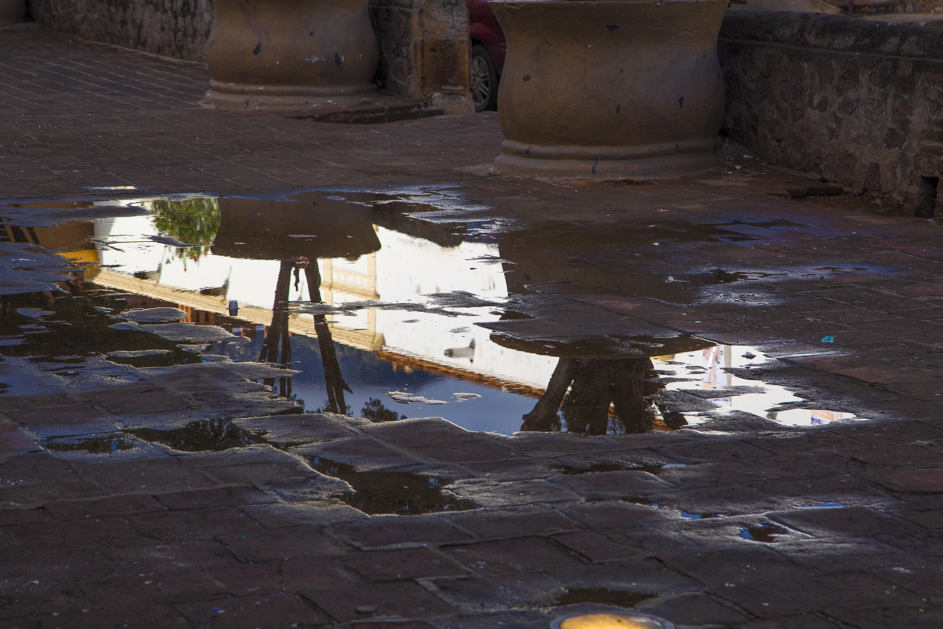
Morning puddle view
And several women and men were sweeping up the confetti from the evening’s revelry.

Confetti cleanup
Cathy, now up, joined me for breakfast and yet further random exploration.
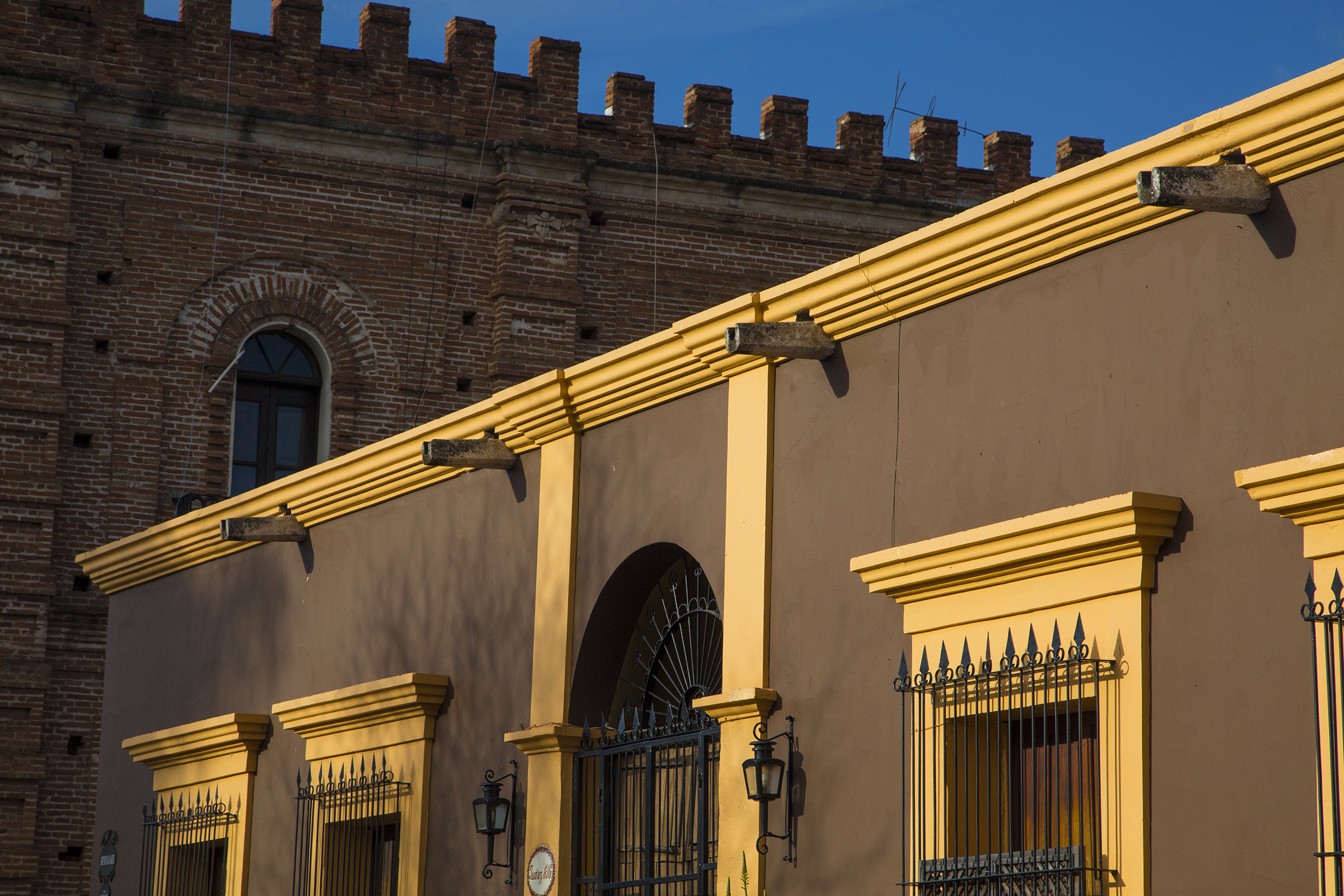
Juarez #16

Álamos plaza scene
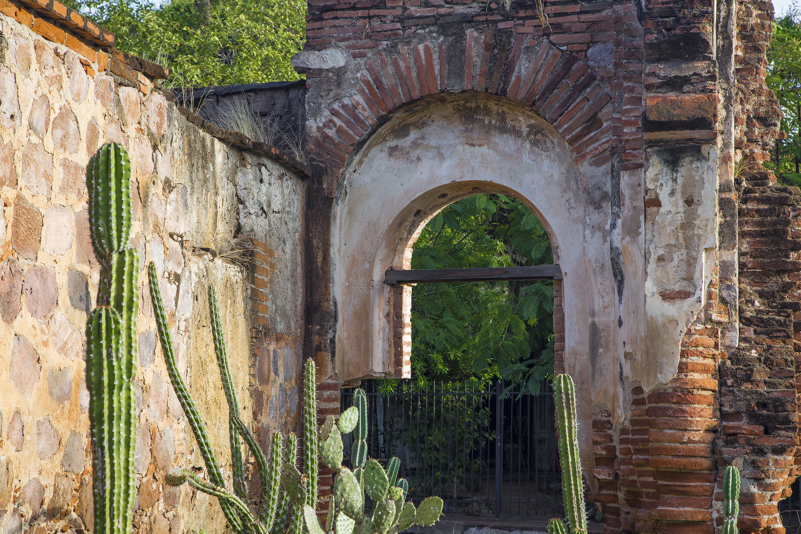
Sublime wall and arch
In a bit of whimsy, I’ve processed this next image as a Van Goghish oil painting.
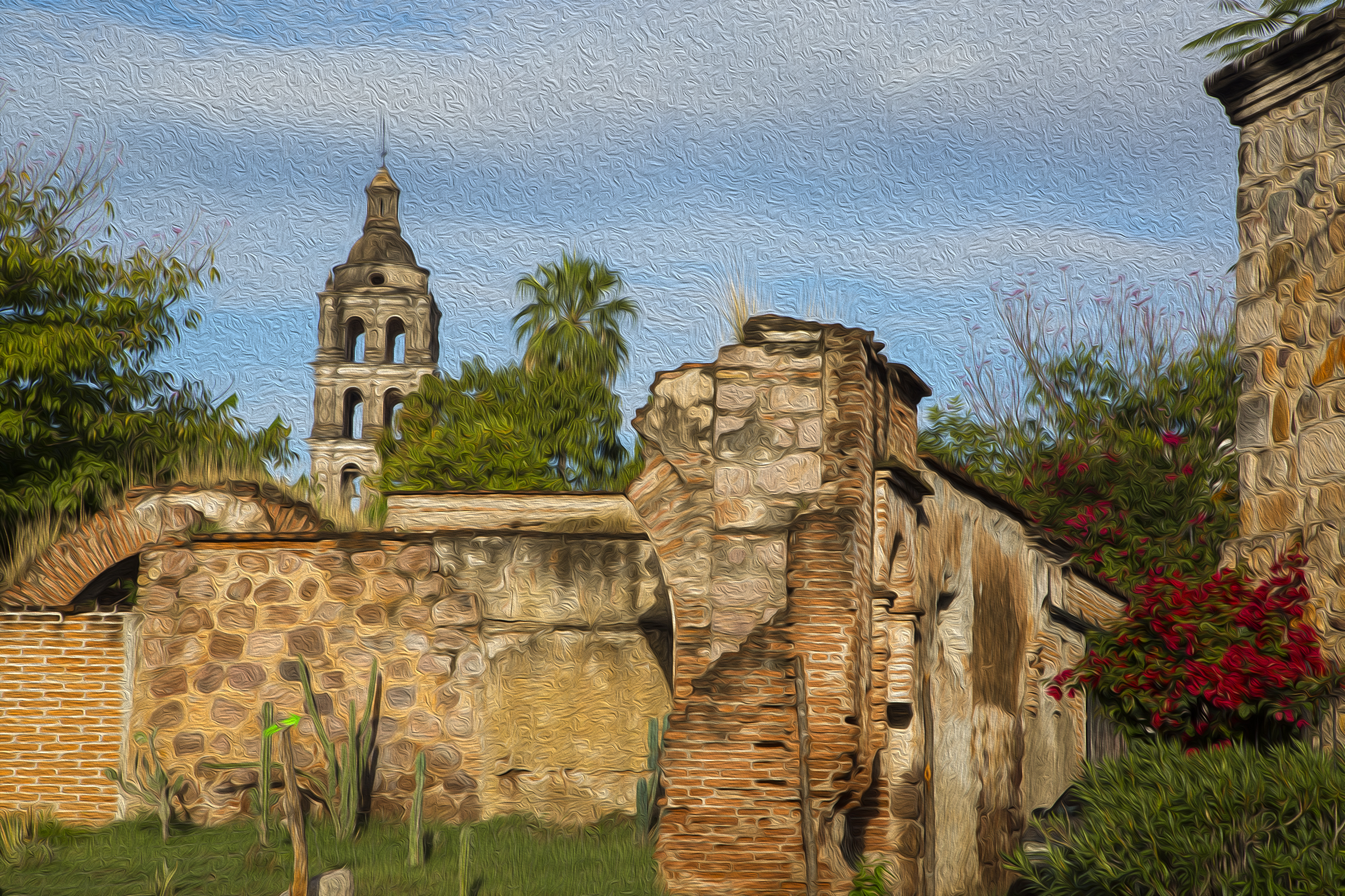
Oil paint effect of Álamos scene
Not so ghoulish as it may sound, I often wander graveyards in places like this, a historical channeling of the lives and passings of its inhabitants. I’ve been humbled and embraced by epiphanies and emotions in places like Zermatt, Switzerland, Tombstone, Arizona, and now, Alamos, where the graveyard dates from 1703. In the afternoon, after returning from town and the graveyard, Cathy and I settled into chaise lounges and umbrella-shaded chairs around the pool next to habitación San Bernardo. I don’t normally write my thoughts underway, but let me share, word for word, the contemporaneously written thoughts I did set down in reflective savoring that afternoon of the day that was: “Warm earth tone hues of the hacienda, bold fuschia bougainvillea, bright sun and crisp shade alternating with the penumbral shadows of the drifting scattered cumulus slipping quietly northward, all a riot of contrasts to the impossibly blue sky. This morning the lad with his ‘coroneta,’ who played in the school ‘banda’, dressed in the tan slacks and blue sweater of his escuela, and the young girl in her uniform, proactively volunteering directions to the sendero leading to the Mirador. Unhurriedly meandering through the graveyard, the Espírito Santo guiding me to the headstone of Marcela Rodriguez, ‘dos mes,’ her forever youngness arresting me in tearful bittersweet recognition of the ephemeral nature of life. A day in Álamos.” Pilots need to stay up on their aviation Ps and Qs, the best pilots regularly studying flight issues. A case in point, Jim Swickard (looking modestly like the photo of revolutionary Emeliano Zapata on the wall below the rifles), maestro of “Tequila 101,” attended by all the COPA pilots and significant others, describing his collection of 500 tequilas, and all things agave and mescal in the Hacienda Tequila Bar. What? You don’t think tequila can elevate your thinking?

The professor, teaching Tequila 101

Tequila postdoctoral classmates
Tuesday, rested from a sumptuous dinner and sueños dulces beside the glowing fire, Cathy and I headed for the airport. The COPAns, minus us, heading back to the Estados Unidos, while we set off on the next aventura—ground exploration of Mexico’s Barrancas del Cobre, the Copper Canyon. Step one, however, involved joining a few of the COPAns with an overflight of the canyon, well, okay, flight through the canyon, before peeling off and heading to our terrestrial starting point of the colonial town of El Fuerte, Sinaloa. Full disclosure, this is the second time that I have piloted an aircraft below the rim of a, shall we say, “grand canyon.” In my more youthful past it wasn’t strictly prohibido in Arizona as it is now. Well, here’s a glimpse of this next leg of our journey.
PFD synthetic vision view descending below the canyon rim

Real vision view of the same scene

Below the rim, above the El Fuerte river

El Fuerte runway 32
We had arranged pickup at the El Fuerte airport (FTE, or ICAO MM79), and the driver was right on time. We paid our landing fee to the airport overseer, filled out paperwork with the soldiers of the on-site military garrison, and headed the :05 into town. Drink in the colors. Yum!
Ah, Mexico!
Our lodging, the Hotel Posada del Hidalgo http://www.hotelposadadelhidalgo.com was the birthplace of El Zorro, and it is located on Cinco de Mayo street, right next to #55..

Cathy’s street address
…which is a touch ironic insofar as Cathy’s 5/5/50 birthdate is strewn with an equal number of cincos. Maybe you had to be there. Access to the canyon is often by the Chihuahua Pacific (ChePe) train that runs from Los Mochis past El Fuerte to Chihuahua and back. We overnighted in El Fuerte for the early morning train departure, and had arranged canyon lodging first at Cerocahui, Chihuahua state, then Barrancas, near the town of Divisadero, essentially the apex of elevation, near 8,000′. Copper Canyon is actually six canyons that run together, ground by eroding rivers coursing out of the Sierra Madre Occidental mountains to combine into the El Fuerte, and eventually emptying into the Sea of Cortez. Billed as bigger and deeper than the Grand Canyon, we found them to be similar, save the fact that Arizona’s is arid red rock terrain, and the Barrancas is pine trees on top and tropical vegetation down low. The expansive vistas are very much cut from the same cloth.
Our lodgings near Cerocahui and at Barrancas:
http://www.hotelmision.com http://www.hotelmirador.mx
In the morning we climbed into the hotel courtesy vehicle headed to the train station to board the ChePe…

ChePe tren
… and struck up a conversation with the one other couple headed out from the Posada. Quick study that I am, I referenced the Australian lilt to the gentleman’s accent, but allowed as how his wife sounded English. She set me straight, as they are both Aussies. And had they come from Australia to visit the canyon? Well, actually they had come from only as far as Mexico City where they currently resided. A conversational trailhead worth following, it turns out that we were riding to the station with the Australian Ambassador to Mexico, the Honorable Tim George, and his spouse, Geraldine. Avoiding my usual churlish behavior and drooling with atypical aplomb, we settled in to enjoying each others’ company for the next four days of Barrancas exploration and sustenance-taking. Just a delightful time with kindred adventurous souls possessed of matching keen wit and senses of humor. Arriving in Cerocahui, an absurdly pugnacious chihuahua pooch barking his territorial claim to turf, Tim, in a delivery embellished with cat that ate the canary grin and eye-twinkle, dryly asserted that clearly we were now in Chihuahua state. As, indeed, we were. Geraldine, evidencing her fun way of looking at life, regaling us with the story of her inadvertent disembarking at a workman’s’ stop on Gibraltar and having to overcome her discomfort with heights amid the scurrying monkeys to reconnect with Tim and their son. What a hoot.
El Embajador Tim, y Esposa Geraldine rolling on the ChePe
Busman’s holiday
Perhaps you’re aware that Barrancas del Cobre is the home turf of the Tarahumara, known for the long distance running of their canyon trails? The remoteness of the canyon, and their small homes (sometimes caves) deep in the canyon were key to avoiding the worst of the Spaniards’ machinations in earlier colonial times. The indigenous people and hiking the canyon trails have loomed large on our many years’ motivation to visit this rugged place.
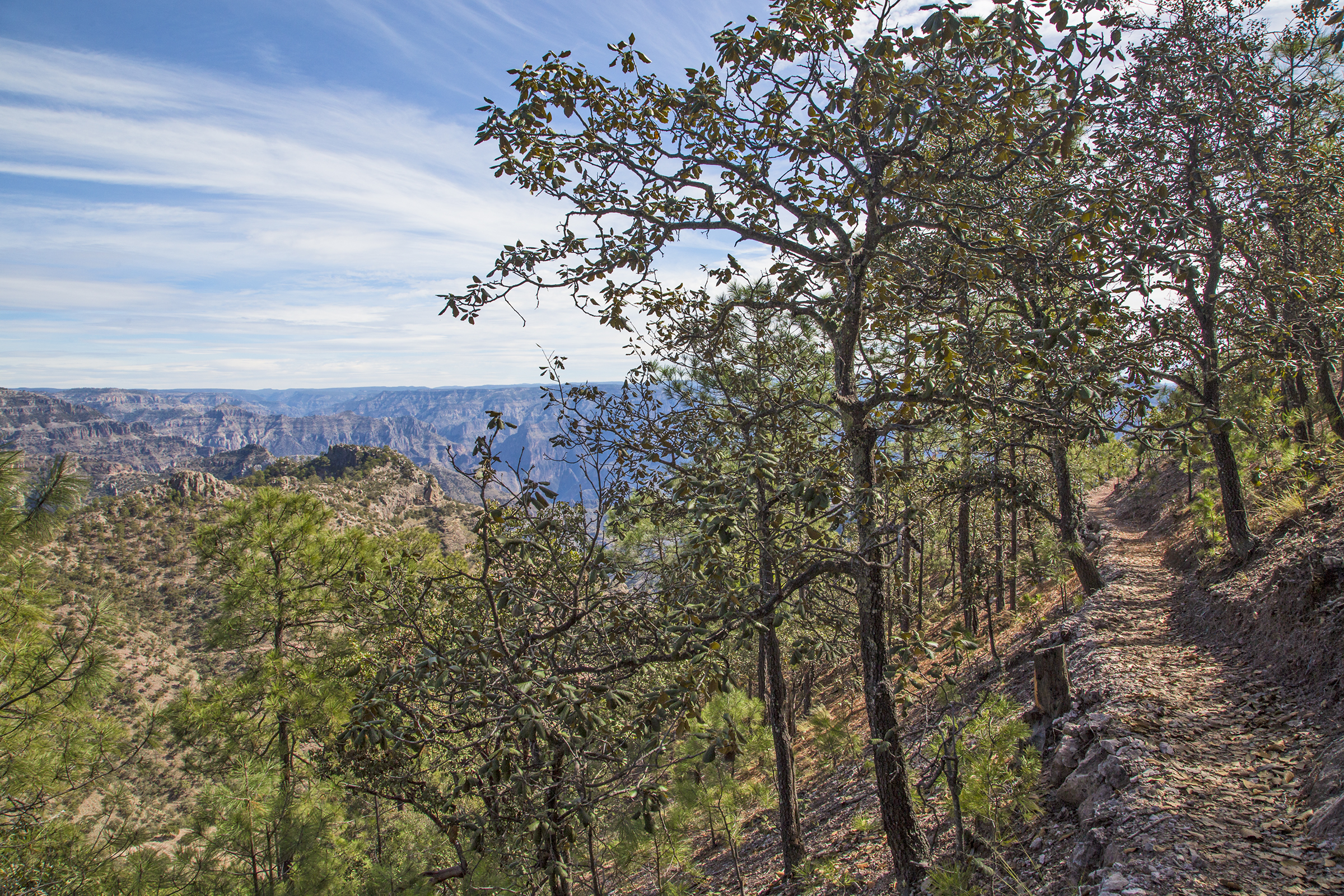
A Tarahumara trail beneath our feet

Tarahumara casita
The canyon walls are strewn with trails, and while plying one, quietly merging with us on a separate trail in the opposite direction, we came upon this lovely teenager, dressed as the females do, in brightly colored attire with pleated skirts. “Quizás un foto, señorita?” “Sí,” answered so quietly that only her barely perceptible affirmative head-nod assured that I had secured her permission.

Enigmatic countenance

Different directions
This lass was offering for sale a few woven items, each for a few pesos. A purchase and a photo? Yes.

Shy Tarahumara smile
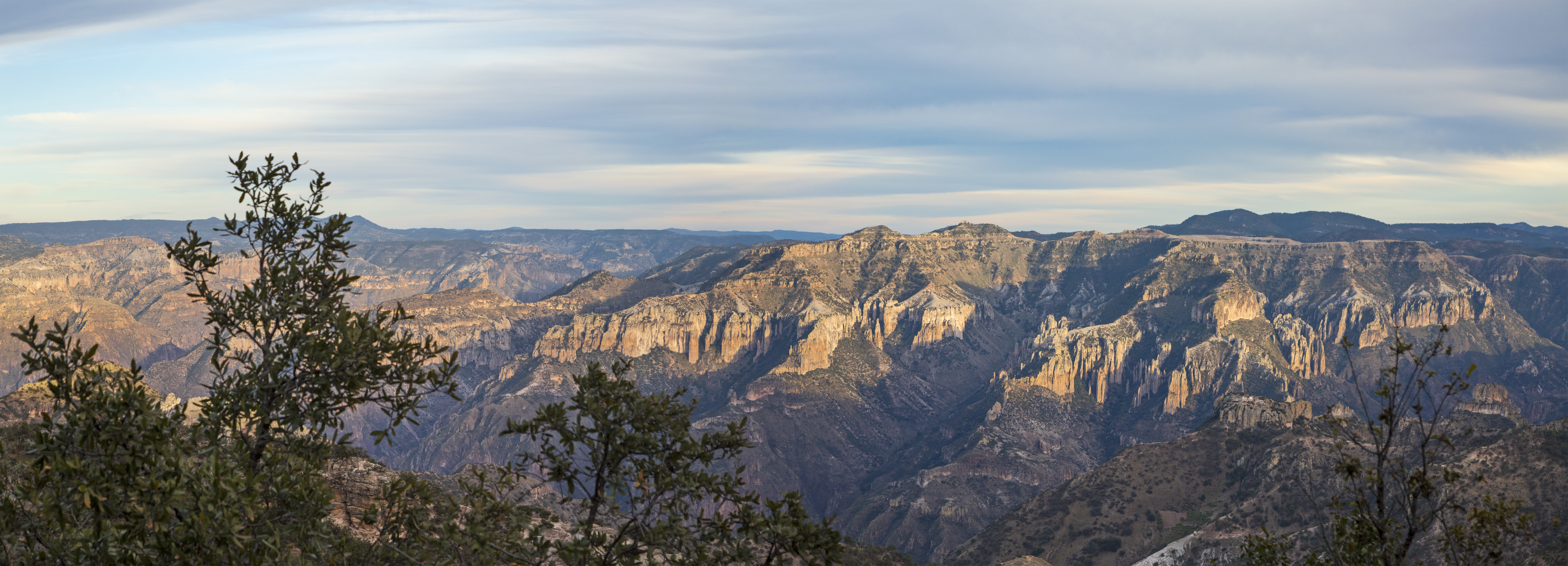
Copper Canyon afternoon light
It is no overstatement to share that my religious faith is buoyed by the extraordinary beauty of nature, and the Barrancas del Cobre only serves as further reinforcement. I am drawn to light and color, to shadow, shape and texture, to the creatures and other humans with whom we inhabit this planet, to the seasons, and I revere sunrises and sunsets, moonrises and moonsets.

Copper Canyon sunrise
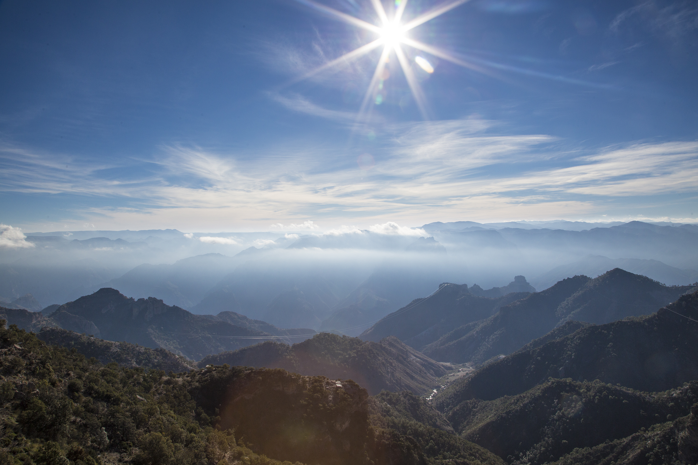
Barrancas del Cobre sol
And then, in what amounts to an exclamation point to our Fine Mexican Winter Trip, there is this glimpse of light in motion, and the rising of the Milky Way.
The Georges continued to Chihuahua, and we returned to El Fuerte, each headed back to our respective worlds of duties and responsibilities.
From FTE we flew to Ciudad Obregon (MMCN) in accordance with the Mexican legal requirement of departing the country from a Mexican Airport of Entry (AOE) and subsequently cleared U.S. Customs and Immigration at the grandiosely, nonetheless accurately named Calexico International (KCXL).
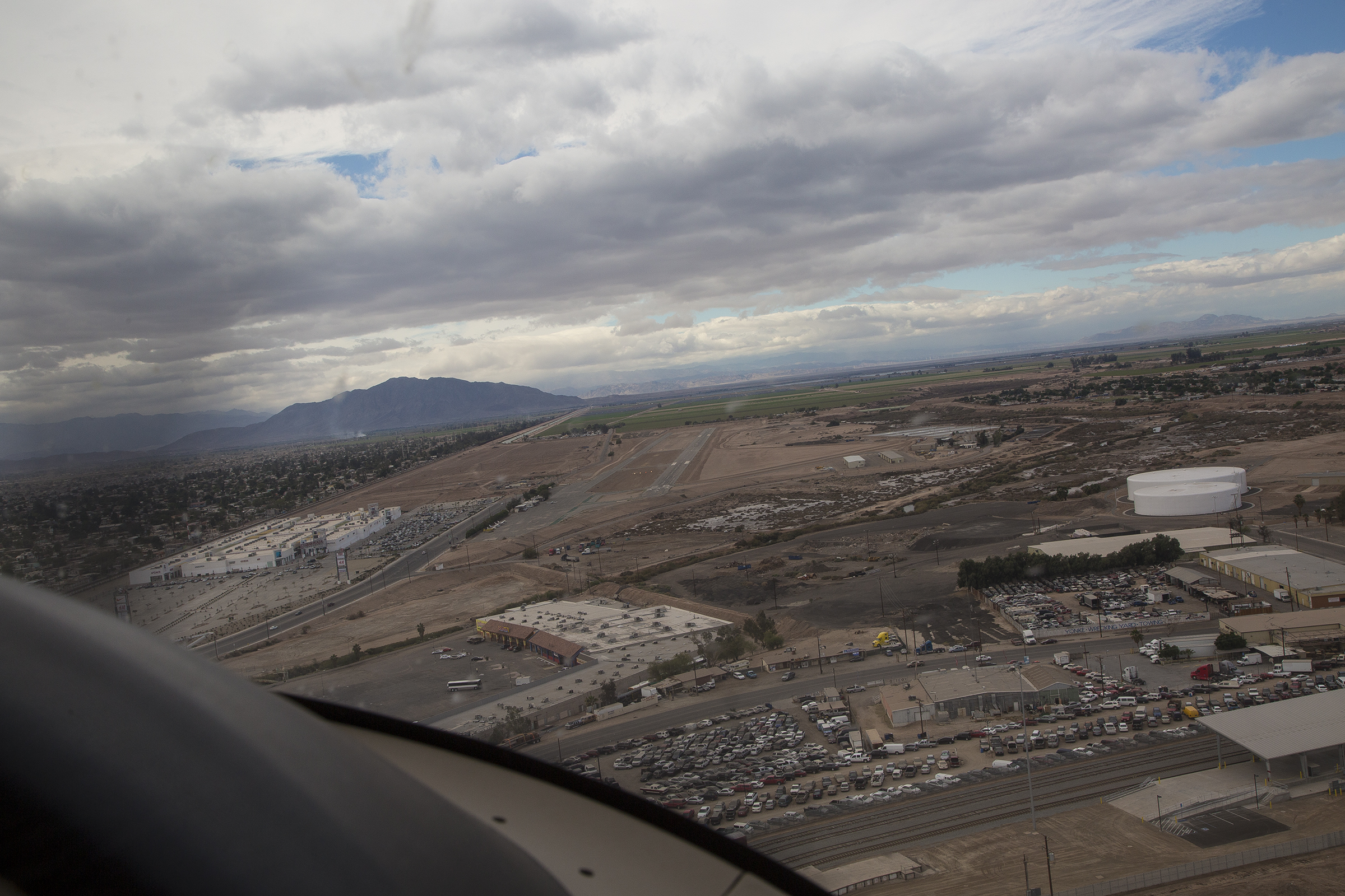
Turning final at Calexico International
I like Calexico, because the formalities take something like five minutes, tops, and you’re on your way. And so it was on this trip, but nature turned the tables on us yet again, returning to a northern hemisphere winter more in keeping with the season than had been our SoCal departure. A cold front was arriving as we were, and I actually had to use the privileges of my airman certificate, climbing to on top of a cumulus strewn sky with strong winds and the potential for a turbulent thrashing about. On top it was smooth, but the rumbles joined a bit of mixed icing on our descent through the inclement weather to an instrument approach back where we’d departed at Montgomery Field. What wonderful opportunities Cathy and I have.
Hasta Luego, Tomás
Flight Review Fun
Posted on November 1, 2014
As a Certified Flight Instructor there are times when I am called upon to conduct a Flight Review for client pilots, required biennially as per Federal Aviation Regulation 61.56 for them to continue to exercise the privileges of their airman certificate. It’s a chance to review, practice, add some polish to perhaps disused operational skills, and to spend time savoring the unbridled joy of flight. I confess that the conduct of some Flight Reviews is more fun than others, as in this past week, “working” with friends John and Howard with their Light Sport Weight Shift trikes. Howard often refers to his as the weed whacker, and you can see why. We do sometimes fly at common general aviation aircraft altitudes, but in the desert toolies, we are oft as not down where you can nearly count the grains of sand.
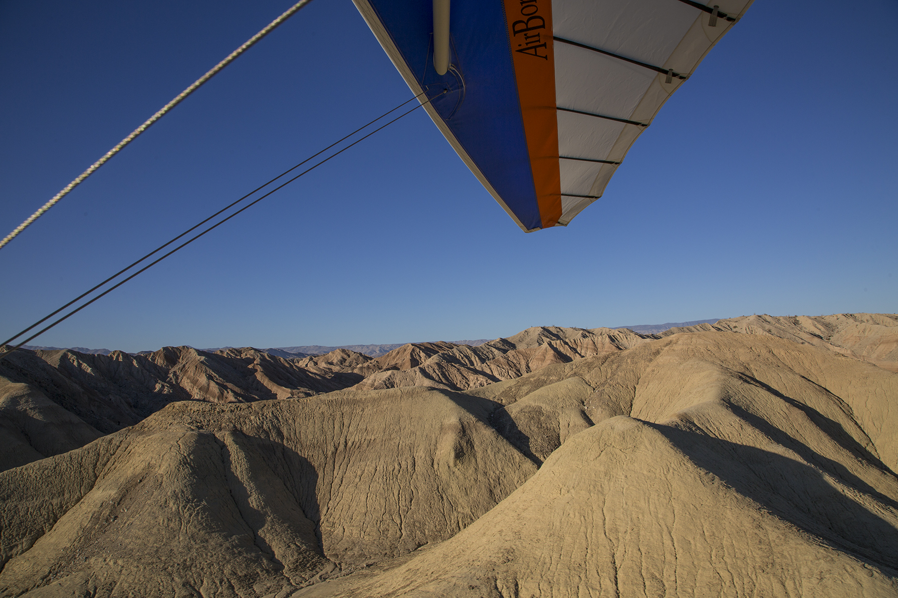
Low and slow’s the way to go
As you can see, the scenery is spectacular, and the view of it is pretty much unobstructed.

Badlands beckon
Did I mention that there is very effective air conditioning with this sort of flying? And there’s always the opportunity to work on one’s suntan. Trikes’ diminutive size and weight, and their flight attitude being controlled by the occupants’ shifting weight means that flight times are routinely early or late in the day when the atmosphere is smoothest. This is also the time of low sun—of rich colors punctuated by bold shadows. Just the stuff to make a photographer or painter effuse.

Low altitude and low sun
Some shadows move at the speed of the earth’s rotation, some at a trike’s cruise speed. This is highly technical physics, of course, most easily explained via “the one picture is worth a thousand words” exegesis.

Follow that shadow
Now, of course, it’s not all just fun and games. This is a Flight Review, after all, so serious pilot skill refresher work is part and parcel with the event. You pilots will surely remember the hours you practiced “ground reference maneuvers?”
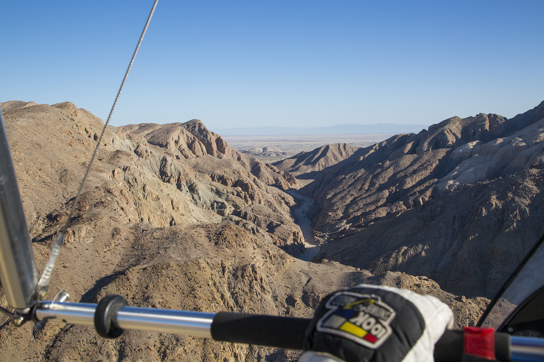
Not S-turns Across a Road, rather, Follow that Arroyo
And then there is the ritual simulated engine failure to an off-airport forced landing. Well, there are lots of definitions for airports, especially if you’re in a trike. Howard scored especially high marks for this dry lake bed landing. A nice opportunity to stretch our legs and decaffeinate.

Trike aerodrome
So, the landing, and the bush-watering completed, it was time to demonstrate a soft field takeoff, which looks like this passing the elevation of the ritual imaginary 50′ obstacle.

Just airborne
Okay, obstacle cleared, with us back at cruise altitude. This is a great vantage point for observing wild flowers, snakes, swallows, and other desert denizens.
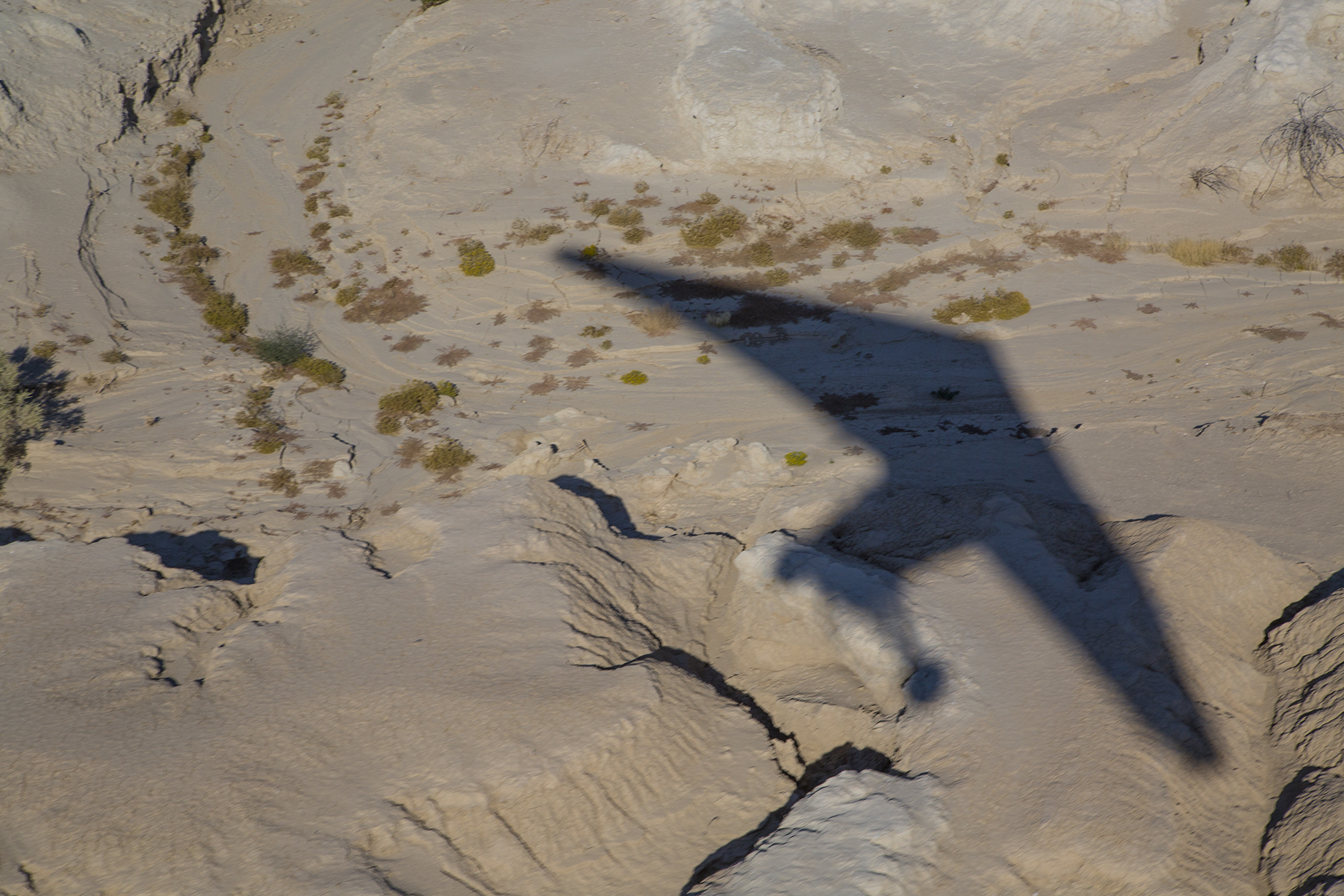
Swept wing shadow
A stressful and successfully completed Flight Review ends with a quiet return for landing at day’s end.

Short Final Approach to Runway 08
As many of you may know, Howard’s day job is as a documentary filmmaker emphasizing the underwater environment. Cameras of this sort need waterproof housings, and those are produced by John’s company. The association we three have with all that is how we came to be chums accomplishing the niceties of the FARs on a late afternoon and early morning. Howard got some extra practice by flying his trike while John and I accomplished his FR. Howard took this as opportunity to roll the cameras on the scenery and the conduct of John’s and my flying. Like I say, some Flight Reviews are just more fun than others. If you need a password for this link, it is—badlands.
A Biplane Landed In Our Yard Today
Posted on August 17, 2014
One of creation’s cooler creatures. Alliteration? Who me?
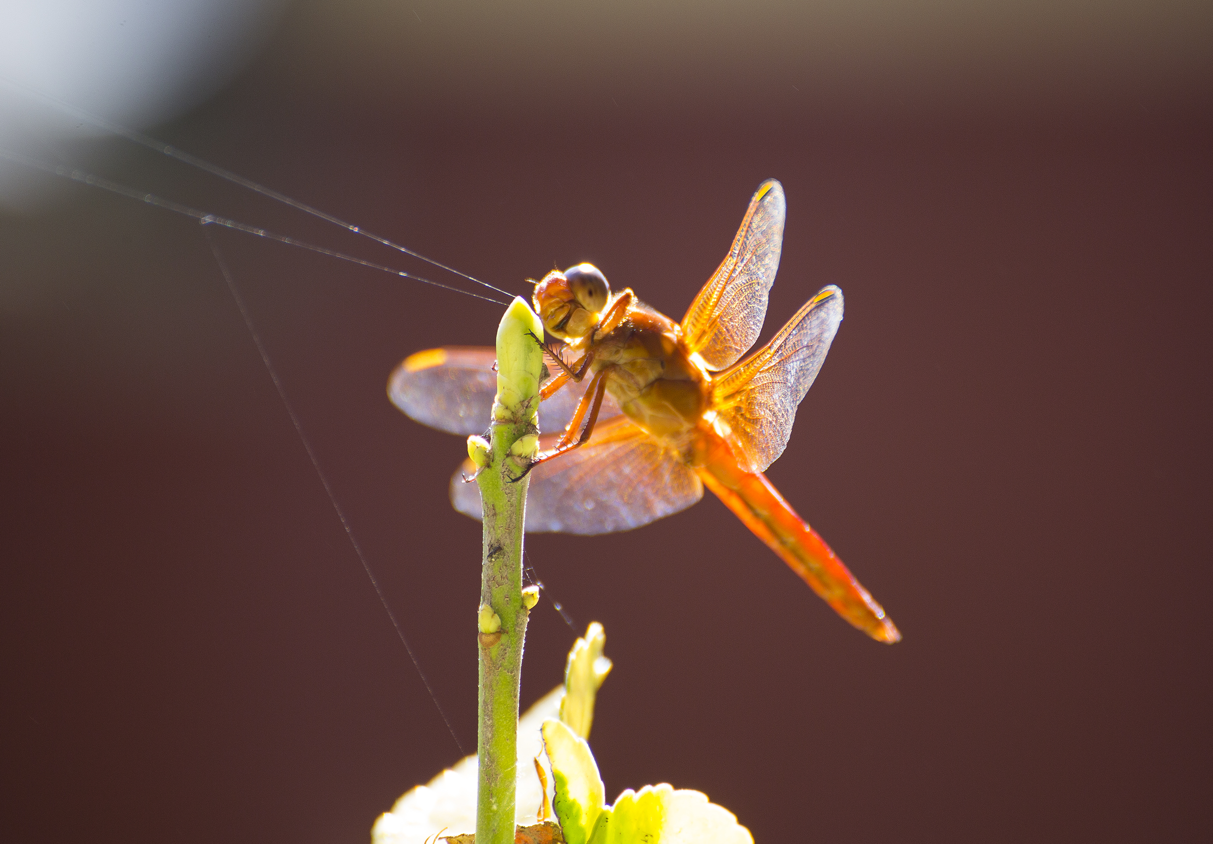
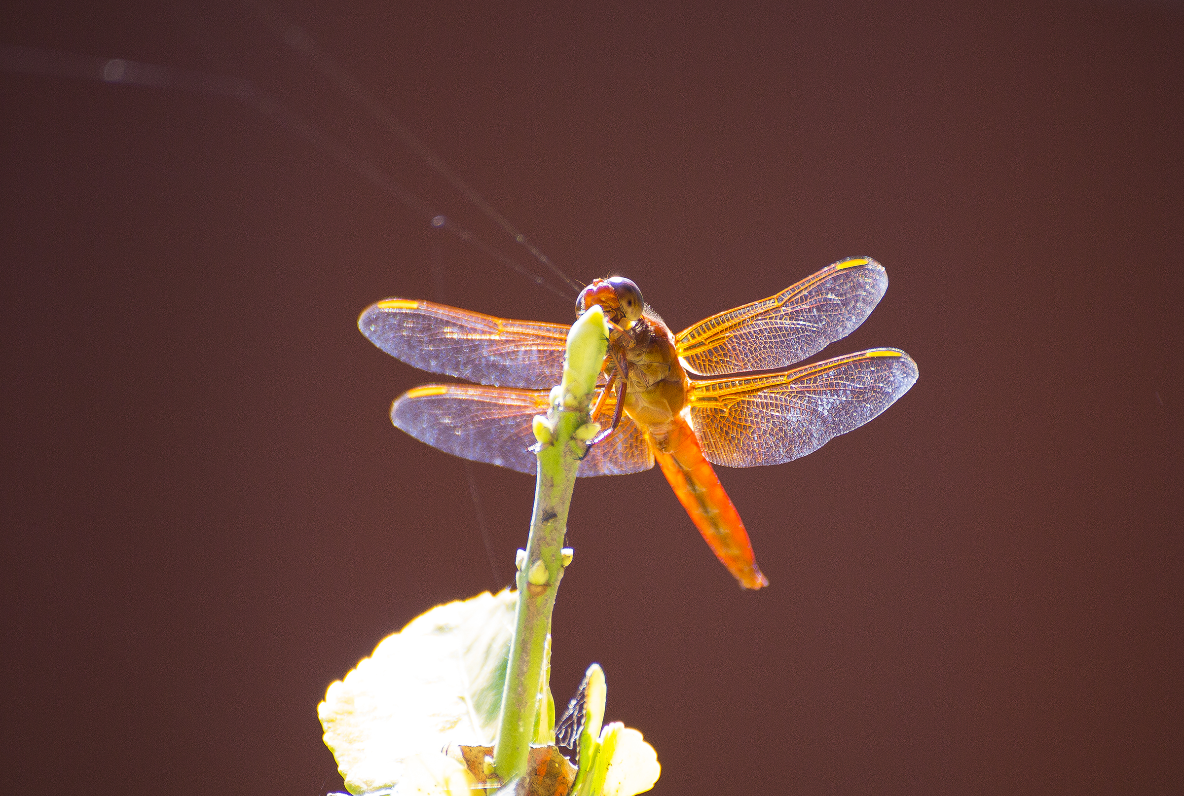
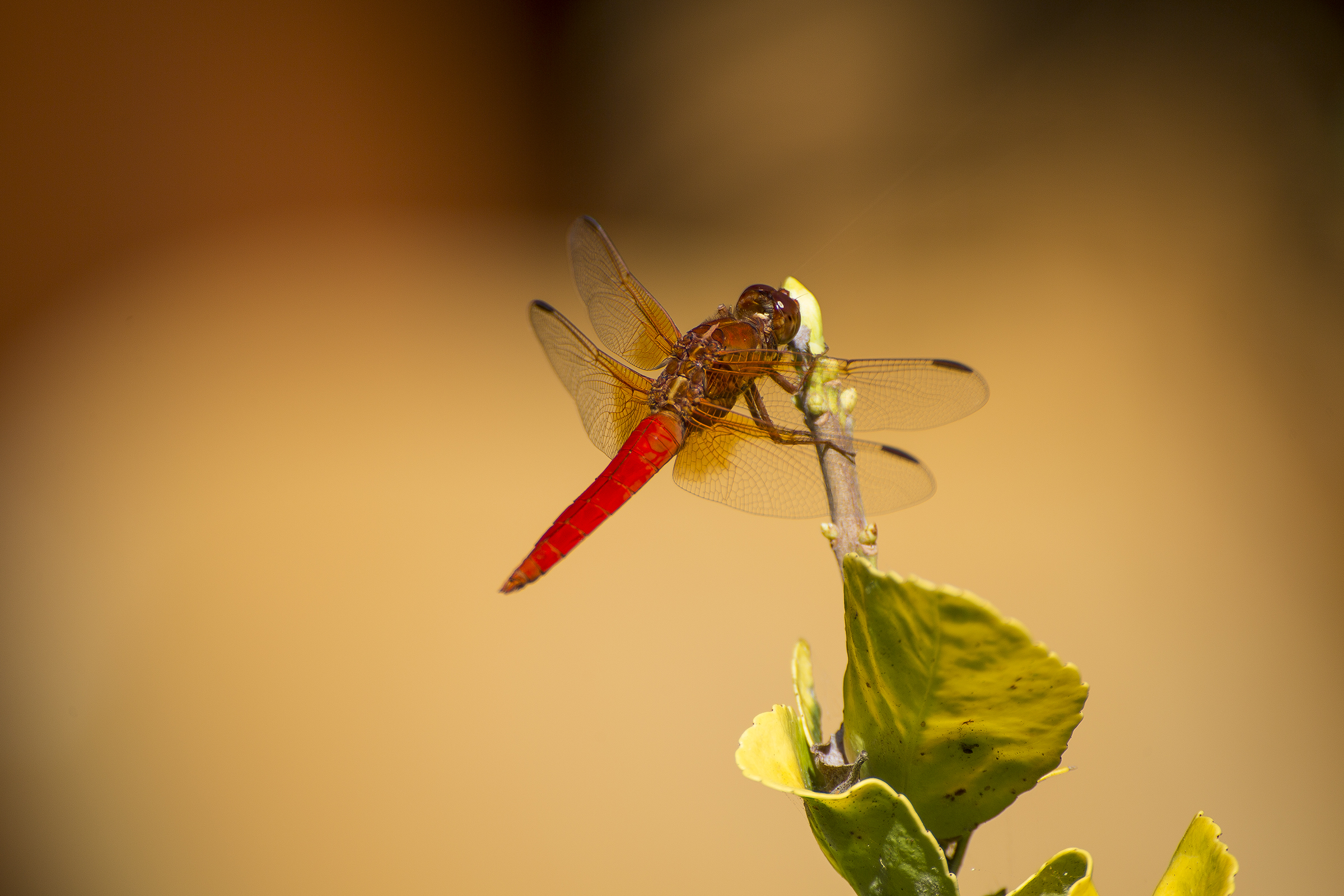
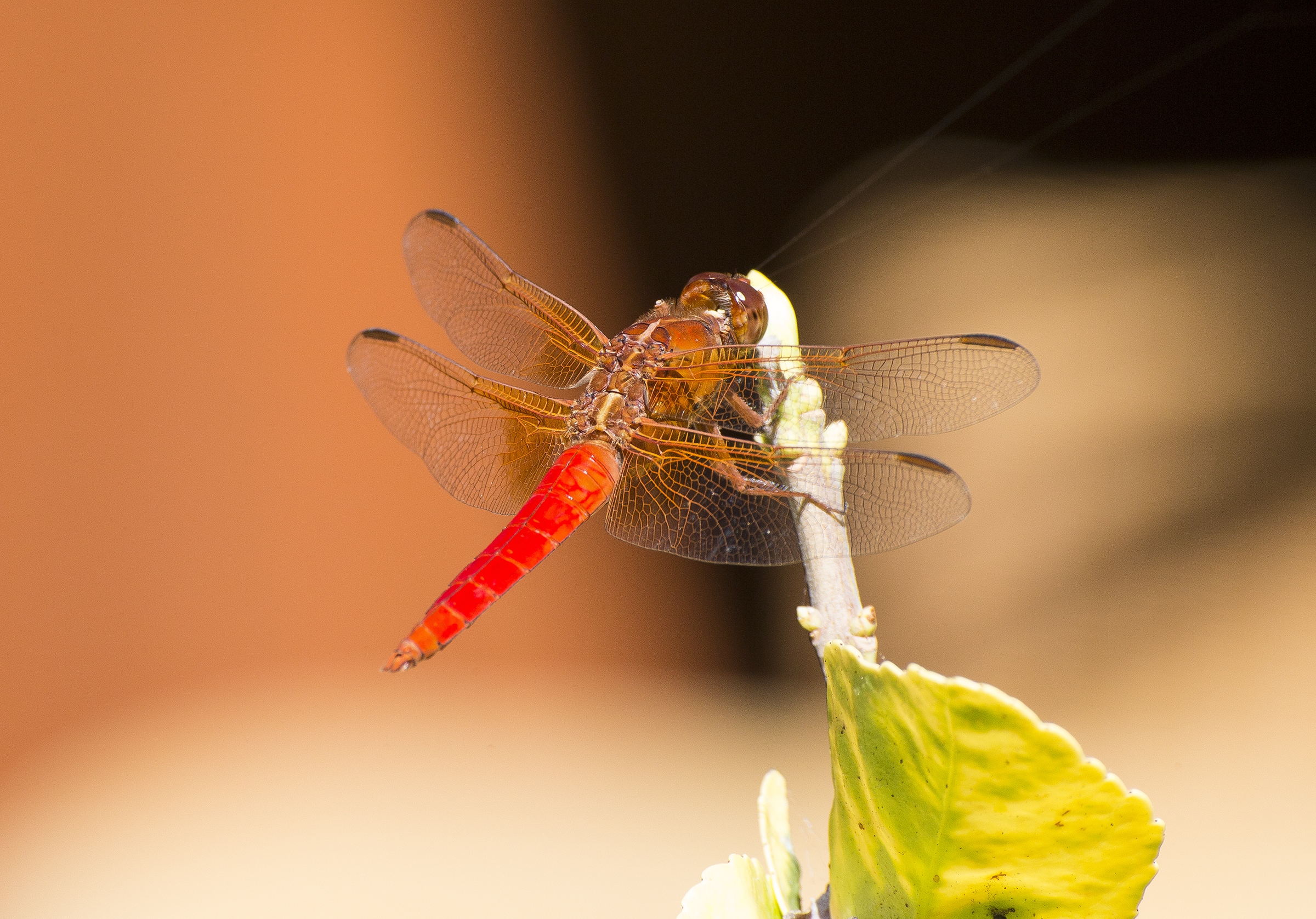
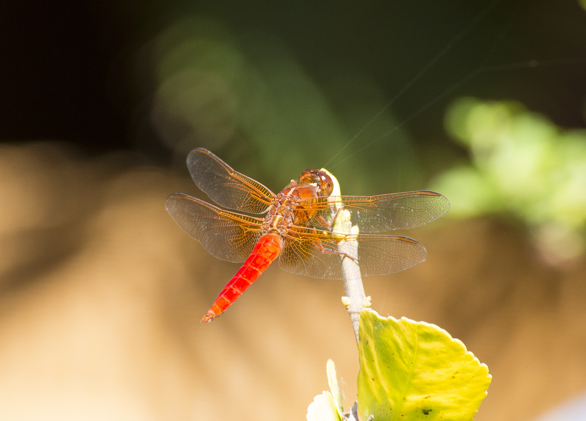


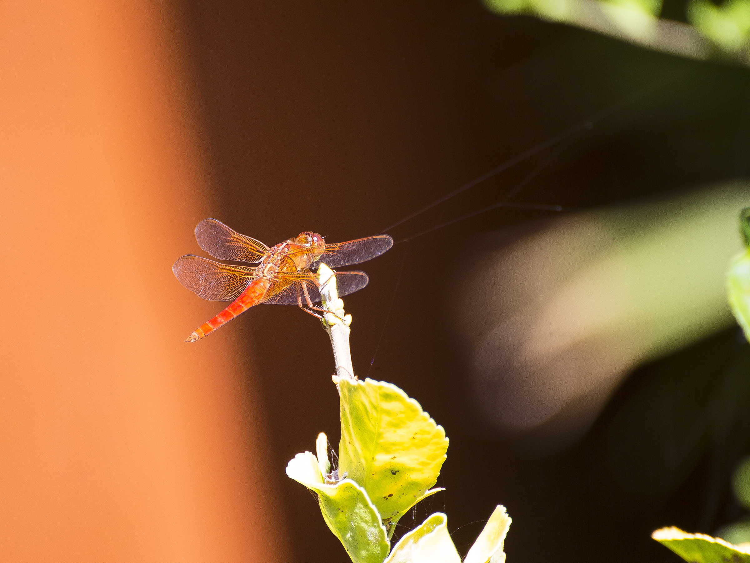


North, by Northwest
Posted on August 10, 2014
Summertime, and the siren call of floats rippling on water. In years past this has always involved the joy of myriad lakes in Alaska’s Kenai peninsula. This year, after due consideration, I decided that Washington’s Puget Sound area beckoned. We made arrangements for lodging and rental car, reserved a couple of days’ floatplane rental, loaded our Cirrus, and struck out for the Pacific Northwest. During the drive to our home aerodrome for departure, the seasonal monsoonal Sea of Cortez airflow was producing a thunderstorm light show, with cloud-to-ground lightening, thunder and rain, but with the convective activity mostly over the east county. I chose a Visual Flight Rules routing that took us beneath the cumulus overhang’s periphery, offshore in San Diego and Orange counties, then over the Los Angeles basin and up the San Joaquin valley for a stretch break and fuel top off in Red Bluff, just south of Mt. Shasta.

Escaping monsoonal thunderstorms off the coast at Camp Pendleton
From there we proceeded via a nearly straight line along the western foothills of the Cascades and the upper Willamette Valley to Port Angeles, nestled on a thin strip of land between the Olympic Peninsula and the Strait of Juan de Fuca.

Mt. Rainier, to starboard
Once beyond SoCal, skies were sublimely clear and smooth until closing in on Olympia, in southern Washington. The forecast actually looked like it would pan out for afternoon clearing at Port Angeles (KCLM, as ICAO identifier), but a half hour south the weather was still reporting overcast. Seattle Center was very user-friendly, agreeing to a pop-up Instrument Flight Rules clearance at 10,000′ MSL about the time we were passing Portland, and the clouds were beginning to gather beneath us as a developing undercast.
I even cajoled them out of a least circuitous routing directly to the Initial Approach fix for the Area Nav approach to runway 26 while savoring the view of Mt. Hood just behind us, and Mt. Rainier, at our three o’clock position (above). All this good fortune was shortly dashed with the dreaded, “come left 15 degrees for traffic.” Looking ahead, I surmised that they might actually be playing into my hands. Ah, such hubris. The mountains of the Olympic peninsula were pumping up a line of cumulus that was principally to the east, whereas to the west, the cloud cover looked lower, in fact altogether benign in the general direction of the Initial fix for the Instrument Landing System approach to runway 8. The latest Sirius downloaded weather still showed overcast, now with a light northeasterly wind, so “Seattle, when done with the traffic vector, how about direct YUCSU?” all the while wondering who thinks up those unpronounceable fix names.
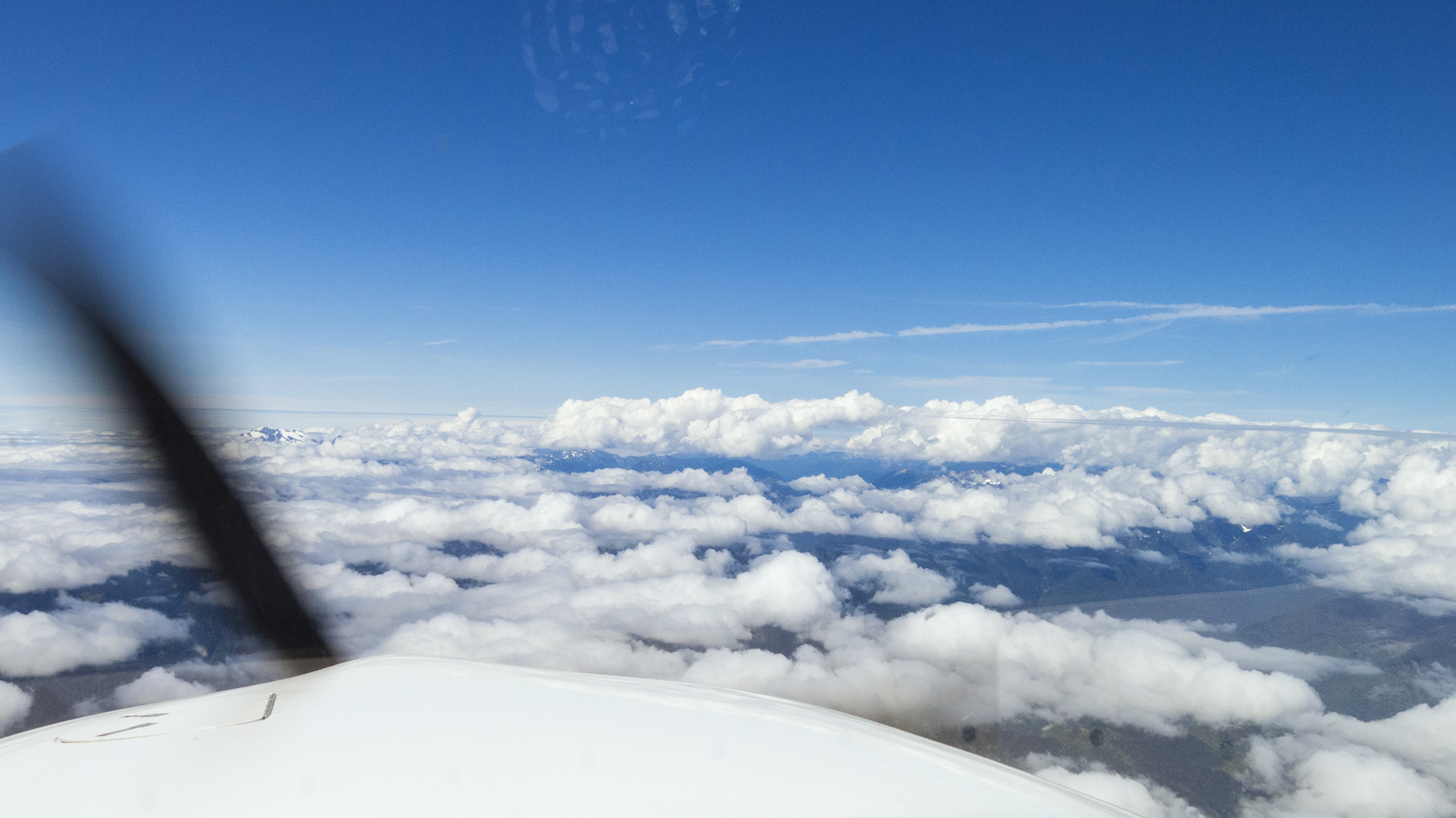
Cumulobumpus over the Olympic peninsula
“N1TT, cleared as requested, maintain One Zero Thousand. We’ll probably lose radio contact with each other for awhile over the Olympics, but I should pick you up again as you near YUCSU.” Hmm. I had the presence of mind to confirm that the charted 118.2 MHz frequency for Whidbey Approach air traffic control was correct, just in case things stayed quiet with Seattle Center. And fortunately, YUCSU possesses a handy holding pattern course reversal to assist in losing a mile or so of that ten thousand feet if I’m doubly bedeviled with a persisting lost communications problem. What was I thinking? Oh, yes, I was thinking of avoiding the towering cumulus on the earlier track. Well, the Center frequency did, indeed, get quiet as we neared the highest mountains over the peninsula, but that just meant having peace to enjoy the view, which was downright gorgeous.

Looking right
And right beneath our left wing, amidst the dance of the veils, was a splendid glimpse of the top of Mt. Olympus, replete with glacial stretch marks. Please note the solid cloud cover beyond the peaks in this image taken maybe fifteen minutes before landing…

That would be Mt. Olympus
…because of that Hubris thing where I actually thought I was being clever in conning a clearance direct to the approach fix for an instrument approach through the clouds and into the wind. However, as we cleared the ridges northbound, the atmosphere dramatically shifted to a ripping west wind, and blew out the overcast near the water. Zeus getting the last laugh on my presumptions and for having the temerity to overfly his residence? At least this meant that I could advise “aerodrome in sight, requesting a visual, circle to land on runway 26,” which gave me the time and distance to lose all that altitude to our sea level destination. So, yes my cleverness backfired by adding a few extra minutes of extended downwind flight time, but nonetheless avoided the cumulus, and gave us a sight-seeing tour of the Olympic peninsula for which many would pay dearly. My grandmother used to allow as how “it’s an ill wind that blows no good.” Double pun, here, bless her.

Short final approach to Port Angeles runway 26
After fueling and securing the airplane we collected the rental car, and decided our internal mental gyros could best spin down with a little post-flight debriefing at Port Angeles’ Bella Italia. Local micro brew for me, local white wine for Ol’ What’s Her Name, and an appetizer of peninsula chanterelle mushrooms and porcini layered on bruschetta. Post lunch, not yet dinner time, and the wine bar seemed to be a favorite of locals who welcomed us with bonhomie and insider tips as to activities and events.
Nice place
Our first few days were spent with family who live between Port Angeles and Sequim, providing us time and place to peruse a bit of the Olympic peninsula. The next morning we drove the roughly two hours to Cape Flattery, beyond Neah Bay. This is a region of dense rainforest, with all manner of wind-blown twisted trees…

Forest S-Turn
…abutting a damp foot trail leading to land’s end. You can’t get farther northwest in the Lower Forty-Eight.
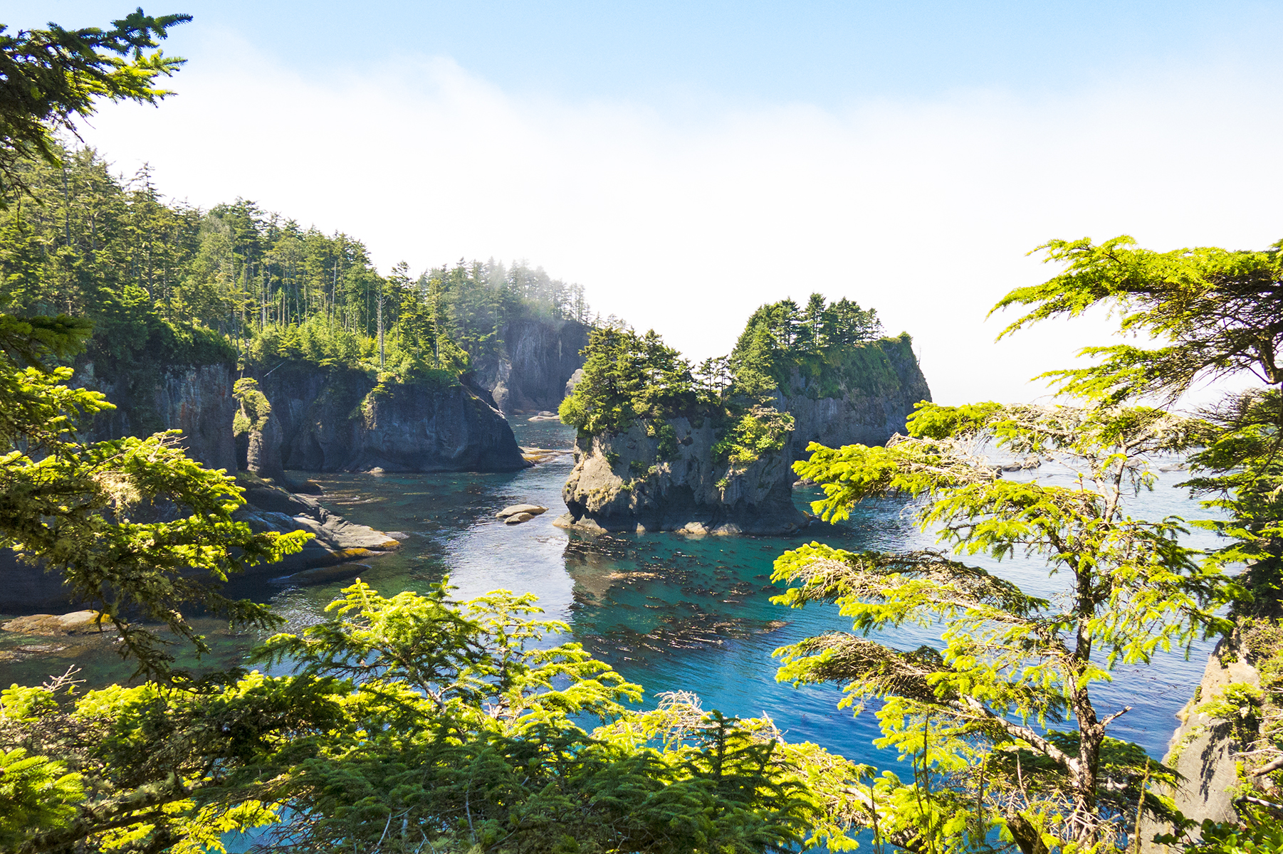
Cape Flattery
As you can see, we were treated to dry weather, radiant blue skies overhead, with the thick morning fog retreating westward before the advancing warmth of late July sunshine. The Olympic peninsula is at once an interlude between seashore and mountains.

Near Neah Bay, with Vancouver Island across the Strait of Juan de Fuca
The following day we hiked the trail up to the apex of Hurricane Ridge. Here we are maybe a mere five miles as the seabird flies from the Strait, steeply downhill to the right.

Hurricane Ridge trail, and Mt. Olympus
The peninsula is a place of nature, raw, thank you, with fauna as compelling as their environment.
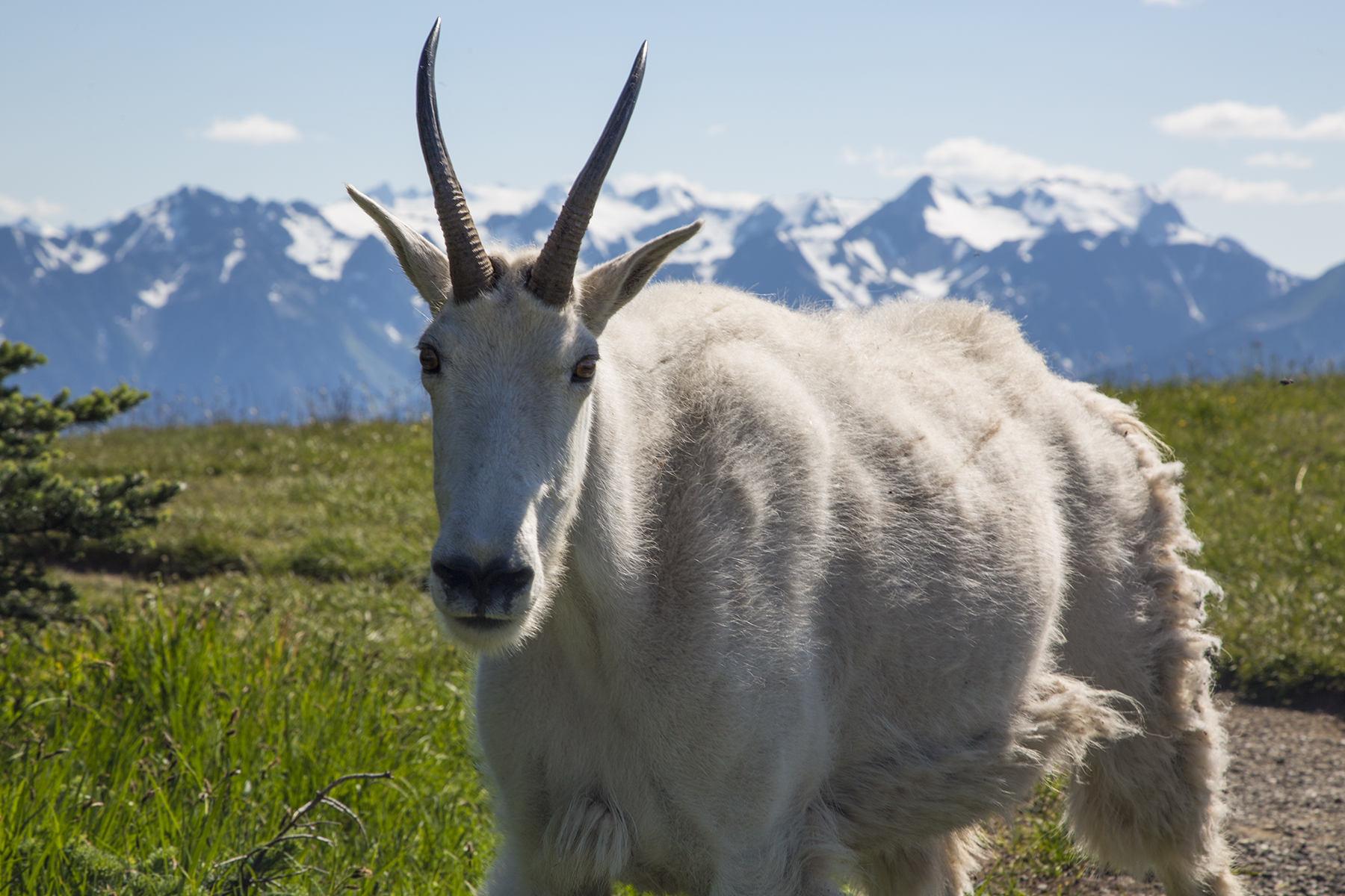
My, what big horns you have, grandma

Marmot trail monitor
My sense of whimsy delights in the occasional bit of silliness. We attended a music cum local wine and brew gig at a handily nearby winery. Check out the vineyard scarecrow.

Nice Hooters
In arranging the dancing with water, I had chosen Rainier Flight Service at Renton Field (KRNT) from a list of the Seaplane Pilots Association, because it was the only operation renting floatplanes that was located on a paved airfield, which enabled my daily :30 Cirrus commute back and forth from Port Angeles. Also, the Champion 8GCBC they used was nominally similar to the Bellanca Decathlon I used to own before building my Pitts S1S, so I had modest familiarity with, and ancient muscle memory from, that two-seat tandem aircraft.
Renton’s Boeing factory is the original manufacturing home of the B707 (aka the “Renton Rocket”) and the current home of the ubiquitous B737 (aka “Guppy,” or sometimes, the “FLUF,” a pilotspeak name you’ll have to ask me about discretely, as the acronym is not for polite company). You may have heard that Seattle is blessed with more than its fair share of rain? Often as not this is associated with southerly winds? In July and August there are many fair weather days, with northerly wind patterns, which was the case on all the days we enjoyed in the region. This had me scratching my head as to how best to plan a flight from Port Angeles, which is northwest of Renton—itself, a stone’s throw SE of Boeing Field and a similar distance NE of SeaTac. Not only is there Class “Delta” tower-controlled airspace for those three, but also the overlaying Class “Bravo” airspace for the greater Seattle area, and oh, yes, a pending Temporary Flight Restriction for the upcoming Seafair airshow. I plotted out a SE routing just high enough to avoid the Olympic peninsula terrain and low enough to be under the Seattle Class “B”—for you non-pilots, a type of airspace aptly described as a three-dimensional inverted wedding cake, centered on SeaTac, flight through which is strictly verboten without a reason to be there, and ATC clearance to do so. My intention was to head over Vashon Island, WSW of SeaTac, and then overfly SeaTac’s runway numbers for northerly runway 34C via the published “Mariner Transition” which would place me south of RNT for a straight in landing on their runway 34. The right hand Cirrus cockpit display in the image below conveys that routing, and also the actual track that Seattle Approach control assigned me when I checked in with them—nowhere’s near where I had planned. Natch.

Airspace convolutions
Looking out the windscreen at more or less the same time and location. That’s downtown Seattle with the Space Needle almost straight ahead, and you are looking almost directly down Boeing Field’s runway 13R just beyond Eliot Bay at the 3 o’clock position in the frame. Yes, that’s Mt. Rainier in the upper right, and Lake Washington and Mercer Island beyond downtown. Renton Field sits at the far right end of Lake Washington. So ATC managed to shorten my flight path and descend me down to a terrific sightseeing altitude and route.
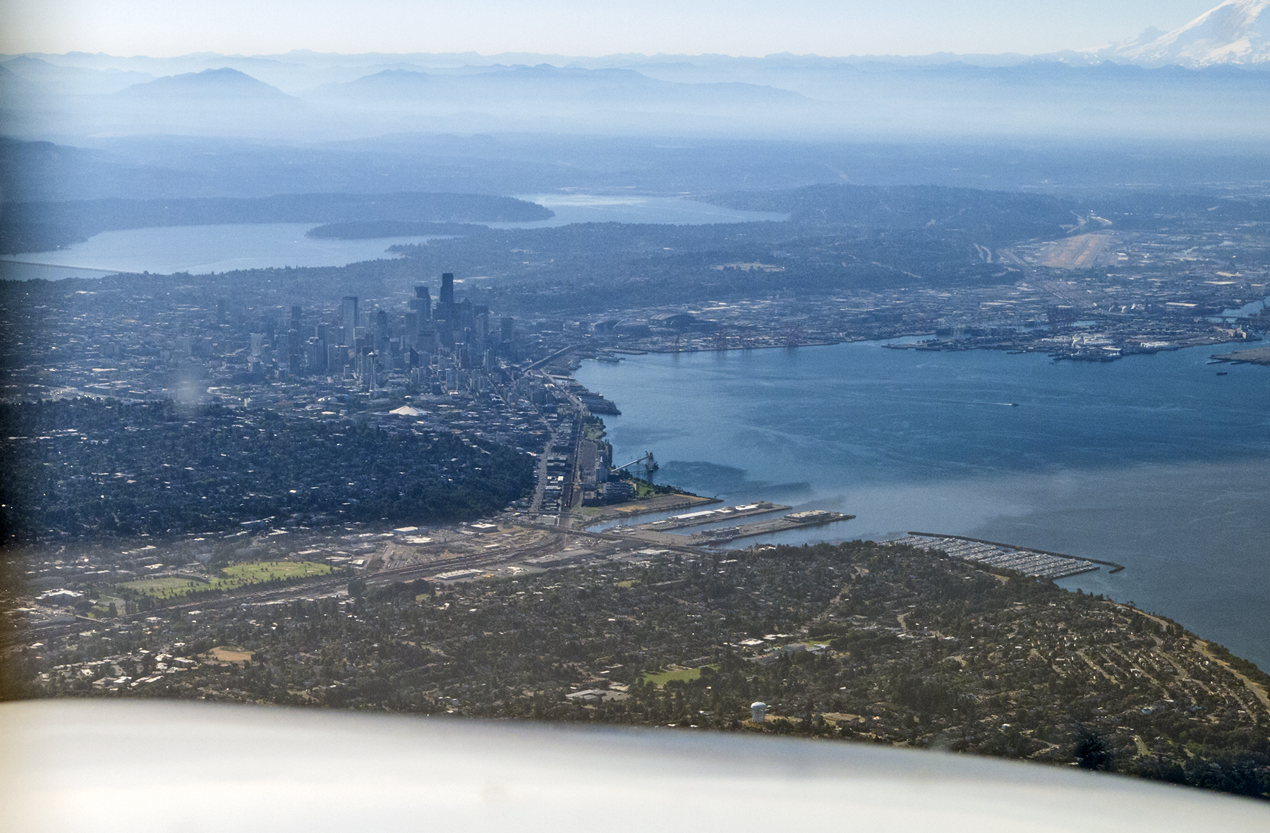
Eliot Bay, et. al.
The ATC path set me up flying southbound over the east shore of Lake Washington, heading past the Boeing Factory in the nearside of the frame, and doing a right 180 degree turn to land in the opposite direction on runway 34, in the center of the image. That light-colored earth with a tiny white vertical projection (its control tower) just this side of the water in the upper right distance is SeaTac. That may look a long ways off in this wide-angle image. It’s about 4 nautical miles, or a minute and a quarter at Cirrus cruise speed. The tower-controlled airspace for all three of these fields literally abuts. Those are the Boeing factory hangars just this side of the Renton runway, and as it turns out, the floatplane ramp and dock is immediately off the north end of the taxiway.
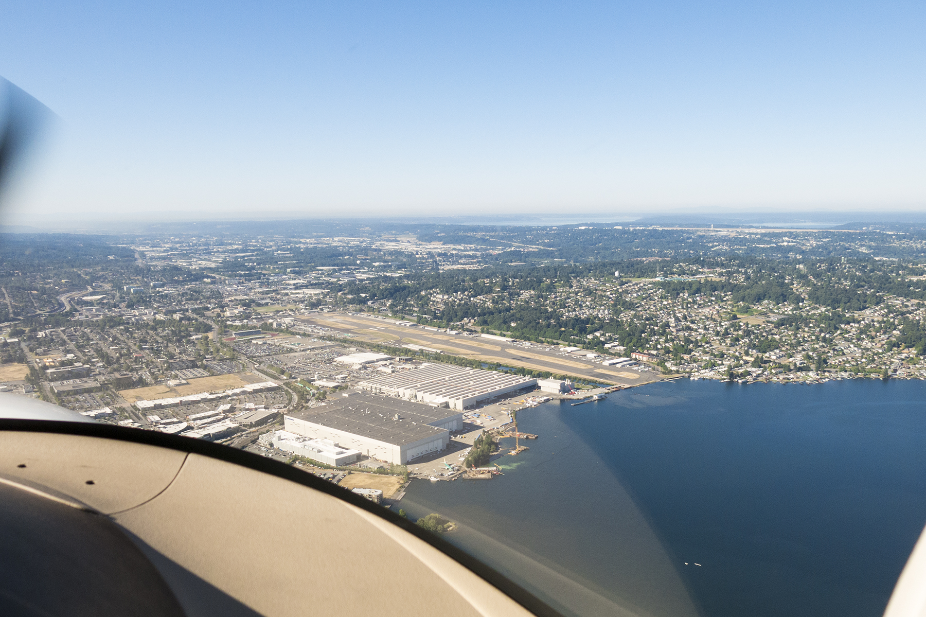
A land plane perspective of Renton Field.
At Rainier, I met up with Byron Palmer, the instructor whose job it was to help me clear out the cobwebs of a half decade of disuse of the seaplane rating on my airman certificate. Said more succinctly, his job was to help keep me out of trouble. Poor soul. Byron comes from a corporate jet background, and moonlights float training from his day job as a B737 simulator instructor at Alaska Airlines. As if that wasn’t enough commonality, his wife is a school teacher. Go figure. We hit it off splendidly and spent a good part of our first day’s briefing thinking about which of the many available lakes we wanted to visit, and completing the preflight inspection of the aircraft. This is a straight floats machine, without the retractable wheels of amphibious floats, so when ready, we tugged it to the water off the north end of the runway with a device that defies easy description—literally the front half of a 4×4 Ford F150, with no bed, rear frame, or rear wheels, and long hydraulically-powered arms out front to lift and hold the plane by the floats until launching at what is for all the world your basic boat ramp. Looks weird as hell, but works like a charm once you get used to the pickup’s steering wheel working backwards. I let him drive, don’t you know!
Intriguingly, the seaport portion of Renton field’s operation has its own name—Will Rogers/Wiley Post Memorial Seaport. Another bit of commonality, here, as well. Last month when returning from the east coast, we landed at Oklahoma City’s Wiley Post field. Some things are just meant to be? In Alaska my float flying had always been in the wilderness, where we were untroubled by the likes of Seattle’s convoluted airspace, or the need to call a tower for takeoff clearance, not to mention boaters and water-skiers who were routinely oblivious to our floatplane comings and goings. Envision the film clip you may have seen of the little old grannie driving too slowly on the freeway and failing to see in her rearview mirror the overtaking jumbo jet about to straddle her in an emergency landing, for how I felt I needed to operate around the frolicking boats and kayaks.
When ready to go we advised Renton tower, and they cleared us to takeoff “at our own discretion” and to report airborne. I used to get that discretion caveat in helicopters, and know, of course that it refers to the fact that you’re not using their handy paved runways. But, heavens, I always figure every takeoff is at the pilot’s discretion! Once “off the water” we proceeded by the “West Channel” routing. There’s a special approval that avoids needing also to talk to Boeing Field tower. This is what staying below 800 feet in compliance with that procedure looks like, while over the water of Lake Washington to the west of Mercer Island. As it turns out, this doesn’t mean that you are clear of air traffic, because all the float planes are doing the same thing. You aerobatic pilots will note the aileron spade in this image, which is there to help lighten the roll control forces. Still rather heavier and slower than the Decathlon, which also had a symmetrical airfoil vs. this pancake flat lower wing surface. 180 horsepower constant-speed prop. Over-floated, which is to say it had plenty of buoyancy, so got off the water pretty readily down here at sea level.  From this extended upwind, we turned west (below), for what would become crosswind for my first landing at busy Lake Union, right in the heart of the Seattle urban area. No pressure, right? Crosswind, at a point upwind of the touchdown zone, means that we ended up flying right over the University of Washington’s Husky Stadium, just off the nose. Our landing lake is off the frame ahead and to the left.
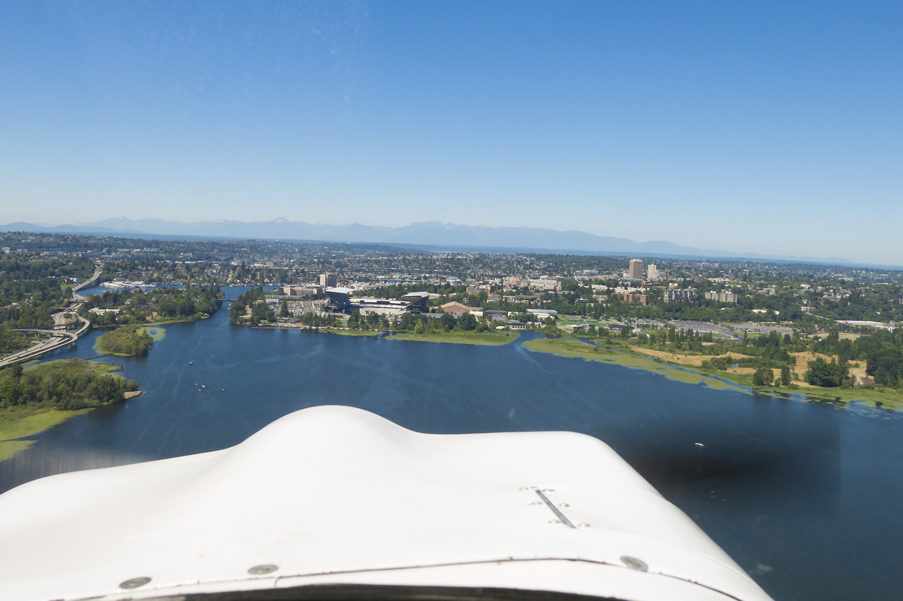
Husky Stadium
Left downwind, with the touchdown zone at 8 o’clock in the frame. The Space needle just right of the nose. Is this cool, or what?
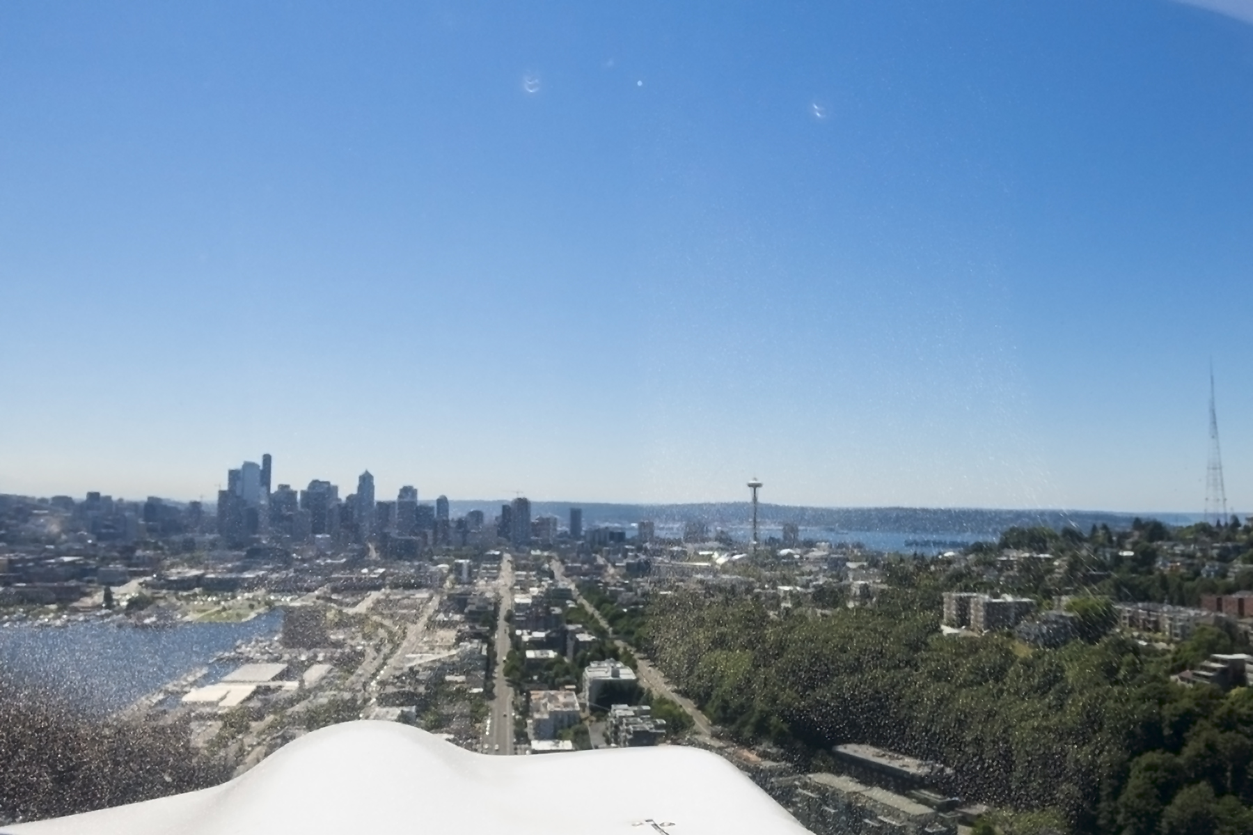
Lake Union, left downwind
We’ve just landed north on the lake, extended the water rudders, and are now taxiing southbound before turning around for a takeoff northbound into the wind. Once turned around and the launch path is confirmed to be relatively clear, its rudders up, full power and full back stick, awaiting the second, higher nose rise—like a stallion tugging on the reins, nostrils flaring—then robust forward stick to get on the step. Quickly follow with just enough back pressure to hold that sight picture with level floats, and then as the speed builds, the slightest additional back pressure allowing the plane to fly itself off the water. Operating a wheeled airplane on turf runways is great. The thrumming of a float plane on water is greater. No tower to call here, but there is a 122.8 MHz Common Traffic Advisory Frequency to keep the other floatplanes apprised. Nah, the boaters don’t monitor it.

Ahoy, matey! On the water at Lake Union.
Next up we headed west and then south to play in and out of a lake in the foothills of the Olympic mountains. I think it might have been something like Lake Cushmore. There we practiced takeoffs and landings, as well as step taxiing, including step taxi turns on the water. These are high speed water ops, just slow enough to stay attached to the water and not get airborne, but fast enough to cover the surface quickly. Step turns feel peculiar because of the centrifugal force pulling you sideways in the seat as you arc through the turn in an essentially flat attitude on the water. Attention has to be paid to turns from downwind to upwind lest the forces bury the outside float, or worse, the outside wingtip. And yet, the skill is essential when operating out of the confined areas of small lakes, with the step turn arcing directly into the takeoff “roll” as you come around into the wind, your speed already just below that needed to get airborne. Then, of course, you might have to keep circling tightly in the air to avoid trees or whatnot on the encircling shore. Flying floats routinely polishes one’s basic stick and rudder skills, not to mention remote area and mountain flying techniques.
That said, we did manage a sufficiently un-remote destination for lunch. I think this might have been Summit Lake. Not sure. Byron’s Seaplane Pilots Association online directory, which he accessed in the air on his i-Pad, said that this was a floatplane-friendly lake with a nice cafe at its north shore. After landing, we taxied up and beached at a grassy picnic area abutting the cafe. This left free their dock for the fishermen to continue casting their lines. Common courtesy between water types, right? We tied up to the picnic table and strolled onto the cafe’s lakeside deck to obtain some sustenance. A fairly suspender-snapping arrival for us non rock stars.

Beached, for lunch.
The next day I brought Cathy and her grand niece, Olivia, with me on the flight to and from Renton. The seaplane, having only two seats was off limits for them, but they borrowed Byron’s car and headed to Pikes Place Market and girls’ lunch and shopping. Byron and I headed south to Lake Tapps, and then overflew McChord Air Force base on our way into and out of American Lake. This generated its own singular recollective grin, as it was McChord where I returned “to the world” to process out of the Army following my tour in Viet Nam in the sixties. After clearing McChord’s airspace I finally got to use the Mariner Transition, overflying SeaTac’s numbers for runway 34C. The aft part of the left float is in the lower left of the frame.

Floats over SeaTac
Now if the above seems like low tech in a high tech world, it is perfectly in keeping with our floatplane TCAS (Traffic Collision and Avoidance System) during our multiple 300 feet AWL base legs for landing on Lake Sammamish.
Floatplane TCAS. Only one shadow is a good thing.
Naturally, at the end of each day’s flying, we returned to Will Rogers/Wiley Post Memorial. On the first return Renton tower directed a conventional righthand landing pattern for runway 34. Except, for a land pilot in a floatplane this is a tad surreal as it amounts to descending over the runway centerline so as to touchdown just beyond the far upwind end of the runway! On day two it got even more whimsical as we approached Renton from Sammamish, which is to the NE, with RNT reporting a dozen or so knots of wind from 290 degrees, or about fifty degrees to the left of runway 34s bearing. It’s considered good capsize-avoidance form in floatplanes to land somewhat closely into the wind, which also attends to their pronounced tendency to weathervane into the wind once on the water. Air traffic was fairly light that afternoon, and the tower turned me loose to initiate base leg as per my own inclinations, with the usual “landing at the pilot’s discretion, report on the water.” Given the confines of the approved landing zone and the wind direction, I throttled back for descent, and laid it over smartly into a right turn to base leg, then quickly another angular change to final approach into the wind. This resulted in a glide that had us crossing over the NW corner of the most westerly Boeing factory hangar about 150 feet above the roof on our way to our splashdown. “Byron, you don’t think Boeing will complain about our ruckus over their roof?” He said he didn’t know of any admonitions to our flight path to touchdown, but I’ll bet he might have been wondering, like me, “probably not complain as much as they would over the ruckus we’d make if we landed ON their roof!” Gallows humor.
The following day, Cathy and I bid our adieus to her Port Angeles family members and launched in N111TT for Orcas, one of the San Juan Islands. Orcas’ aerodrome (KORS) carries the same Eastsound name as the primary village on the island, which is just a :10 walk from the airport transient aircraft tiedown apron. Due to the international border’s dog’s hind-leg meanderings in this area, Orcas actually sits north of British Columbia’s beautiful city of Victoria on the SE end of Vancouver Island. It’s pretty nearly as far north as you can go in the lower forty-eight and still not be in Canada. The San Juan islands are postcard gorgeous with the interplay of land and water everywhere a delight to the eyes.

Passing over Friday Harbor, inbound to Orcas
Below, we are over the sound, itself, with KORS’ runway 34 straight ahead, and the village of Eastsound abutting the water just this side of the runway.

Eastsound runway 34 final approach
I slipped into what would be a prime valet parking spot for an auto, which put us alongside the only other airplane in the transient area. Two Cirri at the same small aerodrome! Note the understated terminal just off the nose of our plane.
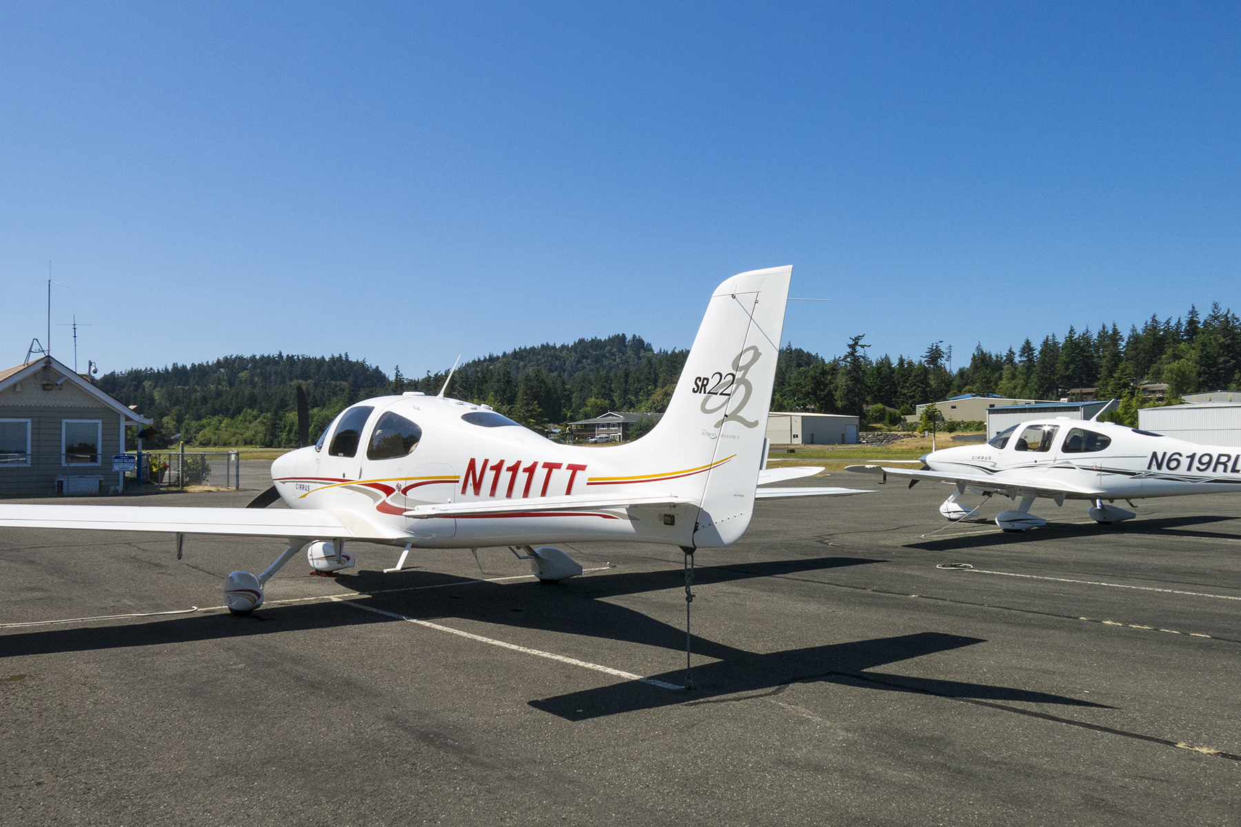
Eastsound, boasting two Cirri at one time
We started our ambulation into town only to be offered a ride by a gentleman who had been in the terminal when we cruised in from the ramp. It turns out he’s the progenitor of the summer chamber music festival, which unfortunately for us, began the weekend after we were to depart for home. Still, we had a delightful conversation before he dropped us off at the Shearwater Kayak outfitter we were using for the next day’s circumnavigation of nearby Sucia Island. And he recommended Roses cafe, in his estimation, the best dining spot in town.
Roses in Eastsound
Cathy, in her inimitable way, seems mostly to luck out on lodging accommodations, and Orcas was no exception. We were here in high season, and just about everyplace was booked full. But she discovered the Old Trout Inn, a B&B off the road between Eastsound and Westsound. Normally this would mean the necessity of a rental car, which we were trying to avoid. It turns out the proprietors Henrí and Nicole were happy to pick us up at the airport after our Roses lunch, drive us to their lodge, as well as to and from our kayaking site the following day, and eventually back to the airport for departure.
The view from our room at the inn.
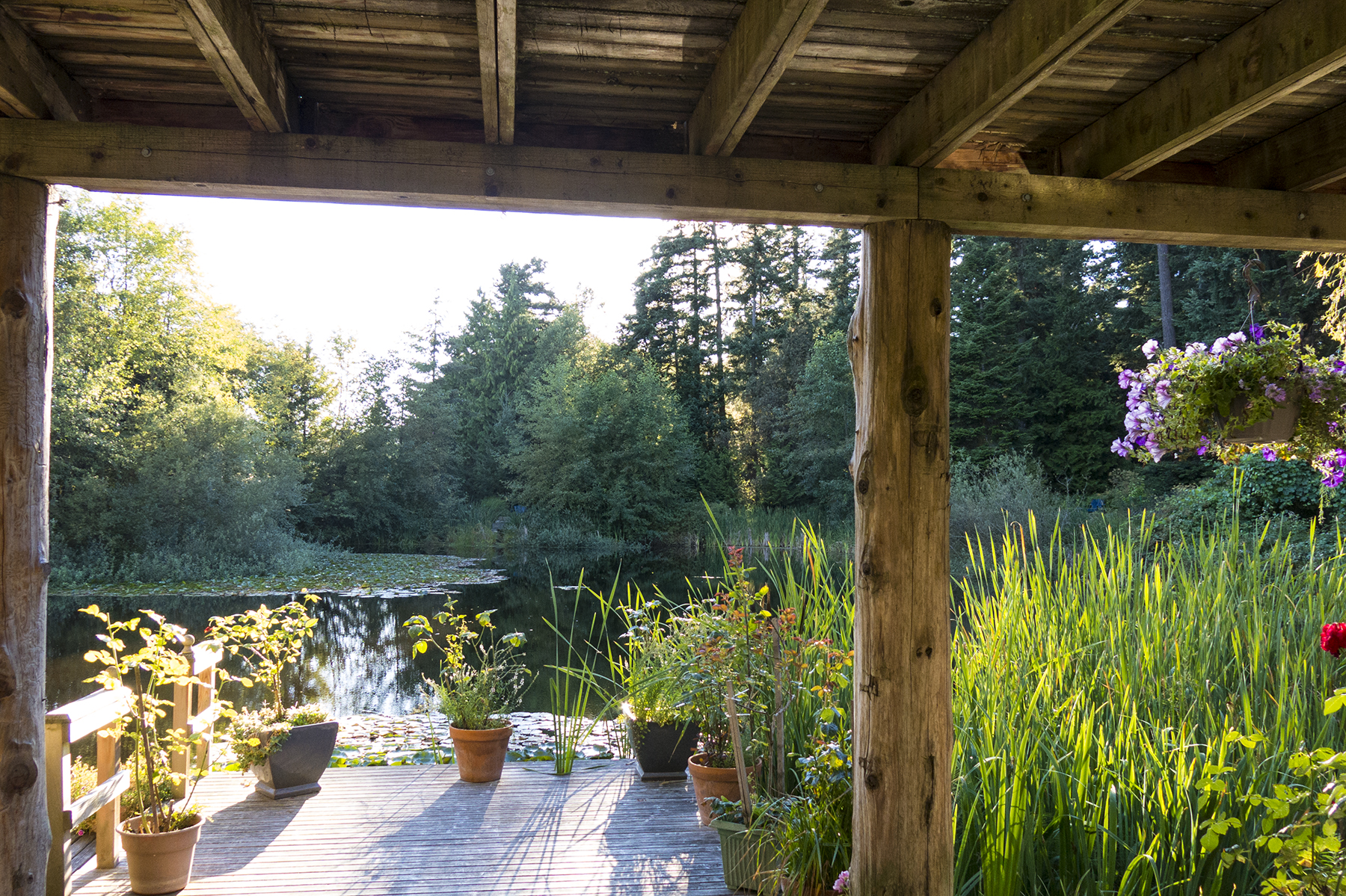
Old Trout Inn room view
Perhaps I should mention that the innkeepers are French, and that Nicole was head chef in their own restaurant for many years? Presentation, for sure. But delicious and filling to cover the first half day of kayaking. We Closes have an in-family game of “Best Croissant, Ever.” Nicole’s freshly hand-prepared version was well to the top of the cream in the milk can of croissant pecking order, and a perfect accompaniment to the delicate and decadent egg soufflé. Henrí was always solicitous, and a marvelous raconteur, sharing stories of his youth when he was a test driver for the Ferrari racing stable’s mounts both in Europe, and after emigrating to the U.S.

Nicole’s breakfast. All handmade that morning
A principle reason we added Orcas to our itinerary was to get in the Sucia Island kayaking exercise. Another way for us to enjoy the water. Spanish-speakers will chuckle over the island’s name, which translates as Dirty Island, an apparent misnomer to me. Our Shearwater group consisted of our guide, Zach, and a total of six of us guests in three ocean-going kayaks. It was seven miles circumnavigating Sucia, requiring sunscreen, exertion, and kayak-mate paddling coordination, but the views were worth the effort.

Kayakers’ view of Mt. Baker
Lunch—deli sandwiches, trail-mix and lemonade, partaken al fresco from washed-ashore sun-bleached logs. Restaurateurs would love the venue. I followed our dining with a bracing full-body emersion in the water, which only raised my voice about an octave. And then Zach, a geology teacher during the year, showed us a Native American shelling site that carbon dates to 11,000 years’ age. Obviously they, too, liked the protected waters and the view, plus the plentiful seafood.
Lunch stop
After lunch we continued our clockwise sojourn.
Greg, Ben, and Zach
At the end of our paddling, we were picked up by a prearranged water taxi and returned to West Beach on Orcas, where Henrí retrieved Cathy and me. We savored a lovely French dinner from the inn’s outdoor deck, washed down with a bottle of bubbly, and prepared for our morning departure home.

Sucia from the air
Our takeoff from Eastsound was to the north, and as we turned a right crosswind, there was Sucia off our left wing, glowing in the morning light. The mountains of mainland British Columbia in the distance. Looking at all the water we’d covered, sometimes overcoming currents, we got a hint at why the arms and low backs were telling us that they had been used.
There’s a modest backstory to our routes going and coming on this trip from SoCal to the Pacific Northwest. We escaped thunderstorms on our departure from our Montgomery Field home ‘drome at the outset. And the weather pattern we had then, had slowly migrated northward, a week later to Washington and Oregon. The return morning weather, studied on my i-Pad, showed cumulonimbus with tops to 51,000 feet, rain, lightning, and hail from around Olympia south toward Salem. The Olympic peninsula was clear, as was the coast leading toward northern California. Ergo, a track back over the Olympics, going as we had come…
Olympics, ahead. Thunderstorms to the left.
…and then past the mouth of the Columbia River, continuing abeam Arcata and Eureka, for a fuel stop and stretch in Healdsburg, CA. Healdsburg appeals to my penurious side, as the quaint and quiet airstrip in the heart of the wine country boasts avgas a full dollar a gallon less than others.
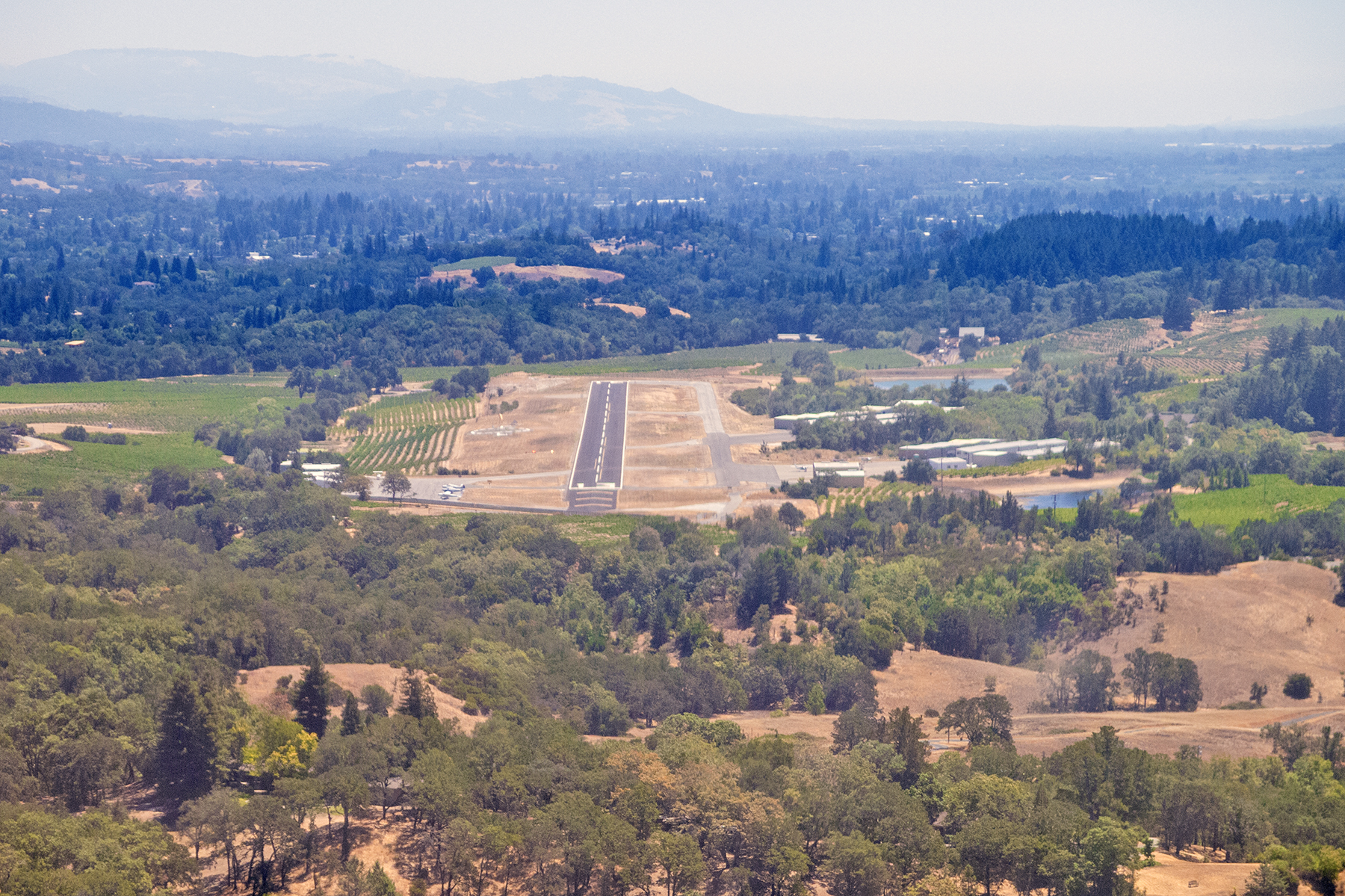
Healdsburg, runway 13
Hmm. Good recon for a future wine country exploration by bicycle? Autumn harvest? Have plane, will travail. Apologies to Paladin.

Recent Comments