There and back again—a bicoastal Cirrus road trip
Posted on June 28, 2014

Mecca for pilots
My wife, Cathy, has an affliction—when she’s free from her SDSU professorial duties, as with the recently completed Spring semester —she’s compelled to tempt me to travel somewhere, anywhere, but especially to regions she has not previously explored. Translated—”Let’s take the Cirrus and fly to the east coast to visit Aunt Tilda, and see some of our country I haven’t yet explored.” What? At one level, this is music to a pilot’s ears. Yet, while I’ve flown more transcontinental crossings than I can count, a bicoastal endeavor in a small plane means being down in the atmospheric levels where experience reminds me that weather actually has some teeth. The most effective methodology is careful advance planning, flexibility and a willingness to adapt—change the route, change the altitude, change the destination, and/or change what day to go or stay put. Words to live by.
We blocked out a couple of weeks and conjured up a route that would take us to the hill country of south/central Texas, the Smoky Mountains of western North Carolina, the Outer Banks abutting our county’s other ocean, a visit with Matilda in Williamsburg, VA, and back, by unknown route to unknown locales.
The trip affirmed the wonderful nature of our populace across the land, certainly in the heartland, and as pilots know, at airports small and large, where Fixed Base Operator (FBO) personnel are friendly can-do spark plugs of help and courtesy. The trip affirmed the vastness of our country, and the incredible diversity of topography, flora and fauna, and the magnificent beauty of it all. If one word sums it up—variety.
Statistics form only a framework to describe our travels. We covered 4481 nautical miles (sorry, I’m a pilot—that’s 5153 statue miles for you terrestrials) in 28.5 flying hours, for an average groundspeed of 157 knots (181 mph), takeoff to touchdown. We operated throughout at economy power settings resulting in a fuel usage of 12.9 gallons per hour. And yes, my credit card was starting to glow by the time we returned home.
We departed our San Diego Montgomery Field home aerodrome under Instrument Flight Rules (IFR) due to a low marine cloud layer. East of the coastal mountains, now beyond the clouds, I cancelled our ATC IFR clearance to proceed under Visual Flight Rules (VFR), following our own noses to our first fuel stop and potty break at Santa Teresa, NM’s Doña Ana County airport, some 20 miles west of El Paso Texas. I can’t resist musing on this ability to fly by one’s own routes and inclinations as being nearly unique to our country, a reflection, I think, of the independence mindset and self-reliance of our forebears. Pilots in other countries marvel at our freedom of flight, and flock here to embrace it. Still, one has to sit up and pay attention, for instance, avoiding the 15,000′ cable securing a US Customs and Border Protection Aerostat balloon, surveilling the nearby border with Mexico. Your tax dollars at work.

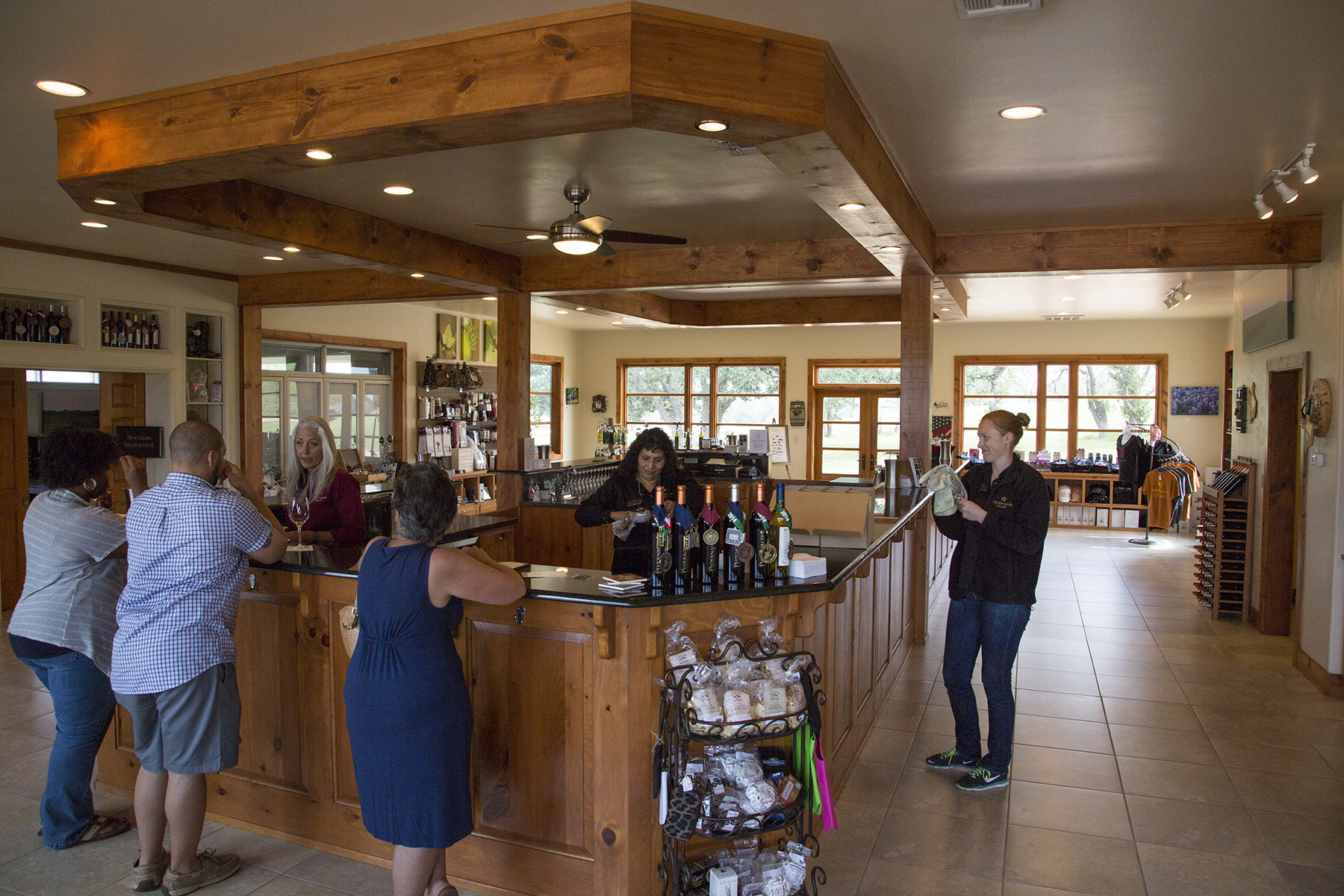
A half hour after landing, we were on our way over El Paso and on to our first destination of the trip at Fredricksburg, TX. Going with the flexibility flow of small plane travel across the multiple weather patterns of great distances in a day, we routinely traveled without advanced reservations for accommodations or rental cars. This mostly worked out, but did require a little ingenuity and patience which added to the sense of adventure in our travels. Where to stay in the Fredricksburg area? Well, how about here? We’ve just landed, and taxied in to the ramp, and have a pretty decent clue before our just-stopped prop.

The hotel was just delightful, with comfortable rooms, and friendly staff. No reservation? No problem. No rental car? Here’s the keys to my car, just out the door, and there’s a really terrific restaurant, just a mile or so down the road. The FBO arranged for a car the following morning, but that first night, being a Tuesday when the adjoining WWII diner was closed, it was hotel receptionist Peggy’s no-worries offer that provided transportation to two hungry travelers. Dorothy, to Toto, I don’t think we’re in Del Mar any more. So you’ve maybe noticed that the hotel is actually a redone Hangar? At this stage we had not yet learned about Fredricksburg’s Admiral Chester Nimitz history, but it began to dawn on us that this community reveres its WWII past, and finds ways to capitalize on it, including right here at the Hangar Hotel. The lobby is delightfully art deco, replete with 1940s era music and period suitcases and decor.

Thirsty? The bar is right this way.
This is in the heart of the Texas hill country, west of Austin and north of San Antonio. Hills in Texas? Something to learn for the both of us. Fredricksburg is a city of some 27,000 inhabitants, sporting multiple fine art galleries, many fine dining establishments, and the absolutely superb National Museum of the Pacific War. What? It turns out that Chester Nimitz, Fleet Admiral, appointed Commander in Chief of the entire WWII Pacific Fleet just after Pearl Harbor, hails from Fredricksburg. The museum is chock full of interactive exhibits conveying the geopolitics and history of the vast sweep of the war from Japan’s early feudal Samurai past through Pearl Harbor and on to the unconditional surrender aboard the USS Missouri in Tokyo bay.
You alert readers will have no doubt noted that Fredricksburg is a rather Germanic name—no accident, as early 19th century settlers in the region were German immigrants grown tired of working some nobleman’s land. From this ethnic history a couple of noteworthy mentionables. A few miles north of Fredricksburg was the Army post of Fort Mason, there to protect the settlers from Apache raids. The fort produced several famous soldiers, among them, generals Robert E Lee and George H Thomas, both southerners. Lee could not abide taking up Civil War arms against his fellow Virginians and so refused the offered command of all Union Forces, casting his fate to the winds leading to the Appomattox courthouse. Thomas served with distinction among the Union forces, and so was disowned by his family, who burned all his possessions and letters. In a more prosaic and current vein, aficionados of craft brewing can sample fine beers in the local micro-breweries, and at their leisure, take an open, still-being-consumed pint with them as they leave the establishment to wander about town, because the good German forefathers thought to include such freedoms in the city charter. How would I know? And, oh yes, this is also the Texas wine region, and I can assure you we discovered our share and yours of fine varietals.
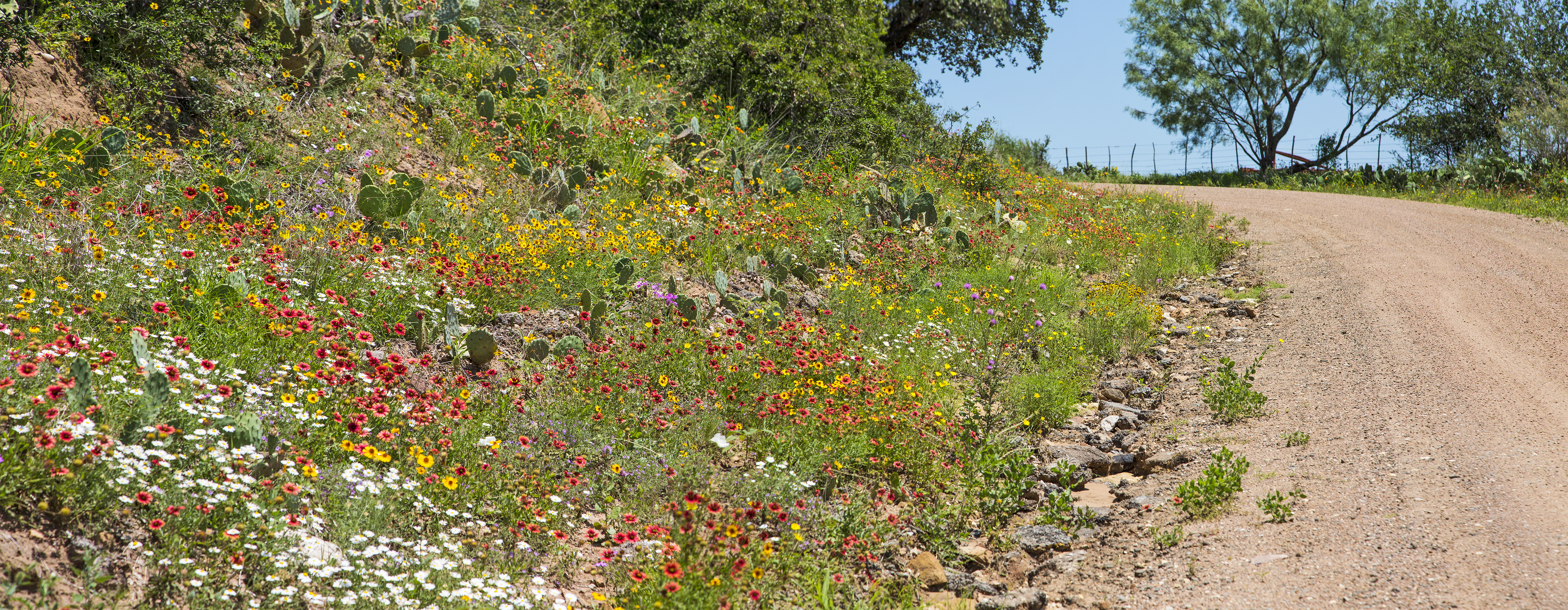
The last thing I expected to see in central Texas in June was wildflowers. The highways and byways surprised me at every turn.

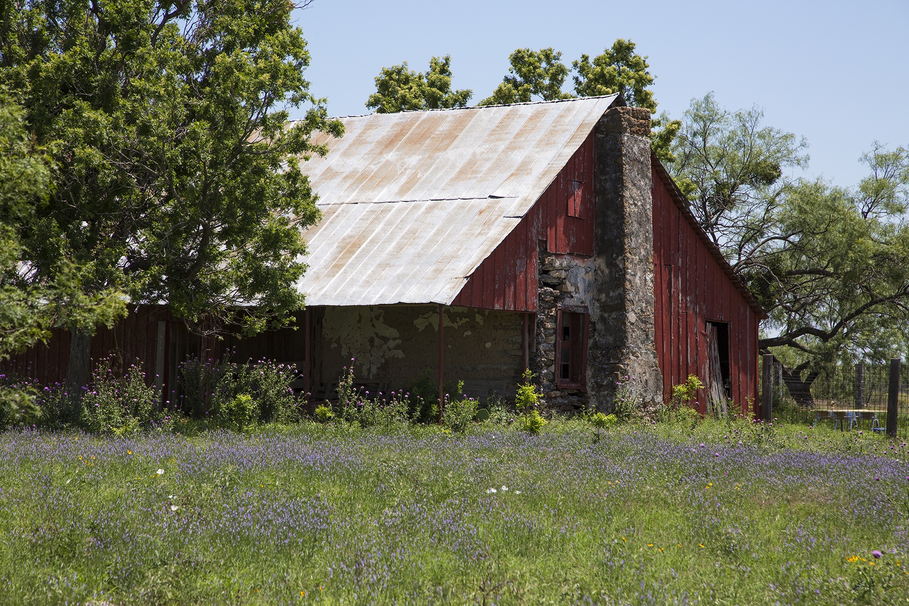
And then, this being rural Texas, there were sights like these, as well.

It’s that German welcome that brings a smile.
On one evening in the area we headed out to an old train tunnel located near Luckenbach Texas, a one horse spot in the road made famous by the Waylon Jennings song of the same name.
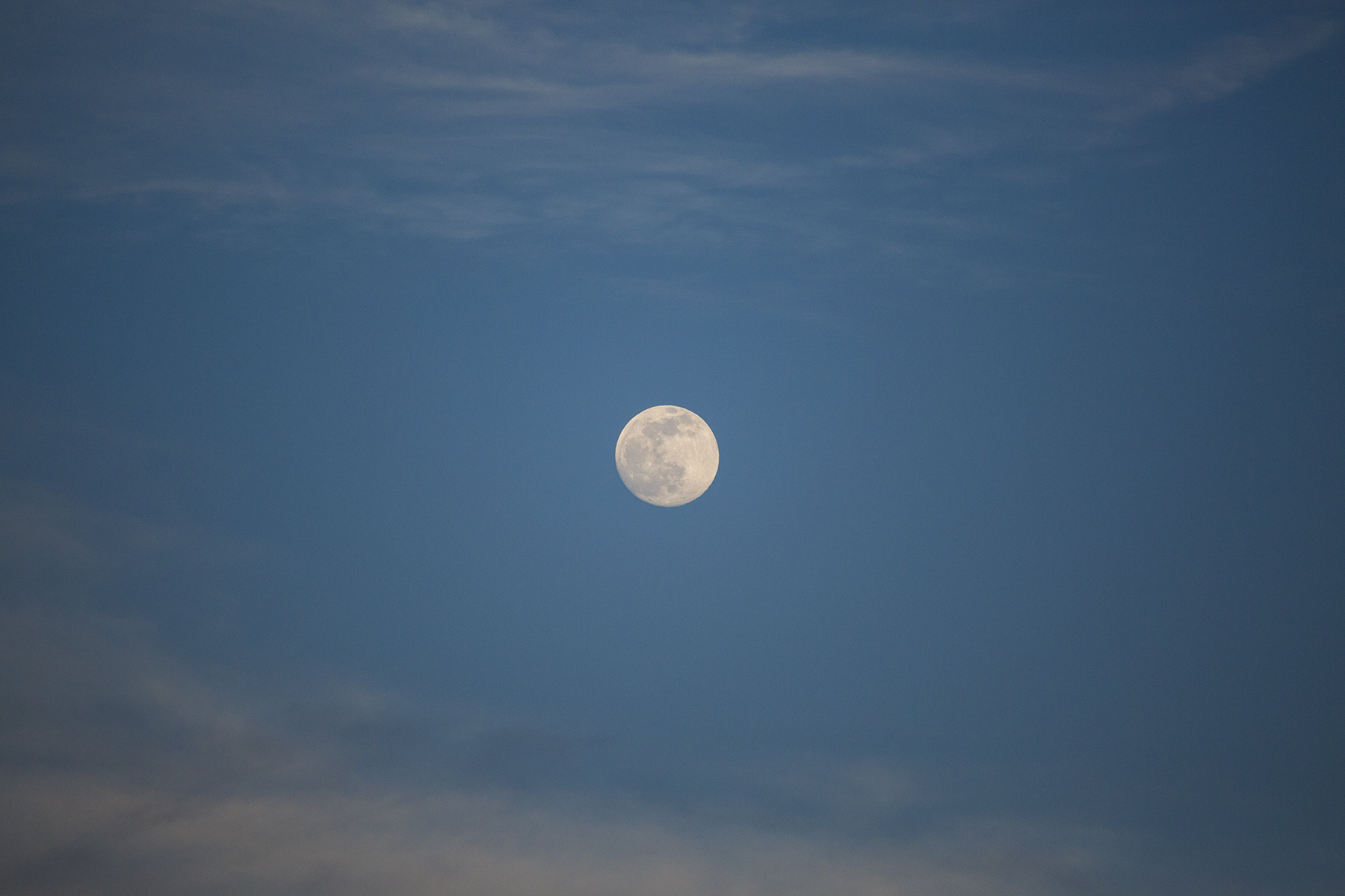
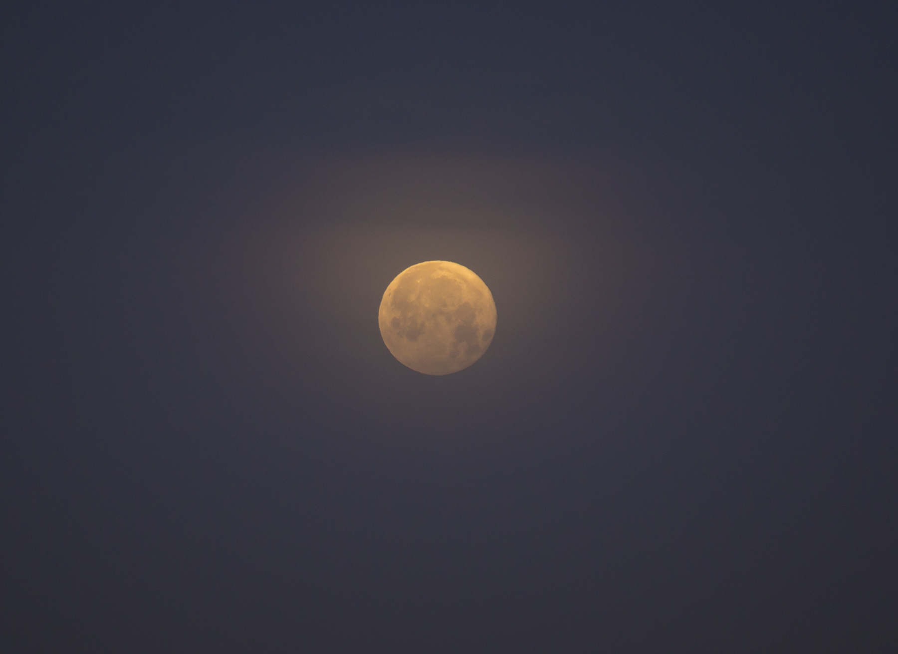
The tunnel boasts a nightly bat exodus of millions of migratory Mexican bats. They rose to the occasion, if you will, but did so late enough that the dim twilight was insufficient for photography. Instead I had to content myself with the only full moon rising on a Friday the 13th for the next century.
After a couple of days exploring Fredricksburg and the environs, we relocated to the Rose Hill Manor in nearby Stonewall, staying in a wonderful bungalow, separated a hundred yards from the main house of the B & B. Cathy knows how to pick our lodgings.

And a short walk in the opposite direction via raised wooden boardwalk through the vineyard is the Pedernales Cellars winery. Oh, must I?
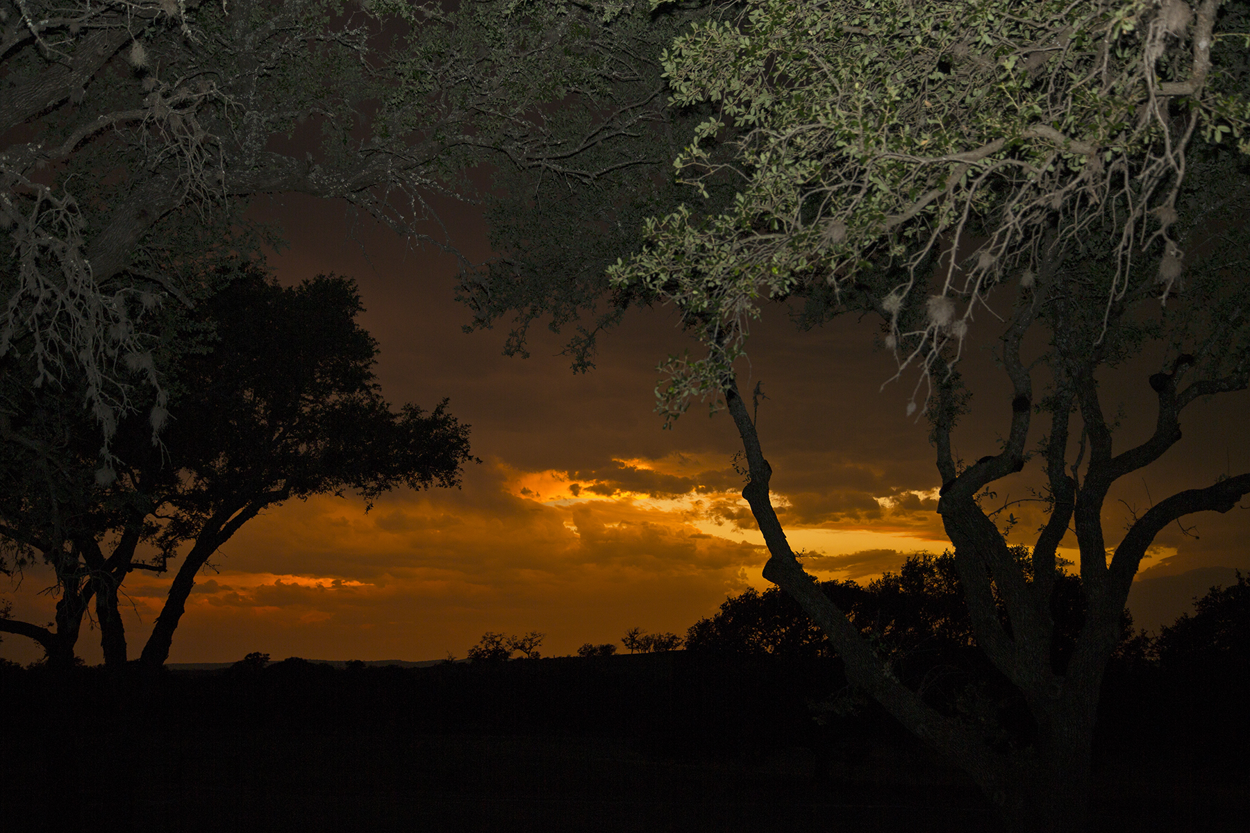
You’re probably aware that I am routinely taken with sunsets, and so, looking west between dinner and desert, this caught my eye.
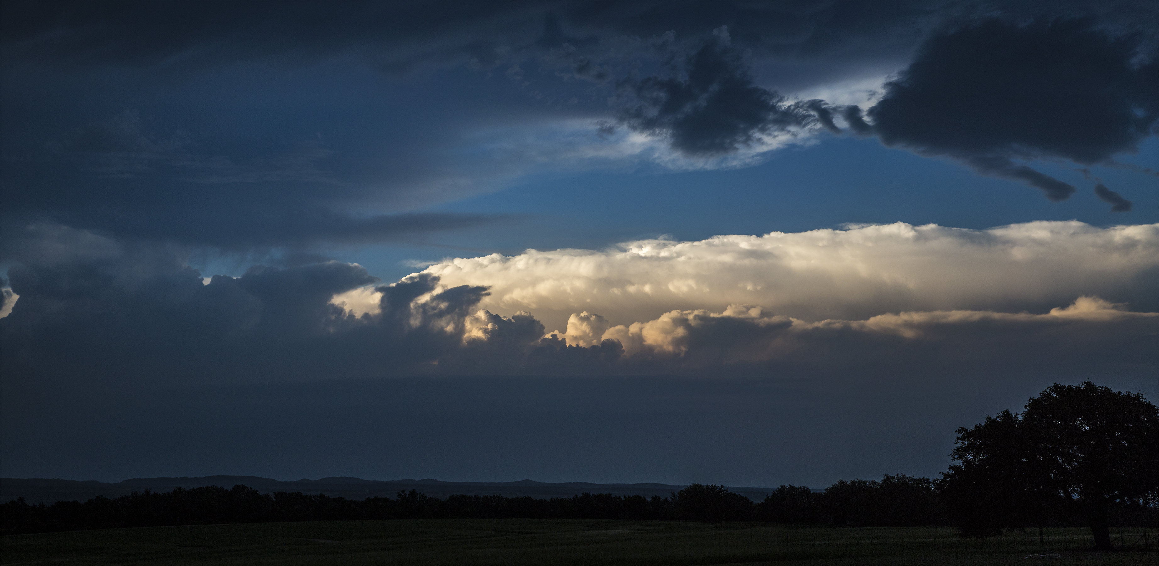
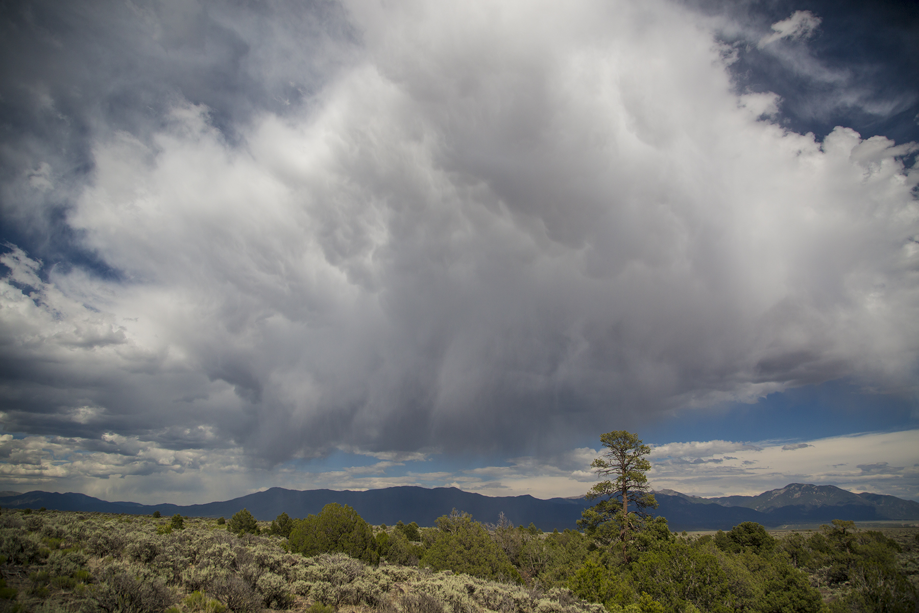
Now it is worth mentioning that I am not unawares that Texas is the southern tether of the region known somewhat euphemistically as our country’s Tornado Alley, and not without good reason. See, looking the other direction from the sunset, this was brewing up. Pilots, this is a clue. Tonight is not a good night to go flying.
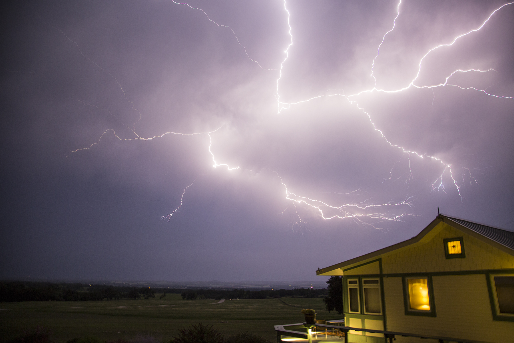
And, then thunderstorms being what they are, all hell broke loose for a full-on light show, pealing cannonades of thunder, and rain like a cow pissing on a flat rock. Texas thunderstorm bragging rights. Remedial meteorology for you aviators, this is what is referred to in METARs remarks as LTG IC CC. That would be Lightning In Cloud and Cloud to Cloud. There was also the LTG CG variety, i.e., Lightning, Cloud to Ground. The locals were very appreciative of the precipitation.
A portent of things to come? Well, yes, as it turns out. Summertime is convection time in the atmosphere. Usually it helps to fly early and quit early, but that is not invariably the case. Flexibility, as mentioned. On our last night in Fredricksburg we returned to the Hangar Hotel so as to facilitate our next day’s early launch, on a northeast track past Shreveport, LA, and on to Greenville, Mississippi for fuel and limb stretching, then continuing on for a second leg past Tupelo, Huntsville, Alabama, past Chattanooga, Tennessee (the identifier of the radio navigational aid for which is Choo Choo!) and into the Macon County strip located in a Smoky Mountains valley in western North Carolina. Checking the professionally-prepared pilot forecast just before turning out the light, it showed nothing but scattered clouds and benign flying for the next day, including the Texas hill country.

Whoops, that doesn’t look like benign scattered clouds, above. Revisiting the weather product sites on line, I discovered that the several counties of the Texas hill country sat dead center below a hastily issued Convective SIGMET. SIGMET is weatherspeak for Significant Meteorology, i.e., dangerous conditions for all types of aircraft including the heavy iron I used to fly. We repaired to the next-door Airport Diner, with decor redolent of my youth, and waited out the storm and its rain, moving southeast at 35 knots. Looking at the radar returns on my i-Pad, I guessed correctly that it would be a couple of hours before we could hope to get airborne.

This, too, shall pass. And it did.

The storm track was moving southeast, and we headed north by northeast, keeping a wary eye on the the VIRGA hanging out of the clouds to our right. Surprisingly smooth. In fact, almost all of our flying for the entire vacation was in remarkably smooth air, even in these and other conditions suggestive of hammering us with a severe washboard ride. I like smooth, thank you.
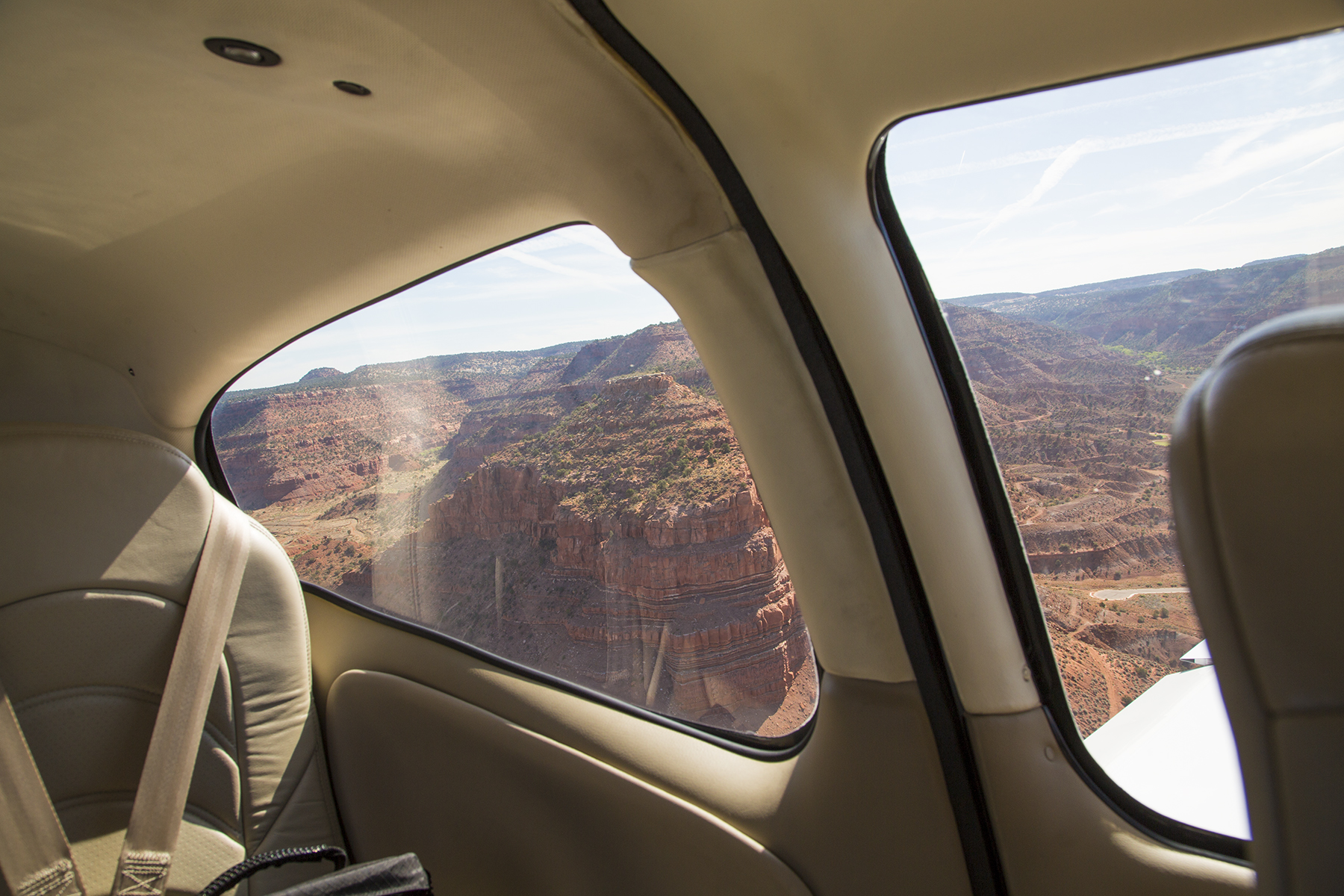
As we moved farther northeast, the weather began to clear, and we came upon Ol’ Muddy just before letting down into Greenville. There’s a nuance in this image, below, which I rather like. In about the five o’clock position of the frame is the top of my flight plan flight log clipped to my knee pad (a mini pilot desk strapped to my thigh) and reflected in the left door window. We got to be good Samaritans helping ATC with a call on a CTAF (Common Traffic Advisory Frequency) for a small rural airstrip, enquiring of anyone on the frequency if an errant Cessna had landed safely. ATC could no longer raise him on the previously used frequency, and was unable to communicate on the strip’s CTAF, so asked us to intervene from the beneficial range of our lofty height. No one ever answered—not the pilot in question, nor anyone who might have been operating at the strip, monitoring the CTAF, and aware of the Cessna’s safe landing.

After a quick pitt stop, we continued on the day’s second and final leg, sashaying around bubbling towering cumulus….

…and eventually started our descent for a quasi straight-in landing on Macon County’s runway 7—that light colored earth in the left center of the frame. Quasi straight-in, because of several mountain peaks betwixt us and the runway. Adjust as needed. Let me call your attention to the lush deciduous foliage wherever one looks. Oh yes, it turned out later that this do-si-do of dodging elevated terrain while maneuvering for landing and takeoff was to become yet another operational theme during our travels. Stay tuned.

My Cirrus training colleagues Trip and Sheri Taylor have this wonderful mountain aerie outside Highlands, NC, a community reminiscent of Carmel by the Sea, but lodged amidst thickly forested mountains. They picked us up at 1A5, the aerodrome identifier for the Macon County airstrip, and off we went to toast the fín del dia from their front deck. Sherri, herself a pilot, is the Energizer Bunny that keeps the Cirrus Owners and Pilots Association’s Cirrus Pilots Proficiency Program recurrent training program functioning smoothly and efficiently. Trip is a gifted pilot, a natural instructor and all-around affable gentleman with a rapier adeptness with the King’s English. And a wonderful and kind friend. Cathy and I have long wanted to visit this, for us, unexplored part of our country, and staying at their place as base of operations made the recon ever so simple and comfortable. Craft beers and vintage wines didn’t hurt, of course.

Views from this deck, conveying some of its multiple moods.


And maybe this hints at why they are called the Smoky Mountains. These low-laying clouds gathering in the valleys are fog on the ground, of course, and why it is routine to be unable to depart by plane from the likes of 1A5 until mid morning when the sun burns off the vapors.

You’ve doubtless discerned the thickness of the foliage when looking into the distance. How about up close? Well, here’s a glimpse of the gravel road leading to their place.

A few looks at the sylvan beauty of this verdant pastoral place. I should mention that our hiking about the hills and dales was accomplished with the good fortune of just getting back to the rental car before the afternoon skies opened up with the day’s sturm und drang lightning, thunder, and downpour. Recurring theme.


While casting one’s gaze at the near distance, it is good to remember the near ground, as well.

Okay, so you can see that these petals stick out at quirky angles, which is my segue into something only those of you who know and tolerate us can appreciate—our goofy, lovable house jester whippet buddy, Sawyer. Segue? Check out the similarity of ears and petals. So there. It might take a thousand words to do this one picture justice. The modern world has FaceTime between two i-Pads. Sawyer, with maybe a modicum of assistance from dog and house-sitting Torrey, called us at Trip’s and Sherri’s mountain aerie. I couldn’t help myself, and, as you can see in the small inclusion screen, pulled out my camera to capture this image of him looking at me. This is a photo of him on my i-Pad screen, and me, as I appeared to him, on Torrey’s i-Pad screen back in Del Mar. This was a wonderful moment, becoming terribly bitter sweet when I called out his name, and Torrey, turned her i-Pad to follow him racing around the house to find us. Wow, but that is devotion. What a bitchen chum is he.

Being time to move on, we elected to embrace an addition to our itinerary that Trip had suggested, and drop in on Billy Mitchell field (KHSE as ICAO identifier) at Cape Hatteras on the Outer Banks before continuing on to First Flight (KFFA) aerodrome at Kitty Hawk, and eventually to Williamsburg, VA (KJGG) to visit Aunt Tilda. Billy Mitchell was a WWI aviator convinced of the importance of air power going forward. Between the world wars, he adamantly harangued the establishment on this vision, to his personal downfall—he was reduced in rank from Brigadier General to Colonel, and court-marshalled for insubordination, before resigning from the military. He died in 1936. The outbreak of WWII proved our country as being woefully underprepared for the importance of aviation in all theaters of the war, and elevated his vision to its rightful place. Establishments hate muckrakers who are right. The twin-engine B25 bomber is named the Mitchell after him. On April 18, 1942, only four months after the Day of Infamy humiliation of our military at Pearl Harbor by the naval air forces of Imperial Japan, Colonel Jimmy Doolittle led a desperate raid of sixteen (U.S. Army) Mitchell bombers from the deck of the U.S.S. Hornet to bomb Tokyo and other targets on Honshu. These were land-based aircraft, stripped of armaments to save weight so they could operate from an aircraft carrier and takeoff without catapult assistance. The raid had to commence at maximum range from Japan because Japanese recon aircraft had spotted the Hornet task force. Doolittle and the Mitchells launched anyway, all assuming that it was a mission from which they would not return. They raced in low, dropped their ordnance and flew on to fuel starvation crash landings and whole crew bailouts in China and Siberia. Most survived. The raid was a gut punch at the Japanese hubris of invincibility, and resulted in whole portions of the Japanese war machine being called back to defend the home islands, effectively stopping the relentless Japanese advance from the Dutch East Indies southward, and saving New Guinea and Australia from the ignominy that befell the Philippines and Singapore. Aviation, with Billy Mitchell’s name on it, delivering on his vision. Anyway, there are two Mitchell fields in the U.S.—General Mitchell International in Milwaukee, WI, into which I have flown countless times with United, being one. Now I got to add the second field to my logbook.
Short final approach to Billy Mitchell field’s runway 25. I like the runway number symbolism as compared to the B25 bomber. Yes! Cathy and I tried to discern and follow a trail from the strip over the sand dunes, so as to stick our toes in the Atlantic, but were bedeviled by cactus and stickers lurking beneath the sand, so chose to return empty-footed.

Less than an hour later we were once again airborne headed for a truly wondrous pilot’s bucket list destination a mere quarter of an hour up the Outer Banks.

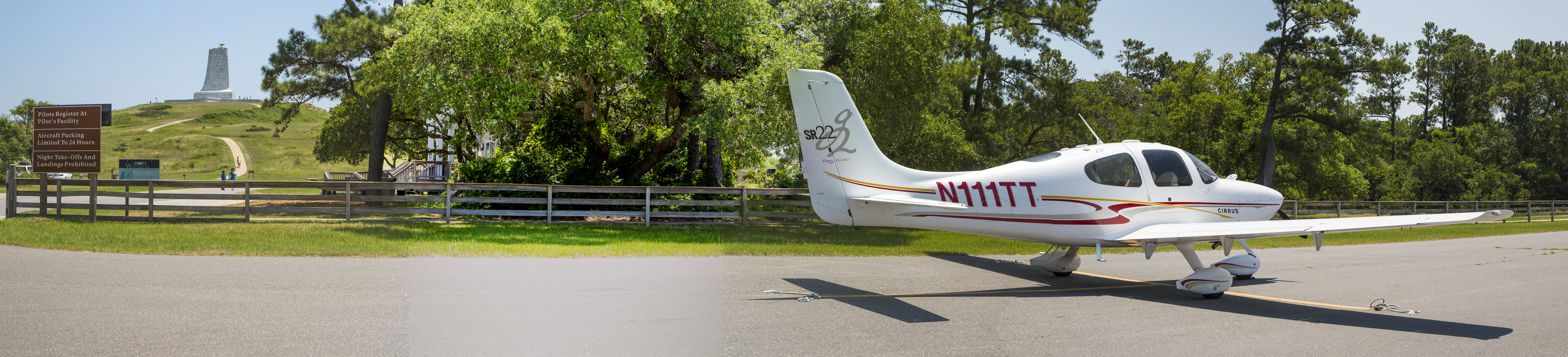
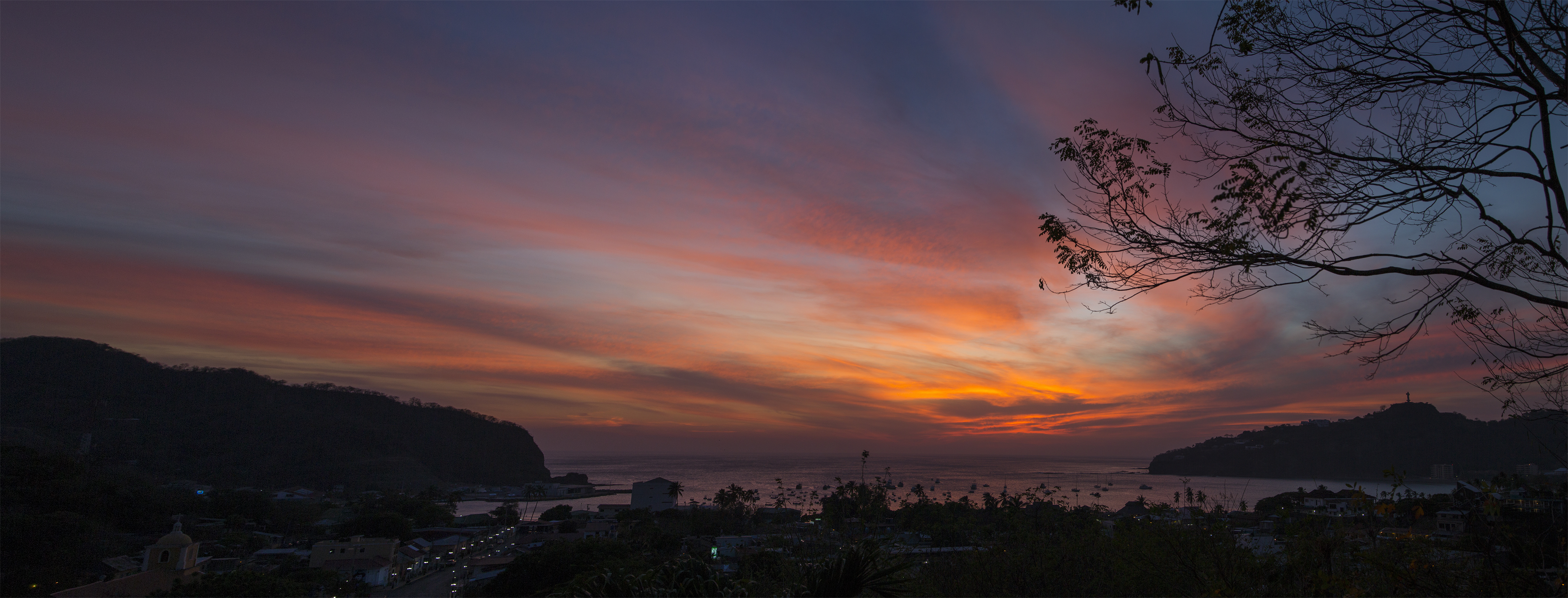
I am maneuvering for landing at Kitty Hawk, NC, the runway to the left in the image, and the memorial to Orville and Wilbur Wright atop Kill Devil Hill on the right.
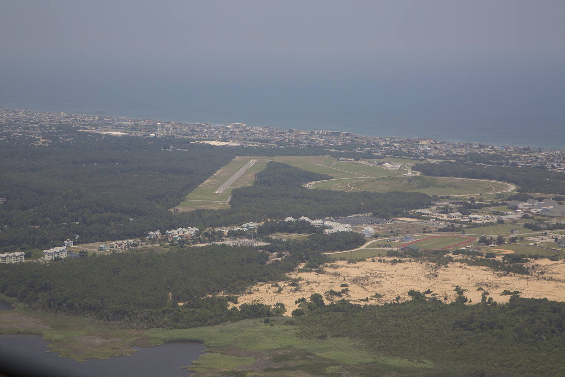
The auto parking lot had many cars, but the aircraft parking apron contained only N111TT when we shut down. Just twenty yards from the tail is the sign that provided the vantage point for the image that begins this blog missive, juxtaposing the Centennial sign and the Kill Devil Hill monument.

This monument to the Wright brothers, atop Kill Devil Hill, was commenced in 1928 commemorating the 25th anniversary of their first powered and controlled flight in December of 1903. These were “mere” bicycle mechanics—you got that?—from Dayton, Ohio, smitten with a yearning for the freedom that flight offers. They began by flying gliders off this very hill as a means of learning about the magic of lift, the force of physics that propels all craft in our atmosphere, and about how to control their flight path. For controllability they developed a method of twisting the wings, known as wing warping, and reminiscent of the twisting of wings and tails of the birds who were their siren prototypes. As they began getting a handle on that they turned their acumen on adding power to the equation. Here I am, barely a century later, honored to gaze up their monument, juxtaposed with a pearly contrail as mute testament to the genius of those remarkable, determined, and self-reliant men.
These two images barely hint at their inspiration and brilliance. You are looking at the front end of their personally devised and hand made wind tunnel. Nothing like this existed before they created it from their own imagination. A fan was positioned before this circular opening directing a wind into the wooden structure looking for all the world in size and shape like a box kite. The X-shaped and honey-comb structures were designed to straighten the wind so it would mimic the flow of air over the wings when their powered craft was propelled through the atmosphere. They managed to figure out how much horsepower they could get from their engine, and how much of that would deliver what speed through the air when harnessed to the plane’s propellers, and then used appropriate fan speeds to equate to that imagined airspeed of the craft underway. No one knew this stuff. No one.

This inspiration was channeled to basic practicality as you can see from this image looking back into the box from the downwind end. They built this simple structure with spring tensioners that sat in the airflow coming in from the other end of the box. They designed rudimentary airfoils, the technical name for a wing that is shaped so as to generate the lift necessary to hold aloft a weighty object when that airfoil is moved through the air. They tested multiple tiny, to-scale airfoil shapes which would pull against the spring tension moving in response to the physics of lift, thus ascertaining which shape would prove most effective given the speed that their propulsion system could provide. No one knew this stuff. No one. Genius.

The museum at Kitty Hawk has replicas of both their glider and their powered Wright Flyer, and here is the latter. The original hangs in the Smithsonian’s National Air & Space Museum on the mall in Washington, D.C. along with countless other aviation treasures. If you haven’t been there, or here, you owe yourself a reverential visit.

Outside you can walk the path of their first four powered flights on that rendezvous with destiny in December 1903. As you may know, their powered flights launched from the flat sands of Kitty Hawk, just below their glider launch point on Kill Devil Hill. Soft sand was good, as it cushioned their small crashes as they learned to put it all together. Remember, no one knew this stuff. No one. To get around the drag of attempting to move tires through soft sand at the start of a takeoff roll, they substituted skids and a short track upon which the Flyer accelerated until reaching flying speed. Four successful flights that December 17 with the brothers alternating as pilots. Each stone marker informs as to who flew, and what the duration and distance was of the respective flights. Let me put this first one, by Orville, in perspective. The length of the white dashed lines demarcating the centerline of a modern airport runway is exactly 200 feet from the beginning of one stripe to the beginning of the next. This first flight, which irrevocably changed the face of the world, is barely half that distance. The distance of this first flight was roughly three wing spans of the Cirrus that bore Cathy and me to First Flight aerodrome.

Eventually we trudged ourselves back across the fields in the June heat and humidity and stopped in the pilots-only lounge (keypad entry to the locked lounge is “Squawk VFR plus #”) to use the facilities and proudly add assertion of our presence to the register, before departing northbound to Colonial Williamsburg.

Our time in Williamsburg was short, and our arrival was late that afternoon. Like touring rock stars, the FBO manager met us with a rental car, plane side, as we shut down the engine on the parking apron. From there it was a short :05 drive to our B&B lodging for the two nights. Both of these conveniences had been secured the day before when I felt confident the day’s weather would enable completing the flight to KJGG. We had a wonderful dinner at the exquisite Prime 46 Forty restaurant that first evening. The next day we went out to visit the Berkeley plantation in the morning, before our lunchtime visit with Tilda. Located on the James River, Berkeley was the home of the Harrisons, William becoming the ninth president of the United States, and the first president to die in office. His grandson, Benjamin became the twenty-third president. That evening we drove the short distance past the College of William and Mary and had burgers and brews at the DoG Street Pub in the heart of Colonial Williamsburg.

We retired to our B&B on the early side, as I had some serious decision-making to accomplish. Our plan had been to fly to Dulles International Airport outside Washington, D.C.. I had already arranged through the Landmark FBO on the field there for ramp space for our plane, nearby hotel reservations with their crew rate, and the use of their shuttle to take us to and from the Air & Space’s expansive Steven F Udvar-Hazy museum located on a far corner of the field at Dulles. The next morning’s weather looked modestly problematic, but I was confident it would not present insurmountable hurdles. However, the day after that, and the next several ensuing days looked like the entire eastern and central U.S. would be slammed by extensive and widespread thunderstorm activity likely to keep us from departing toward home. Command decision time—I cancelled our D.C. plans, and worked out a WSW routing to start us homeward bound. The plan was to depart under IFR because of forecast morning weather, residual to the evening’s thunderstorms and proceed to Huntsville, Alabama for fuel, then on to Oklahoma City’s Wiley Post airport, and if still able due to weather vagaries, carry on to Taos, NM. Three legs, a long day, by all accounts.
The morning dawned, demonstrating the necessity of operating under Instrument Flight Rules, with a ceiling and visibility adequate for takeoff, but below landing minima if a problem should develop after becoming airborne. Shortly after takeoff the lower clouds, now below us, began to break up, but we still had to maneuver so as to avoid the residual towering cumulus. And as we proceeded westbound the clouds were a solid undercast below us with all airports for the first hour of flight below landing minima. I know because I pretty much continuously alternated between checking the health of our engine parameters, and pulling up the weather on our onboard displays for countless nearby airports we were overflying on our track.
A momentary break in the clouds during the climb out from KJGG.

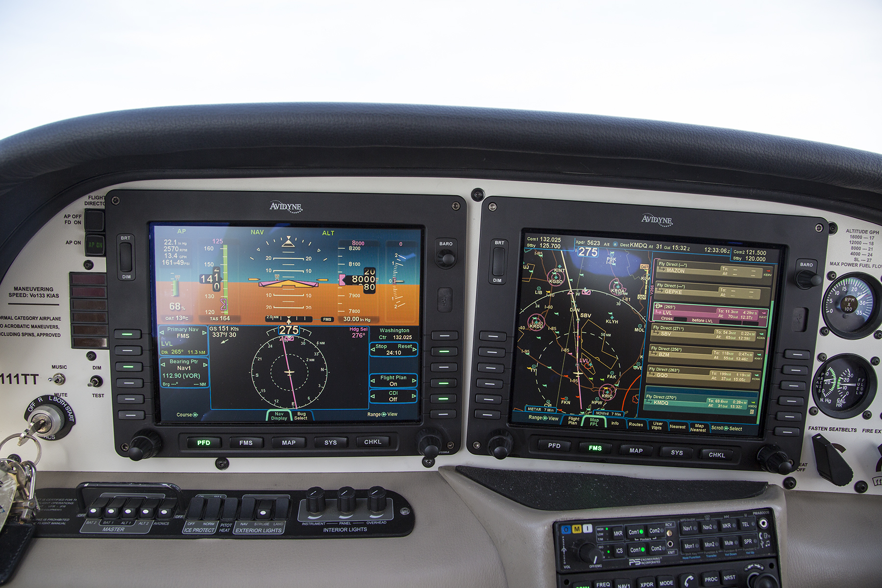
If you are a user of cockpit Multi Function displays, you will note the red flags for low Instrument Meteorological Conditions at aerodromes either side of our ground track.
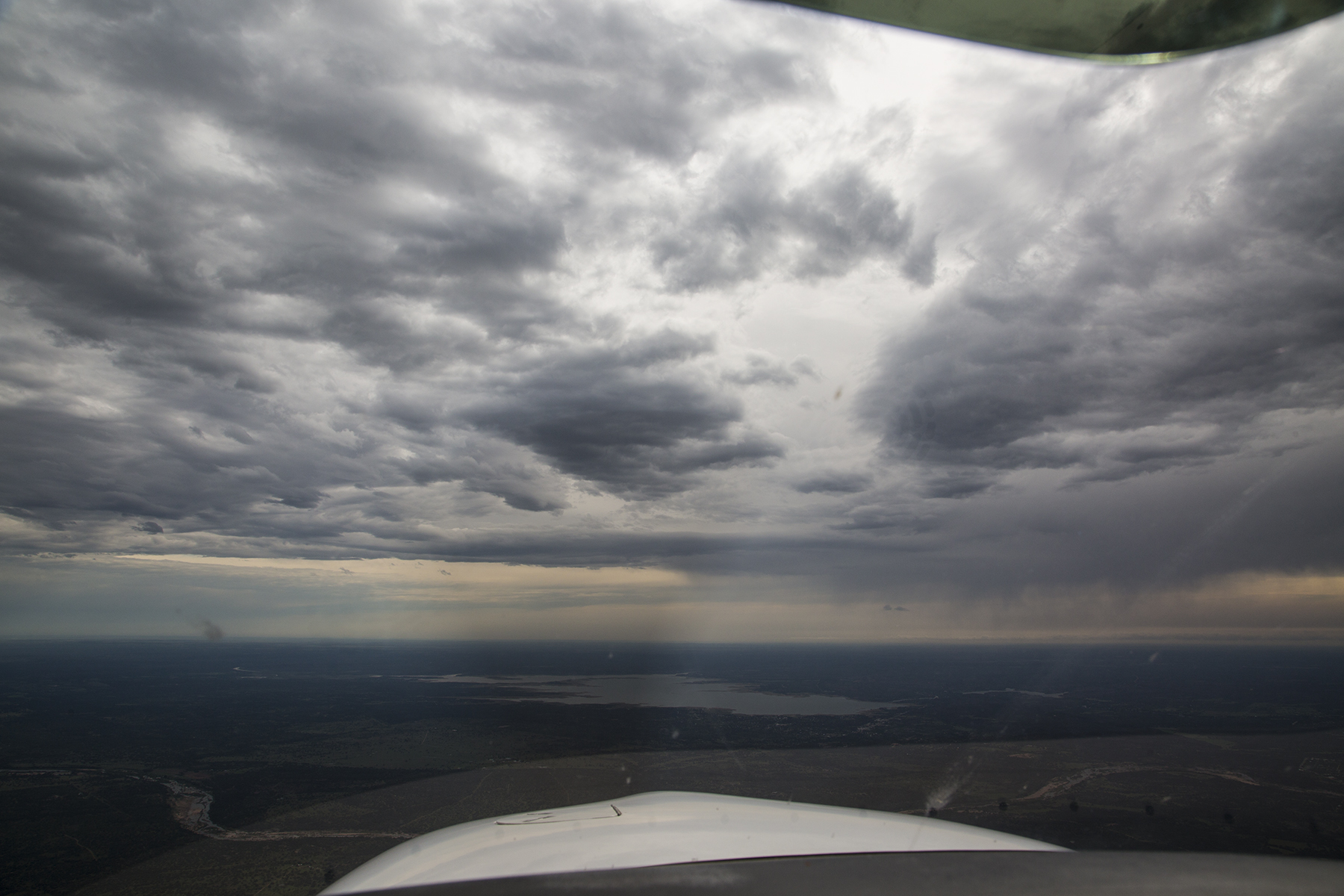
The solid undercast cleared about an hour after takeoff on a route that would take us near Greensboro, and Charlotte, NC, past Choo Choo and further westward. Near the western North Carolina/Tennessee border the skies looked like this. Hmm, let’s see, we are at 10,000′ and it is still relatively early in the morning, and those cumulus are fairly numerous, many already punching up above our altitude. Hmm. Another flexibility decision point—I changed our destination with ATC, electing to substitute Muscle Shoals, Alabama, near the western border of the Crimson Tide state for the more easterly Huntsville, hoping to get beyond the developing cumulus before the cotton balls turned into full-blown thunderstorms.

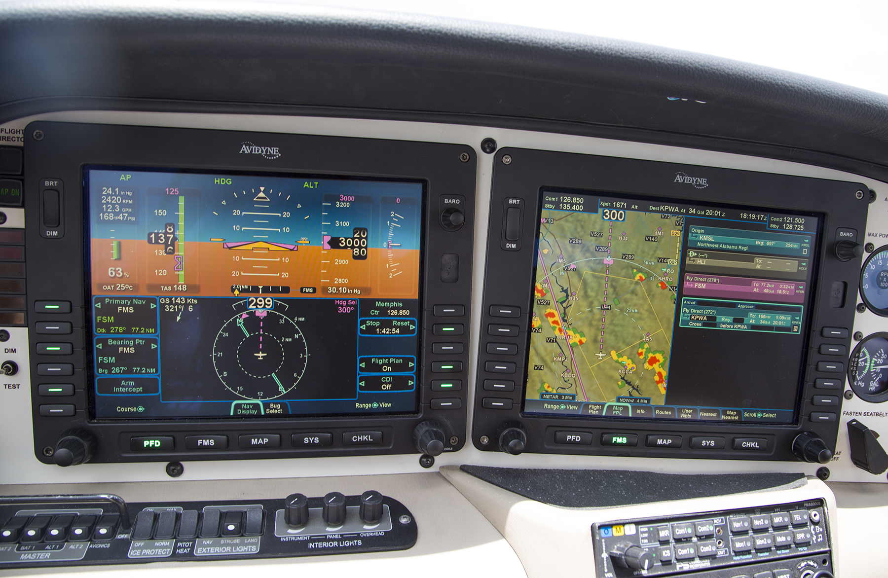
That turned out to be a modestly prudent decision, but prudence only goes so far. After the briefest of time at Muscle Shoals, our climb out had me threading the eyes of multiple needles to work our way up to a 12,500′ cruise altitude detouring around innumerable towering cumulus to stay in the clear during the climb and at cruise. Still the gaps between the clouds stayed adequate to continue operating VFR. See, it turns out that the vertical air currents that produce these towering clouds can produce rather nasty turbulence. Staying in the clear even if the pilot and the aircraft are capable of flight in the clouds is vastly smoother, and has the advantage of minimizing the risk of inadvertently stumbling into something, well, more or less like what it eventually came to near Fort Smith, to the NW of Little Rock, Arkansas. It’s that Hmm, thing on steroids, now. We are still nearly 100 miles away from this developing line of fire-breathing thunderstorms at what is now the early afternoon. I could discern a portion of the line with less development at our twelve o’clock position, right off the nose in this frame. I considered diverting ninety degrees left and landing at Little Rock, but figured I could proceed farther westbound before having to commit to that plan, while appraising what was possible in that central slot as time advanced.

If we had been a half hour earlier, I think we could have gone through there at our existing 12,500′ altitude, but as I got in closer, I decided that a more comfortable option would be to drop down low (around 1,000′ above ground level) and proceed through the now-closing gap, using both the onboard radar display and careful visual scanning to sashay left and right diverting from our flight plan ground track so as to avoid the ugliest of the billowing cumulus still observable above us, and naturally avoid the rain shafts wherever they presented themselves. Worked like a charm, and, again was remarkably smooth notwithstanding the seething nature of the cumulonimbus either side of us. You’ll note from the MFD depiction, where the inner, dashed scale ring is 25 nautical miles, that I was unable to secure a gap of at least 20 nautical miles either side of me to where the thunderstorms glowed red. Real world, that generally accepted separation maxim is frequently unobtainable. Incidentally, ATC seems to have learned from past gaffs, and was routinely warning pilots at all flight levels of “an area of precipitation at X o’clock with moderate, heavy and extreme precipitation.” You non pilots should know that the rate of precipitation in thunderstorms correlates directly with the severity of turbulence.
This location corresponded to a chart admonition of caution for “Rapidly Rising Terrain,” which fortunately I was able to keep in sight. But the low altitude eventually cost us our communication link with ATC, who was able to enquire as to our well being by a relay from a passing jetliner up in the flight levels, more or less turning the tables on our comm relay near Greenville, MS while heading eastward a week earlier. Sometimes you give and you get. After fifteen or twenty miles we were now getting west of the worst of it, and I could climb back up to 12,500′ and resume the back and forth avoidance of what was once again merely modest towering cumulus. This is looking back over my left shoulder at the line of thunderstorms as we proceeded away from it westbound. It looked more or less the same off to the right. All better now.

Flexibility resumed its seminal role yet again following our second landing of the day, at Wiley Post in Oklahoma City. Knowing that weather contentiousness near Fort Smith was a distinct possibility we had purposely not made any accommodation or car rental arrangements at our desired end of the day Taos, NM destination. Said more succinctly, it hadn’t been clear that we’d get that far. We refueled at Atlantic Aviation at KPWA, and got busy with the i-Pad and cell phone seeing what we could drum up at Taos. It was now 3 PM-ish, and we could find no room at the inns, nor rental vehicles. How about if we call it a night, and sort this out in the morning? Atlantic quickly arranged for lodging with their crew discount at a nearby Crown Plaza, and handed us the keys to one of their two crew cars. The hotel room was very nice, the bar and restaurant were terrific, and the hotel staff as friendly as that at Atlantic. A real winner.
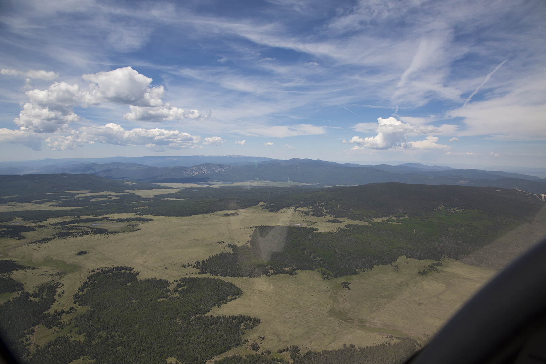
By morning Cathy found a room for us at the Touchstone Inn B & B, and so off we went, still without ground transportation. Oklahoma, northern Texas and far eastern New Mexico are flat, but that changes abruptly as you near Taos from the east. Here we are just to the south of Cimarron, and proceeding to overfly the Angel Fire airstrip in a hanging valley between the middle and most distant mountains ahead. Taos is immediately the other side of the third range.
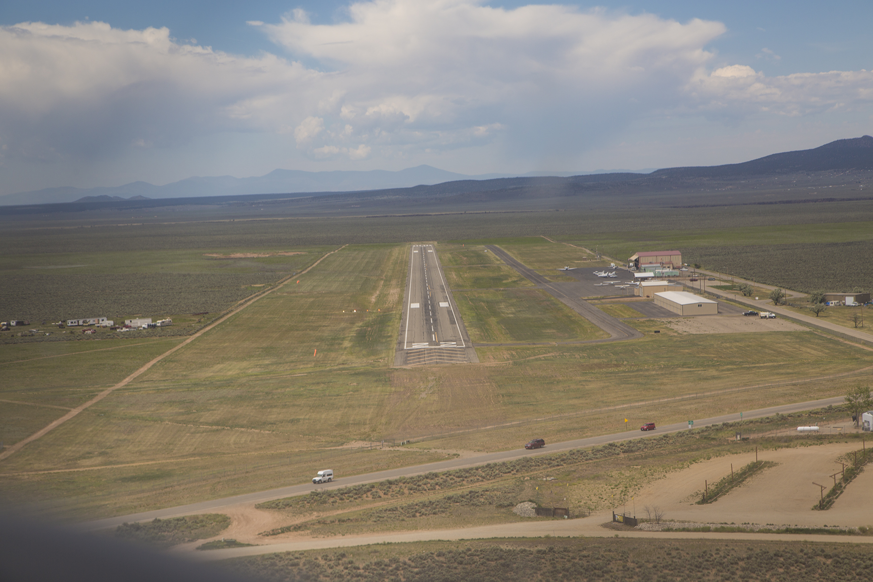
Short final approach to Taos, KSKX. Not much airport development, as you can see. This was another theme at most of our landing sites.
The Big Fella upstairs continued to favor us with His blessings. We shut down, and fueled for our subsequent departure, then learned from Leah—the do-it-all gal and only staff member on duty keeping the FBO humming—that a rental car had been unexpectedly returned this morning. If we weren’t bothered by it being dusty, we had our transportation. She was also a fount of local insider tips including the micro brewery (do you discern a trend here?) just down the road, and the fun that could be had at KTAO, the local solar-powered radio station cum locals’ watering hole. A solar-powered radio station/bar? “Well, Taos is very much a hippy town,” allowed Leah. Happy hour is 4 PM to 6 PM with good cheap drinks and tasty bar food. Well, okay, then. I’m not sure when the radio station broadcasts, but you walk right past the broadcast booth on the way to the bar. Maybe our local public radio station could stifle some of the incessant fund-grovelling if they implemented a similar business model? We managed to maximize what we saw and did during our two days and two nights.
We headed out by the Rio Grande gorge to get in some photos and some Time-Lapse sequences.

Always mindful to look down and enjoy the foreground as well as the vistas.

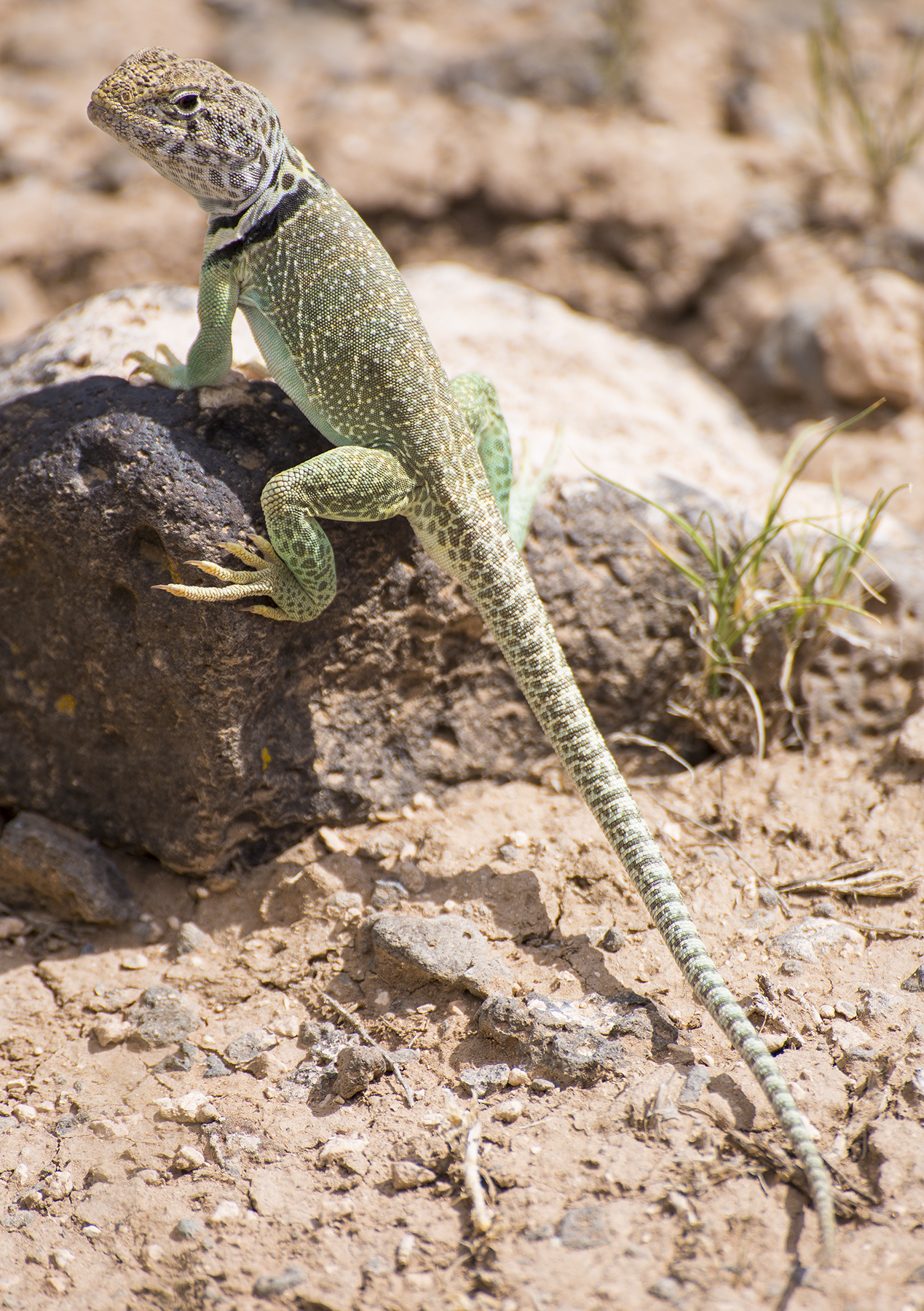
Cathy spotted this delightful collared lizard. These creatures can run at warp speed on their hind legs. Isn’t he handsome, absorbing the warmth of the rock while surveying his kingdom?
The views of his kingdom aren’t too shabby, either.

And, his atmosphere is as dynamic as is he.
We stopped at the brewery and stumbled on why so many places were booked the night before—a sizable conclave of the Hogs and Heifers motorcycle club that was great for people watching over my IPA. Dinner at a fresh and local cafe with great wines by the glass and literally next door to the Touchstone Inn. The next day we hiked some four hours the Devisadero Loop trail in the mountains east of Taos. Devisadero refers to lookout, and it was a site the Taos Pueblo Indians used for advanced warning of impending raids by other marauding tribes. Nice views of the Pueblo below. And of course, we had to peruse the galleries and shops that are part of the charm of Taos.
Well, okay, one always has time for sunsets and sunrises.

Then time to carry on farther westward, heading to Escalante, UT, for a rendezvous with middle daughter, Paisley who was conducting yoga workshops at the Boulder Mountain Lodge in proximal Boulder, Utah. This is the Four Corners region of the U.S., slick rock country with topography and colors unlike any place on earth.
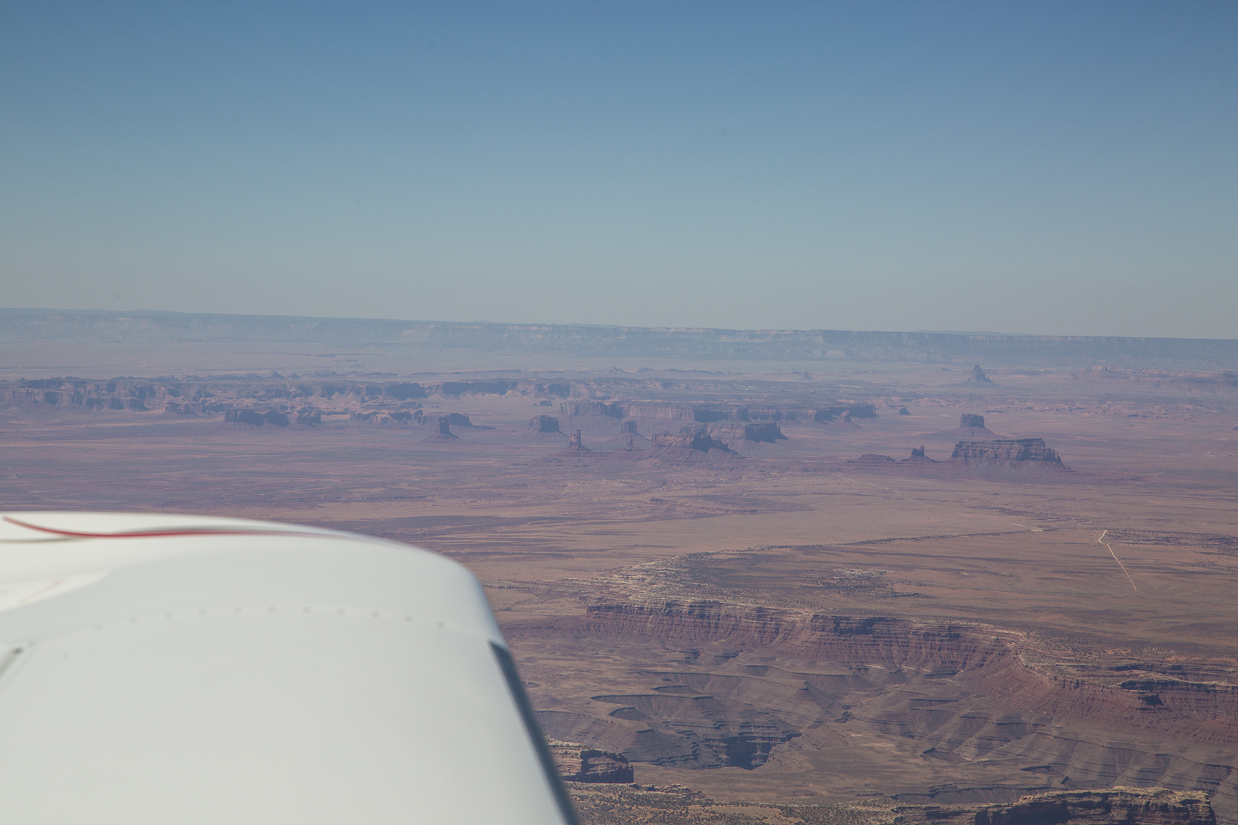

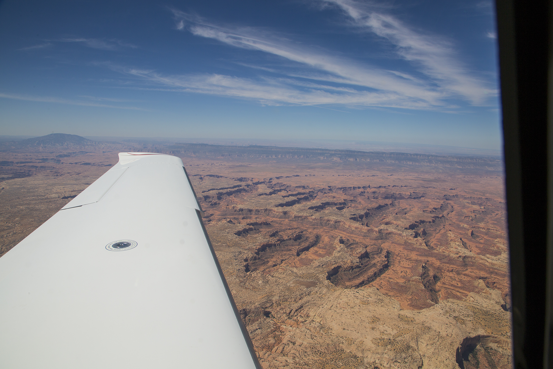

And the scenery from the air was matched by the splendors down on the ground. You fancy Anasazi cliff dwellings alongside a bubbling stream nurturing cottonwood shade?

How about industrious bees and still additional raucous color?

And late in the day, the glow of low light and deep shadows. As I am prone to say…”it’s always about the light.” The fantasy shapes and swirls of the land don’t hurt, either.

Following a gourmet dinner at the Hells Backbone Grill (named for a narrow twisting highway atop a ridge spine leading to Boulder from Escalante) it was time to call it a day. But this is dark sky country, as well, a perfect opportunity for a celestial Time-Lapse, devolving into sunrise, and using the large pond right below our room as worthy foreground for the sequence. Dawn alarm clock? Provided by the ducks and geese.
And then back the 28 miles to the Escalante (1L7) strip, where N111TT was the only airplane on the ramp. Grateful hugs for Paisley being who she is, with thanks for sharing this locale with us, before the southwest flight home on our final day of aviating. First, a stop for fuel in Kanab, UT, just above the Arizona border. Another place I’d never before been, but the maneuvering past a raised plateau just off the north end of KKNB’s runway 19 reminded me of the dance flying the 747 into Hong Kong’s old Kai Tak airport. No checkerboard on the hill, but still, the same bank shot for the runway. Yes, I’m turning base leg to final, and dropping rapidly down between those scalloped ridges on both sides of the airplane.
After fueling up it was nonstop to Montgomery Field, including the opportunity for a look at one more icon of the Four Corners region, the Grand Canyon of the Colorado River.

Random reflections. Our country is vast, and the scenery is stunning. If you are feeling put-upon by urban or suburban pressures, let the sights and people of Middle Earth refresh you. There was tremendous variety in what we saw and did, and each day seemed like the best one so far. Our Cirrus time machine provided a means of accomplishing things not otherwise so easily achieved, not to mention doubling as a splendid vantage point for gawking at the earth slipping by, below. Oh, and Texans are fond of saying “y’all,” the plural of which is “all y’all.”
Thanks for letting me carry on with this all y’all. T
The Intersection of Armageddon and The Savior
Posted on May 27, 2014
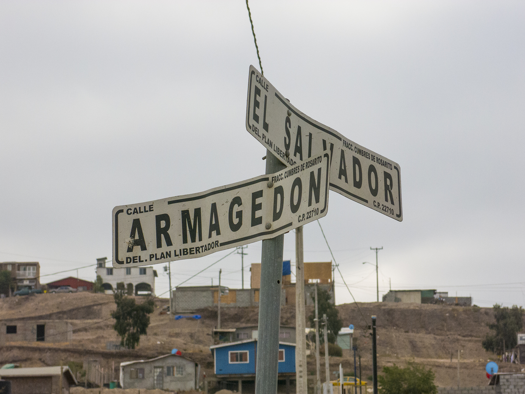
The intersection of Armagedon y El Salvador
For eight of the past nine years, our Solana Beach Presbyterian church has done a mission trip, building homes for struggling families across the border in northern Baja California. Known within our church as Come Build Hope, and accomplished in concert with Amor Ministries, which provides the logistical support and building materials, it is always done over Memorial Day weekend. This year was Cathy’s and my second wade-in, and Solana Presbyterian fielded 315 of us from throughout San Diego County and as far away as Colorado to construct 15 homes. Our building subgroup numbered 19, I think—three women, seven adult men, seven male teens/young adults, and two elementary school boys. The two-room home we were slated to build for Maria Guadalupe (Lupita), her husband Ezequiel, and her brother Jaime, rose up on the back of a tiny lot they owned in the hills overlooking Rosarito Beach, located in the Libertador (Liberator) neighborhood at the dirt street intersection of Armageddon and The Savior. You can’t make this stuff up.
Amor Ministries, headquartered in San Diego, works with Mexican churches and community groups throughout the border region to identify and vet families in need of assistance. As one of many examples of Christian outreach our church enacts worldwide, Solana Beach Presbyterian signs on to provide X worker bees like us to give our time, funds and energy to turning simple plans and a pile of two-by-fours, plywood, wire, paper, windows and stucco into two-room homes the recipient families can call their own.

Fireside fellowship
On Friday, we met at the church and were bussed to a dusty open field campsite just east of the toll road from Tijuana to Ensenada. In a logistical tour de force an Army brigade could be proud of, our names were on a list informing which of the hundreds of already erected tents would be our sleeping quarters, our bags and personal tool kits were stacked on a ground cover between our subgroup’s tents, surrounding a pile of firewood, a shovel to dig a fire pit, and folding chairs we could use to encircle the fire after a great Mexican food dinner. Fellowship time. Time to learn about the old friends and strangers with whom we would spend the next two days living out what we see as fulfillment of God’s plan for truly loving thy neighbor. Enjoy this quiet time of sharing and contemplation, because tomorrow morning we all hit the ground running. The Amor rooster assures a predawn wake up, so that you’ve time to make your brown paper bag lunch, eat breakfast, and board the busses for your 8 AM transport to the job site.

Ezequiel, Sergio, Samuel, Sergio Jr., and Lupita preparing the sand
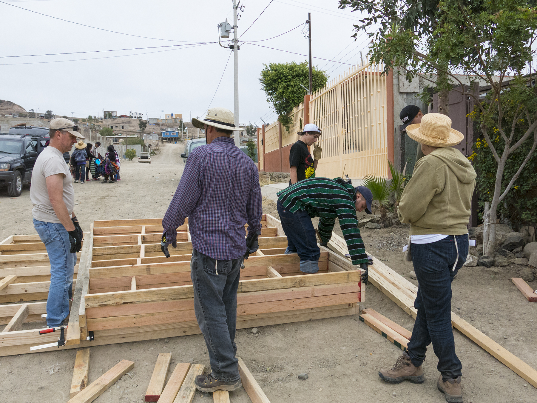
We began with toting our tools off the bus that drove us up into the hills of the colonia, setting up the water jugs, and then gathering for a prayer and a giving of thanks for the bounty in our lives. Our foreman, Dan Salzman, a church and airplane friend of mine (Inspector of Aircraft for the mechanics at High Performance Aircraft), quickly determined that the concrete pad Amor had pre-poured on site was a true rectangle vs. a parallelogram and relatively level. Then he asked the family where they wanted the two windows and front door of their home. That accomplished, he and the assistant foreman, Kent, an architect and builder, split us into two subgroups to start building the front and rear walls, and building the side and interior walls, which are sloped to give the flat roof the necessary angle to achieve runoff in a rain. Our pile of two-by-fours were in 8′ and 12′ lengths, and each group foreman got us separating the lumber and headed to our two hammer and nail spots—on the dirt of El Salvador out front, and my group forming the front and rear walls on the slab, itself.
Meanwhile, Sergio—an Oceanside resident originally from Monterrey, Mexico, and our nominal interpreter, with liltingly accented English on a par with Ricardo Montalban—got his two sons, Sergio Jr. and Samuel started in shoveling the gritty sand pile through a wire strainer. That assured the stucco mud we’d be applying next day would be pebble-free. Embracing the sweat-equity concept, they were quickly joined by Ezequiel and his wife, Lupita.
Let me share a brief bio of our family—Ezequiel and Lupita, and Lupita’s brother Jaime, currently living in the tiny cottage you see on the left, above. Ezequiel is a packer and the breadwinner with his $62/week income, and Lupita takes care of the house, and cares for Jaime, who is developing dementia. Both she and her brother have diabetes. The home we were to build was to give them a bit more room for their unique family dynamic. Things to note in the picture, above—nothing is wasted. If they happen to come upon some societal detritus, like a washer/dryer, they carefully husband it, even if there is no running water or sewer in the colonia. And all three of them were immaculate in their dress, pants ironed to a stiff crease, shoes polished, the whole bit. No one in their neighborhood is buying pre-distressed jeans, I can assure you.

Building the front and rear walls
Dan, on the left edge, and Jordan and John measuring and hammering. I had bought a nifty short crosscut saw at Home Depot, and was routinely called into measure and cut duty to produce the proper lengths of studs and cross braces. Then we worked in small groups of two and three hammering together the two-by-fours, and constantly remeasuring the framed wall, corner to corner, to assure us that it was staying square.
Building the sloping side walls
Meanwhile, Kent’s group of Paul and his son Joshua were well into building the three sloped walls out on the street, with Deborah looking on. Paul is a retired Navy P3 pilot from Coronado, and Josh is a student at Texas A&M. Deborah happened to find out about Come Build Hope when she came to Easter Service at our church. She brought along her son, Connor (backwards ball cap) and his friend Cameron, both hard-working sixteen year-olds.

Cutting the stud sideways to match the roof slope
Taking a drink break I wondered what Paul was doing, sawing his studs on edge like this. He marked the top of each vertical stud with the angle of the roof slope so that the top plate, and eventually the roofing plywood would sit snugly. We had no sawhorses or miter boxes. For safety and because of the lack of adequate power, no power tools, either, except Dan’s battery hand drill, used for the door hinges and handle. Paul is using the tool box provided by Amor as his support, the other end of the wood supported by the growing walls in the image above.
Hinge work on the front door jamb
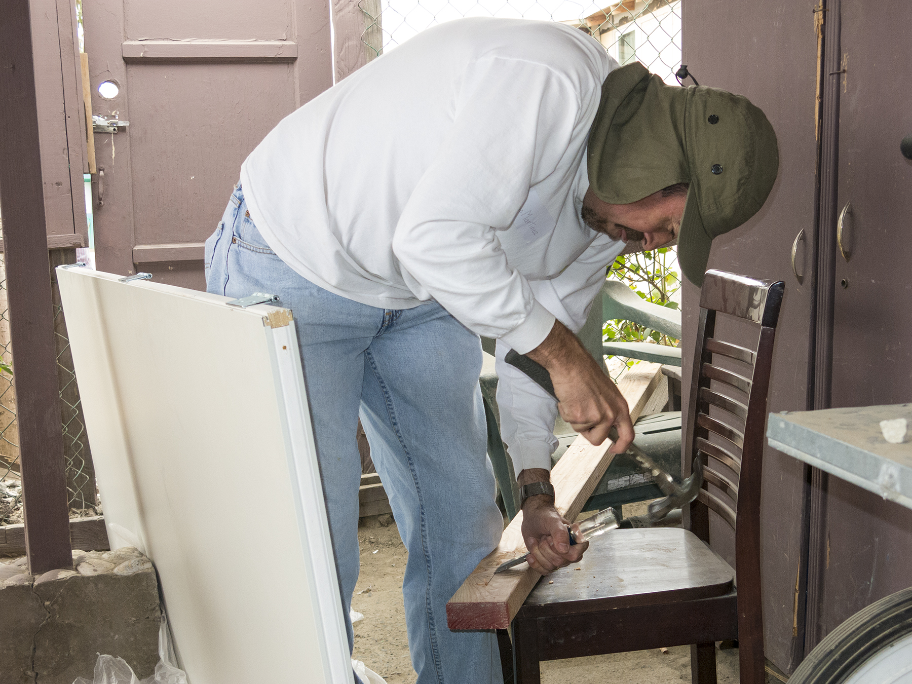
Dan and Kent kept us all cracking, augmented by personal initiative when one could see a job that needed to be done. Various activities were being done simultaneously all over our tiny site, and using whatever we could find to get the job done. Dan and Sergio set up the front door just off the street, and measured and marked the placement of the hinges. Then Dan headed off to continue assisting the rest of us while Sergio chiseled the recesses for the hinges on the door frame that will eventually be hammered in place.
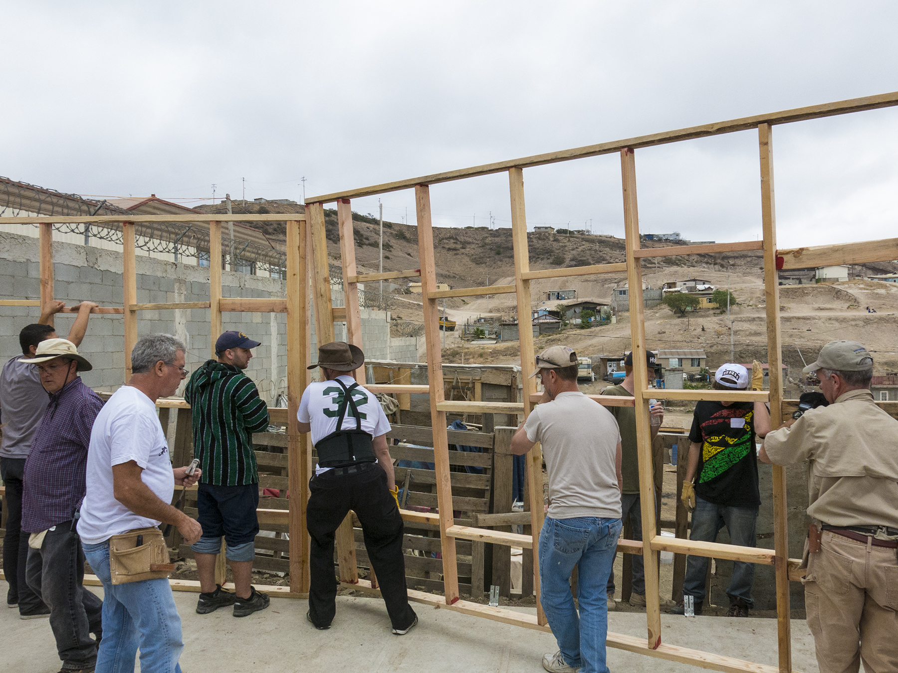
Positioning the wall
Then those walls get hoisted into place, to be nailed together and strapped down with the steel connectors that had been installed in the slab when it was poured. Amazingly, no blue fingernails at the end of our project, but lots of tired hands, stiff backs, and aching hamstrings.

Papering the roof
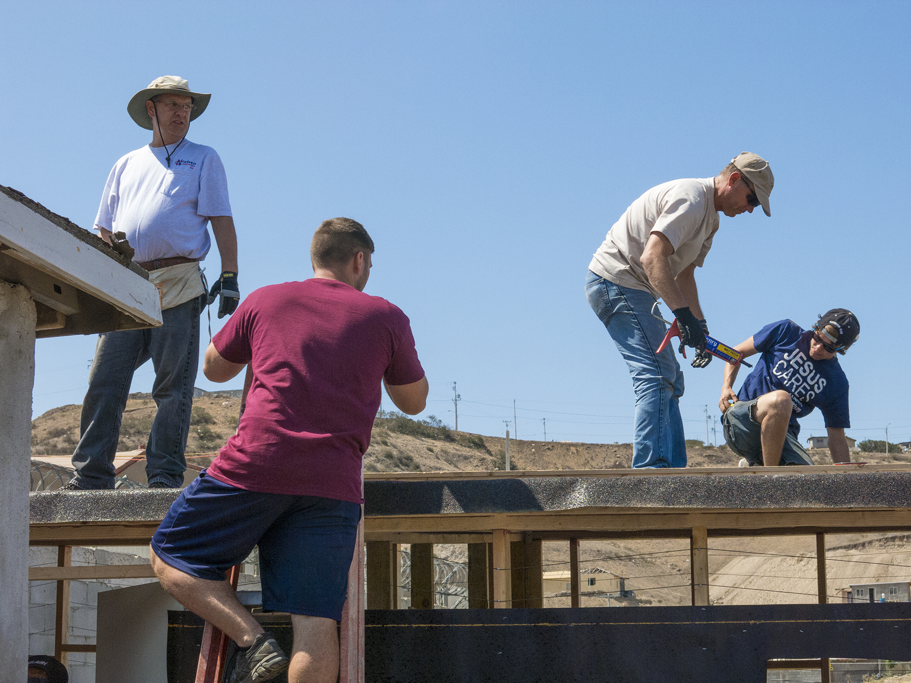
Roof crew
The roof was added in the afternoon of the first day, with sheets of plywood nailed securely to the tops of the walls. The crew was reminded of the importance of watching where they placed their bodies before everything was nailed in place, and also to be very deliberate about laying down any hammers, as others of us were working directly below them. On Saturday morning, the roofing material was applied, and the seams and roofing nails all sealed with caulking. Then the roofing material was rolled over the edge and additionally secured with end strips. Kent, Joshua, Paul and Jordan (a music production student at Southwestern College) left to right. Jordan’s shirt pretty much conveying the spirit of the weekend.

Roof edging
Paul, hammering in the end strips. Note the view, above, not that we ever took the time to drink it in.

Lupita, fully into doing her part
Lupita, having borrowed Cathy’s hammer, is securing bailing wire that encircles the framed house about every six inches vertically. I think that’s Tomas’ hand holding up the wire before Lupita nails it in place. By pulling the wire up on one stud, and down on the next, then nailing it taut in that zigzag, a great deal of tension is placed on the structure to give it rigidity. The wires all sounded about C sharp when strummed. This is also an essential step for getting the tar paper to lay snugly flat against the walls for when the stucco would be shortly added.
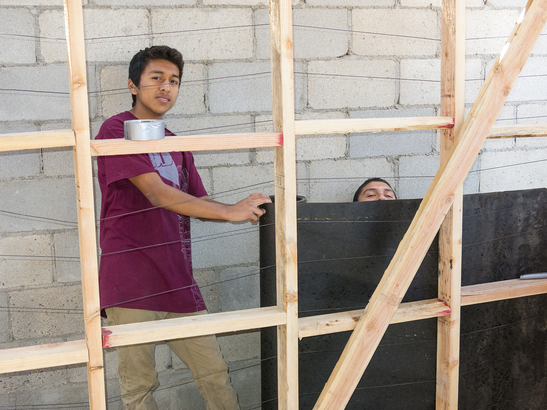
Tomás y Misael
Urgently working to stay on pace, Tomás and Misael, high school students from the Hispanic population of our church, were spreading the lower layer of tarpaper, while on the upper reaches of the back wall, the last of the bailing wire was still being made tight. Now, you need to understand how this was no simple task, given the confines of the site. You can see how close is the block wall belonging to the home next door behind the lads. There was only enough room for the one-at-a-time shoulders of a single person on three sides of the house, and room for about two people on the remaining, front side. This lack of maneuvering room had us constantly adjusting and wriggling sideways past one another. Teamwork.

The top-most tar paper
Cameron, Tomás and Connor trying to find a way to use our two ladders to wriggle up and attach the top layer of tarpaper, while simultaneously notching the paper to fit snugly around each roof joist as it stuck out from the walls for the roof overhang. The property line “fence” on the right is actually equipment crates, laid on end and barely held by a couple of flimsy stakes from falling over into the neighboring yard some eight feet below.

Stretching the chicken wire
Next comes the chicken wire, which is the substrate upon which the cement/stucco “mud” will be applied. The chicken wire is strung in one continuous roll around first the bottom, then secondly around the top. Here, Sergio, who always got the stretch jobs because of his body height, and Dan are hanging the wire from nails in the wall’s top plate, and Glen, who came as reinforcement from another, less minuscule job site with more workers, and thus more rapid progress, is holding up the unwieldy column of wire, while Kent is working on the door frame. Glen is a high-schooler who selflessly gives to others—he’s been on multiple Come Build Hope builds, and has accompanied our SBPC team four times to work with the Afar people in Ethiopia. Once the chicken wire is nailed along its periphery, it is stretched with small hand lengths of PVC pipe over nails seemingly too far to reach, and then another, unique one-turn corkscrew device tightens it even further by grasping it and securing it on itself, eliminating any vestiges of slack.

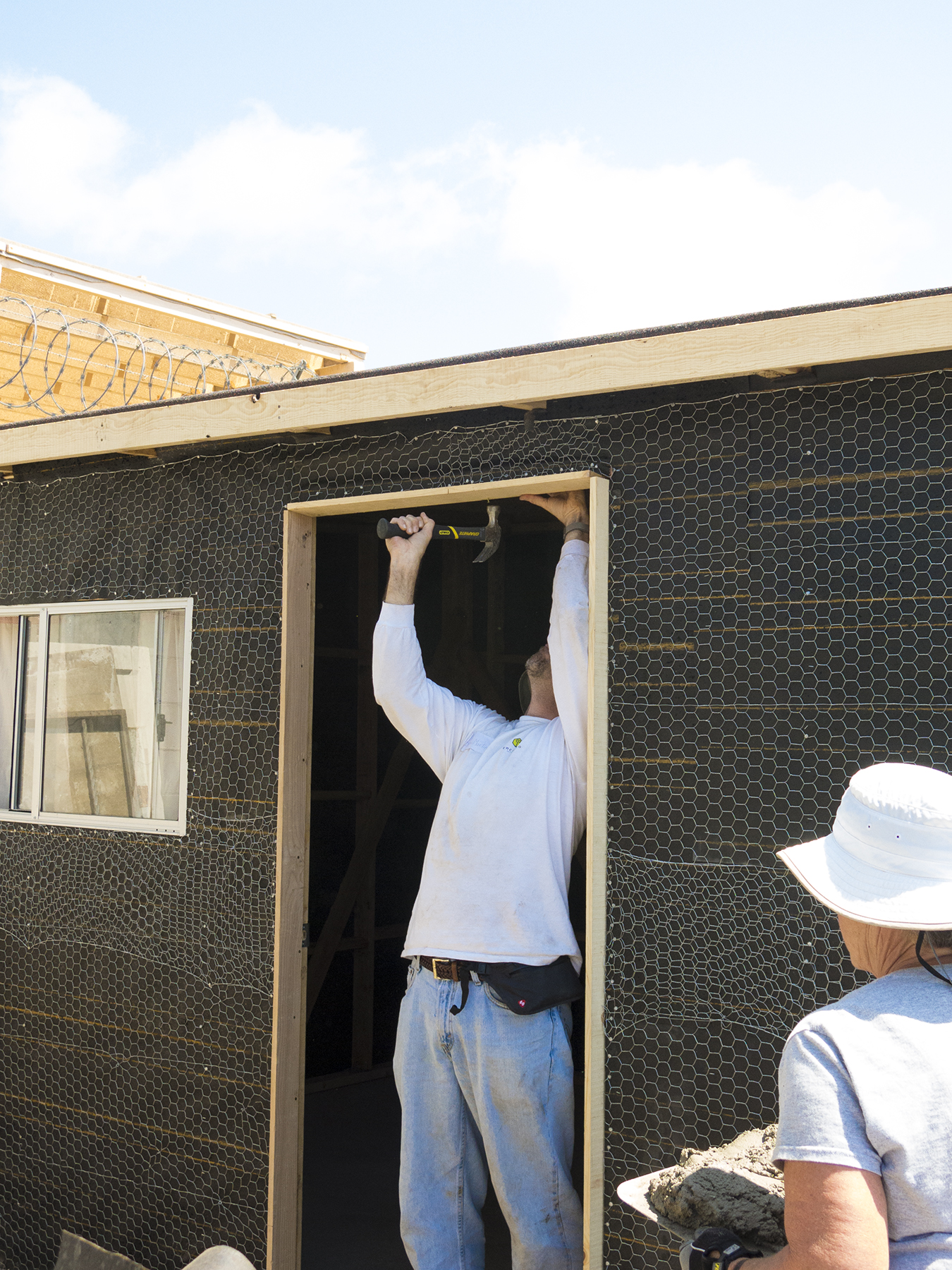
Finishing the window installation
Windows and doors create special challenges for installation of the bailing wire, tarpaper, and chicken wire. The window has to fit snugly in place, and the interface must include waterproofing with the paper, and eventually with the mud. Here, Dan is securing the chicken wire along the lower edge of the window, while Cameron is using the PVC “tool” to stretch the wire heading toward the nearby corner of the wall.

Mixing the mud
Now, in the afternoon of our last day, it’s time to start mixing the mud, using cement, and the sand that Sergio Jr. and Samuel had filtered through wire mesh the morning before. Everyone has a job, and every job is necessary to arrive at the finished product. Here, Kent, Cameron, John, and another young lad from Glen’s site are mixing in the water to get the correct consistency—not unlike oatmeal going a bit stiff.
Door top fitting while mud is heading for the exterior walls
Have you ever wondered about the term “hod carrier?” Cathy, scurrying along with a heavy hod of mud to be applied along the back and east side walls by the high schoolers, and Lupita and Jaime. Sergio nailing in place the top portion of the doorjamb, which I had just finished sawing to the precise dimension needed. Incidentally, Amor has this construction stuff really fine-tuned. There are enough materials if the foremen assure our being careful. We finished with “excess” of half a loop of bailing wire, a partial roll of chicken wire, a single wheel-barrow of two-by-four scraps, a half a bag each of the three nail types we used, and no extra tarpaper or roofing material. This did not resemble a government cost + contract.
Hanging window curtains
Back inside, Deborah is mounting window curtains hand-made by women in our church…
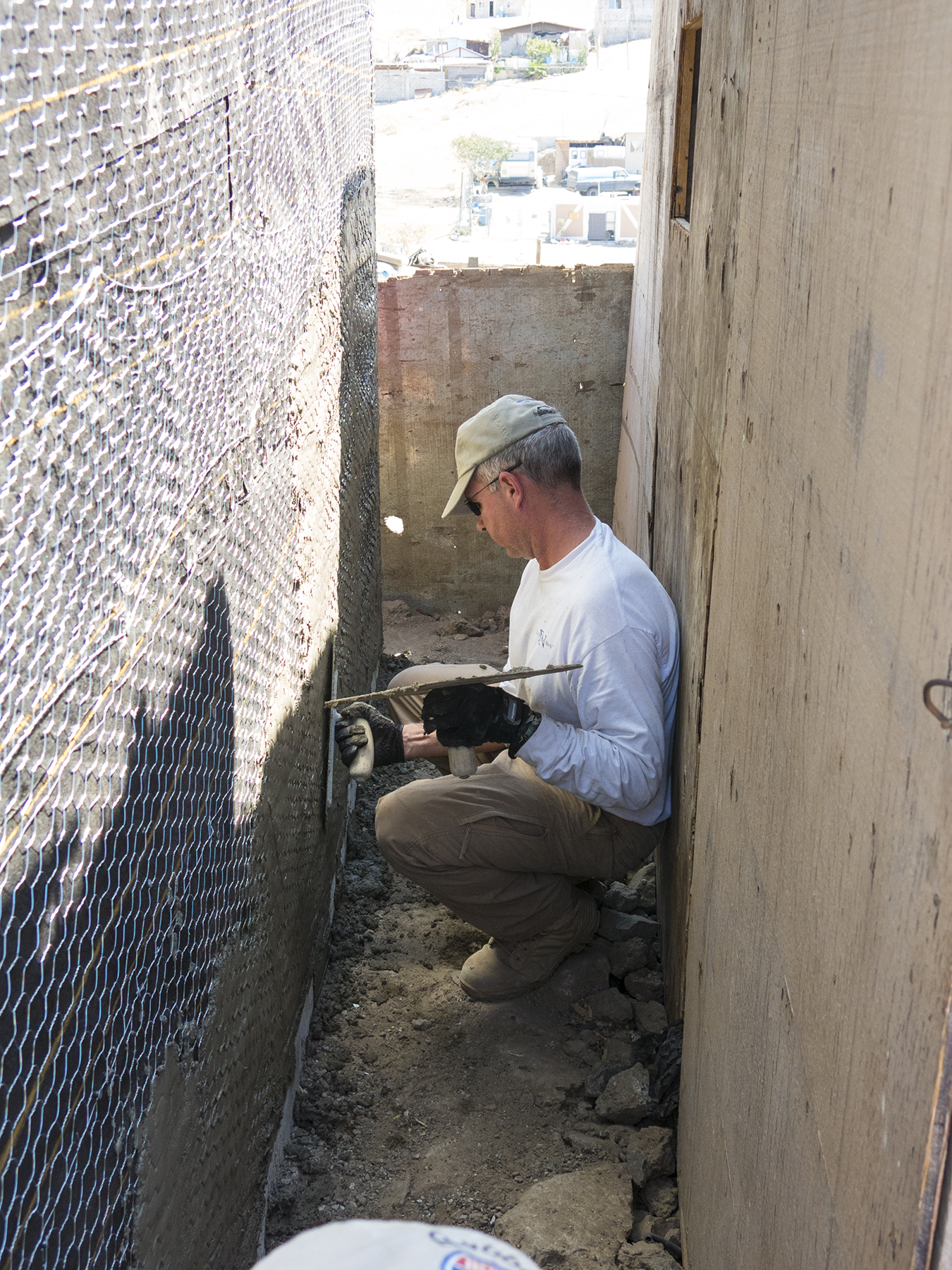
Spreading the mud
…while outside on the west wall, Jay, another retired Navy pilot from Coronado who joined our team, along with Paul (seen on the very bottom of this image), Joshua, Jordan and Kent, all as outreach from their church across the bay, is busy layering on the mud. What motivates people to pay for the privilege of crossing borders, sleeping on the ground, exhausting themselves and generating aches and pains in muscle groups they didn’t even know they possess, to give up their holiday weekend and create a living space for people they hadn’t met until arriving on site? For all of us there’s the belief that we’ve been gifted greatly, and we feel it’s incumbent upon us to follow the Lord’s motto of giving unto others as we’ve been given to. Of course, there’s the undeniable fact that this sort of mission gives back to us considerably more than we give out, and then at the end, when it’s all coming together that is made manifest in the joyful and loving gratitude of our home family.

A bible and a group photo as mementos
Lupita is holding a bible, in Spanish, signed by each of us, and given to her along with a group photo taken on our first morning.

Lupita and Jaime
Dan’s wife, Holly, our group physician, and spiritual spark plug, sharing a prayer of closure, reflecting on the John 15:13 verse that was our byline for our Come Build Hope exercise. (“For greater love hath no man, than to lay down his life for his friends.” A doubly fitting mission motivation, given that this was Memorial Day weekend.) Sergio is dutifully translating Holly’s words into Spanish. Lupita and her brother, Jaime, are holding housewarming gifts, also hand-made by women of our church.

The finished home
We pulled together our tools and stiff bodies, signed the wall stud nearest the front doorjamb, and wished them Amor, Paz, y Familia, trudged out to our waiting bus, and turned to look back on the finished project. Two rooms, two windows, a lockable front door. Secure protection from the elements. And much more that words don’t convey.
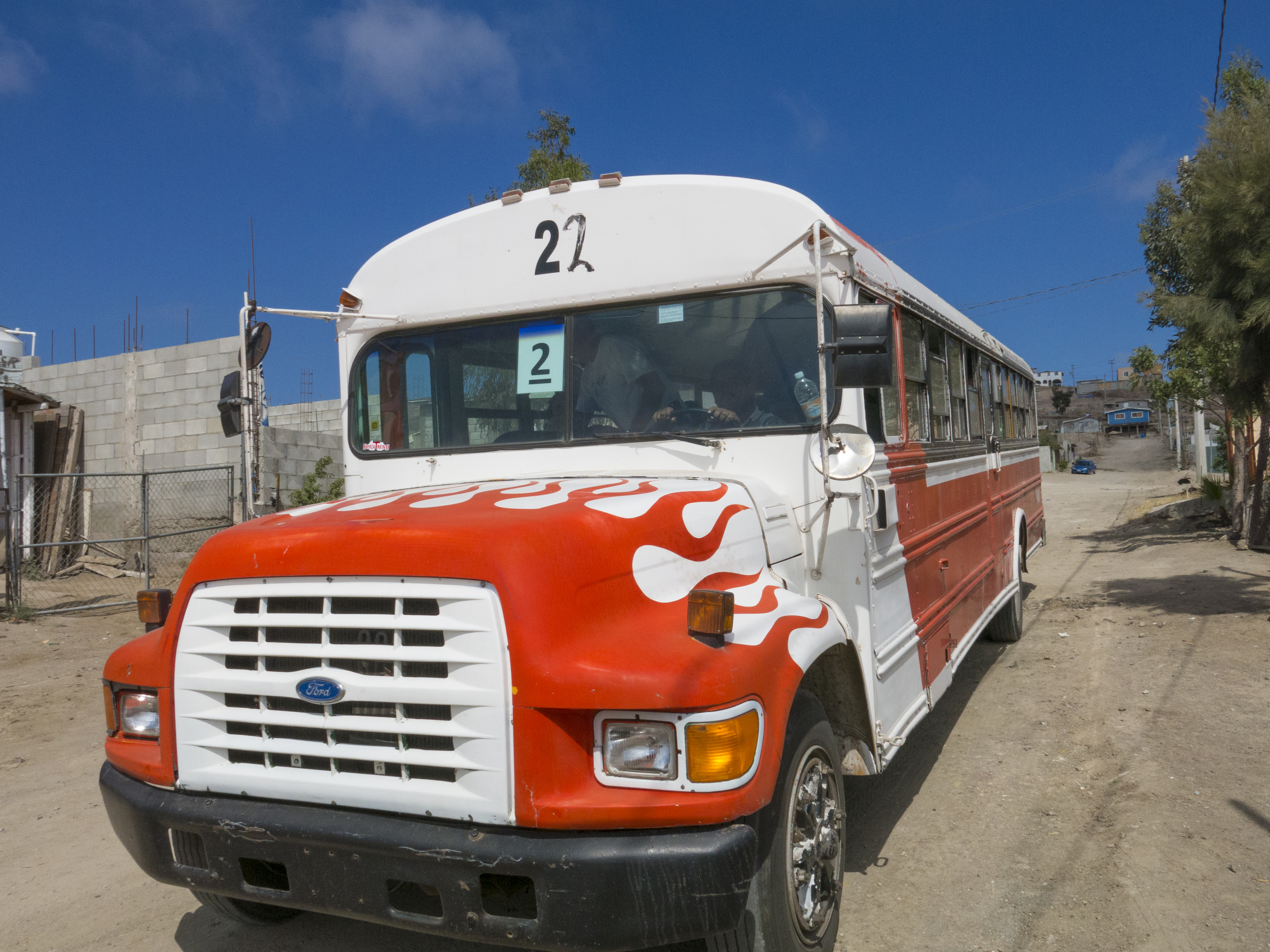
Inflamed Chicken and Pig bus
Nicaragua
Posted on April 17, 2014

Granada train station
Cathy conjured up the idea of Spring in our nation’s capital, with a side trip to visit Aunt Tilda in Williamsburg. Plans laid on, including a visit, at last, to the Smithsonian’s Steven F. Udvar-Hazy expansion to the Air and Space Museum for me, a pilot’s pilgrimage to Mecca. Unfortunately, as we sat in the boarding area awaiting our flight, cancellations on other departures filled our plane to the exclusion of mere Space Available retirees like the three of us. Well, house/Sawyer sitters had been arranged, and ol’ What’s Her Name had time off from her SDSU class demands, so couldn’t we please find somewhere else to go? A day later we were set for a visit to Granada, Nicaragua, and surrounding regions. When it comes to travel pangs, you have to be light on your feet around Cathy.
Granada, population on the order of 120,000, is a Spanish colonial city dating from 1524, on Lake Nicaragua, about 45 minutes south of Managua by car. That we could actually find space on United airplanes to and from Nicaragua was both something of a miracle, and should have been a heads-up clue as to the climate in April—the end of the dry season, and just plain hot and clear-skied day in and day out. Dawn temperatures were all the way down to the upper 70s, with mid afternoon routinely hitting the upper 90s. But this was dry heat with regular breezes, shade that could be sought out, ceiling fans, not to mention cold libations. Glad we didn’t know in advance, because the trip was just dandy once we got there.
We’d found a VRBO house, a short walk from the town’s central park. A plus on this rental was Julio, the Chicago owner’s local agent, who was keen to provide us transportation, and tourist help from his indigenous perspective. His assistance included picking us up at the Managua airport at our 9:30 PM arrival. This relationship provided our first glimpse of the warmth of the Nicaraguan people, right from the get-go. As we reached the Immigration officer’s desk for admission to the country, we nearly foundered on a modest detail we’d not covered—the address of the Dos Palmas rental home in Granada. This entirely stopped that immigration line, with me discussing in my best Spanish our plans, propmting the Nicaraguan officer to call over an assistant to take me outside and find Julio awaiting us curb-side with a hand lettered “Close, Caty” sign. That’s the only way I knew who Julio was, and he and the assistant quickly covered the details, after which the latter took me back through the labyrinth of the airport’s inner corridors to the immigration officer patiently waiting for us. Smiles and thank-yous all around, and the passports were stamped and we were welcomed to Nicaragua. Throughout our stay, the populace again and again demonstrated their friendly, patient, and industrious ways.
Speaking of industriousness, wherever you looked people were making a living in ways as old as the ascendancy of humans over beasts of burden. And when beasts aren’t in the cards, there’s always the bicycle or feet.

One horsepower truck

One-manpower truck
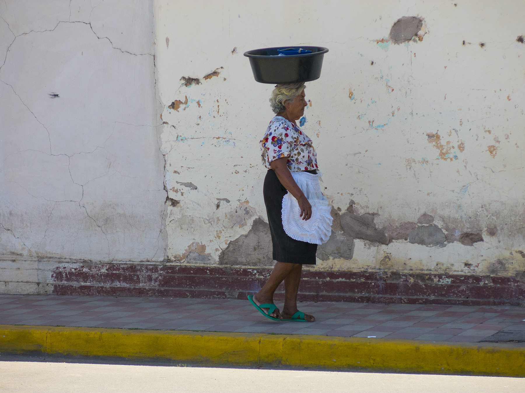
One-womanpower street vendor
The streets abound with vendors like the lady above, walking the neighborhoods from early morning to early evening, calling out their wares…”Pan,” or “Fruitas,” perhaps—”Bread” or “Fruit.”
Presumably this will not be a last minute news flash for those of you who know me, but Tom, is always gaga over color. And Latin America and I have held a long-requited love affair over colors. Granada is very much the rule, not the exception. Yum.

Time to kill, and a place to chill

No miedo de color
What sounded hokey when Julio mentioned it, turned out to be a real treat for exploring the byways of Granada. We began with a visit to a local church, and a climb to its bell tower to take in the 360º vista, followed by a multiple hours’ carriage ride. Even the horses were colorful.

Color y umbra
As were other forms of transportation…

Local bus
With a latitude of 12º north, volcanic soil and rain (except when we were there), tropical fruits are abundant. The industrious fruit vendors sell delicious fruits and delights for the eyes.

Roadside stand
As you might guess, the people are as colorful as their communities. In multiple locales we saw young people energetically whirling in costume to the beat of raucous drumming. Exercise and income for them, entertainment for us. This scene is along Avenida Guzman, if I recall correctly—a couple of blocks of which are dedicated to outside dining and pedestrians only, a happening place at the dinner hour. The figure in the distance would appear to be a ten-foot tall woman with whirling skirts, but the effect is produced with a dress-draped mannequin of sorts, “stretched” vertically with a frame, held up by a youngster underneath, who feverishly spins the contraption. In the foreground it is a tiny elementary school-age kid ensconced in what must have been a large papier maché mask, spinning so fast as to literally blur before the eye. Can you guess how hot it must have been in these props, not to mention the dizziness of it all? You can bet that these folks have never heard of minimum wage, OSHA, or child labor laws.
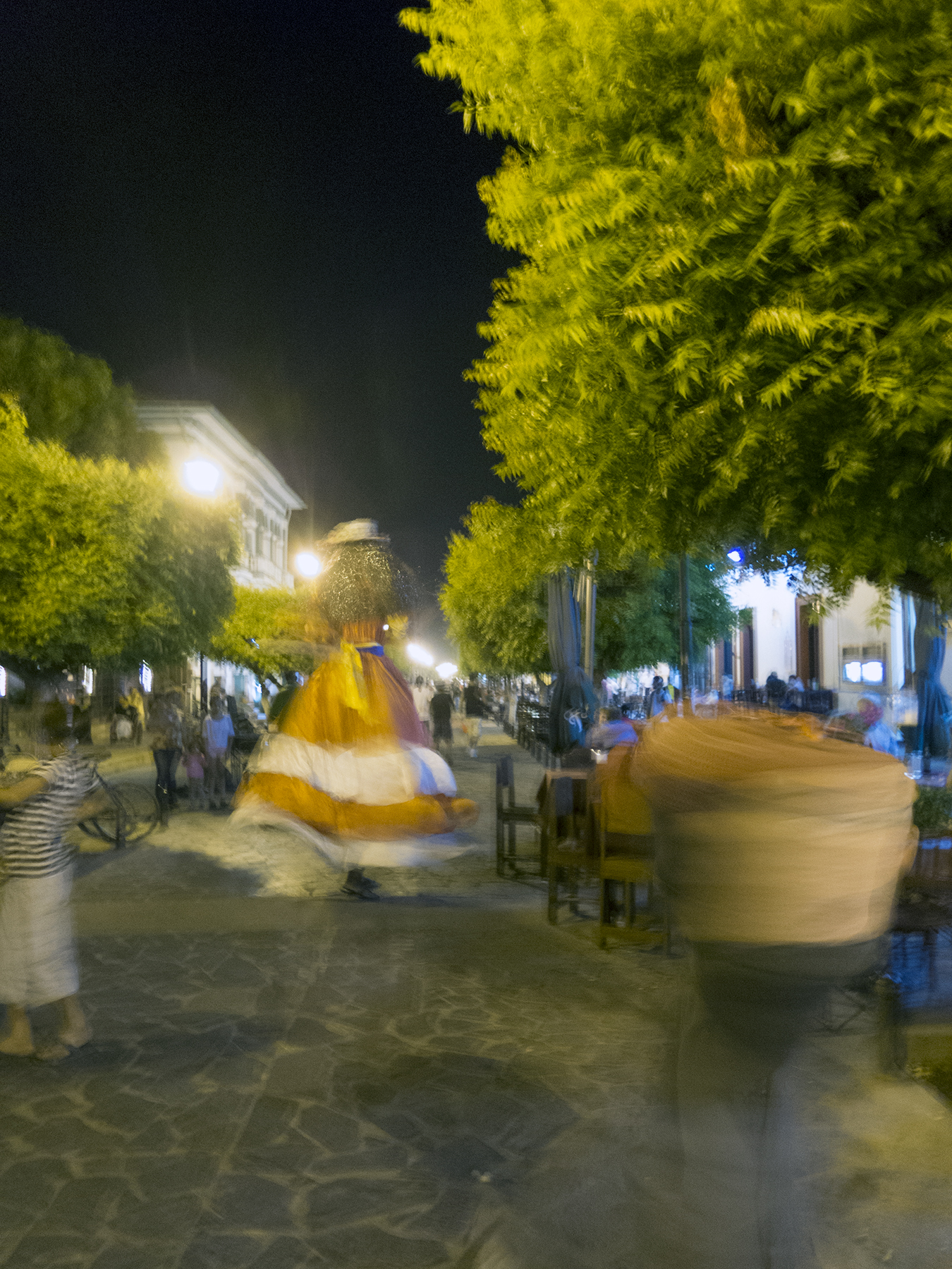
Whirling dervishes beside outdoors dining

Neighborhood passion
Late one afternoon while visiting artisans in one of the Pueblos Blancos, or White Villages, I stepped out to sit in the breeze, to be treated to this street parade. Nicaragua is a deeply Catholic country, and we were there during the Lenten season, just ahead of the beginning of Semana Santa, or Holy Week. Neighborhoods all over had versions of this, a statue of a colorful, bloodied Christ carrying the cross to his crucifixion. Local priests would preach on something biblical, and then the group would begin marching forward to band accompaniment.
In a modestly similar vein, we encountered this large group pilgrimage along the road from Granada to San Juan del Sur, a beach community on the Pacific near the border with Costa Rica. We were told that the entire group proceeded hundreds? of kilometers, one day at a time, taking their animals and camps with them. Lest the caption be too esoteric, RAGBRAI refers to the (Des Moines) Register’s Annual Great Bike Ride Across Iowa, a weeklong block party by bike. There are literally hundreds of travelers with their livestock in this large open field.

Pilgrimage or RAGBRAI?
Herewith, images generally describable as local color shots, figuratively, although literally, in the bargain.

Sonrisa Stupenda, i.e. a stupendous smile
During our carriage ride we proceeded to the original Granada train station, now a museum of sorts, from whence came the first picture in this post. Clopping along the street, this young lad ran alongside just because he could. What a grin.
Now, as I say, the days were downright hot, and the relative cooling of evenings made being outside a family affair all along the streets of Granada. The sun having just set, twilight coming on, this family was relaxing across the street from what became our favorite watering hole, the bar at the Hotel Corazon, a couple of blocks from our local digs. “Un foto de su familia con la puesta del sol, y luz hermosa?” “Claro que sí.” Street photographer daughter, Torrey, is much more surreptitious than my “go direct” approach. Different strokes for different folks.

End of the day chill out

Bells and stone

Bell tower
The large cathedral adjoining Granada’s central park.

Catedral

Church dome
Below, the view from the bell tower above, and from whence we began our carriage ride around town. The cathedral is a couple of blocks away, and Lake Nicaragua is visible above the rooftops in the distance.

Granada bell tower
Perhaps you are aware that Central America is Exhibit Number One to Plate Tectonics? If it wasn’t for the crunching of plates and its coincident volcanism, shippers wouldn’t need the Panama Canal. It would be ocean from Mexico to South America. This plays out with numerous volcanos, active and dormant throughout Nicaragua. There’s a Volcanos National Park just outside of Granada, close enough for an easy day trip. The museum headquarters is very nicely put together, including this nifty diorama that more or less tells it like it is.

Volcano museum diorama
That’s a painting on the wall, with a view looking west toward the Pacific, and a clay topographic map in the foreground. Check out all the white cotton plumes emanating from the model’s volcanos. In case you need a more upfront example of this, there’s always the park’s Masaya Volcano.
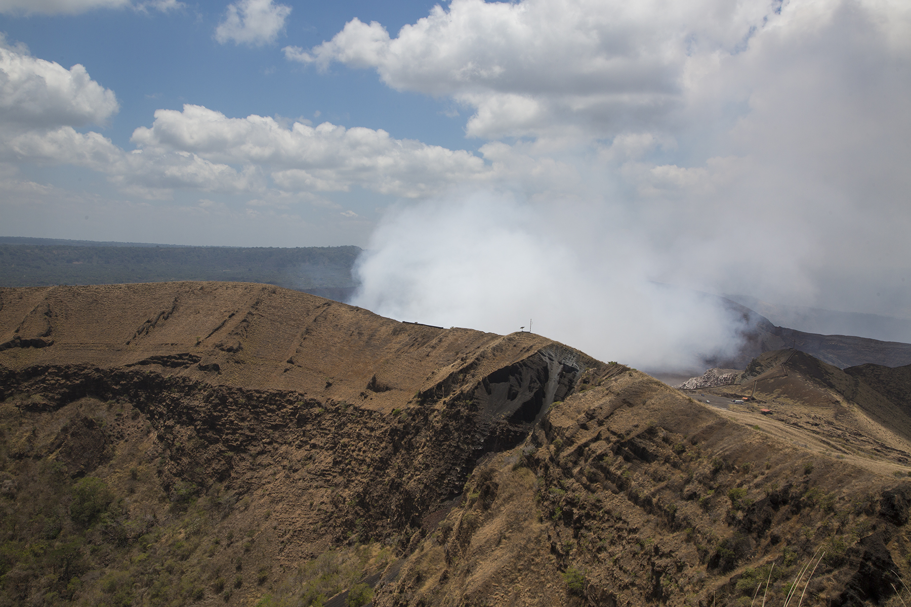
Santiago breath
Julio drove us up to the volcano, and you can look right into its sulfurous maw, and get a whiff of magma halitosis. It was a bit of a photographic letdown because you are effectively in the plume while standing there at the edge of the active part of Vulcan Masaya, known as Santiago vent. So I elected to hike up the face of the adjoining volcano, which is currently dormant, for the perspective above. You can see the rim of the dormant portion of the volcano in the foreground, with Santiago’s plume emanating from its own caldera in the distance. Cathy, Torrey, and Julio indulged me on this longish hike to heed the creative muse in me—a steep and slippery climb of some duration.
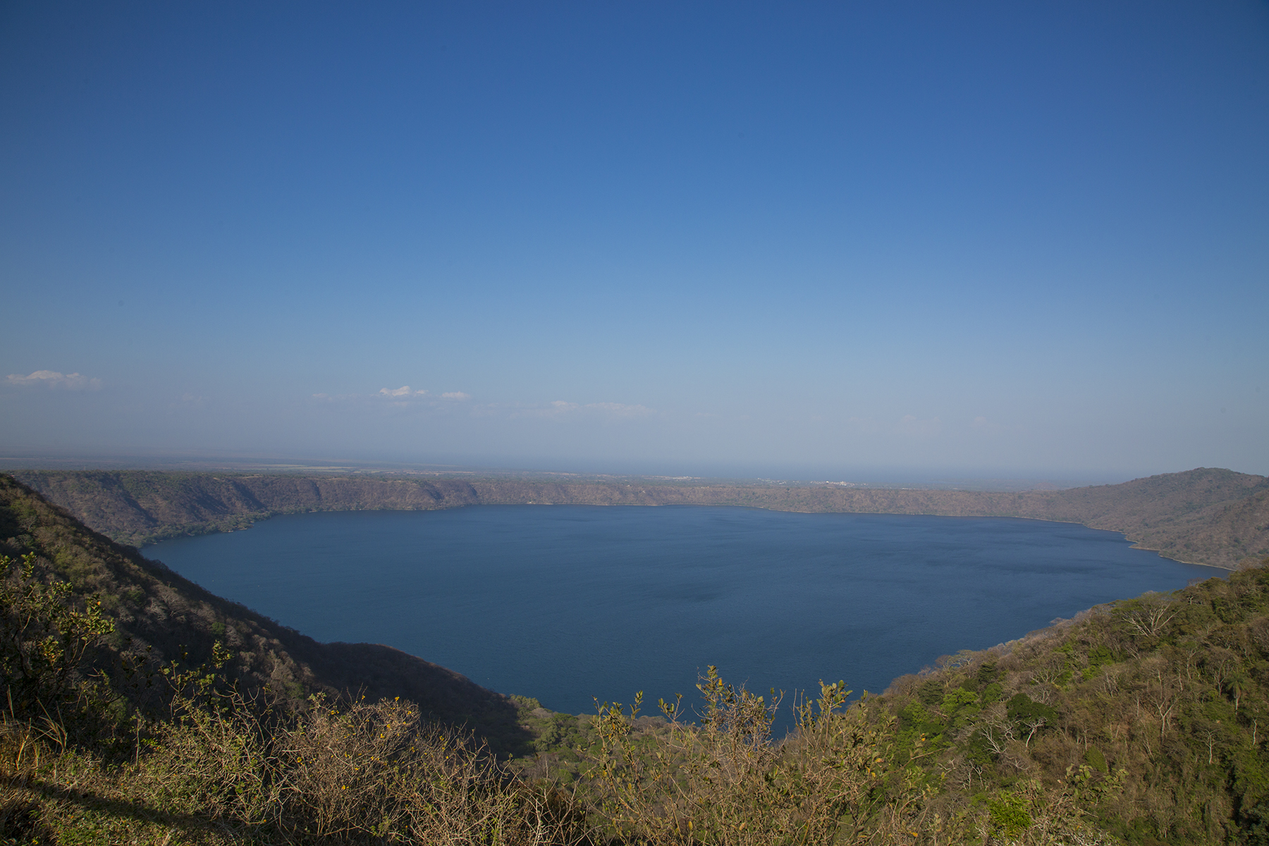
Laguna de Apoyo
Some craters collapse and form lovely lakes, such as Apoyo, above. Not missing an opportunity when they see it, the Nicaraguans have developed lovely small spas and resorts along the edge of the lake. The water is warm, and the cerveza is cold. Below, Cathy and Torrey making their way to the cantina, where we treated ourselves to lunch and libations, followed by refreshing inner tube floating in the waters.

Lakeside retreat
We ended our carriage ride through Granada at a modest dock at Lake Nicaragua, where we boarded a panga, or small boat, to visit a labyrinth of tropical isletas, a cross between something from Pirates of the Caribbean, Jurassic Park, and Century 21 real estate. Homes on some, including a few rather sumptuous examples, but lots of growth and wildlife in the bargain. This would include Monkey Island, where our boatman, over time has befriended one particular monkey he calls Lucy, gaining her acceptance while he feeds her penchant for tomatoes. As we drew nigh, she swung from an overhanging branch and gave the boatman an affectionate hug before scampering over Cathy’s shoulder on her way to the bow to hang out and consume her treat.

Lucy and her tomato
Now I shall move on to the shameless fruits of Gringo tourism. On our first morning in town, we took the advice of the owner of Dos Palmas and walked to Kathy’s Waffle Shop near the town’s central park. Much as I like waffles, we chose a typical Nicaraguan breakfast of juevos revueltos y gallopinto—scrambled eggs and a mixture of black beans, rice and spices common in this part of Central America. Fresh orange juice and a wonderful whole grain toast. Fried plantains, in the bargain, another Nicaraguan staple. Good to go for the next several hours.
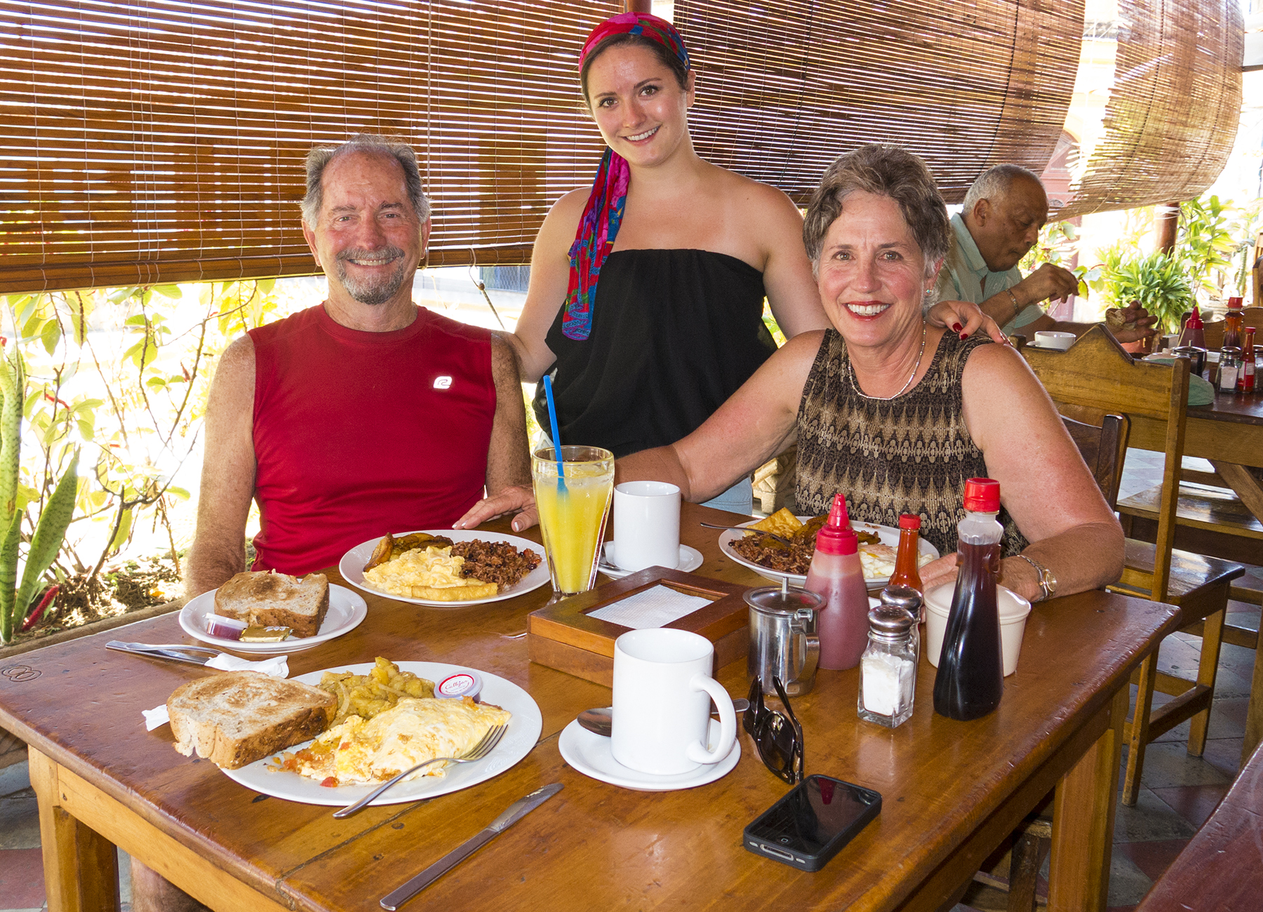
Granada desayuno, Nicaragua tipico
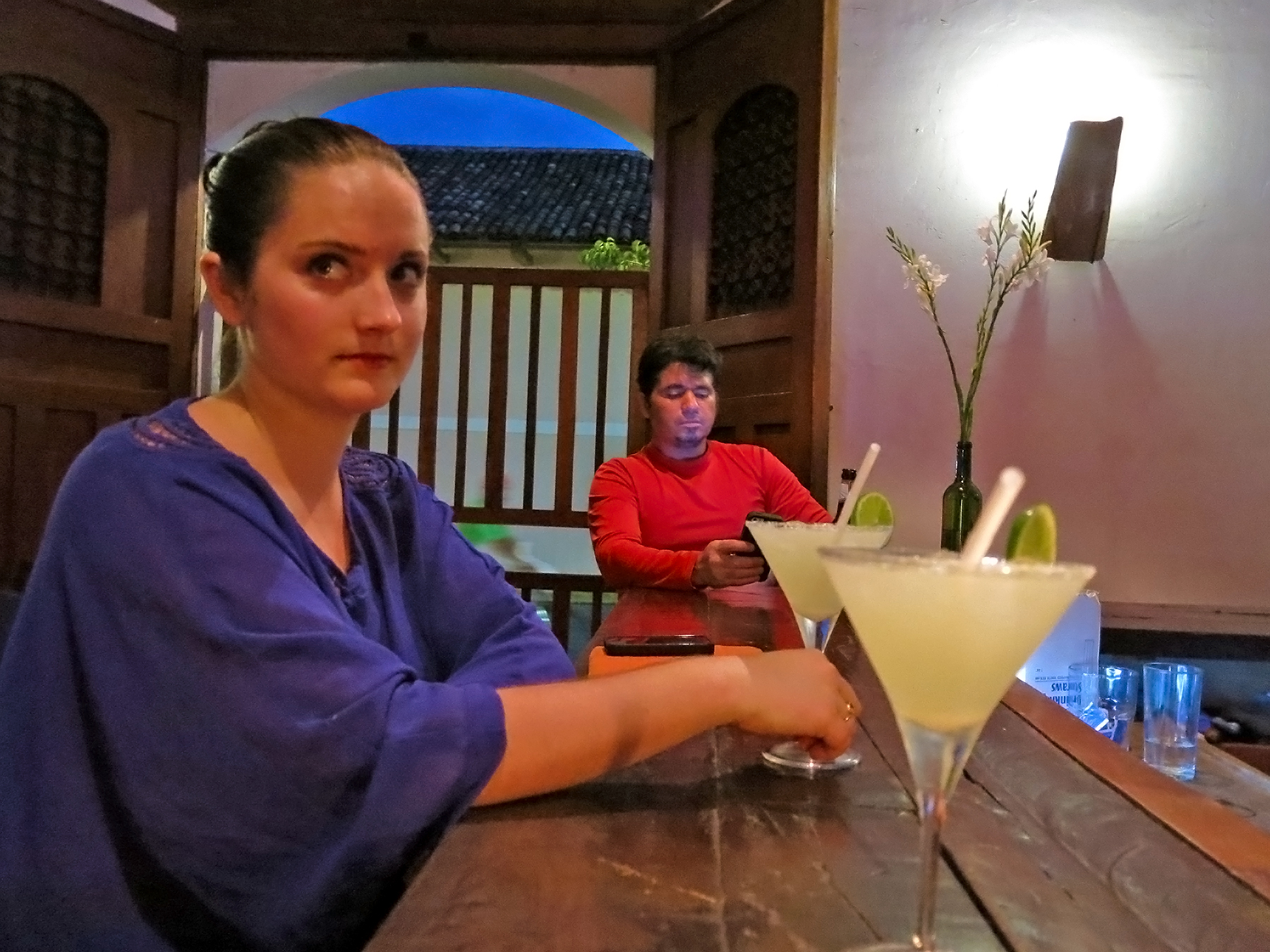
Gracias José Luis. Margaritas Deliciosas
Our proximity to the bar at the nearby Hotel Corazon made us early evening “Cheers” regulars, night after night, and we struck up a marvelous camaraderie with barman José Luis, hand crafting the most delicious margaritas. No mixes—tequila, cointreau, and fresh limes, which he’d literally go pull off the tree when you ordered your drink, and slice and squeeze while fielding our Pavlovian salivating banter delivered with our best quasi effective Spanish.
We felt we ought to at least explore someplace farther afield than Granada, and eventually decided on San Juan del Sur, on the Pacific near the border with Nicaragua. Cathy was researching an eco resort out in the toolies, when I put my foot down for a short dose of full decadence. We selected the Pelican Eyes resort, far and above the fanciest place in the region.
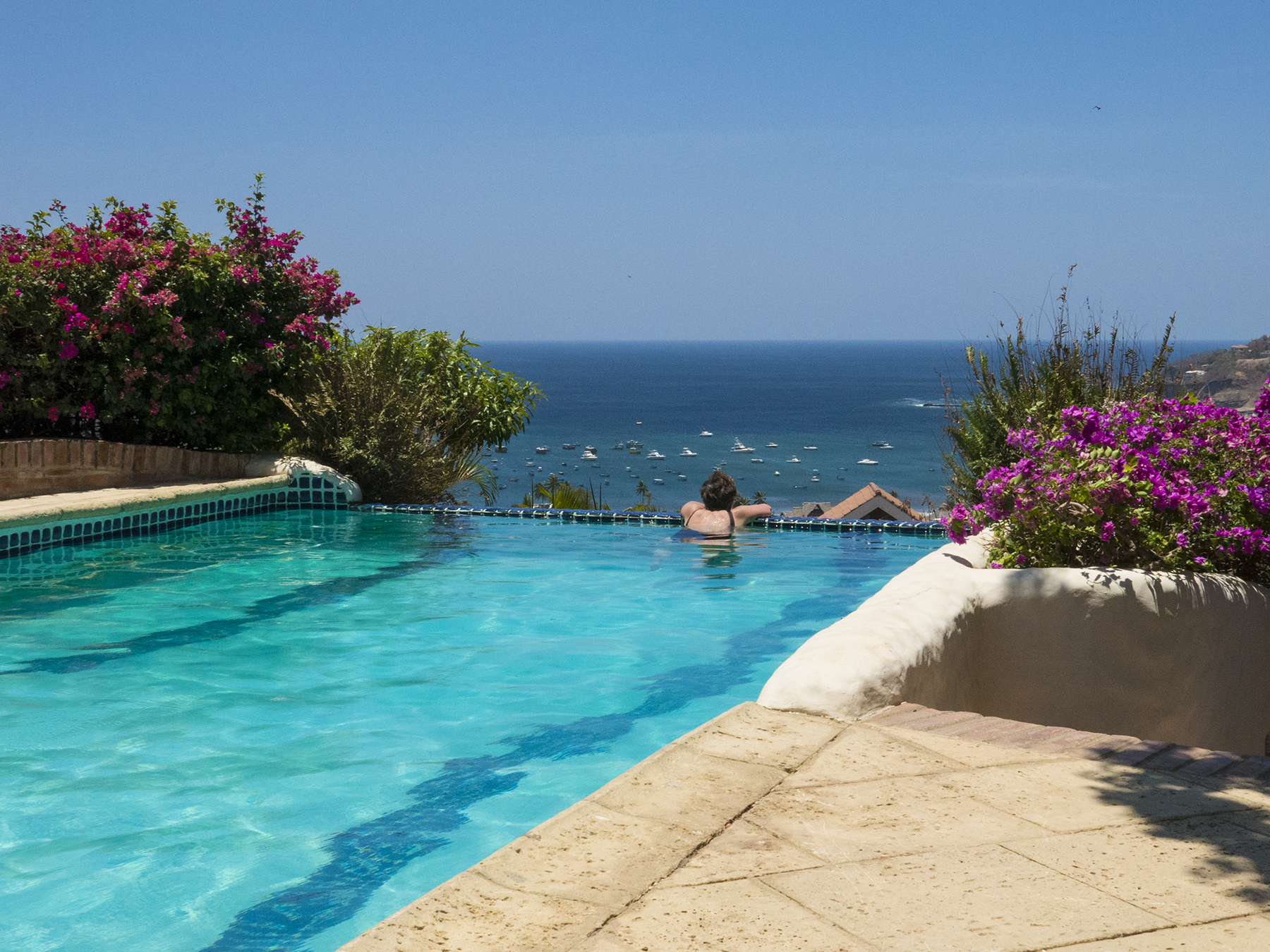
Cathy, struggling to make do with my lodging choice
The sunset view from our casita wasn’t too shabby, either. It’s a small natural harbor buttressed on both sides with headlands— on the right, a large Christ statue reminiscent of our time in San Sebastián, Spain.
San Juan del Sur puesta del sol
Mention of Nicaragua’s dark history is inescapable. I profess no expertise on this subject, but given the vibe with the people in these days of quiescence, I wonder if they haven’t been saddled with excess from both sides of the political spectrum. Our own country has had its fair share of interference in Nicaragua’s affairs, including U.S. Marines (long before Ollie North), endeavoring to put down a revolt against their presence in-country led by Augusto Sandino, whom our country referred to as a bandit, and who Julio likened to a Robin Hood. Sandino waged a guerrilla war against the Marines, who eventually left Nicaragua, probably a response to the fiscal realities of the Great Depression. Before they left, the Marines oversaw the installation of Juan Sacasa, and, in 1934, Sandino was assassinated by forces under General Anastasio Somoza, who later took dictatorial power in a coup, and then elected as president in 1936. That was the extreme right government of Nicaragua until being overthrown by Marxist-Leninist Daniel Ortega’s Sandinista National Liberation Front in 1979. A dictator on the right replaced by one on the left. Ortega retained power until 1990. Since then he tried in 1996 and 2001 to return to power until successfully being reelected president of Nicaragua again in 2006. Make of all this what you will, Marine colonel Ollie North, overseeing the secret sale of arms to Iran, and using the funds to support anti-Sandinista contras in Nicaragua. Ortega, alleged to have sexually abused his adopted stepdaughter, evidencing favor of, and receiving succor from Iran’s Ahmadinejad, and Venezuela’s Chavez, and seeking to gain approval from Nicaragua’s judiciary to exceed current constitutional limits to terms in office.
Julio thought we might find a visit to the hilltop fortaleza (fortress) not far outside Granada informative as to the recent political history of the country, and he was correct. This edifice has existed as a fortress, prison, and of late, a country home of the Boy Scouts. Go figure. This is the look as you climb the hill to the fortress, or prison site.
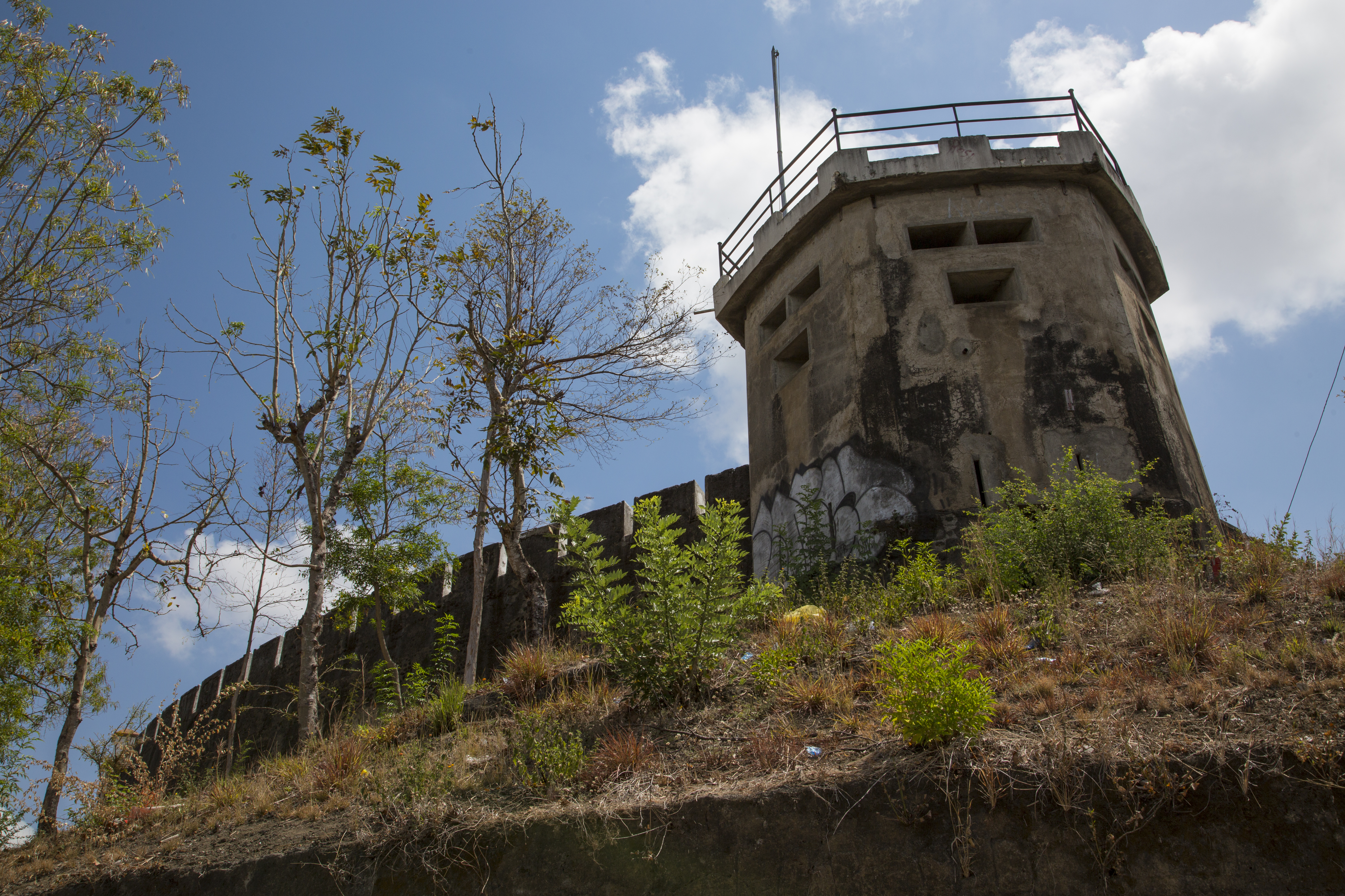
Campo Escuela Scout El Coyotepe—The Coyote Country Scout School
If you were a guard, this might be a common view.
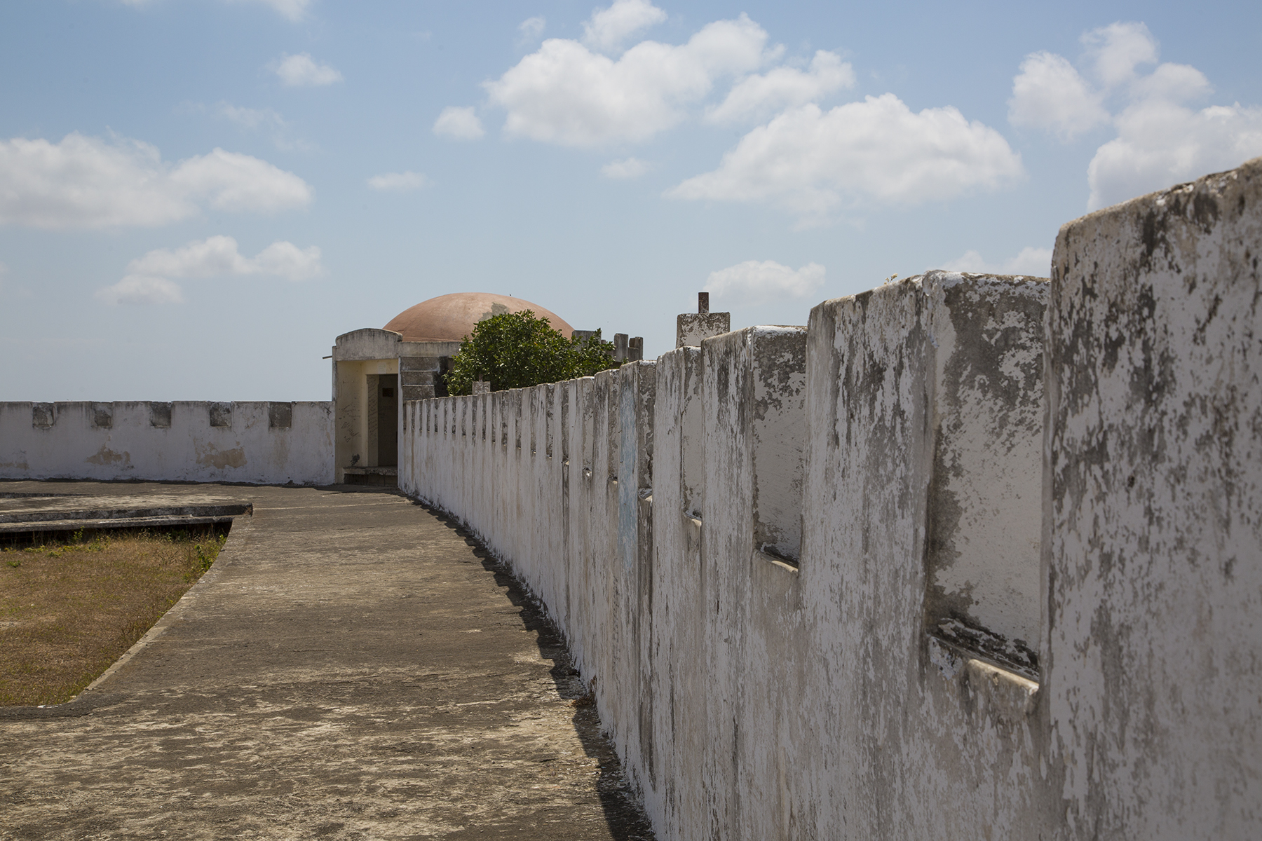
Fortress parapets
And if you were picked up by whoever was in power from the right or the left, this is about where you confront Virgil’s admonition to “Abandon all hope, ye who enter here.”
First level of hell
And, then, they close the doors on you.

The door to close off life
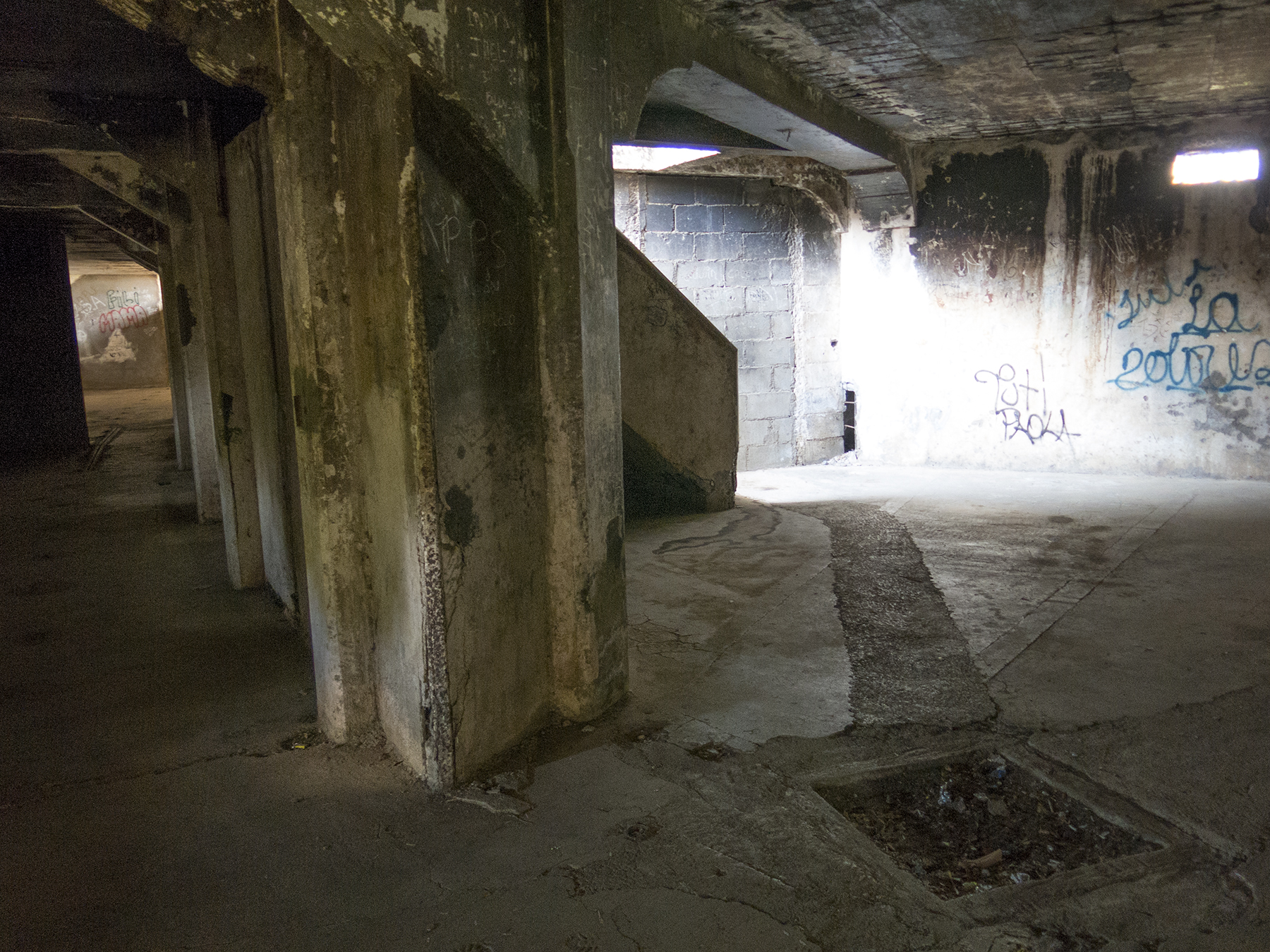
To give you a little idea of just how grim things could be for prisoners, this is a barred-off window, dimensionally about three feet by three feet, maybe nine feet above the floor of a cell for dozens of prisoners. As it turns out, in some cases, the jailers installed three prisoners in the window cube, and closed off the outside.
A cell window, itself, also a cell
It gets even worse, like the excrement cell. Use your imagination. And the prison had three levels below ground, so the bottom two levels had no light whatsoever. Large numbers of internees were never seen again. Dead or alive, their bodies were tossed into handy active volcanos. Man’s inhumanity to man. Give praise to our own relative political stability, and take none of your freedoms for granted. Evil exists, and we humans have plenty of history to prove it.
Last glimpses. Scattered throughout the towns and highways are billboards like this.

Revolutionary, or lifetime politician?
And a favorite glimpse of Nicaragua for me.
The youthful hand of commerce and hope
Bags dropped with the desk staff of Pelican Eyes Resort, Cathy and I hiked down to the beach and decided on lunch at beachfront el Timón. While waiting on our meal, and savoring a Nicaraguan Toña cerveza, the occasional hawker would meander by to offer up their wares—hand wrought bracelets, pottery, knock-off sunglasses, and such. And then this tiny fellow, who could only just barely reach our table top, pushed up his chicle supply. I told him I’d buy a pack of gum, but that he should keep it and resell it to the next chew-needful Gringo. He shyly accepted my offer, and slipped off to other sales opportunities. Take that Daniel Ortega, Anastasio Somoza, and whoever else would hold down, or corruptly prey on these fine people in their volcanic land.
This Week in the ‘Hood
Posted on March 29, 2014
Not much to say, perhaps better to let the images speak for themselves. Some storms, some sun. And Spring flowers. Elements of life.

Nice rays

Blink and it’s gone
A time-lapse sequence. Dvorak, adagio movement, Symphony from the New World.

Goodnight sun
Friday’s finish
Busy ants

Lavender, anyone?

Bold pollen
A birthday present for Rea
Posted on March 4, 2014

030314 sunset #1
My mom, Rea Close, was born on March 4, 1905 in, or near Chappell, Nebraska. I say near, because my grandparents had a farm. Grandpa was also a banker, so they may well have had a house in town. In either case, it is a very small place, (2012 population 943; 13 square blocks) in the SW corner of the state, located between the Platte rivers. I suspect birth, itself, might have been anywhere, including Sidney, the nearest larger town. When she was five, my grandparents relocated to rural Fallbrook, California in the northeast of San Diego County. My mom went on to blaze a trail for today’s achievement-oriented women, graduating from Cal Berkeley and then maintaining both a career in teaching business courses and raising a family.
Last evening, the 3rd, there was a rather nice sunset, which I was able to capture in both stills and time-lapse. I started work on creating the T-L movie after supper, but was tired enough from flying over two days, that I cashed in my chips so as to resume work today. For whatever reason at some point in the middle of the night it came to me that today is mom’s birthday. She lived 95 very full years, before passing on ‘yonder, and I still miss her, revere her, and love all that she was and did for my siblings and me.
So today, I’m giving mom a present of some of last evening’s sunset and the time-lapse. I hope you enjoy it as much as I know she does.

030314 sunset 2

030314 sunset 3

030314 sunset and new moon moonset

Ditto
I’m not sure that the setting crescent new moon shows up at this resolution. It peeked in and out of the upper buttermilk sky clouds as both of them moved relative to one another. Hide and seek.
And here’s the time-lapse, composed of three separate consecutive sequences, threaded together. Happy Birthday, mom. Love, Tommy
Sol y Luna
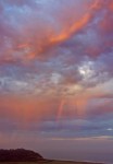
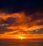
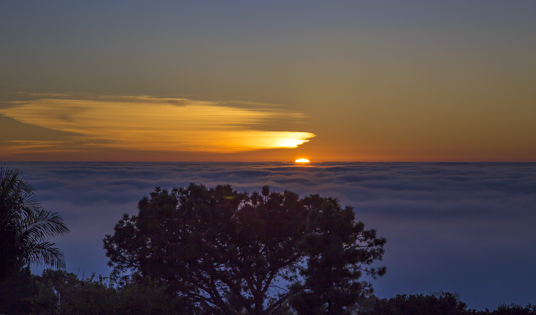
Posted on February 24, 2014
-

- Gliderport view #3
-

- End of the day, end of August
-

- Gliderport view #2
-

- Supermoon cloud blanket
-

- Buttermilk reflections
-
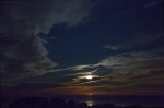
- Moon over the Pacific
-
- Torrey Pines rainbow
-
- Gliderport view #1
-

- Mt. Laguna sundown
-

- Liquid Gold
-

- Moonrise over the Lagunas
-

- October sunset
-

- VIRGA sunrise
-

- Broken Hill trail promontory
-

- Moonset over the Pacific
-

- Moon swathed in clouds
-

- August 31 sunset
-

- New moon sunset
-

- Mt. Woodson moonrise
-

- Greenflash
William Blake had it right
Posted on February 15, 2014

Sun, cirrus, and fog aglow
As Valentine’s Day slipped toward Valentine’s Night, is it any wonder that poetry should be sought as blissful abandon?
The sun descending in the west,
Last light begins Valentine’s Night
The evening star does shine;
The birds are silent in their nest
And I must seek for mine.

Morning moonset
The moon, like a flower
The moon in a cirrus gauze
In heaven’s high bower,

The moon and thin cirrus over the Pacific
With silent delight
Pelicans on the wing, as the moon drifts into dawn
Sits and smiles on the night.
William Blake, 1757—1827
SOCAL TRACON (SCT)
Posted on February 9, 2014
“SOCAL TRACON,” translated, means Southern California Terminal Radar Control—the FAA’s air traffic control facility handling the lower 13,000-17,000′ of airspace from offshore in the west to the beginnings of the California deserts in the east, and, up north, demarcated by a west-east line from around Pt. Dume to Palm Springs, and, in the south, by the border with Mexico. Air traffic control comes in many levels in this country—from an airman’s perspective it is never less than pilots, themselves, controlling the operation of their ships so as to see and avoid other aircraft, terrain, or obstacles, whether at non-towered airports, or en route. For FAA controllers, Job One is assuring that two aircraft do not occupy the same parcel of airspace at the same time. This is accomplished with a tapestry that involves controllers at airports who issue clearances and guidance for surface and traffic pattern operations, with the responsibility for control of aircraft separation being “handed off” by them to what are collectively known as departure/approach control facilities, more technically known as TRACONs. When their craft proceed far enough laterally or vertically, TRACONs hand off ATC responsibility to (en route) Air Route Traffic Control Centers covering wide multi state sized parcels of airspace. As aircraft eventually near their destinations and begin descent for landing, the process is reversed from Center to TRACON to control tower.
The SOCAL TRACON is housed in a capacious facility abutting the NE corner of Miramar MCAS. It is built with an intriguing steel exoskeleton rising vertically out of the ground along the sides of the building and then passing horizontally through the ceiling of the structure, designed to survive a Richter Scale 9.0 quake centered directly under the facility. https://www.facebook.com/photo.php?fbid=610093519043834&set=a.595970633789456.1073741826.112145808838610&type=1&theater Radar antennae throughout Southern California provide the returns visually depicting the controlled aircraft on 48 subregion-specific t.v.-like screens that are individual controller’s workstations, with an additional 16 display workstations in a separate room used for training, and available as backup. Communication links are provided by over 550 fiberoptic cables. Redundancy is ever important in aircraft and the control thereof. That said, the TRACON was evacuated a few years back when one of our large autumn wildfires burned to near the facility property line—yet the evacuation wasn’t caused by the flames, but because they couldn’t properly filter the smoke being ingested into the air inlets for the air conditioning needed to keep the electronics cool. Apparently that weak link has yet to be addressed for future fires or terrorist attack. As to the latter, the facility has a double perimeter barrier and a guard shack, and access, such as with my tour, is controlled by invitation, verification, and identification.
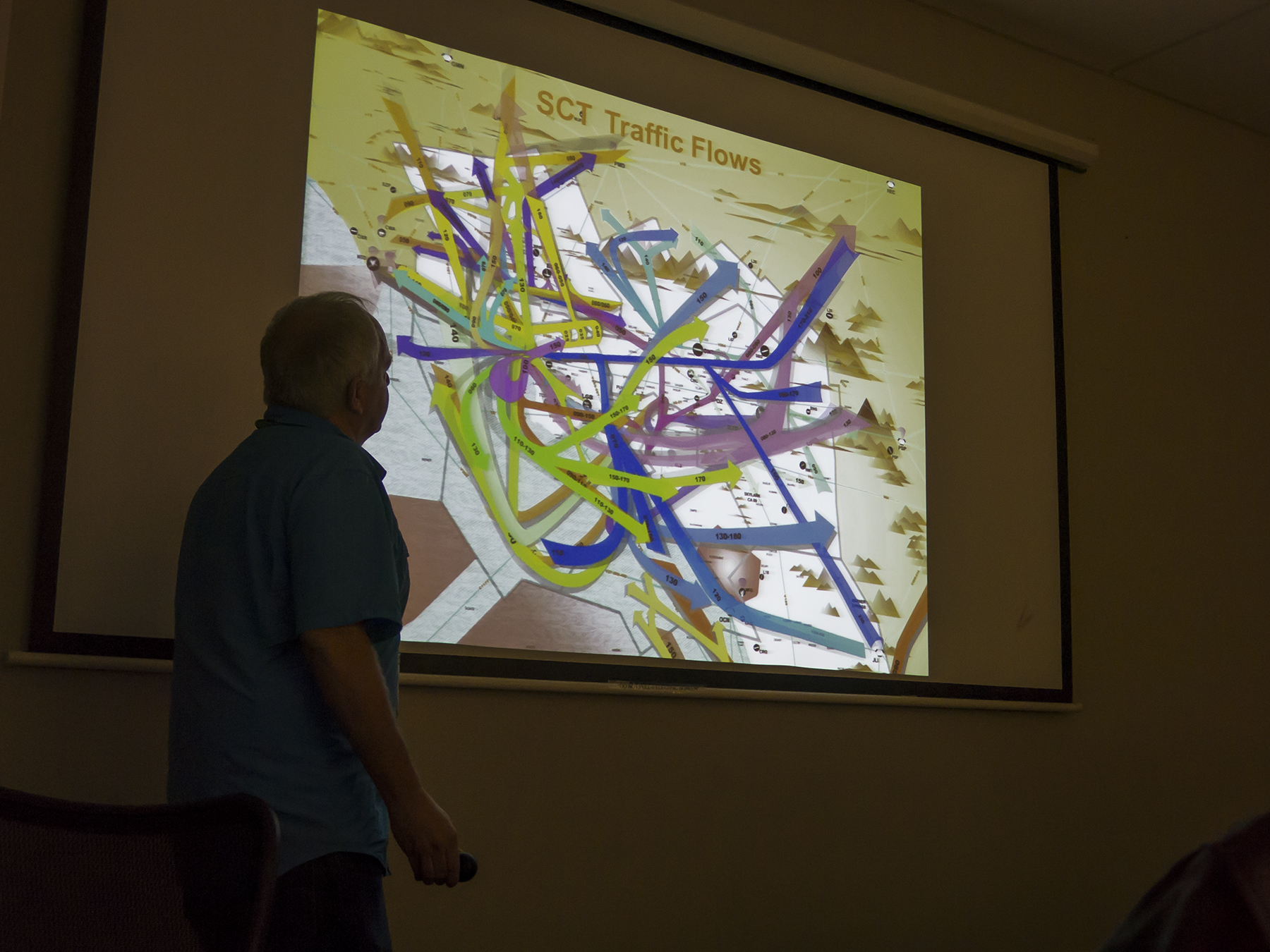
The facility tour was conducted by Robert M., a veteran controller, who had begun his career at the Los Angeles Air Route Traffic Control Center located at Palmdale, and handling the traffic over all of the SW United States—the handoff facility from and to the SOCAL TRACON. He provided an overview of the ATC concept as well as short vignettes about experiences from memory, usually relative to whoops moments and intended to exemplify a point or to lighten the mood with a little black humor. Such as a pilot congesting a control sector’s one-at-a-time ATC communications frequency with a lame request that took 27 seconds to complete—an inflight eternity—while he and another airplane were headed directly at one another at the same altitude. You can guess the points Robert was making, no doubt. A salient tidbit conveyed is the level of traffic the SCT handles. The second bullet point in the slide below screams a hint at why it is so demanding for aviators and controllers in this area—the SCT is not only the busiest ATC facility in the world, but, in fact is busier than the ATC facilities of the seven busiest countries in Europe—combined. For the non-pilots amongst you, the alphabet soup of airspace (Class B, Class C, Class D—control towers—and TRSAs) classification includes requirements for pilot certification, aircraft equipment, communications and ATC clearance, and cloud separation and visibility specifics. It is a 3D puzzle of situational awareness, with a priori pilot/equipment givens and demarcations having to be visualized in one’s head while underway, hopefully with the aid of onboard equipment displays, charts, and looking out the window for geographic clues.

SCT statistics
SOCAL traffic flow routes
The traffic flows within the Southern California airspace are a complex web of aerodrome arrival and departure pathways. The colors on the slide Robert is describing above represent various individual airport’s pathways—LAX, SAN, ONT, BUR, and so on, most of which you may actually know even if only from your airline ticket.
Having been an end-user of the ATC product for the past half century, I already knew most of what was conveyed during the SOCAL TRACON tour, provided to pilots as educational outreach. For me, this was a refresher chance to see what the controllers’ workplace is currently like, to see what upgrades their equipment have taken since the last such visit a couple of decades back, and perchance to trade favors and share the pilots’ perspective on the service they provide. Fewer than 15% of the SOCAL TRACON controllers are also certificated pilots, which has been motivation for me over the past few years to offer up FAM (Familiarization) flights in the Cirrus to both tower and TRACON controllers. These days the controllers’ work interface is a bit more electronic, reflecting the digital age in which we all meander. A controller’s workstation has a large, configurable screen showing traffic underway, and capable of displaying airways and waypoints in the sky, terrain, and minimum vectoring altitudes for terrain avoidance. The image below shows distance rings from the primary airport in this particular ATC sector, here I think it is Burbank (BUR). Traffic is depicted by tiny moving blips on the screen, each with a bright green information code that is electronically paired with the aircraft’s transponder or primary skin-paint radar return. Unseen, here, the aircraft blip leaves behind it a ghostly blue wake, the length of which is an analog depiction of its relative groundspeed, which speed is also conveyed digitally in the paired tag, along with call sign, altitude, and destination. As desired, the controller can also turn on or off a blue headlight-like beam that shows a given aircraft’s forward extended ground track the controller’s vector of the aircraft is producing, given the aircraft’s airspeed and the effect of winds aloft. If several of these were simultaneously selected “on” by the controller it would look like a group of Jedi Knights’ light sabers doing battle across the SOCAL sky! As I say, Job One, is keeping aircraft separated, and the vector track beams can help in times when that is needed beyond the controller’s experience-based intuition. There’s a keyboard for inputing information, and an orange-sized black roller ball that allows moving a screen cursor to an aircraft’s blip for tagging that info input. I suppose I should mention that each controller wears a headset for two-way radio communication with aircraft underway on a discrete frequency specific to his/her given air traffic sector. Controllers still use small paper strips conveying additional aircraft information, that runners in the room bring physically to workstations appropriate to the information—here you can see one such white strip folded in half. And, oh, the screen is also capable of overlaying precipitation returns, important because turbulence is directly correspondent to rates of precipitation. Worthy of note, TRACON weather displays are in real time from the actual antenna sweeps also producing the aircraft returns. The TRACON radar’s RF energy wavelength is designed principally for aircraft observation, but still does a tolerable job of conveying precipitation intensity in real time. Not so, the weather returns displayed on the ARTCC monitors, which aren’t directly from the Center’s radar antennae. Like the satellite-linked weather displays in my Cirrus, the ARTCC precipitation displays are algorithm-manufactured composite digital depictions of what the National Weather Bureau’s separate weather radar is showing—with a lag of up to six minutes. In rapidly moving and changing weather this is about twelve of those in-flight eternities. As verbalized by the Hill Street Blues shift sergeant—”let’s all be careful out there,” lest those figurative eternities become literal. Ahem.

Controller workstation
In the image below Robert is pointing out one tidbit on the screen. The trapezoidal shapes depict various ATC sectors as seen from above. There are a few aircraft with their information tags shown near the top of the screen. As it turns out these three images were all taken in their training room, an exact replication of the real control area just the other side of the adjoining wall. Here pictures were allowed, while, for reasons unclear to me, they were not in the room next door. Both places are hushed areas, in near darkness apparently so that the screens can be seen more readily. To be honest, I wonder about that, given the current technological ability to make LED LCD screens bright enough for daylight viewing. I wonder if this is a holdover from the days that screens were dim monochromatic affairs, and the government, being slow to change, as we all know, still keeps it’s controllers literally in the dark.

Controller monitor
I know that if I am in flight, it is fairly frequent for controllers to enquire as to what sort of day it is out there, as they are huddled in their dark tomb, with no direct sense of the weather in the area where they are controlling traffic. Perhaps the darkness is intended to keep controllers’ minds on the job? Of that I can only guess, but I know that controllers are busy, dedicated professionals, and fully capable of giving their task the undivided attention it calls for.
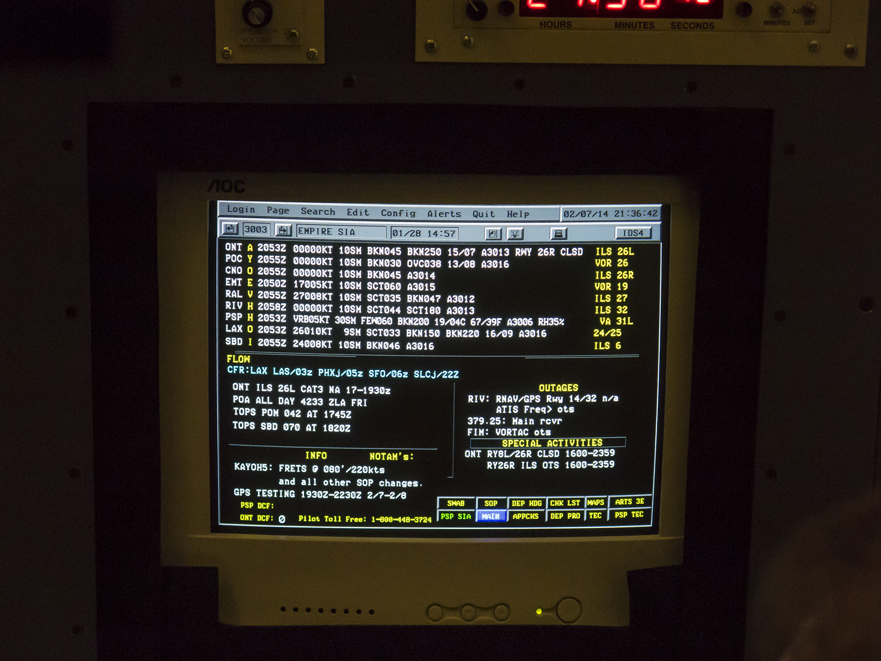
Empire airports ATIS weather & runway information
This is not to say that an air traffic controller is bereft of reliable information about the airspace. Adjacent to each work station there are other displays of ancillary information such as this, showing what airports in the individual controller’s sector have as weather, what approaches and departures are in use, traffic flow delays, outages and unavailable procedures. For instance ONTario Information “A” generated at 2053Z (8:53 PM Greenwich Universal Time—the time standard for everything aviation) is showing calm winds, 10 statute miles visibility, with multiple layers of broken clouds, a temperature of 15 Celsius (59 F) and a barometer of 30.13″ Hg, where runway 26 Right is closed, and with ILS approaches in progress to runway 26 Left, etc.. Seeing this and knowing the sepulchral workplace of controllers toiling in the dark generates a whimsical recollection from my air carrier days, where we frequently operated blind within clouds in areas of thunderstorm activity. We relied upon our onboard weather radar to keep us clear of the heaviest precipitation and coincident turbulence nastiness. Now and again we might pop out into the clear, and appreciated a quick visual scan of the bubbling cumulonimbus around us, routinely allowing as to how “one peek is worth a thousand sweeps” of our onboard radar’s ceaseless back and forth beam emanations. Gallows humor.
Which is modest segue into reflections ending this missive. Not unlike the practice of modern medicine, aviating or traffic-controlling of aircraft is several measures of art combined with science. In all three fields there is growing reliance and enhancement of what is known, by often digital electronic magic. But successful application of a practitioner’s skill set is a balancing of knowledge, experience, data, situational awareness, and a nuanced intuitional synthesis. The tools available are terrific, but it still comes down to the massaging, interpreting and acting upon the entire panoply of information being integrated in that three pounds of gray matter between a specific individual’s temples. It’s an imperfect world, but the ballet of aircraft control works with remarkable success, with the TRACON personnel doing their professional best to facilitate safety and the efficient minimally-impeded flow of traffic in a complex dynamic environment. My hat goes off to them.
Wintertime along the shore
Posted on February 3, 2014

The end of January ’14, take one
As you likely know, I am taken with sunsets and sunrises. Around here, in Del Mar, the best of those are in the winter. January ended and February began with some nice, but not extravagant sunsets worth savoring. This is a panorama, composed of four separate images hinting at the effectively 180 degree scope of the view from the cliff top bluff, from La Jolla on the far left, to just shy of the view all the way to Orange County on the right.

17:21 January 31, 2014
The above caption says it all. Military time.

17:31 January 31, 2014
This caption says as much as that for the previous image, and more. It turns out that the sun dipping below the horizon is a nice moment in time, and is when the occasional green flash can be seen. But the real light show begins just about ten minutes after the sun goes down. It requires some high cirrus or alto clouds, and enough cloud gap right at the horizon for the light to stream up and highlight the upper level clouds in hues that begin with gold and peach, and continue through orange, red and magenta.

The end of January ’14, take two
Now these images were all taken with my G15 while the 5D III was busy capturing a time-lapse sequence. I’ve begun adding those to these posts, as you know, but am going to try a different tack using Vimeo linked URLs that will enable you to see the time-lapse in higher resolution, while keeping down the amount of cache taken up on my blog site. So let’s see if this works and appeals to you.
You may know that yesterday, the 2nd of February, there was a commercials event accompanied by a football game. If you are a Denver fan, you may have wished to focus on the commercials. Anyway, during the halftime show, two of us intrepid Del Martian time-lapsers took the opportunity to see if the afternoon’s buttermilk sky might provide a viable sunset opportunity. Again, nice , but not off the charts.
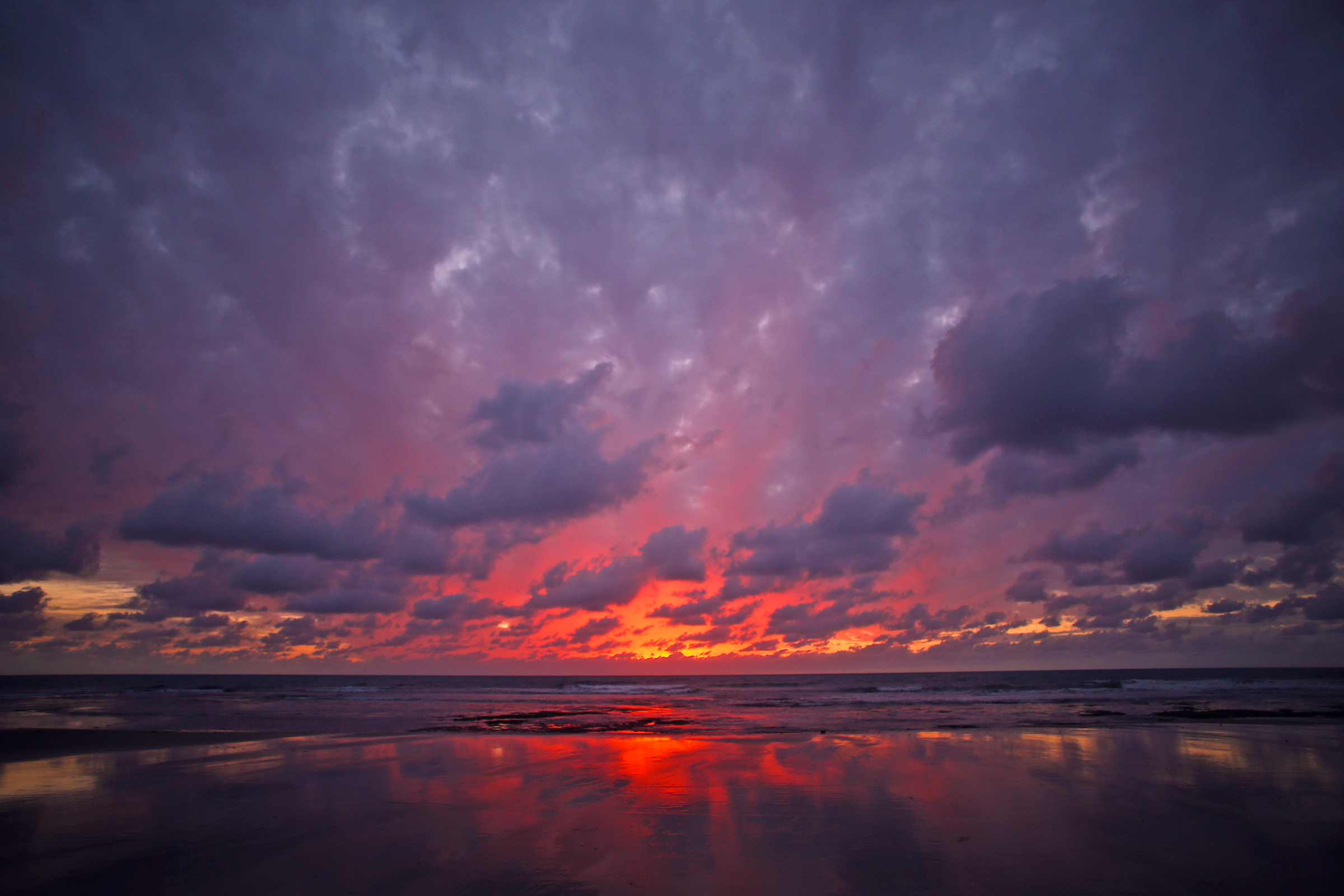
Del Mar Superbowl halftime show
And for the time-lapse: https://vimeo.com/85750580
The shoreside is delightful throughout the day, and that includes the mornings, when all manner of delightful things can be seen.

Everybody rides!
Everybody rides is generic surfspeak for a party wave, when everybody out on a particular break rides the same wave. And there are no better body surfers than dolphins.
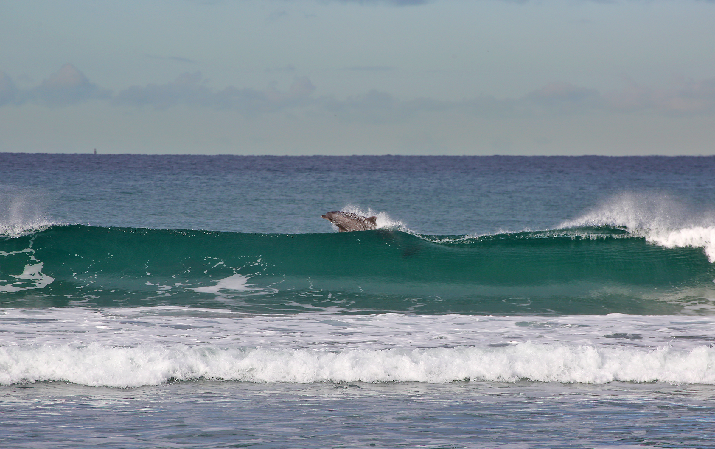
Kick out!
And the dolphin, stage right, in the previous image, decided he needed some air time, and launched out of the back of the wave. Just like human surfers, it was time to exit before the wave closed out on him.

Wave formation

Off the lip

Feathertip flight
Ah, the ubiquitous brown pelican, a California staple, having made a successful comeback from threatened species, after the banning of DDT returned sufficient strength to their eggshells enabling a full gestation period. On the ground, possessed of a face and body that only a mother could love. But in flight, a creature of pure delight. They have mastered the art of gliding in updrafts and ground effect, as it is known for human pilots. A peaking, about-to-break wave face provides sufficient updraft to support the pelican on the wing, and between waves they glide no more than an inch off the water, which results in substantial drag reduction and a supportive cushion of air. They can span miles of shoreline with only the most infrequent flaps between oncoming swells. And, of course, they are the consummate fishermen and women, diving for fish just beneath the surface and scooping them up in their bill pouches before extending their necks and gulping down their ultra fresh sashimi.
There you have it, another few days in the ‘hood.
Pine needles, bluffs, the sky and the sea
Posted on January 30, 2014

Writers, I am told, are oft counseled to write about what they know. Sage advice for any creative endeavor. Subjects, whose beauty calls out for artistic rendering, can be distant, or as closely known as the rough spots on your own skin, or that quirky smile of a loved one.
The Torrey pine tree is native to only two places on earth—the California channel islands, and right here in my backyard, the Torrey Pines Reserve and scattered about my home community of Del Mar. Once nearly extinct as a species, but now numbering a few thousand specimens, it is a rugged, twisted pine tree reminiscent of a well-sculpted Bonsai, albeit 25 to 50 feet tall, and draped with a unique five-needled foliage grouping. Its habitat is the sandstone bluffs and canyons of this region, one not known for abundant rainfall. In response, the Torrey quickly sinks a deep taproot to retrieve water where it can, and also is adept at catching moisture from the coastal sea breezes and fogs.
Our six month-old whippet, Sawyer, takes me for my regular morning and sundown walks along the bluffs, canyons and arroyos, making sure that I get my fresh air and exercise while he explores what the squirrels, birds and other natives are up to. This is officially our rainy season, but we’ve not seen precipitation in recorded memory. However, over the past few days the low spots in the bluffs have awoken swathed in soft blankets of gauze-like fog, embracing the Torreys with dew so heavy that it has literally been raining off the pine needles onto the sandy soil beneath the trees, conditions proving fruitful with creative opportunities.

Morning sun diffused through shallow fog and a Torrey’s pine needles, glowing like ET’s heart
These fogs can be both ephemeral and effervescent, the sort of thing that makes you glad you dragged yourself upright before the day grew long in the tooth, treating us to a fogbow, if you will, like a low-laying rainbow, but where the mists do not refract the light into its component spectra.
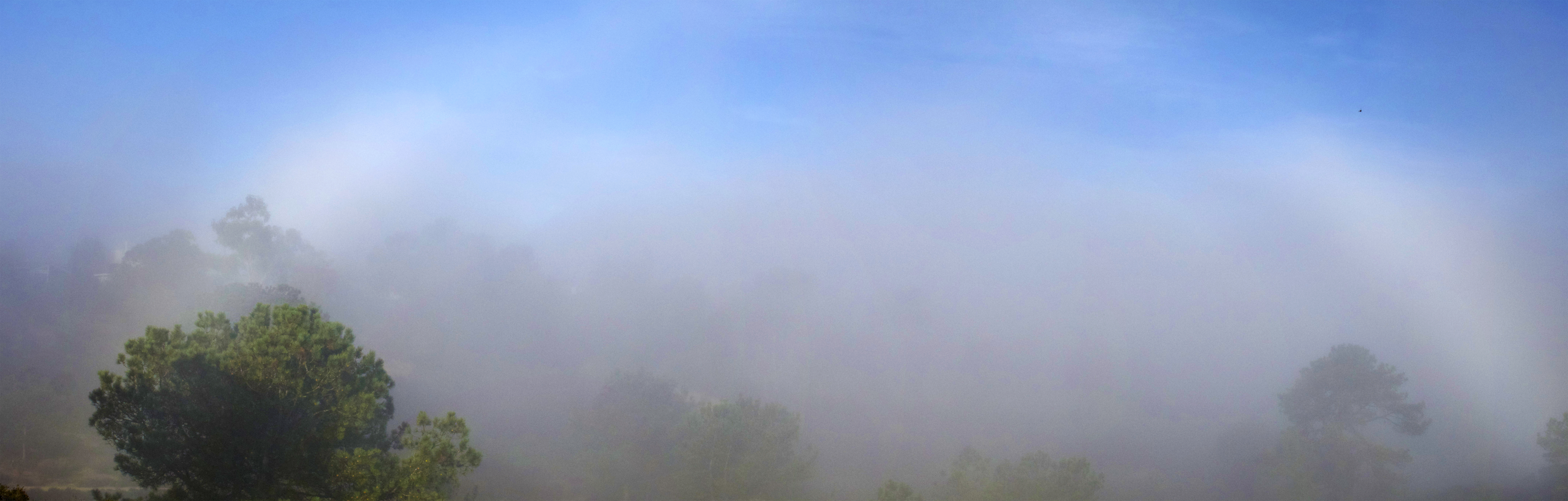
A non-spectral fogbow—the mist and a dancing arc of sunlight
Ofttimes it isn’t fog, but just a low marine layer of stratus clouds, what is locally referred to as May Gray or June Gloom conditions. When the sun starts to burn through, as with this moment, gladdening my heart that I’m not among the weekday road warriors just out of sight down below the ridge rushing off to work.

Morning sun, the jewel in a Torrey pines tiara
Last fall I vaguely remember the occasional storm passing through, and as in Camelot, where, by decree, the rains must be finished by morning, there was wondrous light beguiling and rewarding our early rising. And oh, the sweet bouquet from brushing against the chaparral and scrunching the damp, fallen pine needles beneath our feet—you could actually taste it.

Sunrise through Torreys
Painters and photographers love sunup and sundown for the warmth and iridescence of the light. These times positively insist on the most exorbitant color selection on the palette. And, of course it is decidedly easier to still be up at sunset than to arise at the first hint of morning light. This image was taken not fifty yards away from that above, albeit looking the opposite direction.

Bushwhack a few yards off trail in the Del Mar hills for this bit of solitude
Okay, as I just remembered this is a single frame lift from a time-lapse, I might as well share the T-L while I’m about it. This sequence was an experiment on changing the lens’ focal length while underway, my desire being to zoom in on the sun as it dropped below the horizon. I still like the concept, but clearly need a better method of accomplishing the sought-after effect. So much to learn. The music, Francisco Tárrega’s Recuerdos de la Alhambra performed by the inestimable guitarist, composer, poet, neighbor and friend, Celedonio Romero.
All of the above images are from the various Del Mar bluffs and canyons, truly our back yard. But of course the Torrey Pines Reserve is just a short walk away, and is famous for its rugged cliffs hugging the Pacific shore. There’s an out and back path off the Broken Hill trail which leads to a promontory with this lovely vista, a fitting way to end one’s day and this missive.
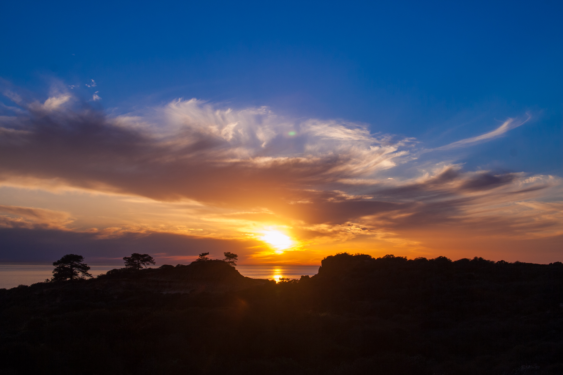

Recent Comments