th2ombre
It's ALWAYS about the light
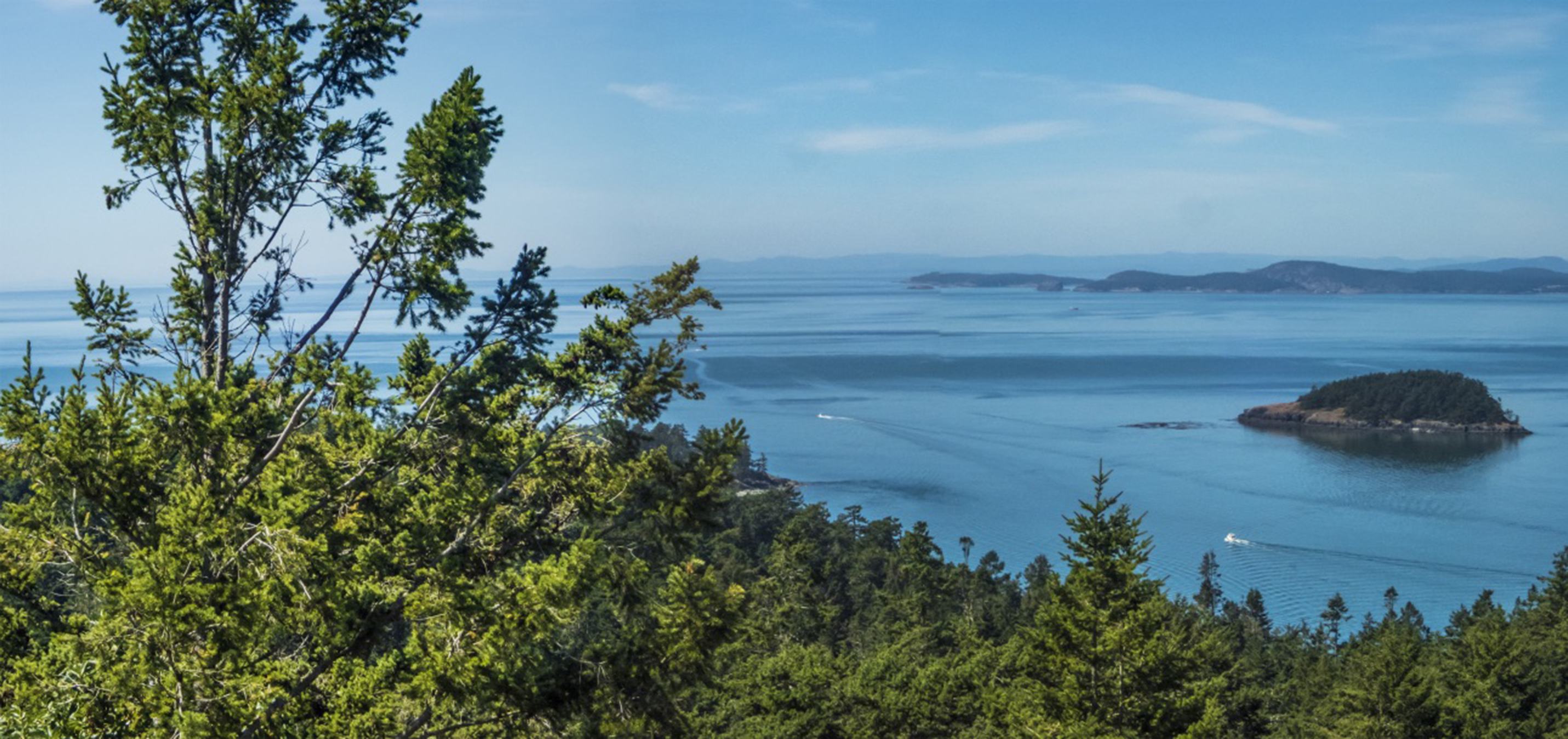
YOUR ISLANDS Await
Posted on August 17, 2021
It’s not exactly Bilbo’s There and Back Again, but any travel in these pandemic cursed times is a bit of an adventure, as was our week-long getaway to Puget Sound, Whidbey and Lopez islands. We weren’t subjected to taking off belts and shoes or mask-fogged glasses while stuffed in a crowded tube, the Cirrus time-machine saving us from that fate. But this year, the 2000+ nautical mile round trip had its own challenges.
As all news media convey, the western United States is going up in flames. Our route had us alongside, between, and over seventeen Temporary Flight Restricted areas established for fire fighting purposes. Our cruise altitude going was 10,000 feet, and returning at 9,000 feet. Neither put us on top of the smoke. Northbound, we were continuously in true Instrument Meteorological Conditions (IMC) from the southern end of the San Joaquin Valley to the Oregon-Washington border, and from north of Olympia, Washington to Ukiah, California, southbound. Not that my logbook needs more Instrument Flight Rules time, but it was legitimate IMC for several hours of flying. No clouds, but no horizon. Like flying around inside a gray pingpong ball that smelled of smoke.
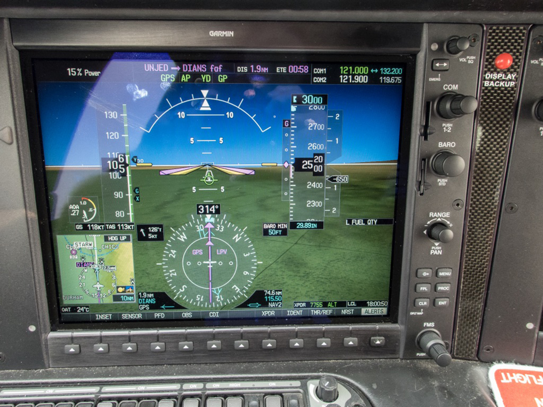
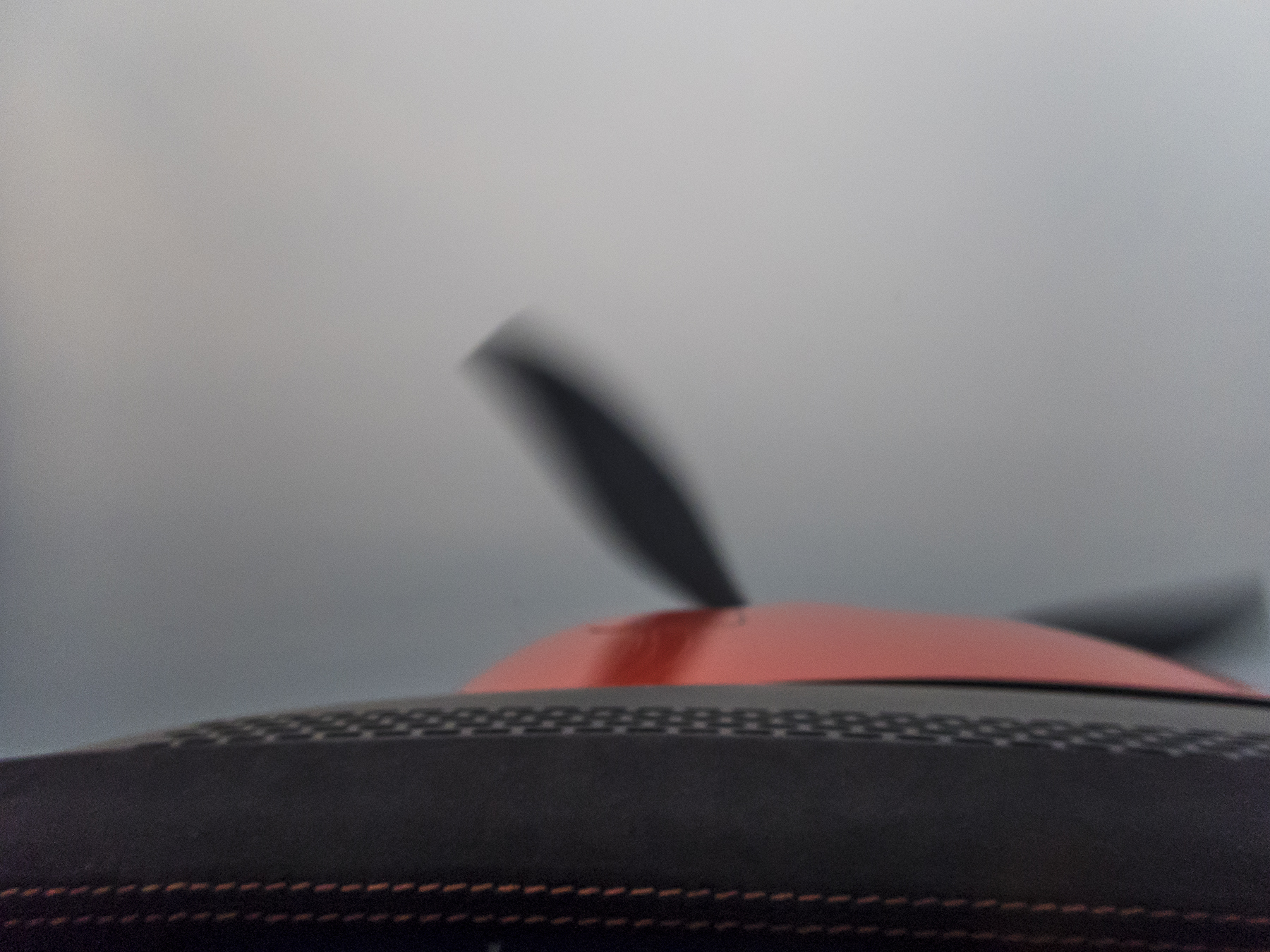
This is the Primary Flight Display look at 1.9 nautical miles outside the Final Approach Fix for Chico, California (KCIC) runway 31R, a fuel and potty break midpoint stop chosen the night before for its favorable fuel prices, and aircraft maintenance service availability if needed. The night before and the morning of our departure, the region was smoky, yes, but above Visual Flight Rule (VFR) minima, and we’d be landing with 1:35 of fuel as an Ace up the sleeve. Our departure weather at Carlsbad Palomar (KCRQ) was IMC with a lowish stratus marine layer and reduced visibility, tops near 2,500 feet. Level in cruise over SoCal, we were in bright sunshine, dealing with early morning quiet ATC, and listening to the classical channel on the Sirius-XM datalink that provides onboard weather and audio entertainment. Don’t worry, it mutes the music when ATC calls. As the saying goes, we were on top, in the clear, and fat dumb and happy. At least that describes me. I’d never verbalize that for ol’ WhatsHerName. Anyway, as we crossed over the Lake Hughes ridge line between the LA basin and Bakersfield, the weather reports on our onboard datalink weather showed KCIC as down to 2 statute miles in FU (not what you might think, that’s weatherspeak for smoke). Pretty much the entire east central San Joaquin valley was that way or worse. Hmm. By the time we neared Chico, the ATIS was reporting 800′ scattered clouds and 2 statute miles in smoke, the wind, south at 3-5 knots. No traffic, so Oakland Center, Chico tower and I conjured up a straight-in to runway 31R served by a WAAS RNAV (GPS) approach with a 250 foot Decision Altitude and 1 statute mile visibility minima. And we needed it. By the time we were halfway between the Final Approach Fix and the runway threshold we could see the ground if we looked straight down, but laterally over the nose it was only smoke and a vague semblance of golden grassland…with no runway in sight. That finally changed below 500 feet AGL, the runway revealing itself as a slowly materializing ghost amidst the vapors . Too much like work after 2:49 of flying, and a 05:30 wakeup call. That adventure thing.
So look, you pilots, here’s some takeaways for our quivers going forward. 800 scattered with 2 sm visibility is technically between requiring Instrument Flight Rules (IFR) and those available by Special Visual Flight Rules (SVFR), but not seeing the runway until below 500′ AGL is anything but VMC. These thoughts are largely tactical. Co-owner, Mason, following us on FlightAware and perusing the regional weather, has wondered strategically as to where we might have gone if unable to land at Chico. The entire region is near the Dixie wildfire, the state’s largest. I had filed Red Bluff (KRBL) as an alternate (and whose weather also deteriorated in FU while en route), but had in the back of my mind that the old USAF McClellan Field (KMCC) would be a reasonable out, and comports with my preference of having an alternate on the near side of the destination, as it effectively means having more fuel since you can drop in before going first to your destination. KMCC doesn’t show weather minima for filing as an alternate, but it has a viable CI ILS available if one chooses to go there. In practice I wasn’t really contemplating using either RBL or MCC, as the CIC weather seemed benign enough—until it took descending below 500 feet to find it. Mason is right—no real easy-peasy strategic choices after the en route visibility degradation. But that 1:35 fuel remaining provided options.
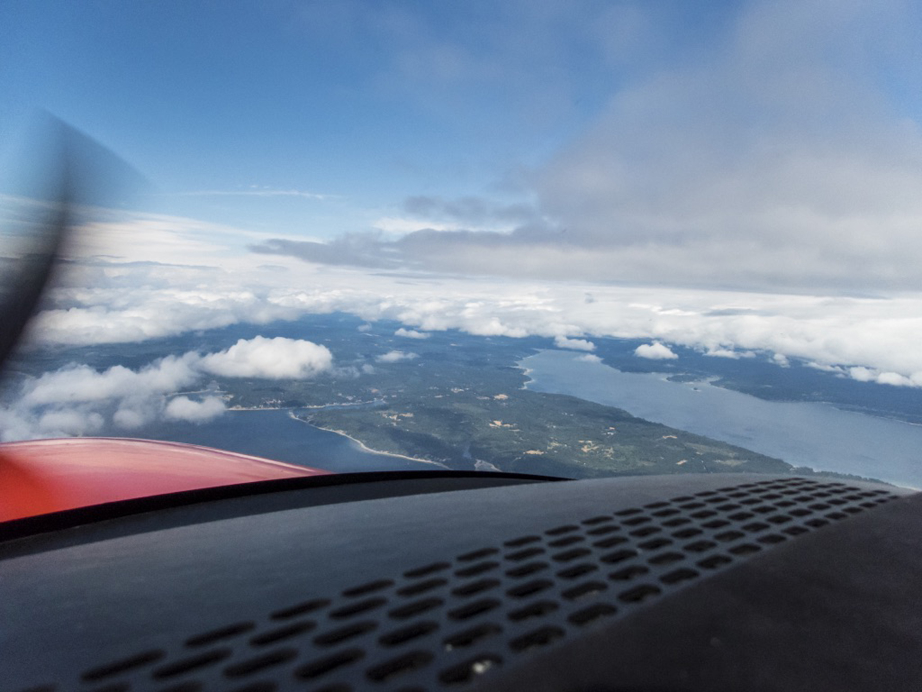
Aircraft tanks filled, and body tanks emptied, we chose to depart on 31R. Straight in, and Straight out. Back up to 10,000′ MSL, and following a route over Fort Jones (west of Mount Shasta) and then mostly up the Willamette Valley over Roseburg, Eugene, Newberg and Olympia to keep us out of the TFRs and to the west of Portland’s and Seattle’s busy airspace. We also flew this leg under IFR because of the relentless horizonless smoke until nearing the Columbia River, but also because it was overcast with rain from Olympia to our destination at Snohomish County, Paine Field (KPAE). At cruise and reported on the surface, the wind was southerly, so a tailwind en route and me planning to go with the ATC least resistance flow, landing south.

I checked into SeaTac approach control with the Paine “Booze News” (Airport Terminal Information Service “Whiskey” information) which reported the surface wind as “150 degrees at 10, gusting to 14, visibility 7 sm in rain, ceiling 1600 overcast, temperature 17 C, dew point 14C, and altimeter of 29.94 ” Hg. Approaches in progress to runway 16R. The CII ILS OTS” (but the CI ILS was useable). I requested the WAAS RNAV (GPS) Y runway 16R approach. Interestingly there’s both an ILS Y and an ILS Z to 16R, and a GPS Y and a GPS Z to 16R. All four approaches do essentially the same things, and even, in some cases, using the same waypoint names. They all have the same 200′ AGL DA and RVR 1800 visibility minima. The missed approaches to a hold SW of the aerodrome are essentially the same as well. The only real difference I could discern puzzling over the procedures is that the missed approach of the Zulus climb to 3,000 feet and the Yankees to 2,000 feet. Speaking with my main squeeze in the first mate’s (pun intended) seat, I allowed as how we’d be flying through rain while maneuvering and when on final approach. As it turns out, these broadcast meteorological conditions portended more than was immediately apparent while flying vectors to the final approach course.

We were following a Cessna Citation biz jet, and when SeaTac Approach switched us over, on check-in, Paine tower advised that the surface wind had shifted to north at 5 knots. Did I wish to abandon the approach and take vectors to the non-WAAS (LNAV+V) RNAV (GPS) approach to runway 34L? The Citation had just landed, and with us both on the same tower frequency, reported it was smooth all the way down, with only those 5 knots of tailwind on touchdown. With a first person PIREP of no wind shear airspeed fluctuations or turbulence, and only a 5 knot tailwind to a 9,000 foot long runway (KPAE is where Boeing builds and flies their wide-body airliners) I conveyed that we’d stick with the GPS Y to 16R, but hold the option of bailing out into a left downwind and land on 34L if needed. Well, we broke out of the overcast at about 1,600 feet alright, wind on final now south at 5-7 knots. And while we could see the aerodrome in spite of the rain, the runway threshold and touchdown zone disappeared from view as I watched. Would you look at that, a genuine roll cloud materializing at right angles between us and the threshold? Maybe a mile long west to east, and a half mile wide, north to south. This could get interesting. Smooth as a baby’s bottom descending on the glide path, and then at about 500 feet AGL we dropped into the gauzy pewter roll cloud, still smooth. I watched the altimeter unwinding through increasingly small numbers, until we finally broke out about 250 to 300 feet AGL. You can exhale now, Tom. Touched down and turned off at A4 leading to to the ramp at the foot of the control tower and where FBO Castle and Cooke and our rental car awaited. I PIREPed our observations on the tower frequency as we cleared the runway, and pondered a very micro local weather pattern, with just the right temperature and dew point forming the cloud right at the juncture of the south wind on final and the north wind on the surface.
Allow me to share a couple more pilot nuggets for the aviators amongst you. While maneuvering, I self briefed both the KCIC runway 31 approach and the KPAE runway 16R approach (both of which I had pre-studied at home and en route). My weather analysis before we left home and with en route datalink weather gave me to expect the two instrument procedures we actually used. Which is to say I knew in advance the missed approach procedures. But given the extant ATIS weather, I had little expectation of a likely missed approach. And yet, in both cases, we were getting inordinately close to the missed approach decision point with no runway in sight. Takeaway? Always be prepared for last minute surprises requiring thought-out codified responses.
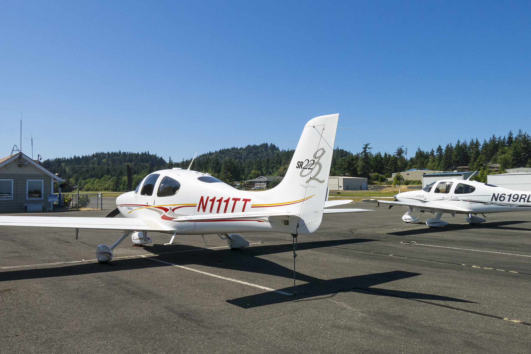
Okay, moving on from getting there, to actually being there. Like rock stars, our rental car was delivered to the plane as we stepped down from the wings onto the ramp. Luggage transferred from plane to auto, our John Hancocks scribbled on the Enterprise paperwork, we were escorted to the exit gate, and navigator Cathy started play by play mobile device directions to the Mukilteo ferry terminal. Lots of indigenous names in the northwest. We stepped onto the steep escalator learning curve of ferry life in the islands of northwest Washington. The roadway shoulder was marked as a ferry-waiting lane beginning about a mile from the actual terminal. We slipped into the shoulder ferry lane and crept to the ticket booth as one ferry departed, relaxing into languid conversation while we waited :30 for the twice-hourly westbound ferry to Clinton, on the SE end of Whidbey Island. A first taste of island pace. At nearly 50 miles in length, Whidbey is purportedly the longest island in the U.S, and the largest in Washington state.
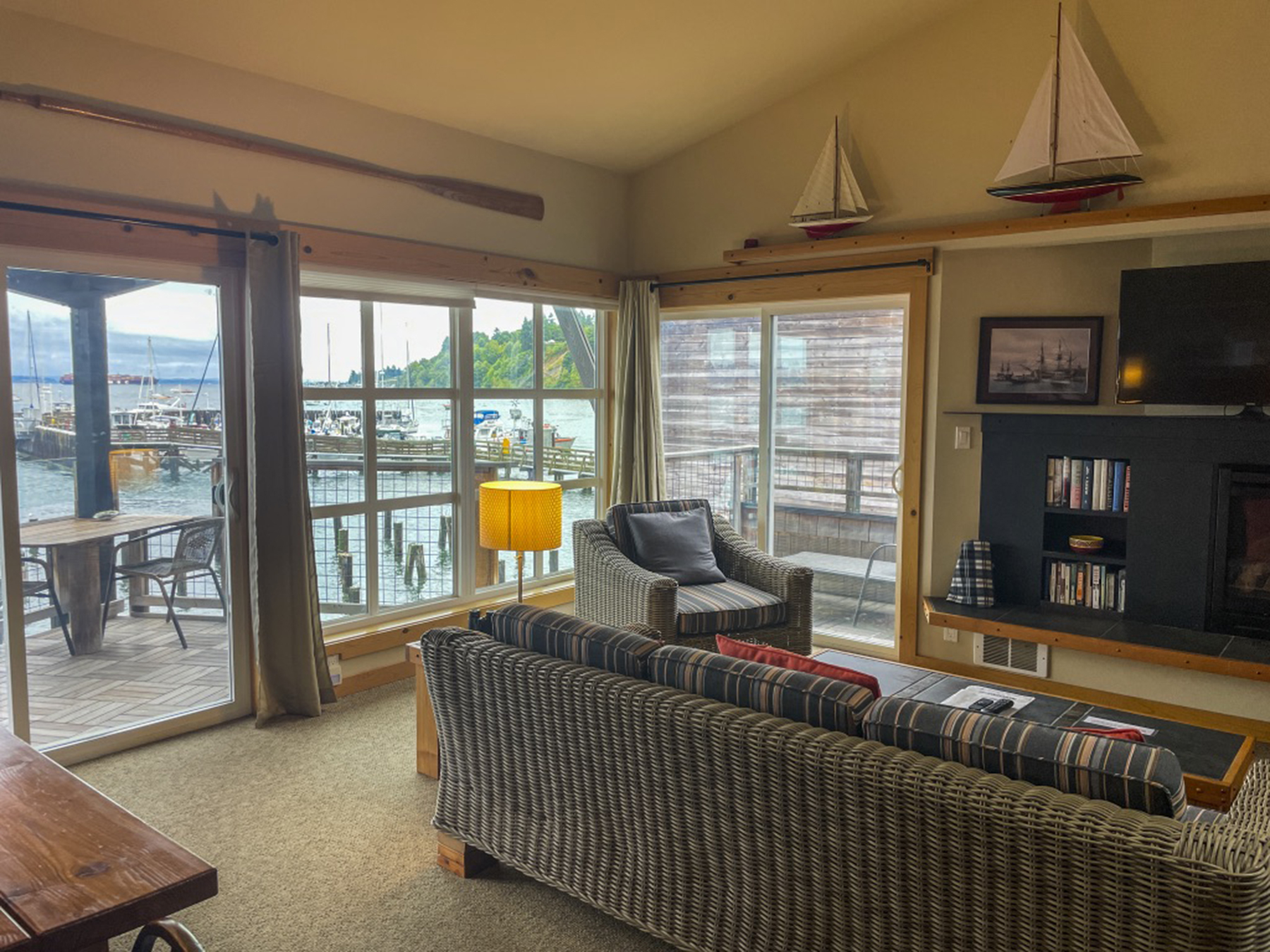
Our lodging was in tiny Langley, population of just over 1,000 of Whidbey’s 70,000 total. Cathy has a knack for finding delightful digs in our travels, and she yet again outdid herself with our Boatyard Inn https://www.boatyardinn.com abode on the water at the harbor, one of thirteen such pied-á-terres.
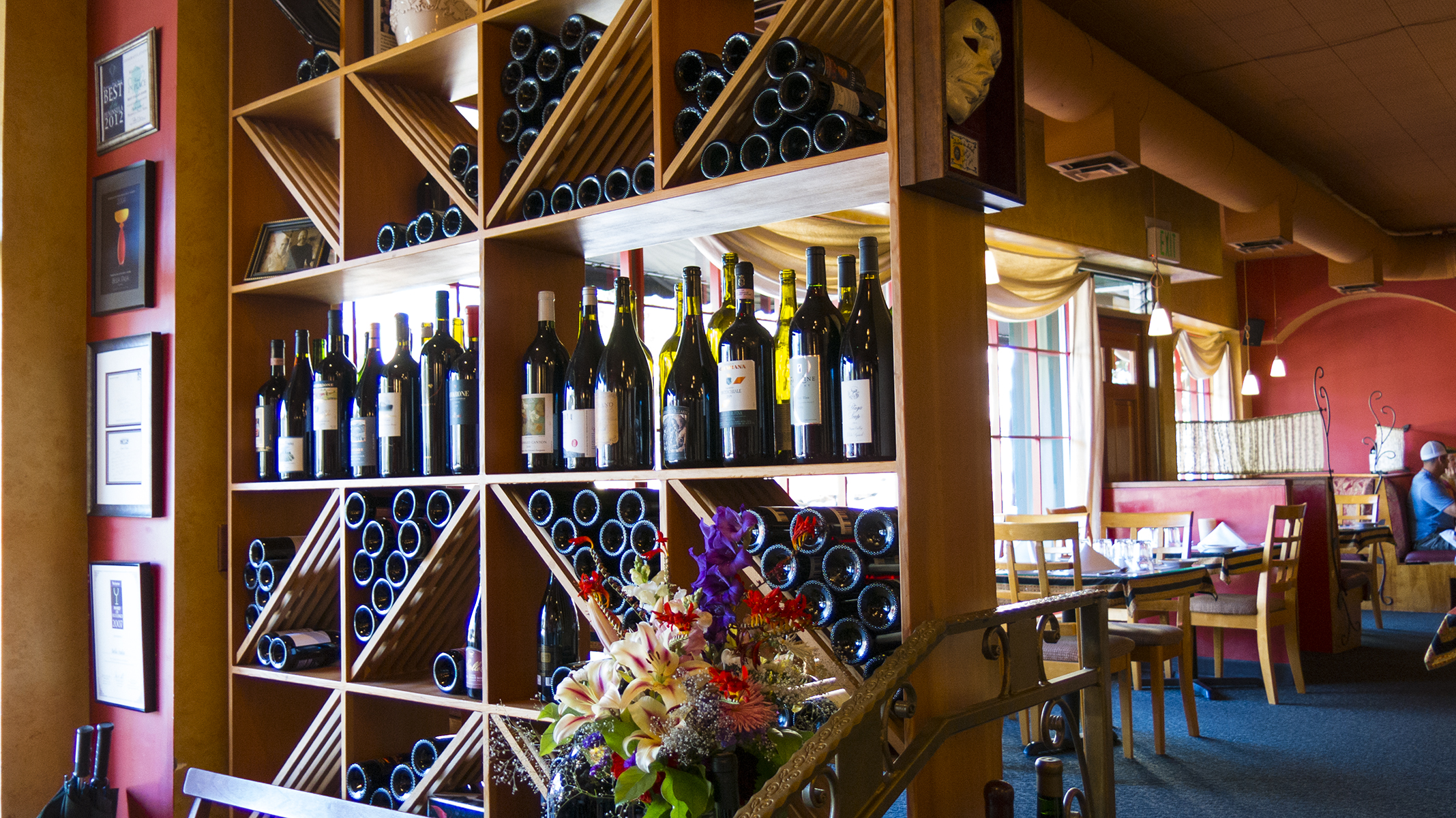
By now it was late afternoon, and being bushed, we made our way to a local brewpub café, one of several in this town which can be traversed on foot in a few short minutes. On a celebratory whim, I tried a locally distilled gin G&T. Then a draft beer with the meal. Both, yummy. Celebration, insofar as this was only our second getaway since the early January 2020 pandemic implosion. Two grownups as giddy as two kids. Our grownup side, cognizant of pandemic realities, had discerned that the pent-up demand for travel, excluding sketchy international options, meant expectations of teeming domestic destinations. It took some pre-planning time to find available worthy accommodations. Another pandemic effect was watering holes being shuttered on certain days, with the operators apparently choosing their dates in concert with one another so that not everything was closed on the same day or evening. The Langley city leaders convinced the local fire-fighters and Knights of Columbus to operate a barbecue hot dog roast on the Second Avenue sidewalk at noon for the midweek slow days Tuesday and Wednesday lest visitors and locals alike go hungry. Middle America chamber of commerce vibe. In a similar vein, cafés didn’t take reservations, but you could pop in and put yourself on the list and they’d phone your mobile that your table was ready while you wandered around town. But you’d also better start early, as the waits could be longish, and some of the menu items would become unavailable as they ran out of ingredients. And everywhere, the restaurateurs were apologizing for the slow service pace resulting from staff shortages. Your tax dollars at work. But, without fail, the innkeepers, restaurateurs, publicans, and shopkeepers were friendly and so happy to have your presence in these recovering times. And without complaint, everyone was complying with posted signs requiring masks indoors.
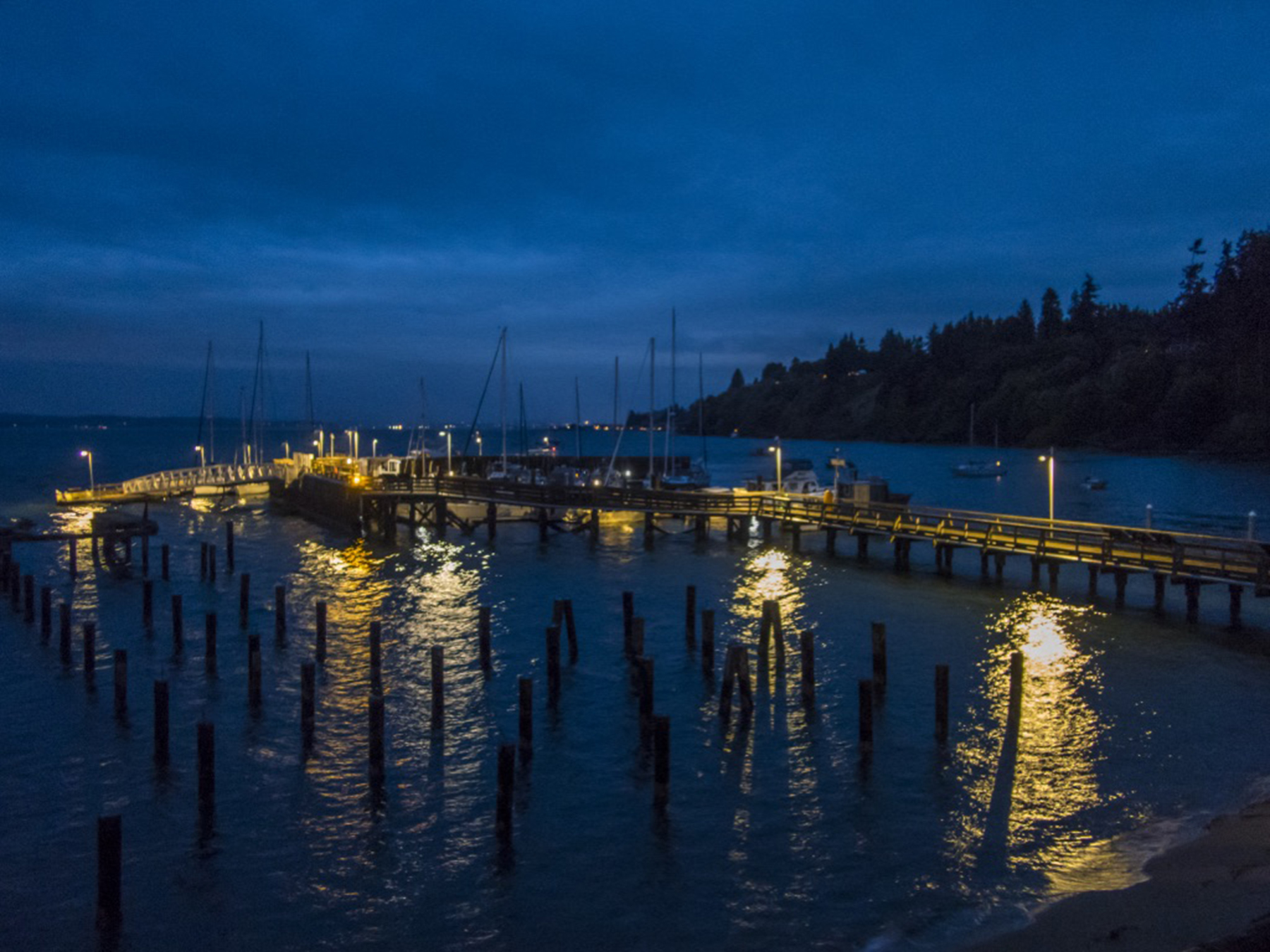
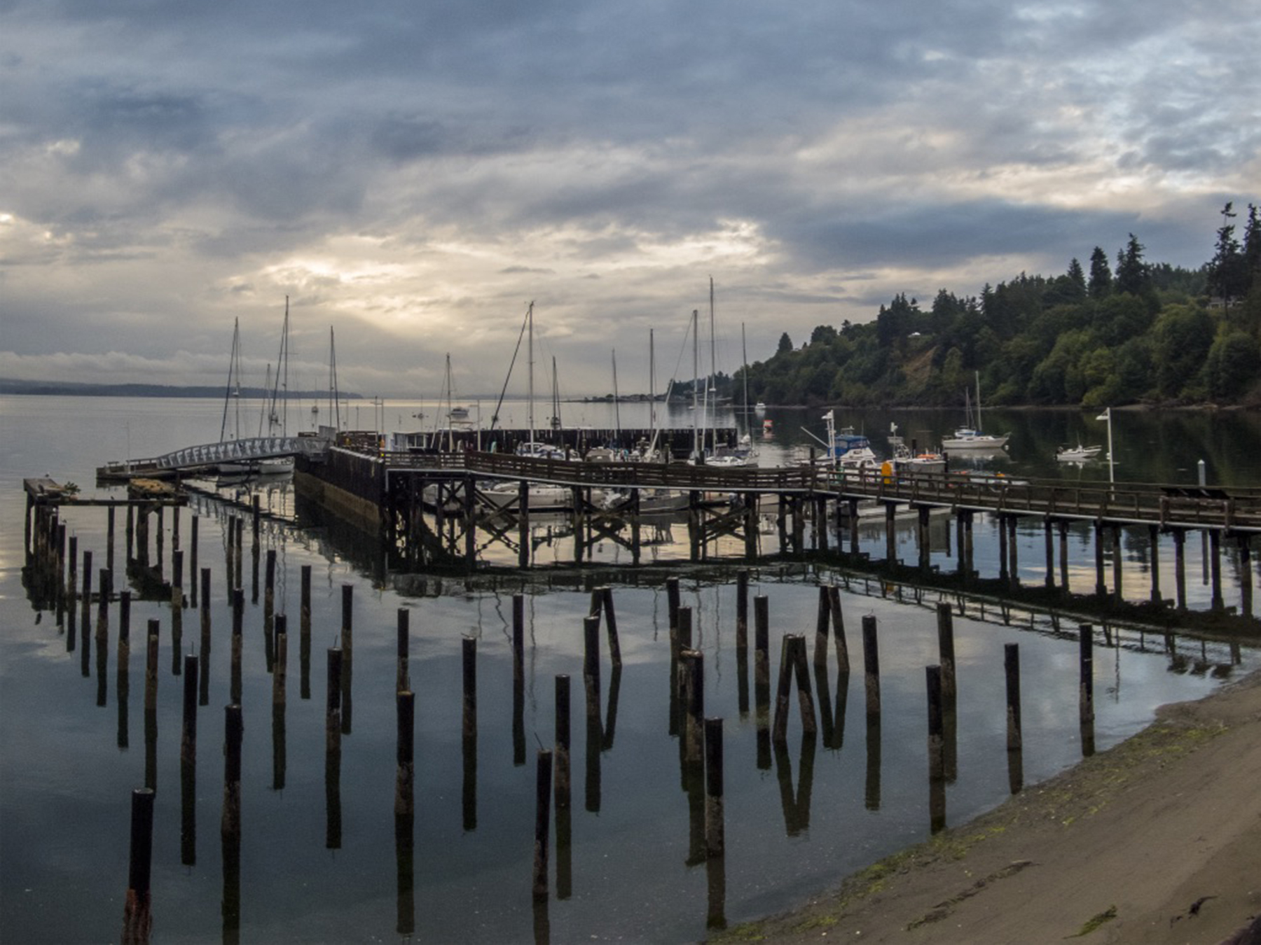
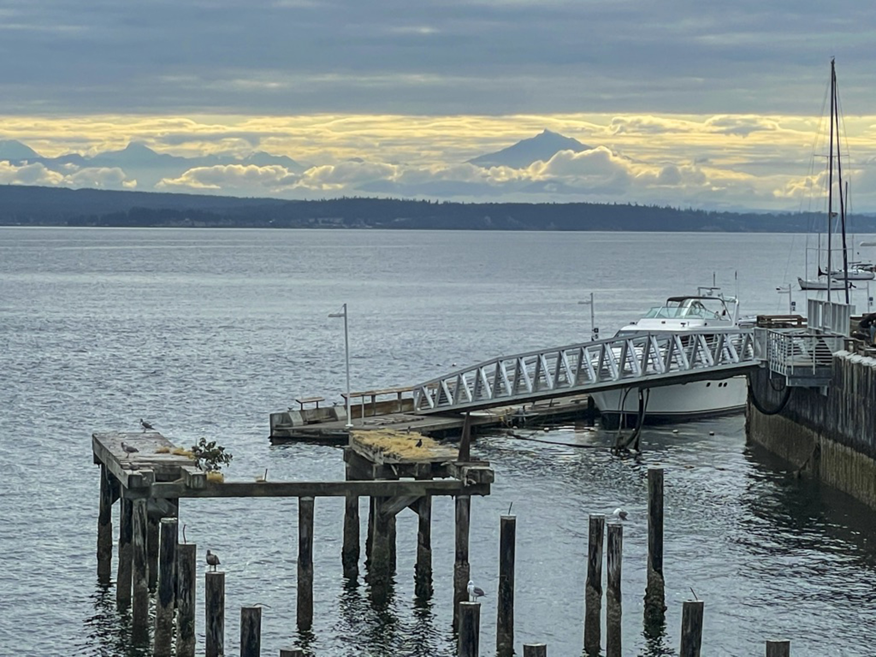
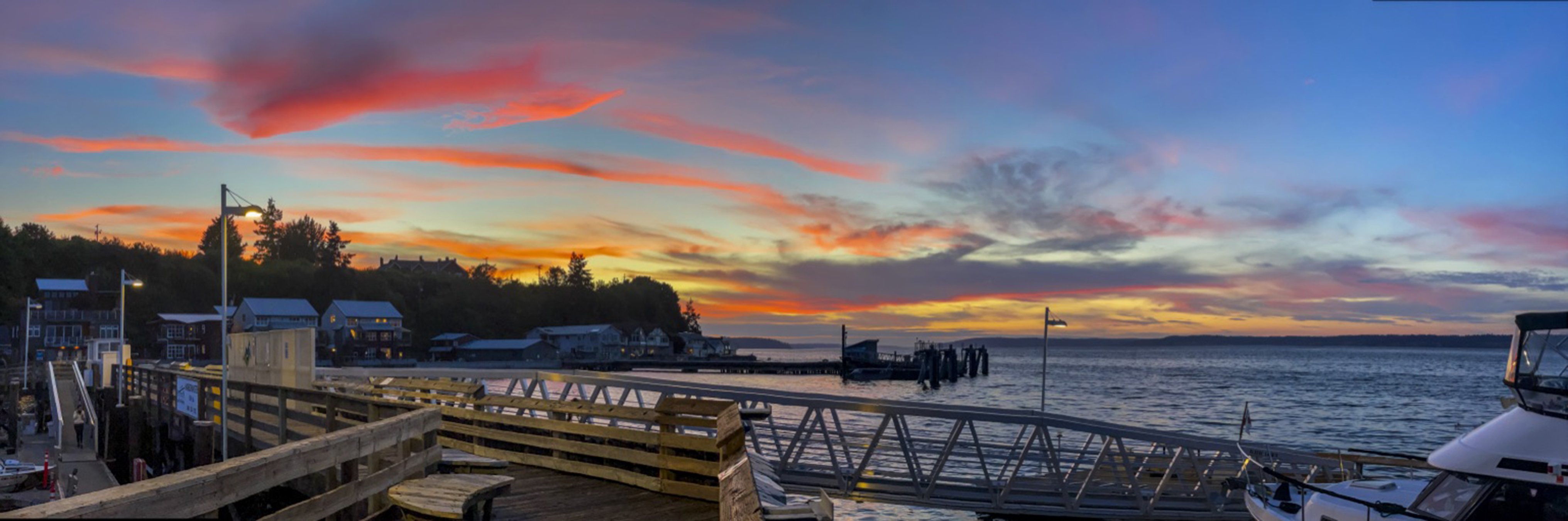
Love it or hate it, Maurice Ravel composed “Bolero” as an exploration of variations on a theme. For non classical music lovers, it was Bo Derek’s musical accompaniment choice in the classic comedy “Ten.” I found I was mesmerized by the infinite moods of this view. Herewith my Ravelian take on this music for the eyes, a kaleidoscope of changing hues, sky cover and tidal lengthening and shortening of piling heights.


Our preference is for vacations that include a modest amount of vigorous physical exercise in nature’s haunts. I can take only so much of the Louvre or the Uffizi, a reasonable amount of ambulating London, Paris or Prague, and almost none of Manhattan’s Fifth Avenue.
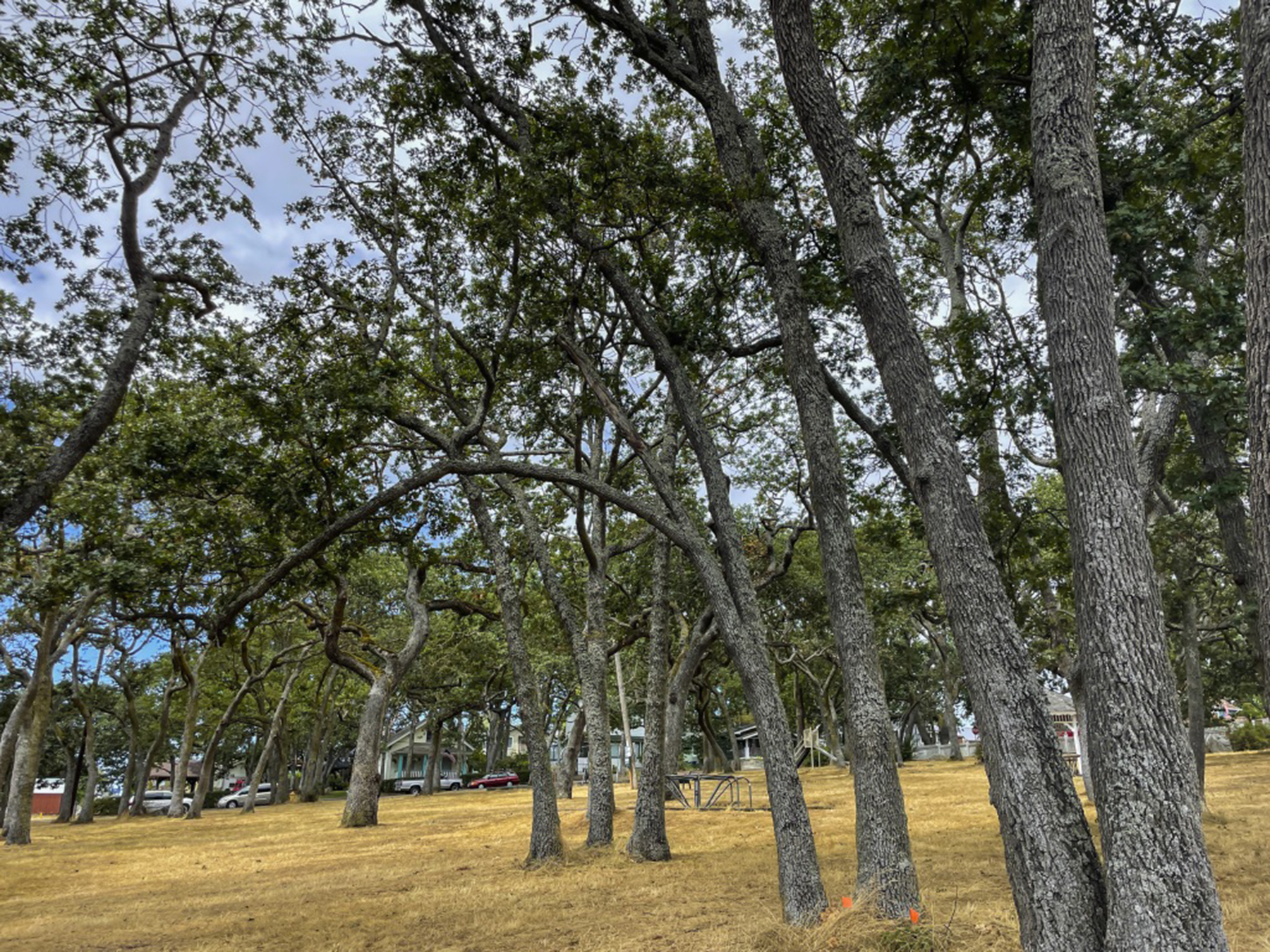
The largest town on Whidbey Island is Oak Harbor, the community next to which NAS Whidbey Island is located. Returning from our first hike near here, this was just too arresting not to capture. The first I’d heard that the King had a preference for a ’55 Chevy convertible. Whimsy.

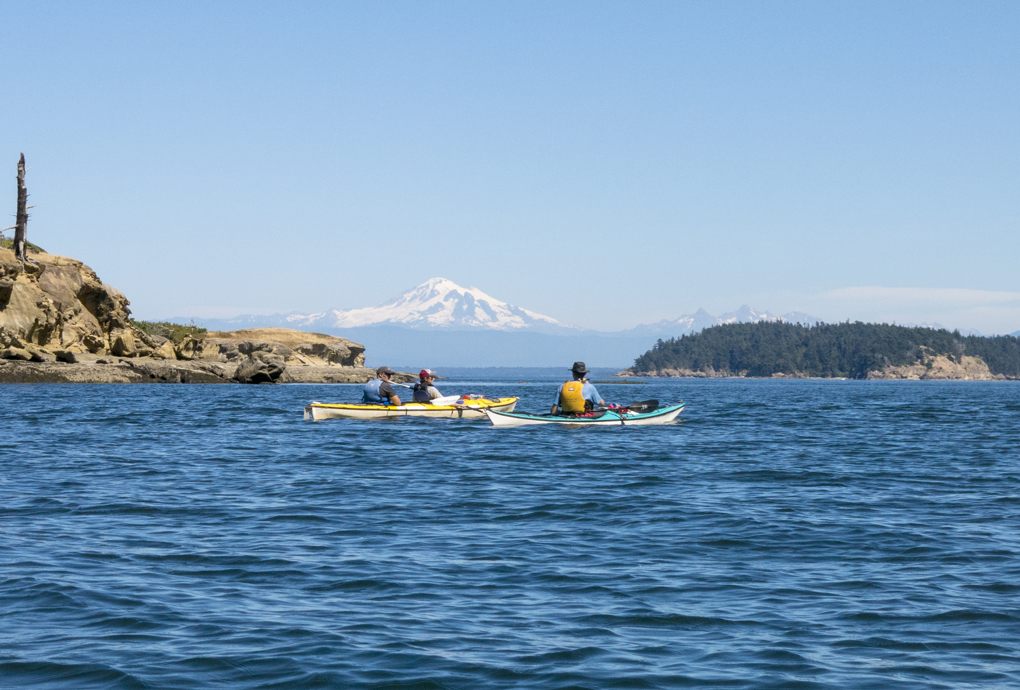
Islands naturally have the sea at hand. Failing to arrange a sailboat, we chose some hours down and close to the tidal swings, wafting over the kelp and Dungeness crabs drifting by below. At least some of the time we did actually synchronize our paddles…an acquired skill set.


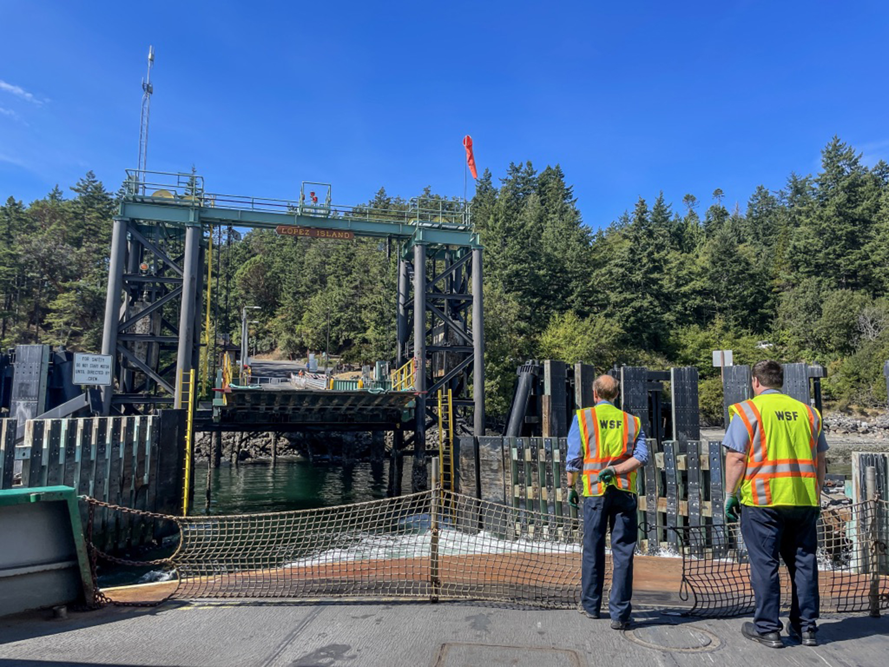
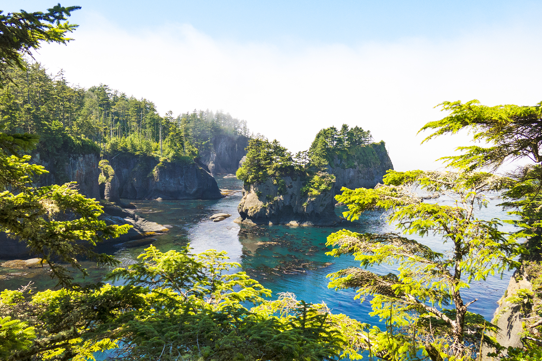
We drove to the Anacortes ferry terminal on Fidalgo Island, across the Deception Pass from Whidbey, parked our rental car and boarded the ferry for Lopez Island on foot. Parking at Lopez is a challenge, and we had pre-arranged two e-bikes (a first for both of us) for retrieval after egress from the vessel. This docking scene suffused me with little kid smiles, it being so redolent of my childhood ferry rides from San Diego to visit my uncle Cap on Coronado.

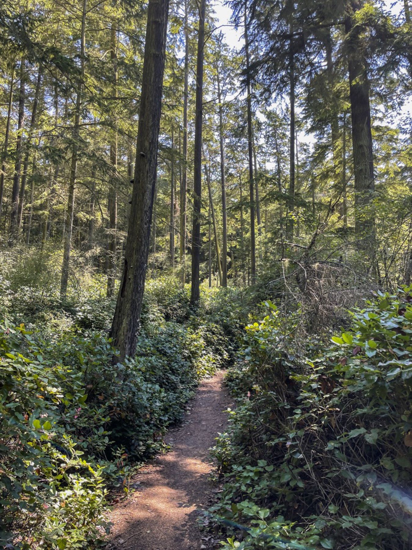
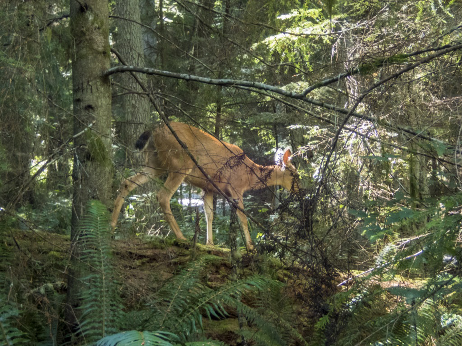
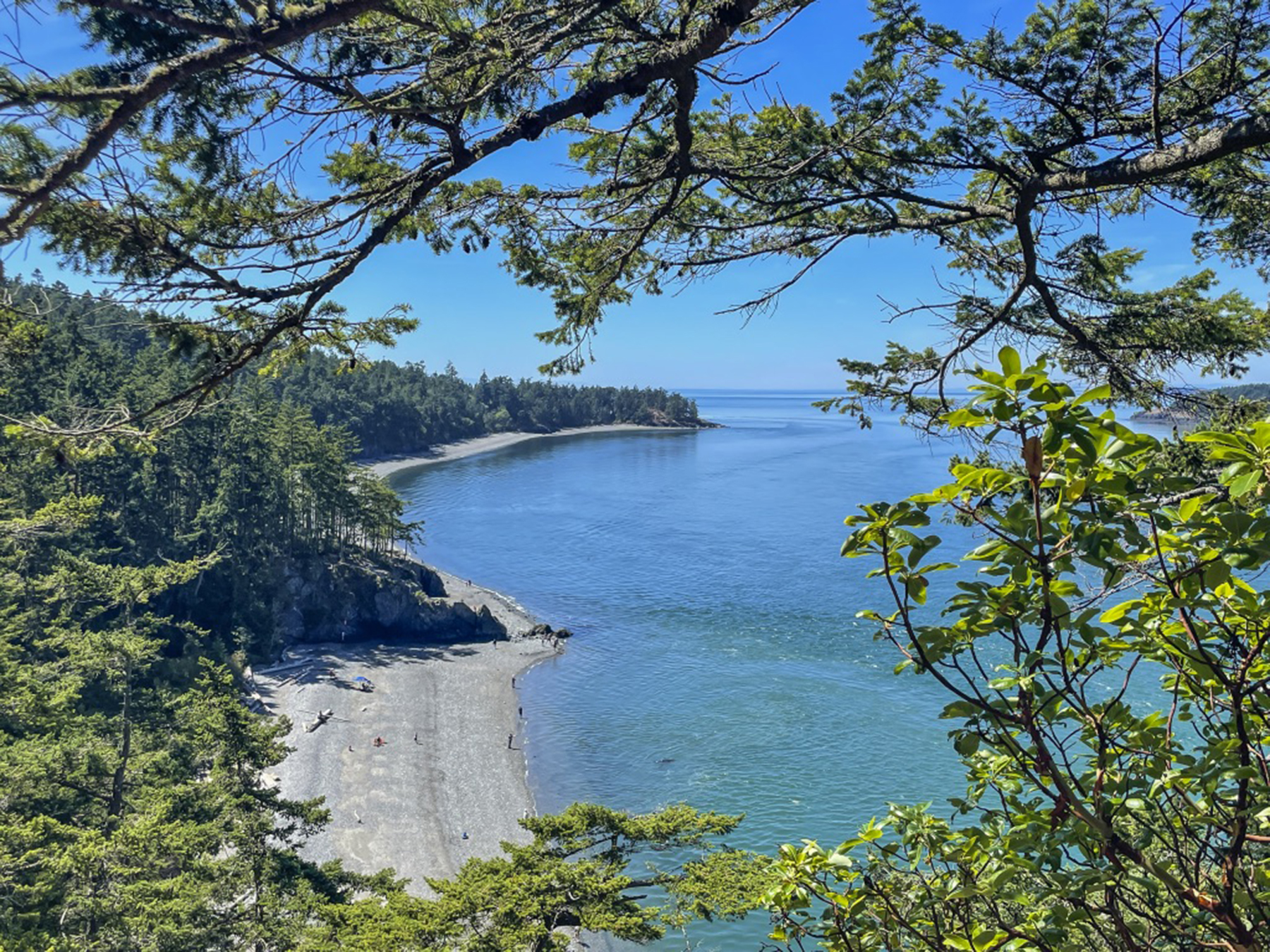
The next day we returned to the northern end of Whidbey Island to do some hiking in the Deception Pass state park. Another day of getting into the island pace, motoring on two-lane roads with only modest traffic, drivers keeping a respectful vehicular distance at an un-frenetic 50-55 mph. Trees and grasses along the highway, and deep old-growth forest hiking trails at the destination.

For our last full day, we motored to the Double Bluff beach along Whidbey’s western shore. The back story is that we learned about this locals’ favorite spot while partaking of a micro brew at Langley’s Double Bluff Brewery, awaiting our “your table’s ready” call to dinner at the Braeburn Restaurant a half block away. The pungent fruit of a getaway without an etched-in-granite itinerary. https://www.dblfbrewing.com https://www.braeburnlangley.com
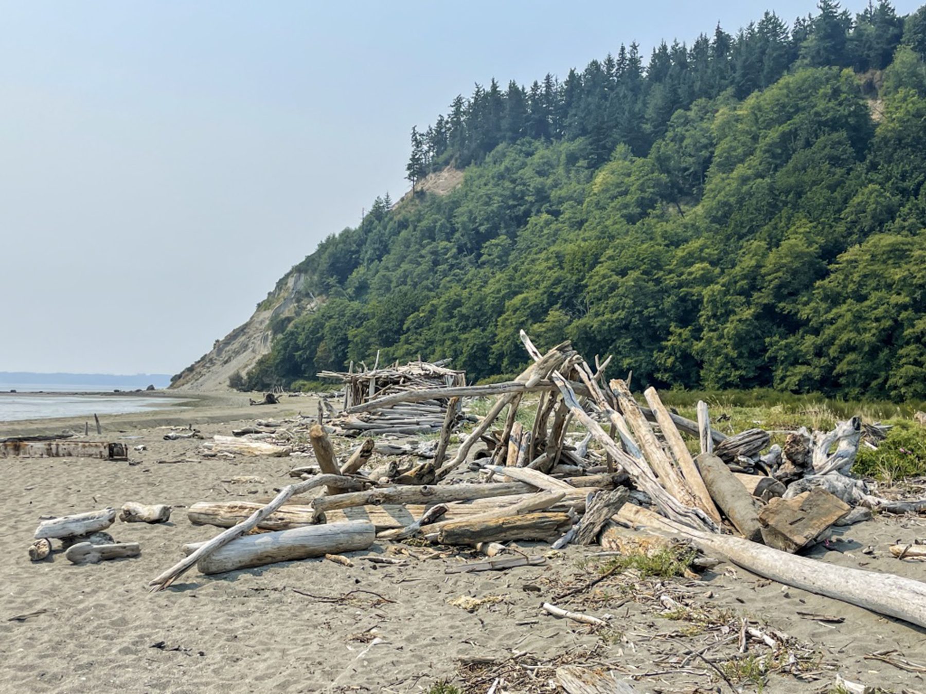
Wading in the shallows, tossing sand dollars, and breathing the fresh air, the serendipity of the unexpected.

.

North, by Northwest
Posted on August 10, 2014
Summertime, and the siren call of floats rippling on water. In years past this has always involved the joy of myriad lakes in Alaska’s Kenai peninsula. This year, after due consideration, I decided that Washington’s Puget Sound area beckoned. We made arrangements for lodging and rental car, reserved a couple of days’ floatplane rental, loaded our Cirrus, and struck out for the Pacific Northwest. During the drive to our home aerodrome for departure, the seasonal monsoonal Sea of Cortez airflow was producing a thunderstorm light show, with cloud-to-ground lightening, thunder and rain, but with the convective activity mostly over the east county. I chose a Visual Flight Rules routing that took us beneath the cumulus overhang’s periphery, offshore in San Diego and Orange counties, then over the Los Angeles basin and up the San Joaquin valley for a stretch break and fuel top off in Red Bluff, just south of Mt. Shasta.

Escaping monsoonal thunderstorms off the coast at Camp Pendleton
From there we proceeded via a nearly straight line along the western foothills of the Cascades and the upper Willamette Valley to Port Angeles, nestled on a thin strip of land between the Olympic Peninsula and the Strait of Juan de Fuca.

Mt. Rainier, to starboard
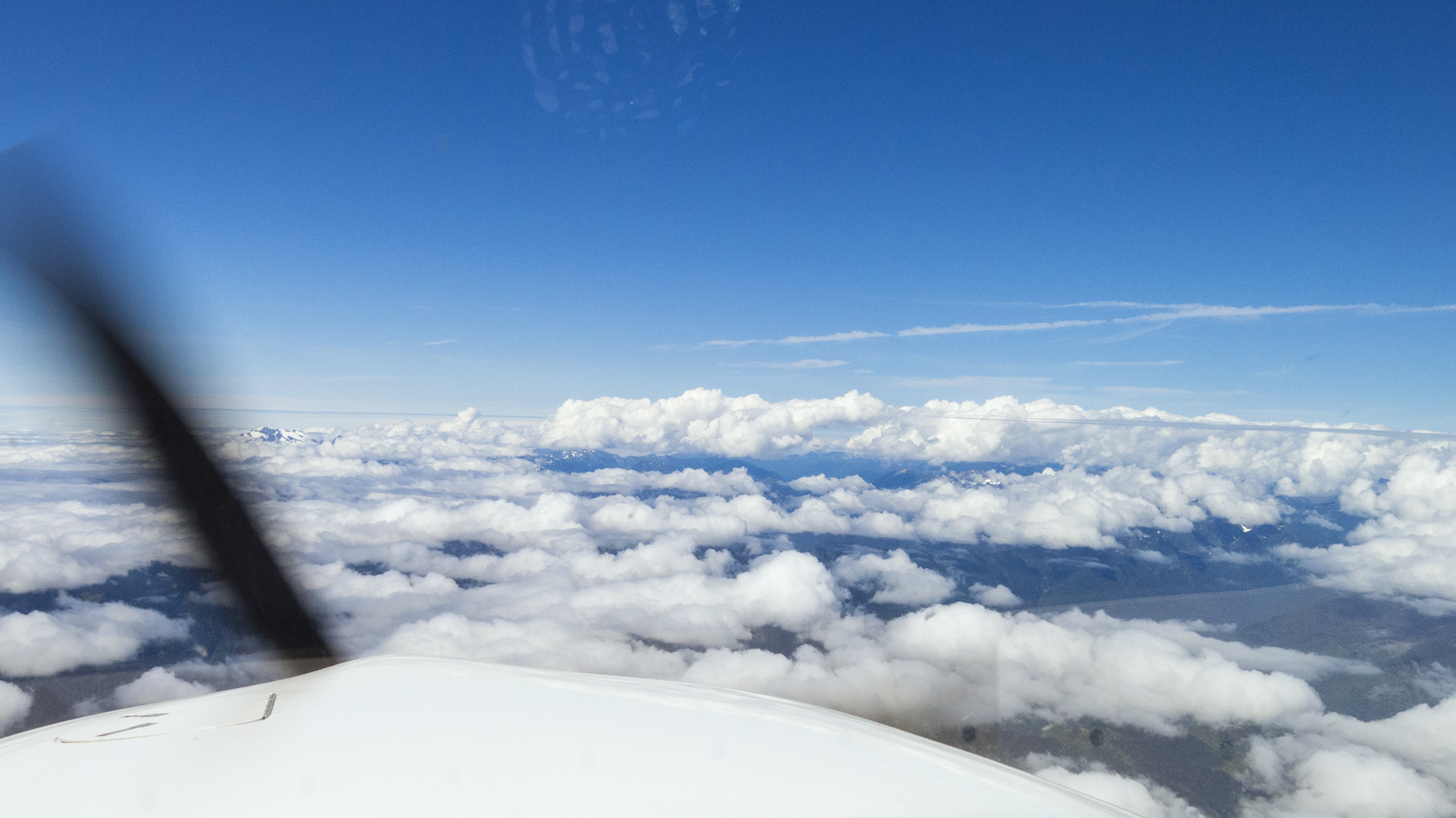
Once beyond SoCal, skies were sublimely clear and smooth until closing in on Olympia, in southern Washington. The forecast actually looked like it would pan out for afternoon clearing at Port Angeles (KCLM, as ICAO identifier), but a half hour south the weather was still reporting overcast. Seattle Center was very user-friendly, agreeing to a pop-up Instrument Flight Rules clearance at 10,000′ MSL about the time we were passing Portland, and the clouds were beginning to gather beneath us as a developing undercast.
I even cajoled them out of a least circuitous routing directly to the Initial Approach fix for the Area Nav approach to runway 26 while savoring the view of Mt. Hood just behind us, and Mt. Rainier, at our three o’clock position (above). All this good fortune was shortly dashed with the dreaded, “come left 15 degrees for traffic.” Looking ahead, I surmised that they might actually be playing into my hands. Ah, such hubris. The mountains of the Olympic peninsula were pumping up a line of cumulus that was principally to the east, whereas to the west, the cloud cover looked lower, in fact altogether benign in the general direction of the Initial fix for the Instrument Landing System approach to runway 8. The latest Sirius downloaded weather still showed overcast, now with a light northeasterly wind, so “Seattle, when done with the traffic vector, how about direct YUCSU?” all the while wondering who thinks up those unpronounceable fix names.
Cumulobumpus over the Olympic peninsula
“N1TT, cleared as requested, maintain One Zero Thousand. We’ll probably lose radio contact with each other for awhile over the Olympics, but I should pick you up again as you near YUCSU.” Hmm. I had the presence of mind to confirm that the charted 118.2 MHz frequency for Whidbey Approach air traffic control was correct, just in case things stayed quiet with Seattle Center. And fortunately, YUCSU possesses a handy holding pattern course reversal to assist in losing a mile or so of that ten thousand feet if I’m doubly bedeviled with a persisting lost communications problem. What was I thinking? Oh, yes, I was thinking of avoiding the towering cumulus on the earlier track. Well, the Center frequency did, indeed, get quiet as we neared the highest mountains over the peninsula, but that just meant having peace to enjoy the view, which was downright gorgeous.

Looking right
And right beneath our left wing, amidst the dance of the veils, was a splendid glimpse of the top of Mt. Olympus, replete with glacial stretch marks. Please note the solid cloud cover beyond the peaks in this image taken maybe fifteen minutes before landing…

That would be Mt. Olympus
…because of that Hubris thing where I actually thought I was being clever in conning a clearance direct to the approach fix for an instrument approach through the clouds and into the wind. However, as we cleared the ridges northbound, the atmosphere dramatically shifted to a ripping west wind, and blew out the overcast near the water. Zeus getting the last laugh on my presumptions and for having the temerity to overfly his residence? At least this meant that I could advise “aerodrome in sight, requesting a visual, circle to land on runway 26,” which gave me the time and distance to lose all that altitude to our sea level destination. So, yes my cleverness backfired by adding a few extra minutes of extended downwind flight time, but nonetheless avoided the cumulus, and gave us a sight-seeing tour of the Olympic peninsula for which many would pay dearly. My grandmother used to allow as how “it’s an ill wind that blows no good.” Double pun, here, bless her.

Short final approach to Port Angeles runway 26
After fueling and securing the airplane we collected the rental car, and decided our internal mental gyros could best spin down with a little post-flight debriefing at Port Angeles’ Bella Italia. Local micro brew for me, local white wine for Ol’ What’s Her Name, and an appetizer of peninsula chanterelle mushrooms and porcini layered on bruschetta. Post lunch, not yet dinner time, and the wine bar seemed to be a favorite of locals who welcomed us with bonhomie and insider tips as to activities and events.
Nice place
Our first few days were spent with family who live between Port Angeles and Sequim, providing us time and place to peruse a bit of the Olympic peninsula. The next morning we drove the roughly two hours to Cape Flattery, beyond Neah Bay. This is a region of dense rainforest, with all manner of wind-blown twisted trees…

Forest S-Turn
…abutting a damp foot trail leading to land’s end. You can’t get farther northwest in the Lower Forty-Eight.
Cape Flattery
As you can see, we were treated to dry weather, radiant blue skies overhead, with the thick morning fog retreating westward before the advancing warmth of late July sunshine. The Olympic peninsula is at once an interlude between seashore and mountains.

Near Neah Bay, with Vancouver Island across the Strait of Juan de Fuca
The following day we hiked the trail up to the apex of Hurricane Ridge. Here we are maybe a mere five miles as the seabird flies from the Strait, steeply downhill to the right.

Hurricane Ridge trail, and Mt. Olympus
The peninsula is a place of nature, raw, thank you, with fauna as compelling as their environment.
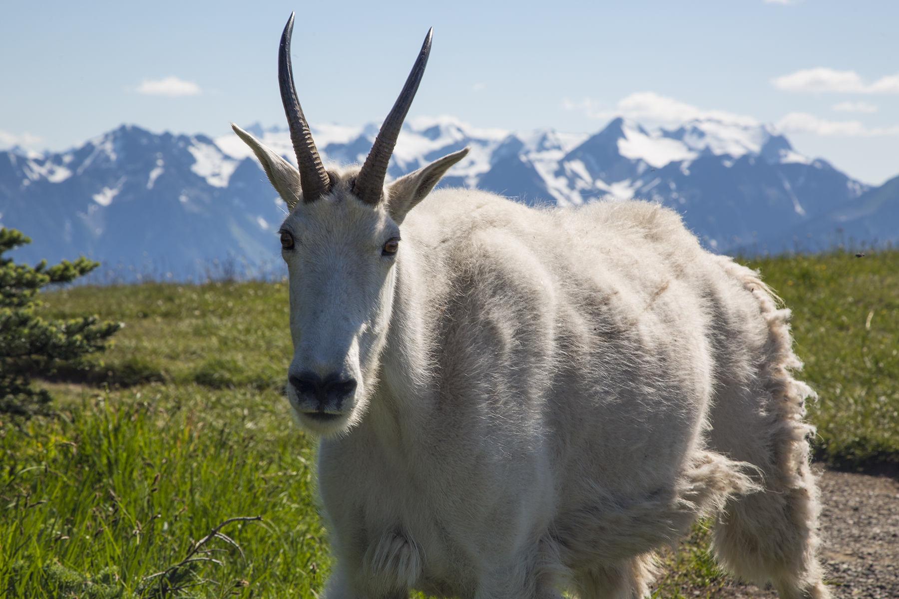
My, what big horns you have, grandma

Marmot trail monitor
My sense of whimsy delights in the occasional bit of silliness. We attended a music cum local wine and brew gig at a handily nearby winery. Check out the vineyard scarecrow.

Nice Hooters
In arranging the dancing with water, I had chosen Rainier Flight Service at Renton Field (KRNT) from a list of the Seaplane Pilots Association, because it was the only operation renting floatplanes that was located on a paved airfield, which enabled my daily :30 Cirrus commute back and forth from Port Angeles. Also, the Champion 8GCBC they used was nominally similar to the Bellanca Decathlon I used to own before building my Pitts S1S, so I had modest familiarity with, and ancient muscle memory from, that two-seat tandem aircraft.
Renton’s Boeing factory is the original manufacturing home of the B707 (aka the “Renton Rocket”) and the current home of the ubiquitous B737 (aka “Guppy,” or sometimes, the “FLUF,” a pilotspeak name you’ll have to ask me about discretely, as the acronym is not for polite company). You may have heard that Seattle is blessed with more than its fair share of rain? Often as not this is associated with southerly winds? In July and August there are many fair weather days, with northerly wind patterns, which was the case on all the days we enjoyed in the region. This had me scratching my head as to how best to plan a flight from Port Angeles, which is northwest of Renton—itself, a stone’s throw SE of Boeing Field and a similar distance NE of SeaTac. Not only is there Class “Delta” tower-controlled airspace for those three, but also the overlaying Class “Bravo” airspace for the greater Seattle area, and oh, yes, a pending Temporary Flight Restriction for the upcoming Seafair airshow. I plotted out a SE routing just high enough to avoid the Olympic peninsula terrain and low enough to be under the Seattle Class “B”—for you non-pilots, a type of airspace aptly described as a three-dimensional inverted wedding cake, centered on SeaTac, flight through which is strictly verboten without a reason to be there, and ATC clearance to do so. My intention was to head over Vashon Island, WSW of SeaTac, and then overfly SeaTac’s runway numbers for northerly runway 34C via the published “Mariner Transition” which would place me south of RNT for a straight in landing on their runway 34. The right hand Cirrus cockpit display in the image below conveys that routing, and also the actual track that Seattle Approach control assigned me when I checked in with them—nowhere’s near where I had planned. Natch.

Airspace convolutions
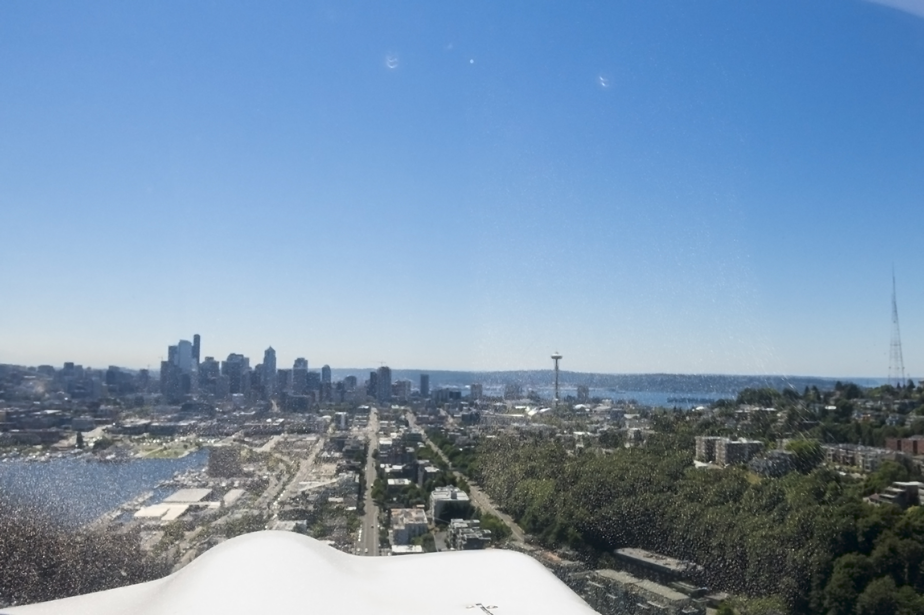
Looking out the windscreen at more or less the same time and location. That’s downtown Seattle with the Space Needle almost straight ahead, and you are looking almost directly down Boeing Field’s runway 13R just beyond Eliot Bay at the 3 o’clock position in the frame. Yes, that’s Mt. Rainier in the upper right, and Lake Washington and Mercer Island beyond downtown. Renton Field sits at the far right end of Lake Washington. So ATC managed to shorten my flight path and descend me down to a terrific sightseeing altitude and route.
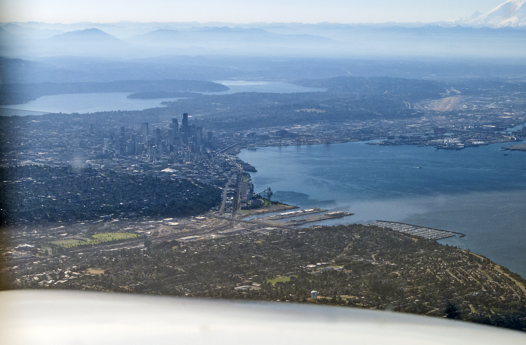
Eliot Bay, et. al.
The ATC path set me up flying southbound over the east shore of Lake Washington, heading past the Boeing Factory in the nearside of the frame, and doing a right 180 degree turn to land in the opposite direction on runway 34, in the center of the image. That light-colored earth with a tiny white vertical projection (its control tower) just this side of the water in the upper right distance is SeaTac. That may look a long ways off in this wide-angle image. It’s about 4 nautical miles, or a minute and a quarter at Cirrus cruise speed. The tower-controlled airspace for all three of these fields literally abuts. Those are the Boeing factory hangars just this side of the Renton runway, and as it turns out, the floatplane ramp and dock is immediately off the north end of the taxiway.
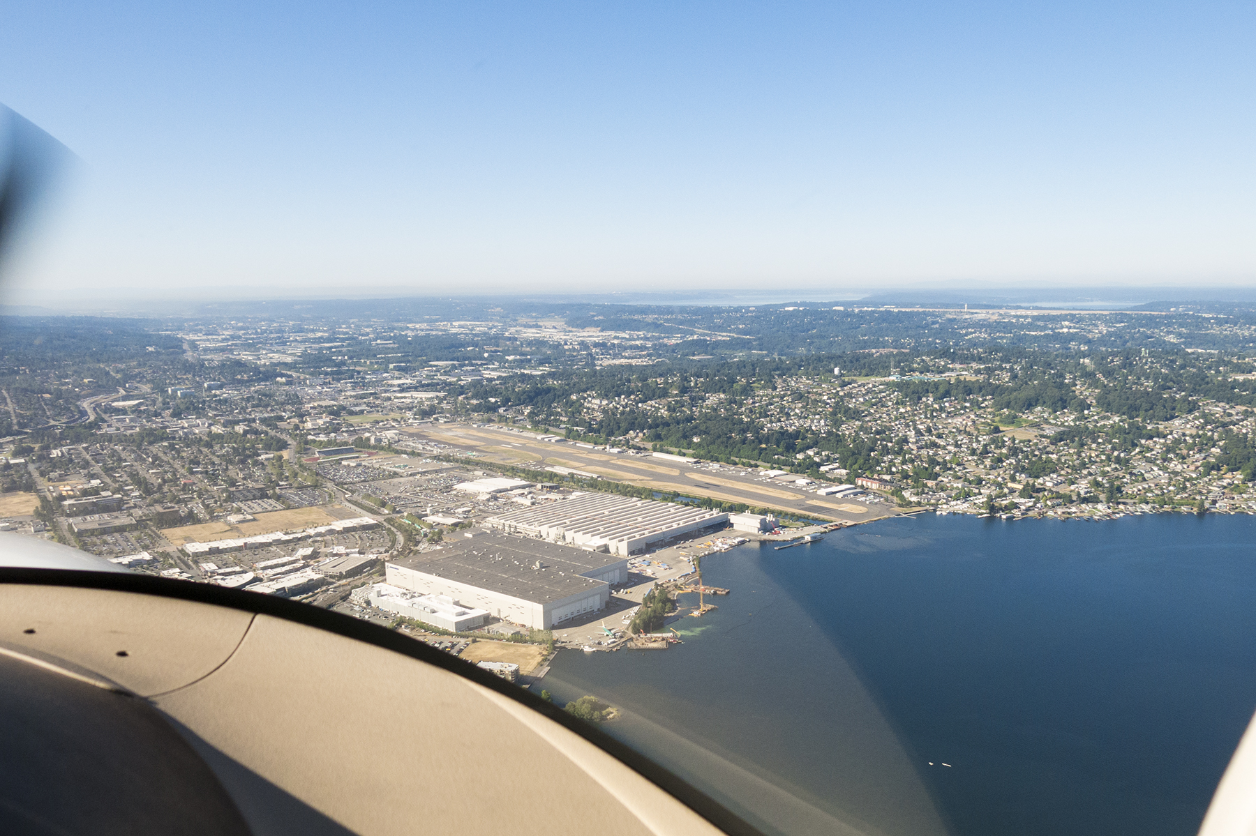
A land plane perspective of Renton Field.
At Rainier, I met up with Byron Palmer, the instructor whose job it was to help me clear out the cobwebs of a half decade of disuse of the seaplane rating on my airman certificate. Said more succinctly, his job was to help keep me out of trouble. Poor soul. Byron comes from a corporate jet background, and moonlights float training from his day job as a B737 simulator instructor at Alaska Airlines. As if that wasn’t enough commonality, his wife is a school teacher. Go figure. We hit it off splendidly and spent a good part of our first day’s briefing thinking about which of the many available lakes we wanted to visit, and completing the preflight inspection of the aircraft. This is a straight floats machine, without the retractable wheels of amphibious floats, so when ready, we tugged it to the water off the north end of the runway with a device that defies easy description—literally the front half of a 4×4 Ford F150, with no bed, rear frame, or rear wheels, and long hydraulically-powered arms out front to lift and hold the plane by the floats until launching at what is for all the world your basic boat ramp. Looks weird as hell, but works like a charm once you get used to the pickup’s steering wheel working backwards. I let him drive, don’t you know!
Intriguingly, the seaport portion of Renton field’s operation has its own name—Will Rogers/Wiley Post Memorial Seaport. Another bit of commonality, here, as well. Last month when returning from the east coast, we landed at Oklahoma City’s Wiley Post field. Some things are just meant to be? In Alaska my float flying had always been in the wilderness, where we were untroubled by the likes of Seattle’s convoluted airspace, or the need to call a tower for takeoff clearance, not to mention boaters and water-skiers who were routinely oblivious to our floatplane comings and goings. Envision the film clip you may have seen of the little old grannie driving too slowly on the freeway and failing to see in her rearview mirror the overtaking jumbo jet about to straddle her in an emergency landing, for how I felt I needed to operate around the frolicking boats and kayaks.
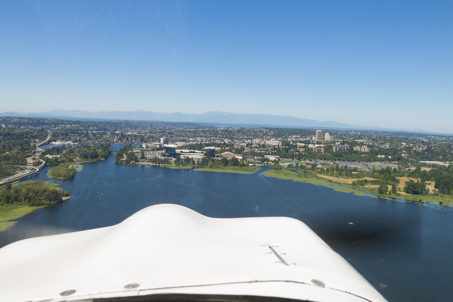
When ready to go we advised Renton tower, and they cleared us to takeoff “at our own discretion” and to report airborne. I used to get that discretion caveat in helicopters, and know, of course that it refers to the fact that you’re not using their handy paved runways. But, heavens, I always figure every takeoff is at the pilot’s discretion! Once “off the water” we proceeded by the “West Channel” routing. There’s a special approval that avoids needing also to talk to Boeing Field tower. This is what staying below 800 feet in compliance with that procedure looks like, while over the water of Lake Washington to the west of Mercer Island. As it turns out, this doesn’t mean that you are clear of air traffic, because all the float planes are doing the same thing. You aerobatic pilots will note the aileron spade in this image, which is there to help lighten the roll control forces. Still rather heavier and slower than the Decathlon, which also had a symmetrical airfoil vs. this pancake flat lower wing surface. 180 horsepower constant-speed prop. Over-floated, which is to say it had plenty of buoyancy, so got off the water pretty readily down here at sea level.  From this extended upwind, we turned west (below), for what would become crosswind for my first landing at busy Lake Union, right in the heart of the Seattle urban area. No pressure, right? Crosswind, at a point upwind of the touchdown zone, means that we ended up flying right over the University of Washington’s Husky Stadium, just off the nose. Our landing lake is off the frame ahead and to the left.
Husky Stadium
Left downwind, with the touchdown zone at 8 o’clock in the frame. The Space needle just right of the nose. Is this cool, or what?
Lake Union, left downwind
We’ve just landed north on the lake, extended the water rudders, and are now taxiing southbound before turning around for a takeoff northbound into the wind. Once turned around and the launch path is confirmed to be relatively clear, its rudders up, full power and full back stick, awaiting the second, higher nose rise—like a stallion tugging on the reins, nostrils flaring—then robust forward stick to get on the step. Quickly follow with just enough back pressure to hold that sight picture with level floats, and then as the speed builds, the slightest additional back pressure allowing the plane to fly itself off the water. Operating a wheeled airplane on turf runways is great. The thrumming of a float plane on water is greater. No tower to call here, but there is a 122.8 MHz Common Traffic Advisory Frequency to keep the other floatplanes apprised. Nah, the boaters don’t monitor it.

Ahoy, matey! On the water at Lake Union.
Next up we headed west and then south to play in and out of a lake in the foothills of the Olympic mountains. I think it might have been something like Lake Cushmore. There we practiced takeoffs and landings, as well as step taxiing, including step taxi turns on the water. These are high speed water ops, just slow enough to stay attached to the water and not get airborne, but fast enough to cover the surface quickly. Step turns feel peculiar because of the centrifugal force pulling you sideways in the seat as you arc through the turn in an essentially flat attitude on the water. Attention has to be paid to turns from downwind to upwind lest the forces bury the outside float, or worse, the outside wingtip. And yet, the skill is essential when operating out of the confined areas of small lakes, with the step turn arcing directly into the takeoff “roll” as you come around into the wind, your speed already just below that needed to get airborne. Then, of course, you might have to keep circling tightly in the air to avoid trees or whatnot on the encircling shore. Flying floats routinely polishes one’s basic stick and rudder skills, not to mention remote area and mountain flying techniques.
That said, we did manage a sufficiently un-remote destination for lunch. I think this might have been Summit Lake. Not sure. Byron’s Seaplane Pilots Association online directory, which he accessed in the air on his i-Pad, said that this was a floatplane-friendly lake with a nice cafe at its north shore. After landing, we taxied up and beached at a grassy picnic area abutting the cafe. This left free their dock for the fishermen to continue casting their lines. Common courtesy between water types, right? We tied up to the picnic table and strolled onto the cafe’s lakeside deck to obtain some sustenance. A fairly suspender-snapping arrival for us non rock stars.

Beached, for lunch.
The next day I brought Cathy and her grand niece, Olivia, with me on the flight to and from Renton. The seaplane, having only two seats was off limits for them, but they borrowed Byron’s car and headed to Pikes Place Market and girls’ lunch and shopping. Byron and I headed south to Lake Tapps, and then overflew McChord Air Force base on our way into and out of American Lake. This generated its own singular recollective grin, as it was McChord where I returned “to the world” to process out of the Army following my tour in Viet Nam in the sixties. After clearing McChord’s airspace I finally got to use the Mariner Transition, overflying SeaTac’s numbers for runway 34C. The aft part of the left float is in the lower left of the frame.

Floats over SeaTac
Now if the above seems like low tech in a high tech world, it is perfectly in keeping with our floatplane TCAS (Traffic Collision and Avoidance System) during our multiple 300 feet AWL base legs for landing on Lake Sammamish.
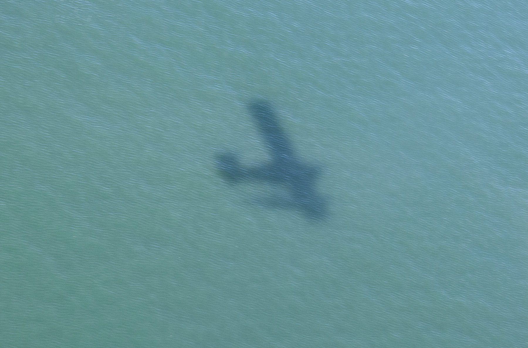
Floatplane TCAS. Only one shadow is a good thing.
Naturally, at the end of each day’s flying, we returned to Will Rogers/Wiley Post Memorial. On the first return Renton tower directed a conventional righthand landing pattern for runway 34. Except, for a land pilot in a floatplane this is a tad surreal as it amounts to descending over the runway centerline so as to touchdown just beyond the far upwind end of the runway! On day two it got even more whimsical as we approached Renton from Sammamish, which is to the NE, with RNT reporting a dozen or so knots of wind from 290 degrees, or about fifty degrees to the left of runway 34s bearing. It’s considered good capsize-avoidance form in floatplanes to land somewhat closely into the wind, which also attends to their pronounced tendency to weathervane into the wind once on the water. Air traffic was fairly light that afternoon, and the tower turned me loose to initiate base leg as per my own inclinations, with the usual “landing at the pilot’s discretion, report on the water.” Given the confines of the approved landing zone and the wind direction, I throttled back for descent, and laid it over smartly into a right turn to base leg, then quickly another angular change to final approach into the wind. This resulted in a glide that had us crossing over the NW corner of the most westerly Boeing factory hangar about 150 feet above the roof on our way to our splashdown. “Byron, you don’t think Boeing will complain about our ruckus over their roof?” He said he didn’t know of any admonitions to our flight path to touchdown, but I’ll bet he might have been wondering, like me, “probably not complain as much as they would over the ruckus we’d make if we landed ON their roof!” Gallows humor.
The following day, Cathy and I bid our adieus to her Port Angeles family members and launched in N111TT for Orcas, one of the San Juan Islands. Orcas’ aerodrome (KORS) carries the same Eastsound name as the primary village on the island, which is just a :10 walk from the airport transient aircraft tiedown apron. Due to the international border’s dog’s hind-leg meanderings in this area, Orcas actually sits north of British Columbia’s beautiful city of Victoria on the SE end of Vancouver Island. It’s pretty nearly as far north as you can go in the lower forty-eight and still not be in Canada. The San Juan islands are postcard gorgeous with the interplay of land and water everywhere a delight to the eyes.

Passing over Friday Harbor, inbound to Orcas
Below, we are over the sound, itself, with KORS’ runway 34 straight ahead, and the village of Eastsound abutting the water just this side of the runway.

Eastsound runway 34 final approach
I slipped into what would be a prime valet parking spot for an auto, which put us alongside the only other airplane in the transient area. Two Cirri at the same small aerodrome! Note the understated terminal just off the nose of our plane.
Eastsound, boasting two Cirri at one time
We started our ambulation into town only to be offered a ride by a gentleman who had been in the terminal when we cruised in from the ramp. It turns out he’s the progenitor of the summer chamber music festival, which unfortunately for us, began the weekend after we were to depart for home. Still, we had a delightful conversation before he dropped us off at the Shearwater Kayak outfitter we were using for the next day’s circumnavigation of nearby Sucia Island. And he recommended Roses cafe, in his estimation, the best dining spot in town.
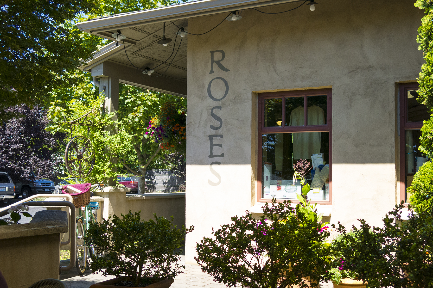
Roses in Eastsound
Cathy, in her inimitable way, seems mostly to luck out on lodging accommodations, and Orcas was no exception. We were here in high season, and just about everyplace was booked full. But she discovered the Old Trout Inn, a B&B off the road between Eastsound and Westsound. Normally this would mean the necessity of a rental car, which we were trying to avoid. It turns out the proprietors Henrí and Nicole were happy to pick us up at the airport after our Roses lunch, drive us to their lodge, as well as to and from our kayaking site the following day, and eventually back to the airport for departure.
The view from our room at the inn.
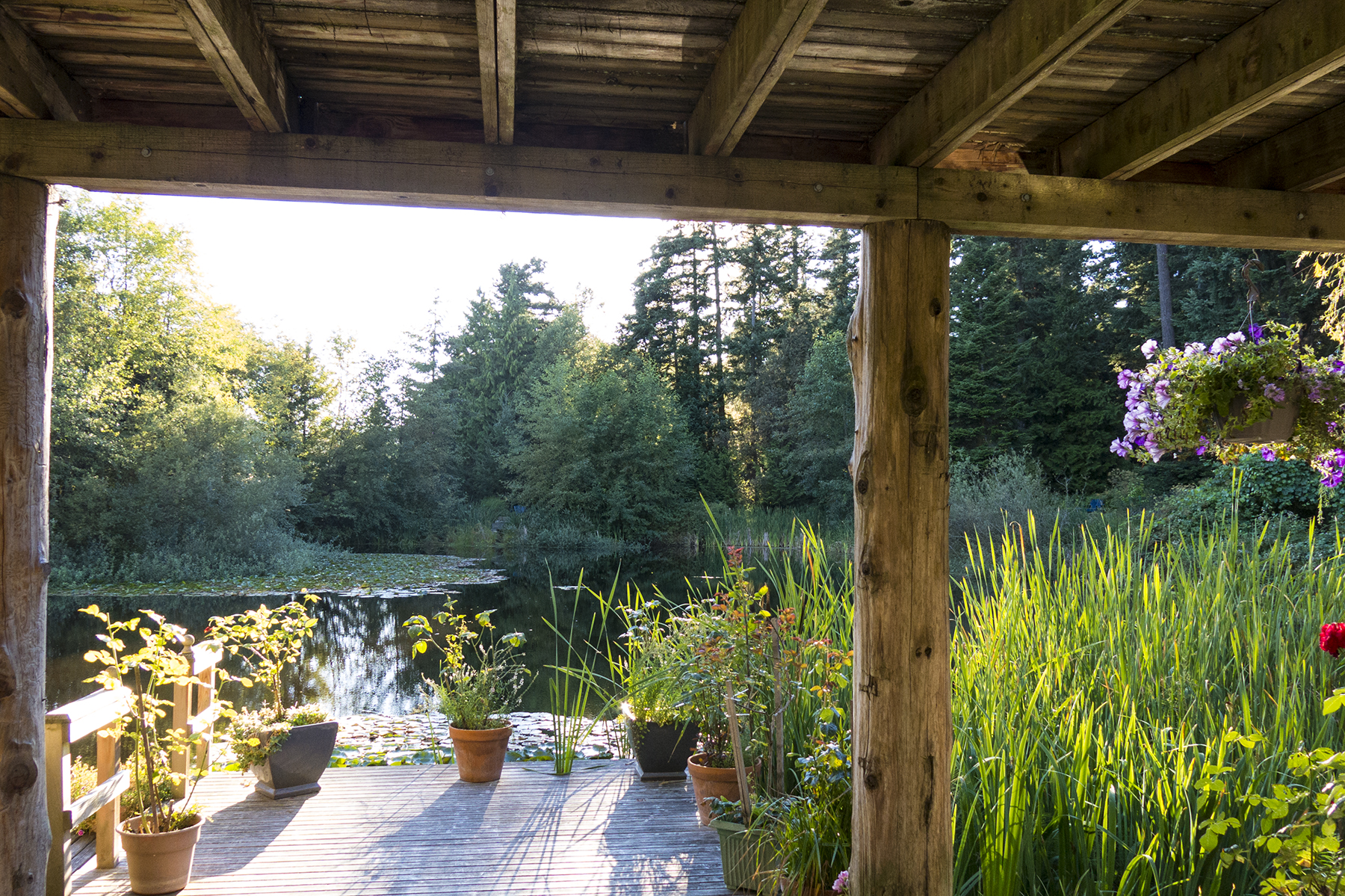
Old Trout Inn room view
Perhaps I should mention that the innkeepers are French, and that Nicole was head chef in their own restaurant for many years? Presentation, for sure. But delicious and filling to cover the first half day of kayaking. We Closes have an in-family game of “Best Croissant, Ever.” Nicole’s freshly hand-prepared version was well to the top of the cream in the milk can of croissant pecking order, and a perfect accompaniment to the delicate and decadent egg soufflé. Henrí was always solicitous, and a marvelous raconteur, sharing stories of his youth when he was a test driver for the Ferrari racing stable’s mounts both in Europe, and after emigrating to the U.S.

Nicole’s breakfast. All handmade that morning
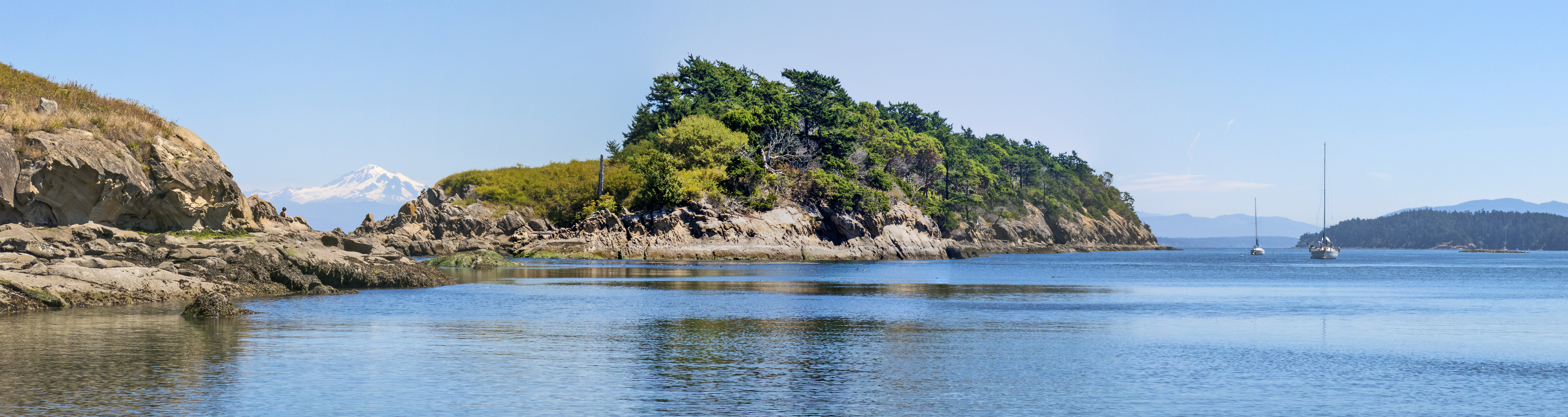
A principle reason we added Orcas to our itinerary was to get in the Sucia Island kayaking exercise. Another way for us to enjoy the water. Spanish-speakers will chuckle over the island’s name, which translates as Dirty Island, an apparent misnomer to me. Our Shearwater group consisted of our guide, Zach, and a total of six of us guests in three ocean-going kayaks. It was seven miles circumnavigating Sucia, requiring sunscreen, exertion, and kayak-mate paddling coordination, but the views were worth the effort.

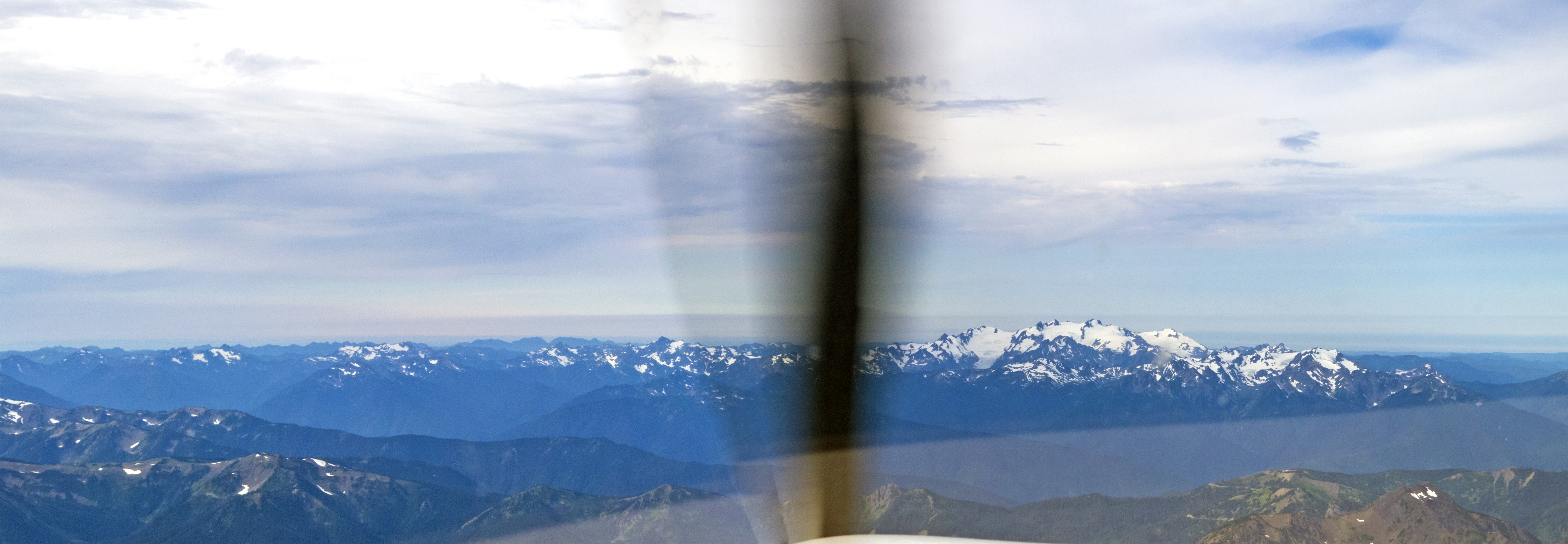
Kayakers’ view of Mt. Baker
Lunch—deli sandwiches, trail-mix and lemonade, partaken al fresco from washed-ashore sun-bleached logs. Restaurateurs would love the venue. I followed our dining with a bracing full-body emersion in the water, which only raised my voice about an octave. And then Zach, a geology teacher during the year, showed us a Native American shelling site that carbon dates to 11,000 years’ age. Obviously they, too, liked the protected waters and the view, plus the plentiful seafood.
Lunch stop
After lunch we continued our clockwise sojourn.
Greg, Ben, and Zach
At the end of our paddling, we were picked up by a prearranged water taxi and returned to West Beach on Orcas, where Henrí retrieved Cathy and me. We savored a lovely French dinner from the inn’s outdoor deck, washed down with a bottle of bubbly, and prepared for our morning departure home.

Sucia from the air
Our takeoff from Eastsound was to the north, and as we turned a right crosswind, there was Sucia off our left wing, glowing in the morning light. The mountains of mainland British Columbia in the distance. Looking at all the water we’d covered, sometimes overcoming currents, we got a hint at why the arms and low backs were telling us that they had been used.
There’s a modest backstory to our routes going and coming on this trip from SoCal to the Pacific Northwest. We escaped thunderstorms on our departure from our Montgomery Field home ‘drome at the outset. And the weather pattern we had then, had slowly migrated northward, a week later to Washington and Oregon. The return morning weather, studied on my i-Pad, showed cumulonimbus with tops to 51,000 feet, rain, lightning, and hail from around Olympia south toward Salem. The Olympic peninsula was clear, as was the coast leading toward northern California. Ergo, a track back over the Olympics, going as we had come…
Olympics, ahead. Thunderstorms to the left.
…and then past the mouth of the Columbia River, continuing abeam Arcata and Eureka, for a fuel stop and stretch in Healdsburg, CA. Healdsburg appeals to my penurious side, as the quaint and quiet airstrip in the heart of the wine country boasts avgas a full dollar a gallon less than others.
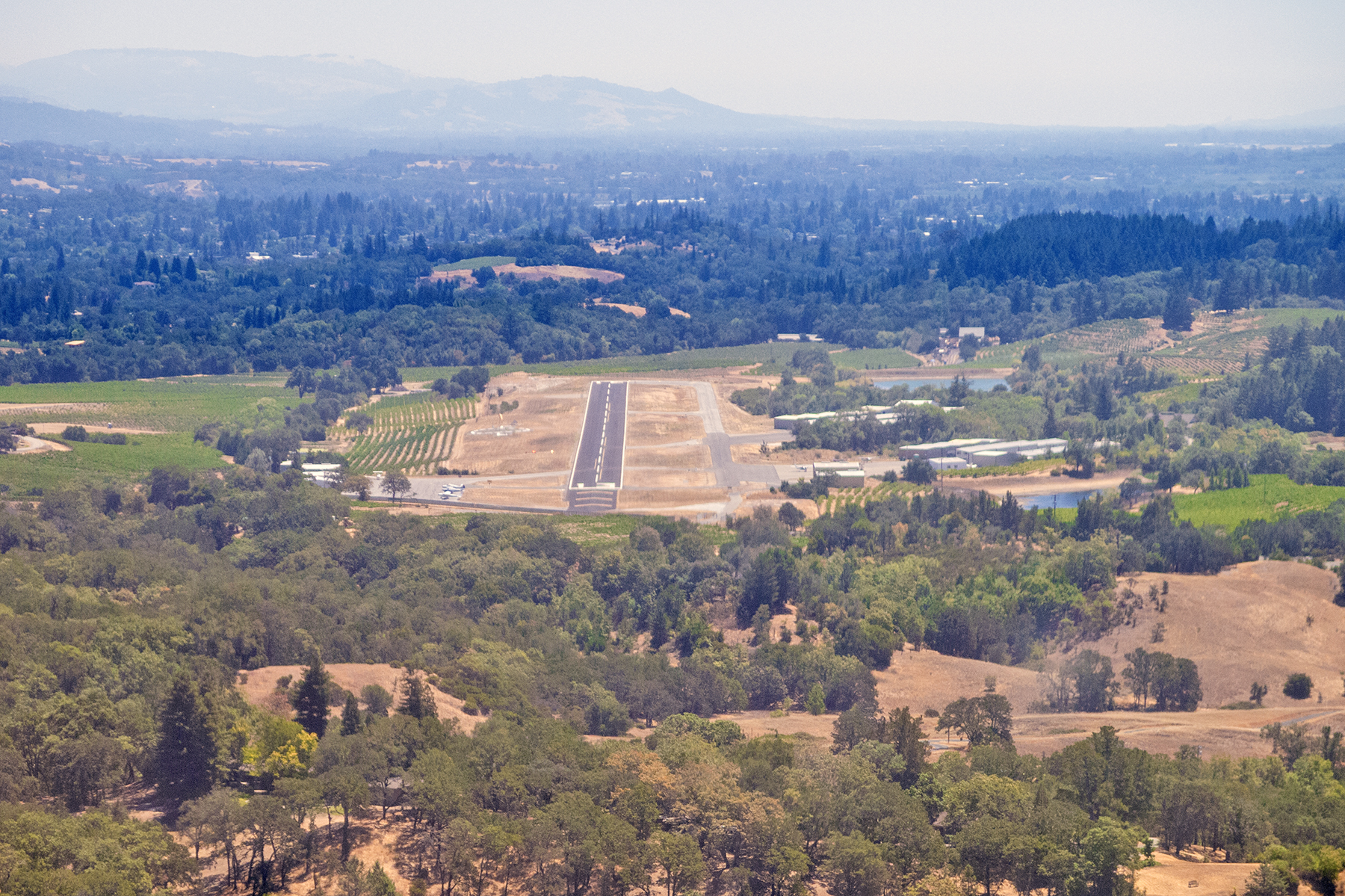
Healdsburg, runway 13
Hmm. Good recon for a future wine country exploration by bicycle? Autumn harvest? Have plane, will travail. Apologies to Paladin.

Recent Comments